GemVoyage Team • World
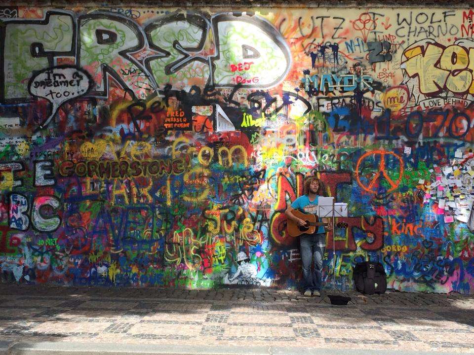
The Lennon Wall in Prague is more than just a colorful stretch of graffiti—it’s a living canvas of freedom, peace, and artistic expression. Located in the historic Malá Strana district, this wall has been a symbol of resistance and hope since the 1980s. After the assassination of John Lennon in 1980, an anonymous artist painted his portrait and lyrics from Beatles songs on the wall. What followed was a spontaneous outpouring of messages, poems, and protest art, especially from Czech youth who saw Lennon as a symbol of Western ideals and freedom during the oppressive communist regime.
Over the years, the wall has evolved into a dynamic, ever-changing mural. Layers of paint have buried the original artwork, but the spirit remains. Today, it features vibrant messages of love, peace, and solidarity, often reflecting global movements and local causes. Though the wall is now semi-regulated—with spray painting banned and only designated areas open to public contributions—it continues to attract artists and visitors from around the world.
A little-known fact: the wall is owned by the Sovereign Military Order of Malta, whose nearby buildings include a church and embassy. Until 2019, anyone could freely paint on the wall, but due to misuse, it’s now monitored by CCTV and curated by selected artists.
The Lennon Wall is located in Czechia (Czech Republic), in the Prague Region, within the city of Prague. Specifically, it sits in Velkopřevorské náměstí (Grand Priory Square) in the Malá Strana neighborhood, just a short walk from the iconic Charles Bridge.
Its central location makes it an easy and worthwhile stop on any Prague itinerary.
To make the most of your visit to the Lennon Wall, keep these tips in mind:
The Lennon Wall in Prague is a vibrant testament to the power of art and free expression. Born from grief and rebellion, it has grown into a global symbol of peace, creativity, and resilience. Whether you're a Beatles fan, a history buff, or simply a curious traveler, the wall offers a colorful and meaningful experience in the heart of Prague.
1. Is there an entrance fee to visit the Lennon Wall?
No, the wall is in a public square and free to visit.
2. Can I paint on the Lennon Wall?
Spray painting is banned, but you can leave messages with markers in designated areas.
3. What is the significance of the Lennon Wall?
It began as a tribute to John Lennon and became a symbol of protest against the communist regime in Czechoslovakia.
4. How often does the wall change?
Constantly. New artwork and messages appear regularly, making each visit unique.
5. Is the wall monitored?
Yes, it’s under CCTV surveillance to prevent vandalism and ensure respectful contributions.
6. What else is nearby?
Charles Bridge, Kampa Island, and the French Embassy are all within walking distance.
Discover more hidden gems you might love.
Malmö
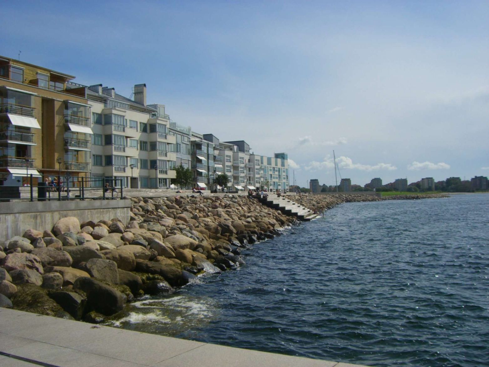
## Description Malmö’s promenades—particularly the waterfront walks in areas like **Sundspromenaden** in **Västra Hamnen**—represent a perfect mix of urban design, nature, sea, and Scandinavian minimalist style. These promenades are places to stroll, cycle, relax by the water, take in views across to Denmark, swim, or simply enjoy public space thoughtfully crafted for citizen leisure. What makes them special is how they combine modern architecture, revitalised waterfront land, and ecological awareness. Västra Hamnen itself is a former industrial/harbour area that has been transformed into a sustainable residential and recreational district. The promenade features wooden jetties, platforms for swimming, promenading paths, seating, small cultural touches, and design elements that allow people to use the space in multiple ways—sunbathing, exercising, enjoying views. ([visitsweden.fr][1]) A lesser-known fact: some portions of the promenades have public bathing decks with ladders into the sea, though the water can be quite deep. Also, lighting design (for example, in other Malmö waterfront developments) is intentionally done so that the ambiance at dusk feels safe, warm, and comfortable—even when colder. ([selux.com][2]) ## Location These promenades are located in **Malmö**, a city in **Skåne County** in southern **Sweden**, lying on the coast of the Öresund strait opposite Denmark. Västra Hamnen is the “Western Harbour” district, by the coast. The sundspromenaden waterfront walk is in/near Västra Hamnen. Other promenades like Ribersborg beach promenade are also in the broader coastal edges of Malmö. ([Travelwider][3]) To get there: if you arrive in Malmö by train (e.g. Malmö Central), you can walk, take local buses or tram to Västra Hamnen. Biking is also very good as Malmö is bike-friendly. From Copenhagen, there are trains across the Öresund Bridge; once in Malmö you use local transport or walk depending on which part of the promenade you aim for. ([Erasmusu][4]) ## Tips * **Time your visit for golden hours**: sunrise or sunset bring beautiful light over the water, especially looking toward Öresund and the Öresund Bridge. ([Wanderlog][5]) * **Bring swim gear**: In summer, many promenades have decks, ladders, or stepping points into the sea. If the weather is warm enough, swimming is possible. ([komoot][6]) * **Dress in layers**: The sea breeze can make things cooler, even in summer evenings. For morning walks or late afternoons it might be windy. * **Biking or walking**: Use the paths designed for pedestrians and cyclists. Some stretches are flat and very pleasant. A bike is a great way to cover longer stretches of promenade. * **Check local weather**: Rain or wind can make parts less pleasant; also, sea conditions vary. Be cautious if swimming. * **Explore by sections**: The waterfront promenade isn’t one single piece—various districts (Ribersborg, Västra Hamnen, etc.) offer different vibes (beach-style, urban, architecturally modern). Choose based on what you want: swimming, views, architecture, relaxation. ## Conclusion Malmö’s promenades are a standout example of how a coastal city can turn its sea edges into spaces that are both beautiful and functional. Whether for locals or visitors, they offer calm, recreation, waterfront views, and a chance to experience Malmö’s blend of urban renewal, sustainability, and Scandinavian waterfront charm. A walk here is more than just moving from A to B—it’s an experience of light, water, architecture, and local life. ## FAQ **1. Are the promenades free to access?** Yes, public promenades are free. There is no entrance fee to walk along Västra Hamnen waterfront or to use public seating areas, jetties, etc. **2. Can you swim there?** Yes—in parts. Some sections have bathing platforms, ladders, and wooden jetties. But water can be deep, and conditions (temperature, currents) vary. It’s good to check locally and stay where it’s safe. ([komoot][6]) **3. What is the best time of year to enjoy the promenade?** Late spring through early autumn (May to September) is best, when weather is warm, days are long, and outdoor amenities are most usable. Summer evenings are particularly lovely. Winters are colder and more challenging for outdoor swimming or lounging. **4. Are the promenades suitable for someone with limited mobility or stroller?** Many paths are flat and well-maintained, so promenading/strollers are possible in many places. However, wooden platforms or jetties might have steps or ladders for water access not suitable for all. It’s best to choose accessible sections near Västra Hamnen or Ribersborg. **5. What else can I see or do near the waterfront promenade?** Plenty: architectural highlights like the Turning Torso, cafés and restaurants in Västra Hamnen, parks, local beaches (Ribersborg), views of the Öresund Bridge, outdoor workouts, bike paths, evening walks. The area combines leisure, modern design, and views. **6. How long should I plan to walk to get a good sense of the place?** If you set aside 1-2 hours, you can enjoy a stretch with views, maybe stop for café or swim. For a full exploration of different sections, 3-4 hours or more allows you to experience the variety between Ribersborg, Västra Hamnen, and other promenades. ## Links * [Visit Sweden – Malmö Outdoor & Nature](https://visitsweden.com) * [Malmö City Official Site](https://malmo.se)
GemVoyage Team • World
Seoul
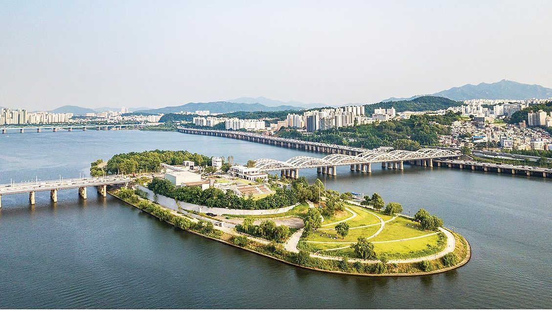
## Description Nodeul Island is a compact cultural complex on the Han River offering performance spaces, green areas, and a music-focused programming lineup. More than just a riverside park, Nodeul is a deliberate cultural experiment: its architecture and programming weave public space, live performance, and small-scale festivals into a compact, walkable site. The island hosts live concerts ranging from acoustic singer-songwriters to electronic sets, pop-up book fairs, artist talks, workshops, and rotating markets. Its landscaped terraces and shaded lawns are deliberately designed to encourage lingering, informal performances, and community gatherings. Nodeul has become known for spotlighting emerging Korean musicians and experimental performers alongside established acts, making it an attractive place for music lovers who want to catch fresh talent in an intimate setting. The island’s mix of architecture, open-air stages, and sheltered rooms means events happen year-round—outdoor stages run during warmer months while smaller indoor spaces host talks and exhibitions in cooler seasons. For photographers and writers looking for evocative urban scenes, Nodeul’s riverside vistas, evening concert lighting, and the soft hum of Seoul traffic across the water make for compelling subjects. The island also supports small food vendors and seasonal stalls that bring a local flavor to the cultural programming. From a practical standpoint, Nodeul is a model for how urban design can activate a riverside edge: pedestrian bridges and plazas, varied seating, and clear sightlines to performance areas keep programming accessible and family-friendly. The island’s public calendar is updated frequently, and local arts organizations often collaborate with the site to pilot new formats—outdoor listening sessions, experimental pop-up shows, and community workshops are common. Whether you’re planning an evening concert or a daytime literature event, Nodeul’s programming rewards repeat visits: familiar artists return, and new creative experiments appear each season. ## Location Nodeul Island sits on the Han River close to the Noryangjin and Yeouido areas of Seoul, reachable by subway and a short walk across a well-maintained pedestrian bridge from the south bank. The nearest major subway stops provide easy access for visitors staying anywhere in central Seoul, and the island’s signage in English and Korean helps international visitors orient themselves quickly. Because the island sits on the river, walking routes from nearby neighborhoods are scenic and often used by locals for jogging and evening strolls. ## Tips - Check the events calendar ahead of time: Nodeul’s draw is its programming, and many of the best concerts and markets are pre-announced online. Booking tickets in advance for popular shows avoids disappointment. - Arrive early for evening concerts to claim good riverside seating; bring a small blanket or foldable chair if you prefer more comfortable seating on the grass. - Visit at sunset for the best photo opportunities: the interplay of river light, concert lights, and Seoul’s skyline creates a memorable atmosphere. - Pack layers—a light jacket is wise for open-air evening events when the river breeze picks up, even in summer. - Explore the island’s perimeter paths before events; quiet spots and viewpoints are often less crowded than main plazas. - Support local vendors: seasonal food stalls and nearby cafés help sustain small operators who participate in Nodeul’s pop-up markets. - If you’re interested in emerging music, follow local promoters and Nodeul’s newsletter for surprise showcases and free programs. ## Conclusion Nodeul Island is a compact cultural destination that combines live music, community programming, and riverside relaxation in Seoul. It succeeds as a place where design, sound, and community converge—ideal for travelers who want to experience contemporary Korean culture beyond mainstream tourist stops. With a packed calendar, accessible layout, and an emphasis on new voices in music and the arts, Nodeul rewards curious visitors and repeat explorers alike. ## FAQ Q: Is there an admission fee? A: Many daytime activities and free concerts are available without charge, while larger evening shows or special events may require purchased tickets—check the event listing. Q: How do I get there by public transport? A: Use the nearest subway stations (check local maps), then follow pedestrian signage to the river bridge that leads to Nodeul; buses and taxis also serve the area. Q: Are events kid-friendly? A: Yes—many daytime workshops and family-oriented performances are suitable for children, though some late-night concerts may be more adult-focused. Q: Can I bring food and drink? A: Outside food and non- alcoholic drinks are generally allowed; licensed vendors operate during larger events—always check event-specific rules. Q: Is the island wheelchair accessible? A: The site offers accessible paths and ramps, but some elevated terraces may have limited access—consult the venue map for specific event locations. ## Links - [Seoul Travel Guide](https://www.visitseoul.net/)
GemVoyage Team • World
Copenhagen
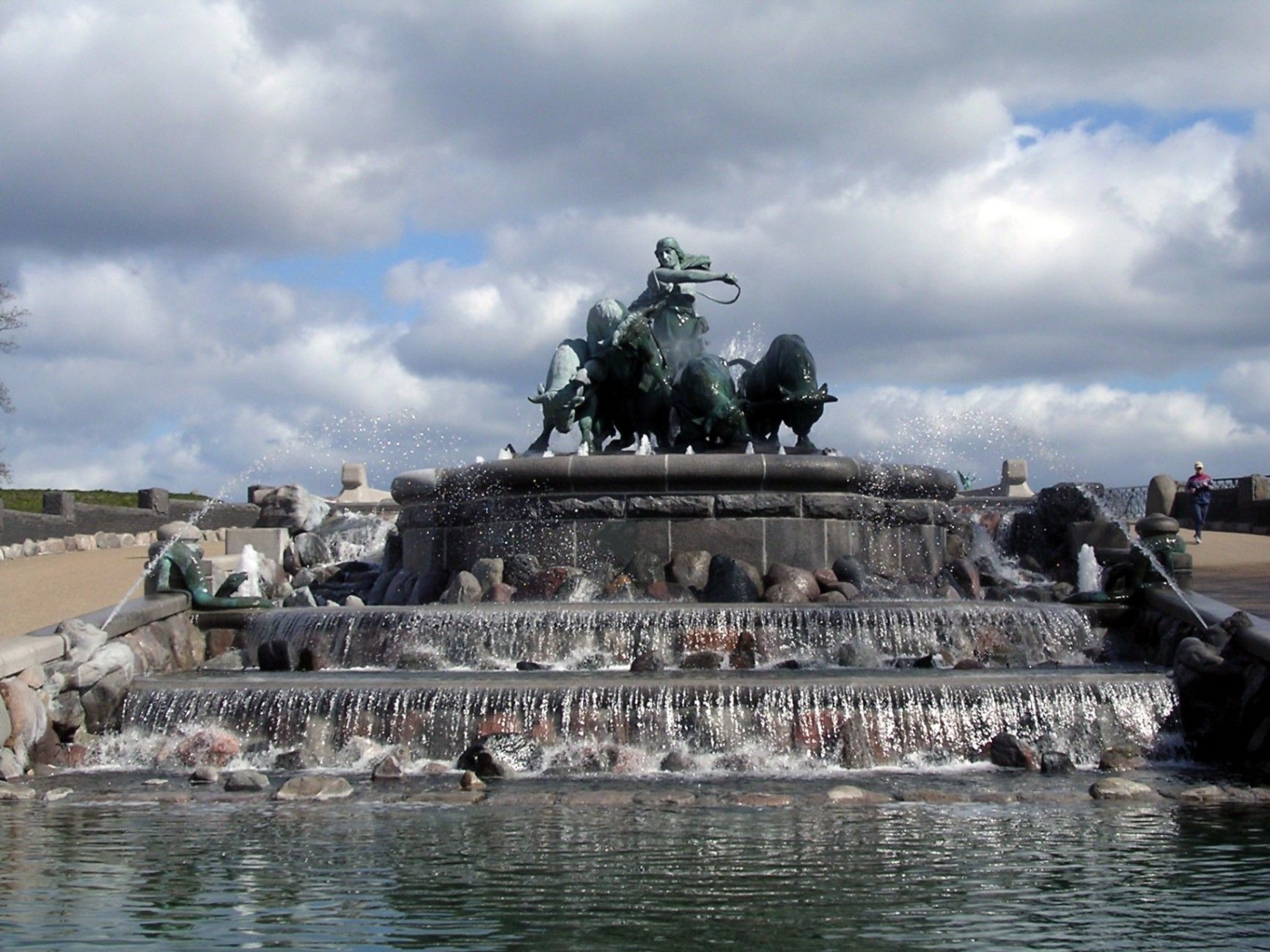
## Description The **Gefion Fountain (Gefionspringvandet)** is one of **Copenhagen’s most iconic landmarks**, combining stunning sculpture, mythological symbolism, and the serene beauty of its waterfront setting. Unveiled in **1908**, the fountain depicts the **Norse goddess Gefion**, a figure from ancient Scandinavian mythology, driving a group of **powerful oxen** as they pull the land that became the island of **Zealand (Sjælland)** — where Copenhagen stands today — from the depths of the sea. Designed by **Danish sculptor Anders Bundgaard**, the fountain is both a **monumental work of art** and a **celebration of Danish legend and identity**. The dynamic bronze figures, set atop a granite basin, capture the dramatic moment of transformation: Gefion’s oxen straining against their harnesses, water surging around them, and the goddess commanding them with divine strength. The story behind the sculpture comes from **Norse mythology**, where Gefion tricks the Swedish king **Gylfi** into granting her as much land as she can plow in one night. Transforming her four sons into oxen, she plows through the earth and casts the land into the sea — forming the island of Zealand. The resulting lake in Sweden, **Lake Vänern**, is said to match Zealand’s shape. What makes the Gefion Fountain unique is not only its **artistic detail and mythological depth** but also its **location** — it sits between **Kastellet Fortress** and **Langelinie Promenade**, surrounded by lush greenery and views of the **harbor** and **The Little Mermaid statue** nearby. The fountain is especially magical when illuminated at night, with the flowing water and shimmering bronze giving it an ethereal glow. A lesser-known fact is that the fountain was originally commissioned by the **Carlsberg Foundation** to celebrate the brewery’s 50th anniversary and was gifted to the city of Copenhagen. Another interesting detail: the granite blocks forming the base came from **Sweden**, a subtle nod to the myth that connects the two lands. ## Location The **Gefion Fountain** is located in **Churchillparken (Churchill Park)** near **Langelinie**, in the **central harbor area of Copenhagen**, **Denmark**. It sits just east of **Amalienborg Palace** and north of the **Kastellet (The Citadel)** fortress. To get there: * **By metro:** Take the **M3 (City Circle Line)** to **Marmorkirken Station**, then walk about **10 minutes** northeast toward the harbor. * **By bus:** Several local buses, including routes **26** and **27**, stop nearby at **Esplanaden**. * **By foot or bike:** The fountain is part of a popular **walking and cycling route** that connects **Amalienborg**, **The Little Mermaid**, and **Kastellet**. * **By car:** Limited parking is available nearby, though walking or cycling is more convenient in this area. ## Tips * **Visit in the morning or late evening:** The light at sunrise and sunset enhances the sculpture’s bronze tones and reflections. * **Combine with nearby landmarks:** The **Little Mermaid**, **Kastellet Fortress**, and **Amalienborg Palace** are all within walking distance. * **Evening illumination:** Visit after dark to see the fountain beautifully lit — a favorite spot for photographers. * **Learn the mythology:** Understanding the legend of Gefion adds depth to your visit; many plaques around the site explain the story. * **Bring a camera:** The fountain’s movement, water effects, and sculptural detail make it a fantastic subject for photos. * **Relax nearby:** The surrounding park offers benches and green spaces perfect for a quiet break during a city walk. * **Visit year-round:** While the fountain operates mainly in warmer months, the sculptures remain accessible and impressive throughout the year. ## Conclusion The **Gefion Fountain** is much more than a beautiful monument — it’s a vivid connection between Denmark’s ancient mythology and its modern identity. With its stunning artistry, powerful symbolism, and scenic harbor location, it perfectly embodies Copenhagen’s blend of **history, legend, and elegance**. Whether you’re tracing the city’s cultural landmarks, enjoying a peaceful stroll through Churchill Park, or exploring Norse mythology, the Gefion Fountain offers a moment of reflection and wonder that captures the timeless spirit of Denmark. ## FAQ **1. What does the Gefion Fountain represent?** It depicts the Norse goddess **Gefion** plowing the land that became the island of **Zealand (Sjælland)**, symbolizing the creation of Denmark’s largest island. **2. Who designed the fountain?** The fountain was created by **Anders Bundgaard**, one of Denmark’s most celebrated sculptors, and unveiled in **1908**. **3. Where is the Gefion Fountain located?** In **Churchillparken**, near **Langelinie Promenade** and **Kastellet Fortress**, in central **Copenhagen**, Denmark. **4. Is it near other attractions?** Yes — it’s just a short walk from **The Little Mermaid**, **Amalienborg Palace**, and the **harborfront**. **5. When does the fountain operate?** The fountain usually runs from **April to October**, depending on weather conditions. The sculptures can be viewed year-round. **6. Is there an entrance fee?** No — visiting the Gefion Fountain is **free of charge**. **7. Can I visit at night?** Yes, and it’s highly recommended. The **evening lighting** creates a beautiful, almost mythical atmosphere. ## Links * [Official Visit Copenhagen – Gefion Fountain](https://www.visitcopenhagen.com/)
GemVoyage Team • World
Athens
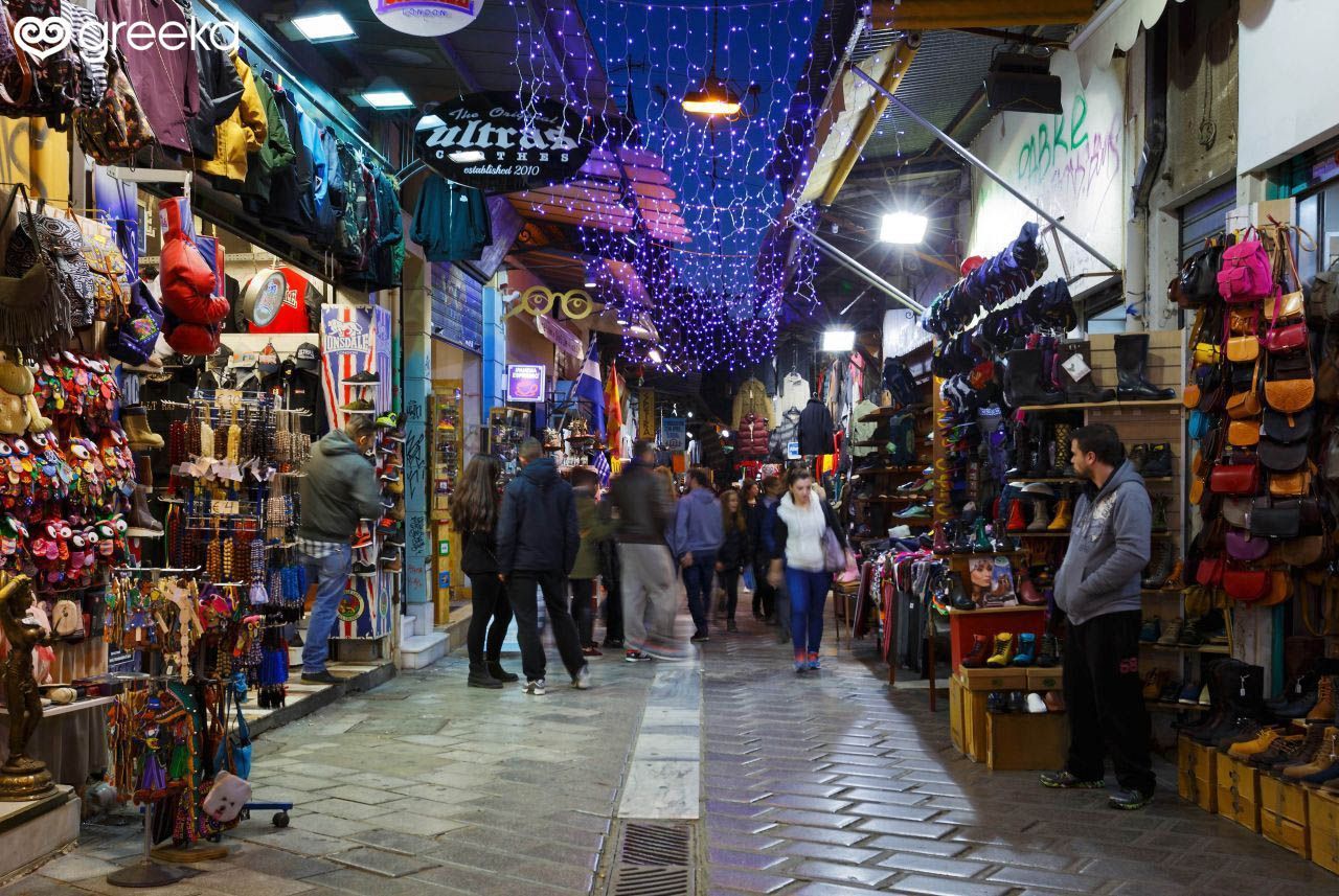
## Description Monastiraki Flea Market is the beating, bustling heart of Athens' informal shopping scene—an open, labyrinthine neighborhood market where layers of history and commerce intersect. Stalls and small shops spill into pedestrian lanes, offering antiques, textiles, ceramics, vintage clothing, books, and artisan curios alongside more touristic souvenirs. What makes Monastiraki especially compelling is its density of experiences: within a few minutes you can move from a stall stacked with retro vinyl to a tiny workshop crafting leather goods, or from a sidewalk cafe to a covered antique arcade. The market’s appeal is not only in the goods but in the social choreography: bargaining conversations, the rhythm of vendors calling out, and the way the market sits against a backdrop of ancient ruins and Ottoman-era alleys. Many travelers are surprised by the market’s everyday qualities—local shoppers source household goods and clothing here, so it’s not just a tourist carnival. At the same time, antiques and rare finds do appear, especially in the narrower lanes where veteran dealers have made their homes. ## Location Monastiraki is a central Athens neighborhood clustered around Monastiraki Square and the Monastiraki metro station. It sits adjacent to the ancient Agora and within easy walking distance of Plaka, the Acropolis, and Syntagma Square. The market isn’t confined to a single street but spills across several narrow lanes and squares, so plan to wander on foot and let the area unfold gradually. Because the market is woven into the city center, the best approach is pedestrian: arrive by metro and start on the main square, then explore side streets and covered arcades for more specialized finds. Nearby rooftop cafés and tavernas allow for breaks and people-watching between shopping spurts. ## Tips - Bring cash and small bills—while many places accept cards, smaller stalls often prefer cash. - Start early to avoid the thickest crowds and to catch dealers arranging their stalls. - Compare prices across stalls when shopping for antiques or vintage items; genuine bargains sometimes appear mid-week. - Ask questions and be friendly when bargaining—polite conversation gets better results than hard haggling. - Protect your belongings: crowds and narrow lanes make pickpocketing a possibility. - Explore beyond the main lanes: covered arcades and quieter side streets sometimes hold the best finds. ## Conclusion Monastiraki Flea Market is more than shopping; it’s an urban ritual that mixes trade, food, and history. Whether you come looking for a specific antique or just want to soak up Athens’ street-level energy, Monastiraki rewards curiosity, patience, and a willingness to wander. ## FAQ ### Is Monastiraki Flea Market only for tourists? No. While tourists are common, the market also serves local shoppers and small businesses, giving it a layered, authentic atmosphere. ### Can I bargain there? Yes—especially for antiques, vintage items, and bulk purchases. Approach bargaining with politeness and realistic expectations. ### What should I look for? Keep an eye out for vintage jewelry, retro vinyl, ceramics, handmade leather, and secondhand books. Antiques and unique local crafts are concentrated in side lanes and arcades. ### How crowded does it get? It can be very crowded on weekends and afternoons. Early morning weekdays are quieter and often more pleasant for careful browsing. ### How much time should I allow? Give yourself at least 1.5–3 hours if you want to browse comfortable; plan more time if you intend to hunt for specific antiques. ## Links - [Wikipedia](https://en.wikipedia.org/wiki/Monastiraki)
GemVoyage Team • World
Kaimonkawashiri
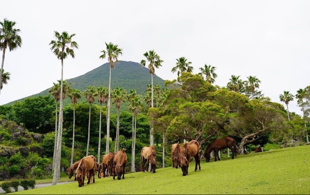
## Description **Kaimon Foothills Nature Park** is a serene and picturesque destination located at the base of Mount Kaimon, often nicknamed the “Fuji of Satsuma” because of its elegant, conical shape that resembles Japan’s iconic Mount Fuji. This park is a favorite among nature enthusiasts, hikers, and families looking for a peaceful escape into lush greenery and panoramic landscapes. What makes Kaimon Foothills Nature Park unique is its perfect blend of natural beauty and cultural significance. The area offers walking trails surrounded by seasonal flowers, open lawns ideal for picnics, and scenic viewpoints where visitors can admire Mount Kaimon towering in the distance. On clear days, you can even catch a glimpse of **Yakushima Island**, a UNESCO World Heritage Site known for its ancient cedar forests. A little-known fact is that the park is home to rare flora native to the Kagoshima region, making it a hidden gem for botany lovers. Another interesting detail is that the park also serves as a base for those who want to climb Mount Kaimon, with the trailhead conveniently located nearby. ## Location Kaimon Foothills Nature Park is located in **Ibusuki City**, within **Kagoshima Prefecture** in southern **Kyushu, Japan**. The park sits at the base of Mount Kaimon, which rises 924 meters above sea level and is a defining landmark of the Satsuma Peninsula. Getting there is straightforward. From **Kagoshima City**, travelers can take the **JR Ibusuki-Makurazaki Line** to **Kaimon Station**. From the station, the park is just a short taxi ride or a leisurely walk. Alternatively, those traveling by car can reach the park in about 90 minutes from central Kagoshima via Route 226, a scenic coastal road. For visitors who enjoy road trips, this drive offers stunning views of Kagoshima Bay and the surrounding countryside. ## Tips To make the most of your visit to Kaimon Foothills Nature Park, keep these tips in mind: * **Wear comfortable shoes** – The park has walking trails and natural terrain, so sturdy footwear will make your visit more enjoyable. * **Bring a picnic** – With wide open spaces and shaded areas, the park is perfect for relaxing and enjoying a homemade lunch outdoors. * **Check the weather** – Clear days provide the best views of Mount Kaimon and the surrounding region, so plan accordingly. * **Combine with a hike** – If you’re up for adventure, start your climb up Mount Kaimon from the trailhead near the park. The hike typically takes 3–4 hours round trip. * **Visit nearby attractions** – Ibusuki is famous for its unique **sand baths**, where visitors are buried in naturally heated volcanic sand. It’s an excellent way to relax after exploring the park. * **Bring a camera** – Whether it’s the seasonal flowers, the majestic peak of Mount Kaimon, or the sunset views, the park is full of photo-worthy moments. ## Conclusion **Kaimon Foothills Nature Park in Japan** is a charming and peaceful destination that offers both relaxation and adventure. With its breathtaking views of Mount Kaimon, lush greenery, and cultural significance, it’s the perfect spot for families, hikers, and nature lovers alike. Conveniently located in Ibusuki, Kagoshima, the park also serves as a gateway to exploring southern Kyushu’s natural wonders. ## FAQ **1. What is Kaimon Foothills Nature Park best known for?** The park is best known for its scenic location at the base of Mount Kaimon, offering beautiful views, picnic areas, and access to the hiking trail up the mountain. **2. Can you climb Mount Kaimon from the park?** Yes, the park serves as a starting point for the Mount Kaimon hiking trail, which takes about 3–4 hours to complete round trip. **3. When is the best time to visit?** Spring and autumn are ideal, with pleasant weather and colorful seasonal flowers. However, the park is open year-round and offers different charms in each season. **4. Is the park family-friendly?** Absolutely. The open lawns, easy walking paths, and picnic spots make it a great destination for families with children. **5. How long should I plan to stay?** Most visitors spend 1–2 hours enjoying the park, but if you add a Mount Kaimon hike or nearby Ibusuki attractions, you can easily plan a full-day trip. **6. Are there facilities like restrooms or shops?** Yes, the park has basic facilities, but it’s a good idea to bring your own snacks and drinks, especially if you plan to stay for a while. ## Links * [Japan Travel – Kyushu Attractions](https://www.japan.travel/en)
GemVoyage Team • World
Ontario
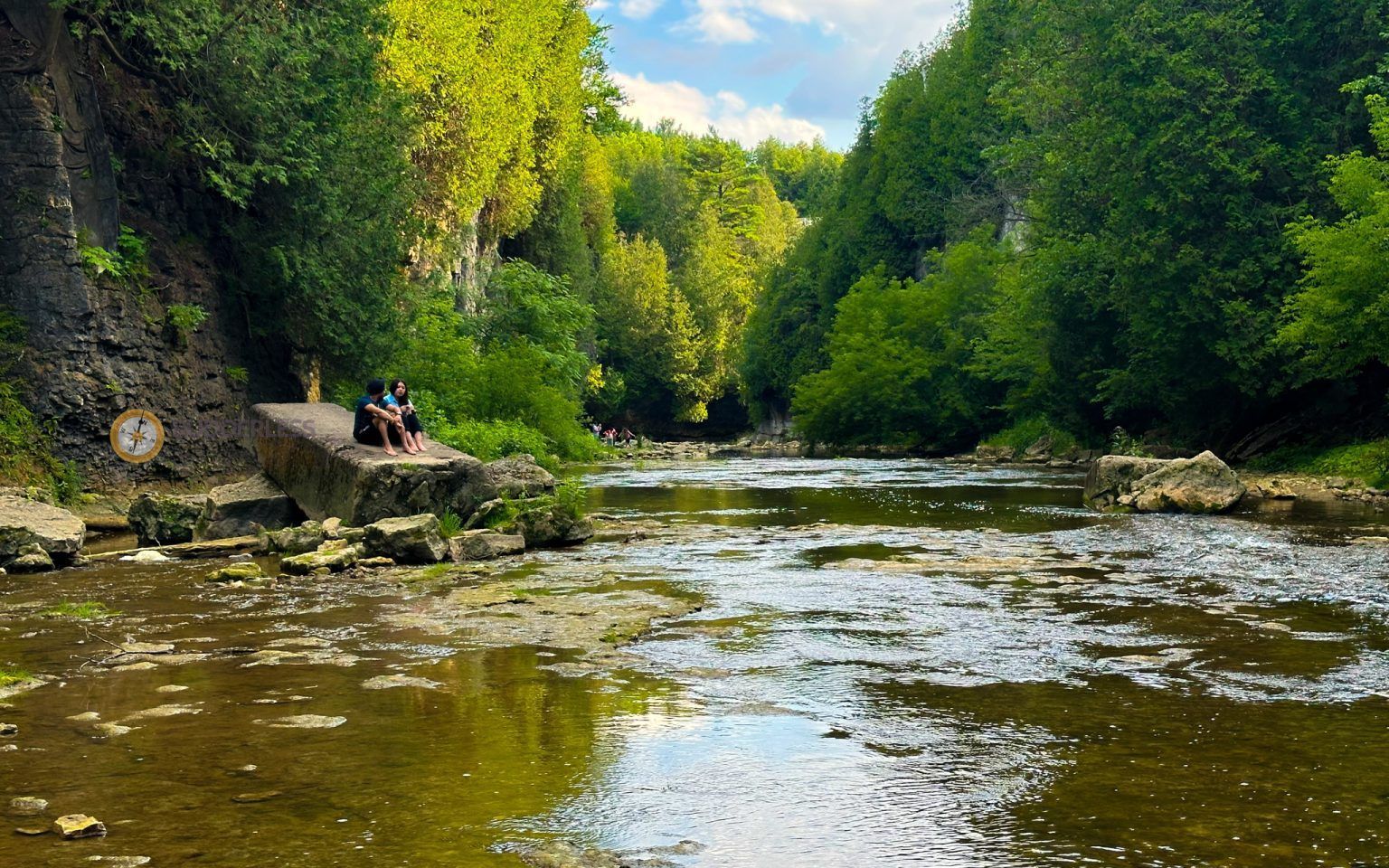
## Description Elora Gorge is one of Ontario’s most striking natural attractions, known for its steep limestone cliffs, fast-moving Grand River scenery, and a landscape that feels more dramatic than most visitors expect from southern Ontario. The gorge is part nature preserve, part outdoor recreation area, and part classic day-trip destination. People come for the views, the trails, the river access, and the feeling of standing in a place where water has carved a deep, narrow route through rock over a very long span of time. What makes Elora Gorge memorable is its contrast. The surrounding region is gently rural and easygoing, but the gorge itself is rugged and visually intense. When you stand on the edge and look down, the river appears surprisingly powerful as it moves through the canyon-like setting. The rock walls, tree cover, and water together create a scene that feels almost larger than life for a place that is relatively easy to access from nearby towns and cities. It is the kind of landscape that immediately rewards anyone who likes geology, photography, hiking, or simply being outdoors. One little-known fact about the area is how much its shape influences the mood of the visit. Even short walks feel more memorable because the viewpoint changes quickly from forest to cliff edge to river corridor. Another detail many visitors appreciate only after arriving is how seasonally different the gorge can feel. In spring, the river runs energetically and the foliage is fresh. In summer, the greens are dense and the area becomes a prime outdoor destination. In autumn, the cliffs and trees around the gorge can create a particularly vivid palette. Winter visits are quieter and more austere, but they can also be beautiful in a stark, sculptural way. Elora Gorge is also appealing because it can satisfy different travel styles. A casual visitor can enjoy the scenery and take a short walk, while a more active traveler can turn the visit into a longer outdoor outing. The gorge is one of those places where people often arrive with modest expectations and leave impressed by how photogenic and substantial it feels. ## Location Elora Gorge is in Ontario, Canada, near the village of Elora and within reach of the wider Waterloo Region and Wellington County area. The gorge is associated with the Grand River and is close enough to several southwestern Ontario cities to function as a realistic day trip. For many travelers, the easiest way to visit is by car, since that gives the most flexibility for parking, timing, and combining the gorge with nearby Elora village or other regional stops. If you are driving from Toronto, Kitchener-Waterloo, Guelph, or nearby communities, the route is straightforward enough for a day outing. Public transit is usually less convenient, so road travel is the most practical option for most visitors. Once you arrive, the experience is mostly about walking, looking, and choosing how active you want to be. If you are planning a fuller outdoor day, it makes sense to pair the gorge with village cafés, local shops, or other conservation-area activities in the surrounding region. ## Tips Wear footwear that can handle uneven paths and potentially muddy or damp ground. The gorge is beautiful, but it is not a place where fashionable footwear matters more than stability and comfort. If you want photos from scenic viewpoints, take your time and be cautious near edges and steep sections. The views are worth slowing down for, and safety should always come first. Check conditions before you go. Water levels, trail conditions, and seasonal access can change the experience significantly. A gorge that looks calm in one season can be much more energetic in another, and some areas may be better suited to certain weather conditions. If you are visiting with children, choose routes and viewpoints that match their energy and attention span. Bring water, snacks, and weather-appropriate layers. The gorge can feel cooler or windier than the nearby town, and you may spend more time outside than planned once you start enjoying the scenery. If you are interested in photography, morning and late afternoon are usually the best times for softer light. Consider making time for Elora village as well. The gorge is the headline attraction, but the surrounding area often makes the trip more satisfying. Many visitors find that pairing the natural site with a meal or wander in town creates the most balanced experience. ## Conclusion Elora Gorge is one of Ontario’s most rewarding scenic escapes, offering dramatic geology, outdoor recreation, and easy access from nearby communities. It is a strong choice for travelers who want nature without a complicated journey. ## FAQ ### Is Elora Gorge good for a quick visit? Yes. Even a short stop can be worthwhile if you want a scenic view and a brief walk. If you have more time, though, the gorge becomes much richer because you can explore the trails and surrounding area more fully. ### Is it suitable for families? It can be, provided you choose paths and viewpoints that fit your group’s comfort level. Families should pay close attention near steep edges and areas with uneven terrain. ### What is the best season to visit? There is no single best season, because each one has a different appeal. Spring and autumn are especially attractive for scenery, while summer is popular for outdoor activity and longer visits. ### Do I need to be an experienced hiker? No. There are options for casual visitors as well as more active hikers. You can tailor the trip to your own pace and interests. ### Can I see the gorge without a long hike? Yes. The attraction is accessible enough that you can enjoy views and the setting without committing to a major hike, although walking deeper into the area gives a fuller experience. ## Links - [Wikipedia](https://en.wikipedia.org/wiki/Elora_Gorge_Conservation_Area)
GemVoyage Team • World

Comments