GemVoyage Team • World
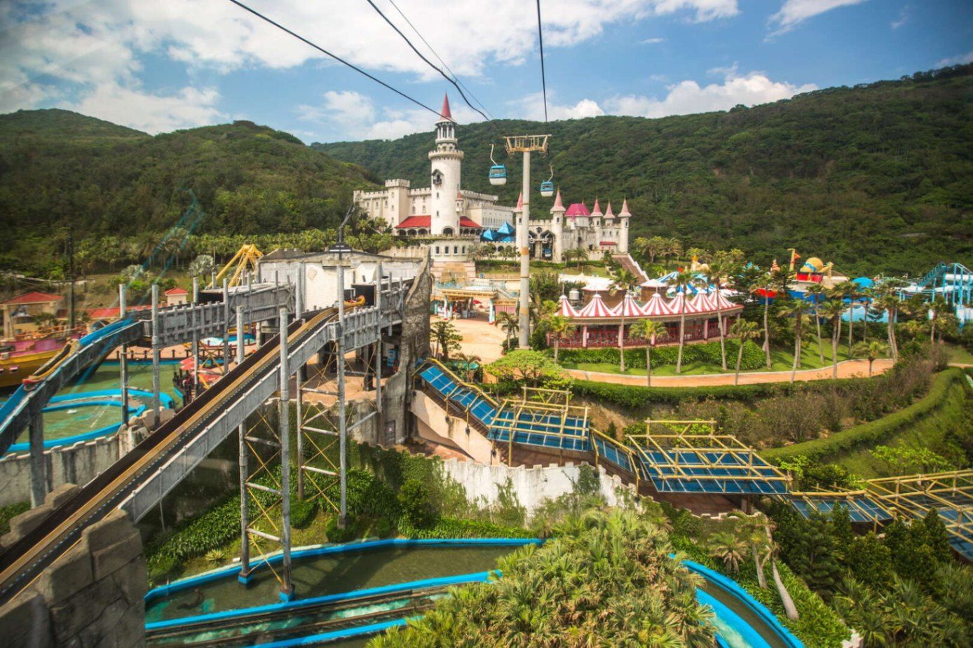
Farglory Ocean Park (遠雄海洋公園) is Taiwan’s most prominent marine-themed amusement park, uniquely positioned on a cliff overlooking the Pacific Ocean near the city of Hualien. Unlike typical flatland theme parks, Farglory combines high-altitude sea views, performance-based attractions, and family-oriented thrill rides into a single destination where entertainment and ocean scenery merge into one continuous visual experience.
Opened in 2007, the park was designed to blend the excitement of a modern amusement park with the educational storytelling of marine life and ocean ecology. Rather than focusing solely on rides, Farglory emphasizes live animal shows, interactive exhibits, aquarium tunnels, and water-based performances, which give it a hybrid identity somewhere between a theme park and a marine discovery center.
One of the defining features of Farglory Ocean Park is its elevated position on coastal cliffs, providing uninterrupted panoramic views of the Pacific. On clear days, visitors can watch waves crash far below while riding attractions located hundreds of meters above sea level. This geographical advantage gives the park an atmosphere unlike any other marine park in East Asia, where the ocean is not just a theme but a constant natural presence.
The park is divided into several themed zones, including areas focused on marine exploration, fantasy, adventure rides, and live entertainment. Dolphin and sea lion performances are among its most popular attractions, carefully choreographed to combine education, humor, and athletic spectacle. The aquarium zones feature massive tanks with sharks, rays, and tropical fish, while tunnel walkways place visitors directly below swimming marine life.
Beyond animals, Farglory also invests heavily in aerial rides, roller coasters, river rapids, and rotating observation attractions. Many of these rides take full advantage of the park’s cliffside location, creating the illusion that visitors are floating above the open ocean. This vertical relationship with the sea adds a psychological thrill even to moderate rides.
A little-known fact is that Farglory Ocean Park was originally conceived as part of a larger coastal tourism transformation project for eastern Taiwan, intended to balance the heavy development of the west coast. Another lesser-known detail is that due to its seaside exposure, the park’s rides and structures are built with enhanced corrosion-resistant materials to withstand salt air and typhoon conditions, making maintenance far more complex than at inland parks.
Emotionally, the park offers a dual experience. For children and families, it is colorful, loud, and filled with motion and music. For adults, it can feel unexpectedly cinematic, particularly at sunset, when the park’s observation decks and outdoor rides become framed by deep orange skies and dark blue ocean horizons. The contrast between artificial entertainment and raw nature is one of Farglory’s strongest unspoken features.
Farglory Ocean Park is located near Hualien City on Taiwan’s eastern coast, facing the Pacific Ocean.
City: Hualien
Region: Eastern Taiwan
Country: Taiwan
Area: Shoufong Township (near Hualien City)
Its coastal position makes the park a natural addition to a Taroko Gorge and East Coast scenic road trip.
Farglory Ocean Park stands at the intersection of entertainment, marine education, and dramatic Pacific coast scenery. Its elevated cliffside location transforms a conventional theme park into a panoramic ocean viewpoint layered with rides, shows, and aquarium experiences. While it may not compete with the world’s largest amusement parks in scale, it delivers something far rarer: a theme park where the real ocean is always the main attraction.
1. What type of park is Farglory Ocean Park?
It is a marine-themed amusement park that combines rides, animal shows, and aquarium exhibits.
2. Is Farglory Ocean Park suitable for young children?
Yes. It is highly family-friendly, with many attractions designed for children.
3. How long does a full visit usually take?
Most visitors spend 5 to 7 hours to experience the park properly.
4. Does the park operate year-round?
Yes, but ride availability may be limited during typhoon season or severe weather.
5. Is the park accessible for non-Chinese speakers?
Yes. Basic signage and staff support are available in English, though detailed explanations may be in Chinese.
6. Is it better to visit independently or with a tour?
Independent visits offer flexibility, while tours are easier for transport logistics, especially for short stays in Hualien.
Discover more hidden gems you might love.
Shkodër
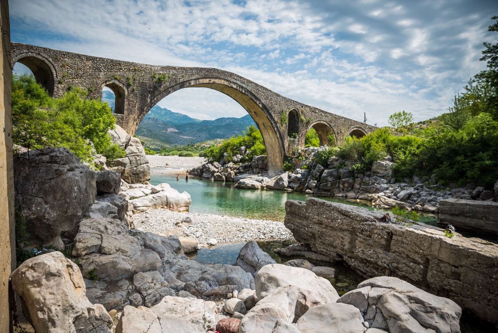
## Description Mesi Bridge (Ura e Mesit), an 18th-century Ottoman-era stone bridge, is one of Albania’s most captivating historical landmarks. Located near the city of Shkodër, this architectural gem spans the Kir River with a graceful series of 13 arches, stretching 108 meters in length. Built around 1770 by Kara Mahmud Bushati, a powerful Ottoman pasha, the bridge was part of a strategic infrastructure project to connect Shkodër with the northern highlands, including the medieval town of Drisht. What makes Mesi Bridge unique is its asymmetrical design and the craftsmanship of its construction. The bridge was built in two phases: the central arch and one adjacent arch were completed first, followed by the remaining eleven. The structure features round river stones and chiseled stone plates, giving it both strength and aesthetic charm. Despite centuries of wear and occasional flooding, the bridge remains remarkably well-preserved and is considered the largest and best-preserved Ottoman bridge in Albania. A little-known fact is that the bridge once formed part of a trade route that extended all the way to Pristina, Kosovo. Another intriguing detail is that the English artist Edward Lear sketched the bridge during his travels in Albania in 1848, captivated by its elegance and the surrounding landscape. ## Location Mesi Bridge is located in **Albania**, in the **Shkodër County**, near the **city of Shkodër**. Specifically, it sits in the village of **Mes**, approximately 5 to 8 kilometers northeast of the city center. ### How to Get There - **By Car**: The most convenient way to reach Mesi Bridge is by car. From Shkodër, follow the road toward the village of Mes. The route is well-marked and passes through scenic countryside. - **By Taxi**: Taxis from Shkodër are affordable and can take you directly to the bridge. - **By Bicycle**: Adventurous visitors can enjoy a leisurely bike ride along quiet rural roads. - **By Public Transport**: Options are limited, so planning ahead is recommended if you’re not driving. The journey itself is part of the experience, offering views of lush greenery, distant mountains, and traditional Albanian villages. ## Tips - **Visit in Spring or Early Summer**: The surrounding landscape is at its most vibrant, and water levels in the Kir River are ideal for photography. - **Wear Comfortable Footwear**: The bridge’s surface is uneven, and exploring nearby trails requires sturdy shoes. - **Bring Water and Sun Protection**: Especially in summer, temperatures can be high and shade is limited. - **Explore Nearby Sites**: Combine your visit with a trip to Drisht Castle or a walk along the Kir Valley. - **Photography**: Early morning or late afternoon offers the best lighting for capturing the bridge and its surroundings. - **Respect the Site**: Though open to the public, the bridge is a protected cultural monument. Avoid climbing on fragile sections. ## Conclusion Mesi Bridge is a stunning example of Ottoman engineering and Albanian heritage. With its elegant arches, historical significance, and picturesque setting, it offers visitors a peaceful and enriching escape just outside Shkodër. ## FAQ **1. Is there an entrance fee to visit Mesi Bridge?** No, the site is free to visit. **2. Can I swim in the Kir River near the bridge?** Yes, swimming is possible, especially in spring and early summer. Water levels may be low in July and August. **3. Is the bridge accessible year-round?** Yes, but heavy rains in winter may make the area muddy or slippery. **4. How long should I plan for the visit?** A visit typically takes 1–2 hours, including time for photos and exploring the surroundings. **5. Is Mesi Bridge suitable for children?** Yes, but supervision is recommended due to uneven surfaces and proximity to the river. **6. Are guided tours available?** Local guides in Shkodër may offer tours that include Mesi Bridge and nearby historical sites. ## Links - [Mesi Bridge – Wikipedia Overview](https://en.wikipedia.org/wiki/Mesi_Bridge) - [VisitShkodër – Mesi Bridge Guide](https://visitshkoder.org/mesi-bridge/)
GemVoyage Team • World
Cairo
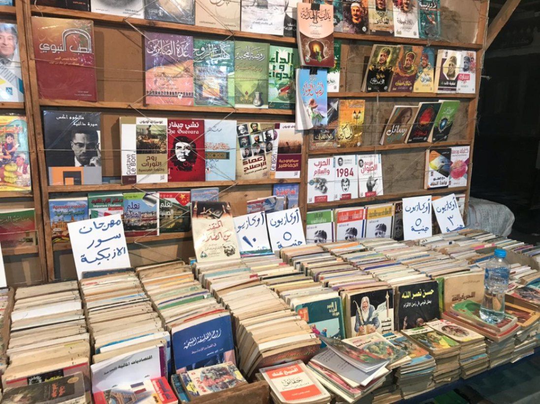
## Description Al-Azbakiyya Wall Book Market, known in Arabic as سور الأزبكية, is one of Cairo’s most distinctive and culturally rich attractions. Located near the historic Azbakeya Gardens, this open-air book market has long been a gathering place for readers, students, and collectors in search of affordable books and rare printed materials. The market is famous for its rows of simple stalls and tables stacked high with books covering every imaginable subject, from classical Arabic literature and religious texts to modern novels, academic works, and children’s books. What makes Al-Azbakiyya Wall Book Market unique is its role in preserving and circulating literary heritage at accessible prices. Many of the books sold here are second-hand, out-of-print, or rescued from private libraries, making the market a haven for hidden literary gems. A lesser-known fact is that some vendors specialize in vintage magazines, old school textbooks, and early 20th-century publications that are difficult to find elsewhere. Another interesting detail is that the market becomes especially lively during the annual Cairo International Book Fair, when sellers temporarily relocate to fairgrounds while maintaining the spirit of the original market. Beyond commerce, Sur Al-Azbakiyya represents Cairo’s deep-rooted intellectual culture, offering visitors a chance to engage with the city’s literary soul in an informal and welcoming setting. ## Location Al-Azbakiyya Wall Book Market is located in **Egypt**, in the **Cairo Governorate**, within **central Cairo**. It is situated near **Ataba Square**, close to the Azbakeya Gardens and within walking distance of several historic and commercial areas. The market is easily accessible by public transportation. The **Ataba Metro Station** serves Lines 2 and 3 and is the most convenient way to reach the area. Numerous buses and minibuses also stop nearby. Due to heavy traffic and limited parking, public transport or walking from nearby districts is strongly recommended. ## Tips * Visit in the morning to browse comfortably before the area becomes crowded. * Take your time and explore multiple stalls, as prices and selections can vary widely. * Bargaining is common and generally expected, but should be done politely. * Bring cash in small denominations, as most vendors do not accept electronic payments. * If you are looking for rare or academic books, ask vendors directly—they often keep special items tucked away. * Be mindful of your belongings, as the area can be busy. ## Conclusion Al-Azbakiyya Wall Book Market is a living cultural institution that reflects Cairo’s love for knowledge, literature, and learning. Whether you are searching for rare books or simply soaking in the atmosphere, it offers a unique and deeply local experience in the heart of the city. ## FAQ **What kind of books can I find at Al-Azbakiyya Wall Book Market?** You can find a wide range of books, including Arabic literature, religious texts, textbooks, novels, magazines, and children’s books. **Are the books new or used?** Most books are second-hand or older editions, though some new and reprinted titles may also be available. **Is the market open every day?** The market is generally open daily, though hours may vary and some stalls close on Fridays. **Can tourists who do not speak Arabic visit?** Yes, visitors are welcome, though knowledge of Arabic helps when browsing and negotiating. **Is photography allowed?** Photography is usually allowed, but it is polite to ask vendors before taking photos. ## Links * [Wiki page](https://ar.wikipedia.org/wiki/%D8%B3%D9%88%D8%B1_%D8%A7%D9%84%D8%A3%D8%B2%D8%A8%D9%83%D9%8A%D8%A9)
GemVoyage Team • World
Tunis
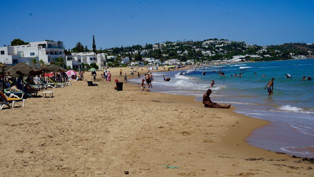
## Description La Marsa Beach is a beloved coastal escape northeast of Tunis that combines Mediterranean charm with an approachable, local atmosphere. Far from the large resort complexes of some Mediterranean destinations, La Marsa offers a more neighborhood-oriented seaside experience: a promenade lined with cafés, bakeries, and small restaurants; stretches of sandy shore where locals swim and sunbathe; and scenic viewpoints that look across the blue Mediterranean. For visitors seeking a short seaside interlude from Tunis’s historic core, La Marsa is an ideal half-day or day-trip destination. The area’s allure stems from its balance of leisure and everyday life. Residents walk their dogs along the promenade, families picnic on the sand, and fishermen haul in their catches at dawn. This authentic feel makes La Marsa attractive to travelers who want to witness contemporary Tunisian coastal life, not just the staged beachfront experience. The neighborhood also contains pockets of cultural interest—small galleries, local bakeries serving traditional pastries, and seasonal markets—that reward time spent wandering. ## Location La Marsa is located along the Mediterranean coast, approximately a 20–40 minute drive from central Tunis depending on traffic. It is part of the larger Tunis metropolitan area and is commonly reached by taxi, rideshare, or regional train in combination with local buses. The promenade and main beach are clustered near the town center, making it easy to combine a seaside visit with cafés or a short walk through residential streets to see local homes and shops. For a relaxed day, arrive mid-morning to stroll the promenade, have a seaside lunch, and enjoy a late-afternoon walk as light softens over the water. If you want to swim, check local conditions—lifeguard presence and sea state vary by season and specific beach segments. ## Tips - Check tide and sea conditions before planning a swim day; calmer days are best for families and casual swimming. - Visit early in the day or later in the afternoon to avoid peak crowds and capture better light for photos. - Bring essentials: water, sun protection, and a towel—some smaller beaches do not have full-service rental facilities. - Sample local cafés and seafood restaurants along the promenade for a taste of Tunisian coastal cuisine. - Pair the beach with cultural stops: a short walk through La Marsa’s streets reveals bakeries, small galleries, and neighborhood markets. - If you prefer quieter spots, walk a little farther from the main promenade where smaller coves and rocky outcrops provide a calmer atmosphere. ## Conclusion La Marsa Beach is an ideal complement to a Tunis itinerary for visitors who want to add gentle sea air to a cultural visit. It offers an accessible, everyday Mediterranean experience that feels comfortably local—and it’s an excellent reminder that Tunisia’s coastline is as varied and alive as its historic medinas. ## FAQ ### Is La Marsa Beach good for a quick escape from Tunis? Yes. It’s one of the closest coastal escapes from the capital and works well for half-day or full-day visits without complicated logistics. ### Is La Marsa only a summer destination? No. While beachgoing peaks in summer, the promenade and cafés are pleasant year-round for walks and dining. ### What facilities are available? Facilities vary by spot: some stretches have cafés and basic rental services, while smaller coves may lack amenities—bring essentials if you’re unsure. ### How do I get there from central Tunis? Taxi or rideshare are the most direct options; regional trains and buses also connect the area but may require short onward transfers. ### Is La Marsa family-friendly? Generally yes—shallow water and promenade facilities make it suitable for families, though conditions vary by season and exact location. ## Links - [Wikipedia](https://en.wikipedia.org/wiki/La_Marsa)
GemVoyage Team • World
Barcelona
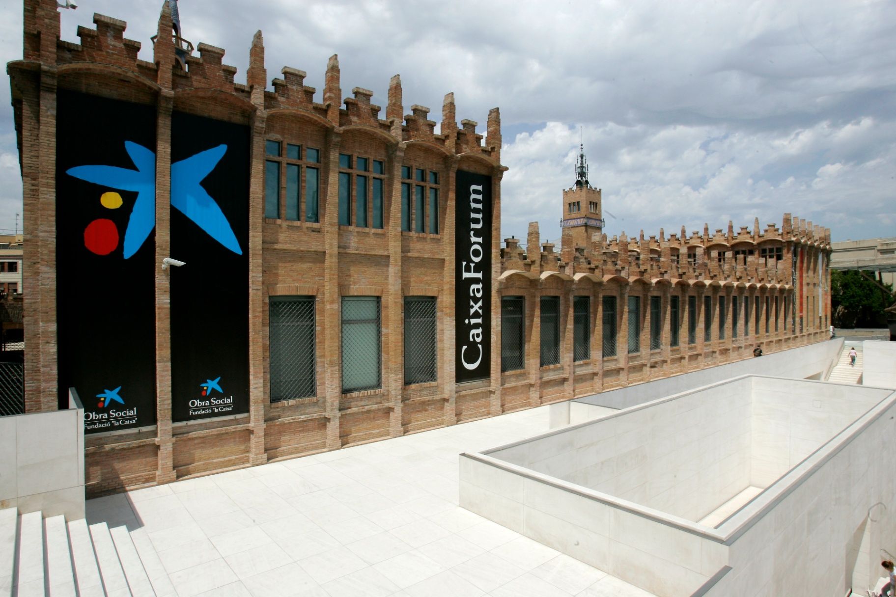
## Description **CaixaForum Barcelona** is one of the city’s most important cultural institutions, combining architecture, contemporary thought, and public education under one roof. It is housed in the former **Casaramona Textile Factory**, an early 20th-century industrial complex designed by the modernist architect Josep Puig i Cadafalch. Rather than demolishing the structure, it was carefully restored and repurposed, turning a once-abandoned factory into a vibrant center for exhibitions, debates, and artistic exploration. What makes CaixaForum Barcelona unique is its **programmatic diversity**. It is not a conventional museum with a permanent collection on display. Instead, it hosts a rotating schedule of high-quality temporary exhibitions covering art, photography, history, science, archaeology, music, and social issues. These exhibitions are often produced in collaboration with major international institutions, giving visitors access to works and ideas that rarely appear elsewhere in the city. Architecturally, the building itself is part of the experience. The red brick façades, sharp geometric volumes, and absence of ornamentation reflect a restrained form of Catalan modernism that contrasts with the more decorative style of Gaudí. A lesser-known fact is that the factory was originally built in 1911 but **never actually operated as an industrial plant**, as production ceased before it could fully open. Another interesting detail is the dramatic entrance plaza, redesigned by Japanese architect Arata Isozaki, which creates a striking dialogue between old and new through stone, steel, and light. Beyond exhibitions, CaixaForum functions as a **cultural forum in the literal sense**. It hosts lectures, film screenings, concerts, workshops, and family-oriented activities, making it appealing to a wide range of audiences. The institution emphasizes accessibility and education, aiming to make complex cultural topics understandable without oversimplifying them. ## Location **Country:** Spain **Region:** Catalonia **City:** Barcelona **District:** Sants-Montjuïc CaixaForum Barcelona is located at the foot of **Montjuïc Hill**, near Plaça d’Espanya, an area known for its concentration of museums, exhibition spaces, and monumental architecture. ### How to Get There * **By metro:** * Lines L1 (Red) or L3 (Green) to **Plaça d’Espanya** station. From there, it is a 5–7 minute walk. * **By bus:** * Several bus lines stop around Plaça d’Espanya and along Avinguda de Francesc Ferrer i Guàrdia. * **On foot:** * Easily reachable from Plaça d’Espanya and the surrounding exhibition grounds. * **By taxi:** * A convenient option if coming from other parts of the city; drop-off points are nearby. ## Tips * **Check the exhibition schedule in advance:** Exhibitions change regularly, and some are time-limited. * **Allow enough time:** One exhibition can easily take 90 minutes if explored thoroughly. * **Visit during weekdays:** Weekends tend to be busier, especially during popular exhibitions. * **Use the audio guides:** They provide context and depth without overwhelming the visitor. * **Combine with Montjuïc sights:** Pair your visit with nearby attractions such as museums or gardens. * **Look for free-entry times:** Certain days or time slots may offer reduced or free admission. ## Conclusion CaixaForum Barcelona is a cultural anchor that successfully bridges Barcelona’s industrial past with its intellectual present. Through its thoughtful exhibitions, adaptive architecture, and commitment to public engagement, it offers a meaningful alternative to traditional museums and rewards visitors seeking substance over spectacle. ## FAQ **1. Is CaixaForum Barcelona a museum?** It functions more as a cultural center with temporary exhibitions rather than a permanent museum collection. **2. How long does a visit usually take?** Most visitors spend between **1.5 and 3 hours**, depending on the exhibitions. **3. Is it suitable for children?** Yes, there are family-friendly exhibitions and interactive educational activities. **4. Are exhibitions available in multiple languages?** Yes, information panels and guides are usually available in Catalan, Spanish, and English. **5. Is the building accessible?** Yes, the center is fully accessible for visitors with reduced mobility. **6. Can you visit just for the architecture?** Yes, the building itself is worth seeing even without attending an exhibition. ## Links * [Official CaixaForum website](https://caixaforum.org/es/home)
GemVoyage Team • World
Seville
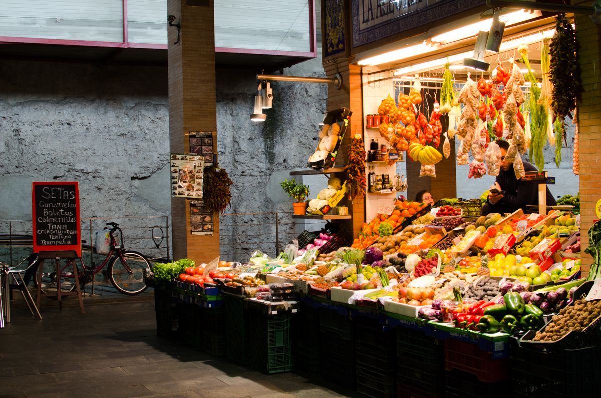
## Description Triana Market is one of the most characterful places to experience everyday Seville beyond the postcard version of the city. Set in the Triana neighborhood, it combines the energy of a traditional neighborhood market with the atmosphere of a place shaped by river life, ceramics, flamenco, and strong local identity. Visitors come here for produce, but they often stay longer because the market feels like a living introduction to the district itself. It is not a polished tourist stage. It is a working market where stallholders greet regulars, chefs shop for ingredients, and curious travelers can see how Seville still feeds itself in a very local way. What makes Triana Market especially appealing is the balance between food and history. The market sits close to the Guadalquivir River and near the area where Triana’s old artisan traditions developed, so a visit naturally turns into a wider walk through one of Seville’s most distinctive quarters. You can browse fruit, fish, meat, olives, pastries, spices, and tapas-style snacks while hearing the rhythm of a neighborhood that has long been associated with sailors, potters, and performers. A little-known detail is that the market stands near archaeological remains tied to the former Castle of San Jorge, which adds a historical layer that many visitors miss when they come only for lunch. Another less obvious fact is that the market is often the place where locals go to buy ingredients for home cooking rather than a destination designed mainly for tourists, which is part of why it feels authentic. The best experience here is not rushed. Start by looking around rather than ordering immediately, because the market rewards observation. The colors of the fruit stalls, the smell of fried food, the chatter from the bars, and the pace of local shopping all help explain why Triana is one of Seville’s most beloved neighborhoods. If you are interested in local culture, this is also an excellent point of departure for exploring ceramics shops, riverfront views, and the streets around Calle Betis and the Triana Bridge. ## Location Triana Market is in the Triana neighborhood on the west bank of the Guadalquivir River in Seville, Andalusia, Spain. The neighborhood sits just across the river from the historic center, so the market is easy to include in a day of sightseeing. If you are already in central Seville, the simplest approach is to walk across the Triana Bridge and continue into the market area on foot. That route is especially enjoyable because it gives you a clear sense of how the city changes from the monument-filled center to the more residential and traditionally working-class Triana side. If you are coming from farther away, a taxi, city bus, or a combination of walking and public transport will work well. The market is compact, so once you arrive, you will not need additional transport. It also pairs naturally with nearby river walks, ceramic workshops, and tapas stops, which makes it a practical base rather than a standalone quick stop. In hot weather, plan your arrival earlier in the day, since the surrounding streets can become warm by midday and the market itself is more enjoyable before the lunch rush. ## Tips - Go in the morning if you want the fullest market atmosphere and the best selection of produce and seafood. - Bring both cash and a card, because some smaller stalls prefer one or the other. - Do not limit yourself to shopping; the bars inside and around the market are part of the experience. - Combine the visit with a walk through Triana’s ceramic streets and the riverfront. - If you want photos, arrive early enough to avoid the busiest lunch crowd. - Ask stallholders what is in season, since that is often the fastest way to taste the most local products. ## Conclusion Triana Market is one of the most rewarding places in Seville for travelers who want local flavor, neighborhood character, and a real sense of daily life. It is easy to reach, rich in atmosphere, and memorable well beyond a simple shopping stop. ## FAQ ### Is Triana Market worth visiting even if I am not cooking? Yes. The market is worth visiting for its atmosphere, food counters, and neighborhood character even if you do not plan to buy ingredients. ### What is the best time to visit Triana Market? Morning is usually best, especially if you want fresh produce and a calmer pace before the lunch rush begins. ### Can I eat inside or near the market? Yes. The market and the surrounding streets have bars and food counters where you can eat casually and try local dishes. ### How long should I spend there? Plan at least one hour, and more if you want to combine shopping, snacks, and a walk through the neighborhood. ## Links - [Wikipedia](https://en.wikipedia.org/wiki/Triana,_Seville) - [Seville tourism information](https://www.visitasevilla.es/en)
GemVoyage Team • World
Giresun
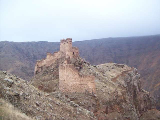
## Description The Castle of the Devil, known locally as Şeytan Kalesi, is one of Turkey’s most dramatic and mysterious fortress ruins. Perched atop a rocky bluff in the Çıldır district of Ardahan Province, this ancient stronghold commands sweeping views of the plunging Karaçay Canyon and the surrounding highlands. Its name—“Castle of the Devil”—stems from local folklore that claims an evil spirit once haunted the area, a myth that still lingers in the collective memory of nearby villagers. Dating back to the Hellenistic period, the castle has seen a succession of rulers and empires, including the Urartians, Persians, Romans, Byzantines, and Ottomans. Its strategic location in the Upper Kur Valley made it a vital military outpost and a gateway between Anatolia and the Caucasus. The fortress was continuously modified and expanded by its various occupants, and today visitors can still see remnants of cisterns, staircases descending to water sources, and a small chapel tucked within the ruins. A little-known fact is that the castle was once a Georgian stronghold known as Qajis Tsikhe, and it played a key role in regional defense for centuries. Another intriguing detail: the site reportedly housed a prison, as noted by Georgian historian Ekvtime Takaishvili in the early 20th century. ## Location The Castle of the Devil is located in **Turkey**, within the **Eastern Anatolia Region**, in the **Çıldır district of Ardahan Province**. Specifically, it lies about 1.5 kilometers northeast of the village of Yıldırımtepe, nestled deep within the rugged terrain of the Karaçay Canyon. ### How to Get There - **By Car**: The most practical way to reach the castle is by car. From Ardahan city center, it’s roughly a 45-minute drive. The final stretch includes narrow rural roads, so a vehicle with good clearance is recommended. - **By Tour**: Local tour operators in Ardahan occasionally offer guided excursions to Şeytan Kalesi, often combined with visits to Çıldır Lake and other regional landmarks. - **By Public Transport**: Public transport options are limited. Visitors relying on buses should travel to Çıldır town and arrange a taxi or private transfer from there. The journey itself is part of the adventure, with dramatic landscapes unfolding as you approach the fortress. ## Tips - **Wear Hiking Shoes**: The terrain around the castle is rocky and uneven. Good footwear is essential for exploring safely. - **Bring Water and Snacks**: There are no facilities at the site, so come prepared. - **Visit in Spring or Early Autumn**: These seasons offer the most comfortable weather and the clearest views. - **Respect the Site**: The ruins are fragile and unguarded. Avoid climbing on unstable sections and leave no trace. - **Pair with Nearby Attractions**: Combine your visit with a trip to Çıldır Lake, especially in winter when the lake freezes and offers unique activities like horse-drawn sleigh rides. - **Photography**: The castle’s dramatic setting makes it a fantastic spot for landscape photography, especially at sunrise or sunset. ## Conclusion The Castle of the Devil in Ardahan is a hauntingly beautiful relic of Turkey’s layered history. With its mythic name, panoramic views, and centuries-old architecture, it offers a compelling experience for travelers seeking both adventure and cultural depth. ## FAQ **1. Is there an entrance fee to visit the Castle of the Devil?** No, the site is open to the public and free to visit. **2. How long does it take to explore the castle?** Most visitors spend 1–2 hours exploring the ruins and enjoying the views. **3. Is the site accessible year-round?** Yes, but winter conditions can make access difficult due to snow and ice. **4. Can children visit the castle?** Yes, but due to the rugged terrain, close supervision is necessary. **5. Are guided tours available?** Occasionally, local guides and tour companies offer excursions. It’s best to inquire in Ardahan or Çıldır. **6. Is there any accommodation nearby?** Basic guesthouses and hotels are available in Çıldır and Ardahan. Booking in advance is recommended during peak seasons. ## Links - [Şeytan Castle – Wikipedia Overview](https://en.wikipedia.org/wiki/%C5%9Eeytan_Castle)
GemVoyage Team • World

Comments