GemVoyage Team • World
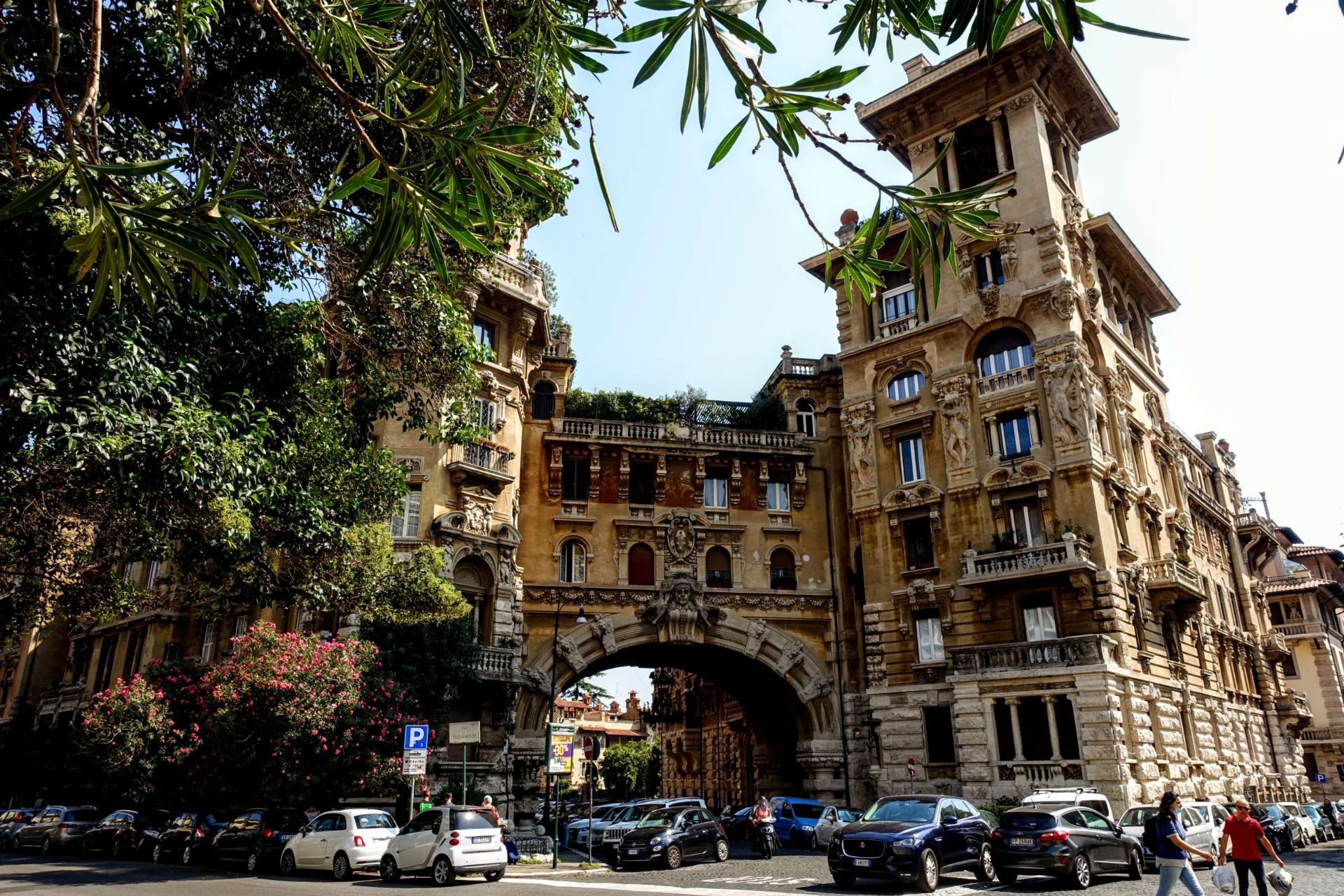
The district’s central Fountain of the Frogs remains the visual and social heart of Coppedè, anchoring a piazza that draws photographers and architecture lovers. Film crews and editorial shoots often favor the quarter for its cinematic, slightly surreal quality. A lesser-known nuance is the abundance of small symbolic details—carvings referencing mythology, architecture that blends multiple historical styles on a single facade, and discreet plaques that hint at the designer’s playful intentions.
Q: Are guided tours available for Coppedè?
A: Yes, some walking tours include Coppedè as part of broader neighborhood routes, and independent guides can tailor visits for architecture lovers.
Q: Can I enter the buildings in Coppedè?
A: Many buildings are private residences; admire the ornate facades from the street and respect private property.
Q: What is the best time of day to visit?
A: Morning or late afternoon for softer light and fewer people—midday can be busier and harsher for photos.
Q: Are there nearby cafes or amenities?
A: Yes—small cafes and restaurants are within walking distance in the Trieste area; stop for a coffee after exploring.
Discover more hidden gems you might love.
Tirana
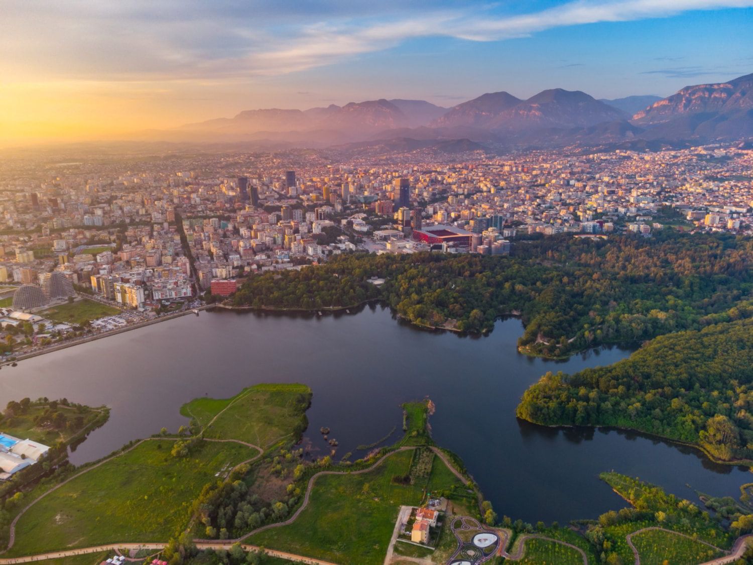
## Description The Grand Park of Tirana is one of the city’s most important public spaces and one of the best places to understand how Tirana balances urban growth with everyday leisure. Often treated simply as a park, it is actually a large and layered landscape that includes walking paths, shaded areas, open lawns, the artificial lake, family spaces, cafés, and quiet corners where people come to jog, socialize, or simply rest away from the intensity of the city center. For visitors, it offers an easy way to experience a more relaxed side of Tirana without leaving the capital. What makes the Grand Park special is its role as a civic landscape. It is not only a place for tourists; it is part of daily life for residents. People use it in the morning for exercise, in the afternoon for strolls, and in the evening for gatherings. That local rhythm gives the park a real sense of authenticity. One little-known fact is that the area around the lake and its green edges has changed significantly over time, reflecting broader shifts in how Tirana has developed as a modern city. Another interesting point is that the park’s size makes it one of the city’s most important environmental buffers, helping create a calmer microclimate in a fast-growing urban area. The Grand Park is also a good place for visitors who want to slow down their sightseeing. Tirana can feel energetic and busy, and the park offers balance. You can walk, rent a bike in some areas, sit by the water, or simply watch the city’s social life unfold. It is not a museum-like attraction with a fixed narrative; it is a lived-in urban landscape. That flexibility is part of its appeal, because it can fit into a trip in many different ways: as a morning workout, a midday break, a sunset walk, or a family outing. ## Location The Grand Park of Tirana is in southern-central Tirana, Albania, extending around the artificial lake and nearby green spaces. Because it covers a large area, there is no single exact “entrance” experience; instead, visitors usually approach it from the city side that is most convenient for their itinerary. The easiest way to get there is by taxi, ride-hailing, or a long walk from central Tirana. Many travelers also reach the park from nearby neighborhoods on foot. If you are already exploring central landmarks, it makes sense to build in a walking break and head toward the lake. Since the park is broad, choose a route that matches the part you want to see most, whether that is the waterfront, the tree-lined paths, or the recreational zones. ## Tips Go early in the day or near sunset for the most pleasant temperatures and the nicest light around the lake. Wear comfortable shoes because the park is best enjoyed on foot. If you like a local atmosphere, spend time watching how residents use the park rather than focusing only on the scenery. Bring water and expect a leisurely pace; this is a place for lingering, not rushing. ## Conclusion The Grand Park of Tirana is a spacious urban retreat that gives visitors a calmer, more local perspective on the Albanian capital. ## FAQ ### Is the Grand Park of Tirana good for tourists? Yes. It is one of the easiest and most enjoyable places to experience daily life in Tirana. ### Can I walk around the lake? Yes, the park is designed for walking and recreation, though routes vary by area. ### Is it family-friendly? Very much so. It is one of the city’s most popular family and leisure spaces. ### How long should I spend there? Anywhere from one hour to half a day, depending on whether you want a short walk or a longer picnic-style visit. ### What is the best time to go? Early morning and late afternoon are usually the most pleasant times. ## Links - [Tirana tourism information](https://visit-tirana.com/) - [Grand Park of Tirana on Wikipedia](https://en.wikipedia.org/wiki/Grand_Park_of_Tirana)
GemVoyage Team • World
Milan
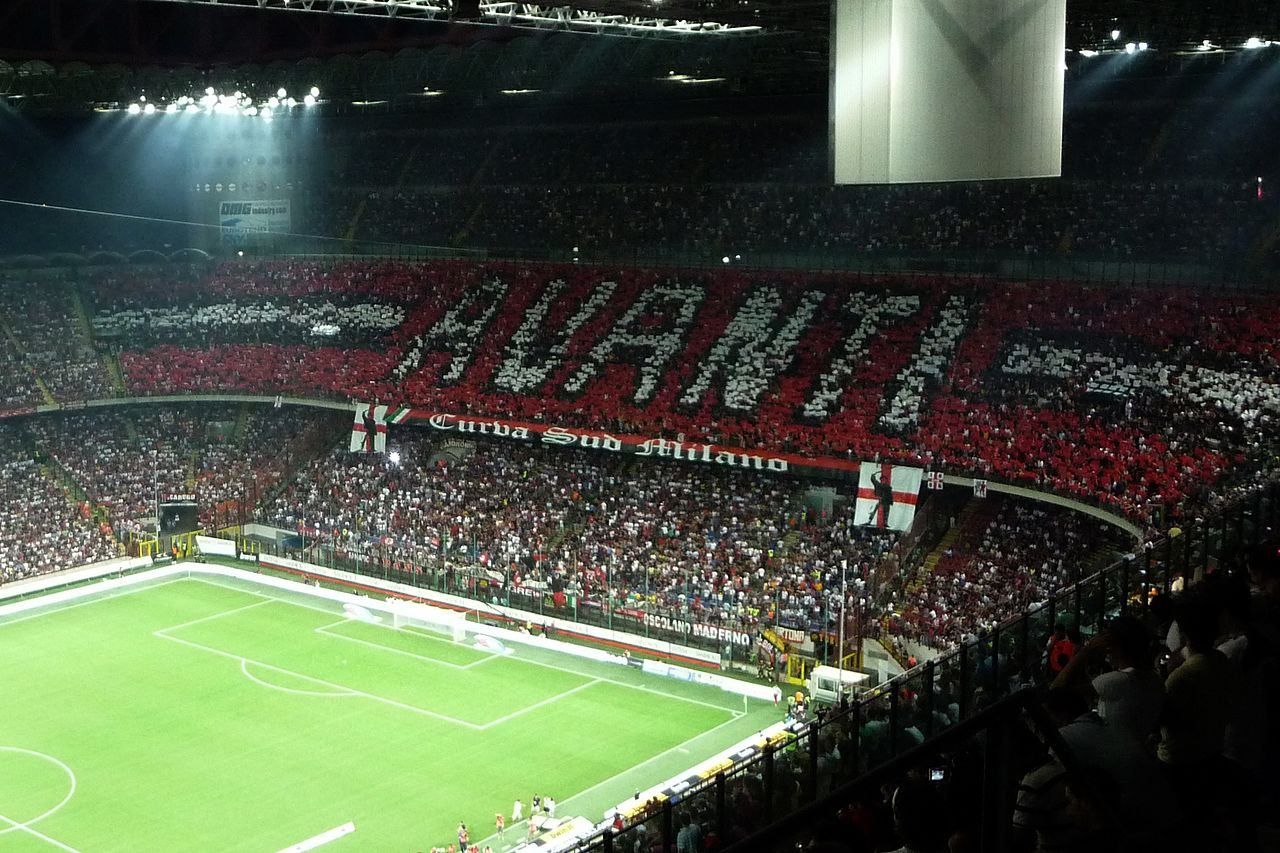
## Description The **San Siro Stadium**, officially named **Stadio Giuseppe Meazza**, is one of the most legendary football arenas in the world — a true **temple of sport and passion**. Located in the heart of **Milan**, Italy’s fashion and football capital, San Siro stands as a colossal monument to the city’s competitive spirit and shared love for the beautiful game. Originally inaugurated in **1926**, the stadium was built under the direction of **Piero Pirelli**, then-president of **A.C. Milan**, and was later named after **Giuseppe Meazza**, one of Italy’s most celebrated footballers who played for both **A.C. Milan** and **Inter Milan**. Over the decades, it has undergone multiple renovations, including major updates in **1955**, **1990** (for the FIFA World Cup), and **2015**, giving it the imposing, futuristic appearance it has today. With a seating capacity of over **75,000 spectators**, San Siro is Italy’s **largest stadium** and one of the most atmospheric in Europe. Its distinctive **spiral towers** and red roof beams are architectural icons, visible from across the city skyline. Inside, the steep stands ensure that fans feel incredibly close to the pitch — creating an electric atmosphere during matches, especially when **A.C. Milan** and **Inter Milan** face off in the legendary **Derby della Madonnina**. Beyond football, San Siro has hosted countless **historic events**, from **FIFA World Cup** and **UEFA Champions League** finals to concerts by international superstars like **U2, Coldplay, and Beyoncé**. Few stadiums in the world can match its mix of **sporting heritage and cultural influence**. A lesser-known fact is that the **stadium has its own museum**, the **San Siro Museum**, dedicated to the history of Milan’s two football clubs. Visitors can explore trophies, jerseys, and memorabilia from more than a century of football history — and even step into the players’ tunnel and onto the field itself, experiencing what legends once did. While discussions continue about a possible **new stadium** in the coming years, San Siro remains a beloved landmark — a living piece of Milanese identity and an enduring shrine to Italian football glory. ## Location The **San Siro Stadium (Stadio Giuseppe Meazza)** is located in the **San Siro district**, in the **northwestern part of Milan**, **Lombardy**, **Italy**. **Address:** Piazzale Angelo Moratti, 20151 Milano MI, Italy To get there: * **By metro:** Take **Line M5 (Lilac Line)** to **San Siro Stadio Station**, located just steps from the stadium entrance. * **By tram:** Line **16** (direction San Siro) stops directly outside the venue. * **By bus:** Lines **49, 64, 78, 80, 98,** and **423** all serve the stadium area. * **By car:** Accessible from **Viale Caprilli** or **Via Novara**, though parking can be limited on match or concert days. * **By bike or scooter:** Milan’s **bike-sharing and e-scooter services** have designated parking zones near the stadium. ## Tips * **Book tickets early:** Matches, especially the **Derby della Madonnina**, sell out quickly. Buy tickets through official club websites or authorized partners. * **Take the stadium tour:** Visit the **San Siro Museum**, explore locker rooms, and walk through the players’ tunnel onto the field. * **Arrive early:** On match days, the area fills with fans, street food stands, and merchandise stalls — a festive pre-game experience. * **Check the schedule:** Even if no match is on, the **museum and tour** are open most days. * **Use public transport:** Parking is limited, so the **M5 metro** line is the most convenient and efficient way to get there. * **Stay for the atmosphere:** The energy of Italian fans, complete with chants, banners, and flares, makes every match unforgettable. * **Bring ear protection for children:** The volume during matches can be intense, especially in the Curva Sud and Curva Nord sections. * **Combine with nearby attractions:** Visit **Casa Milan (A.C. Milan headquarters)** or enjoy the nearby **Monte Stella Park** for a relaxing contrast to the excitement. ## Conclusion The **San Siro Stadium** is more than just a sports venue — it’s the **heart of Milanese football culture** and a symbol of Italian pride. From hosting world-class matches to staging concerts for thousands of fans, San Siro has witnessed nearly a century of unforgettable moments. Its towering architecture, roaring crowds, and legendary rivalries make it a must-see destination for anyone visiting Milan. Whether you’re a devoted football fan or simply curious about the passion that drives Italy’s sporting soul, a visit to San Siro is an experience you’ll never forget. ## FAQ **1. When was San Siro Stadium built?** It was inaugurated in **1926** and has undergone several major renovations since, most notably in **1955** and **1990**. **2. Why is it also called Stadio Giuseppe Meazza?** The stadium was renamed after **Giuseppe Meazza**, a famous Italian footballer who played for both Milan and Inter, in recognition of his contribution to Italian football. **3. Which teams play at San Siro?** It is home to both **A.C. Milan** and **Inter Milan (Internazionale)**. **4. How can I visit the stadium when there’s no match?** You can book a **guided tour and museum visit**, available daily except on event days. **5. What is the capacity of San Siro?** The stadium can hold approximately **75,000 spectators**, making it the **largest in Italy**. **6. Are there restaurants or shops nearby?** Yes — the surrounding area has **cafés, restaurants, and team merchandise stores**, as well as pop-up vendors on match days. **7. Is the stadium being replaced?** Plans are being discussed for a **new stadium** in the coming years, but **San Siro remains open and active** for matches and events for now. ## Links * [Official A.C. Milan Website – Tickets & Matches](https://www.acmilan.com) * [Official Inter Milan Website – Tickets & Events](https://www.inter.it) * [San Siro Stadium Tour & Museum](https://www.sansirostadium.com)
GemVoyage Team • World
Gmunden
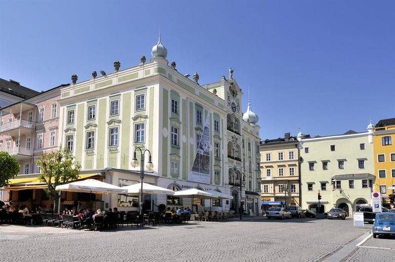
## Description The **Rathaus Gmunden** — the **Town Hall of Gmunden** — is one of Austria’s most charming and picturesque civic buildings, perfectly reflecting the town’s **historic elegance and lakeside serenity**. Standing proudly on the shore of **Traunsee Lake**, surrounded by the scenic peaks of the **Salzkammergut Mountains**, this 16th-century building combines Renaissance architecture, local craftsmanship, and cultural pride in a way few town halls do. Built between **1574 and 1577**, the Rathaus originally served as a **merchant and administrative center** during a period when Gmunden was thriving as a salt-trading hub. Its architecture features a **Renaissance façade** with beautifully arched arcades, intricate window frames, and an elegant clock tower topped with a small bell turret. The building’s exterior is painted in soft pastel hues that harmonize with the lakeside scenery, giving it a warm and inviting appearance. However, what truly makes Rathaus Gmunden stand out — and one of Austria’s most photographed town halls — is its **ceramic carillon** (a set of bells made from Gmunden pottery). Installed in **1961**, this unique feature consists of **24 hand-painted ceramic bells**, crafted by local artisans from the renowned **Gmundner Keramik** workshop, which has been producing distinctive green-flamed pottery since the 17th century. Several times a day, the bells chime melodiously across the old town, filling the air with a sound that has become a symbol of Gmunden’s artistic heritage. Few visitors realize that it is **one of the only ceramic carillons in the world** still in operation — a beautiful fusion of art, music, and tradition. Inside, the Rathaus still functions as the **seat of the local government**, but parts of it are open to visitors, showcasing historical rooms, exhibitions, and cultural displays. The nearby **Rathausplatz (Town Hall Square)** hosts markets, festivals, and outdoor concerts throughout the year, offering a lively glimpse of local life. Whether you visit for its craftsmanship, its lakeside views, or the charm of its daily chimes, Rathaus Gmunden is a small-town treasure that embodies the **soul of the Austrian Alps**. ## Location The **Rathaus Gmunden** is located in the **heart of Gmunden**, a town in **Upper Austria (Oberösterreich)**, on the **northern shore of Lake Traunsee**. **Address:** Rathausplatz 1, 4810 Gmunden, Austria To get there: * **By train:** From **Linz** or **Salzburg**, take an **ÖBB regional train** to **Gmunden Station**, then walk about **10–15 minutes** to the old town. * **By tram:** From the station, you can also take the **Traunseetram**, which stops near Rathausplatz. * **By car:** Easily accessible via the **A1 motorway**, exit **Regau** or **Laakirchen**, with several nearby parking options. * **By boat:** Ferries on **Traunsee Lake** stop at **Gmunden Seebahnhof**, just steps away from the Town Hall. * **By foot or bike:** The promenade around the lake connects the Rathaus to the main attractions of Gmunden, including **Schloss Ort** and the **Esplanade**. ## Tips * **Don’t miss the carillon performance:** The ceramic bells ring several times daily — typically at **11:00 AM**, **3:00 PM**, and **5:00 PM** (check local schedules). * **Visit the Gmundner Keramik Manufaktur:** Just outside town, you can see how the world-famous green-flamed pottery is made — a perfect complement to the Rathaus visit. * **Take photos from the lake promenade:** The Town Hall reflected in the water, with mountains in the background, is one of Austria’s most postcard-worthy views. * **Enjoy the market:** On Fridays, Rathausplatz hosts a **local farmers’ market** selling fresh regional produce, cheese, and crafts. * **Visit nearby Schloss Ort:** A short walk away, this fairytale castle on the lake is another Gmunden highlight. * **Stop for coffee by the lake:** There are several cozy cafés around Rathausplatz with views of the water and the mountains. * **Combine with a boat tour:** Scenic cruises on Traunsee often pass by the Rathaus, offering a new perspective from the lake. ## Conclusion The **Rathaus Gmunden** is far more than a historic building — it’s the **heart of a town steeped in art, tradition, and Alpine beauty**. From its Renaissance architecture to the enchanting ceramic bells that sing across Traunsee, it tells the story of a community that has blended craftsmanship and culture for centuries. Whether you’re exploring the Salzkammergut for its lakes, castles, or peaceful charm, a stop at the Rathaus Gmunden is an experience that captures the very essence of Austrian heritage. ## FAQ **1. When was the Rathaus Gmunden built?** It was constructed between **1574 and 1577** during the height of Gmunden’s salt-trading prosperity. **2. What makes the Rathaus special?** Its **ceramic carillon**, made from locally produced Gmundner pottery, is **one of the few of its kind in the world**. **3. How often does the carillon play?** The bells ring several times daily, typically at **11:00 AM, 3:00 PM, and 5:00 PM**, though times may vary seasonally. **4. Can visitors enter the Rathaus?** Yes, parts of the building are open to visitors, especially during cultural events or exhibitions. **5. Where is Gmunden located?** Gmunden lies on **Lake Traunsee** in **Upper Austria (Oberösterreich)**, roughly halfway between **Linz** and **Salzburg**. **6. Is it easy to reach from Vienna or Salzburg?** Yes — from Vienna or Salzburg, take a train to **Attnang-Puchheim**, then connect to Gmunden via a regional line (total travel time: around **2 hours**). **7. What nearby attractions should I see?** Don’t miss **Schloss Ort**, **Traunsee Lake cruises**, and the **Gmundner Keramik Factory** for a complete cultural experience. ## Links * [Gmunden Tourism Official Website](https://www.gmunden.at)
GemVoyage Team • World
Neuquén
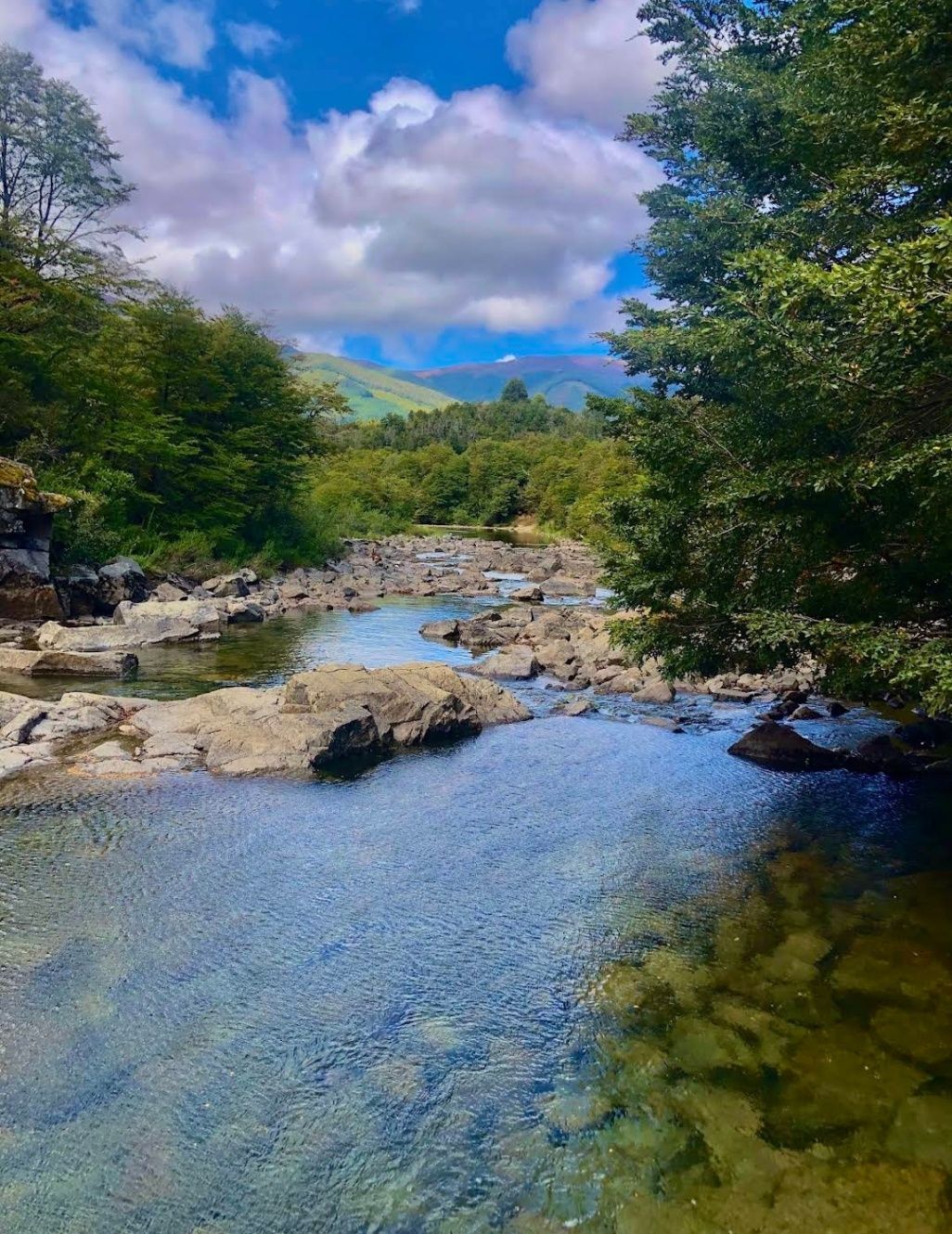
## Description Nestled within the heart of Argentina’s Patagonia, **Cascadas del Río Hermoso** is a breathtaking natural wonder that captivates visitors with its unspoiled beauty. The waterfalls are part of the Río Hermoso, which translates to “Beautiful River,” and the name is no exaggeration. Surrounded by dense forests, clear mountain air, and the soothing sound of rushing water, this destination offers a perfect blend of serenity and adventure. What makes Cascadas del Río Hermoso unique is not only its picturesque setting but also its relative tranquility compared to more popular sites like Iguazú Falls. Here, you won’t find large crowds or bustling tourist infrastructure—just raw, pristine nature. The waterfalls are small to medium in size, cascading down in multiple tiers, forming natural pools that invite visitors to rest and reflect. A little-known fact is that the river is fed by meltwater from the Andes, meaning that the water levels and flow change significantly with the seasons. Another detail often overlooked is the region’s rich biodiversity: the surrounding forests are home to species such as the Patagonian woodpecker and the elusive pudú, one of the world’s smallest deer. For nature enthusiasts, Cascadas del Río Hermoso is a rare opportunity to encounter untouched ecosystems. ## Location Cascadas del Río Hermoso is located in **Argentina, in the Neuquén Province of northern Patagonia**, within the boundaries of **Lanín National Park**. The closest town is **San Martín de los Andes**, a charming Patagonian village known for its alpine-style architecture, lakes, and outdoor activities. To get there, travelers usually fly into Aviador Carlos Campos Airport, just 20 km from San Martín de los Andes. From the town, the waterfalls can be reached by car via **Ruta Nacional 40** and then **Ruta Provincial 63**, which winds through stunning Andean landscapes. The trip itself is a highlight, with panoramic views of lakes, mountains, and valleys. Renting a car is highly recommended, as it allows for flexible stops at scenic viewpoints along the way. ## Tips * **Best Time to Visit**: Late spring to early autumn (November to March) offers the best weather and water flow. Winter can be beautiful too but access may be more difficult due to snow. * **What to Bring**: Comfortable hiking shoes, layered clothing (Patagonia weather is unpredictable), water, snacks, and a camera. * **Respect Nature**: Since this is a less-visited area, maintaining its pristine condition is important. Avoid leaving trash and stick to marked trails. * **Combine Your Trip**: Consider combining your visit with nearby attractions like Lake Lácar, Chapelco ski resort, or even the famous Seven Lakes Route. * **Local Guides**: Hiring a local guide can enrich your experience with stories about the region’s history, culture, and flora and fauna. ## Conclusion Cascadas del Río Hermoso is a tranquil, hidden treasure in Argentina’s Patagonia, offering visitors a rare chance to connect with untouched nature. Surrounded by forests, wildlife, and the pure waters of the Andes, it’s a destination that rewards travelers seeking peace, adventure, and authenticity. ## FAQ **1. How difficult is the hike to Cascadas del Río Hermoso?** The hike is considered easy to moderate. Most trails are well-marked and accessible, making it suitable for families and casual hikers. **2. Is swimming allowed in the river or waterfalls?** Yes, swimming is possible in some of the natural pools, especially during the summer months, though the water can be very cold due to glacial origins. **3. Are there entrance fees?** Since Cascadas del Río Hermoso is part of Lanín National Park, a small entrance fee may apply, depending on the season and visitor category. **4. Can I visit Cascadas del Río Hermoso year-round?** Yes, but accessibility varies. Summer and spring are ideal, while winter may present challenges due to snow-covered roads. **5. Are there facilities near the waterfalls?** Facilities are limited. Visitors should bring their own supplies, although San Martín de los Andes has plenty of options for food, lodging, and equipment rentals. ## Links * [Neuquén Province Tourism](https://www.argentina.travel/en/province/neuquen)
GemVoyage Team • World
Berlin
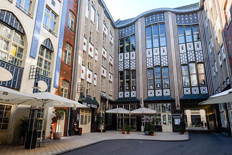
## Description **Hackesche Höfe** is one of Berlin’s most distinctive architectural and cultural complexes, known for its **series of interconnected courtyards**, richly decorated façades, and lively mix of art, retail, and everyday urban activity. Completed in **1906**, the complex was designed by architect **August Endell** and is considered one of the most important examples of **Jugendstil (Art Nouveau)** architecture in Germany. What makes Hackesche Höfe unique is its structure: eight separate courtyards connected by narrow passageways, forming a small urban world within the city. Originally, the complex combined residential apartments, workshops, offices, and entertainment venues, reflecting early 20th-century ideas about efficient mixed-use development. This design allowed craftsmen, artists, and residents to live and work in close proximity, a concept that feels surprisingly modern today. A lesser-known fact is that Hackesche Höfe narrowly escaped demolition during the post-war period, when much of the surrounding area was heavily damaged and later neglected. During the division of Berlin, the complex fell into disrepair, especially in the eastern sector. Its careful restoration in the 1990s played a key role in the **revitalization of Mitte**, helping transform the district into one of Berlin’s cultural and creative centers. Today, Hackesche Höfe hosts boutiques, design shops, cafés, galleries, cinemas, theaters, and apartments. The atmosphere shifts throughout the day, from quiet mornings to lively evenings, making it a place that rewards repeat visits. Despite its popularity, the courtyards retain a sense of intimacy that contrasts with the busy streets just outside. ## Location **Country:** Germany **Region:** Berlin **City:** Berlin **District:** Mitte Hackesche Höfe is located just off **Rosenthaler Straße**, close to Alexanderplatz and the Hackescher Markt area. ### How to Get There * **By S-Bahn:** * Take any line to **Hackescher Markt** station. From there, it is a 5-minute walk. * **By tram:** * Several tram lines stop at Hackescher Markt, offering easy access from across the city. * **By U-Bahn:** * Line U8 to **Weinmeisterstraße**, followed by a short walk. * **On foot:** * Easily reachable from Museum Island and Alexanderplatz. ## Tips * **Explore all courtyards:** Many visitors stop at the first courtyard, but the quieter inner ones are worth seeking out. * **Visit during the day for architecture:** Jugendstil details are best appreciated in natural light. * **Return in the evening for dining and culture:** Restaurants, theaters, and the cinema create a vibrant nightlife atmosphere. * **Be mindful of residential areas:** Some courtyards still contain private apartments. * **Combine with nearby attractions:** Museum Island, Monbijou Park, and the Jewish Quarter are close by. * **Photography is allowed:** Just avoid disturbing patrons or residents. ## Conclusion Hackesche Höfe is a living example of Berlin’s layered history, combining early modern architecture with contemporary creative life. Its courtyards offer a unique way to experience the city’s past and present in a single, walkable space, making it an essential stop for visitors to Berlin. ## FAQ **1. What does Hackesche Höfe mean?** It translates roughly to “Hackesche Courtyards,” referring to the interconnected inner yards. **2. Is there an entrance fee?** No. The courtyards are freely accessible. **3. How long should I plan for a visit?** About **1–2 hours**, depending on shopping, dining, or cultural activities. **4. Are guided tours available?** Occasionally, through private tour operators focusing on Berlin architecture or history. **5. Is Hackesche Höfe suitable for families?** Yes, though it is more oriented toward adults and cultural exploration. **6. What is the best time to visit?** Late afternoon to evening offers a balance of light, atmosphere, and open venues. ## Links * [Berlin tourism official site](https://www.visitberlin.de)
GemVoyage Team • World
Lima
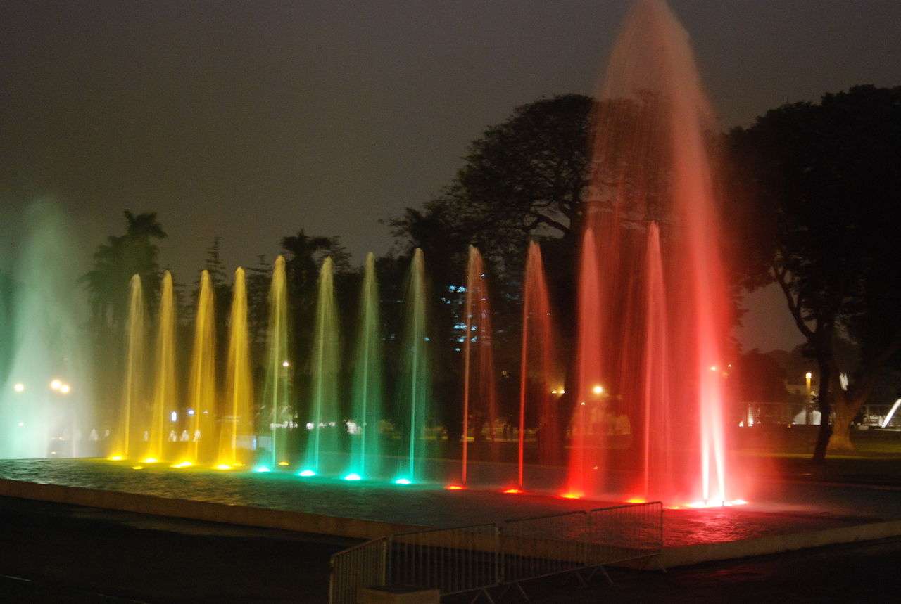
## Description The Magic Water Circuit (Circuito Mágico del Agua) in Lima is a dazzling display of light, music, and water that transforms a traditional city park into a nighttime spectacle. Located in the historic Parque de la Reserva, this attraction features 13 cybernetic fountains that combine cutting-edge technology with artistic choreography. Each fountain is uniquely designed, offering a blend of interactive experiences, visual storytelling, and cultural symbolism. The centerpiece of the park is the Fantasia Fountain, a 130-meter-long installation that hosts nightly multimedia shows. These performances blend water jets, laser lights, and music to create a captivating narrative—often highlighting Peruvian history, landscapes, and folklore. Other notable fountains include the Tunnel of Surprises, a 35-meter-long water tunnel that visitors can walk through, and the Dream Maze, where timing and agility are key to staying dry. A little-known fact: upon its opening in 2007, the Magic Water Circuit was recognized by the Guinness Book of World Records as the largest fountain complex in a public park. Another unique feature is the educational exhibits that occasionally accompany the fountains, such as historical photo displays or water conservation messages, adding depth to the entertainment. ## Location The Magic Water Circuit is located in **Peru**, in the **Lima Region**, within the **city of Lima**. Specifically, it sits in **Parque de la Reserva**, in the downtown district of Cercado de Lima. ### How to Get There - **By Taxi or Ride-Share**: Services like Uber and Cabify are widely available and can drop you off at the main entrance on Jr. Madre de Dios. - **By Public Transport**: The Metropolitano bus system stops nearby at Estación Central. From there, it’s a short walk to the park. - **By Foot**: If you're staying in central Lima, the park is easily accessible on foot from nearby neighborhoods like Jesús María or San Isidro. - **By Car**: Parking is available at the site, with flat rates depending on the lot. Its central location makes it a convenient stop for both tourists and locals exploring Lima’s cultural core. ## Tips - **Visit After Sunset**: The fountain shows begin around 7:15 PM and run multiple times throughout the evening. Arriving after dark ensures you catch the full spectacle. - **Bring a Rain Jacket or Poncho**: Some fountains are interactive, and you may get wet—especially in the maze or tunnel. - **Buy Tickets in Advance**: Entry is affordable (around S/5), but lines can form during weekends and holidays. Booking online or arriving early helps. - **Check for Special Events**: The park occasionally hosts themed shows or cultural exhibitions. Visit the official site for updates. - **Use a Tripod for Photos**: The lighting and water movement make for stunning photography, especially with long exposures. - **Respect the Rules**: Children under 5 enter free with ID, and discounts are available for seniors and people with disabilities. ## Conclusion The Magic Water Circuit in Lima is a vibrant fusion of art, technology, and public space. With its record-breaking fountains, immersive light shows, and family-friendly atmosphere, it offers a memorable evening experience that showcases the creative spirit of Peru’s capital. ## FAQ **1. What are the operating hours of the Magic Water Circuit?** The park is open daily from 3:00 PM to 10:00 PM. Multimedia shows begin at 7:15 PM, 8:15 PM, and 9:10 PM. **2. Is there an entrance fee?** Yes, general admission is S/5. Children under 5 enter free with ID. Discounts are available for seniors and people with disabilities. **3. Is the park suitable for children?** Absolutely. The interactive fountains and colorful displays are especially popular with families. **4. Can I bring food or drinks into the park?** Outside food is discouraged, but there are vendors and kiosks inside offering snacks and refreshments. **5. Are the shows in English or Spanish?** The multimedia shows are primarily visual and musical, with minimal spoken content, making them accessible to all visitors. **6. Is the park wheelchair accessible?** Yes, the park is designed to accommodate visitors with mobility needs, and discounted entry is available with proper ID. ## Links - [Official Magic Water Circuit Website](https://circuitomagicodelagua.pe/)
GemVoyage Team • World

Comments