GemVoyage Team • World
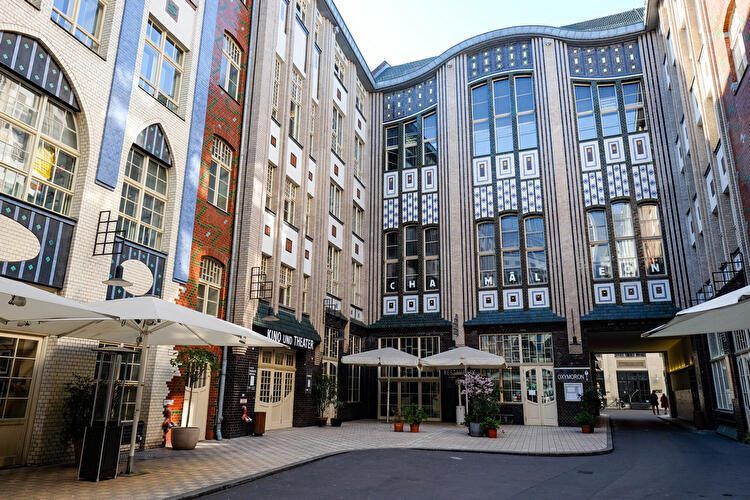
Hackesche Höfe is one of Berlin’s most distinctive architectural and cultural complexes, known for its series of interconnected courtyards, richly decorated façades, and lively mix of art, retail, and everyday urban activity. Completed in 1906, the complex was designed by architect August Endell and is considered one of the most important examples of Jugendstil (Art Nouveau) architecture in Germany.
What makes Hackesche Höfe unique is its structure: eight separate courtyards connected by narrow passageways, forming a small urban world within the city. Originally, the complex combined residential apartments, workshops, offices, and entertainment venues, reflecting early 20th-century ideas about efficient mixed-use development. This design allowed craftsmen, artists, and residents to live and work in close proximity, a concept that feels surprisingly modern today.
A lesser-known fact is that Hackesche Höfe narrowly escaped demolition during the post-war period, when much of the surrounding area was heavily damaged and later neglected. During the division of Berlin, the complex fell into disrepair, especially in the eastern sector. Its careful restoration in the 1990s played a key role in the revitalization of Mitte, helping transform the district into one of Berlin’s cultural and creative centers.
Today, Hackesche Höfe hosts boutiques, design shops, cafés, galleries, cinemas, theaters, and apartments. The atmosphere shifts throughout the day, from quiet mornings to lively evenings, making it a place that rewards repeat visits. Despite its popularity, the courtyards retain a sense of intimacy that contrasts with the busy streets just outside.
Country: Germany
Region: Berlin
City: Berlin
District: Mitte
Hackesche Höfe is located just off Rosenthaler Straße, close to Alexanderplatz and the Hackescher Markt area.
* Take any line to Hackescher Markt station. From there, it is a 5-minute walk.
* Several tram lines stop at Hackescher Markt, offering easy access from across the city.
* Line U8 to Weinmeisterstraße, followed by a short walk.
* Easily reachable from Museum Island and Alexanderplatz.
Hackesche Höfe is a living example of Berlin’s layered history, combining early modern architecture with contemporary creative life. Its courtyards offer a unique way to experience the city’s past and present in a single, walkable space, making it an essential stop for visitors to Berlin.
1. What does Hackesche Höfe mean?
It translates roughly to “Hackesche Courtyards,” referring to the interconnected inner yards.
2. Is there an entrance fee?
No. The courtyards are freely accessible.
3. How long should I plan for a visit?
About 1–2 hours, depending on shopping, dining, or cultural activities.
4. Are guided tours available?
Occasionally, through private tour operators focusing on Berlin architecture or history.
5. Is Hackesche Höfe suitable for families?
Yes, though it is more oriented toward adults and cultural exploration.
6. What is the best time to visit?
Late afternoon to evening offers a balance of light, atmosphere, and open venues.
Discover more hidden gems you might love.
Amsterdam
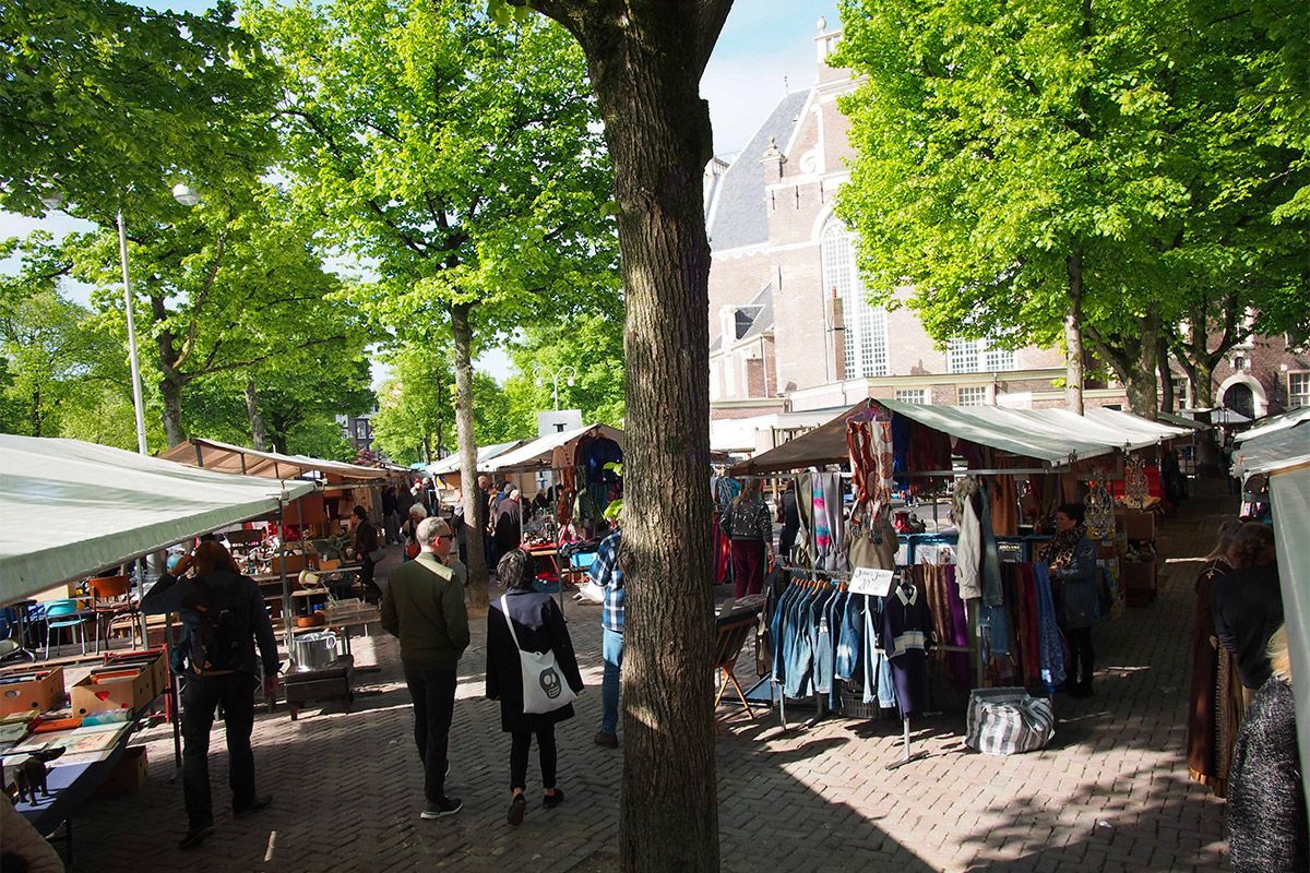
## Description Noordermarkt is one of Amsterdam’s most beloved local market squares, and its reputation comes from how naturally it fits into the fabric of the Jordaan. Rather than feeling like a market created purely for visitors, it feels embedded in neighborhood life. That is a major reason people keep returning. On different days it shifts character: one version is especially known for organic produce, another for antiques and secondhand browsing, but the common thread is a lively, human-scale market atmosphere that reflects Amsterdam at its most practical and convivial. For food travelers, Noordermarkt is a particularly strong stop because the organic market gives you access to fresh, seasonal, and artisanal products in a place that locals actually use. Bakers, cheese sellers, fruit vendors, and farmers bring a quality-first approach that makes browsing feel meaningful rather than transactional. A lesser-known fact is that the square sits beside the Noorderkerk, which means the market occupies a historic urban setting where weekly commerce and neighborhood identity have long been intertwined. Another detail that visitors often appreciate only after arriving is how easy it is to combine market browsing with Jordaan walking routes, canal views, and coffee stops. The atmosphere is relaxed but not sleepy. Noordermarkt has enough energy to feel active, yet it avoids the polished, overproduced feeling that sometimes affects famous market destinations. That is part of its charm. You can browse vegetables, bread, flowers, and prepared foods one moment, then shift to antiques or old objects another day, depending on when you visit. The market is also a good reminder that Amsterdam is a city of local habits, not just major sights. Watching residents shop here tells you something about the city’s pace and values. If you want a market that rewards curiosity and gives you a real sense of the Jordaan, Noordermarkt belongs near the top of your list. ## Location Noordermarkt is located in the Jordaan district of Amsterdam, North Holland, Netherlands, adjacent to the Noorderkerk. The square sits in a central yet neighborhood-oriented part of the city, making it easy to include in a broader day of walking along canals, visiting cafés, and exploring independent shops. Because the Jordaan is one of Amsterdam’s most enjoyable areas on foot, the market works especially well as part of a slow morning or early afternoon route. Getting there is simple by tram, bicycle, or a walk from the historic center. Many visitors find that biking is the most Amsterdam-like way to reach it, though trams and walking are equally practical. Once you arrive, the market is easy to navigate because it is organized around the square and the surrounding streets. If you are interested in the organic market specifically, check the day and time before going, since the square’s character changes across the week. The market is often best in the morning, when produce is freshest and the surroundings still feel animated without being crowded. ## Tips Go early for the best selection, especially if you want produce, bread, or specialty foods. Bring a shopping bag or backpack. The market is ideal for spontaneous purchases, and carrying your own bag makes the experience much easier. Allow time for the neighborhood. Noordermarkt is best when paired with a walk through the Jordaan, so do not treat it as a standalone stop. Be open to seasonal differences. What you find depends heavily on when you visit, and that is part of the appeal. If you enjoy antiques or vintage objects, check whether the day you are visiting aligns with the best browsing opportunities for that side of the market. ## Conclusion Noordermarkt is a classic Amsterdam market with a strong local identity, good food, and a setting that makes it easy to enjoy the Jordaan at a relaxed pace. It is one of the city’s best places to experience daily life with a distinctly neighborhood feel. ## FAQ ### Is Noordermarkt only for tourists? No. It is strongly used by locals, especially for organic produce and everyday shopping, which is a big part of why it feels authentic. ### What can I buy there? Organic food, bread, cheese, flowers, prepared snacks, and on some days antiques or secondhand goods. ### When is the best time to visit? Morning is usually best, particularly if you want the freshest products and a more active market atmosphere. ### Is it easy to combine with sightseeing? Very. Noordermarkt fits naturally into a Jordaan walking route and pairs well with canal-side exploring and nearby cafés. ## Links - [Noordermarkt on Wikipedia](https://en.wikipedia.org/wiki/Noordermarkt)
GemVoyage Team • World
.jpg)
Scotland
## Description The Fairy Pools on the Isle of Skye in Scotland are a series of crystal-clear, aqua-blue pools and cascading waterfalls that tumble down from the foothills of the Black Cuillin mountains. These natural pools, fed by the Allt Coire a’ Mhadaidh stream, are renowned for their ethereal beauty and have become one of Skye’s most iconic and photographed attractions. Whether you're a hiker, wild swimmer, or simply a lover of dramatic landscapes, the Fairy Pools offer a magical experience that feels straight out of folklore. The walk to the pools is relatively short—about 2.4 kilometers round trip—and follows a well-maintained gravel path that winds through heather-covered moorland. Along the way, visitors encounter a series of waterfalls and pools, each more striking than the last. The water is so clear that you can see the rocky bottoms and reflections of the surrounding hills, making it a favorite spot for photographers and nature enthusiasts. A little-known fact: the area around the Fairy Pools was the site of the last and bloodiest clan battle in Scottish history—the Battle of Coire na Creiche in 1601 between the MacLeods of Dunvegan and the MacDonalds of Sleat. Legend has it that the stream ran red with blood, a stark contrast to its current tranquil appearance. Another quirky detail is that despite their name, there’s no historical association with fairies—the name “Fairy Pools” only began appearing in guidebooks in the 20th century. ## Location The Fairy Pools are located in **Scotland**, on the **Isle of Skye**, near the village of **Carbost** in the **Highland region**. They sit at the base of the Black Cuillin mountains in **Glen Brittle**, on the western side of the island. ### How to Get There - **By Car**: From Portree, the island’s main town, it’s about a 30-minute drive (20.5 miles) via the B8009 and Glenbrittle road. The route includes single-track roads with passing places. - **By Bus**: Public transport is limited. Buses run to Carbost, but you’ll need to arrange a taxi or walk from there. - **By Tour**: Several guided tours from Portree or Inverness include the Fairy Pools as part of a day trip. - **By Foot**: The walk to the pools begins at the Fairy Pools car park, located near Glenbrittle. From the car park, it’s a 20-minute walk to the first waterfall. ## Tips - **Visit Early or Late**: The site gets crowded during peak hours, especially in summer. Early morning or late afternoon offers better light and fewer visitors. - **Wear Waterproof Footwear**: The path can be muddy and uneven, especially after rain. - **Bring Layers**: Weather on Skye is unpredictable. Pack a waterproof jacket and warm clothing. - **Wild Swimming**: Brave souls can swim in the pools, but the water is icy year-round. A wetsuit is recommended. - **Respect Nature**: Follow the Scottish Outdoor Access Code—take your litter with you and stick to marked paths. - **Parking**: There is a charge for parking at the Fairy Pools car park, which helps maintain the site. ## Conclusion The Fairy Pools on the Isle of Skye are a breathtaking blend of natural beauty and Highland mystique. With their vivid waters, dramatic mountain backdrop, and rich history, they offer a memorable experience for anyone exploring Scotland’s rugged landscapes. ## FAQ **1. Is there an entrance fee to visit the Fairy Pools?** No, the pools are free to visit, but there is a charge for parking. **2. How long is the walk to the Fairy Pools?** The round-trip walk is approximately 2.4 kilometers and takes 40 minutes to 1.5 hours depending on pace and stops. **3. Can I swim in the Fairy Pools?** Yes, wild swimming is allowed, but the water is extremely cold. A wetsuit is recommended. **4. Are the Fairy Pools suitable for children?** Yes, but children should be supervised due to uneven terrain and cold water. **5. Is the site wheelchair accessible?** No, the terrain is rugged and includes steep inclines, making it unsuitable for wheelchairs. **6. What is the best time of year to visit?** Spring and autumn offer mild weather and fewer crowds. Summer is busiest, while winter can be icy and less accessible. ## Links - [Fairy Pools Walk – Isle of Skye Guide](https://www.isleofskye.com/skye-guide/top-ten-skye-walks/fairy-pools) - [Fairy Pools – VisitScotland Overview](https://www.visitscotland.com/info/see-do/fairy-pools-p1770011) - [Fairy Pools – Wikipedia Entry](https://en.wikipedia.org/wiki/Fairy_Pools) Description The Fairy Pools on the Isle of Skye in Scotland are a series of crystal-clear, aqua-blue pools and cascading waterfalls that tumble down from the foothills of the Black Cuillin mountains. These natural pools, fed by the Allt Coire a’ Mhadaidh stream, are renowned for their ethereal beauty and have become one of Skye’s most iconic and photographed attractions. Whether you're a hiker, wild swimmer, or simply a lover of dramatic landscapes, the Fairy Pools offer a magical experience that feels straight out of folklore. The walk to the pools is relatively short—about 2.4 kilometers round trip—and follows a well-maintained gravel path that winds through heather-covered moorland. Along the way, visitors encounter a series of waterfalls and pools, each more striking than the last. The water is so clear that you can see the rocky bottoms and reflections of the surrounding hills, making it a favorite spot for photographers and nature enthusiasts. A little-known fact: the area around the Fairy Pools was the site of the last and bloodiest clan battle in Scottish history—the Battle of Coire na Creiche in 1601 between the MacLeods of Dunvegan and the MacDonalds of Sleat. Legend has it that the stream ran red with blood, a stark contrast to its current tranquil appearance. Another quirky detail is that despite their name, there’s no historical association with fairies—the name “Fairy Pools” only began appearing in guidebooks in the 20th century. Location The Fairy Pools are located in Scotland, on the Isle of Skye, near the village of Carbost in the Highland region. They sit at the base of the Black Cuillin mountains in Glen Brittle, on the western side of the island. How to Get There By Car: From Portree, the island’s main town, it’s about a 30-minute drive (20.5 miles) via the B8009 and Glenbrittle road. The route includes single-track roads with passing places. By Bus: Public transport is limited. Buses run to Carbost, but you’ll need to arrange a taxi or walk from there. By Tour: Several guided tours from Portree or Inverness include the Fairy Pools as part of a day trip. By Foot: The walk to the pools begins at the Fairy Pools car park, located near Glenbrittle. From the car park, it’s a 20-minute walk to the first waterfall. Tips Visit Early or Late: The site gets crowded during peak hours, especially in summer. Early morning or late afternoon offers better light and fewer visitors. Wear Waterproof Footwear: The path can be muddy and uneven, especially after rain. Bring Layers: Weather on Skye is unpredictable. Pack a waterproof jacket and warm clothing. Wild Swimming: Brave souls can swim in the pools, but the water is icy year-round. A wetsuit is recommended. Respect Nature: Follow the Scottish Outdoor Access Code—take your litter with you and stick to marked paths. Parking: There is a charge for parking at the Fairy Pools car park, which helps maintain the site. Conclusion The Fairy Pools on the Isle of Skye are a breathtaking blend of natural beauty and Highland mystique. With their vivid waters, dramatic mountain backdrop, and rich history, they offer a memorable experience for anyone exploring Scotland’s rugged landscapes. FAQ 1. Is there an entrance fee to visit the Fairy Pools? No, the pools are free to visit, but there is a charge for parking. 2. How long is the walk to the Fairy Pools? The round-trip walk is approximately 2.4 kilometers and takes 40 minutes to 1.5 hours depending on pace and stops. 3. Can I swim in the Fairy Pools? Yes, wild swimming is allowed, but the water is extremely cold. A wetsuit is recommended. 4. Are the Fairy Pools suitable for children? Yes, but children should be supervised due to uneven terrain and cold water. 5. Is the site wheelchair accessible? No, the terrain is rugged and includes steep inclines, making it unsuitable for wheelchairs. 6. What is the best time of year to visit? Spring and autumn offer mild weather and fewer crowds. Summer is busiest, while winter can be icy and less accessible. Links Fairy Pools Walk – Isle of Skye Guide Fairy Pools – VisitScotland Overview Fairy Pools – Wikipedia Entry 715 words37 lines4484 characters4520 bytes
GemVoyage Team • World
Barcelona
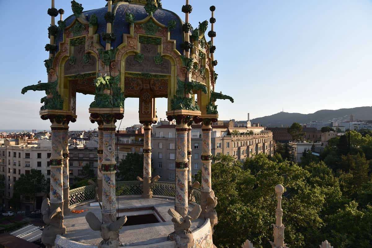
## Description **Torre Andreu**, more commonly known as **La Rotonda**, is one of Barcelona’s most distinctive yet often overlooked pieces of **Modernisme architecture**. Located at the upper edge of the city near the foothills of Tibidabo, this circular, turreted building looks more like a **fairytale castle than a residential structure**, making it one of the most visually unusual landmarks in Barcelona. The building was originally constructed in **1906** as a **luxury private residence** for a wealthy industrial family at a time when Barcelona’s elite were moving uphill away from the dense urban core. Its architectural language reflects the late phase of Catalan Modernisme, but with a lighter, more playful character than the monumental works of Gaudí. The structure’s curved form, decorative balconies, stained glass, floral stonework, and rooftop tower give it a **whimsical, almost theatrical presence**. What truly sets La Rotonda apart is its **cylindrical layout**, which is extremely rare in Barcelona’s residential architecture. While most Modernist buildings rely on flat façades and vertical symmetry, Torre Andreu embraces a soft, flowing geometry that produces constantly shifting perspectives as you walk around it. From different angles, the building seems to change character—from grand to intimate, from playful to mysterious. After serving as a private mansion, the building was later transformed into a **luxury hotel**, gaining the nickname “La Rotonda” due to its circular shape. Over the decades, it hosted visiting elites, business figures, and international guests. Its decline began in the late 20th century as the area lost its tourism focus, and the building passed through phases of limited use, abandonment, and restoration attempts. A little-known fact is that Torre Andreu spent many years in a **state of legal and architectural limbo**, with disputes over ownership and protection status delaying proper restoration. Another lesser-known detail is that its rooftops once hosted **social gatherings with views stretching across the entire city and toward the Mediterranean**, making it one of the most exclusive view points in pre-war Barcelona. Today, La Rotonda stands as a **symbol of architectural memory suspended between preservation and neglect**. While parts of the structure have undergone restoration at different times, it remains largely inaccessible to the public. Despite this, it continues to attract architects, photographers, and urban explorers who see it as a **ghost of Barcelona’s upper-class expansion era**, frozen between past luxury and uncertain future use. Emotionally, Torre Andreu is a place of contrast. It feels playful yet melancholic, elegant yet isolated. It reminds visitors that not all architectural masterpieces sit in crowded tourist centers—some survive quietly at the city’s edges, waiting to be rediscovered. ## Location **Torre Andreu (La Rotonda)** is located in the **Sant Gervasi–La Bonanova area**, near the start of **Avinguda del Tibidabo**, one of Barcelona’s most elegant upper-city avenues. **City:** Barcelona **Region:** Catalonia (Catalunya) **Country:** Spain **District:** Sarrià-Sant Gervasi **Nearby Landmark:** Plaça Kennedy ### How to Get There: * **By Tramvia Blau:** Take the historic **Blue Tram** from Plaça Kennedy up toward Tibidabo and get off at the early stops. * **By FGC (Train):** Take **FGC Line L7** to **Avinguda Tibidabo Station**, then walk about 10–12 minutes uphill. * **By bus:** Several lines from the city center serve Plaça Kennedy and Avinguda Tibidabo. * **By taxi:** A convenient option given the uphill location. * **By car:** Limited street parking is available; traffic can be heavy during peak hours. This location places La Rotonda along a scenic route that connects the city to **Tibidabo Mountain, the funicular, and the upper residential quarters**. ## Tips * **Admire it from the street:** The building is **not generally open to the public**, so plan for an exterior visit. * **Visit during daylight:** Details in stone, glass, and ironwork are best visible in strong natural light. * **Combine with Avinguda Tibidabo:** The walk itself features some of Barcelona’s most impressive mansions. * **Photography enthusiasts:** A wide-angle lens works best due to the building’s curved geometry. * **Do not expect tourist facilities:** No tickets, gift shops, or official visitor services are available on-site. * **Urban-exploration atmosphere:** The charm lies in observing a historic building existing quietly within daily city life. * **Respect private property limits:** Security patrols may restrict close access to entrances. ## Conclusion **Torre Andreu (La Rotonda)** is one of Barcelona’s most unusual Modernist buildings—**playful in form, dramatic in history, and quiet in presence**. Once a symbol of luxury living at the city’s upper edge, it now stands as a reminder that architectural brilliance does not always remain in the spotlight. For those willing to explore beyond the standard tourist circuit, La Rotonda offers a rare encounter with **Barcelona’s forgotten elegance and unresolved heritage**. ## FAQ **1. Why is Torre Andreu called “La Rotonda”?** Because of its **distinct circular shape**, which is rare in Barcelona’s residential architecture. **2. Can visitors go inside La Rotonda?** No. It is **not generally open to the public** and is viewed from the exterior only. **3. Who designed Torre Andreu?** It was designed in the early 20th century in the **Catalan Modernisme style**, attributed to architect **Adolf Ruiz i Casamitjana**. **4. Was it always a hotel?** No. It was originally built as a **private luxury residence** and later converted into a hotel. **5. Is Torre Andreu protected as a heritage site?** Yes. It is recognized as part of **Barcelona’s protected architectural heritage**, though restoration has been slow. **6. How long does a visit typically take?** About **10 to 20 minutes**, mainly for observation and photography. ## Links * [Visit Barcelona](https://www.barcelonaturisme.com)
GemVoyage Team • World
Tanzania
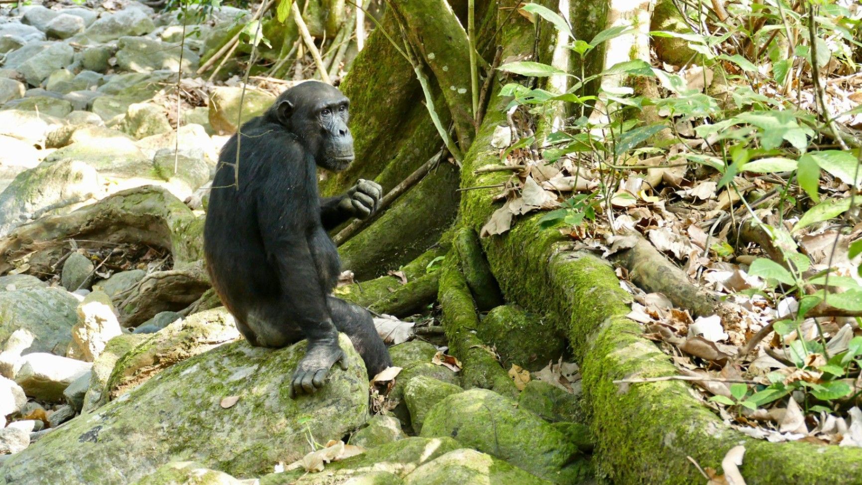
## Description Nestled on the remote eastern shores of **Lake Tanganyika**, the **Mahale Mountains National Park** is one of **Tanzania’s most untouched and magical wilderness areas**. Famous for its **wild chimpanzee population**, pristine forests, and turquoise waters, this park offers an experience unlike any other in Africa — where jungle-clad mountains meet one of the world’s oldest and deepest lakes. Covering over **1,600 square kilometers**, Mahale Mountains National Park lies at the crossroads of **rainforest, savanna, and miombo woodland**, creating a spectacularly diverse ecosystem. Its landscape is dominated by the dramatic **Mahale Mountain Range**, with **Mount Nkungwe** — the highest peak — rising to 2,462 meters above sea level. The park is most renowned for being home to one of the **largest known communities of wild chimpanzees**, with around **800 individuals**. Visitors have the rare opportunity to **trek into the forest** and observe these intelligent primates in their natural habitat — grooming, feeding, and socializing just a few meters away. The **Mimikire community** of chimps has been studied since the 1960s by Japanese researchers, making Mahale a world center for primate research and conservation. Beyond the chimpanzees, Mahale is a haven for **biodiversity**. The park shelters **leopards, bushbucks, red colobus monkeys, blue duikers, warthogs**, and hundreds of **bird species**. The crystal-clear waters of **Lake Tanganyika**, bordering the park to the west, are home to over **250 species of cichlid fish**, many found nowhere else on Earth. One of Mahale’s most fascinating aspects is its isolation — there are **no roads inside the park**. Access is only by **boat or plane**, ensuring that the park remains wild and unspoiled. Visitors walk along forest trails, wade across rivers, and travel by dhow or motorboat, surrounded by breathtaking scenery and deep tranquility. A lesser-known fact is that the area is the **ancestral home of the Tongwe people**, who once lived in the forest and practiced traditional customs linked to nature and the spirits of the mountains. Some cultural heritage still survives, adding a layer of human history to Mahale’s natural beauty. With its mix of adventure, serenity, and ecological wonder, **Mahale Mountains National Park** is a destination for those seeking a **genuine wilderness experience** — where you can track chimpanzees in the morning, swim in the world’s longest freshwater lake in the afternoon, and watch the sun set behind the Congo mountains in the distance. ## Location **Mahale Mountains National Park** is located in **western Tanzania**, along the **eastern shore of Lake Tanganyika**, opposite the **Democratic Republic of the Congo**. **Coordinates:** Approximately 6°S, 30°E To get there: * **By air:** The most convenient way is by **charter flight** from **Arusha, Dar es Salaam, or Kigoma** to the **Mahale airstrip**, followed by a **boat transfer** (typically 1–2 hours) to your lodge or campsite. * **By boat:** From **Kigoma**, you can take a **boat or dhow** along Lake Tanganyika, which takes between **6–10 hours** depending on the vessel. * **By road and boat (adventurous option):** Drive from **Kigoma** to **Kagunga village** (about 3–4 hours), then continue by boat to Mahale. Because of its remoteness, Mahale is best visited as part of a planned safari itinerary with **arranged transport and accommodation** through a tour operator or lodge. ## Tips * **Plan ahead:** Due to its remote location, logistics can be complex — book accommodation and flights well in advance. * **Chimp trekking:** The best time to see chimpanzees is during the **dry season (May to October)** when they stay closer to the lower slopes. * **Fitness required:** Trekking can involve steep and humid trails; wear comfortable shoes, long pants, and bring plenty of water. * **Stay several days:** Allow at least **3–4 nights** to enjoy chimp tracking, lake swimming, and forest hikes. * **Bring lightweight clothing:** The climate is tropical, but evenings near the lake can be cooler. * **Malaria precautions:** Use repellent and consult your doctor before travel — Mahale is a tropical zone. * **No roads, no crowds:** Be prepared for total disconnection — there is limited electricity and no phone signal in most areas. * **Combine with Katavi National Park:** Many travelers pair Mahale with nearby **Katavi**, another remote gem known for its wildlife-filled plains. ## Conclusion The **Mahale Mountains National Park** is one of Africa’s last true wildernesses — a place of **raw beauty and profound peace**. From tracking wild chimpanzees through lush forests to swimming in the crystal-clear waters of Lake Tanganyika, every moment in Mahale feels extraordinary. Its isolation ensures that it remains a haven for both wildlife and travelers seeking solitude. Visiting Mahale is not just a safari — it’s a **journey into the heart of nature**, untouched and unforgettable. ## FAQ **1. What is Mahale Mountains National Park famous for?** It’s best known for its **wild chimpanzees** and stunning **mountain–lake scenery**. **2. How many chimpanzees live in the park?** Around **800 individuals**, including the well-studied **Mimikire community**, habituated to human presence. **3. How do I reach Mahale?** Most visitors arrive by **charter flight** from **Arusha, Dar es Salaam, or Kigoma**, followed by a **boat transfer** to their lodge. **4. When is the best time to visit?** The **dry season (May–October)** is ideal for chimpanzee tracking, while **November–April** brings lush scenery and birdlife. **5. Are there accommodations inside the park?** Yes — there are a few **exclusive lodges and tented camps** along Lake Tanganyika’s shores, such as **Greystoke Mahale** and **Kungwe Beach Lodge**. **6. What other animals can be seen?** Besides chimpanzees, the park is home to **leopards, bushpigs, red colobus monkeys, giant squirrels**, and **hundreds of bird species**. **7. Can visitors swim in Lake Tanganyika?** Yes — it’s safe for swimming and snorkeling near the lodges, with **exceptionally clear freshwater** and tropical fish. ## Links * [Tanzania National Parks Authority – Mahale Mountains](https://storymaps.arcgis.com/stories/4bf12795a5b44f3482b580e692c465a4)
GemVoyage Team • World
Cairo
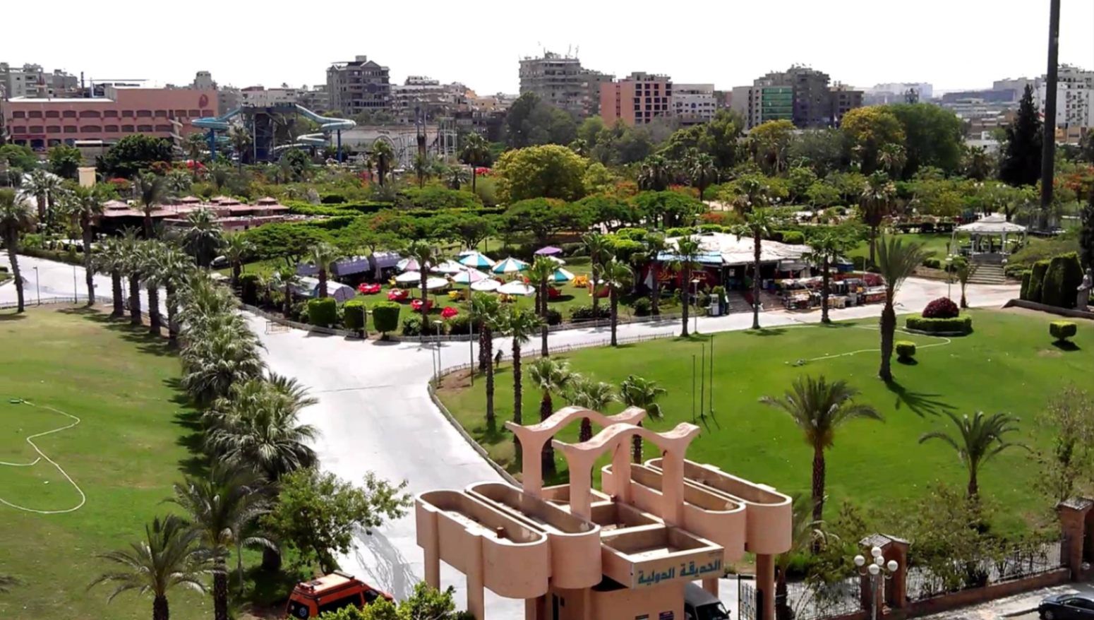
## Description **The International Park (الحديقة الدولية بالقاهرة)** is one of Cairo’s most distinctive public green spaces, designed to showcase a miniature journey through different countries and cultures within a single park. Established in the late 1980s, the park was conceived as a cultural and recreational project where landscaped areas, architectural replicas, and themed gardens represent nations from around the world. While not polished in the way of modern theme parks, its charm lies in its **ambitious concept, open space, and local atmosphere**. What makes the International Park unique is its layout: each section is inspired by a different country, featuring symbolic structures, sculptures, plants, or design elements associated with that nation. Visitors can walk from Asian-inspired pavilions to European-style gardens within minutes. This eclectic mix gives the park an almost nostalgic quality, reflecting Cairo’s vision of internationalism during the late 20th century. A lesser-known fact is that several embassies and cultural institutions contributed ideas or symbolic elements during the park’s early development, even if execution varied over time. Another interesting detail is that the park was once a major venue for **school trips and cultural festivals**, making it an important part of collective memory for many Cairenes who grew up in the 1990s. Today, the park functions primarily as a **family-friendly recreational space**. It is popular for picnics, casual walks, and affordable outings, especially for residents of eastern Cairo. While some areas show signs of aging, the park’s size, greenery, and concept still make it a refreshing escape from the dense urban environment. ## Location **Country:** Egypt **Region:** Greater Cairo **City:** Cairo **District:** Nasr City The International Park is located in **Nasr City**, one of Cairo’s largest residential districts, close to major roads and residential compounds. ### How to Get There * **By taxi or ride-hailing:** * Uber and local taxis are the most convenient option from anywhere in Cairo. * **By car:** * Easily accessible via Nasr City’s main roads, with parking available near the entrance. * **By public transport:** * Microbuses and buses serving Nasr City pass close to the park, though routes can be confusing for first-time visitors. * **From central Cairo:** * Expect a 30–45 minute drive depending on traffic. ## Tips * **Visit in the afternoon:** Late afternoon offers better weather and softer light, especially in warmer months. * **Bring your own food:** Picnic areas are common, and outside food is usually allowed. * **Wear comfortable shoes:** The park is large, and exploring all sections involves significant walking. * **Manage expectations:** Some country sections are more symbolic than detailed replicas. * **Good for children:** Open spaces allow kids to run freely, and the atmosphere is relaxed. * **Avoid peak public holidays:** The park can become crowded during major Egyptian holidays. ## Conclusion The International Park is a spacious, culturally themed green retreat that offers a simple but enjoyable experience for families and casual visitors. Its global concept, combined with its local character, makes it a nostalgic and accessible escape from Cairo’s urban intensity. ## FAQ **1. When was the International Park opened?** It was established in the late 1980s as a cultural and recreational project. **2. Is there an entrance fee?** Yes, there is a low entrance fee, making it affordable for families. **3. How long should I plan for a visit?** Most visitors spend **1.5 to 3 hours**, depending on walking pace and activities. **4. Is the park suitable for tourists?** Yes, especially for those interested in local leisure spaces rather than major monuments. **5. Are there food stalls inside?** Basic snacks may be available, but bringing your own food is recommended. **6. Is it good for photography?** Yes, particularly for casual photography and wide shots of greenery and themed structures. ## Links * [Egyptian tourism portal](https://www.experienceegypt.eg/en)
GemVoyage Team • World
Kyoto
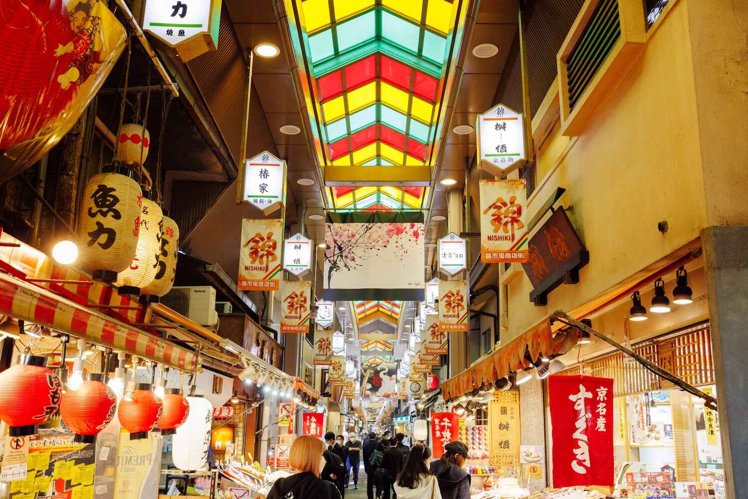
## Description Nishiki Market, often called **“Kyoto’s Kitchen”**, is one of the most famous traditional markets in Japan. Stretching about 400 meters through the heart of Kyoto, this lively covered arcade is lined with more than 120 shops and stalls, each offering a unique slice of local culture. From fresh seafood and seasonal produce to traditional sweets, pickles, and kitchenware, Nishiki Market provides an authentic experience of Kyoto’s culinary heritage. What makes Nishiki Market truly unique is its focus on local and specialty products. Many of the vendors have been running family businesses for generations, preserving recipes and traditions that date back hundreds of years. As you wander through, you’ll notice the atmosphere is both bustling and intimate—a blend of locals doing their shopping and tourists sampling delicacies for the first time. A little-known fact is that Nishiki Market dates back to the early **14th century**, making it more than 700 years old. It originally started as a wholesale fish market before expanding into a diverse food street. Another interesting detail is that some stalls offer free samples, encouraging visitors to try everything from roasted chestnuts to unusual treats like octopus stuffed with quail eggs. ## Location Nishiki Market is located in **Kyoto**, within the **Kansai region** of **Japan**. More precisely, it lies in the **downtown Nakagyo Ward**, running parallel to Shijo Street and between Teramachi and Takakura streets. Its central location makes it easy to access and an ideal stop while exploring other nearby attractions such as Gion, Pontocho Alley, and Nishiki Tenmangu Shrine. How to get there: * **By subway:** Take the Karasuma Line to **Shijo Station** or the Tozai Line to **Karasuma Oike Station**, then walk about 5–10 minutes. * **By bus:** Several Kyoto City buses stop near Shijo Street, providing easy access from other parts of the city. * **By taxi:** A taxi is convenient if you’re traveling with luggage or staying outside the downtown area. Because of its central location, Nishiki Market can easily be combined with a day of shopping in Shijo-Kawaramachi or sightseeing in Gion. ## Tips To fully enjoy Nishiki Market, here are some practical tips for visitors: 1. **Go early or late** – The market can get crowded around midday, so visiting in the morning or late afternoon offers a more relaxed experience. 2. **Try local specialties** – Don’t miss Kyoto delicacies like yuba (tofu skin), tsukemono (pickles), fresh mochi, and matcha-flavored treats. 3. **Bring cash** – While larger shops may accept cards, many stalls are cash-only. 4. **Respect the “no eating while walking” rule** – Many stalls ask customers to eat food in designated areas instead of while walking through the market. 5. **Plan for at least an hour** – With so many shops and food stalls to explore, allow enough time to browse and taste at leisure. 6. **Combine with nearby attractions** – After exploring the market, visit Nishiki Tenmangu Shrine, which sits at the eastern end of the street. ## Conclusion Nishiki Market is more than just a shopping street—it’s a living museum of Kyoto’s culinary traditions. With its centuries-old history, diverse food offerings, and lively atmosphere, the market provides visitors with an unforgettable journey into the flavors and culture of Japan’s ancient capital. Whether you’re sampling street food, buying souvenirs, or soaking in the ambiance, Nishiki Market is a must-visit destination in Kyoto. ## FAQ **1. What is Nishiki Market famous for?** Nishiki Market is known as “Kyoto’s Kitchen,” offering traditional foods, local specialties, and cultural goods that represent the essence of Kyoto’s culinary heritage. **2. What are the opening hours of Nishiki Market?** Most shops open around 9:00 AM and close by 6:00 PM, though hours vary by vendor. It’s best to visit during the daytime. **3. Is Nishiki Market free to enter?** Yes, entry is free. You only pay for the food or items you buy. **4. How long does it take to walk through Nishiki Market?** The market itself can be walked in 20–30 minutes, but most visitors spend 1–2 hours browsing, eating, and shopping. **5. Is Nishiki Market suitable for vegetarians?** Yes, while many stalls sell seafood and meat, there are plenty of vegetarian options like tofu, yuba, pickles, and sweets. **6. Can I buy souvenirs at Nishiki Market?** Absolutely. In addition to food, the market has shops selling kitchenware, chopsticks, ceramics, and traditional Kyoto crafts. ## Links * [Kyoto Official Travel Guide](https://kyoto.travel) * [Japan National Tourism Organization](https://www.japan.travel)
GemVoyage Team • World

Comments