GemVoyage Team • World
The scale of Teotihuacan is what first seizes visitors: broad causeways, stepped pyramids and the linear discipline of its urban plan. Archaeologists have uncovered multi-storey apartment compounds, market areas and ceremonial platforms that together suggest a dense, highly organized city capable of hosting tens of thousands of residents at its peak. A walk along the Avenue of the Dead reveals architectural rhythms and sightlines intentionally designed to focus processions and ritual movement toward the city’s great pyramids.
Climbing the Pyramid of the Sun rewards visitors with sweeping panoramas across the valley and a visceral sense of how the site would have been experienced in antiquity. The Pyramid of the Moon at the northern end of the avenue faces a ceremonial plaza that preserves carved stones and remnants of ritual deposits. Murals and painted architectural fragments found in residential and administrative compounds hint at complex iconography, trade networks reaching into Oaxaca and the Gulf coast, and religious ideas that later influenced the Aztecs.
Teotihuacan continues to be a dynamic archaeological landscape: excavations reveal changing construction phases, evidence of craft production zones, and records of trade in obsidian and pottery that tie the city to a broader Mesoamerican world. While key questions remain — notably about the language(s) spoken by Teotihuacanos and the political organization behind the city’s monumental building — continuing research and improved visitor interpretation make Teotihuacan a compelling stop for history-minded travelers.
Discover more hidden gems you might love.
Cologne
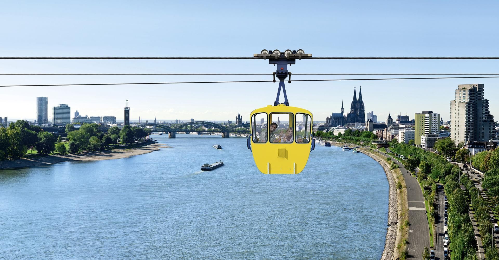
## Description The Cologne Cable Car, also known as the Rhine Ropeway, is one of the city’s most enjoyable short experiences because it turns a simple river crossing into a memorable view-filled ride. Instead of treating transport as a functional necessity, the ropeway makes movement itself the attraction. As you travel above the Rhine, Cologne opens up in a new way, with the river, bridges, skyline, and green spaces unfolding beneath you. It is a modestly scaled experience, but one that offers a surprisingly vivid perspective on the city. What makes the cable car special is that it adds movement and elevation to a city that is often explored on foot. From above, familiar landmarks look different. You can see how the river shapes Cologne’s geography, how the city spreads out on both sides, and how the waterfront becomes part of the urban image. For many visitors, the ride is also a welcome break from walking. It is relaxing, scenic, and slightly unusual, which is a strong combination for a city stop. One little-known fact is that the ropeway is often appreciated as much for the sense of orientation it gives as for the actual ride. It helps visitors understand how Cologne sits in relation to the Rhine. Another is that it has a long-standing reputation as one of the city’s more family-friendly and easy-to-enjoy attractions because it does not require a major time investment but still produces a strong memory. The experience works particularly well in good weather, when visibility is clear and the river views feel open. It also pairs nicely with other riverside activities or a park visit. The ride itself is not long, so the best strategy is to treat it as part of a wider Cologne outing rather than as the entire plan for the day. Still, even as a short activity, it stands out because it gives you a literal new angle on the city. ## Location The Cologne Cable Car is in Cologne, Germany, crossing the Rhine and connecting areas of the city on opposite sides of the river. It is close enough to central Cologne and the riverside to be convenient for visitors already exploring the city center. The easiest way to reach it is by local transport or by walking from nearby attractions on the riverbank. Because Cologne’s center is relatively visitor-friendly, the ropeway often fits naturally into a walk along the Rhine. Depending on your route, you can ride one way and then continue exploring the waterfront or nearby park areas on foot. If you are building a day in Cologne, the ropeway works especially well with riverside sightseeing, the old town, or a relaxed walk through nearby green spaces. It is a small addition that can make the whole day feel more varied. ## Tips Go on a clear day if possible. Visibility makes a huge difference to the experience. Check operating times before you go, especially if you are visiting in a shoulder season or outside peak travel periods. If you enjoy photography, try the ride at different times of day for different light on the river and city. Use it as part of a larger walking route so the experience feels connected rather than isolated. Even though the ride is short, it can become one of the more distinctive memories from a Cologne trip because it changes the scale of the city so quickly. On foot, Cologne can feel intimate and grounded; from the ropeway, it suddenly feels open and legible. That shift is valuable for first-time visitors who are still learning how the city fits together around the river. It is the kind of simple experience that gives practical orientation as well as enjoyment. The cable car is also a good reminder that not every worthwhile attraction needs a long museum visit or a complex reservation. Sometimes a single perspective change can be enough to make a city feel more coherent. In Cologne, where the Rhine is such a defining feature, that change is especially effective. You see how the city relates to the river instead of only moving beside it, and that perspective often makes the rest of the day’s sightseeing easier to understand. ## Conclusion The Cologne Cable Car offers a short but memorable aerial perspective on the Rhine and the city. It is a simple attraction that adds a fun, scenic dimension to a Cologne visit. ## FAQ **How long is the cable car ride?** It is a short crossing, designed more for scenery than for distance. **Is it worth doing?** Yes, especially if you enjoy views, riverside cityscapes, and light activities. **Can I use it as transport?** It can function that way, but most visitors treat it as an attraction. **Is it good for families?** Yes, it is one of the more relaxed and accessible Cologne experiences. **When is the best time to ride?** On a clear day with good visibility, ideally when the light is favorable. ## Links - [Official website](https://www.koelner-seilbahn.de/en/) - [Wikipedia](https://en.wikipedia.org/wiki/Cologne_Cable_Car)
GemVoyage Team • World
Alexandria
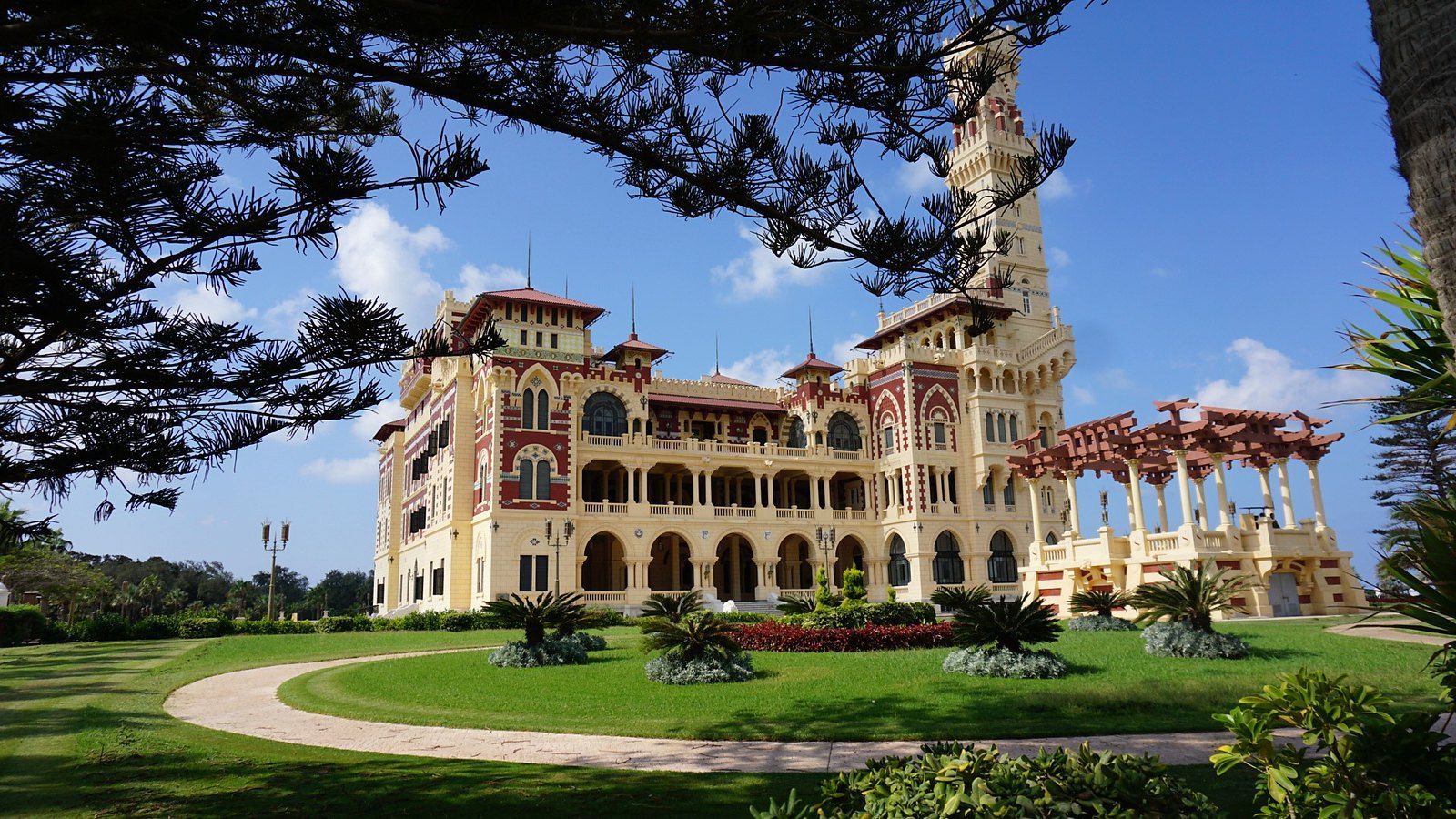
## Description On the eastern edge of Alexandria, where the city dissolves into a long sweep of Mediterranean coastline, lies one of Egypt's most beautiful and historically resonant public spaces. The Montaza Palace Gardens are a vast and carefully maintained park surrounding two royal palaces, stretching along the sea for over 150 acres of palm trees, manicured paths, ornamental fountains, and wild coastal landscape. For Alexandrians, it is a beloved retreat from the heat and noise of the city. For visitors, it is a rare opportunity to walk through a landscape that was once the private domain of Egyptian royalty and to see a side of Alexandria that few tourists ever discover. The garden complex is centered on two palaces: the Salamlek Palace, a small and elegant hunting lodge built in 1892 by Khedive Abbas II for his Austrian mistress, and the Haramlek Palace, a much larger and more elaborate structure built by King Fuad I in the 1930s as a summer residence for the Egyptian royal family. The Haramlek Palace, also sometimes referred to as the Montaza Palace, is the more architecturally dramatic of the two, combining Ottoman and Florentine Renaissance influences in a way that feels simultaneously exotic and strangely European. Its distinctive tower, visible from a considerable distance along the coast, has become one of the iconic images of Alexandria. A lesser-known fact about the Montaza complex is that it was the favored retreat of King Farouk, the last king of Egypt, who spent considerable time here before his abdication and exile following the 1952 revolution. The palace grounds were subsequently nationalized and opened to the public, transforming what had been an entirely private royal estate into one of Alexandria's most treasured public parks. Another interesting detail is that the Salamlek Palace has been converted into a boutique hotel, meaning it is actually possible to stay overnight inside one of the original royal buildings and wake up to views over the Mediterranean. The gardens themselves are beautiful regardless of any historical interest. Paths wind between towering palms and ancient trees, passing small bridges over ornamental streams and opening onto wide lawns that slope down toward the sea. The coastline within the park includes several small beaches and a private harbor. In the late afternoon, the light on the water and across the palace facades is extraordinary. ## Location The Montaza Palace Gardens are located in the Montaza district of Alexandria, Egypt, approximately 12 kilometers east of the city center along the Mediterranean coast. Alexandria is Egypt's second-largest city and sits on the northern coast of the country, about 220 kilometers northwest of Cairo. Getting to the gardens from central Alexandria is straightforward. The most convenient option is by taxi or ride-hailing app, which typically takes 20 to 30 minutes from the city center depending on traffic. Microbuses and public buses also run along the coastal road toward Montaza, though they can be busy and navigation requires some familiarity with local routes. For visitors staying in central Alexandria, a taxi is the recommended option for comfort and simplicity. From Cairo, Alexandria is accessible by train in approximately two hours, with frequent services running throughout the day from Ramses Station. Once in Alexandria, the journey to Montaza continues by taxi from the main train station. ## Tips - **Visit in the late afternoon.** The light over the Mediterranean in the hours before sunset is magical, and the temperature is much more comfortable than in the midday heat, especially in summer. - **Purchase entry to the full park.** There is a small entrance fee to access the main gardens. Certain sections and beach areas may have separate fees. Having Egyptian pounds in small denominations makes entry smoother. - **Explore both palaces.** While the Haramlek Palace is the more visually dramatic, the Salamlek building and its surroundings are worth visiting for the contrast in scale and atmosphere. - **Consider staying at the Salamlek Hotel.** For those seeking a unique accommodation experience, the Salamlek Palace Hotel allows overnight stays in the original royal lodge. It is a remarkable way to experience the atmosphere of the estate. - **Bring water and snacks.** The gardens are large and there are not always food and drink vendors conveniently located throughout the park. Bringing your own supplies ensures you can spend more time exploring comfortably. - **Respect the rules of the park.** As a family-oriented public space with a conservative local clientele, visitors should dress modestly and be mindful of the norms of the space. - **Go on a weekday if possible.** The gardens can be busy on weekends, particularly in summer when Alexandrians escape the heat. Weekday visits tend to be quieter and more relaxed. ## Conclusion The Montaza Palace Gardens represent one of Alexandria's greatest treasures and one of the most underappreciated royal heritage sites in the entire Mediterranean world. The combination of magnificent landscape, royal architecture, a fascinating history rooted in Egypt's final monarchical era, and a setting directly on the Mediterranean coast makes this a destination that rewards visitors generously. Whether you come for the history, the beauty, the sea air, or simply to walk beneath the palms and let the city recede for a few hours, Montaza delivers an experience that is genuinely difficult to find anywhere else in Egypt. ## FAQ **Is there an entrance fee for the Montaza Palace Gardens?** Yes, there is a small entrance fee to access the gardens. The fee is modest and is paid at the main gate. Some areas within the complex, such as certain beaches or the palace viewpoints, may have additional separate fees. It is advisable to bring small denomination Egyptian pound notes. **Can you go inside the Montaza Palace?** The main Haramlek Palace is not generally open for public interior tours, as it is used as a presidential guest residence. The exterior and the surrounding gardens are accessible. The Salamlek Palace functions as a hotel and can be visited or stayed in by hotel guests. **What is the best time of year to visit the Montaza Gardens?** Spring, from March to May, and autumn, from September to November, offer the most comfortable temperatures for exploring the outdoor gardens. Summer is hot but popular with local visitors. Winter tends to be mild but can be rainy. **How long should I spend at the Montaza Gardens?** A visit of two to three hours is typical for a comfortable exploration of the main paths, palace exteriors, and seafront areas. Garden enthusiasts or those who wish to sit and enjoy the atmosphere by the sea may happily spend a full half day. **Is Montaza Palace the same as Montaza Gardens?** The name Montaza refers to the entire complex, which includes the gardens, the coastline, the Haramlek Palace (often called Montaza Palace), and the Salamlek Palace. The gardens and the palaces are part of the same heritage site. **What else is there to see near the Montaza Gardens?** The Montaza district itself has a pleasant coastal road with cafes and seafood restaurants. Further along the coast toward the east is Mamoura Beach, another popular coastal area. Central Alexandria with its many historical sites, including the Citadel of Qaitbay and the Library of Alexandria, is approximately 30 minutes away by taxi. ## Links - [Montaza Palace on Wikipedia](https://en.wikipedia.org/wiki/Montaza_Palace)
GemVoyage Team • World
Egypt
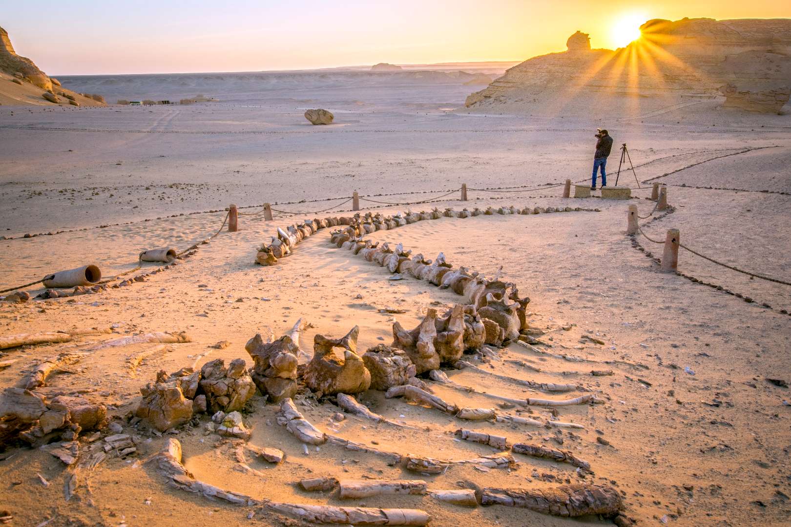
## Description The Valley of the Whales, known locally as Wadi Al-Hitan, is one of Egypt’s most extraordinary and scientifically significant natural sites. Located deep in the Western Desert, this UNESCO World Heritage Site offers a rare glimpse into the evolutionary history of whales. What makes Wadi Al-Hitan truly unique is its collection of fossilized remains of early whale species—particularly the now-extinct Archaeoceti—that vividly illustrate the transition of whales from land-dwelling mammals to fully aquatic creatures. The site contains hundreds of fossils, including complete skeletons, some of which still retain vestigial hind limbs, feet, and toes—features that modern whales no longer possess. These fossils date back approximately 40 million years and are remarkably well-preserved, with some even showing stomach contents. The surrounding desert landscape, sculpted by wind and time, adds to the surreal experience, with rock formations resembling alien sculptures and ancient seabeds. A little-known fact: the first whale fossils in Wadi Al-Hitan were discovered in the early 1900s, but the site remained largely unexplored until the 1980s when improved access and growing scientific interest led to its preservation. Another fascinating detail is that the area also contains fossils of other marine life, including sharks, rays, and sawfish, helping researchers reconstruct the ancient ecosystem of the Tethys Sea. ## Location Wadi Al-Hitan is located in **Egypt**, within the **Faiyum Governorate**, approximately 150 kilometers southwest of **Cairo**. It lies within the Wadi El-Rayan Protected Area, a vast desert reserve known for its sand dunes, lakes, and biodiversity. ### How to Get There - **By Car**: The most practical way to reach Wadi Al-Hitan is by private vehicle or organized tour. From Cairo, the drive takes about 2.5 to 3 hours. A 4x4 vehicle is recommended due to the unpaved desert roads leading to the site. - **By Tour**: Several eco-tourism operators offer guided day trips from Cairo or Faiyum, often including stops at Wadi El-Rayan and the Magic Lake. - **By Public Transport**: Public transport is not available directly to the site. Visitors must arrange private transport from Faiyum city. Due to its remote location, planning ahead is essential, and traveling with a guide is highly recommended. ## Tips - **Visit in Cooler Months**: The best time to visit is between October and April when temperatures are milder. - **Bring Essentials**: Pack water, snacks, sunscreen, and a hat. There are limited facilities at the site. - **Wear Sturdy Shoes**: The terrain is sandy and uneven, so comfortable walking shoes are a must. - **Respect the Fossils**: Do not touch or remove any fossils. The site is protected, and preservation is crucial. - **Explore the Museum**: The Fossil and Climate Change Museum at the entrance offers interactive exhibits and context for the fossils you’ll see. - **Combine with Nearby Attractions**: Pair your visit with Wadi El-Rayan’s waterfalls and lakes for a full desert adventure. ## Conclusion Wadi Al-Hitan is a captivating destination that blends natural beauty with scientific wonder. Its fossil-rich landscape tells a story millions of years old, making it one of the most important paleontological sites in the world and a must-visit for anyone intrigued by Earth’s evolutionary history. ## FAQ **1. Is there an entrance fee to Wadi Al-Hitan?** Yes, there is a small entrance fee, which may vary depending on whether you’re visiting with a guide or tour group. **2. Can I visit Wadi Al-Hitan without a guide?** While possible, it’s highly recommended to go with a guide due to the remote location and lack of signage. **3. Are there accommodations nearby?** There are eco-lodges and campsites in the Wadi El-Rayan area, but most visitors stay in Faiyum or return to Cairo. **4. Is the site suitable for children?** Yes, children can enjoy the site, especially the museum, but supervision is necessary due to the terrain and fragile fossils. **5. How long should I plan for the visit?** A typical visit lasts 2–3 hours, not including travel time. Full-day trips from Cairo are common. **6. Is photography allowed?** Yes, photography is permitted, but drones may require special permission. ## Links - [Wadi Al-Hitan – UNESCO World Heritage Centre](https://whc.unesco.org/en/list/1186) - [Wadi Al-Hitan Overview – Wikipedia](https://en.wikipedia.org/wiki/Wadi_al_Hitan)
GemVoyage Team • World
Cairo
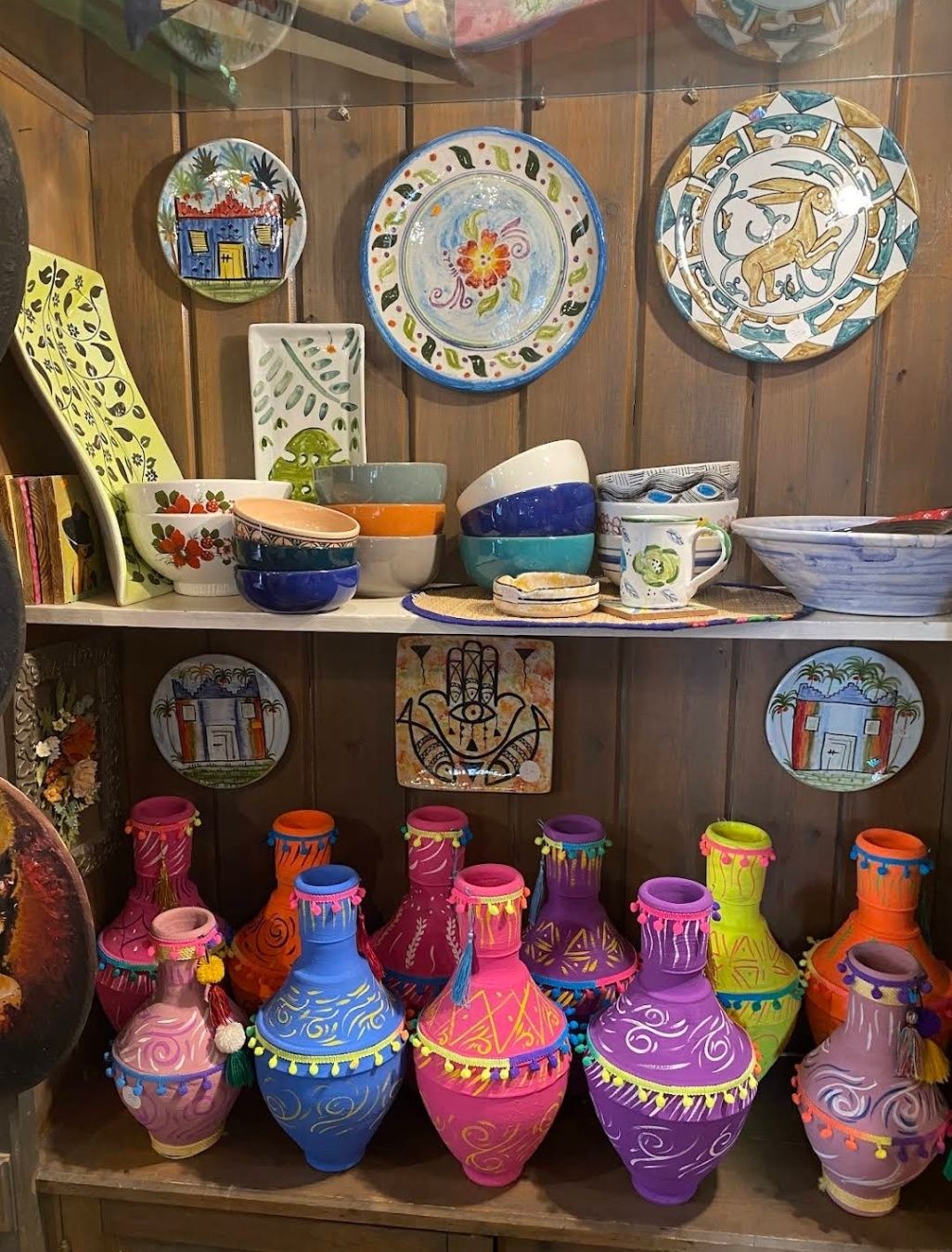
## Description **Souk Al Fustat** is one of Cairo’s most fascinating markets, blending traditional Egyptian craftsmanship with a modern, organized atmosphere. Unlike the bustling and chaotic feel of Khan El Khalili, Souk Al Fustat offers a calmer, more curated shopping experience where visitors can explore handmade goods, artisanal crafts, and cultural souvenirs in a relaxed setting. What makes this market particularly unique is its focus on **authentic, high-quality handicrafts**. Here, you’ll find exquisite pottery, handwoven textiles, blown glass, leather goods, and jewelry made by local artisans who carry on centuries-old traditions. Many items are produced using techniques passed down through generations, making every piece a little work of art. A lesser-known fact about Souk Al Fustat is that it was established in the early 2000s as part of an initiative to revive Egypt’s traditional crafts and support artisans economically. Another hidden gem is that the market is located near some of Cairo’s most historic landmarks, making it easy to combine shopping with cultural exploration in a single trip. ## Location Souk Al Fustat is located in **Old Cairo**, near **Amr Ibn Al-As Mosque** and the **Hanging Church**, within the **Fustat area** of Cairo, Egypt. The address places it right in the heart of Cairo’s oldest district, which is rich in both Islamic and Coptic heritage. Getting there is fairly simple. From downtown Cairo, you can take a taxi or a ride-hailing service like Uber, which is the most convenient option for visitors unfamiliar with the city. The drive usually takes around 20–30 minutes depending on traffic. Alternatively, you can use the **Cairo Metro** and get off at **Mar Girgis Station**, which is just a short walk from the market and other Old Cairo attractions. ## Tips To make the most out of your visit to Souk Al Fustat, consider these tips: * **Bring cash** – While some shops may accept cards, cash is the preferred method of payment, especially for smaller purchases. * **Bargain respectfully** – Unlike Khan El Khalili, prices here are often fixed, but it doesn’t hurt to politely ask for a discount if you’re buying multiple items. * **Visit nearby landmarks** – Plan your visit around Old Cairo so you can explore attractions like the Coptic Museum, Amr Ibn Al-As Mosque, and the Synagogue of Ben Ezra. * **Go in the morning or late afternoon** – This helps you avoid the midday heat and ensures a quieter shopping experience. * **Look for workshops** – Some artisans allow visitors to watch them work, offering a unique opportunity to see traditional crafts being made before your eyes. * **Support local artisans** – Many of the sellers depend on this market as their main livelihood, so buying directly from them helps preserve Egypt’s cultural heritage. ## Conclusion **Souk Al Fustat in Cairo** is more than just a marketplace—it’s a cultural hub where history, craftsmanship, and tradition come together. With its authentic handmade goods, peaceful shopping environment, and proximity to Old Cairo’s iconic landmarks, it’s the perfect spot for travelers who want to take home a meaningful piece of Egypt. ## FAQ **1. What is Souk Al Fustat known for?** It’s best known for selling authentic Egyptian handicrafts such as pottery, textiles, jewelry, glassware, and leather goods, all made by local artisans. **2. How is it different from Khan El Khalili?** Souk Al Fustat is smaller, calmer, and more organized than Khan El Khalili, focusing on quality handmade crafts rather than mass-produced souvenirs. **3. Is it family-friendly?** Yes, the market has a relaxed atmosphere, making it suitable for families with children who want to explore Egyptian crafts without the overwhelming crowds. **4. How much time should I plan for my visit?** You can comfortably explore the market in 1–2 hours, but if you combine it with nearby Old Cairo attractions, plan for a half-day trip. **5. Are prices fixed at Souk Al Fustat?** Many shops have fixed prices, but some sellers may allow light bargaining, especially if you’re purchasing multiple items. **6. When is the best time to visit?** The best times are mornings or late afternoons to avoid the heat and enjoy a more relaxed shopping experience. ## Links * [Official Egypt Tourism Website](https://www.egypt.travel)
GemVoyage Team • World
Bruges
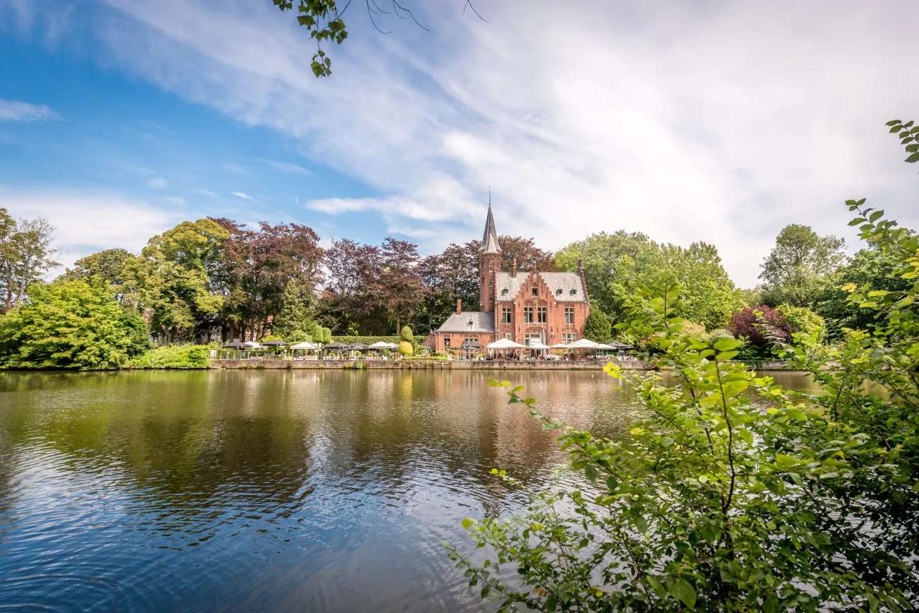
## Description Minnewater Lake, often called the “Lake of Love,” is one of Bruges’ most enchanting and romantic spots. Nestled at the southern edge of the medieval city, this tranquil lake is surrounded by lush greenery, swans gliding across the water, and historic architecture that seems pulled from a fairy tale. It’s a place where time slows down, inviting visitors to stroll, reflect, and soak in the serene beauty of Bruges. The name “Minnewater” comes from the Dutch word “minne,” meaning love, and the lake is steeped in legend. One popular tale tells of a young woman named Minna who died of heartbreak near the lake, and her lover Stromberg buried her beneath the waters—thus giving the lake its poetic name. Today, couples often cross the Minnewater Bridge and share a kiss, believing it will seal their love forever. A little-known fact: Minnewater Lake was originally a reservoir created in the 13th century to regulate water levels and prevent flooding in Bruges. It also served as a docking point for cargo barges from Ghent until the late 18th century. The lake’s historical role in the city’s development adds depth to its romantic reputation. ## Location Minnewater Lake is located in **Belgium**, in the **Flemish Region**, within the city of **Bruges**. It sits just south of the city center, adjacent to the Begijnhof (Beguinage) and near the city ramparts. ### How to Get There: - **By Train**: From Bruges Railway Station, it’s a short 10-minute walk to the lake. Just follow signs toward Minnewaterpark. - **By Bus**: Bus lines 12 and 14 stop near the lake. Get off at Brugge Station Perron 1 and walk toward the park entrance. - **By Foot**: If you’re exploring Bruges on foot, Minnewater is easily accessible from the historic center and makes a perfect stop before or after visiting the Begijnhof. Its proximity to the train station makes it an ideal first or last stop on your Bruges itinerary. ## Tips for Visitors To make the most of your visit to Minnewater Lake, consider these helpful tips: - **Visit at Sunrise or Sunset**: The soft light and peaceful atmosphere make these times ideal for photography and quiet reflection. - **Bring a Camera**: The lake, bridge, and surrounding park offer postcard-perfect views—especially with swans in the frame. - **Explore Nearby Sites**: Don’t miss the Begijnhof, the Gunpowder Tower (Poertoren), and the neo-Gothic Kasteel de la Faille, now a restaurant. - **Pack a Picnic**: The park surrounding the lake is perfect for a relaxed lunch or snack. - **Attend a Festival**: Minnewater Park hosts occasional cultural events and music festivals—check local listings if you’re visiting in summer. - **Avoid Peak Hours**: Weekends can be crowded. For a more intimate experience, visit on a weekday morning. ## Conclusion Minnewater Lake is a poetic blend of history, legend, and natural beauty. Whether you're drawn by its romantic lore, its peaceful setting, or its role in Bruges’ medieval past, the Lake of Love offers a timeless escape in one of Europe’s most charming cities. ## FAQ **1. Is Minnewater Lake free to visit?** Yes, the lake and surrounding park are open to the public and free of charge. **2. Can I take a boat ride on Minnewater Lake?** No, boating is not permitted on the lake, as it’s part of a protected park area. **3. Is Minnewater Lake suitable for children?** Absolutely. The park is safe and spacious, with plenty of room for kids to explore. **4. Are there restaurants nearby?** Yes, including the Kasteel de la Faille, a neo-Gothic castle turned restaurant, and several cafés near the park. **5. Is Minnewater Lake accessible year-round?** Yes, the park is open year-round, though spring and summer offer the most vibrant scenery. **6. Can I visit Minnewater Lake with a dog?** Yes, dogs are welcome in the park but should be kept on a leash. ## Links - [Minnewater Lake – Visit Bruges Overview](https://www.visitbruges.be/en/things-to-do/culture-and-heritage/minnewater-lake-love) - [Minnewater Lake and Park – Discover World Guide](https://discover-world.eu/en/countries/belgium/brugge/minnewater-lake-and-park-in-bruges) - [Minnewater – Wikipedia](https://de.wikipedia.org/wiki/Minnewater)
GemVoyage Team • World
Munich
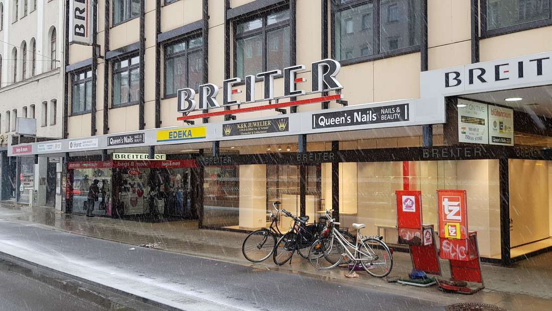
## Description **Breiterhof Passage** is a discreet but culturally significant pedestrian passageway in the heart of Munich’s old town. Unlike the city’s grand squares or monumental avenues, Breiterhof Passage represents a more **intimate layer of urban history**, where commerce, architecture, and everyday life intersect quietly rather than dramatically. The passage dates back to the **postwar reconstruction period**, when Munich rebuilt much of its historic core after World War II. Instead of restoring medieval structures wholesale, planners integrated modern functionality with traditional urban patterns. Breiterhof Passage exemplifies this approach: a short, covered walkway connecting streets while sheltering small shops, cafés, and offices. Its modest scale reflects a deliberate choice to prioritize **human movement and local commerce** over architectural spectacle. What makes Breiterhof Passage unique is its **contrast with Munich’s surrounding grandeur**. Just steps away from busy shopping streets and historic landmarks, the passage offers a slower, enclosed environment that feels almost private. A lesser-known fact is that passages like Breiterhof were designed to maintain pedestrian permeability in dense urban blocks, preserving historic movement patterns even when buildings were rebuilt. Another overlooked detail is that many businesses here are long-standing local operations rather than international chains, giving the space a distinctly Munich character. The passage is not a destination in itself, but a **transitional urban experience**. It rewards attentive visitors who appreciate the city’s smaller architectural gestures and the continuity of everyday life embedded within them. ## Location **Country:** Germany **State:** Bavaria **City:** Munich **District:** Altstadt-Lehel Breiterhof Passage is located in Munich’s historic center, close to major shopping streets and within easy walking distance of Marienplatz. ### How to Get There * **By metro or S-Bahn:** * Travel to **Marienplatz** station, then walk approximately 3–5 minutes. * **By tram:** * Several tram lines stop near the old town perimeter, followed by a short walk. * **On foot:** * Ideal when exploring Altstadt-Lehel, as the passage connects naturally to pedestrian routes. * **By bicycle:** * Bike parking is available nearby, though cycling through the passage itself is not permitted. ## Tips * **Visit during business hours:** The passage is most lively when shops and cafés are open. * **Look beyond storefronts:** Architectural details and spatial proportions are easy to miss if rushed. * **Use it as a shortcut:** It provides a calmer alternative to crowded shopping streets. * **Combine with old town exploration:** It fits naturally into a walking itinerary through central Munich. * **Respect the quiet tone:** This is a working urban space, not a tourist attraction. * **Photography is permitted:** Be mindful of people working or dining inside. ## Conclusion Breiterhof Passage is a subtle reminder that cities are shaped as much by small connective spaces as by major landmarks. Modest, functional, and quietly local, it offers insight into Munich’s postwar urban identity and everyday rhythms. ## FAQ **1. Is Breiterhof Passage a tourist attraction?** No, it is primarily a functional pedestrian passage used by locals. **2. Is there an entrance fee?** No, access is completely free. **3. How long does it take to visit?** Only a few minutes, unless stopping at a café or shop. **4. Is it historically significant?** Yes, as part of Munich’s postwar reconstruction and pedestrian network. **5. Is it suitable for children?** Yes, though there are no child-specific activities. **6. Can it be visited at night?** Access may vary depending on building hours, but daytime visits are recommended. ## Links * [Munich tourism board](https://www.munich.travel)
GemVoyage Team • World


Comments