GemVoyage Team • World
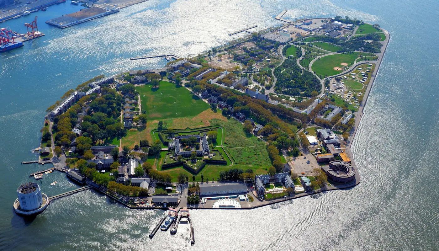
What makes Governors Island particularly interesting is that it has moved from a former military and administrative site to a public destination with recreation, arts, and heritage uses. A lesser-known fact is that much of the island's character comes from its reuse: old structures now sit alongside lawns, paths, and public programming. Another detail many first-time visitors appreciate is how easy it is to build a flexible day there, whether you want to picnic, explore, rent bikes, or simply enjoy the harbor air.
The best way to visit is to check ferry times ahead of time and plan enough hours on the island to make the crossing worthwhile. Once there, the grounds are easy to explore on foot or by bike. It is one of the most straightforward and rewarding day trips in the New York area.
Discover more hidden gems you might love.
Chicago
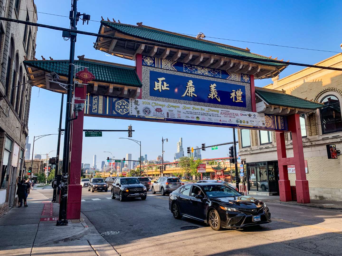
## Description Chicago’s Chinatown is a vibrant, historic neighborhood that offers a rich tapestry of culture, cuisine, and community. Established in its current location in 1912, Chinatown is one of the oldest and most dynamic Chinese-American enclaves in the United States. Located on the South Side of Chicago, it’s a place where tradition meets modernity—where you can sip bubble tea in a sleek café and then step into a century-old herbal shop just down the street. The neighborhood is anchored by the iconic Chinatown Gate on Wentworth Avenue, a symbol of welcome and cultural pride. Beyond the gate lies a bustling corridor filled with dim sum restaurants, bakeries, gift shops, and grocery stores stocked with imported goods. Chinatown Square, a two-level outdoor mall inspired by Chinese imperial architecture, features statues of the twelve zodiac animals and hosts seasonal performances and festivals. A little-known fact: the design of the Chinatown Gate was inspired by a gate in Beijing and was completed in 1975. Another hidden gem is the Chinese American Museum of Chicago, housed in a former grocery store and offering exhibits on immigration, community history, and cultural heritage. ## Location Chicago Chinatown is located in the **United States**, in the **state of Illinois**, within the **city of Chicago**. It sits in the **Armour Square** community area, primarily along **South Wentworth Avenue**, between **Cermak Road** and **W. 26th Street**. ### How to Get There: - **By Train**: Take the CTA Red Line to Cermak-Chinatown Station. The entrance to Chinatown is just steps away. - **By Bus**: Several CTA bus routes, including the 24 and 62, stop near Chinatown. - **By Car**: Parking is available in designated lots and metered spots, but public transit is recommended due to limited space. - **By Water Taxi**: In warmer months, you can take a scenic water taxi from downtown to Ping Tom Memorial Park, located in Chinatown. Its accessibility and proximity to downtown Chicago make it a convenient and rewarding destination for locals and tourists alike. ## Tips for Visitors To make the most of your visit to Chicago Chinatown, consider these tips: - **Come Hungry**: The neighborhood is a culinary paradise. Try dim sum at MingHin Cuisine or hand-pulled noodles at Lao Sze Chuan. - **Explore Chinatown Square**: This open-air plaza is perfect for shopping, dining, and snapping photos with zodiac statues. - **Visit Ping Tom Memorial Park**: A peaceful riverside park with skyline views, ideal for a picnic or a stroll. - **Check the Calendar**: Chinatown hosts vibrant events like the Lunar New Year Parade and the Summer Fair. - **Take a Walking Tour**: The Chicago Chinese Cultural Institute offers guided tours that delve into the neighborhood’s history and architecture. - **Bring Cash**: While many places accept cards, some smaller shops and eateries prefer cash. ## Conclusion Chicago Chinatown is a dynamic blend of history, culture, and flavor. Whether you're indulging in authentic cuisine, learning about Chinese-American heritage, or simply soaking in the atmosphere, this neighborhood offers a memorable experience that reflects the spirit of its community. ## FAQ **1. Is Chicago Chinatown safe to visit?** Yes, it’s generally safe and welcoming. As with any urban area, stay aware of your surroundings. **2. What is the best time to visit Chinatown?** Weekends offer the most energy and activity, especially during festivals. Weekdays are quieter and ideal for relaxed exploration. **3. Are there vegetarian or vegan options in Chinatown?** Yes, many restaurants offer plant-based dishes, especially tofu and vegetable stir-fries. **4. Is Chinatown family-friendly?** Absolutely. Kids will enjoy the colorful shops, parks, and cultural events. **5. Can I find souvenirs in Chinatown?** Yes, from traditional teas and ceramics to novelty gifts and zodiac-themed items. **6. Is there parking available?** Limited street parking and paid lots are available, but public transit is often more convenient. ## Links - [Chicago Chinatown – Wikipedia Overview](https://en.wikipedia.org/wiki/Chinatown,_Chicago)
GemVoyage Team • World
Sedgefield
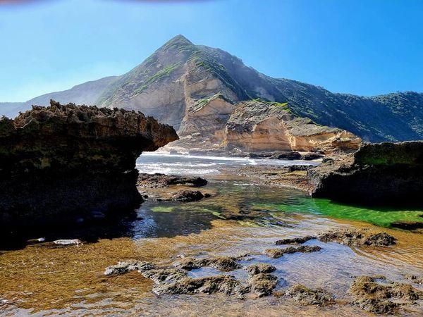
## Description **Gericke’s Point** is one of the hidden gems of South Africa’s Garden Route. Famous for its striking sandstone cliff that resembles the profile of a lion’s head, this natural landmark offers both geological beauty and incredible biodiversity. At low tide, the area transforms into a natural aquarium, revealing tidal pools brimming with colorful marine life such as starfish, sea anemones, and small fish. The rock formation itself is over 150 million years old, part of the ancient Table Mountain sandstone system. Its unusual shape and size make it one of the most photogenic spots along the coast. Beyond its geology, Gericke’s Point is also a birdwatcher’s paradise, with seabirds often seen diving for fish and dolphins occasionally passing offshore. A little-known fact is that the tidal pools here are considered some of the most diverse along the Garden Route, making it a favorite spot for marine biologists and nature enthusiasts. Another fascinating detail is that the rock face has long been a landmark for sailors navigating the coast between Sedgefield and Wilderness. ## Location Gericke’s Point is located near **Sedgefield**, a small town along the **Garden Route** in the **Western Cape Province** of **South Africa**. It lies about 25 kilometers from Knysna and around 40 kilometers from George. To reach the point, visitors typically start at Swartvlei Beach near Sedgefield. From there, a scenic beach walk of about 2–3 kilometers leads to the rock formation. The best time to go is at low tide, when the tidal pools are accessible and the walk is safe. Travelers driving the Garden Route can easily stop at Sedgefield, with parking available near the beach entrance. ## Tips * **Check the tide tables:** Low tide is the only safe and rewarding time to visit. High tide can make the walk dangerous. * **Wear sturdy shoes:** Although the walk is along the beach, exploring the tidal pools requires footwear with good grip. * **Bring a camera:** The lion-shaped rock formation and vibrant tidal pools make for excellent photography opportunities. * **Pack water and sun protection:** There are no facilities along the beach walk, so carry essentials with you. * **Respect marine life:** Avoid disturbing or removing creatures from the tidal pools—this is a fragile ecosystem. * **Stay for sunset:** The area is particularly stunning in the golden light of late afternoon, with the rock formation silhouetted against the ocean. ## Conclusion Gericke’s Point is more than just a rock formation—it is a window into South Africa’s geological past and a living showcase of coastal biodiversity. With its tidal pools, dramatic cliffs, and sweeping ocean views, it offers a perfect mix of adventure and tranquility along the Garden Route. For travelers seeking a memorable nature experience off the beaten path, Gericke’s Point is not to be missed. ## FAQ **1. How long is the walk to Gericke’s Point?** The walk from Swartvlei Beach to Gericke’s Point takes about 30–40 minutes each way, depending on pace and tide conditions. **2. Is it safe to swim near Gericke’s Point?** Swimming is possible in some tidal pools, but the open ocean can be rough. Always exercise caution and avoid strong currents. **3. Can children visit the point?** Yes, children often enjoy exploring the tidal pools, but they should be supervised closely due to slippery rocks and the incoming tide. **4. Is there an entrance fee?** No, Gericke’s Point is free to access, though parking at Swartvlei Beach may sometimes require a small fee. **5. What wildlife might I see?** In addition to tidal pool creatures, visitors may spot dolphins offshore, oystercatchers, and other seabirds. In whale season (June–November), southern right whales are sometimes visible. **6. When is the best time to visit?** The best time is at low tide and preferably in the morning or late afternoon when temperatures are milder and light conditions are ideal. ## Links * [Visit Garden Route – Sedgefield](https://www.visitgardenrouteandkleinkaroo.com) * [South African Tourism – Garden Route](https://www.southafrica.net)
GemVoyage Team • World
Tokyo
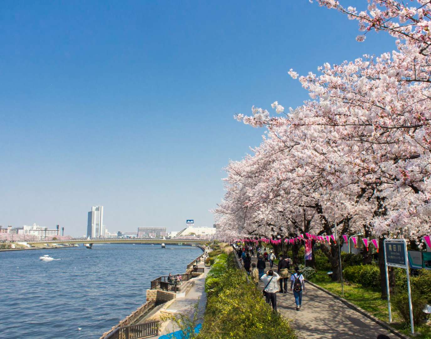
## Description Sumida Park is a serene riverside oasis in the heart of Tokyo, offering a refreshing contrast to the city’s fast-paced urban energy. Stretching along both banks of the Sumida River, the park is located between the Azumabashi and Sakurabashi bridges and provides stunning views of the Tokyo Skytree rising above the skyline. It’s a favorite spot for locals and tourists alike, especially during spring when the park transforms into one of Tokyo’s most celebrated cherry blossom viewing locations. The park’s history dates back to the Edo period, when the riverbanks were popular gathering spots for hanami (cherry blossom viewing), festivals, and leisurely strolls. Today, Sumida Park continues that tradition with over 600 cherry trees lining the paths, creating a tunnel of blossoms that draws thousands of visitors each year. In summer, the park becomes a prime viewing location for the Sumida River Fireworks Festival, one of Japan’s oldest and most spectacular pyrotechnic displays. A little-known fact: the cherry trees in Sumida Park were planted under the orders of shogun Tokugawa Yoshimune in the 18th century, making the park not only a natural retreat but also a living piece of Tokyo’s cultural heritage. Another quirky detail is the nearby Asahi Beer Tower, visible from the park, which was designed to resemble a frothy mug of beer—a playful architectural nod to the area’s modern flair. ## Location Sumida Park is located in **Japan**, in the **Kanto region**, within the **city of Tokyo**. It spans the **Taito and Sumida wards**, with entrances near the historic Asakusa district and the Sumida River waterfront. ### How to Get There - **By Train**: The park is a five-minute walk from Asakusa Station, served by the Ginza Line, Asakusa Line, Tobu Isesaki Line, and Tsukuba Express. - **By Bus**: Several local buses stop near Asakusa and Sumida Park. - **By Water Bus**: The Tokyo Water Bus docks near the park and offers scenic rides to destinations like Odaiba and Hamarikyu Gardens. - **By Foot or Bike**: The park is easily accessible from nearby neighborhoods and is ideal for walking or cycling along the river. Its central location makes it a convenient stop during a day of sightseeing in eastern Tokyo. ## Tips - **Visit During Cherry Blossom Season**: Late March to early April is peak bloom time. Arrive early to avoid crowds and secure a good picnic spot. - **Stay for the Fireworks**: If visiting in late July, plan to attend the Sumida River Fireworks Festival. Arrive hours in advance for a good viewing location. - **Bring a Camera**: The park offers excellent photo opportunities, especially with Tokyo Skytree in the background. - **Explore Both Sides of the River**: Cross the Sakurabashi pedestrian bridge to enjoy views from both banks. - **Pack a Picnic**: There are no large restaurants inside the park, but nearby Asakusa has plenty of takeout options. - **Check for Events**: Seasonal festivals and cultural performances are often held in the park—check local listings for details. ## Conclusion Sumida Park is a tranquil yet culturally rich destination in Tokyo, offering scenic river views, seasonal beauty, and a deep connection to the city’s history. Whether you're admiring cherry blossoms, watching fireworks, or simply enjoying a quiet walk, the park provides a memorable escape in the heart of the metropolis. ## FAQ **1. Is there an entrance fee to Sumida Park?** No, the park is free and open to the public year-round. **2. When is the best time to visit Sumida Park?** Spring (late March to early April) for cherry blossoms and summer (late July) for the fireworks festival. **3. Are there restrooms and facilities in the park?** Yes, there are public restrooms and seating areas throughout the park. **4. Can I bring pets to Sumida Park?** Yes, pets are allowed but should be kept on a leash and cleaned up after. **5. Is the park wheelchair accessible?** Most paths are flat and accessible, though some areas may have uneven terrain. **6. Are there guided tours available?** While not specific to the park, many Asakusa walking tours include Sumida Park as part of their itinerary. ## Links - [Sumida Park – Japan National Tourism Organization](https://www.japan.travel/en/spot/2114/)
GemVoyage Team • World
Algeria
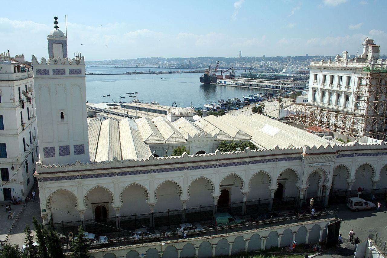
## Description Djamaa El Kbir Mosque, known in Arabic as الجامع الكبير الأثري, is one of the oldest and most historically significant mosques in Algeria. Built in 1097 during the Almoravid dynasty, it stands as a powerful reminder of Algiers’ deep Islamic and Mediterranean roots. Unlike more monumental later mosques, Djamaa El Kbir is admired for its restrained elegance, spiritual atmosphere, and architectural authenticity rather than sheer scale. What makes Djamaa El Kbir truly unique is its remarkable continuity. For more than nine centuries, the mosque has remained an active place of worship, surviving earthquakes, invasions, and centuries of urban transformation. Its minaret, added in the 14th century during the Zayyanid period, is one of the oldest in Algiers and features beautifully carved stone decoration that subtly blends Andalusian and Maghrebi styles. A little-known fact is that the mosque was built using spolia—reused columns and materials from earlier Roman structures—linking Islamic Algiers to its ancient past. Another lesser-known detail is that the mosque once formed part of a much larger religious and educational complex serving the Casbah community. Djamaa El Kbir is not only an architectural treasure but also a living symbol of faith, scholarship, and continuity in Algerian history. ## Location Djamaa El Kbir Mosque is located in **Algeria**, in the **Algiers Province**, within the city of **Algiers**. It stands in the historic Casbah district, close to the old harbor and not far from the Ketchaoua Mosque and other major landmarks of the old city. The mosque is easily accessible by foot if you are exploring the Casbah. Visitors can also reach the area by taxi or public transport from central Algiers. The nearest metro stations and bus routes serve the lower Casbah area, from where the mosque is a short walk. Due to narrow streets and limited parking, walking or using public transport is the most practical option. ## Tips * Dress modestly, as Djamaa El Kbir is an active place of worship. * Visit outside of prayer times if you wish to explore quietly and observe architectural details. * Photography may be restricted inside, so always ask permission before taking photos. * Take time to admire the minaret’s stone carvings, which are among the mosque’s most distinctive features. * Combine your visit with a walk through the Casbah to gain deeper historical context. * Consider visiting with a local guide to better understand the mosque’s architectural and historical significance. ## Conclusion Djamaa El Kbir Mosque is a rare and precious link to Algeria’s medieval Islamic past. Its simplicity, age, and continued religious function make it a deeply meaningful site, offering visitors a quiet but powerful insight into the spiritual and historical heart of Algiers. ## FAQ **When was Djamaa El Kbir Mosque built?** The mosque was built in 1097 during the Almoravid period. **Is Djamaa El Kbir still used for prayer?** Yes, it remains an active mosque and serves the local community daily. **Can non-Muslims visit the mosque?** Access may be limited to certain areas, and visitors should be respectful of religious practices. **How long does a visit take?** Most visits last 20 to 40 minutes, depending on access and interest. **Is there an entrance fee?** No, entrance is generally free, though donations may be welcomed. ## Links * [The Mosque's wiki page](https://en.wikipedia.org/wiki/Djamaa_el_Kebir)
GemVoyage Team • World
Laos
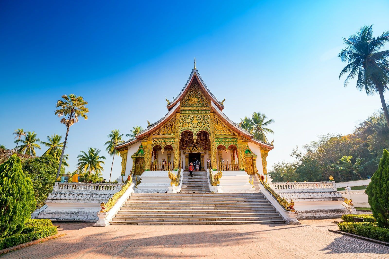
## Description Luang Prabang, nestled where the Mekong and Nam Khan rivers meet, is a compact and remarkably well-preserved city in northern Laos. Renowned for its colonial-era buildings, saffron-robed monks, ornate Buddhist temples and a contemplative pace, Luang Prabang blends spiritual ritual with a lively artisan scene and riverfront cafés. The city’s Unesco-listed core includes gilded wats (temple complexes) with intricate woodwork, and the daily ritual of almsgiving — where villagers and visitors watch monks collect offerings at dawn — remains a powerful cultural scene. Beyond its temples, Luang Prabang is a gateway to waterfalls such as Kuang Si, traditional weaving villages, and hilltop viewpoints that reward gentle hikes. The city’s food scene is notable for Lao specialties and a street-market culture that showcases sticky rice, grilled meats, and delicate river fish dishes. Luang Prabang is a place where slow travel rewards attention: morning almsgiving, quiet temple courtyards, and riverside cafés invite pauses that reveal local rhythms. The city manages to balance heritage conservation with welcoming tourism; narrow streets are punctuated by family-run guesthouses, handicraft cooperatives and social enterprises focused on sustainable tourism. Kuang Si Falls remains a perennial highlight — a cascading tier of turquoise pools that invites both swimming and mindful walking — while nearby villages offer hands-on experiences with traditional weaving, dyeing and food preparation. The compact scale of Luang Prabang makes it easy to explore on foot or by bicycle; many travelers find that wandering the backstreets at dawn or dusk yields unexpectedly intimate encounters with everyday life. Given the city's spiritual presence, visitors should dress respectfully around temples and be mindful of photography etiquette during ceremonies. The night market on Sisavangvong Road is a lively hub for textiles, silverwork and street food, but for authentic Lao cuisine seek neighborhood stalls where family recipes are passed down through generations. Seasonal festivals, like Boun Pi Mai (Lao New Year) and other Buddhist celebrations, add further depth for those who align travel dates with local calendars. ## Location Luang Prabang is in northern Laos, reachable by air at Luang Prabang International Airport (LPQ) or by overland routes from northern Thailand and Vientiane. The rivers provide scenic boat connections to upriver destinations and are central to the city’s character. Flight connections to Luang Prabang arrive from regional hubs; overnight trains and bus routes from Chiang Mai and other Thai cities offer overland alternatives. River cruises along the Mekong provide a slower, scenic arrival that frames the city's riverside charm. Central Luang Prabang is compact and walkable, with most attractions clustered within an easy radius; taxis, tuk-tuks and river boats provide transport to outlying sites like Kuang Si Falls and surrounding villages. ## Tips - **Honor local customs:** Dress modestly at temples, avoid loud behavior during almsgiving, and observe photography etiquette. - **Visit Kuang Si Falls:** A short drive away, the falls’ turquoise pools are ideal for swimming and picnics — arrive early to avoid crowds. - **Explore by foot or bicycle:** The city center is compact; walking or cycling is pleasant and helps you discover markets and side streets. - **Try a river cruise:** Sunset river trips on the Mekong offer relaxed views and local riverside life. - **Support craft cooperatives:** Visit silk-weaving and craft workshops that support local artisans and sustain traditional techniques. - **Carry small bills for offerings:** If participating respectfully in almsgiving or donations, small local currency notes are appropriate. - **Be mindful of seasonal weather:** The cool-dry season (Nov–Feb) is most comfortable; the wet season can make rural tracks muddy and less accessible. - **Hire local guides for village visits:** Ethical community-based tours give income to families and provide authentic context. - **Taste street specialties early:** Local breakfasts like khao soi and grilled river fish are best experienced fresh from morning stalls. ## Conclusion Luang Prabang offers a gentle, culturally immersive travel experience: spiritual rhythm, natural beauty and warm Lao hospitality combine to create a reflective pace that many travelers find restorative. Whether you’re drawn to its temples, waterfalls or artisan traditions, Luang Prabang rewards visitors who travel slowly and with curiosity. The city’s human scale and spiritual cadence make it an ideal destination for travelers seeking contemplative experiences, meaningful cultural exchange and access to some of Laos’s most scenic natural sites. ## FAQ - **Q: Is Luang Prabang safe for solo travelers?** - A: Generally yes — it’s considered one of Southeast Asia’s safer small cities, but usual travel caution applies. - **Q: When is the best time to visit?** - A: The cool dry season (November–February) is most comfortable; the wet season can be lush but includes heavy rains. - **Q: Are there international flights?** - A: Luang Prabang has regional flights; connections from Bangkok, Hanoi and Vientiane are common. - **Q: How many days are ideal for a first visit?** - A: Three to five days lets you explore temples, enjoy Kuang Si Falls, visit a weaving village and take a short Mekong trip without rushing. - **Q: What should I wear for temple visits?** - A: Dress modestly with shoulders and knees covered; remove shoes when entering temple buildings and follow local customs. - **Q: Can I use ATMs and credit cards?** - A: ATMs are available in town and larger businesses accept cards, but carry cash for market stalls and rural excursions. - **Q: Are there ethical ways to visit villages?** - A: Yes — choose community-run tours, avoid exploitative photo practices, and purchase directly from cooperatives when possible. ## Links - [Luang Prabang — Wikipedia](https://en.wikipedia.org/wiki/Luang_Phrabang)
GemVoyage Team • World
Salto
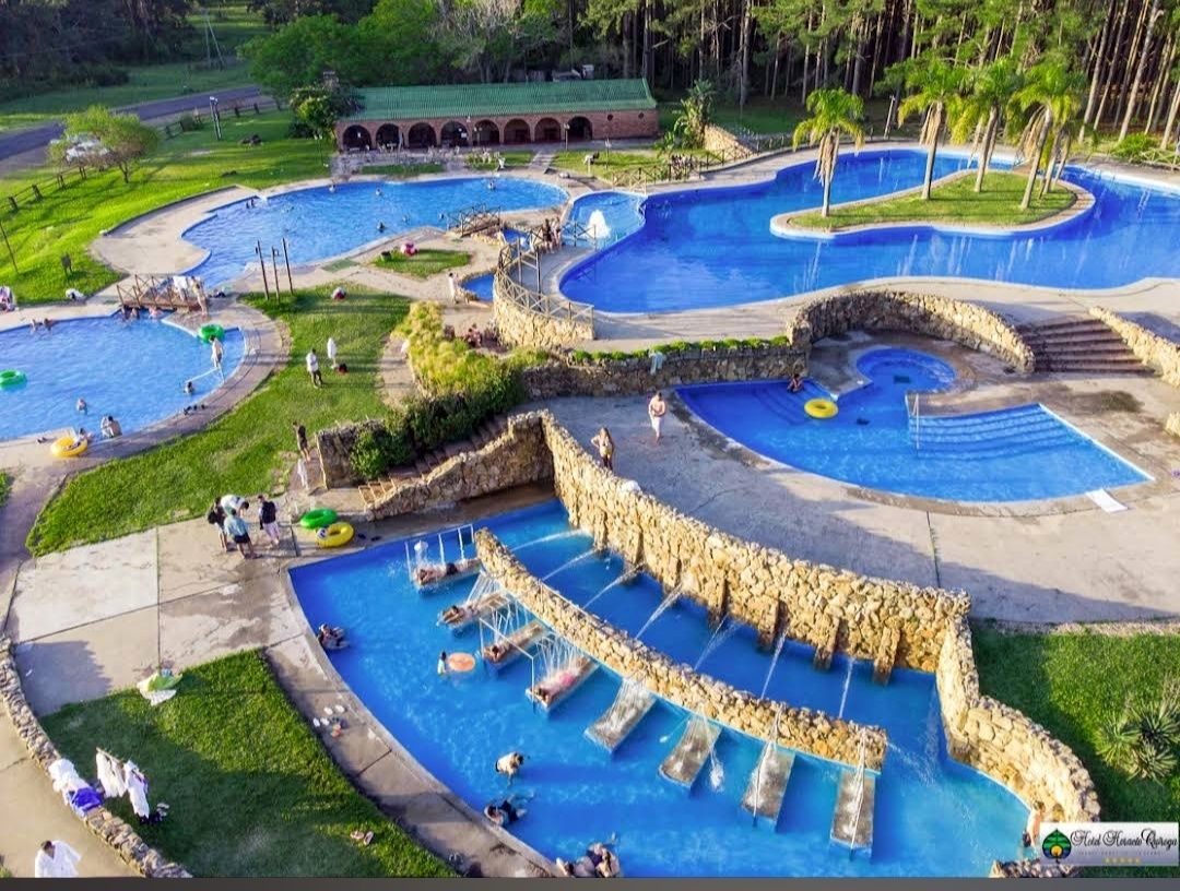
## Description **Parque Aquático Termas de Salto Grande** is one of Uruguay’s most popular thermal water parks, offering a unique blend of relaxation, recreation, and family fun. Located near the Salto Grande Dam, the park is famous for its naturally heated pools, which are fed by underground hot springs rich in minerals. These thermal waters are believed to have therapeutic properties, making the park not just an entertainment venue but also a wellness destination. The park features a variety of attractions, including outdoor and indoor pools, water slides, jacuzzis, and dedicated children’s areas. Families can enjoy thrilling rides while others unwind in the warm, soothing waters. The design of the park strikes a balance between leisure and adventure, making it suitable for visitors of all ages. **Little-known facts**: * The thermal waters in Salto reach temperatures of **38–46°C**, perfect for relaxation and health benefits. They are said to help with circulation, joint pain, and stress relief. * The park is part of the larger **Salto Grande hot springs circuit**, which is considered one of the most important in Uruguay and the entire Río de la Plata region. --- ## Location Parque Aquático Termas de Salto Grande is located in the **city of Salto**, in **northwestern Uruguay**, within the **Salto Department**. The park lies just a few kilometers from the **Salto Grande Dam**, which sits on the Uruguay River and borders Argentina. ### How to get there: * From **Salto city center**, the park is around 10 kilometers away. Taxis, local buses, or rental cars are convenient options. * Visitors traveling from **Montevideo** (about 500 kilometers away) can reach Salto by long-distance bus or a domestic flight. From there, it’s a short drive to the park. * If coming from **Argentina**, the park is easily accessible through the Concordia–Salto International Bridge, making it a popular cross-border attraction. --- ## Tips * **Bring swimwear and sandals**: Comfortable water-friendly clothing is essential, and sandals are useful for walking around hot pavements. * **Plan a full day**: With multiple pools, slides, and relaxation areas, you’ll want plenty of time to enjoy everything. * **Visit on weekdays**: The park can get very crowded on weekends and holidays, so weekdays are more peaceful. * **Stay hydrated**: The warm thermal waters can dehydrate you faster than you might expect, so drink plenty of water. * **Combine with nearby attractions**: The Salto region offers other hot spring complexes, like Termas del Daymán, and cultural attractions in Salto city itself. --- ## Conclusion Parque Aquático Termas de Salto Grande combines the thrill of a water park with the healing benefits of natural hot springs. Whether you’re seeking wellness, family fun, or just a relaxing escape, the park delivers an experience that is both entertaining and rejuvenating. With its unique thermal waters, diverse facilities, and prime location near Salto Grande, it’s one of Uruguay’s standout destinations. --- ## FAQ **1. What makes Parque Aquático Termas de Salto Grande special?** Its natural thermal pools, therapeutic waters, and mix of fun attractions like slides and jacuzzis make it a unique destination in Uruguay. **2. Is it family-friendly?** Yes, the park has areas designed specifically for children, making it a great choice for families. **3. What is the water temperature in the pools?** The thermal water ranges between 38°C and 46°C, depending on the pool. **4. Do I need to bring my own food?** The park has on-site restaurants and snack bars, but visitors can also bring their own food if they prefer. **5. Can I visit from Argentina?** Yes, the park is very close to the border with Argentina, and many visitors come via the Concordia–Salto bridge. **6. How much time should I plan for my visit?** Most visitors spend at least half a day, but a full day allows you to enjoy both relaxation and water attractions. --- ## Links * [Salto Tourism – Official Website](https://www.salto.gub.uy/) * [Uruguay Natural – Official Tourism Site](https://www.uruguaynatural.com/)
GemVoyage Team • World

Comments