GemVoyage Team • World
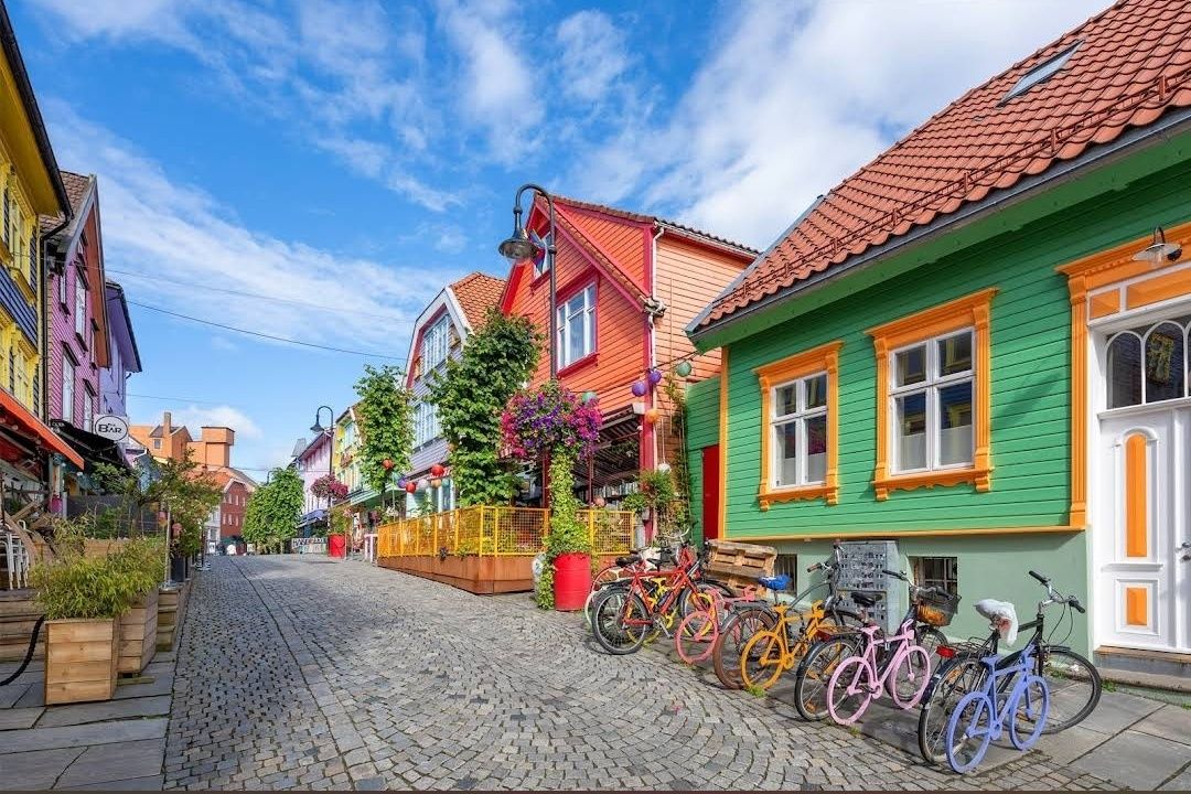
Fargegaten stands out as one of Norway’s most visually striking streets, where entire facades burst with vivid hues. This creative transformation turned a once-dull, quiet lane into a lively, Instagram-worthy pedestrian hotspot. What started as a revitalization project has become a beloved urban gem.
Little-known facts:
Fargegaten is located in Stavanger, within the Rogaland county of Norway—specifically on the eastern stretch of Øvre Holmegate, between Kirkegata and Østervåg.
---
---
Fargegaten in Stavanger is more than a pretty street—it's a community-driven masterpiece. From a faded, overlooked lane to a radiant display of color and culture, it’s a testament to local creativity, persistence, and transformation. Whether you're snapping photos, exploring boutiques, or simply soaking in the atmosphere, Fargegaten offers a joyful, memorable slice of Stavanger life.
---
1. Why is it called Fargegaten?
“Fargegaten” translates to “The Colour Street,” a nickname earned from its boldly painted façades that made the once-quiet Øvre Holmegate a vivid landmark.
2. Who came up with the idea to paint the street?
A local hairdresser named Tom Kjørsvik initiated the project, aiming to revive the neglected street. The transformation spanned over four years, involving landlords, the city council, and artist Craig Flannagan to plan the color scheme.
3. Is Fargegaten suitable for families?
Absolutely—it's pedestrian-friendly, safe, and fun to explore. With boutiques, cafés, and colorful surroundings, it offers a lively but relaxed experience that’s great for all ages.
4. What types of shops can I find there?
Expect niche boutiques, dress shops like Den Syvende Himmel, sewing stores like Bernina, barbershops, tattoo parlors, and even a store offering handmade silkscreen clothing prints (Kant).
5. Can you drive there?
No—Fargegaten has been a pedestrian-only street since 2005, and additional sections between Skagenkaien and Kirkegata were later closed to cars, making for a safe and pleasant stroll.
6. What's the best time to visit?
Any time during daylight is best—colorful façades stand out beautifully under natural light, making for perfect photo conditions and cheerful ambiance.
---
Discover more hidden gems you might love.
Tokyo
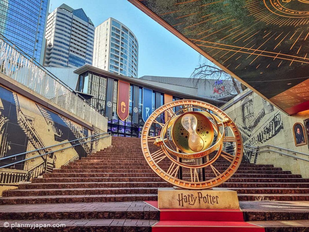
## Description The **Harry Potter Stairs & Time Turner (ハリー・ポッター階段とタイムターナー)** in Tokyo is one of the city’s most popular **pop-culture photo landmarks**, blending cinematic fantasy with modern urban design. This attraction is not a historical monument or a traditional museum—it is a **themed visual installation inspired by the Harry Potter film series**, designed specifically for fans who want to step inside the wizarding world without leaving central Tokyo. The installation recreates two of the most iconic visual elements from the films: the **magical moving staircase of Hogwarts** and **Hermione Granger’s Time Turner** from *Harry Potter and the Prisoner of Azkaban*. The staircase evokes the illusion of shifting directions and hidden passages, while the oversized Time Turner sculpture serves as a symbolic centerpiece representing time travel, destiny, and choice—core themes in the Potter universe. What makes this location truly unique is that it exists **inside a contemporary commercial complex rather than a theme park**. This means visitors do not need to buy expensive tickets or travel to a resort location to enjoy an immersive Harry Potter-themed environment. The installation uses **cinematic lighting, reflective metallic surfaces, stone textures, and enchanted-style typography** to create a convincing atmosphere of fantasy within a very modern architectural setting. The stairs are often used as a **staged photo zone**, where visitors recreate scenes, cosplay as characters, or simulate stepping into a time-loop narrative. The Time Turner sculpture is particularly photogenic when illuminated in the evening, when its rotating rings and glowing accents transform the space into a dramatic visual set piece. Many visitors describe the experience as feeling like walking into a **film trailer set inside a shopping mall**—brief, stylized, and designed for visual impact rather than storytelling depth. A little-known fact is that the stairs and Time Turner installation were part of a **long-term promotional collaboration connected to Warner Bros. Japan and official Harry Potter licensing projects**, timed to coincide with renewed franchise activity in Tokyo. Another lesser-known detail is that the space is frequently **updated with seasonal lighting themes and limited-time character visuals**, which means repeat visits can feel subtly different across the year. Importantly, this site is not meant to replace **The Making of Harry Potter Studio Tour Tokyo**; rather, it acts as a **public teaser-style landmark**, accessible to anyone passing through the district. It attracts an extremely diverse crowd: international tourists, Japanese fans, casual shoppers, cosplayers, couples, and social-media creators all intersect in the same space. The emotional appeal of the installation lies in its ability to deliver **instant recognition and nostalgia**. Even a short visit—often no more than 10 to 15 minutes—can trigger powerful emotional connections for fans who grew up with the books and films. It is, at its core, not a storytelling space but a **symbolic photo experience**, built for visual memory rather than narrative immersion. ## Location The **Harry Potter Stairs & Time Turner** installation is located in **central Tokyo**, inside a major commercial complex in the **Akasaka / Roppongi area**, which has become a hub for large-scale themed entertainment projects. **City:** Tokyo **Region:** Kantō **Country:** Japan **District:** Minato Ward (Akasaka / Roppongi area) ### How to Get There: * **By Tokyo Metro:** * **Chiyoda Line** to **Akasaka Station** * **Hibiya Line or Toei Oedo Line** to **Roppongi Station** * **By JR Train:** Use JR lines to nearby hubs such as **Shinjuku or Tokyo Station**, then transfer to the metro. * **By taxi:** Easy and accurate if you show the Japanese attraction name. * **On foot:** The area is highly walkable and well-connected through underground passages and plazas. The installation is typically integrated into a **shopping, dining, and entertainment complex**, making it easy to combine with cafés, retail stores, and evening nightlife. ## Tips * **Visit in the evening:** The lighting effects are significantly more dramatic after sunset. * **Go on weekdays for clearer photos:** Weekends often bring long lines of people waiting for their turn. * **Bring a small tripod if allowed:** For steady night photos, especially around the Time Turner. * **Do not expect a full “attraction experience”:** This is a **visual installation**, not a ride or museum. * **Cosplay is common:** Light cosplay is generally accepted and often encouraged by visitors. * **Respect queue etiquette:** Japanese photo spots usually operate with informal but strict order. * **Combine with nearby Harry Potter experiences:** If you are a serious fan, this pairs well with the Studio Tour Tokyo. * **Check for seasonal updates:** Lighting schemes and banners occasionally change. ## Conclusion The **Harry Potter Stairs & Time Turner in Tokyo** is a compact yet powerful example of how modern cities translate cinematic fantasy into everyday urban space. It is not a destination for long exploration, but a **precise, visually engineered moment of nostalgia**, crafted for fans who want a tangible connection to the wizarding world without committing an entire day to a theme park. For Harry Potter enthusiasts, it delivers something precise and valuable: **a magical pause inside the rhythm of real city life**. ## FAQ **1. Is the Harry Potter Stairs & Time Turner a real theme park attraction?** No. It is a **public visual installation**, not a ride or ticketed experience. **2. Is it free to visit?** Yes. Access is **free**, as it is located inside a public commercial complex. **3. How long does a visit typically take?** Most visitors spend **10 to 20 minutes**, depending on photo queues. **4. Is it suitable for children?** Yes. It is **family-friendly**, though it can get crowded. **5. Is this the same as the Harry Potter Studio Tour Tokyo?** No. This is a **small themed photo landmark**, whereas the studio tour is a full museum-style experience. **6. Can I take professional photos there?** Casual photography is allowed. **Commercial shoots may require permission** from the property management. ## Links * [Warner Bros. Japan](https://www.warnerbros.co.jp) * [Harry Potter Studio Tour Tokyo](https://www.wbstudiotour.jp)
GemVoyage Team • World
Milan
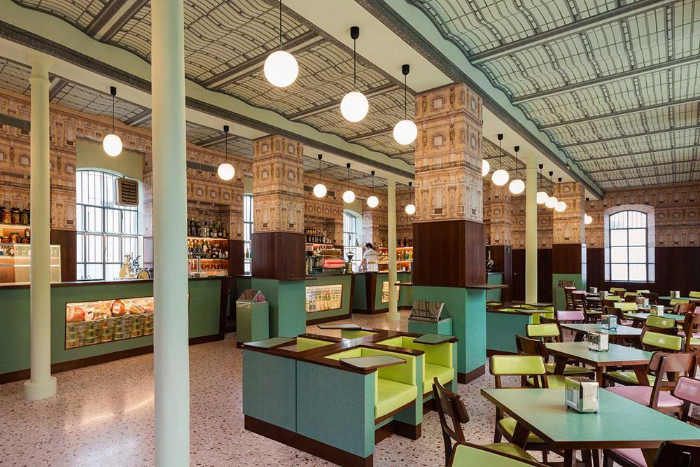
## Description Fondazione Prada is one of Milan’s most compelling cultural destinations because it transforms the idea of a museum into a broader artistic environment. Rather than presenting art in a neutral white box, it brings together exhibition spaces, architecture, cinema, hospitality, and urban transformation in a way that feels highly Milanese: design-driven, ambitious, and outward-looking. The complex is famous for its mix of old industrial structures and new architectural interventions, and that contrast is central to the experience. It is not just a place to view art. It is a place to move through ideas. The foundation is especially attractive to travelers who appreciate contemporary art, architecture, and thoughtful curation. One of its most notable features is the way the old distillery buildings and the new additions sit together without erasing each other. A little-known fact is that the complex includes the striking golden building often called the Haunted House, which is visually unforgettable and not at all shy about making an impression. Another detail visitors may miss is how carefully the site is organized to encourage lingering. You can shift from exhibition spaces to café areas, to outdoor courtyards, to the cinema program, which makes the visit feel more like entering a cultural district than entering a single institution. Fondazione Prada stands out because it helps explain Milan’s current identity. The city has long been important in fashion and design, but here those strengths are translated into a broader cultural ambition. The exhibitions often engage with international art, theory, and contemporary practice, while the architecture itself becomes part of the argument. For many visitors, that makes the foundation one of the city’s most memorable modern experiences, especially if they want to balance Milan’s historic monuments with something more experimental. ## Location Fondazione Prada is located in the Largo Isarco area of southern Milan, Lombardy, Italy. It is not in the very center of the tourist district, but it is still easy to reach by public transport. Metro and tram connections make the trip manageable, and many visitors arrive by taxi or rideshare if they are short on time. Because the foundation sits in a developing cultural and residential zone, the arrival experience feels slightly different from the grand central avenues of Milan. That difference is part of the appeal. The best way to plan a visit is to give it a dedicated block of time rather than trying to squeeze it between other sights. If you are interested in art and architecture, you will likely want a few hours. If you also want to eat or drink on site, plan even longer. It is a destination that rewards unhurried exploration and works especially well for travelers who want a contemporary counterpart to Milan’s historic churches, palaces, and shopping streets. ## Tips - Check the current exhibition schedule before you go, because the experience changes with the program. - Allow enough time to move between buildings rather than rushing from one room to the next. - Visit the café or bar if you want a full sense of the atmosphere, not just the galleries. - Photography enthusiasts should pay attention to the architecture as much as the art. - Pair it with a nearby modern or design-focused itinerary for a fuller Milan experience. - If you are interested in architecture, go with the expectation that the building is part of the exhibition. ## Conclusion Fondazione Prada is one of Milan’s strongest contemporary cultural landmarks. It combines art, architecture, and atmosphere in a way that feels both sophisticated and accessible to curious visitors. ## FAQ ### Is Fondazione Prada only for art experts? No. It is accessible to general visitors, although those with an interest in contemporary art will get the deepest experience. ### How long should I spend there? At least two hours is sensible, and longer if you want to explore exhibitions and amenities fully. ### Is the architecture important here? Very much so. The architecture is a major part of what makes the site distinctive. ### Can I visit without a guided tour? Yes. Most visitors explore independently and use the signage and exhibition materials on site. ## Links - [Official website](https://www.fondazioneprada.org/) - [Wikipedia](https://en.wikipedia.org/wiki/Fondazione_Prada) - [Milan tourism information](https://www.yesmilano.it/en)
GemVoyage Team • World
Lille
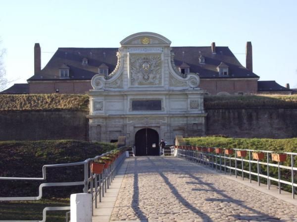
## Description The Citadel of Lille is one of the most impressive military structures in France and a major reason the city is often mentioned in discussions of European fortress design. Built in the 17th century under the direction of Vauban, the citadel is a star-shaped defensive complex that demonstrates both engineering precision and political ambition. It was intended to protect Lille after the city came under French control, and today it stands as a reminder of how military architecture could also shape a city's identity and landscape. What makes the citadel special is that it is not only technically significant but also visually elegant. Its geometric form, wide moats, robust bastions, and open green surroundings make it feel like a fortress designed by someone who understood both defense and urban order. Even if you are not deeply interested in military history, the citadel is compelling because of how it connects architecture, public space, and the natural environment. It is both a monument and a park-like setting, which gives it a very different feeling from densely built old-town landmarks. One little-known fact is that the Citadel of Lille is sometimes referred to as the "queen of citadels" because of its importance in Vauban's defensive system. Another detail many visitors miss is how well the structure fits into the modern city. Although originally conceived for warfare, the citadel now helps define a recreational and cultural zone where walking, cycling, family outings, and visits to nearby attractions all take place. That transformation from military stronghold to civic landmark is part of what makes the site interesting today. The citadel also helps visitors understand Lille's broader history. The city sat near contested borders for centuries, so fortifications were more than symbolic; they were necessary tools of survival and control. Standing at the citadel, you can sense the strategic value of the location and see how a military engineer like Vauban thought about terrain, sightlines, and access. For architecture lovers, history enthusiasts, and casual walkers alike, it is one of Lille's most rewarding destinations. ## Location The Citadel of Lille is in Lille, in the Hauts-de-France region of France, west of the historic center near the Deûle River and surrounding parkland. Its location makes it easy to combine with a broader exploration of Lille's old quarters, especially if you are already spending time around the city center. Unlike a fortress in a remote military zone, this citadel sits comfortably within the urban fabric while still feeling spacious. Getting there is simple by foot, bicycle, or local transport. If you are staying in central Lille, a walk to the citadel is pleasant and reveals how the city's layout changes as you move from dense streets to more open green space. Buses and taxis can also bring you close, but many visitors prefer to use the approach as part of a longer stroll. Because the citadel is surrounded by parks and walking routes, it works especially well as part of a relaxed day outdoors. You can combine it with the nearby zoo, river paths, or other west-side attractions if you want to make the most of the area. ## Tips Allow time for the surroundings as well as the fortress itself. The citadel's setting in parkland is one of its greatest strengths, and the experience improves when you treat it as part of a broader walk rather than a quick photo stop. If you are interested in military history, read a little about Vauban before visiting. His work shaped many French fortifications, and understanding his methods makes the citadel much more meaningful. Visit in good weather if you want to enjoy the outdoor environment fully. The site is enjoyable year-round, but clear conditions make the geometry and scale easier to appreciate. Bring comfortable shoes or use a bicycle if you plan to cover more of the surrounding area. The citadel fits naturally into an active day in Lille and is especially pleasant for travelers who enjoy a mix of history and open-air walking. ## Conclusion The Citadel of Lille is a landmark of French military architecture and a beautiful place to understand the strategic history of the city while enjoying one of its most open and pleasant landscapes. ## FAQ ### Who built the Citadel of Lille? It was designed by Vauban, the famous French military engineer, in the 17th century. ### Why is the citadel important? It is important because it is one of the best examples of Vauban's fortification work and a key part of Lille's historical defense. ### Can you visit the citadel today? Yes. The area is accessible and widely used for walking and recreation, though access may vary in specific sections. ### Is it close to Lille's city center? Yes. It is located west of the center and is easy to reach on foot or by local transport. ## Links - [Lille tourism](https://www.lilletourism.com/) - [Wikipedia article](https://en.wikipedia.org/wiki/Citadel_of_Lille)
GemVoyage Team • World
Rome
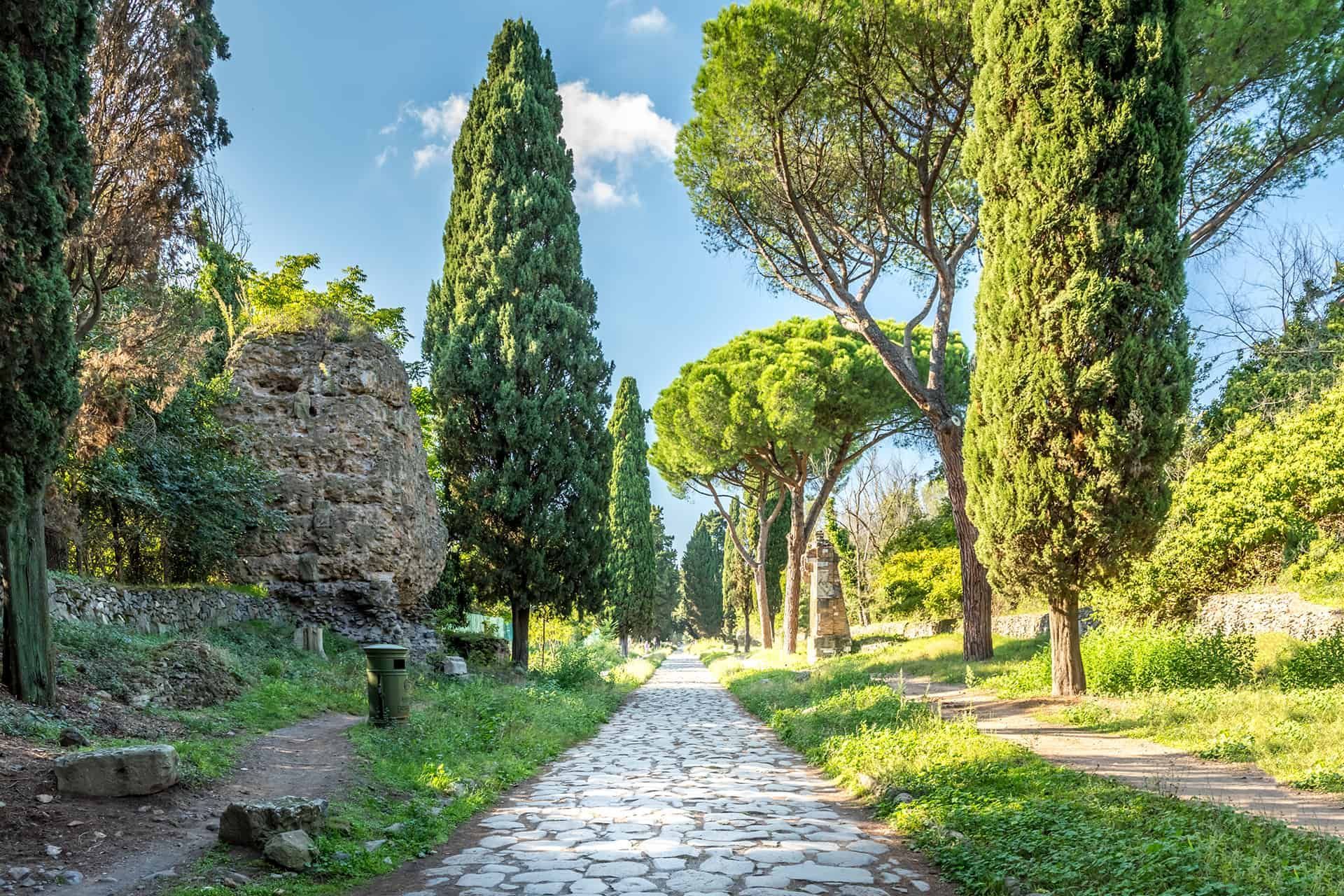
## Description The Appian Way (Via Appia Antica) is one of the most evocative ancient roads in Europe, running southeast from Rome and threading tombs, ruins, and the remains of Roman infrastructure through a pastoral corridor. Lined with funerary monuments and early Christian catacombs, sections of the route preserve original Roman paving and milestones that offer a tangible link to antiquity. Walking, cycling, or riding portions of the Appian Way reveals layers of history: imperial-era tombs, remains of villas, and quieter stretches where the path feels remarkably rural despite being inside Rome's larger urban boundary. Beyond the monuments, the Appian Way is also a public park and archaeological corridor, with protected areas that encourage slow exploration. Many travelers prefer to rent bicycles to cover more ground, though walking smaller stretches provides time to read inscriptions, visit specific catacombs, and take photographs without hurrying. Search-relevant phrases to plan a visit include "Appian Way Rome bike rental", "Via Appia Antica catacombs", and "walk the Appian Way"—terms that match travel guides and visitor resources. ## Location Via Appia Antica begins near the Aurelian Walls and continues southeast into the Roman countryside. Key visitor access points include the Appian Way Park Visitor Center and the areas near the Baths of Caracalla. Public transit options include buses that stop near the main entrances; taxis and bike rentals from central Rome are also common. Parts of the road become parkland with restricted car access, which makes cycling and walking safer and more pleasant. ## Tips - Rent a bike to see more of the route in a single visit: many rental shops offer city pickups and drop-offs near the park. - Visit catacombs with a guide: guided tours provide historical context and access to sites that close early or require reservations. - Wear durable shoes: while paved in places, many stretches have uneven ancient stones—sturdy footwear prevents slips and makes exploration easier. - Start early to avoid midday heat and to capture softer morning light for photography. - Bring water and snacks: services are limited along some stretches, so pack essentials for longer rides or walks. - Respect preservation rules: follow designated paths and do not remove artifacts or disturb archaeological features. ## Conclusion The Appian Way is a living museum and countryside escape rolled into one: accessible, atmospheric, and rich with Roman history. Whether you're cycling past tombs or pausing in a quiet olive grove, the route offers a memorable way to connect with ancient Rome's infrastructure and the everyday topography that shaped imperial travel. ## FAQ Q: How long is the Appian Way and how much can I cover in a day? A: The historic Appian Way stretches for many kilometers; most visitors focus on a 10–20 km segment near Rome that can be walked or cycled in a half-day to full-day depending on pace. Q: Are bicycles available for rent near the Appian Way? A: Yes—bike rental shops and guided bike tours operate from central Rome and near the park entrances. Q: Can I visit catacombs along the Appian Way without a guide? A: Some catacombs permit independent visits, but many recommend or require guided entry to provide context and control visitor numbers—check schedules in advance. Q: Is the Appian Way accessible year-round? A: Generally yes, though some sites and visitor centers follow seasonal hours; winter weather can be cooler and quieter, while spring and fall are popular. Q: Are there food and restroom facilities along the route? A: Basic facilities are available near major access points and visitor centers, but services are sparse in remote stretches—plan accordingly. ## Links - [Appian Way (Wikipedia)](https://en.wikipedia.org/wiki/Appian_Way)
GemVoyage Team • World
Lisbon
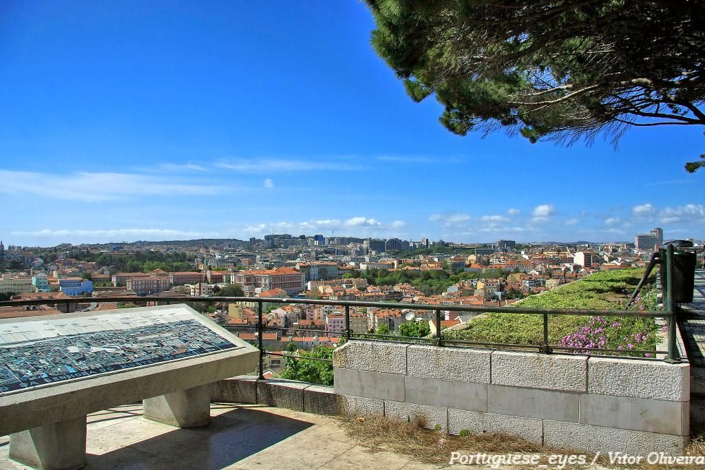
## Description Miradouro da Senhora do Monte is one of Lisbon’s most beloved viewpoints, offering a tranquil perch with unrestricted vistas across the city’s red rooftops, the Tagus River and landmarks like São Jorge Castle and the historic downtown. Tucked in the Graça neighborhood, the miradouro (viewpoint) is less crowded than some of Lisbon’s better-known terraces, making it a favorite among locals seeking a peaceful panorama and photographers hunting for unobstructed compositions. The small chapel of Senhora do Monte adds a devotional nuance to the setting, while benches and shaded nooks invite lingering. The viewpoint’s orientation gives particularly broad views to the east and south of the city, and because it is elevated, light at sunrise and sunset can be spectacular. Little-known facts: Miradouro da Senhora do Monte sits at one of the city’s highest natural points and was historically used to monitor the Tagus approaches; its quieter reputation owes partly to steeper approaches that keep the most casual visitors away. ## Location Miradouro da Senhora do Monte is located in the Graça parish of Lisbon, in the Lisbon District, Portugal. The viewpoint occupies a hilltop position above the Alfama and Graça neighborhoods and is within walking distance of São Vicente hill and several historic lanes. Getting there: The easiest ways are a short uphill walk through Graça from the tram 28 route or a ride to the Largo da Graça and a brief ascent. Tram 28 passes through Alfama and Graça and is a scenic option; buses also serve nearby stops. If using a taxi or rideshare, ask to be dropped at Largo da Senhora do Monte or the small square near the chapel. Wear comfortable shoes for the short climb. ## Tips - Timing: Sunrise and sunset are prime times for soft, warm light; sunrise is quieter and ideal for photographers. Weekday mornings are the least busy. - Safety & comfort: The area is generally safe and frequented by locals; standard precautions suffice. Bring water in warmer months and a light jacket in evenings. - Accessibility: The viewpoint involves steep streets and steps; it’s less accessible for visitors with limited mobility. - Neighborhood exploration: Combine the visit with a walk through Graça and Alfama’s lanes, sample local cafés and pastelarias nearby. - Respectful behavior: The chapel is a place of worship; observe quiet respect if services occur. ## Conclusion Miradouro da Senhora do Monte is an essential Lisbon experience for those seeking scenic calm and panoramic perspectives without the crowds of more famous terraces. Its high vantage point, local atmosphere and exceptional light conditions make it ideal for reflective moments, photography, and absorbing Lisbon’s layered skyline. ## FAQ Q: Is the miradouro crowded? A: It’s quieter than many Lisbon viewpoints but can be busy at sunset on weekends. Q: Are there cafés nearby? A: Yes, Graça and Alfama have several small cafés and bakeries within a short walk. Q: Does public transport reach it? A: Yes — Tram 28 and several buses serve the Graça area; from stops expect a short uphill walk. Q: Is there a fee to visit? A: No. The viewpoint and surrounding terraces are free and open to the public. ## Links [Detailed Guide](https://lisbonlisboaportugal.com/Alfama-Lisbon/miradouro-da-senhora-do-monte-lisbon.html)
GemVoyage Team • World
Malmö
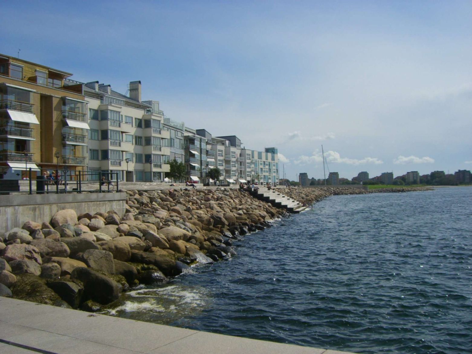
## Description Malmö’s promenades—particularly the waterfront walks in areas like **Sundspromenaden** in **Västra Hamnen**—represent a perfect mix of urban design, nature, sea, and Scandinavian minimalist style. These promenades are places to stroll, cycle, relax by the water, take in views across to Denmark, swim, or simply enjoy public space thoughtfully crafted for citizen leisure. What makes them special is how they combine modern architecture, revitalised waterfront land, and ecological awareness. Västra Hamnen itself is a former industrial/harbour area that has been transformed into a sustainable residential and recreational district. The promenade features wooden jetties, platforms for swimming, promenading paths, seating, small cultural touches, and design elements that allow people to use the space in multiple ways—sunbathing, exercising, enjoying views. ([visitsweden.fr][1]) A lesser-known fact: some portions of the promenades have public bathing decks with ladders into the sea, though the water can be quite deep. Also, lighting design (for example, in other Malmö waterfront developments) is intentionally done so that the ambiance at dusk feels safe, warm, and comfortable—even when colder. ([selux.com][2]) ## Location These promenades are located in **Malmö**, a city in **Skåne County** in southern **Sweden**, lying on the coast of the Öresund strait opposite Denmark. Västra Hamnen is the “Western Harbour” district, by the coast. The sundspromenaden waterfront walk is in/near Västra Hamnen. Other promenades like Ribersborg beach promenade are also in the broader coastal edges of Malmö. ([Travelwider][3]) To get there: if you arrive in Malmö by train (e.g. Malmö Central), you can walk, take local buses or tram to Västra Hamnen. Biking is also very good as Malmö is bike-friendly. From Copenhagen, there are trains across the Öresund Bridge; once in Malmö you use local transport or walk depending on which part of the promenade you aim for. ([Erasmusu][4]) ## Tips * **Time your visit for golden hours**: sunrise or sunset bring beautiful light over the water, especially looking toward Öresund and the Öresund Bridge. ([Wanderlog][5]) * **Bring swim gear**: In summer, many promenades have decks, ladders, or stepping points into the sea. If the weather is warm enough, swimming is possible. ([komoot][6]) * **Dress in layers**: The sea breeze can make things cooler, even in summer evenings. For morning walks or late afternoons it might be windy. * **Biking or walking**: Use the paths designed for pedestrians and cyclists. Some stretches are flat and very pleasant. A bike is a great way to cover longer stretches of promenade. * **Check local weather**: Rain or wind can make parts less pleasant; also, sea conditions vary. Be cautious if swimming. * **Explore by sections**: The waterfront promenade isn’t one single piece—various districts (Ribersborg, Västra Hamnen, etc.) offer different vibes (beach-style, urban, architecturally modern). Choose based on what you want: swimming, views, architecture, relaxation. ## Conclusion Malmö’s promenades are a standout example of how a coastal city can turn its sea edges into spaces that are both beautiful and functional. Whether for locals or visitors, they offer calm, recreation, waterfront views, and a chance to experience Malmö’s blend of urban renewal, sustainability, and Scandinavian waterfront charm. A walk here is more than just moving from A to B—it’s an experience of light, water, architecture, and local life. ## FAQ **1. Are the promenades free to access?** Yes, public promenades are free. There is no entrance fee to walk along Västra Hamnen waterfront or to use public seating areas, jetties, etc. **2. Can you swim there?** Yes—in parts. Some sections have bathing platforms, ladders, and wooden jetties. But water can be deep, and conditions (temperature, currents) vary. It’s good to check locally and stay where it’s safe. ([komoot][6]) **3. What is the best time of year to enjoy the promenade?** Late spring through early autumn (May to September) is best, when weather is warm, days are long, and outdoor amenities are most usable. Summer evenings are particularly lovely. Winters are colder and more challenging for outdoor swimming or lounging. **4. Are the promenades suitable for someone with limited mobility or stroller?** Many paths are flat and well-maintained, so promenading/strollers are possible in many places. However, wooden platforms or jetties might have steps or ladders for water access not suitable for all. It’s best to choose accessible sections near Västra Hamnen or Ribersborg. **5. What else can I see or do near the waterfront promenade?** Plenty: architectural highlights like the Turning Torso, cafés and restaurants in Västra Hamnen, parks, local beaches (Ribersborg), views of the Öresund Bridge, outdoor workouts, bike paths, evening walks. The area combines leisure, modern design, and views. **6. How long should I plan to walk to get a good sense of the place?** If you set aside 1-2 hours, you can enjoy a stretch with views, maybe stop for café or swim. For a full exploration of different sections, 3-4 hours or more allows you to experience the variety between Ribersborg, Västra Hamnen, and other promenades. ## Links * [Visit Sweden – Malmö Outdoor & Nature](https://visitsweden.com) * [Malmö City Official Site](https://malmo.se)
GemVoyage Team • World

Comments