GemVoyage Team • World
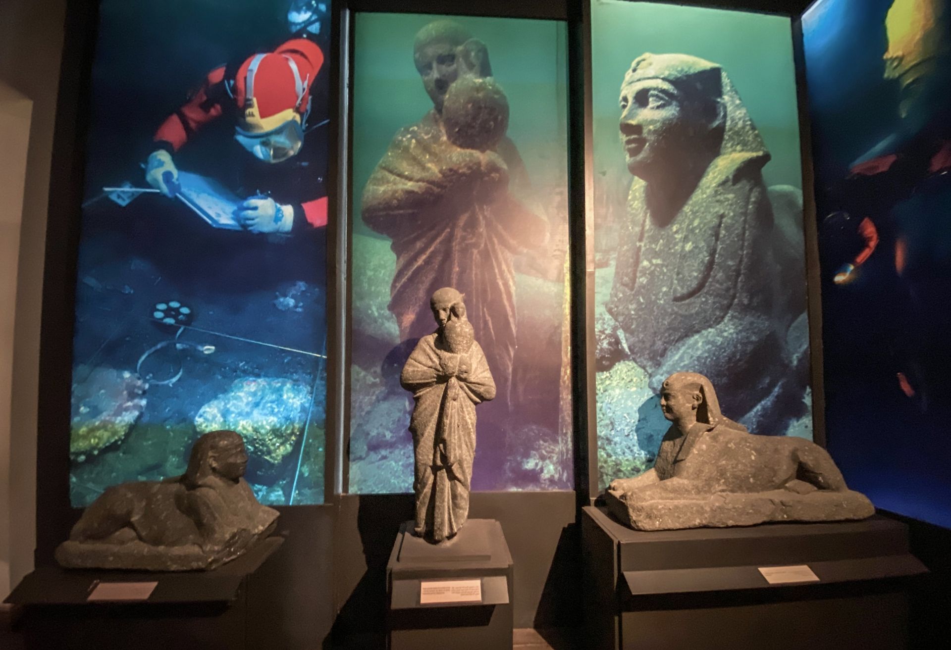
What makes the museum especially effective is its scale and clarity. It is not so large that it becomes exhausting, but it is substantial enough to offer real historical depth. A lesser-known fact is that the museum is housed in a restored historic building, which gives the visit a layered architectural context beyond the displays themselves. Another detail many visitors appreciate is the way the collection helps connect objects with city identity, so that artifacts do not feel detached from place. Instead, they reinforce the idea that Alexandria’s history is cumulative, cosmopolitan, and constantly reshaped by different eras.
The museum is a strong choice for anyone who wants to understand why Alexandria has such a special place in Egyptian and Mediterranean history. It contextualizes the city’s role as a port, a cultural crossroads, and a site of repeated transformation. If you visit only the waterfront, you get atmosphere; if you add the national museum, you get a framework for understanding what that atmosphere means.
Because the galleries are organized for accessible browsing, the museum is also suitable for visitors with limited time. You can make a focused visit without feeling that you are missing the essential story. That balance is one of its biggest strengths.
The easiest way to get there is by taxi or local transport from wherever you are staying in the city. If you are already exploring central Alexandria, a walk may also be practical depending on your route. Because the museum is in a central setting, it pairs naturally with other historical stops and gives structure to a city day.
If you want the most rewarding visit, allow enough time to move through the collection steadily rather than rushing from room to room.
Read the labels and thematic sections carefully. The museum is most useful when you connect the objects to the city’s wider story.
Plan for a visit of about 1.5 to 2 hours unless you are particularly interested in museum detail.
Combine it with other Alexandria heritage stops for a fuller understanding of the city.
If you are short on time, focus on the sections that tie the city’s different eras together rather than trying to absorb every detail equally.
Discover more hidden gems you might love.
Seoul
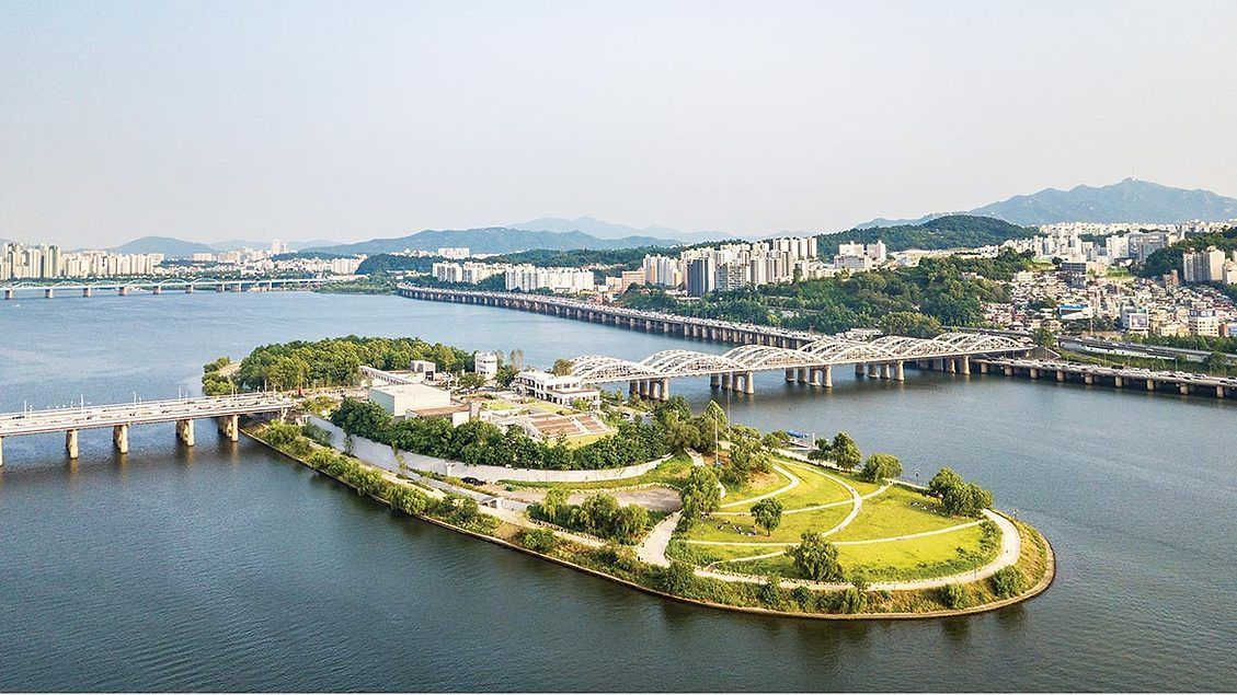
## Description Nodeul Island is a compact cultural complex on the Han River offering performance spaces, green areas, and a music-focused programming lineup. More than just a riverside park, Nodeul is a deliberate cultural experiment: its architecture and programming weave public space, live performance, and small-scale festivals into a compact, walkable site. The island hosts live concerts ranging from acoustic singer-songwriters to electronic sets, pop-up book fairs, artist talks, workshops, and rotating markets. Its landscaped terraces and shaded lawns are deliberately designed to encourage lingering, informal performances, and community gatherings. Nodeul has become known for spotlighting emerging Korean musicians and experimental performers alongside established acts, making it an attractive place for music lovers who want to catch fresh talent in an intimate setting. The island’s mix of architecture, open-air stages, and sheltered rooms means events happen year-round—outdoor stages run during warmer months while smaller indoor spaces host talks and exhibitions in cooler seasons. For photographers and writers looking for evocative urban scenes, Nodeul’s riverside vistas, evening concert lighting, and the soft hum of Seoul traffic across the water make for compelling subjects. The island also supports small food vendors and seasonal stalls that bring a local flavor to the cultural programming. From a practical standpoint, Nodeul is a model for how urban design can activate a riverside edge: pedestrian bridges and plazas, varied seating, and clear sightlines to performance areas keep programming accessible and family-friendly. The island’s public calendar is updated frequently, and local arts organizations often collaborate with the site to pilot new formats—outdoor listening sessions, experimental pop-up shows, and community workshops are common. Whether you’re planning an evening concert or a daytime literature event, Nodeul’s programming rewards repeat visits: familiar artists return, and new creative experiments appear each season. ## Location Nodeul Island sits on the Han River close to the Noryangjin and Yeouido areas of Seoul, reachable by subway and a short walk across a well-maintained pedestrian bridge from the south bank. The nearest major subway stops provide easy access for visitors staying anywhere in central Seoul, and the island’s signage in English and Korean helps international visitors orient themselves quickly. Because the island sits on the river, walking routes from nearby neighborhoods are scenic and often used by locals for jogging and evening strolls. ## Tips - Check the events calendar ahead of time: Nodeul’s draw is its programming, and many of the best concerts and markets are pre-announced online. Booking tickets in advance for popular shows avoids disappointment. - Arrive early for evening concerts to claim good riverside seating; bring a small blanket or foldable chair if you prefer more comfortable seating on the grass. - Visit at sunset for the best photo opportunities: the interplay of river light, concert lights, and Seoul’s skyline creates a memorable atmosphere. - Pack layers—a light jacket is wise for open-air evening events when the river breeze picks up, even in summer. - Explore the island’s perimeter paths before events; quiet spots and viewpoints are often less crowded than main plazas. - Support local vendors: seasonal food stalls and nearby cafés help sustain small operators who participate in Nodeul’s pop-up markets. - If you’re interested in emerging music, follow local promoters and Nodeul’s newsletter for surprise showcases and free programs. ## Conclusion Nodeul Island is a compact cultural destination that combines live music, community programming, and riverside relaxation in Seoul. It succeeds as a place where design, sound, and community converge—ideal for travelers who want to experience contemporary Korean culture beyond mainstream tourist stops. With a packed calendar, accessible layout, and an emphasis on new voices in music and the arts, Nodeul rewards curious visitors and repeat explorers alike. ## FAQ Q: Is there an admission fee? A: Many daytime activities and free concerts are available without charge, while larger evening shows or special events may require purchased tickets—check the event listing. Q: How do I get there by public transport? A: Use the nearest subway stations (check local maps), then follow pedestrian signage to the river bridge that leads to Nodeul; buses and taxis also serve the area. Q: Are events kid-friendly? A: Yes—many daytime workshops and family-oriented performances are suitable for children, though some late-night concerts may be more adult-focused. Q: Can I bring food and drink? A: Outside food and non- alcoholic drinks are generally allowed; licensed vendors operate during larger events—always check event-specific rules. Q: Is the island wheelchair accessible? A: The site offers accessible paths and ramps, but some elevated terraces may have limited access—consult the venue map for specific event locations. ## Links - [Seoul Travel Guide](https://www.visitseoul.net/)
GemVoyage Team • World
Rome
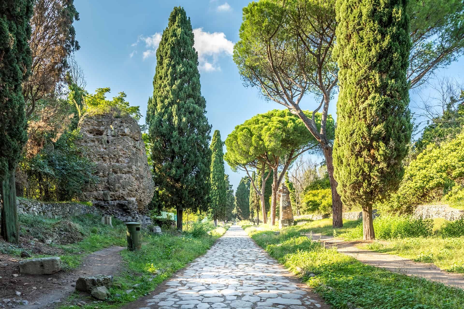
## Description The Appian Way (Via Appia Antica) is one of the most evocative ancient roads in Europe, running southeast from Rome and threading tombs, ruins, and the remains of Roman infrastructure through a pastoral corridor. Lined with funerary monuments and early Christian catacombs, sections of the route preserve original Roman paving and milestones that offer a tangible link to antiquity. Walking, cycling, or riding portions of the Appian Way reveals layers of history: imperial-era tombs, remains of villas, and quieter stretches where the path feels remarkably rural despite being inside Rome's larger urban boundary. Beyond the monuments, the Appian Way is also a public park and archaeological corridor, with protected areas that encourage slow exploration. Many travelers prefer to rent bicycles to cover more ground, though walking smaller stretches provides time to read inscriptions, visit specific catacombs, and take photographs without hurrying. Search-relevant phrases to plan a visit include "Appian Way Rome bike rental", "Via Appia Antica catacombs", and "walk the Appian Way"—terms that match travel guides and visitor resources. ## Location Via Appia Antica begins near the Aurelian Walls and continues southeast into the Roman countryside. Key visitor access points include the Appian Way Park Visitor Center and the areas near the Baths of Caracalla. Public transit options include buses that stop near the main entrances; taxis and bike rentals from central Rome are also common. Parts of the road become parkland with restricted car access, which makes cycling and walking safer and more pleasant. ## Tips - Rent a bike to see more of the route in a single visit: many rental shops offer city pickups and drop-offs near the park. - Visit catacombs with a guide: guided tours provide historical context and access to sites that close early or require reservations. - Wear durable shoes: while paved in places, many stretches have uneven ancient stones—sturdy footwear prevents slips and makes exploration easier. - Start early to avoid midday heat and to capture softer morning light for photography. - Bring water and snacks: services are limited along some stretches, so pack essentials for longer rides or walks. - Respect preservation rules: follow designated paths and do not remove artifacts or disturb archaeological features. ## Conclusion The Appian Way is a living museum and countryside escape rolled into one: accessible, atmospheric, and rich with Roman history. Whether you're cycling past tombs or pausing in a quiet olive grove, the route offers a memorable way to connect with ancient Rome's infrastructure and the everyday topography that shaped imperial travel. ## FAQ Q: How long is the Appian Way and how much can I cover in a day? A: The historic Appian Way stretches for many kilometers; most visitors focus on a 10–20 km segment near Rome that can be walked or cycled in a half-day to full-day depending on pace. Q: Are bicycles available for rent near the Appian Way? A: Yes—bike rental shops and guided bike tours operate from central Rome and near the park entrances. Q: Can I visit catacombs along the Appian Way without a guide? A: Some catacombs permit independent visits, but many recommend or require guided entry to provide context and control visitor numbers—check schedules in advance. Q: Is the Appian Way accessible year-round? A: Generally yes, though some sites and visitor centers follow seasonal hours; winter weather can be cooler and quieter, while spring and fall are popular. Q: Are there food and restroom facilities along the route? A: Basic facilities are available near major access points and visitor centers, but services are sparse in remote stretches—plan accordingly. ## Links - [Appian Way (Wikipedia)](https://en.wikipedia.org/wiki/Appian_Way)
GemVoyage Team • World

Moscow
## Description Winzavod Art Center is one of Moscow’s most important contemporary cultural destinations because it transformed an industrial site into a living arts quarter. Located in a former winery complex, it combines galleries, studios, exhibition spaces, design shops, and creative institutions in an environment that feels both raw and intentionally curated. For visitors interested in contemporary art, design, urban regeneration, or Moscow’s creative scene, it is an essential stop. What makes Winzavod especially compelling is the way the setting shapes the experience. The industrial architecture gives the center a strong visual identity, and the reuse of the space reinforces the idea that art can emerge from older urban infrastructure rather than only from formal museum buildings. A lesser-known fact is that Winzavod has played a major role in Moscow’s contemporary art ecosystem, helping to establish a more visible platform for galleries, experimental projects, and creative communities. Another detail many travelers appreciate is that the site does not feel like a single static institution. It often feels like a district within the city, with overlapping uses and constantly changing cultural energy. For visitors, the attraction is not just the exhibitions but the atmosphere of making and experimentation. You can encounter established artists, emerging voices, design-driven retail, and a kind of creative density that is difficult to find in more conventional museums. This gives the center a special value for travelers who want to understand how Moscow’s cultural life operates in the present tense, not only through its imperial or Soviet past. Winzavod also works well because it is approachable. You do not need specialist knowledge to enjoy the visit. Even if you are not deeply immersed in contemporary art, the setting, programming, and urban energy make it a stimulating place to spend time. ## Location Winzavod Art Center is located in Moscow, Russia, in the city’s central creative and industrial-adjacent area. Its position makes it accessible from major parts of the city while still retaining a distinct identity separate from the classic tourist circuit. Because it is part of a larger former industrial complex, the site feels like a destination rather than a simple gallery visit. The easiest way to reach it is by Moscow Metro followed by a short walk, though taxis and rideshares are also practical. Once there, the best approach is to move slowly through the complex and check the current exhibition mix. Since the site often hosts multiple galleries and spaces, the experience can vary depending on the day. If you are building a broader Moscow itinerary, Winzavod pairs well with other contemporary or alternative cultural stops, as well as food and coffee breaks in the surrounding area. ## Tips Check current exhibitions before going. The experience is best when you know what is showing. Allow time for wandering. The site rewards exploration across multiple spaces rather than a quick single-room visit. Pay attention to the architecture. The industrial shell is a major part of the atmosphere. If you enjoy design, books, or independent retail, give yourself time to browse beyond the exhibitions. Use it as a contrast to Moscow’s older heritage sites. The juxtaposition makes the city feel more complete. ## Conclusion Winzavod Art Center is one of Moscow’s most distinctive creative spaces, blending contemporary art with industrial architecture and a strong urban identity. It is ideal for travelers who want to see the city’s present-day cultural energy. ## FAQ ### Is Winzavod only for contemporary art specialists? No. It is accessible to general visitors and works well even if you are simply curious about Moscow’s creative scene. ### How much time should I spend there? Around 1.5 to 3 hours, depending on how many galleries and spaces are open when you visit. ### Is it easy to reach from central Moscow? Yes. Metro access makes it relatively straightforward. ### What makes it different from a normal museum? It is more of a cultural complex than a single museum, with a stronger sense of creative ecosystem and adaptive reuse. ## Links - [Winzavod official site](https://winzavod.ru/eng/)
GemVoyage Team • World
Beijing
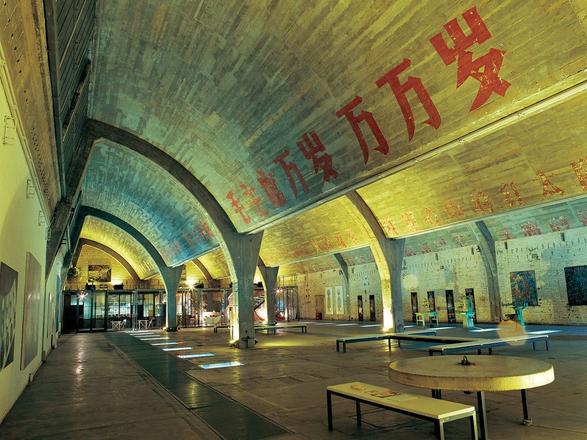
## Description Tucked in the northeastern corner of Beijing, the 798 Art District is one of the most compelling destinations in all of China. What was once a sprawling complex of military and industrial factories has been transformed into a world-class hub for contemporary art, design studios, galleries, cafes, and cultural institutions. The district draws millions of visitors each year, from seasoned art collectors to curious travelers who simply want to walk through one of Asia's most visually striking urban landscapes. The complex was originally built in the 1950s with assistance from East German engineers, and the architecture reflects that influence heavily. The Bauhaus-inspired buildings, with their distinctive sawtooth roofs designed to let in consistent northern light, still stand largely intact. They now house some of the most important contemporary art galleries in Asia. Walking through the district feels like moving through layers of history: Cold War-era industrial slogans still painted on the walls sit side by side with bold modern installations and cutting-edge sculpture. One little-known fact about 798 is that it was artists and designers who moved in illegally during the late 1990s and early 2000s, attracted by the cheap rent and massive open spaces, before the government formally recognized it as a cultural zone in 2006. Another lesser-known detail is that the district is named after Factory 798, which was just one of many factories in the complex known collectively as the 718 Joint Factory, originally built as part of China's first Five-Year Plan. Today, the 798 Art District is home to over 200 galleries and art spaces, including branches of internationally recognized institutions. The streets between buildings are filled with large-scale outdoor sculptures and murals, making even a casual stroll through the area feel like a walk through an open-air museum. Annual events like the Beijing International Art Biennale and 798 Art Festival bring the district's creative energy to its peak. ## Location The 798 Art District is located in the Chaoyang District of Beijing, China, in an area called Dashanzi. It sits in the northeastern part of the city, not far from the Beijing Capital International Airport and within reasonable distance of major city landmarks. The most convenient way to get there is by taking the Beijing Subway to Line 14 and exiting at Jiangtai Station, from which the district is about a 10 to 15 minute walk or a short taxi ride. Alternatively, many visitors take a taxi or use a ride-hailing app like DiDi directly to the 798 Art District entrance. Buses also serve the area, with several routes stopping near Dashanzi. Despite being somewhat off the typical tourist trail, it is well connected to the rest of the city. For those staying in central Beijing near Sanlitun or the CBD area, the journey by taxi typically takes 20 to 30 minutes depending on traffic. ## Tips - **Go on a weekday if possible.** Weekends, especially during festivals and national holidays, can see very large crowds. Visiting on a Tuesday or Wednesday will give you a quieter, more contemplative experience. - **Wear comfortable shoes.** The district is large and most of the experience involves walking on uneven ground, past industrial spaces and outdoor installations. Good walking shoes make a considerable difference. - **Allocate at least half a day.** There is far more to see here than most people expect. A proper visit to even a fraction of the galleries and outdoor spaces takes a minimum of three to four hours. - **Many galleries are free.** While some exhibitions charge entrance fees, a large number of the galleries in 798 are free to enter. Always check at the door before assuming you need to purchase a ticket. - **Bring cash as well as a card.** Some smaller cafes, shops, and studios may not accept international credit cards. Having some Chinese yuan on hand is always helpful. - **Visit in spring or autumn.** Beijing's summers are hot and humid, and winters are extremely cold. The spring months of April and May and the autumn months of September and October offer the most comfortable conditions for exploring the outdoor areas. - **Check the event calendar in advance.** The district hosts rotating exhibitions, openings, and festivals that can significantly enhance your visit. Checking what is on before you go is always worthwhile. ## Conclusion The 798 Art District is far more than a tourist attraction. It is a living, breathing creative community that offers a genuine window into contemporary Chinese culture and the global art world. Its unique combination of preserved industrial architecture, international-caliber art, and vibrant street life makes it unlike anywhere else in Beijing or, indeed, in the world. Whether you are an art enthusiast, a photographer, a design professional, or simply a curious traveler, the 798 Art District deserves a place near the top of your Beijing itinerary. ## FAQ **What are the opening hours of the 798 Art District?** The outdoor streets and public areas of the district are accessible at all hours, but most individual galleries and studios are open from around 10:00 AM to 6:00 PM. Hours can vary by gallery, and some are closed on Mondays. It is advisable to check specific gallery websites if you have particular venues in mind. **Is the 798 Art District free to visit?** Entry to the district itself is free. Many of the galleries and outdoor installations are also free. However, some exhibitions and events charge admission fees. Budget a small amount in case anything you want to enter requires a ticket. **How much time should I spend in the 798 Art District?** Most visitors find that three to five hours is ideal for a satisfying visit. If you are a serious art enthusiast or plan to visit multiple galleries in depth, a full day is not excessive. **Is the 798 Art District suitable for children?** Yes, in general the district is suitable for families. The outdoor sculptures and the visual spectacle of the space tend to engage younger visitors. Some contemporary art exhibitions may contain mature themes, so parents should use their discretion when entering individual galleries. **Are there places to eat and drink in the district?** Yes, there is a good variety of cafes, restaurants, and small eateries scattered throughout the district. Options range from local Chinese food stalls to international cafes and upscale dining. The area is well suited for a leisurely lunch or a coffee break between gallery visits. **How large is the 798 Art District?** The district covers an area of approximately 60,000 square meters. It contains hundreds of galleries, studios, shops, and eating establishments across a network of streets and converted industrial buildings. ## Links - [798 Art District on Wikipedia](https://en.wikipedia.org/wiki/798_Art_Zone) - [Beijing Tourism Official Website](https://www.visitbeijing.com.cn)
GemVoyage Team • World
Pula
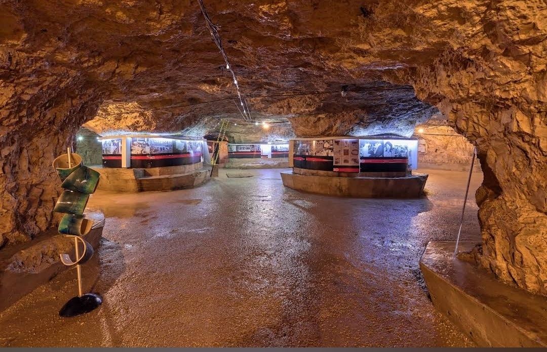
## Description **Zerostrasse** is one of the most intriguing attractions in Pula, Croatia—a vast underground tunnel system built during the early 20th century. Constructed by the Austro-Hungarian Empire during World War I, the tunnels were designed as air raid shelters and storage spaces to protect the population and military resources in case of bombings. Today, this subterranean network has been transformed into a historical site and cultural venue, giving visitors a rare glimpse into the city’s wartime past. What makes Zerostrasse unique is its **labyrinth-like layout**, stretching under Pula’s historic city center. The tunnels connect several important points of the city, including the central hill where Pula’s Venetian fortress is located. Walking through the underground passages feels like stepping back in time, with cool stone walls and dim lighting creating an atmosphere that is both mysterious and fascinating. A little-known fact is that the tunnels were engineered to hold up to **50,000 people**, which was nearly the entire population of Pula at the time. Another interesting detail is that today, parts of Zerostrasse are used as exhibition spaces, often hosting displays about Pula’s history, photography collections, and cultural events. ## Location Zerostrasse is located in **Pula**, a coastal city in **Istria, Croatia**, well-known for its Roman amphitheater and ancient heritage. The tunnels run beneath the **central hill of Pula**, with multiple entrances around the city. One of the main access points is near the **Venetian fortress (Kaštel)**, making it easy to combine a visit to both attractions. Getting there is simple. If you’re already in Pula, the entrances are within walking distance of the main city square and other landmarks. Visitors coming from outside the city can reach Pula by car, bus, or train. The **Pula Airport** also connects the city with several European destinations, and from there, the city center is just a 15-minute drive. ## Tips Here are some useful tips for enjoying your visit to Zerostrasse: * **Wear comfortable shoes** – The tunnels involve some walking, and the ground may be slightly uneven. * **Bring a light jacket** – The underground passages are cooler than the outside, even in summer. * **Check for exhibitions** – Before your visit, see if there are any ongoing cultural or art displays inside the tunnels. * **Visit the fortress too** – Since Zerostrasse is connected to the Venetian fortress, it’s worth combining both for a full historical experience. * **Allow time for exploration** – While the tunnels aren’t endless, you’ll want to spend at least an hour exploring and reading the exhibits. * **Good for hot days** – On particularly warm summer afternoons, the tunnels offer a refreshing escape from the heat. ## Conclusion **Zerostrasse in Pula** is more than just a network of tunnels—it’s a living piece of history that tells the story of the city’s strategic importance during wartime. With its unique underground passages, cool atmosphere, and cultural exhibitions, it’s a fascinating stop for history buffs, families, and curious travelers. By visiting Zerostrasse, you not only explore Pula from below but also gain a deeper appreciation for its resilience and heritage. ## FAQ **1. What was Zerostrasse originally built for?** It was constructed during World War I by the Austro-Hungarian Empire as an air raid shelter and storage facility. **2. How big is the Zerostrasse tunnel system?** The tunnels cover a large portion beneath Pula’s city center and were built to accommodate up to 50,000 people. **3. Can tourists visit the tunnels?** Yes, Zerostrasse is open to visitors, with guided tours and exhibitions available throughout the year. **4. How long does a visit take?** Most visits last about 45 minutes to an hour, depending on how much time you spend exploring exhibitions. **5. Is Zerostrasse suitable for children?** Yes, children can visit the tunnels, and many enjoy the sense of adventure, though very young kids may find the dark passages intimidating. **6. When is the best time to visit?** The tunnels are open year-round, but they are particularly enjoyable in summer when the cool underground air provides relief from the heat. ## Links * [Pula Tourist Board – Official Website](https://www.pulainfo.hr)
GemVoyage Team • World
Los Angeles
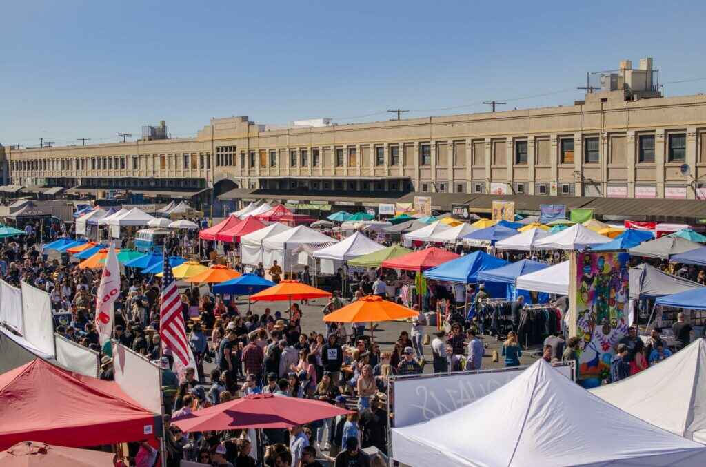
## Description Smorgasburg Los Angeles is one of the city’s most vibrant and eclectic open-air food markets, drawing in foodies, families, and curious visitors every Sunday. What started as a popular market in Brooklyn, New York, has successfully expanded to Los Angeles, where it has taken on its own West Coast identity. The market brings together **dozens of vendors** offering everything from Korean barbecue tacos to vegan donuts, lobster rolls, artisanal coffee, and even experimental food trends that often go viral on social media. What makes Smorgasburg LA unique is not only the incredible variety of food but also its **community-centered atmosphere**. Beyond food, the market also features small retail vendors selling local crafts, clothing, home goods, and artwork. It’s as much a cultural gathering spot as it is a food haven. A little-known fact is that Smorgasburg LA is located on the site of the **old Alameda Produce Market**, connecting today’s modern street food scene with the historic roots of Los Angeles’ food distribution hub. Another fun detail is that the market regularly hosts **pop-up events and chef collaborations**, meaning visitors can often find exclusive dishes available for a limited time. ## Location Smorgasburg Los Angeles is located in the **United States, California, Los Angeles**, specifically in the **ROW DTLA (Downtown Los Angeles)** complex. Its address is **777 S. Alameda Street, Los Angeles, CA 90021**, making it conveniently situated near the Arts District and Little Tokyo. ### Recommendation on How to Get There The easiest way to reach Smorgasburg is by **car**, as it offers a large parking structure with several hours of free parking for market visitors. However, for those who prefer not to drive, public transportation is also an option—the market is accessible via the **Metro Gold Line (Little Tokyo/Arts District Station)**, followed by a short walk. Ridesharing services such as Uber and Lyft are also widely available and recommended if you plan on enjoying craft beers or cocktails at the market. ## Tips Here are some helpful tips for making the most out of your Smorgasburg LA visit: * **Arrive Early**: Popular vendors often have long lines, and some specialty dishes sell out quickly. * **Bring Friends**: Sharing dishes allows you to sample a wider variety of foods without getting too full. * **Bring Cash and Cards**: Most vendors accept cards, but having some cash on hand can speed things up. * **Check the Schedule**: Some vendors rotate weekly, and there are often special events or limited-time pop-ups. * **Wear Comfortable Clothing**: Since the market is outdoors, dress for the weather and wear comfortable shoes. * **Stay Hydrated**: Los Angeles can get hot, so grab drinks from one of the fresh juice or craft soda stalls. * **Don’t Skip the Retail Vendors**: Beyond food, you’ll find unique handmade goods, vintage items, and local art. ## Conclusion Smorgasburg Los Angeles is more than just a food market—it’s an experience that captures the city’s creative energy and love of diverse cuisines. With its wide selection of vendors, lively atmosphere, and mix of food, retail, and entertainment, it’s the perfect Sunday destination in Downtown LA. Whether you’re a local foodie or a visitor exploring the city, Smorgasburg LA offers a taste of Los Angeles’ culinary innovation at its best. ## FAQ **1. What day is Smorgasburg LA open?** Smorgasburg Los Angeles is open every **Sunday from 10 AM to 4 PM**. **2. How much does it cost to enter the market?** Entry is **free**, but you’ll need to pay for food, drinks, and any retail items you purchase. **3. Is there parking available?** Yes, the market offers **several hours of free parking** at the ROW DTLA parking structure for visitors. **4. Are there vegetarian or vegan options?** Absolutely—many vendors specialize in vegetarian, vegan, and gluten-free dishes. **5. Can I bring my kids or pets?** Yes, the market is **family-friendly**, and pets are also welcome, making it a great outing for the whole family. **6. Are the vendors always the same?** Some vendors are permanent, but many rotate, and there are frequent pop-up collaborations, so you’ll often find new foods to try. ## Links * [Official Smorgasburg Los Angeles Website](https://la.smorgasburg.com/)
GemVoyage Team • World

Comments