GemVoyage Team • World
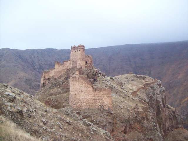
The Castle of the Devil, known locally as Şeytan Kalesi, is one of Turkey’s most dramatic and mysterious fortress ruins. Perched atop a rocky bluff in the Çıldır district of Ardahan Province, this ancient stronghold commands sweeping views of the plunging Karaçay Canyon and the surrounding highlands. Its name—“Castle of the Devil”—stems from local folklore that claims an evil spirit once haunted the area, a myth that still lingers in the collective memory of nearby villagers.
Dating back to the Hellenistic period, the castle has seen a succession of rulers and empires, including the Urartians, Persians, Romans, Byzantines, and Ottomans. Its strategic location in the Upper Kur Valley made it a vital military outpost and a gateway between Anatolia and the Caucasus. The fortress was continuously modified and expanded by its various occupants, and today visitors can still see remnants of cisterns, staircases descending to water sources, and a small chapel tucked within the ruins.
A little-known fact is that the castle was once a Georgian stronghold known as Qajis Tsikhe, and it played a key role in regional defense for centuries. Another intriguing detail: the site reportedly housed a prison, as noted by Georgian historian Ekvtime Takaishvili in the early 20th century.
The Castle of the Devil is located in Turkey, within the Eastern Anatolia Region, in the Çıldır district of Ardahan Province. Specifically, it lies about 1.5 kilometers northeast of the village of Yıldırımtepe, nestled deep within the rugged terrain of the Karaçay Canyon.
The journey itself is part of the adventure, with dramatic landscapes unfolding as you approach the fortress.
The Castle of the Devil in Ardahan is a hauntingly beautiful relic of Turkey’s layered history. With its mythic name, panoramic views, and centuries-old architecture, it offers a compelling experience for travelers seeking both adventure and cultural depth.
1. Is there an entrance fee to visit the Castle of the Devil?
No, the site is open to the public and free to visit.
2. How long does it take to explore the castle?
Most visitors spend 1–2 hours exploring the ruins and enjoying the views.
3. Is the site accessible year-round?
Yes, but winter conditions can make access difficult due to snow and ice.
4. Can children visit the castle?
Yes, but due to the rugged terrain, close supervision is necessary.
5. Are guided tours available?
Occasionally, local guides and tour companies offer excursions. It’s best to inquire in Ardahan or Çıldır.
6. Is there any accommodation nearby?
Basic guesthouses and hotels are available in Çıldır and Ardahan. Booking in advance is recommended during peak seasons.
Discover more hidden gems you might love.
Ottawa
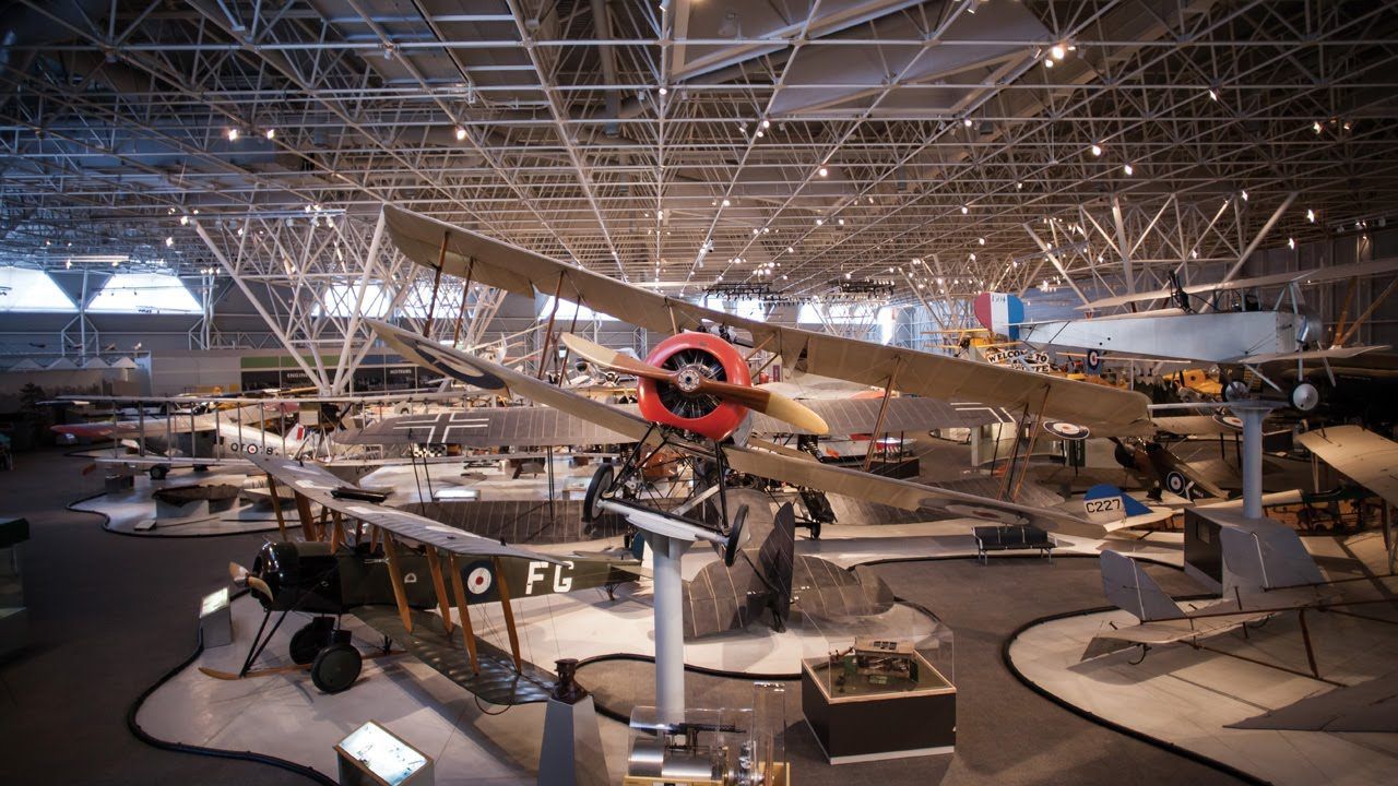
## Description The **Canada Aviation and Space Museum**, located in **Ottawa, Ontario**, is one of the most comprehensive aviation museums in the world and the premier institution of its kind in Canada. It showcases the country’s rich history of flight and space exploration, from the earliest biplanes to cutting-edge spacecraft technology. The museum’s vast collection includes **more than 130 aircraft and artifacts** representing civil, military, and experimental aviation. Visitors can see iconic planes such as the **Avro Arrow**, the **Silver Dart** (Canada’s first powered aircraft), and **Second World War fighters** like the **Spitfire** and **Hurricane**. There’s also an impressive section dedicated to **Canadian contributions to space exploration**, including displays about the **Canadarm**, **satellite technology**, and the role of Canadian astronauts in international missions. What makes the museum unique is its **hands-on, immersive experience**. Guests can climb into the cockpits of select aircraft, take guided tours of the restoration hangars, or even book a **real sightseeing flight** over Ottawa in a vintage **Waco UPF-7 biplane** (available seasonally). Interactive exhibits explain the physics of flight and the engineering challenges behind space travel, making it an engaging experience for visitors of all ages. A lesser-known fact is that the museum sits on the site of a **former Royal Canadian Air Force base**, and its origins date back to **1964**, when the National Aeronautical Collection was established. Another little-known feature is the **Living History program**, where retired pilots and engineers volunteer to share personal stories about the aircraft they flew or maintained — adding a deeply human dimension to the experience. ## Location The **Canada Aviation and Space Museum** is located at **11 Aviation Parkway**, in **Ottawa, Ontario, Canada**. It sits along the **Ottawa River**, just **10 minutes northeast of downtown Ottawa** and close to the **Rockcliffe Airport**. To get there: * **By car:** Take the **Aviation Parkway** from the city center; parking is available on-site for a small fee. * **By public transport:** OC Transpo bus routes connect from downtown Ottawa to stops near the museum (check current schedules before traveling). * **By bike or on foot:** The scenic **Ottawa River Pathway** leads directly to the museum for those enjoying a leisurely ride or walk. The museum’s location offers not only history and technology but also beautiful natural surroundings, making it a great addition to a full day of sightseeing in the capital. ## Tips * **Plan 2–3 hours for your visit:** The collection is large, and the interactive displays deserve time to explore. * **Check for special exhibitions:** The museum frequently hosts temporary displays, from space robotics to women in aviation. * **Book the biplane ride early:** The **Waco biplane experience** is a highlight for many visitors and sells out quickly, especially in summer. * **Visit with children:** The **Kids’ Zone** and interactive simulators make it family-friendly and educational. * **Photography:** Cameras are welcome — you can take stunning shots of aircraft interiors and panoramic hangar views. * **Combine with nearby attractions:** The **Canada Science and Technology Museum** and **Rideau Hall** are nearby for a full day of exploration. * **Visit in winter:** Indoor exhibits make it a great year-round attraction, ideal for cold or rainy days in Ottawa. ## Conclusion The **Canada Aviation and Space Museum** is more than a collection of aircraft — it’s a journey through Canada’s technological spirit, courage, and imagination. From early bush pilots who connected remote regions to astronauts who ventured beyond Earth’s atmosphere, the museum celebrates the nation’s boundless drive to explore. Whether you’re an aviation enthusiast, a history lover, or simply curious about humanity’s quest to fly, this Ottawa landmark offers an inspiring and educational experience that soars above expectations. ## FAQ **1. When was the museum founded?** The museum was established in **1964** as the National Aeronautical Collection and became the **Canada Aviation and Space Museum** in **1982**. **2. What are the museum’s main highlights?** Key attractions include the **Avro Arrow**, **Silver Dart**, **WWII aircraft**, **Canadarm**, and the **space exploration gallery**. **3. Is it suitable for children?** Yes, the museum is very family-friendly, featuring hands-on activities, simulators, and a dedicated **Kids’ Zone**. **4. How long should I spend there?** Most visitors spend **2 to 3 hours**, though aviation enthusiasts may want to stay longer. **5. Is there parking available?** Yes, there is ample on-site parking for a small daily fee. **6. Can I take a real flight?** Yes, visitors can book **sightseeing flights** in a vintage **Waco UPF-7 biplane** during the warmer months. **7. Is it open year-round?** Yes, the museum is open throughout the year, though operating hours may vary seasonally. ## Links * [Ottawa Tourism – Aviation and Space Museum](https://www.ottawatourism.ca)
GemVoyage Team • World
Dubysa
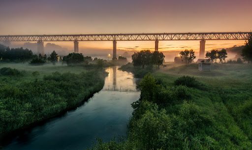
## Description Lyduvėnai Bridge is an arresting piece of nineteenth- and twentieth-century engineering that spans the deep, wooded Dubysa River valley near Lyduvėnai. Its soaring iron arches and lattice work combine functional railway engineering with a sculptural presence that is particularly striking when framed by the steep gorge below. Photographers, history enthusiasts and hikers are drawn to the site for the dramatic perspectives it creates—an industrial monument suspended over a wild, verdant canyon. Over time the bridge has required restorations and careful maintenance, and those interventions are part of its layered history. Local preservation efforts have sought to keep the bridge operational while respecting its historical materials and structure. The engineered spans and riveted ironwork tell a story about rail transport, regional development and the craft of steel construction. Beyond its technical merits, Lyduvėnai Bridge sits within a landscape of trails, viewpoints and small rural roads that allow visitors to explore the canyon from multiple angles. Birdsong and river sounds contrast with the bridge’s metallic lines, and seasonal changes—spring greens, autumn foliage—transform the setting dramatically, offering different moods for photographic study. ## Location Lyduvėnai Bridge is located near the village of Lyduvėnai in Raseiniai district municipality, Kaunas County, central-western Lithuania. It spans the Dubysa River in a steep, forested valley that is characteristic of the region’s mixed agricultural and wooded landscape. Access is most convenient by car: follow regional roads from Raseiniai and nearby towns. Public transport to the immediate vicinity is limited, so visitors relying on buses or trains should plan for a taxi or private transfer for the final leg. The rural setting rewards a slower pace—park at designated pullouts or village car parks and follow marked trails toward viewpoints. ## Tips - Photograph at golden hour—early morning or late afternoon—when light sculpts the ironwork and the valley takes on warm tones. - Never walk on active tracks; use official viewpoints and trails to keep a safe distance while still getting dramatic compositions. - Bring sturdy shoes and insect repellant for nearby trails; the area can be steep and overgrown in parts. - Combine the visit with local villages, riverside hikes and birdwatching; pack water and snacks as amenities are sparse. - Check local guidance on accessibility—some viewpoints require steep walks, while others are more level and family-friendly. ## Conclusion Lyduvėnai Bridge is an exemplar of how engineering and landscape can produce a site of compelling beauty. The bridge rewards visitors who slow down to observe structural detail, changing light and the interplay of human craft with natural settings. Whether you come for history, photography or a quiet day outdoors, the bridge and its surrounding valley offer memorable vistas and a distinct slice of regional heritage. ## FAQ Q: Can visitors walk across the bridge? A: No. For safety and legal reasons, do not walk on active railway tracks. Use the designated viewpoints and trails which provide safe vantage points. Q: Is the bridge accessible by car? A: Yes, but roads are rural and sometimes narrow—drive carefully and park only in designated areas or official pullouts. Q: Are there guided tours or information panels on site? A: Information is limited on-site; local heritage groups sometimes publish guides or online materials—check regional tourism resources for up-to-date information. Q: What wildlife might I see in the Dubysa valley? A: The valley supports woodland birds, small mammals and a range of plant life; spring and autumn are best for birdwatching and seasonal flora. Q: Is it possible to photograph the bridge from below? A: Some viewpoints near the riverside allow lower-angle shots, but access may be steep and require caution; respect private property and posted restrictions. ## Links - [Lyduvėnai Bridge](https://militaryheritagetourism.info/en/military/sites/view/800)
GemVoyage Team • World
Tirana
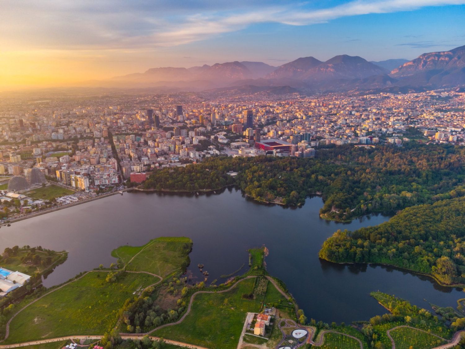
## Description The Grand Park of Tirana is one of the city’s most important public spaces and one of the best places to understand how Tirana balances urban growth with everyday leisure. Often treated simply as a park, it is actually a large and layered landscape that includes walking paths, shaded areas, open lawns, the artificial lake, family spaces, cafés, and quiet corners where people come to jog, socialize, or simply rest away from the intensity of the city center. For visitors, it offers an easy way to experience a more relaxed side of Tirana without leaving the capital. What makes the Grand Park special is its role as a civic landscape. It is not only a place for tourists; it is part of daily life for residents. People use it in the morning for exercise, in the afternoon for strolls, and in the evening for gatherings. That local rhythm gives the park a real sense of authenticity. One little-known fact is that the area around the lake and its green edges has changed significantly over time, reflecting broader shifts in how Tirana has developed as a modern city. Another interesting point is that the park’s size makes it one of the city’s most important environmental buffers, helping create a calmer microclimate in a fast-growing urban area. The Grand Park is also a good place for visitors who want to slow down their sightseeing. Tirana can feel energetic and busy, and the park offers balance. You can walk, rent a bike in some areas, sit by the water, or simply watch the city’s social life unfold. It is not a museum-like attraction with a fixed narrative; it is a lived-in urban landscape. That flexibility is part of its appeal, because it can fit into a trip in many different ways: as a morning workout, a midday break, a sunset walk, or a family outing. ## Location The Grand Park of Tirana is in southern-central Tirana, Albania, extending around the artificial lake and nearby green spaces. Because it covers a large area, there is no single exact “entrance” experience; instead, visitors usually approach it from the city side that is most convenient for their itinerary. The easiest way to get there is by taxi, ride-hailing, or a long walk from central Tirana. Many travelers also reach the park from nearby neighborhoods on foot. If you are already exploring central landmarks, it makes sense to build in a walking break and head toward the lake. Since the park is broad, choose a route that matches the part you want to see most, whether that is the waterfront, the tree-lined paths, or the recreational zones. ## Tips Go early in the day or near sunset for the most pleasant temperatures and the nicest light around the lake. Wear comfortable shoes because the park is best enjoyed on foot. If you like a local atmosphere, spend time watching how residents use the park rather than focusing only on the scenery. Bring water and expect a leisurely pace; this is a place for lingering, not rushing. ## Conclusion The Grand Park of Tirana is a spacious urban retreat that gives visitors a calmer, more local perspective on the Albanian capital. ## FAQ ### Is the Grand Park of Tirana good for tourists? Yes. It is one of the easiest and most enjoyable places to experience daily life in Tirana. ### Can I walk around the lake? Yes, the park is designed for walking and recreation, though routes vary by area. ### Is it family-friendly? Very much so. It is one of the city’s most popular family and leisure spaces. ### How long should I spend there? Anywhere from one hour to half a day, depending on whether you want a short walk or a longer picnic-style visit. ### What is the best time to go? Early morning and late afternoon are usually the most pleasant times. ## Links - [Tirana tourism information](https://visit-tirana.com/) - [Grand Park of Tirana on Wikipedia](https://en.wikipedia.org/wiki/Grand_Park_of_Tirana)
GemVoyage Team • World
Prague
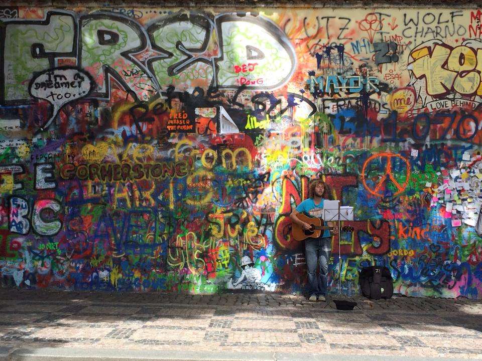
## Description The Lennon Wall in Prague is more than just a colorful stretch of graffiti—it’s a living canvas of freedom, peace, and artistic expression. Located in the historic Malá Strana district, this wall has been a symbol of resistance and hope since the 1980s. After the assassination of John Lennon in 1980, an anonymous artist painted his portrait and lyrics from Beatles songs on the wall. What followed was a spontaneous outpouring of messages, poems, and protest art, especially from Czech youth who saw Lennon as a symbol of Western ideals and freedom during the oppressive communist regime. Over the years, the wall has evolved into a dynamic, ever-changing mural. Layers of paint have buried the original artwork, but the spirit remains. Today, it features vibrant messages of love, peace, and solidarity, often reflecting global movements and local causes. Though the wall is now semi-regulated—with spray painting banned and only designated areas open to public contributions—it continues to attract artists and visitors from around the world. A little-known fact: the wall is owned by the Sovereign Military Order of Malta, whose nearby buildings include a church and embassy. Until 2019, anyone could freely paint on the wall, but due to misuse, it’s now monitored by CCTV and curated by selected artists. ## Location The Lennon Wall is located in **Czechia (Czech Republic)**, in the **Prague Region**, within the city of **Prague**. Specifically, it sits in **Velkopřevorské náměstí (Grand Priory Square)** in the **Malá Strana** neighborhood, just a short walk from the iconic Charles Bridge. ### How to Get There: - **By Foot**: From Charles Bridge, it’s a 5-minute walk through the charming streets of Malá Strana. - **By Tram**: Take tram lines 12, 15, 20, or 22 to Malostranské náměstí, then walk toward the French Embassy. - **By Metro**: The nearest metro station is Malostranská (Line A), followed by a short walk. - **By Bus**: Bus line 194 stops at Malostranské náměstí, close to the wall. Its central location makes it an easy and worthwhile stop on any Prague itinerary. ## Tips for Visitors To make the most of your visit to the Lennon Wall, keep these tips in mind: - **Visit Early or Late**: The wall gets crowded during midday, especially with tour groups. Early morning or evening offers a quieter experience. - **Bring a Marker**: While spray painting is banned, you can still leave a message with a marker in designated areas. - **Respect the Art**: Avoid defacing existing artwork. The wall is a shared space for expression, not vandalism. - **Pair with Nearby Attractions**: Combine your visit with a stroll through Kampa Island or a walk across Charles Bridge. - **Photography**: The wall changes frequently, so it’s a great spot for unique photos. Look for Beatles lyrics or peace symbols hidden among the layers. - **Learn the History**: Guided walking tours often include the Lennon Wall and provide deeper insight into its role during the communist era. ## Conclusion The Lennon Wall in Prague is a vibrant testament to the power of art and free expression. Born from grief and rebellion, it has grown into a global symbol of peace, creativity, and resilience. Whether you're a Beatles fan, a history buff, or simply a curious traveler, the wall offers a colorful and meaningful experience in the heart of Prague. ## FAQ **1. Is there an entrance fee to visit the Lennon Wall?** No, the wall is in a public square and free to visit. **2. Can I paint on the Lennon Wall?** Spray painting is banned, but you can leave messages with markers in designated areas. **3. What is the significance of the Lennon Wall?** It began as a tribute to John Lennon and became a symbol of protest against the communist regime in Czechoslovakia. **4. How often does the wall change?** Constantly. New artwork and messages appear regularly, making each visit unique. **5. Is the wall monitored?** Yes, it’s under CCTV surveillance to prevent vandalism and ensure respectful contributions. **6. What else is nearby?** Charles Bridge, Kampa Island, and the French Embassy are all within walking distance. ## Links - [Lennon Wall – Wikipedia Overview](https://en.wikipedia.org/wiki/Lennon_Wall) - [Prague Tourist Information – Lennon Wall Guide](https://praguetouristinformation.com/en/sightseeing/lesser-town/john-lennon-wall)
GemVoyage Team • World
Egypt
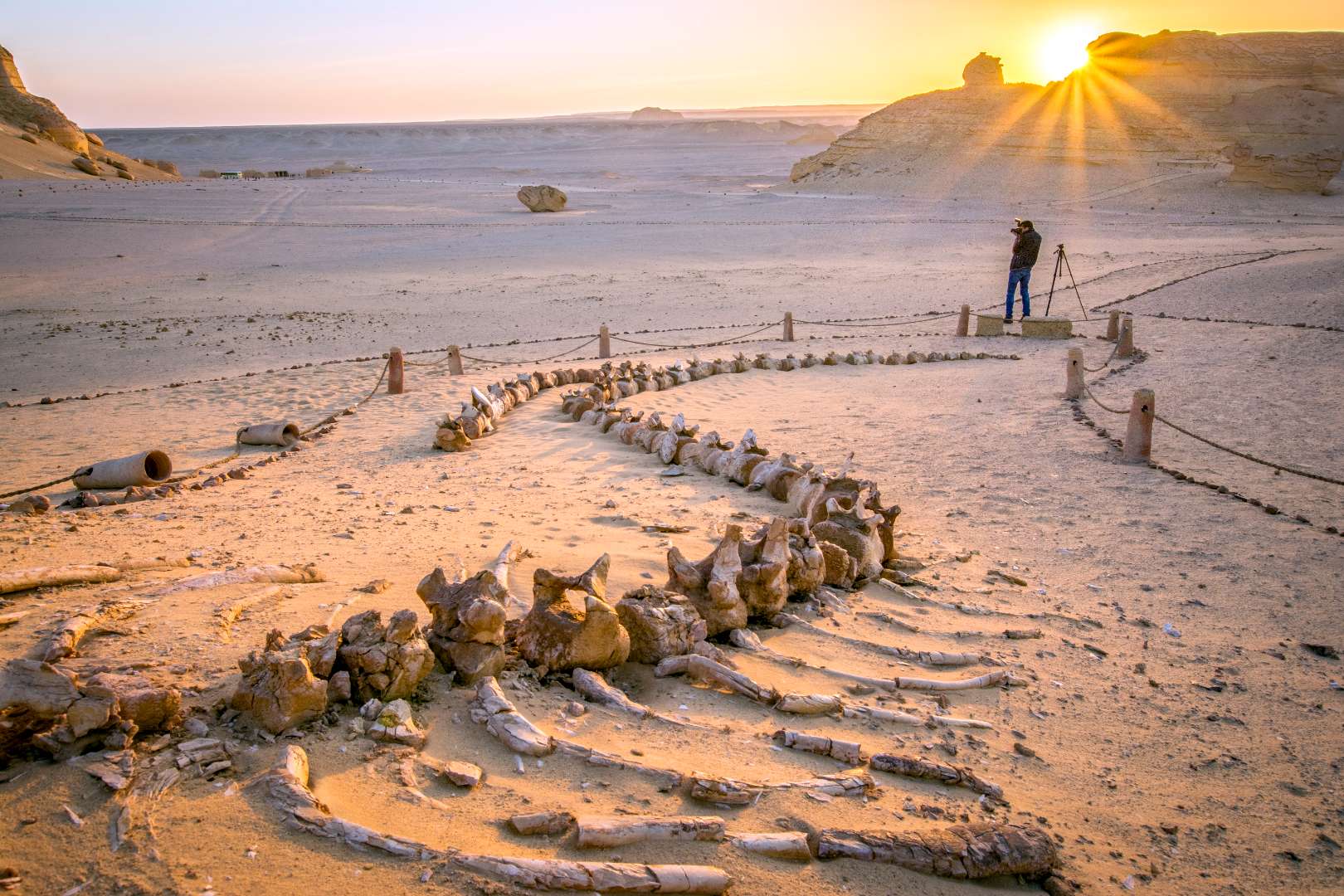
## Description The Valley of the Whales, known locally as Wadi Al-Hitan, is one of Egypt’s most extraordinary and scientifically significant natural sites. Located deep in the Western Desert, this UNESCO World Heritage Site offers a rare glimpse into the evolutionary history of whales. What makes Wadi Al-Hitan truly unique is its collection of fossilized remains of early whale species—particularly the now-extinct Archaeoceti—that vividly illustrate the transition of whales from land-dwelling mammals to fully aquatic creatures. The site contains hundreds of fossils, including complete skeletons, some of which still retain vestigial hind limbs, feet, and toes—features that modern whales no longer possess. These fossils date back approximately 40 million years and are remarkably well-preserved, with some even showing stomach contents. The surrounding desert landscape, sculpted by wind and time, adds to the surreal experience, with rock formations resembling alien sculptures and ancient seabeds. A little-known fact: the first whale fossils in Wadi Al-Hitan were discovered in the early 1900s, but the site remained largely unexplored until the 1980s when improved access and growing scientific interest led to its preservation. Another fascinating detail is that the area also contains fossils of other marine life, including sharks, rays, and sawfish, helping researchers reconstruct the ancient ecosystem of the Tethys Sea. ## Location Wadi Al-Hitan is located in **Egypt**, within the **Faiyum Governorate**, approximately 150 kilometers southwest of **Cairo**. It lies within the Wadi El-Rayan Protected Area, a vast desert reserve known for its sand dunes, lakes, and biodiversity. ### How to Get There - **By Car**: The most practical way to reach Wadi Al-Hitan is by private vehicle or organized tour. From Cairo, the drive takes about 2.5 to 3 hours. A 4x4 vehicle is recommended due to the unpaved desert roads leading to the site. - **By Tour**: Several eco-tourism operators offer guided day trips from Cairo or Faiyum, often including stops at Wadi El-Rayan and the Magic Lake. - **By Public Transport**: Public transport is not available directly to the site. Visitors must arrange private transport from Faiyum city. Due to its remote location, planning ahead is essential, and traveling with a guide is highly recommended. ## Tips - **Visit in Cooler Months**: The best time to visit is between October and April when temperatures are milder. - **Bring Essentials**: Pack water, snacks, sunscreen, and a hat. There are limited facilities at the site. - **Wear Sturdy Shoes**: The terrain is sandy and uneven, so comfortable walking shoes are a must. - **Respect the Fossils**: Do not touch or remove any fossils. The site is protected, and preservation is crucial. - **Explore the Museum**: The Fossil and Climate Change Museum at the entrance offers interactive exhibits and context for the fossils you’ll see. - **Combine with Nearby Attractions**: Pair your visit with Wadi El-Rayan’s waterfalls and lakes for a full desert adventure. ## Conclusion Wadi Al-Hitan is a captivating destination that blends natural beauty with scientific wonder. Its fossil-rich landscape tells a story millions of years old, making it one of the most important paleontological sites in the world and a must-visit for anyone intrigued by Earth’s evolutionary history. ## FAQ **1. Is there an entrance fee to Wadi Al-Hitan?** Yes, there is a small entrance fee, which may vary depending on whether you’re visiting with a guide or tour group. **2. Can I visit Wadi Al-Hitan without a guide?** While possible, it’s highly recommended to go with a guide due to the remote location and lack of signage. **3. Are there accommodations nearby?** There are eco-lodges and campsites in the Wadi El-Rayan area, but most visitors stay in Faiyum or return to Cairo. **4. Is the site suitable for children?** Yes, children can enjoy the site, especially the museum, but supervision is necessary due to the terrain and fragile fossils. **5. How long should I plan for the visit?** A typical visit lasts 2–3 hours, not including travel time. Full-day trips from Cairo are common. **6. Is photography allowed?** Yes, photography is permitted, but drones may require special permission. ## Links - [Wadi Al-Hitan – UNESCO World Heritage Centre](https://whc.unesco.org/en/list/1186) - [Wadi Al-Hitan Overview – Wikipedia](https://en.wikipedia.org/wiki/Wadi_al_Hitan)
GemVoyage Team • World
Paris
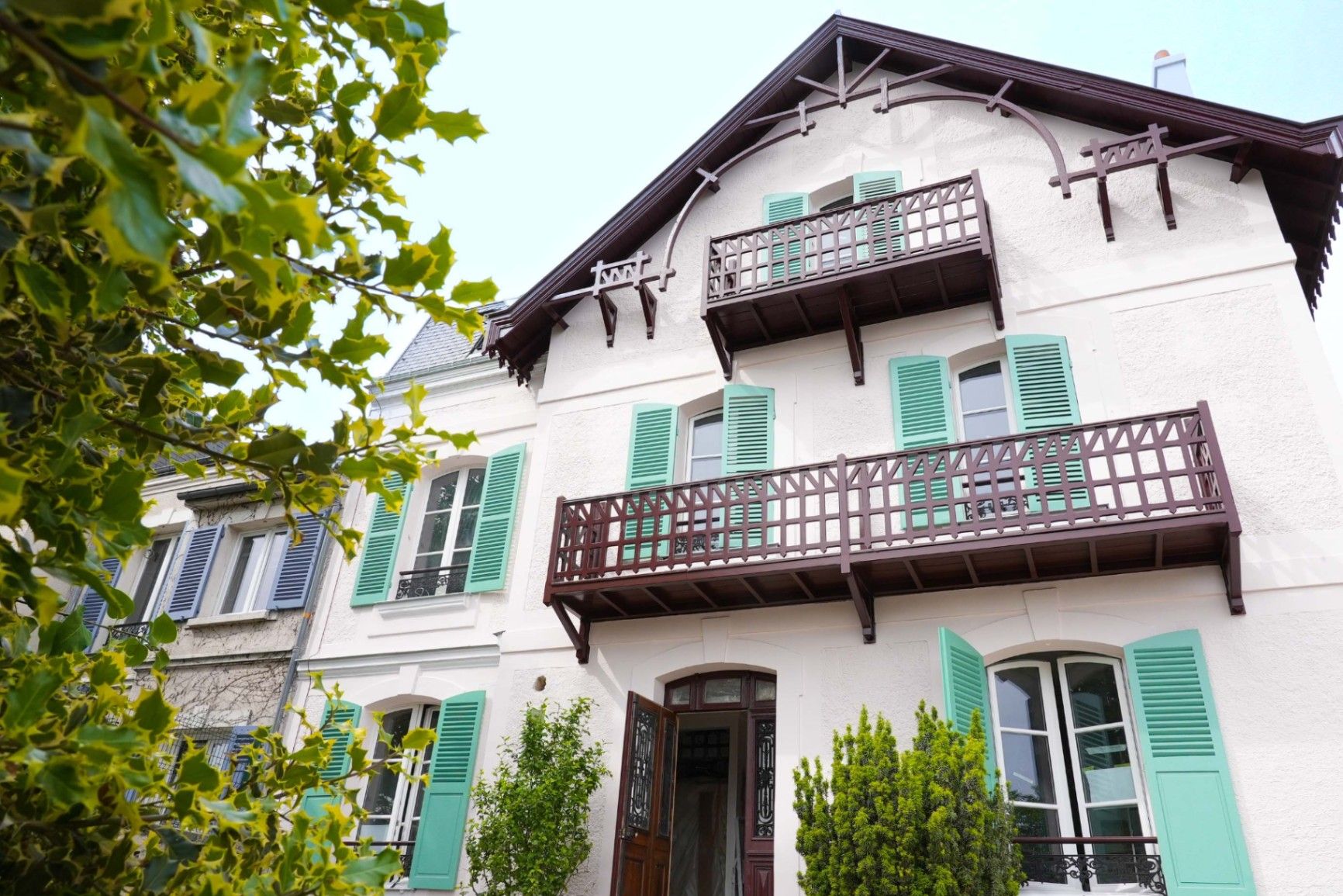
## Description **Maison Impressionniste Claude Monet Argenteuil** is a carefully reconstructed space dedicated to the years when Claude Monet lived and worked in Argenteuil, a suburb northwest of Paris. Although not the original residence, the house functions as a faithful evocation of Monet’s daily environment between 1871 and 1878, a period widely considered formative for the **Impressionist movement**. This is where Monet refined his techniques of capturing light, atmosphere, and everyday scenes, and where he produced some of his most celebrated works, including views of the Seine, gardens, and his own home life. The house is arranged to resemble the domestic context that influenced Monet’s early mastery. Rooms are curated with period furniture, reproductions of key paintings, personal objects, and interpretive displays illustrating how Monet painted outdoors, how he experimented with color, and how Argenteuil became a meeting point for artists such as Renoir, Manet, and Sisley. The staging provides an accessible narrative of Monet as a young pioneer, long before his later fame at Giverny. A little-known fact is that Argenteuil was once a **boating and leisure capital** for Parisians, and Monet frequently painted regattas and pleasure craft from the riverbanks near his home. Another lesser-known detail is that Monet’s time in Argenteuil coincided with substantial urban development, which threatened some of the very landscapes he painted. This tension between modernization and natural beauty appears subtly throughout his Argenteuil canvases. Today, the Maison Impressionniste offers a more intimate and less crowded alternative to major Impressionist institutions in Paris. It gives visitors the chance to walk through reconstructed interiors that feel personal rather than monumental and to understand the roots of what would become Monet’s global artistic influence. ## Location **City:** Argenteuil (Greater Paris area) **Region:** Île-de-France **Country:** France The house is situated in a residential part of Argenteuil, within walking distance of the Seine and the locations that inspired many of Monet’s paintings. ### How to Get There * **By train:** * From **Gare Saint-Lazare** in Paris, take a Transilien J train to **Argenteuil Station**. From there, it is a short walk or a brief bus ride. * **By bus:** * Several suburban bus lines connect Argenteuil with northern districts of Paris. * **By car:** * The area is accessible via the A15 or A86, but parking can be limited in residential streets. * **On foot from the center of Argenteuil:** * A pleasant 10–15 minute walk through town streets leads directly to the museum. ## Tips * **Visit on a weekday** to avoid periods when small tour groups pass through. * **Combine it with a Seine riverside walk**, retracing the landscapes Monet depicted in his Argenteuil period. * **Plan 45–60 minutes**, as the museum is compact but detailed. * **Photography policies may vary**, so check signage before taking photos inside. * **The museum often hosts temporary exhibits** on Impressionism and plein-air painting; check ahead for program changes. * **Bring context:** Reviewing Monet’s Argenteuil works beforehand will enrich the visit, as many are referenced in the interpretive materials. ## Conclusion Maison Impressionniste Claude Monet Argenteuil offers an intimate and historically grounded perspective on Monet’s early Impressionist years. The reconstructed spaces, the focus on daily life, and the proximity to the landscapes that shaped his artistic eye make it a meaningful stop for those seeking a deeper understanding of how Impressionism emerged and matured. ## FAQ **1. Is the house original?** No. It is a faithful reconstruction designed to evoke Monet’s home during his Argenteuil years. **2. How long did Monet live in Argenteuil?** From 1871 to 1878, a key period of his early Impressionist development. **3. Can visitors see original artworks?** The museum primarily displays reproductions and interpretive materials; original works are held in major museums in Paris and abroad. **4. Is the visit suitable for children?** Yes. The rooms are accessible, and the museum offers educational materials for younger visitors. **5. How long should I plan for the visit?** Around 1 hour, depending on reading speed and interest in the exhibits. **6. Is the museum wheelchair accessible?** Accessibility can vary; checking ahead with the museum is recommended. ## Links * [Official tourism information for Argenteuil](https://www.argenteuil.fr)
GemVoyage Team • World

Comments