GemVoyage Team • World
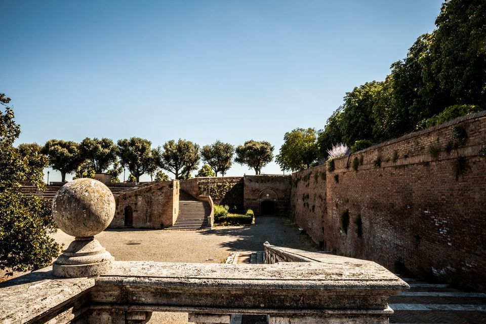
The fortress is memorable because of its scale and shape. Its bastioned walls form a strong geometric presence above the city, and the elevated position gives visitors sweeping views over Siena and the surrounding Tuscan landscape. That combination of fortification and panorama makes it especially rewarding for travelers who appreciate places where architecture tells a political story. The walls are not just old stone; they are evidence of conquest, rule, and the reshaping of urban space.
One little-known fact is that the fortress became less about defense over time and more about civic and cultural use, showing how military architecture can be repurposed for public life. Another detail many visitors miss is how the fortress helps explain the relationship between Siena and Florence. It is not just a monument standing above the city but a reminder of an era when regional power was expressed through earthworks, bastions, and visible control of the landscape.
Visitors often appreciate the fortress for its calm atmosphere. While the city center of Siena can be bustling with tourists, the Fortezza Medicea feels more open and spacious. It is a good place to pause, look out across rooftops and hills, and understand how Siena sits within the broader Tuscan setting. If you are interested in military history, urban viewpoints, or Renaissance politics, the fortress is one of the city's most significant stops.
If you are coming from Piazza del Campo or the cathedral area, the walk to the fortress is straightforward and can be done on foot. Buses and taxis can take you close as well, but walking is usually the best option because it lets you experience the transition from Siena's dense medieval streets to the more open fortified landscape.
The most practical recommendation is to visit it while exploring Siena on foot, especially if you want to combine the fortress with other panoramic stops. Because the site is open and spacious, it works well as a late-afternoon or early-evening destination when the light becomes softer.
If possible, combine the fortress with a walk through the surrounding park-like areas and nearby city streets. That allows you to see how the fortress integrates into Siena's urban edge rather than treating it as a disconnected monument.
Read a little about the Medici and the political history of Siena before your visit. Knowing why the fortress was built changes the experience from a simple architectural stop into a clearer story about conquest and control.
Visit on a day with good visibility if scenic views matter to you. The fortress is enjoyable in many conditions, but its strongest appeal is the way it frames the city and countryside.
Discover more hidden gems you might love.
Munich
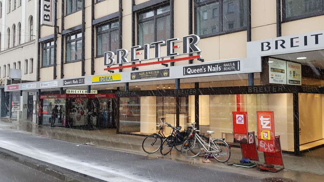
## Description **Breiterhof Passage** is a discreet but culturally significant pedestrian passageway in the heart of Munich’s old town. Unlike the city’s grand squares or monumental avenues, Breiterhof Passage represents a more **intimate layer of urban history**, where commerce, architecture, and everyday life intersect quietly rather than dramatically. The passage dates back to the **postwar reconstruction period**, when Munich rebuilt much of its historic core after World War II. Instead of restoring medieval structures wholesale, planners integrated modern functionality with traditional urban patterns. Breiterhof Passage exemplifies this approach: a short, covered walkway connecting streets while sheltering small shops, cafés, and offices. Its modest scale reflects a deliberate choice to prioritize **human movement and local commerce** over architectural spectacle. What makes Breiterhof Passage unique is its **contrast with Munich’s surrounding grandeur**. Just steps away from busy shopping streets and historic landmarks, the passage offers a slower, enclosed environment that feels almost private. A lesser-known fact is that passages like Breiterhof were designed to maintain pedestrian permeability in dense urban blocks, preserving historic movement patterns even when buildings were rebuilt. Another overlooked detail is that many businesses here are long-standing local operations rather than international chains, giving the space a distinctly Munich character. The passage is not a destination in itself, but a **transitional urban experience**. It rewards attentive visitors who appreciate the city’s smaller architectural gestures and the continuity of everyday life embedded within them. ## Location **Country:** Germany **State:** Bavaria **City:** Munich **District:** Altstadt-Lehel Breiterhof Passage is located in Munich’s historic center, close to major shopping streets and within easy walking distance of Marienplatz. ### How to Get There * **By metro or S-Bahn:** * Travel to **Marienplatz** station, then walk approximately 3–5 minutes. * **By tram:** * Several tram lines stop near the old town perimeter, followed by a short walk. * **On foot:** * Ideal when exploring Altstadt-Lehel, as the passage connects naturally to pedestrian routes. * **By bicycle:** * Bike parking is available nearby, though cycling through the passage itself is not permitted. ## Tips * **Visit during business hours:** The passage is most lively when shops and cafés are open. * **Look beyond storefronts:** Architectural details and spatial proportions are easy to miss if rushed. * **Use it as a shortcut:** It provides a calmer alternative to crowded shopping streets. * **Combine with old town exploration:** It fits naturally into a walking itinerary through central Munich. * **Respect the quiet tone:** This is a working urban space, not a tourist attraction. * **Photography is permitted:** Be mindful of people working or dining inside. ## Conclusion Breiterhof Passage is a subtle reminder that cities are shaped as much by small connective spaces as by major landmarks. Modest, functional, and quietly local, it offers insight into Munich’s postwar urban identity and everyday rhythms. ## FAQ **1. Is Breiterhof Passage a tourist attraction?** No, it is primarily a functional pedestrian passage used by locals. **2. Is there an entrance fee?** No, access is completely free. **3. How long does it take to visit?** Only a few minutes, unless stopping at a café or shop. **4. Is it historically significant?** Yes, as part of Munich’s postwar reconstruction and pedestrian network. **5. Is it suitable for children?** Yes, though there are no child-specific activities. **6. Can it be visited at night?** Access may vary depending on building hours, but daytime visits are recommended. ## Links * [Munich tourism board](https://www.munich.travel)
GemVoyage Team • World
Seattle
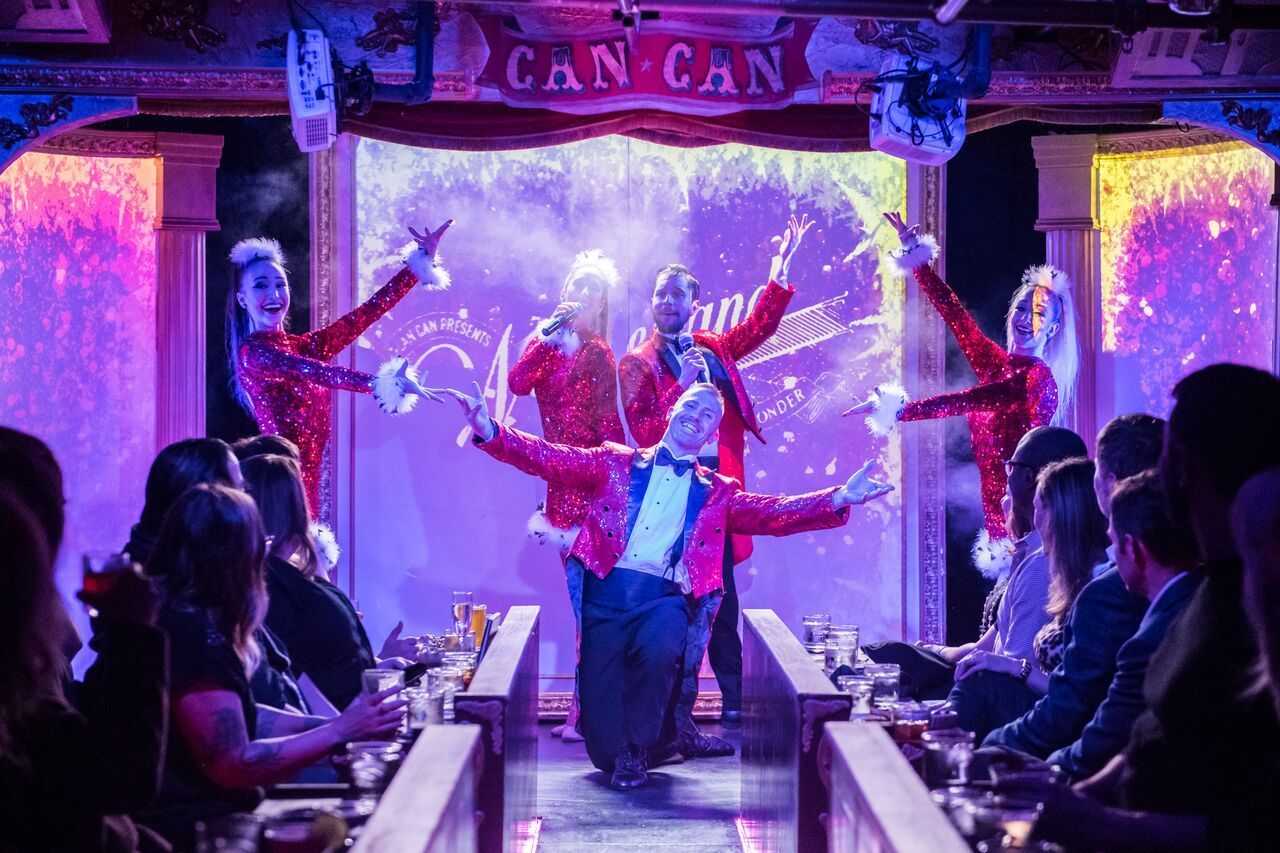
## Description Can Can Culinary Cabaret is a celebrated dinner theatre nestled inside Seattle's historic Pike Place Market. Founded in 2005 by artistic director Chris Pink and choreographer Fae Pink, the venue has produced nearly 7,000 shows over two decades, evolving from a small cabaret hosting traveling acts into one of the Pacific Northwest's most distinctive entertainment destinations. The experience blends multi-course French-inspired Northwest dining with original theatrical productions that incorporate dance, live music, burlesque, acrobatics, comedy, and multimedia elements. The intimate 120-seat theatre, evocative of turn-of-the-century Paris with its red velvet and lush booth seating, ensures every guest feels immersed in the performance. Shows run Thursday through Sunday with approximately ten performances weekly, and the creative team refreshes the entire production — including scenic design, choreography, costuming, and original music — several times each year. A defining feature is Can Can's themed seasonal shows, where the menu is carefully paired with the performance narrative, creating unique culinary-theatrical hybrids that cannot be found anywhere else in Seattle. Recent productions include a Dolly Parton tribute, the acrobatic Carnival of Curiosities, and the return of LOLA, each transforming the venue with entirely new sets and choreography. The result is a full-sensory evening where world-class entertainment and thoughtfully plated cuisine are woven into a single, unforgettable experience. ## Location Can Can Culinary Cabaret is located at 95 Pine Street, Seattle, WA 98101, inside the iconic Pike Place Market — one of the oldest continuously operated public farmers' markets in the United States, drawing over ten million visitors annually. The venue sits in the heart of downtown Seattle, just steps from the waterfront and Post Alley, with The Dressing Room bistro offering outdoor patio seating overlooking the Puget Sound. Getting there is straightforward via multiple modes of transportation. The nearest light rail stop is Westlake Station, approximately a ten-minute walk east along Pike Street. Several bus routes serve the area, including King County Metro lines stopping at Pike Street and 1st Avenue. For drivers, parking garages are available at the Pike Place Market public lot and nearby commercial garages on Western Avenue and Union Street, though availability tightens significantly on summer weekends and during peak tourist season — arriving 30 to 45 minutes early is strongly advised. Rideshare drop-offs are seamless at the Pine Street entrance. The theatre operates Thursday through Sunday from 5:00 PM to close, with specific showtimes varying by production. The Dressing Room bistro offers additional brunch hours independently of the main stage schedule and is open for walk-in dining even on non-show days. ## Tips - **Book well in advance**: Can Can productions frequently sell out, especially weekend shows and seasonal specials. Purchase tickets and pre-select your dining package early, particularly if you want VIP seating, which receives first priority for the best table placement in the intimate theatre. - **Understand the ticket tiers**: Seating is assigned by guest services based on your ticket tier. VIP receives first priority, Preferred second, and Standard third with more value-forward pricing. Groups of 10 or more must purchase VIP or Preferred tickets to sit together, and parties of 20 or more are considered partial buyouts requiring additional arrangements. - **Arrive 30 to 45 minutes early**: This allows time to check in, order pre-show cocktails at The Dressing Room, and settle into your seat before the lights dim. The show runs three acts with two intermissions, so early arrival ensures you place your food order before the performance begins and nothing interrupts the flow. - **Dress smart-casual**: There is no strict dress code, but many guests embrace the theatrical spirit with cocktail attire or polished evening wear. Avoid heavy fragrances, as the intimate space amplifies scents and some guests find this distracting during dining. - **Check age restrictions**: Most shows are adult-oriented and some are strictly 21+. Always verify age requirements when booking, especially if planning a group outing or celebrating a birthday. - **Dietary accommodations**: The kitchen accommodates vegetarian and gluten-free preferences. Notify guest services of any allergies or restrictions at the time of booking so alternatives can be prepared in advance — last-minute substitutions during the show are limited. - **Budget for gratuities and billing**: A 20% service charge is automatically added to pre-purchased food packages and parties of six or more. A 5% living-wage surcharge applies to all checks. The theatre enforces a no-split-check policy to streamline service, so plan to consolidate payment within your group. - **Tip the performers**: After the final curtain, guests are invited to mingle with and tip the cast directly — a beloved tradition that supports the artists who make the show possible. ## Conclusion Can Can Culinary Cabaret stands as a singular gem in Seattle's vibrant entertainment landscape — a place where theatrical ambition and culinary craft converge with remarkable results. Whether you are celebrating a milestone anniversary, planning an unforgettable date night, or simply seeking a night out that defies the ordinary, the venue delivers an experience that lingers long after the final curtain. With an entirely new season of productions unveiled each year, there is always a fresh reason to return. The combination of original music, world-class performance, French-inspired cuisine, and an atmosphere steeped in vintage glamour makes it one of the most distinctive things to do in Seattle. Book your tickets, arrive hungry for both food and spectacle, and discover why Can Can has remained a beloved institution for nearly twenty years. ## FAQ - **How long does a typical show last?** Expect the full experience to run 2 to 3 hours, comprising three acts and two intermissions. Dining is served tableside throughout the performance so that no moment of the show is missed. - **Is there a dress code?** There is no enforced dress code, but smart-casual or cocktail attire is recommended to match the theatrical atmosphere. Many guests treat it as a special-occasion event and dress accordingly. - **Can I dine without seeing the show?** Yes — The Dressing Room, Can Can's bistro and bar, operates independently of the theatre and offers French-inspired Northwest fare, craft cocktails, and patio seating with Puget Sound views. Reservations are recommended. - **What if I have dietary restrictions?** Vegetarian and gluten-free options are available. Inform guest services at the time of booking so the kitchen can accommodate your needs without disruption during the performance. - **Is the show appropriate for children?** Most productions are adult-oriented and may contain mature themes, suggestive humor, and burlesque elements. Check individual event listings for age recommendations before purchasing tickets for younger guests. - **Can I buy a gift certificate?** Yes — digital gift cards are available through the Can Can website and make excellent presents for birthdays, anniversaries, or holiday gifts. - **What is the cancellation and refund policy?** All sales are final. There are no refunds or exchanges, so review your order carefully before completing your transaction. - **Is there a Portland location?** Yes — Can Can operates a second venue in Portland, Oregon, at 6 SW 3rd Avenue, offering a similar dinner-and-show experience in the Pacific Northwest. ## Links - [Can Can Culinary Cabaret — Official Website](https://www.cancanseattle.com) - [Visit Seattle — Official Tourism Guide](https://www.visitseattle.org)
GemVoyage Team • World
Berlin
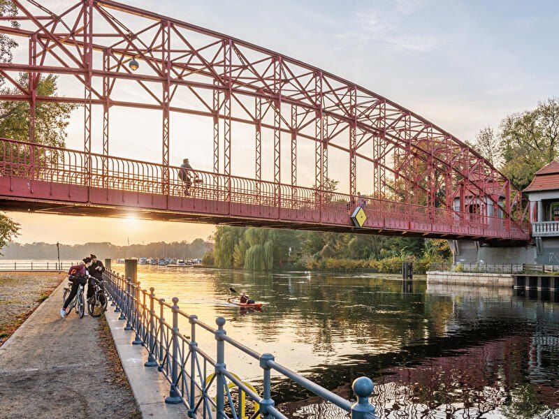
## Description **Tegeler See** is one of Berlin’s largest and most beloved lakes, offering a rare combination of **deep forest landscapes, wide open water, historic promenades, and recreational freedom** within a major European capital. Unlike the carefully curated parks of central Berlin, Tegeler See feels **expansive, natural, and quietly powerful**, a place where the city dissolves into wind, water, and tree canopy. The lake stretches across the northern edge of Berlin and forms part of a much larger **interconnected water system** linking rivers, canals, and smaller lakes. Its shoreline alternates between **elegant promenades, dense woodland, sandy bathing areas, hidden coves, and small harbors**, giving every section a distinct character. On one walk you might pass joggers and cyclists near cafés, and moments later find yourself alone on a forested shoreline with only birds and passing sailboats for company. What makes Tegeler See especially unique is its **scale and visual openness**. The lake is wide enough to feel almost coastal in certain sections. Wind patterns shape large ripples across the surface, and on clear days the sky reflects endlessly into the water. Sailboats, paddleboards, kayaks, ferries, and swimmers all share the same space, creating an ever-moving ecological and recreational system. The western and northern edges of the lake are bordered by the **Tegel Forest (Tegeler Forst)**, one of Berlin’s largest continuous woodland zones. This forest contains long hiking paths, wildlife corridors, thick pine stands, and historic hunting routes that once served Prussian royalty. This direct interface between **urban lake and protected forest** is one of Tegeler See’s defining strengths. Few European capitals offer this scale of natural immersion without leaving city limits. From an urban perspective, the lake is closely tied to the borough of **Reinickendorf** and the historic district of **Alt-Tegel**. The Alt-Tegel promenade along the eastern shoreline functions as a social spine, lined with restaurants, ice cream shops, boat docks, beer gardens, and terraces overlooking the water. This area transforms in summer into one of Berlin’s most relaxed outdoor social scenes, blending families, cyclists, couples, and long-term residents. A little-known fact is that Tegeler See was once part of the **Havel River’s natural floodplain system**, and its modern form is the result of long-term hydraulic engineering dating back centuries. Another lesser-known detail is that the famous German poet and philosopher **Gotthold Ephraim Lessing** once lived near the lake, and the nearby Tegel Palace was home to the Humboldt family, including **Alexander von Humboldt**, one of history’s most influential natural scientists. Tegeler See’s emotional identity is shaped by **seasonality**. In spring, the forest releases fresh green layers and migrating birds return. Summer brings swimming, paddleboarding, lakeside dining, and long evening sunsets. Autumn covers the surrounding hills in gold and copper tones. Winter transforms the lake into a minimalist landscape of cold light, mist, and silence, occasionally frozen at the edges. Unlike Berlin’s central landmarks, Tegeler See does not present itself as a destination of spectacle. Its appeal is built on **duration rather than intensity**. People do not come for a single photo; they come to spend hours walking, reading, boating, cycling, swimming, and simply existing beside water and forest. It is one of the few places in Berlin where **time visibly slows down**. In a city often defined by density, history, and cultural pressure, Tegeler See functions as a **pressure valve**. It absorbs excess motion and releases calm. ## Location **Tegeler See** is located in **northwestern Berlin**, primarily within the borough of **Reinickendorf**, near the historic district of **Tegel**. **City:** Berlin **State (Region):** Berlin **Country:** Germany **Primary Area:** Reinickendorf / Alt-Tegel ### How to Get There: * **By S-Bahn:** * Take **S25** to **Tegel Station**, then walk 10 minutes to the lakeside. * **By U-Bahn:** * Take **U6** to **Alt-Tegel**, which places you directly at the main promenade. * **By bus:** Multiple bus routes connect Tegel with central and northern Berlin. * **By bicycle:** A well-developed bike network connects Tegeler See to the city center. * **By car:** Parking is available but is limited on busy summer days. The lake is easily combined with visits to **Alt-Tegel old town, Tegel Forest hiking trails, and the Havel River network**. ## Tips * **Visit on weekdays if you prefer quiet:** Weekends can be very busy in summer. * **Walk both the promenade and the forest side:** Each offers a completely different experience. * **Bring swimwear in summer:** Designated bathing areas are popular and well maintained. * **Sunset is the most atmospheric time:** Especially from western shoreline viewpoints. * **Boat rentals are widely available during the warm season.** * **Dress for wind:** The open water creates noticeable temperature shifts. * **Combine with Alt-Tegel dining:** Lakeside restaurants are a core part of the experience. * **Winter visits are underrated:** The silence and mist create a dramatic, cinematic mood. ## Conclusion **Tegeler See** is Berlin at its most expansive and elemental. It is where the city trades architecture for horizon, traffic for water movement, and density for breathing space. By uniting forest, lake, promenade, and history into one continuous landscape, Tegeler See offers a version of Berlin that is **slower, wider, and deeply restorative**. ## FAQ **1. Is Tegeler See suitable for swimming?** Yes. Several **official bathing areas** operate during the summer season. **2. Can you rent boats on Tegeler See?** Yes. **Paddleboats, kayaks, and small sailboats** are available for rent. **3. Is Tegeler See family-friendly?** Yes. It is widely used by **families, cyclists, walkers, and swimmers**. **4. How long does it take to walk around Tegeler See?** Walking the full perimeter can take **2.5 to 4 hours**, depending on pace and route. **5. Is Tegeler See good in winter?** Yes, especially for **quiet walks, photography, and forest exploration**. **6. Is there wildlife around the lake?** Yes. The area supports **water birds, foxes, deer, and diverse forest species**. ## Links * [Visit Berlin](https://www.visitberlin.de)
GemVoyage Team • World
Seville
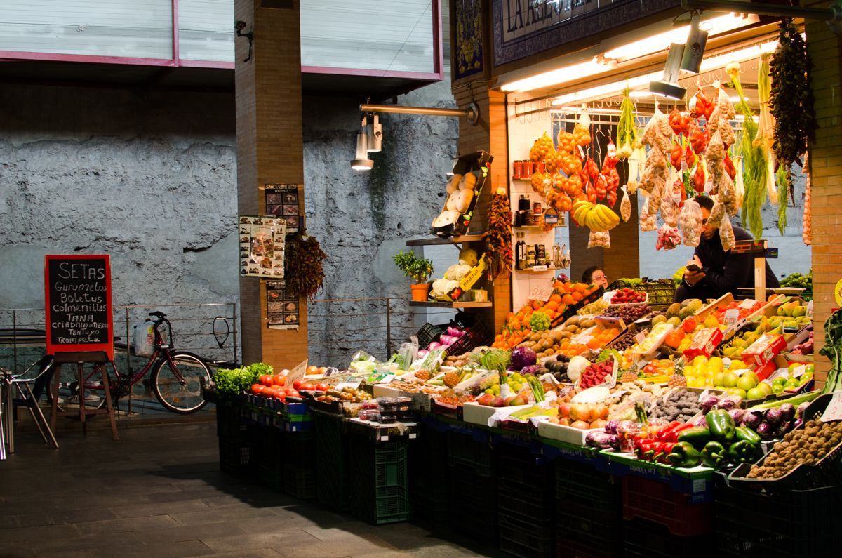
## Description Triana Market is one of the most characterful places to experience everyday Seville beyond the postcard version of the city. Set in the Triana neighborhood, it combines the energy of a traditional neighborhood market with the atmosphere of a place shaped by river life, ceramics, flamenco, and strong local identity. Visitors come here for produce, but they often stay longer because the market feels like a living introduction to the district itself. It is not a polished tourist stage. It is a working market where stallholders greet regulars, chefs shop for ingredients, and curious travelers can see how Seville still feeds itself in a very local way. What makes Triana Market especially appealing is the balance between food and history. The market sits close to the Guadalquivir River and near the area where Triana’s old artisan traditions developed, so a visit naturally turns into a wider walk through one of Seville’s most distinctive quarters. You can browse fruit, fish, meat, olives, pastries, spices, and tapas-style snacks while hearing the rhythm of a neighborhood that has long been associated with sailors, potters, and performers. A little-known detail is that the market stands near archaeological remains tied to the former Castle of San Jorge, which adds a historical layer that many visitors miss when they come only for lunch. Another less obvious fact is that the market is often the place where locals go to buy ingredients for home cooking rather than a destination designed mainly for tourists, which is part of why it feels authentic. The best experience here is not rushed. Start by looking around rather than ordering immediately, because the market rewards observation. The colors of the fruit stalls, the smell of fried food, the chatter from the bars, and the pace of local shopping all help explain why Triana is one of Seville’s most beloved neighborhoods. If you are interested in local culture, this is also an excellent point of departure for exploring ceramics shops, riverfront views, and the streets around Calle Betis and the Triana Bridge. ## Location Triana Market is in the Triana neighborhood on the west bank of the Guadalquivir River in Seville, Andalusia, Spain. The neighborhood sits just across the river from the historic center, so the market is easy to include in a day of sightseeing. If you are already in central Seville, the simplest approach is to walk across the Triana Bridge and continue into the market area on foot. That route is especially enjoyable because it gives you a clear sense of how the city changes from the monument-filled center to the more residential and traditionally working-class Triana side. If you are coming from farther away, a taxi, city bus, or a combination of walking and public transport will work well. The market is compact, so once you arrive, you will not need additional transport. It also pairs naturally with nearby river walks, ceramic workshops, and tapas stops, which makes it a practical base rather than a standalone quick stop. In hot weather, plan your arrival earlier in the day, since the surrounding streets can become warm by midday and the market itself is more enjoyable before the lunch rush. ## Tips - Go in the morning if you want the fullest market atmosphere and the best selection of produce and seafood. - Bring both cash and a card, because some smaller stalls prefer one or the other. - Do not limit yourself to shopping; the bars inside and around the market are part of the experience. - Combine the visit with a walk through Triana’s ceramic streets and the riverfront. - If you want photos, arrive early enough to avoid the busiest lunch crowd. - Ask stallholders what is in season, since that is often the fastest way to taste the most local products. ## Conclusion Triana Market is one of the most rewarding places in Seville for travelers who want local flavor, neighborhood character, and a real sense of daily life. It is easy to reach, rich in atmosphere, and memorable well beyond a simple shopping stop. ## FAQ ### Is Triana Market worth visiting even if I am not cooking? Yes. The market is worth visiting for its atmosphere, food counters, and neighborhood character even if you do not plan to buy ingredients. ### What is the best time to visit Triana Market? Morning is usually best, especially if you want fresh produce and a calmer pace before the lunch rush begins. ### Can I eat inside or near the market? Yes. The market and the surrounding streets have bars and food counters where you can eat casually and try local dishes. ### How long should I spend there? Plan at least one hour, and more if you want to combine shopping, snacks, and a walk through the neighborhood. ## Links - [Wikipedia](https://en.wikipedia.org/wiki/Triana,_Seville) - [Seville tourism information](https://www.visitasevilla.es/en)
GemVoyage Team • World
.jpg)
Scotland
## Description The Fairy Pools on the Isle of Skye in Scotland are a series of crystal-clear, aqua-blue pools and cascading waterfalls that tumble down from the foothills of the Black Cuillin mountains. These natural pools, fed by the Allt Coire a’ Mhadaidh stream, are renowned for their ethereal beauty and have become one of Skye’s most iconic and photographed attractions. Whether you're a hiker, wild swimmer, or simply a lover of dramatic landscapes, the Fairy Pools offer a magical experience that feels straight out of folklore. The walk to the pools is relatively short—about 2.4 kilometers round trip—and follows a well-maintained gravel path that winds through heather-covered moorland. Along the way, visitors encounter a series of waterfalls and pools, each more striking than the last. The water is so clear that you can see the rocky bottoms and reflections of the surrounding hills, making it a favorite spot for photographers and nature enthusiasts. A little-known fact: the area around the Fairy Pools was the site of the last and bloodiest clan battle in Scottish history—the Battle of Coire na Creiche in 1601 between the MacLeods of Dunvegan and the MacDonalds of Sleat. Legend has it that the stream ran red with blood, a stark contrast to its current tranquil appearance. Another quirky detail is that despite their name, there’s no historical association with fairies—the name “Fairy Pools” only began appearing in guidebooks in the 20th century. ## Location The Fairy Pools are located in **Scotland**, on the **Isle of Skye**, near the village of **Carbost** in the **Highland region**. They sit at the base of the Black Cuillin mountains in **Glen Brittle**, on the western side of the island. ### How to Get There - **By Car**: From Portree, the island’s main town, it’s about a 30-minute drive (20.5 miles) via the B8009 and Glenbrittle road. The route includes single-track roads with passing places. - **By Bus**: Public transport is limited. Buses run to Carbost, but you’ll need to arrange a taxi or walk from there. - **By Tour**: Several guided tours from Portree or Inverness include the Fairy Pools as part of a day trip. - **By Foot**: The walk to the pools begins at the Fairy Pools car park, located near Glenbrittle. From the car park, it’s a 20-minute walk to the first waterfall. ## Tips - **Visit Early or Late**: The site gets crowded during peak hours, especially in summer. Early morning or late afternoon offers better light and fewer visitors. - **Wear Waterproof Footwear**: The path can be muddy and uneven, especially after rain. - **Bring Layers**: Weather on Skye is unpredictable. Pack a waterproof jacket and warm clothing. - **Wild Swimming**: Brave souls can swim in the pools, but the water is icy year-round. A wetsuit is recommended. - **Respect Nature**: Follow the Scottish Outdoor Access Code—take your litter with you and stick to marked paths. - **Parking**: There is a charge for parking at the Fairy Pools car park, which helps maintain the site. ## Conclusion The Fairy Pools on the Isle of Skye are a breathtaking blend of natural beauty and Highland mystique. With their vivid waters, dramatic mountain backdrop, and rich history, they offer a memorable experience for anyone exploring Scotland’s rugged landscapes. ## FAQ **1. Is there an entrance fee to visit the Fairy Pools?** No, the pools are free to visit, but there is a charge for parking. **2. How long is the walk to the Fairy Pools?** The round-trip walk is approximately 2.4 kilometers and takes 40 minutes to 1.5 hours depending on pace and stops. **3. Can I swim in the Fairy Pools?** Yes, wild swimming is allowed, but the water is extremely cold. A wetsuit is recommended. **4. Are the Fairy Pools suitable for children?** Yes, but children should be supervised due to uneven terrain and cold water. **5. Is the site wheelchair accessible?** No, the terrain is rugged and includes steep inclines, making it unsuitable for wheelchairs. **6. What is the best time of year to visit?** Spring and autumn offer mild weather and fewer crowds. Summer is busiest, while winter can be icy and less accessible. ## Links - [Fairy Pools Walk – Isle of Skye Guide](https://www.isleofskye.com/skye-guide/top-ten-skye-walks/fairy-pools) - [Fairy Pools – VisitScotland Overview](https://www.visitscotland.com/info/see-do/fairy-pools-p1770011) - [Fairy Pools – Wikipedia Entry](https://en.wikipedia.org/wiki/Fairy_Pools) Description The Fairy Pools on the Isle of Skye in Scotland are a series of crystal-clear, aqua-blue pools and cascading waterfalls that tumble down from the foothills of the Black Cuillin mountains. These natural pools, fed by the Allt Coire a’ Mhadaidh stream, are renowned for their ethereal beauty and have become one of Skye’s most iconic and photographed attractions. Whether you're a hiker, wild swimmer, or simply a lover of dramatic landscapes, the Fairy Pools offer a magical experience that feels straight out of folklore. The walk to the pools is relatively short—about 2.4 kilometers round trip—and follows a well-maintained gravel path that winds through heather-covered moorland. Along the way, visitors encounter a series of waterfalls and pools, each more striking than the last. The water is so clear that you can see the rocky bottoms and reflections of the surrounding hills, making it a favorite spot for photographers and nature enthusiasts. A little-known fact: the area around the Fairy Pools was the site of the last and bloodiest clan battle in Scottish history—the Battle of Coire na Creiche in 1601 between the MacLeods of Dunvegan and the MacDonalds of Sleat. Legend has it that the stream ran red with blood, a stark contrast to its current tranquil appearance. Another quirky detail is that despite their name, there’s no historical association with fairies—the name “Fairy Pools” only began appearing in guidebooks in the 20th century. Location The Fairy Pools are located in Scotland, on the Isle of Skye, near the village of Carbost in the Highland region. They sit at the base of the Black Cuillin mountains in Glen Brittle, on the western side of the island. How to Get There By Car: From Portree, the island’s main town, it’s about a 30-minute drive (20.5 miles) via the B8009 and Glenbrittle road. The route includes single-track roads with passing places. By Bus: Public transport is limited. Buses run to Carbost, but you’ll need to arrange a taxi or walk from there. By Tour: Several guided tours from Portree or Inverness include the Fairy Pools as part of a day trip. By Foot: The walk to the pools begins at the Fairy Pools car park, located near Glenbrittle. From the car park, it’s a 20-minute walk to the first waterfall. Tips Visit Early or Late: The site gets crowded during peak hours, especially in summer. Early morning or late afternoon offers better light and fewer visitors. Wear Waterproof Footwear: The path can be muddy and uneven, especially after rain. Bring Layers: Weather on Skye is unpredictable. Pack a waterproof jacket and warm clothing. Wild Swimming: Brave souls can swim in the pools, but the water is icy year-round. A wetsuit is recommended. Respect Nature: Follow the Scottish Outdoor Access Code—take your litter with you and stick to marked paths. Parking: There is a charge for parking at the Fairy Pools car park, which helps maintain the site. Conclusion The Fairy Pools on the Isle of Skye are a breathtaking blend of natural beauty and Highland mystique. With their vivid waters, dramatic mountain backdrop, and rich history, they offer a memorable experience for anyone exploring Scotland’s rugged landscapes. FAQ 1. Is there an entrance fee to visit the Fairy Pools? No, the pools are free to visit, but there is a charge for parking. 2. How long is the walk to the Fairy Pools? The round-trip walk is approximately 2.4 kilometers and takes 40 minutes to 1.5 hours depending on pace and stops. 3. Can I swim in the Fairy Pools? Yes, wild swimming is allowed, but the water is extremely cold. A wetsuit is recommended. 4. Are the Fairy Pools suitable for children? Yes, but children should be supervised due to uneven terrain and cold water. 5. Is the site wheelchair accessible? No, the terrain is rugged and includes steep inclines, making it unsuitable for wheelchairs. 6. What is the best time of year to visit? Spring and autumn offer mild weather and fewer crowds. Summer is busiest, while winter can be icy and less accessible. Links Fairy Pools Walk – Isle of Skye Guide Fairy Pools – VisitScotland Overview Fairy Pools – Wikipedia Entry 715 words37 lines4484 characters4520 bytes
GemVoyage Team • World
Paris
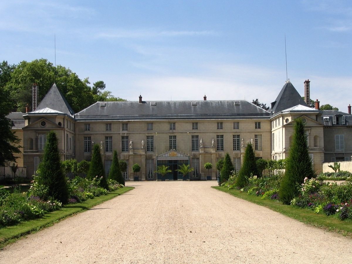
## Description The **Château de Malmaison** is one of the most historically intimate and emotionally rich landmarks of the Napoleonic era. Unlike grand imperial palaces designed to impress the masses, Malmaison was a **private retreat**—a place of strategy, domestic life, and personal ambition. It served as the residence of **Napoleon Bonaparte and Empress Joséphine** from 1799 to 1802 and later remained Joséphine’s home until her death in 1814. What makes Malmaison particularly unique is that it offers a deeply human perspective on figures often seen only through the lens of military and political power. Here, visitors encounter **Napoleon the husband and strategist**, and **Joséphine the patron of art, architecture, and botanical science**. Many decisive political meetings were held within these walls, including sessions of the **French government during Napoleon’s rise to power**. In effect, Malmaison briefly functioned as an **unofficial seat of the French state**. Architecturally, the château reflects the transition from late 18th-century aristocratic style to the early **Empire aesthetic**. Under Joséphine’s direction, the interior was redesigned by leading architects and decorators of the time, introducing **elegant neoclassical motifs, sculpted columns, rich textiles, and furniture that defined what would later be known as the Empire style**. The combination of political authority and refined domestic comfort was revolutionary for its time. The interior rooms remain remarkably authentic. Highlights include **Napoleon’s council chamber**, where official meetings took place, Joséphine’s private apartments, and the refined dining rooms used for state dinners. Furnishings, clocks, paintings, and personal objects are original or meticulously restored, giving the impression that the imperial couple has only just stepped away. Beyond politics, Malmaison holds global botanical importance. Joséphine was passionately devoted to **botanical exploration and exotic plant collection**. She transformed the estate into **one of Europe’s most important experimental botanical gardens**, introducing dozens of new plant species to France. Most famously, she established **the largest rose collection in Europe**, making Malmaison the birthplace of modern rose breeding. A little-known fact is that **Napoleon and Joséphine’s divorce was finalized while he was already Emperor**, a rare example of a ruler separating from his consort at the height of power. After the divorce, Napoleon retained Malmaison for Joséphine, allowing her to live there independently—an extraordinary privilege for the era. Another lesser-known detail is that the Russian Tsar **Alexander I visited Joséphine at Malmaison shortly before her death**, underscoring her lasting influence on European politics even after her fall from power. Today, Malmaison stands as a **museum of extraordinary intimacy**, preserving both the machinery of empire and the vulnerability of personal life. It is not a monument to victory, but a space that reveals **ambition, intelligence, loss, and legacy** at a human scale. ## Location **Château de Malmaison** is located in **Rueil-Malmaison**, a historic suburban town just west of **Paris**, in the **Île-de-France region**, France. **City:** Rueil-Malmaison **Region:** Île-de-France **Country:** France ### How to Get There: * **By RER:** Take **RER A** toward Saint-Germain-en-Laye and exit at **Rueil-Malmaison Station**, then take a bus or walk approximately 25 minutes. * **By bus:** Several local bus lines connect directly from central Paris to the château area. * **By taxi or ride-hailing apps:** A direct and convenient option from central Paris, typically 25–40 minutes depending on traffic. * **By car:** Easily accessible via Paris’s western ring roads; parking is available near the site. While not inside the historic center of Paris, the château is easy to reach and offers a calm, cultured contrast to the city’s intensity. ## Tips * **Visit the gardens as well as the interior:** The landscape is essential to understanding Joséphine’s legacy. * **Go in spring or early summer:** The rose garden is at its best during these months. * **Use the audio guide:** It adds essential political and personal context. * **Allow at least 2 hours:** One hour for the interior, one for the gardens and exhibitions. * **Arrive early:** The château is smaller than major Paris museums and can feel crowded later in the day. * **Combine with a Seine walk:** The nearby riverbanks are ideal for a relaxed post-visit stroll. * **Photography is usually permitted without flash:** Always verify current rules at entry. * **Not a grand palace experience:** If you expect Versailles-level scale, you will be disappointed; Malmaison is about intimacy and insight, not spectacle. ## Conclusion The **Château de Malmaison** offers one of the most personal and revealing encounters with the Napoleonic era. As both a political nerve center and a deeply private refuge, it captures the complexity of power, love, ambition, and legacy embodied by **Napoleon and Joséphine**. Quiet, refined, and historically profound, Malmaison stands as one of the most meaningful imperial sites in greater Paris. ## FAQ **1. What is Château de Malmaison famous for?** It is best known as the **private residence of Napoleon Bonaparte and Empress Joséphine** and a major center of early Napoleonic political life. **2. Is Château de Malmaison inside Paris?** No, it is located in **Rueil-Malmaison**, a suburb just west of Paris. **3. Can you visit the interior?** Yes, the château operates as a **fully accessible museum** with original furnishings and artifacts. **4. What happened to Joséphine after the divorce?** She remained at Malmaison until her death in **1814**, continuing her botanical and social work independently. **5. How long does a visit take?** Most visitors spend **1.5 to 2.5 hours** including the gardens. **6. Is Château de Malmaison suitable for children?** Yes, especially for older children interested in history, though the visit is primarily educational rather than interactive. ## Links * [French National Museums](https://www.culture.gouv.fr) * [Napoleonic History Resources](https://www.napoleon.org)
GemVoyage Team • World

Comments