GemVoyage Team • World
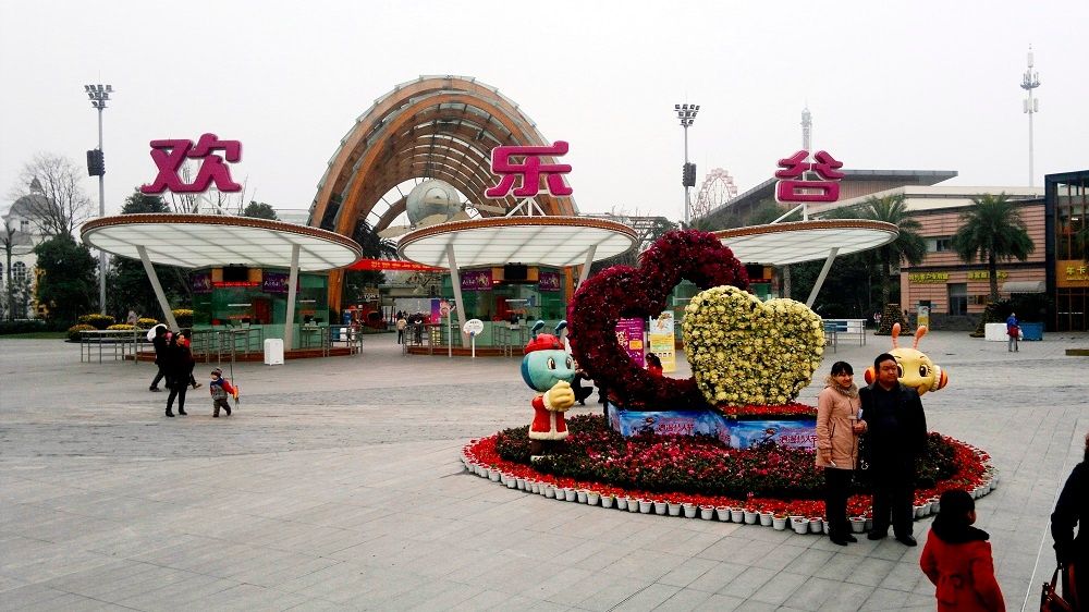
Happy Valley Chengdu, known locally as 成都欢乐谷, is one of the largest and most popular theme parks in western China. Designed to appeal to visitors of all ages, the park combines high-adrenaline rides, family-friendly attractions, live entertainment, and themed zones inspired by global cultures and fantasy worlds. As part of the well-known Happy Valley chain across China, the Chengdu location stands out for its scale, variety, and strong integration of local elements.
What makes Happy Valley Chengdu unique is its balance between intense thrill rides and immersive leisure experiences. Roller coasters, giant pendulum rides, and drop towers attract adrenaline seekers, while gentler attractions, parades, and interactive shows cater to families and younger visitors. A little-known fact is that some areas of the park subtly incorporate Sichuan cultural motifs in their design and performances, reflecting the region’s identity beyond the rides themselves. Another lesser-known detail is that Happy Valley Chengdu often hosts large-scale seasonal festivals, such as night-time light events and themed celebrations, which can significantly change the atmosphere of the park depending on when you visit.
With its wide range of attractions and polished facilities, Happy Valley Chengdu has become a major entertainment destination not only for tourists but also for residents of Chengdu and neighboring cities.
Happy Valley Chengdu is located in China, in Sichuan Province, within the city of Chengdu. The park sits in the Jinniu District, in the northern part of the city, making it accessible from central Chengdu while still offering a spacious layout.
Getting to the park is convenient using public transportation. Visitors can take the Chengdu Metro to Xipu or nearby stations depending on current routes, then transfer to a bus or taxi for a short ride to the entrance. Taxis and ride-hailing apps are widely used in Chengdu and provide a straightforward option, especially for families. If traveling by car, the park has designated parking areas, though arriving early is recommended during weekends and holidays.
Happy Valley Chengdu is a lively and well-rounded theme park that delivers excitement, entertainment, and memorable experiences for visitors of all ages. Whether you are seeking thrilling rides or relaxed family fun, the park offers a dynamic escape within one of China’s most vibrant cities.
Is Happy Valley Chengdu suitable for young children?
Yes, the park includes many family-friendly rides, play areas, and shows designed specifically for younger visitors.
How long should I plan to spend at Happy Valley Chengdu?
Most visitors spend a full day at the park to experience a wide range of attractions and shows.
Are English signs available in the park?
Some signage includes English, but having a translation app can be helpful for show schedules and ride details.
Is food available inside the park?
Yes, there are numerous food stalls and restaurants offering both Chinese and international options.
When is the best time to visit Happy Valley Chengdu?
Spring and autumn offer the most comfortable weather, while weekdays are best for avoiding crowds.
Discover more hidden gems you might love.

Laos
## Description Phou Si, often referred to as Mount Phou Si or Phu Si, is a sacred hill that rises 100 meters above the UNESCO World Heritage city of Luang Prabang in Laos. It’s not just a geographical landmark—it’s a spiritual and cultural centerpiece that offers panoramic views, serene temples, and a glimpse into the soul of Lao Buddhism. The name “Phou Si” translates to “Sacred Hill,” and true to its name, it’s dotted with shrines, Buddha statues, and two prominent temples: Wat Tham Phou Si halfway up, and Wat Chom Si at the summit. The climb to the top involves ascending over 300 steps, but the reward is a breathtaking 360-degree view of Luang Prabang, the Mekong and Nam Khan rivers, and the surrounding jungle-clad mountains. Along the way, saffron-robed monks stroll the leafy paths, incense drifts through the air, and small altars invite quiet reflection. A little-known fact: legend has it that a powerful Naga (a mythical serpent deity) once lived on the hill, adding a mystical layer to its spiritual significance. Another hidden treasure is a small chapel said to house a footprint of the Buddha, tucked along one of the stairways—a detail often missed by hurried visitors. ## Location Phou Si is located in **Laos**, within the **Luang Prabang Province**, in the city of **Luang Prabang**. It sits in the heart of the old town peninsula, bordered by the Mekong River on one side and the Nam Khan River on the other. ### How to Get There: - **By Foot**: Most visitors reach Phou Si by walking from nearby attractions like the Royal Palace Museum or the Night Market. The two main stairways are accessible from Sisavangvong Road and Thanon Phousi. - **By Tuk-Tuk**: If you're staying farther out, a tuk-tuk can drop you off at either entrance. - **By Bicycle**: Luang Prabang is bike-friendly, and cycling to the base of Phou Si is a scenic option. Its central location makes it an easy and essential stop on any Luang Prabang itinerary. ## Tips for Visitors To make the most of your visit to Phou Si, consider these tips: - **Go for Sunset**: The summit offers one of the best sunset views in Laos. Arrive early to secure a good spot—it's popular! - **Bring Water**: The climb can be steep and humid, especially in the afternoon. Hydration is key. - **Wear Comfortable Shoes**: The stairways are uneven in places, so sturdy footwear is recommended. - **Respect the Sacredness**: Dress modestly and be mindful of local customs. Offerings like incense and flowers are available for purchase along the way. - **Explore Both Routes**: Ascend via the Nam Khan side for scenic statues and descend via the Royal Palace side for a shorter walk. - **Entrance Fee**: Expect to pay around 20,000 Kip (~$2.50 USD), collected halfway up the hill. ## Conclusion Phou Si is more than just a viewpoint—it’s a spiritual journey, a cultural experience, and a photographer’s dream. With its sacred temples, mythical legends, and sweeping vistas, it captures the essence of Luang Prabang and offers a moment of peace above the city’s gentle bustle. ## FAQ **1. How many steps are there to reach the top of Phou Si?** There are over 300 steps, depending on the route you take—328 from the Royal Palace side and 355 from the Nam Khan side. **2. What is the best time to visit Phou Si?** Sunset is the most popular time, but early morning offers tranquility and cooler temperatures. **3. Is there an entrance fee?** Yes, the fee is approximately 20,000 Kip, payable halfway up the hill. **4. Can children climb Phou Si?** Yes, but supervision is recommended due to the steep stairways. **5. Are there restrooms or shops at the summit?** No facilities at the top, but vendors sell drinks and offerings near the base. **6. Is Phou Si wheelchair accessible?** Unfortunately, due to the stair-only access, it is not suitable for visitors with mobility issues. ## Links - [Mount Phou Si – Wikipedia](https://en.wikipedia.org/wiki/Phou_Si)
GemVoyage Team • World
Beijing
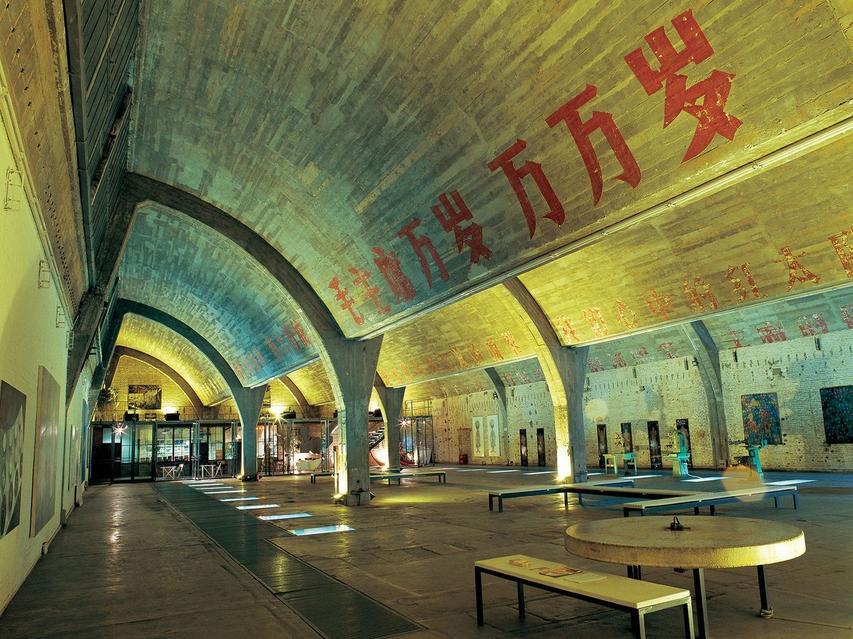
## Description Tucked in the northeastern corner of Beijing, the 798 Art District is one of the most compelling destinations in all of China. What was once a sprawling complex of military and industrial factories has been transformed into a world-class hub for contemporary art, design studios, galleries, cafes, and cultural institutions. The district draws millions of visitors each year, from seasoned art collectors to curious travelers who simply want to walk through one of Asia's most visually striking urban landscapes. The complex was originally built in the 1950s with assistance from East German engineers, and the architecture reflects that influence heavily. The Bauhaus-inspired buildings, with their distinctive sawtooth roofs designed to let in consistent northern light, still stand largely intact. They now house some of the most important contemporary art galleries in Asia. Walking through the district feels like moving through layers of history: Cold War-era industrial slogans still painted on the walls sit side by side with bold modern installations and cutting-edge sculpture. One little-known fact about 798 is that it was artists and designers who moved in illegally during the late 1990s and early 2000s, attracted by the cheap rent and massive open spaces, before the government formally recognized it as a cultural zone in 2006. Another lesser-known detail is that the district is named after Factory 798, which was just one of many factories in the complex known collectively as the 718 Joint Factory, originally built as part of China's first Five-Year Plan. Today, the 798 Art District is home to over 200 galleries and art spaces, including branches of internationally recognized institutions. The streets between buildings are filled with large-scale outdoor sculptures and murals, making even a casual stroll through the area feel like a walk through an open-air museum. Annual events like the Beijing International Art Biennale and 798 Art Festival bring the district's creative energy to its peak. ## Location The 798 Art District is located in the Chaoyang District of Beijing, China, in an area called Dashanzi. It sits in the northeastern part of the city, not far from the Beijing Capital International Airport and within reasonable distance of major city landmarks. The most convenient way to get there is by taking the Beijing Subway to Line 14 and exiting at Jiangtai Station, from which the district is about a 10 to 15 minute walk or a short taxi ride. Alternatively, many visitors take a taxi or use a ride-hailing app like DiDi directly to the 798 Art District entrance. Buses also serve the area, with several routes stopping near Dashanzi. Despite being somewhat off the typical tourist trail, it is well connected to the rest of the city. For those staying in central Beijing near Sanlitun or the CBD area, the journey by taxi typically takes 20 to 30 minutes depending on traffic. ## Tips - **Go on a weekday if possible.** Weekends, especially during festivals and national holidays, can see very large crowds. Visiting on a Tuesday or Wednesday will give you a quieter, more contemplative experience. - **Wear comfortable shoes.** The district is large and most of the experience involves walking on uneven ground, past industrial spaces and outdoor installations. Good walking shoes make a considerable difference. - **Allocate at least half a day.** There is far more to see here than most people expect. A proper visit to even a fraction of the galleries and outdoor spaces takes a minimum of three to four hours. - **Many galleries are free.** While some exhibitions charge entrance fees, a large number of the galleries in 798 are free to enter. Always check at the door before assuming you need to purchase a ticket. - **Bring cash as well as a card.** Some smaller cafes, shops, and studios may not accept international credit cards. Having some Chinese yuan on hand is always helpful. - **Visit in spring or autumn.** Beijing's summers are hot and humid, and winters are extremely cold. The spring months of April and May and the autumn months of September and October offer the most comfortable conditions for exploring the outdoor areas. - **Check the event calendar in advance.** The district hosts rotating exhibitions, openings, and festivals that can significantly enhance your visit. Checking what is on before you go is always worthwhile. ## Conclusion The 798 Art District is far more than a tourist attraction. It is a living, breathing creative community that offers a genuine window into contemporary Chinese culture and the global art world. Its unique combination of preserved industrial architecture, international-caliber art, and vibrant street life makes it unlike anywhere else in Beijing or, indeed, in the world. Whether you are an art enthusiast, a photographer, a design professional, or simply a curious traveler, the 798 Art District deserves a place near the top of your Beijing itinerary. ## FAQ **What are the opening hours of the 798 Art District?** The outdoor streets and public areas of the district are accessible at all hours, but most individual galleries and studios are open from around 10:00 AM to 6:00 PM. Hours can vary by gallery, and some are closed on Mondays. It is advisable to check specific gallery websites if you have particular venues in mind. **Is the 798 Art District free to visit?** Entry to the district itself is free. Many of the galleries and outdoor installations are also free. However, some exhibitions and events charge admission fees. Budget a small amount in case anything you want to enter requires a ticket. **How much time should I spend in the 798 Art District?** Most visitors find that three to five hours is ideal for a satisfying visit. If you are a serious art enthusiast or plan to visit multiple galleries in depth, a full day is not excessive. **Is the 798 Art District suitable for children?** Yes, in general the district is suitable for families. The outdoor sculptures and the visual spectacle of the space tend to engage younger visitors. Some contemporary art exhibitions may contain mature themes, so parents should use their discretion when entering individual galleries. **Are there places to eat and drink in the district?** Yes, there is a good variety of cafes, restaurants, and small eateries scattered throughout the district. Options range from local Chinese food stalls to international cafes and upscale dining. The area is well suited for a leisurely lunch or a coffee break between gallery visits. **How large is the 798 Art District?** The district covers an area of approximately 60,000 square meters. It contains hundreds of galleries, studios, shops, and eating establishments across a network of streets and converted industrial buildings. ## Links - [798 Art District on Wikipedia](https://en.wikipedia.org/wiki/798_Art_Zone) - [Beijing Tourism Official Website](https://www.visitbeijing.com.cn)
GemVoyage Team • World
Cairo
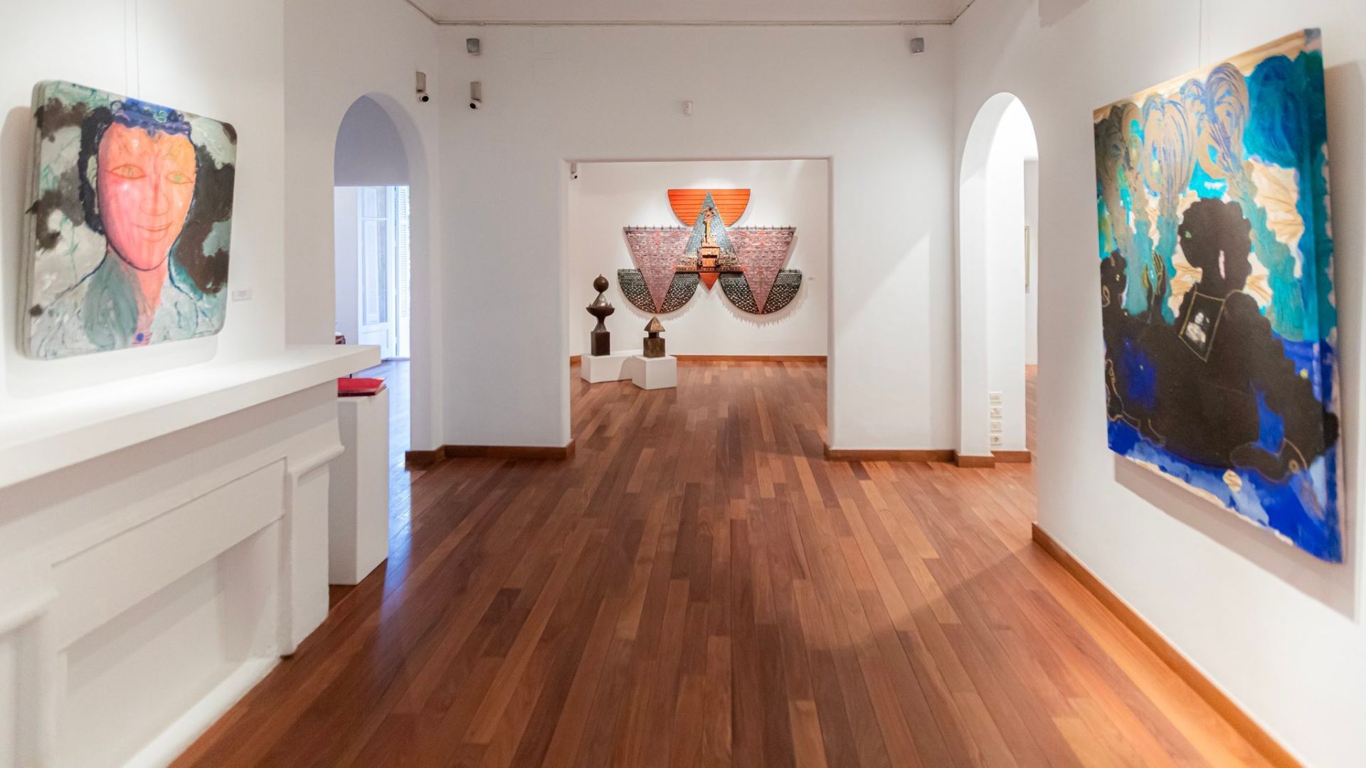
## Description Zamalek is one of Cairo's most elegant and culturally layered neighborhoods, and its art galleries give it a character that feels distinct from the city's more hurried commercial districts. Set on Gezira Island in the Nile, the area blends leafy streets, embassies, old villas, cafes, and a compact but lively contemporary art scene. Visitors come here for more than just one gallery; they come for the atmosphere of walking through a district where art, architecture, and everyday Cairo life overlap in a way that feels intimate and refined. What makes Zamalek special is how accessible its creative life is. Many galleries are tucked into residential streets or historic buildings, so the experience is as much about discovery as it is about the exhibitions themselves. You can move from one space to another on foot, stopping for coffee, browsing small bookstores, or taking in the shade of the trees that line the streets. The district has long attracted diplomats, artists, writers, and collectors, which has helped shape a culture that values conversation and experimentation. One little-known fact is that Zamalek's modern identity was influenced by the island's role in late 19th and early 20th century urban planning, when it became a showcase for Cairo's cosmopolitan elite. Another is that several of the area's smaller galleries change their exhibitions frequently, so repeat visits can feel completely different from one month to the next. That makes Zamalek especially rewarding for travelers who enjoy current art rather than static museum visits. The galleries themselves often highlight a wide range of work: painting, mixed media, sculpture, photography, printmaking, and conceptual installations. Some spaces represent established Egyptian artists, while others support younger voices and cross-disciplinary projects. As a result, you may encounter work that speaks to Cairo's daily life, regional politics, identity, memory, urban transformation, or the relationship between traditional craft and contemporary expression. Zamalek is also a good place to slow down. Cairo can be intense, and this neighborhood gives you a softer rhythm. Between gallery visits, you can wander down quiet streets, notice historic facades, and enjoy views of the river. The district's cultural character is not confined to exhibition halls; it extends into bookshops, design stores, and cafes where artists and students often gather. This makes the area feel like a living creative ecosystem rather than a tourist display. For travelers interested in culture, Zamalek is one of the most rewarding ways to experience Cairo beyond its major monuments. It reveals how contemporary Egyptian creativity lives alongside the city's long historical memory. If you want an afternoon that combines urban charm, art, and a sense of place, Zamalek delivers that with very little effort and a lot of style. ## Location Zamalek is a district on Gezira Island in the Nile River, within Cairo, Egypt. It sits in the central part of the city and is connected to both riverbanks by bridges, making it easy to reach from Downtown Cairo, Garden City, or Giza. Because the area is compact, many art galleries are best explored on foot once you arrive. The most practical way to get there is by taxi or ride-hailing service, especially if you are moving between different neighborhoods in Cairo. Public transport is also possible, but first-time visitors usually find it simpler to be dropped near a known landmark in Zamalek and then walk from gallery to gallery. If you are staying in central Cairo, the trip is usually short, though traffic can be heavy during peak hours. ## Tips Visit in the late morning or early afternoon if you want a quieter gallery experience and easier walking between venues. Check exhibition schedules in advance, because some galleries close between shows or rotate their collections frequently. Wear comfortable shoes. Zamalek is walkable, but you may cover more distance than expected if you plan to visit several galleries in one day. Pair the galleries with a cafe stop or lunch break. The neighborhood rewards unhurried exploration, and a meal between visits helps you take in the atmosphere without rushing. If you are serious about collecting or meeting artists, do not hesitate to ask gallery staff questions. Many spaces are small and personal, and conversations are often part of the experience. Keep some flexibility in your itinerary. The best discovery in Zamalek is often an unexpected side street, a temporary exhibit, or a gallery you did not plan to visit. ## Conclusion Zamalek's art galleries offer a polished but approachable introduction to Cairo's contemporary creative life, making the district ideal for visitors who want culture, walkability, and a distinct local atmosphere in one compact neighborhood. ## FAQ ### What is Zamalek known for? Zamalek is known for its leafy streets, embassies, historic villas, cafes, and a strong concentration of art galleries and cultural spaces. ### How long should I spend in Zamalek for gallery hopping? A half day is usually enough for a relaxed visit, but art lovers may want a full day to combine galleries with cafes, shops, and riverside walks. ### Is Zamalek safe for visitors? It is generally considered one of Cairo's calmer neighborhoods, especially during the day. As with any large city, basic travel awareness is still recommended. ### Are the galleries free to enter? Some galleries are free, while others may charge for special exhibitions or events. It is best to check in advance. ## Links - [Zamalek](https://en.wikipedia.org/wiki/Zamalek) - [Zamalek Art Gallery on Facebook](https://www.facebook.com/zamalekartgallery)
GemVoyage Team • World

Tunis
## Description Sidi Bou Said is one of the most iconic destinations in Tunisia, famous for its whitewashed walls, blue doors, bougainvillea, sea views, and elegant hilltop atmosphere. Perched above the Mediterranean near Tunis, the town feels both picturesque and culturally rich, with a strong artistic heritage that has attracted painters, writers, and travelers for generations. It is one of those places that can seem almost too beautiful in photographs, yet still manages to feel authentic when you walk its streets. The appeal of Sidi Bou Said is not just visual. Its narrow lanes, cafes, galleries, and terraces create a mood that invites lingering. Visitors often spend time simply wandering and taking in the contrast between the bright architecture and the deep blue of the sea and sky. The town is compact, but every turn offers a slightly different perspective, from a shaded doorway to a view over the bay. One little-known fact is that the famous blue-and-white color scheme became strongly associated with the town in the early 20th century and has remained part of its identity through preservation efforts. Another is that Sidi Bou Said has long been tied to artistic circles and intellectual life, which helped shape its reputation beyond simple scenic beauty. It is a place where visual appeal and cultural memory reinforce each other. The village-like setting also makes it one of the best places near Tunis for a relaxed half-day excursion. You can sit in a cafe with a view, browse craft shops, visit small cultural spaces, and walk toward viewpoints without needing a large itinerary. That simplicity is part of the charm. The town feels refined but not sterile, traditional but not frozen. Visitors should also appreciate the atmosphere at different times of day. In the morning, the streets are calm and luminous. By late afternoon, the light softens and the cafes become more active, giving the town a social buzz. Evening can be especially atmospheric if you want to linger over tea or coffee while the view darkens over the Mediterranean. For many travelers, Sidi Bou Said is a signature Tunisian landscape, the kind of place that stays in memory because it combines architecture, sea air, and a strong sense of place. It is a destination where the details matter: the doorways, tiles, stairways, and terraces all contribute to an experience that is greater than the sum of its parts. ## Location Sidi Bou Said is located just northeast of Tunis, Tunisia, overlooking the Gulf of Tunis on the Mediterranean coast. It is one of the easiest scenic day trips from the capital. The most convenient way to get there is by taxi, car, or rail from Tunis. Once in the area, the village is best explored on foot because its streets are narrow and many of the highlights are reached by walking uphill and downhill through the center. ## Tips Go early if you want fewer crowds and clearer views of the town's architecture. Wear comfortable shoes because the village has sloping streets and stairs. Allow time for a cafe stop. Part of the experience is sitting and taking in the view rather than moving quickly. Bring a camera, but do not forget to look up and around. Many details are easy to miss if you only focus on wide shots. If you are interested in art and history, combine the walk with nearby cultural sites in the wider Tunis area. Expect a popular destination. The town can be busy, so patience and a flexible schedule help. ## Conclusion Sidi Bou Said blends coastal scenery, iconic blue-and-white architecture, and a strong artistic atmosphere into one of Tunisia's most beautiful and memorable places to visit. ## FAQ ### Why is Sidi Bou Said so famous? It is famous for its distinct white-and-blue architecture, hillside views over the Mediterranean, and artistic heritage. ### Is Sidi Bou Said worth visiting from Tunis? Yes, it is one of the most rewarding short trips from the capital. ### How long should I stay? Half a day is enough for a relaxed visit, though some travelers stay longer for cafes and sunset views. ### Is it a historic village? Yes, it has deep historical and cultural associations and has been carefully preserved as a distinctive settlement. ## Links - [Sidi Bou Said](https://en.wikipedia.org/wiki/Sidi_Bou_Said) - [Tunisian tourism](https://www.tourismtunisia.com/)
GemVoyage Team • World
Venice
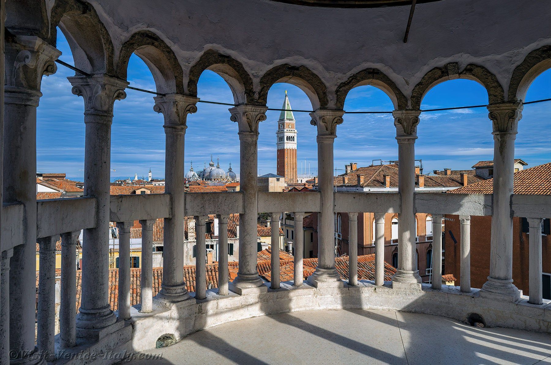
## Description Scala Contarini del Bovolo is one of those Venice attractions that feels almost secret, even though it has become increasingly known among travelers who enjoy architecture and quieter city experiences. Its fame comes from the extraordinary spiral staircase wrapped around the exterior of the building, rising like a stone shell above the narrow streets of the city. The staircase is the defining image, but the true appeal is the way it combines elegance, surprise, and Venetian craftsmanship in one compact site. The word “bovolo” refers to a snail shell in Venetian dialect, and that name makes perfect sense once you stand in front of the structure. The staircase coils upward in a graceful helix, creating one of the most photogenic details in all of Venice. Unlike the grand tourist corridors around St. Mark’s Square and the Rialto Bridge, this attraction feels tucked away and intimate. That sense of discovery is part of what makes it special. You are not just seeing another palace exterior; you are encountering a design that rewards curiosity and close attention. Another reason the Scala Contarini del Bovolo matters is that it represents a different side of Venice. Many visitors come for canals and churches, but this site shows how the city’s private palaces could also be architectural statements. The stair tower itself is a visual bridge between medieval urban density and Renaissance taste for ornament and order. A lesser-known fact is that the staircase became famous not only because it is beautiful, but because it is unusual in a city where vertical, exterior stair structures are relatively rare compared with the canals and façades that usually dominate the skyline. The experience is best when you take your time. From outside, the staircase already looks distinctive, but going inside and climbing it gives you a more complete sense of the building’s scale and perspective. As you ascend, the geometry changes and the city reveals itself through narrow openings, which creates a memorable transition from enclosed courtyard space to elevated views. It is a small attraction, but one that lingers in memory because it feels like a compact lesson in Venetian design. ## Location Scala Contarini del Bovolo is in Venice, Italy, in the historic center not far from the San Marco area and within walking distance of key inner-city landmarks. Its position in the dense urban fabric of Venice means it is easy to overlook unless you are specifically looking for it, which is part of the charm. The simplest way to reach it is on foot from the San Marco or Rialto area. Venice’s pedestrian layout makes walking the natural choice, and the staircase is best approached as part of a wandering route through the city rather than as a stand-alone destination by vehicle. If you are arriving by vaporetto, get off at a nearby stop such as Rialto or San Marco and continue on foot using a map, because the final approach takes you through small streets and passages that are easier to navigate slowly. Because Venice can be crowded, it is worth planning this visit during a quieter part of the day. Early morning or later afternoon can make the approach more pleasant and give you better photos without too many people around the staircase itself. ## Tips Bring a charged phone or camera, because the staircase is one of those details that rewards multiple angles. A shot from below captures the full spiral, while higher viewpoints show the contrast between the tower and the surrounding rooftops. Wear comfortable shoes. The site is small, but the walk through Venice often adds up to more steps than expected. The surrounding streets are also easier to enjoy when you are not rushed. Allow the visit to be part of a larger walking day rather than an isolated stop. It pairs well with nearby palaces, squares, and canal crossings, and that combination makes the city feel more layered. If you are interested in architecture, this is one of the most worthwhile short visits in Venice because it delivers a strong visual identity without requiring a major time commitment. ## Conclusion Scala Contarini del Bovolo is a compact but unforgettable Venetian landmark, known for its elegant spiral staircase and hidden location. It is a perfect stop for travelers who enjoy distinctive architecture and the quieter side of Venice. ## FAQ **Why is the Scala Contarini del Bovolo famous?** It is best known for its exterior spiral staircase, one of the most unusual and photogenic architectural details in Venice. **How long does a visit take?** Usually not long. Many visitors spend around thirty to sixty minutes, depending on how much time they spend taking photos and enjoying the views. **Is it easy to find?** It can be a little tricky because it is tucked into Venice’s narrow streets, so navigation by map is useful. **Is it good for photography?** Yes. The staircase itself and the elevated views from the structure both make it a strong photo stop. **Should I book in advance?** It is wise to check current opening arrangements before visiting, especially during busy travel periods. ## Links - [Wikipedia](https://en.wikipedia.org/wiki/Scala_Contarini_del_Bovolo)
GemVoyage Team • World
Kyoto
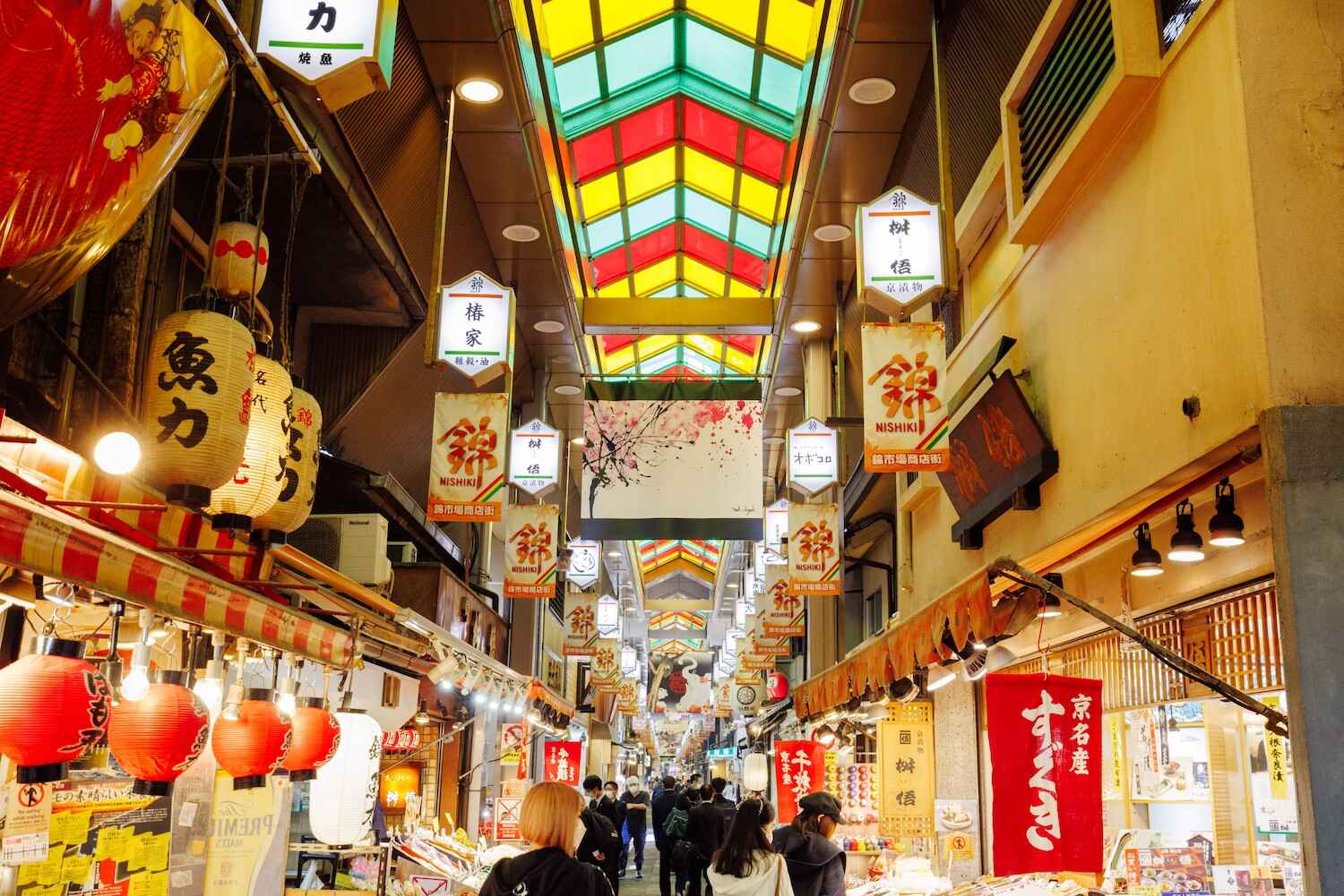
## Description Nishiki Market, often called **“Kyoto’s Kitchen”**, is one of the most famous traditional markets in Japan. Stretching about 400 meters through the heart of Kyoto, this lively covered arcade is lined with more than 120 shops and stalls, each offering a unique slice of local culture. From fresh seafood and seasonal produce to traditional sweets, pickles, and kitchenware, Nishiki Market provides an authentic experience of Kyoto’s culinary heritage. What makes Nishiki Market truly unique is its focus on local and specialty products. Many of the vendors have been running family businesses for generations, preserving recipes and traditions that date back hundreds of years. As you wander through, you’ll notice the atmosphere is both bustling and intimate—a blend of locals doing their shopping and tourists sampling delicacies for the first time. A little-known fact is that Nishiki Market dates back to the early **14th century**, making it more than 700 years old. It originally started as a wholesale fish market before expanding into a diverse food street. Another interesting detail is that some stalls offer free samples, encouraging visitors to try everything from roasted chestnuts to unusual treats like octopus stuffed with quail eggs. ## Location Nishiki Market is located in **Kyoto**, within the **Kansai region** of **Japan**. More precisely, it lies in the **downtown Nakagyo Ward**, running parallel to Shijo Street and between Teramachi and Takakura streets. Its central location makes it easy to access and an ideal stop while exploring other nearby attractions such as Gion, Pontocho Alley, and Nishiki Tenmangu Shrine. How to get there: * **By subway:** Take the Karasuma Line to **Shijo Station** or the Tozai Line to **Karasuma Oike Station**, then walk about 5–10 minutes. * **By bus:** Several Kyoto City buses stop near Shijo Street, providing easy access from other parts of the city. * **By taxi:** A taxi is convenient if you’re traveling with luggage or staying outside the downtown area. Because of its central location, Nishiki Market can easily be combined with a day of shopping in Shijo-Kawaramachi or sightseeing in Gion. ## Tips To fully enjoy Nishiki Market, here are some practical tips for visitors: 1. **Go early or late** – The market can get crowded around midday, so visiting in the morning or late afternoon offers a more relaxed experience. 2. **Try local specialties** – Don’t miss Kyoto delicacies like yuba (tofu skin), tsukemono (pickles), fresh mochi, and matcha-flavored treats. 3. **Bring cash** – While larger shops may accept cards, many stalls are cash-only. 4. **Respect the “no eating while walking” rule** – Many stalls ask customers to eat food in designated areas instead of while walking through the market. 5. **Plan for at least an hour** – With so many shops and food stalls to explore, allow enough time to browse and taste at leisure. 6. **Combine with nearby attractions** – After exploring the market, visit Nishiki Tenmangu Shrine, which sits at the eastern end of the street. ## Conclusion Nishiki Market is more than just a shopping street—it’s a living museum of Kyoto’s culinary traditions. With its centuries-old history, diverse food offerings, and lively atmosphere, the market provides visitors with an unforgettable journey into the flavors and culture of Japan’s ancient capital. Whether you’re sampling street food, buying souvenirs, or soaking in the ambiance, Nishiki Market is a must-visit destination in Kyoto. ## FAQ **1. What is Nishiki Market famous for?** Nishiki Market is known as “Kyoto’s Kitchen,” offering traditional foods, local specialties, and cultural goods that represent the essence of Kyoto’s culinary heritage. **2. What are the opening hours of Nishiki Market?** Most shops open around 9:00 AM and close by 6:00 PM, though hours vary by vendor. It’s best to visit during the daytime. **3. Is Nishiki Market free to enter?** Yes, entry is free. You only pay for the food or items you buy. **4. How long does it take to walk through Nishiki Market?** The market itself can be walked in 20–30 minutes, but most visitors spend 1–2 hours browsing, eating, and shopping. **5. Is Nishiki Market suitable for vegetarians?** Yes, while many stalls sell seafood and meat, there are plenty of vegetarian options like tofu, yuba, pickles, and sweets. **6. Can I buy souvenirs at Nishiki Market?** Absolutely. In addition to food, the market has shops selling kitchenware, chopsticks, ceramics, and traditional Kyoto crafts. ## Links * [Kyoto Official Travel Guide](https://kyoto.travel) * [Japan National Tourism Organization](https://www.japan.travel)
GemVoyage Team • World

Comments