GemVoyage Team • World
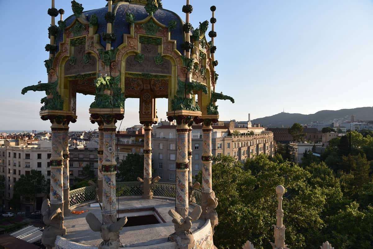
Torre Andreu, more commonly known as La Rotonda, is one of Barcelona’s most distinctive yet often overlooked pieces of Modernisme architecture. Located at the upper edge of the city near the foothills of Tibidabo, this circular, turreted building looks more like a fairytale castle than a residential structure, making it one of the most visually unusual landmarks in Barcelona.
The building was originally constructed in 1906 as a luxury private residence for a wealthy industrial family at a time when Barcelona’s elite were moving uphill away from the dense urban core. Its architectural language reflects the late phase of Catalan Modernisme, but with a lighter, more playful character than the monumental works of Gaudí. The structure’s curved form, decorative balconies, stained glass, floral stonework, and rooftop tower give it a whimsical, almost theatrical presence.
What truly sets La Rotonda apart is its cylindrical layout, which is extremely rare in Barcelona’s residential architecture. While most Modernist buildings rely on flat façades and vertical symmetry, Torre Andreu embraces a soft, flowing geometry that produces constantly shifting perspectives as you walk around it. From different angles, the building seems to change character—from grand to intimate, from playful to mysterious.
After serving as a private mansion, the building was later transformed into a luxury hotel, gaining the nickname “La Rotonda” due to its circular shape. Over the decades, it hosted visiting elites, business figures, and international guests. Its decline began in the late 20th century as the area lost its tourism focus, and the building passed through phases of limited use, abandonment, and restoration attempts.
A little-known fact is that Torre Andreu spent many years in a state of legal and architectural limbo, with disputes over ownership and protection status delaying proper restoration. Another lesser-known detail is that its rooftops once hosted social gatherings with views stretching across the entire city and toward the Mediterranean, making it one of the most exclusive view points in pre-war Barcelona.
Today, La Rotonda stands as a symbol of architectural memory suspended between preservation and neglect. While parts of the structure have undergone restoration at different times, it remains largely inaccessible to the public. Despite this, it continues to attract architects, photographers, and urban explorers who see it as a ghost of Barcelona’s upper-class expansion era, frozen between past luxury and uncertain future use.
Emotionally, Torre Andreu is a place of contrast. It feels playful yet melancholic, elegant yet isolated. It reminds visitors that not all architectural masterpieces sit in crowded tourist centers—some survive quietly at the city’s edges, waiting to be rediscovered.
Torre Andreu (La Rotonda) is located in the Sant Gervasi–La Bonanova area, near the start of Avinguda del Tibidabo, one of Barcelona’s most elegant upper-city avenues.
City: Barcelona
Region: Catalonia (Catalunya)
Country: Spain
District: Sarrià-Sant Gervasi
Nearby Landmark: Plaça Kennedy
This location places La Rotonda along a scenic route that connects the city to Tibidabo Mountain, the funicular, and the upper residential quarters.
Torre Andreu (La Rotonda) is one of Barcelona’s most unusual Modernist buildings—playful in form, dramatic in history, and quiet in presence. Once a symbol of luxury living at the city’s upper edge, it now stands as a reminder that architectural brilliance does not always remain in the spotlight. For those willing to explore beyond the standard tourist circuit, La Rotonda offers a rare encounter with Barcelona’s forgotten elegance and unresolved heritage.
1. Why is Torre Andreu called “La Rotonda”?
Because of its distinct circular shape, which is rare in Barcelona’s residential architecture.
2. Can visitors go inside La Rotonda?
No. It is not generally open to the public and is viewed from the exterior only.
3. Who designed Torre Andreu?
It was designed in the early 20th century in the Catalan Modernisme style, attributed to architect Adolf Ruiz i Casamitjana.
4. Was it always a hotel?
No. It was originally built as a private luxury residence and later converted into a hotel.
5. Is Torre Andreu protected as a heritage site?
Yes. It is recognized as part of Barcelona’s protected architectural heritage, though restoration has been slow.
6. How long does a visit typically take?
About 10 to 20 minutes, mainly for observation and photography.
Discover more hidden gems you might love.
Laos
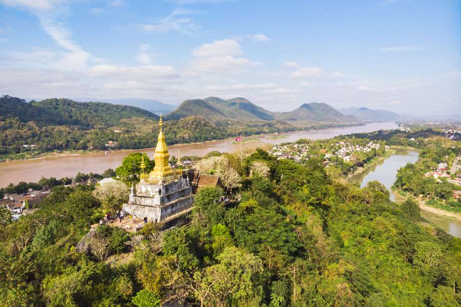
## Description Phou Si, often referred to as Mount Phou Si or Phu Si, is a sacred hill that rises 100 meters above the UNESCO World Heritage city of Luang Prabang in Laos. It’s not just a geographical landmark—it’s a spiritual and cultural centerpiece that offers panoramic views, serene temples, and a glimpse into the soul of Lao Buddhism. The name “Phou Si” translates to “Sacred Hill,” and true to its name, it’s dotted with shrines, Buddha statues, and two prominent temples: Wat Tham Phou Si halfway up, and Wat Chom Si at the summit. The climb to the top involves ascending over 300 steps, but the reward is a breathtaking 360-degree view of Luang Prabang, the Mekong and Nam Khan rivers, and the surrounding jungle-clad mountains. Along the way, saffron-robed monks stroll the leafy paths, incense drifts through the air, and small altars invite quiet reflection. A little-known fact: legend has it that a powerful Naga (a mythical serpent deity) once lived on the hill, adding a mystical layer to its spiritual significance. Another hidden treasure is a small chapel said to house a footprint of the Buddha, tucked along one of the stairways—a detail often missed by hurried visitors. ## Location Phou Si is located in **Laos**, within the **Luang Prabang Province**, in the city of **Luang Prabang**. It sits in the heart of the old town peninsula, bordered by the Mekong River on one side and the Nam Khan River on the other. ### How to Get There: - **By Foot**: Most visitors reach Phou Si by walking from nearby attractions like the Royal Palace Museum or the Night Market. The two main stairways are accessible from Sisavangvong Road and Thanon Phousi. - **By Tuk-Tuk**: If you're staying farther out, a tuk-tuk can drop you off at either entrance. - **By Bicycle**: Luang Prabang is bike-friendly, and cycling to the base of Phou Si is a scenic option. Its central location makes it an easy and essential stop on any Luang Prabang itinerary. ## Tips for Visitors To make the most of your visit to Phou Si, consider these tips: - **Go for Sunset**: The summit offers one of the best sunset views in Laos. Arrive early to secure a good spot—it's popular! - **Bring Water**: The climb can be steep and humid, especially in the afternoon. Hydration is key. - **Wear Comfortable Shoes**: The stairways are uneven in places, so sturdy footwear is recommended. - **Respect the Sacredness**: Dress modestly and be mindful of local customs. Offerings like incense and flowers are available for purchase along the way. - **Explore Both Routes**: Ascend via the Nam Khan side for scenic statues and descend via the Royal Palace side for a shorter walk. - **Entrance Fee**: Expect to pay around 20,000 Kip (~$2.50 USD), collected halfway up the hill. ## Conclusion Phou Si is more than just a viewpoint—it’s a spiritual journey, a cultural experience, and a photographer’s dream. With its sacred temples, mythical legends, and sweeping vistas, it captures the essence of Luang Prabang and offers a moment of peace above the city’s gentle bustle. ## FAQ **1. How many steps are there to reach the top of Phou Si?** There are over 300 steps, depending on the route you take—328 from the Royal Palace side and 355 from the Nam Khan side. **2. What is the best time to visit Phou Si?** Sunset is the most popular time, but early morning offers tranquility and cooler temperatures. **3. Is there an entrance fee?** Yes, the fee is approximately 20,000 Kip, payable halfway up the hill. **4. Can children climb Phou Si?** Yes, but supervision is recommended due to the steep stairways. **5. Are there restrooms or shops at the summit?** No facilities at the top, but vendors sell drinks and offerings near the base. **6. Is Phou Si wheelchair accessible?** Unfortunately, due to the stair-only access, it is not suitable for visitors with mobility issues. ## Links - [Mount Phou Si – Wikipedia](https://en.wikipedia.org/wiki/Phou_Si)
GemVoyage Team • World
Albania
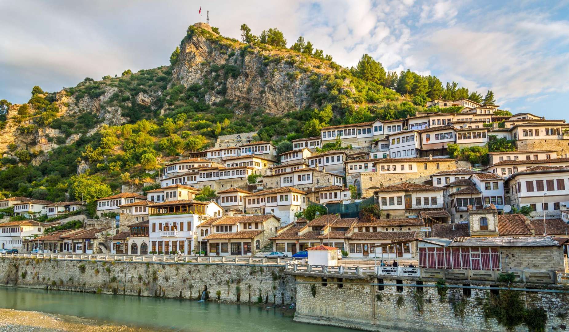
## Description Old Town Berat, often called the “City of a Thousand Windows,” is one of Albania’s most captivating historical destinations. Recognized as a UNESCO World Heritage Site, Berat is a living museum of Ottoman architecture, Byzantine churches, and layered cultural heritage. The town’s name is believed to derive from the Slavic “Beligrad,” meaning “white city,” and its origins trace back to the 6th century BC as the Illyrian settlement of Antipatrea. What makes Old Town Berat unique is its harmonious blend of religious and architectural diversity. The town is divided into three main quarters: Kala (the castle district), Mangalem (the Muslim quarter), and Gorica (the Christian quarter). Each area offers a distinct character, yet together they form a cohesive and picturesque whole. The iconic white Ottoman houses, stacked on the hillsides with large windows facing outward, give the town its poetic nickname and create a stunning visual symmetry. A little-known fact: Berat Castle is still inhabited. Unlike many European castles that serve solely as tourist attractions, locals live within its ancient walls, maintaining a vibrant community among Byzantine churches and Ottoman mosques. Another fascinating detail is the Onufri Museum, housed in the Church of the Dormition of St. Mary, which showcases the works of Onufri, a 16th-century Albanian iconographer known for his vivid use of color and gold. ## Location Old Town Berat is located in **Albania**, in the **Berat County**, within the **city of Berat**. It lies in central Albania, nestled along the banks of the Osum River and surrounded by the Tomorr Mountains. ### How to Get There - **By Bus**: From Tirana, minibuses depart regularly from the South and North Bus Terminals. The journey takes about 2.5 to 3 hours. - **By Car**: Driving from Tirana or other major cities is straightforward, with well-marked roads leading to Berat. The drive offers scenic views of the Albanian countryside. - **By Tour**: Many day tours from Tirana include transportation and guided visits to Berat’s key attractions. - **By Foot**: Once in Berat, the Old Town is best explored on foot. Cobblestone streets and narrow alleys connect the historic quarters. Its central location makes Berat an ideal base for exploring southern Albania’s natural and cultural sites. ## Tips - **Wear Comfortable Shoes**: The cobbled streets and steep paths, especially in the castle district, require sturdy footwear. - **Visit Early or Late**: To avoid crowds and enjoy the best light for photography, explore the Old Town in the morning or late afternoon. - **Stay Overnight**: Spending a night in a traditional guesthouse allows you to experience the town’s quiet charm after day-trippers leave. - **Try Local Cuisine**: Berat is known for its hearty Albanian dishes. Don’t miss specialties like stuffed peppers, lamb with yogurt, and homemade raki. - **Respect Religious Sites**: Many churches and mosques are still active. Dress modestly and ask before taking photos inside. - **Explore Beyond the Town**: Nearby attractions like Osum Canyon and Bogove Waterfall make excellent day trips. ## Conclusion Old Town Berat is a timeless blend of history, architecture, and cultural harmony. With its layered past, stunning vistas, and welcoming atmosphere, it offers a deeply enriching experience for travelers seeking authenticity in Albania. ## FAQ **1. Is there an entrance fee to visit Old Town Berat?** No, the Old Town itself is free to explore. Specific sites like the Onufri Museum or Berat Castle may charge small entrance fees. **2. How long should I spend in Berat?** A full day is enough to see the highlights, but staying overnight allows for a more relaxed and immersive experience. **3. Is Berat suitable for children?** Yes, though supervision is needed in areas with steep paths and uneven terrain. **4. Are guided tours available?** Yes, local guides offer walking tours that include historical insights and visits to key landmarks. **5. What is the best time of year to visit?** Spring and autumn offer mild weather and fewer crowds. Summer is popular but can be hot. **6. Can I stay inside the castle?** Yes, some guesthouses are located within the castle walls, offering a unique lodging experience. ## Links - [Old Town Berat – Albania Turism Overview](https://albaniaturism.com/old-town-berat-unesco-discovery/)
GemVoyage Team • World
Berlin
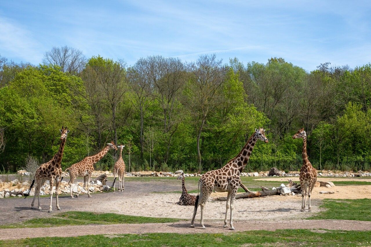
## Description Tierpark Berlin is one of the most impressive zoological parks in Europe and a standout attraction in the German capital. Unlike traditional city zoos, Tierpark Berlin is designed as a vast landscape park where animals live in spacious, naturalistic enclosures spread across rolling lawns, wooded areas, and historic parkland. With more than 160 hectares to explore, it offers a relaxed and immersive experience that feels closer to a nature reserve than a conventional zoo. What makes Tierpark Berlin truly unique is its scale and setting. It is the largest zoo in Europe by area, allowing animals such as elephants, giraffes, bison, and big cats to roam in environments that closely resemble their natural habitats. A little-known fact is that the zoo is located on the former grounds of Friedrichsfelde Palace, an 18th-century baroque residence that still stands at the heart of the park and is open to visitors. Another lesser-known detail is that Tierpark Berlin was established in 1955 in what was then East Berlin, serving as the counterpart to Zoo Berlin in the western part of the city during the Cold War. Today, Tierpark Berlin combines animal conservation, education, and leisure, making it especially appealing for families, nature lovers, and visitors seeking a slower-paced zoo experience. ## Location Tierpark Berlin is located in **Germany**, in the city-state of **Berlin**, within the **Lichtenberg** district. It lies in the eastern part of the city, surrounded by residential neighborhoods and green spaces. Getting there is simple using public transportation. The most convenient option is the U-Bahn (metro): take Line U5 to **Tierpark** station, which exits directly in front of the main entrance. Several bus and tram lines also stop nearby. For visitors traveling by car, parking is available close to the entrances, though public transport is generally the easiest and most efficient way to reach the zoo. ## Tips * Allow plenty of time for your visit; exploring Tierpark Berlin properly can take four to six hours or more. * Wear comfortable walking shoes, as distances inside the park are long. * Consider renting a wagon or using the park’s internal transport options if visiting with small children. * Bring snacks or enjoy one of the on-site cafés and restaurants, especially during longer visits. * Visit on weekdays or outside school holidays to enjoy a quieter atmosphere. * Check feeding times and animal talks in advance for a more educational experience. ## Conclusion Tierpark Berlin offers a unique zoo experience defined by space, greenery, and a strong focus on animal welfare. Its combination of wildlife, historic surroundings, and relaxed atmosphere makes it one of Berlin’s most rewarding attractions for visitors of all ages. ## FAQ **How is Tierpark Berlin different from Zoo Berlin?** Tierpark Berlin is much larger and more spacious, focusing on landscape-style enclosures, while Zoo Berlin is more compact and centrally located. **How long does a visit usually take?** Most visitors spend between four and six hours, though a full day is ideal for seeing everything at a relaxed pace. **Is Tierpark Berlin suitable for children?** Yes, it is very family-friendly, with playgrounds, open spaces, and child-focused facilities. **Is the zoo accessible for people with limited mobility?** Yes, the park has wide paths and is generally accessible, though the large size may require planning. **Can I visit Tierpark Berlin year-round?** Yes, the zoo is open throughout the year, with seasonal highlights in every season. ## Links * [Tierpark Berlin Official Website](https://www.tierpark-berlin.de) * [Visit Berlin Official Tourism Website](https://www.visitberlin.de)
GemVoyage Team • World
Tokyo
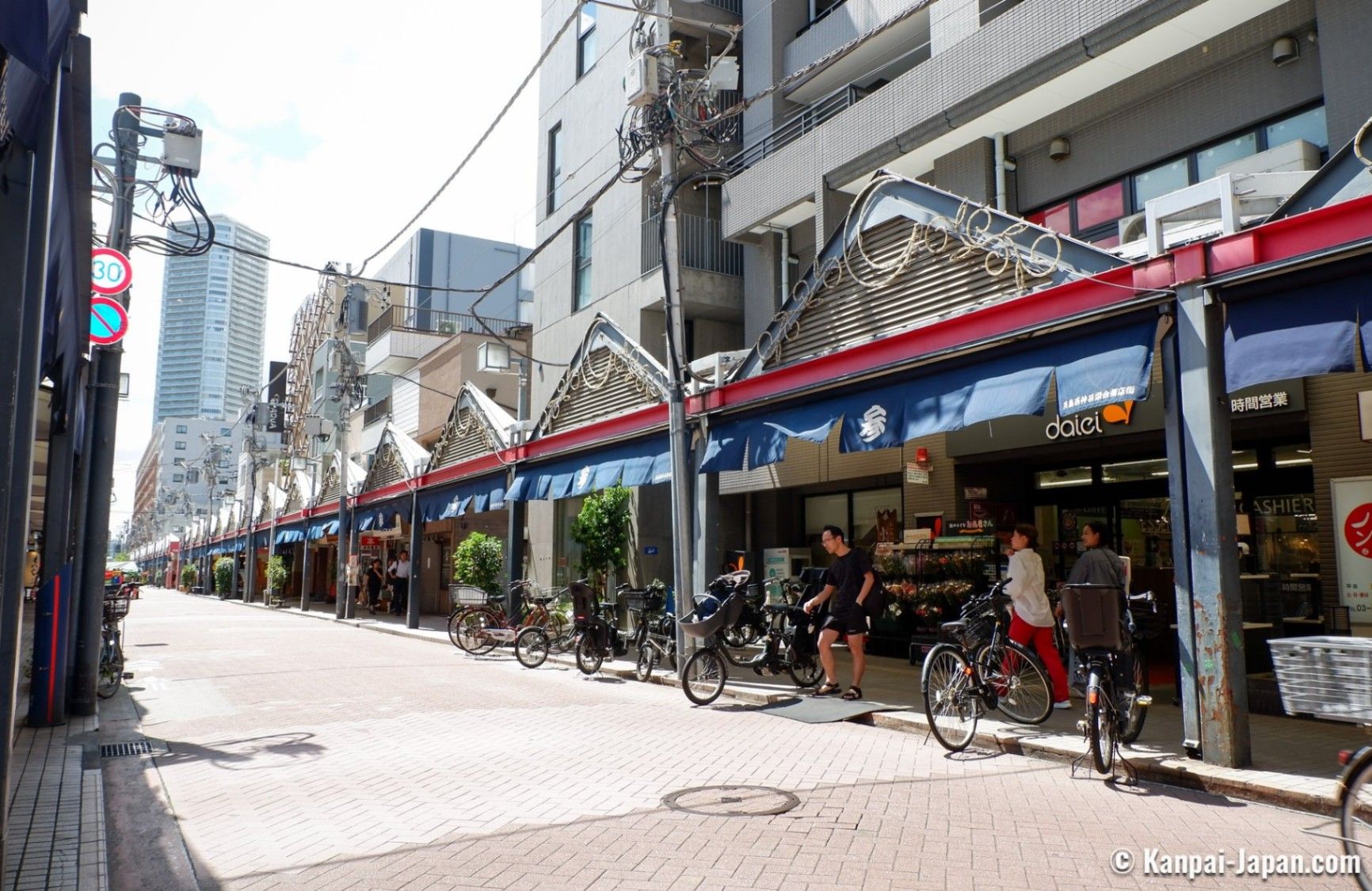
## Description Tsukishima Monja Street, known in Japanese as 月島もんじゃストリート, is one of Tokyo’s most distinctive and food-focused streets, celebrated as the birthplace and spiritual home of monjayaki. Stretching for several hundred meters and lined with dozens of specialized restaurants, the street offers an immersive culinary experience centered on this savory, pan-cooked dish that is especially popular in Tokyo’s downtown areas. Visiting Tsukishima Monja Street is not just about eating; it is about participating in a local tradition that brings people together around the grill. What makes Tsukishima Monja Street unique is the sheer concentration of monjayaki restaurants, many of which have been operating for generations. Each establishment offers its own variations, secret sauces, and ingredient combinations, ranging from classic cabbage and seafood to more modern versions with cheese or spicy flavors. A little-known fact is that Tsukishima developed rapidly after the Great Kanto Earthquake of 1923, and monjayaki became popular as an affordable, filling meal during reconstruction. Another lesser-known detail is that some restaurants still use original family recipes passed down since the early Shōwa period, preserving flavors that have largely disappeared elsewhere in Tokyo. The lively atmosphere, sizzling grills, and nostalgic touches make Tsukishima Monja Street a must-visit for food lovers seeking an authentic Tokyo experience. ## Location Tsukishima Monja Street is located in **Japan**, in the **Tokyo Metropolis**, within the **Chūō Ward** of **Tokyo**. The street runs near Tsukishima Station, close to the Sumida River and Tokyo Bay area. Getting there is easy using public transportation. Visitors can take the Tokyo Metro Yurakucho Line or the Toei Oedo Line to **Tsukishima Station**. From Exit 7, Monja Street is just a short walk away. The area is also accessible by bus or on foot from nearby neighborhoods such as Kachidoki. Due to limited parking, public transport is strongly recommended. ## Tips * Visit in the evening when the street is most lively and the restaurants are fully open. * If you have never tried monjayaki before, choose a restaurant where staff will help cook or explain the process. * Expect casual seating and shared grills; monjayaki is a social dining experience. * Bring cash, as some smaller restaurants may not accept credit cards. * Be prepared for queues during weekends and holidays, especially at well-known restaurants. * Avoid wearing clothes that easily absorb smells, as the cooking process produces strong aromas. ## Conclusion Tsukishima Monja Street offers a flavorful and cultural journey into one of Tokyo’s most beloved local dishes. With its rich history, welcoming atmosphere, and endless variations of monjayaki, it stands out as a unique culinary destination that captures the spirit of old-town Tokyo. ## FAQ **What is monjayaki?** Monjayaki is a savory Japanese dish similar to okonomiyaki but with a runnier batter, cooked directly on a hot griddle at the table. **Do I need to speak Japanese to visit Monja Street?** No, many restaurants are used to tourists, and some offer English menus or visual guides. **How much does a typical meal cost?** Most monjayaki dishes are reasonably priced, typically ranging from moderate to affordable compared to other Tokyo dining areas. **Is Tsukishima Monja Street family-friendly?** Yes, families are welcome, though supervision is needed around the hot grills. **Can I visit during the daytime?** Yes, some restaurants open for lunch, but the street is more vibrant in the evening. ## Links * [Tsukishima Monja Street Official Website](https://www.gotokyo.org/en/spot/85/index.html)
GemVoyage Team • World
Oslo
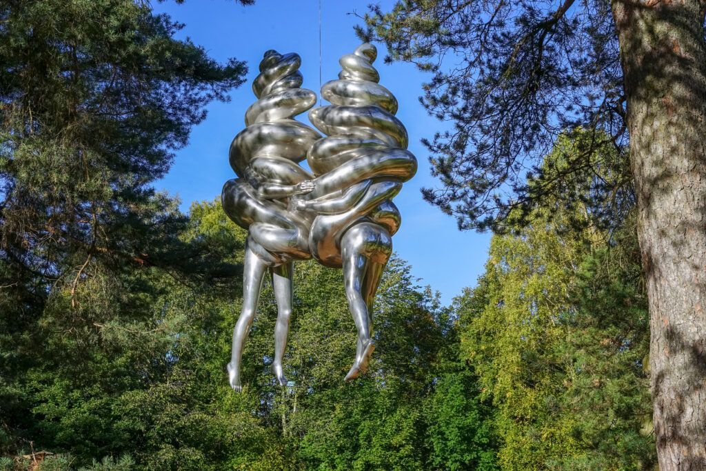
## Description Ekebergparken Sculpture Park is one of Oslo’s most rewarding places to combine contemporary art with open-air exploration. Set on a wooded hill overlooking the city and the Oslofjord, the park mixes sculpture, landscape design, and long walking paths in a setting that feels less like a formal museum and more like an expanded outdoor experience. Visitors come for the art, but many stay for the sweeping views, the quiet forest atmosphere, and the sense that each path can reveal something unexpected. The park’s appeal lies in its variety. One moment you are looking at a monumental sculpture in an open clearing, and the next you are walking through trees where smaller works appear almost discreetly within the landscape. That balance between art and nature gives the park a strong identity. It is also one of the few places in Oslo where you can experience large-scale contemporary sculpture without the pressure of indoor galleries or ticket-driven time limits. The overall effect is relaxed, but it is also carefully curated. One lesser-known aspect of Ekebergparken is that the site has long carried cultural associations beyond its current role as a sculpture park. The hill has been important in Oslo’s history and imagination for centuries, and the park’s placement takes advantage of both the geological terrain and the city views. Another interesting fact is that the park is not only about major names in sculpture; it often rewards visitors who slow down and pay attention to how each work interacts with light, weather, and seasonal changes. A piece that seems subtle in summer can feel dramatically different in winter or at dusk. ## Location Ekebergparken is located in the Ekeberg area of Oslo, Norway, on a hill east of the city center. Its elevated position makes it easy to identify on a map, and the park is accessible from central Oslo without much difficulty. The simplest way to get there is by tram or bus followed by a short uphill walk, though many visitors use taxis or ride-hailing services to save energy for the walking inside the park. If you enjoy city walks, you can also reach the area on foot from central Oslo, but be prepared for a climb. Because the park is spread out, comfortable shoes matter more than almost anything else. ## Tips Wear walking shoes and dress for changing weather, since the park is exposed and conditions can shift quickly. Allow more time than you think you need. The park is best enjoyed slowly, with room for detours and view stops. Bring a camera, but do not rush the experience. Some of the best moments happen when you simply pause at a viewpoint or sit near a sculpture. Visit near sunset if you want the city views at their most dramatic, but note that the park can feel cooler and windier later in the day. Check the park’s current sculpture map or seasonal information before going, since installations and access details can change. ## Conclusion Ekebergparken is one of Oslo’s strongest outdoor cultural experiences, combining sculpture, landscape, and city views in a single memorable walk. ## FAQ ### Is Ekebergparken free to visit? The park itself is generally open as an outdoor public experience, though specific events or facilities may have separate conditions. ### How long should I spend there? Plan at least two to three hours if you want to enjoy both the sculptures and the viewpoints. ### Is Ekebergparken suitable for families? Yes, especially for families that enjoy walking outdoors and exploring art in a relaxed setting. ### What makes the park different from a regular sculpture garden? Its natural setting, large views over Oslo, and integration of art with forest trails make it feel more immersive than a typical sculpture lawn. ### Can I visit in winter? Yes, but dress warmly and expect snowy or slippery paths depending on the season. ## Links - [Official website](https://ekebergparken.com/) - [Ekebergparken on Wikipedia](https://en.wikipedia.org/wiki/Ekebergparken_Sculpture_Park)
GemVoyage Team • World
Graz
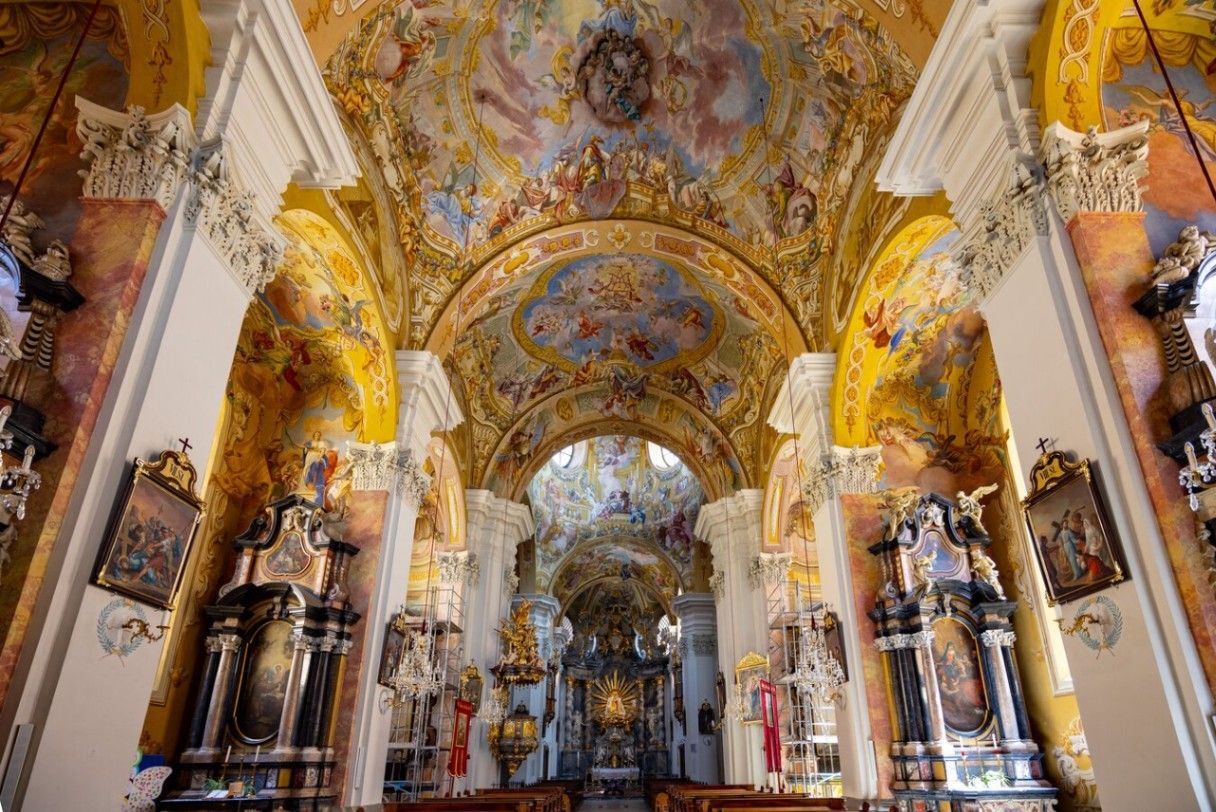
## Description **Basilika Mariatrost** is the most important pilgrimage church in the region of Styria and one of the most visually striking religious landmarks in Graz. Perched on a hill overlooking the eastern edge of the city, the basilica is a masterpiece of **Austrian Baroque architecture**, instantly recognizable by its twin towers and commanding elevated position. More than a place of worship, it represents centuries of faith, healing traditions, and regional identity. Construction of the basilica began in the early 18th century under the patronage of the Pauline Order, following reports of miraculous healings associated with a statue of the Virgin Mary. The church was intentionally built high above the surrounding landscape, reinforcing its role as a spiritual refuge removed from everyday life. Its grand staircase—over 200 steps long—adds a sense of ritual to the approach, turning the journey itself into part of the pilgrimage experience. Inside, the basilica is richly decorated with frescoes, gilded altars, and intricate stucco work. The high altar frames the revered **Marian statue**, the spiritual heart of the church. One lesser-known fact is that the church temporarily lost its religious function during Emperor Joseph II’s reforms in the late 18th century and was repurposed before later being restored as a pilgrimage site. Another notable detail is that Mariatrost was elevated to the status of a **minor basilica** by the Vatican in 1999, recognizing its historical and spiritual significance. Despite its religious importance, Basilika Mariatrost is also appreciated for its **panoramic views**, serene atmosphere, and harmonious integration with the surrounding greenery. It attracts pilgrims, architecture enthusiasts, photographers, and visitors seeking quiet contemplation. ## Location **Country:** Austria **Region:** Styria **City:** Graz **District:** Mariatrost The basilica is located in the **northeastern part of Graz**, on a wooded hill that rises above the Mariatrost district. ### How to Get There * **By tram:** * Take **Tram Line 1** from Graz city center to the final stop, **Mariatrost**. From there, it is a short walk to the basilica. * **On foot:** * Walking routes and pilgrimage paths lead uphill from the tram stop. * **By car:** * Accessible by local roads, with limited parking available nearby. * **By bicycle:** * Possible for experienced cyclists, though the ascent can be steep. ## Tips * **Climb the staircase at least once:** It enhances the sense of arrival and offers changing views. * **Visit in the morning or late afternoon:** The light is softer, and the atmosphere is quieter. * **Dress respectfully:** The basilica is an active place of worship. * **Attend a service if possible:** Music and acoustics add depth to the experience. * **Combine with a walk:** The surrounding area has pleasant walking paths and forest trails. * **Photography is best outside:** Interior photography may be restricted during services. ## Conclusion Basilika Mariatrost is both a spiritual landmark and an architectural highlight of Graz. Its elevated position, Baroque elegance, and centuries-old pilgrimage tradition make it a meaningful destination for visitors seeking history, culture, and calm above the city. ## FAQ **1. Why is Basilika Mariatrost important?** It is the most significant pilgrimage church in Styria, centered around devotion to the Virgin Mary. **2. Is there an entrance fee?** No. Entry to the basilica is free. **3. How long should I plan for a visit?** Around **45 minutes to 1.5 hours**, depending on whether you attend a service or explore the surroundings. **4. Is the basilica accessible for people with limited mobility?** Yes, though the main staircase is steep; alternative access routes are available. **5. Can tourists visit during services?** Yes, but visitors should remain respectful and avoid photography. **6. What is the best time of year to visit?** Spring and early autumn offer pleasant weather and clear views. ## Links * [Official Graz tourism site](https://www.graztourismus.at)
GemVoyage Team • World

Comments