GemVoyage Team • World
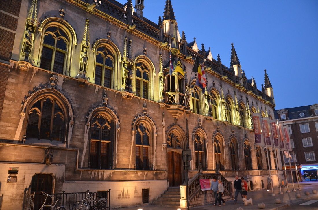
Courtrai City Hall, known locally as Historisch Stadhuis Kortrijk, is one of the most architecturally layered civic buildings in Belgium. Rather than being the product of a single era, the City Hall is a composite structure formed by the gradual integration of several historic buildings, most notably the medieval Cloth Hall and later Renaissance and Baroque additions. This architectural layering makes it a visual record of Kortrijk’s political, economic, and cultural evolution.
The origins of the complex date back to the 14th and 15th centuries, when Kortrijk was a prosperous center of the Flemish cloth trade. The Cloth Hall section symbolized the city’s commercial power and autonomy, while later expansions reflected its growing administrative role. Over time, stylistic elements ranging from Gothic verticality to Renaissance symmetry were added, resulting in a façade that is rich, complex, and deliberately expressive of civic pride.
What makes Courtrai City Hall particularly distinctive is its ornamental façade, decorated with statues representing Flemish counts and historical figures associated with the region. These sculptures were not merely decorative; they were political statements asserting local identity and authority during periods of regional tension. A lesser-known fact is that several statues visible today are 19th-century restorations, replacing originals that were damaged or lost during conflicts and urban changes. Another interesting detail is that parts of the interior were adapted multiple times to accommodate shifting administrative needs, meaning some rooms combine medieval proportions with later decorative finishes.
Beyond its architectural value, the City Hall has remained a living institution. Unlike many historic civic buildings that function solely as museums, it continues to host municipal activities, official ceremonies, and cultural events. This continuity reinforces its role not just as a monument, but as an active participant in the city’s daily life.
Country: Belgium
Region: Flanders
City: Kortrijk
Province: West Flanders
Courtrai City Hall is located in the historic center of Kortrijk, close to key landmarks such as the main square and medieval streets that define the city’s core.
* Kortrijk Station has direct connections to Brussels, Ghent, and Lille. From the station, the City Hall is a 10–15 minute walk.
* Local bus routes stop near the city center, within walking distance of the building.
* Easily accessible when exploring Kortrijk’s historic center.
* Public parking is available nearby, though walking is preferable in the old town.
Courtrai City Hall is a powerful expression of civic identity shaped over centuries. Its layered architecture, historical symbolism, and continued administrative role make it a compelling destination for visitors interested in urban history and Flemish heritage.
1. Is Courtrai City Hall a museum?
No, it is an active municipal building, though some areas may be accessible to visitors.
2. How old is the building?
Its oldest parts date back to the late medieval period, with later additions from subsequent centuries.
3. Can visitors enter the City Hall?
Limited interior access is possible, depending on events and official use.
4. How long should a visit take?
Around 20 to 40 minutes for an exterior and contextual visit; longer if interior access is available.
5. Is it suitable for children?
Yes, particularly for those interested in history and architecture.
6. Is the building accessible?
Accessibility varies due to the historic structure; some areas may have limited access.
Discover more hidden gems you might love.
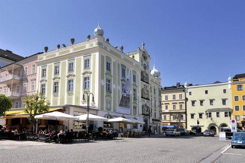
Gmunden
## Description The **Rathaus Gmunden** — the **Town Hall of Gmunden** — is one of Austria’s most charming and picturesque civic buildings, perfectly reflecting the town’s **historic elegance and lakeside serenity**. Standing proudly on the shore of **Traunsee Lake**, surrounded by the scenic peaks of the **Salzkammergut Mountains**, this 16th-century building combines Renaissance architecture, local craftsmanship, and cultural pride in a way few town halls do. Built between **1574 and 1577**, the Rathaus originally served as a **merchant and administrative center** during a period when Gmunden was thriving as a salt-trading hub. Its architecture features a **Renaissance façade** with beautifully arched arcades, intricate window frames, and an elegant clock tower topped with a small bell turret. The building’s exterior is painted in soft pastel hues that harmonize with the lakeside scenery, giving it a warm and inviting appearance. However, what truly makes Rathaus Gmunden stand out — and one of Austria’s most photographed town halls — is its **ceramic carillon** (a set of bells made from Gmunden pottery). Installed in **1961**, this unique feature consists of **24 hand-painted ceramic bells**, crafted by local artisans from the renowned **Gmundner Keramik** workshop, which has been producing distinctive green-flamed pottery since the 17th century. Several times a day, the bells chime melodiously across the old town, filling the air with a sound that has become a symbol of Gmunden’s artistic heritage. Few visitors realize that it is **one of the only ceramic carillons in the world** still in operation — a beautiful fusion of art, music, and tradition. Inside, the Rathaus still functions as the **seat of the local government**, but parts of it are open to visitors, showcasing historical rooms, exhibitions, and cultural displays. The nearby **Rathausplatz (Town Hall Square)** hosts markets, festivals, and outdoor concerts throughout the year, offering a lively glimpse of local life. Whether you visit for its craftsmanship, its lakeside views, or the charm of its daily chimes, Rathaus Gmunden is a small-town treasure that embodies the **soul of the Austrian Alps**. ## Location The **Rathaus Gmunden** is located in the **heart of Gmunden**, a town in **Upper Austria (Oberösterreich)**, on the **northern shore of Lake Traunsee**. **Address:** Rathausplatz 1, 4810 Gmunden, Austria To get there: * **By train:** From **Linz** or **Salzburg**, take an **ÖBB regional train** to **Gmunden Station**, then walk about **10–15 minutes** to the old town. * **By tram:** From the station, you can also take the **Traunseetram**, which stops near Rathausplatz. * **By car:** Easily accessible via the **A1 motorway**, exit **Regau** or **Laakirchen**, with several nearby parking options. * **By boat:** Ferries on **Traunsee Lake** stop at **Gmunden Seebahnhof**, just steps away from the Town Hall. * **By foot or bike:** The promenade around the lake connects the Rathaus to the main attractions of Gmunden, including **Schloss Ort** and the **Esplanade**. ## Tips * **Don’t miss the carillon performance:** The ceramic bells ring several times daily — typically at **11:00 AM**, **3:00 PM**, and **5:00 PM** (check local schedules). * **Visit the Gmundner Keramik Manufaktur:** Just outside town, you can see how the world-famous green-flamed pottery is made — a perfect complement to the Rathaus visit. * **Take photos from the lake promenade:** The Town Hall reflected in the water, with mountains in the background, is one of Austria’s most postcard-worthy views. * **Enjoy the market:** On Fridays, Rathausplatz hosts a **local farmers’ market** selling fresh regional produce, cheese, and crafts. * **Visit nearby Schloss Ort:** A short walk away, this fairytale castle on the lake is another Gmunden highlight. * **Stop for coffee by the lake:** There are several cozy cafés around Rathausplatz with views of the water and the mountains. * **Combine with a boat tour:** Scenic cruises on Traunsee often pass by the Rathaus, offering a new perspective from the lake. ## Conclusion The **Rathaus Gmunden** is far more than a historic building — it’s the **heart of a town steeped in art, tradition, and Alpine beauty**. From its Renaissance architecture to the enchanting ceramic bells that sing across Traunsee, it tells the story of a community that has blended craftsmanship and culture for centuries. Whether you’re exploring the Salzkammergut for its lakes, castles, or peaceful charm, a stop at the Rathaus Gmunden is an experience that captures the very essence of Austrian heritage. ## FAQ **1. When was the Rathaus Gmunden built?** It was constructed between **1574 and 1577** during the height of Gmunden’s salt-trading prosperity. **2. What makes the Rathaus special?** Its **ceramic carillon**, made from locally produced Gmundner pottery, is **one of the few of its kind in the world**. **3. How often does the carillon play?** The bells ring several times daily, typically at **11:00 AM, 3:00 PM, and 5:00 PM**, though times may vary seasonally. **4. Can visitors enter the Rathaus?** Yes, parts of the building are open to visitors, especially during cultural events or exhibitions. **5. Where is Gmunden located?** Gmunden lies on **Lake Traunsee** in **Upper Austria (Oberösterreich)**, roughly halfway between **Linz** and **Salzburg**. **6. Is it easy to reach from Vienna or Salzburg?** Yes — from Vienna or Salzburg, take a train to **Attnang-Puchheim**, then connect to Gmunden via a regional line (total travel time: around **2 hours**). **7. What nearby attractions should I see?** Don’t miss **Schloss Ort**, **Traunsee Lake cruises**, and the **Gmundner Keramik Factory** for a complete cultural experience. ## Links * [Gmunden Tourism Official Website](https://www.gmunden.at)
GemVoyage Team • World
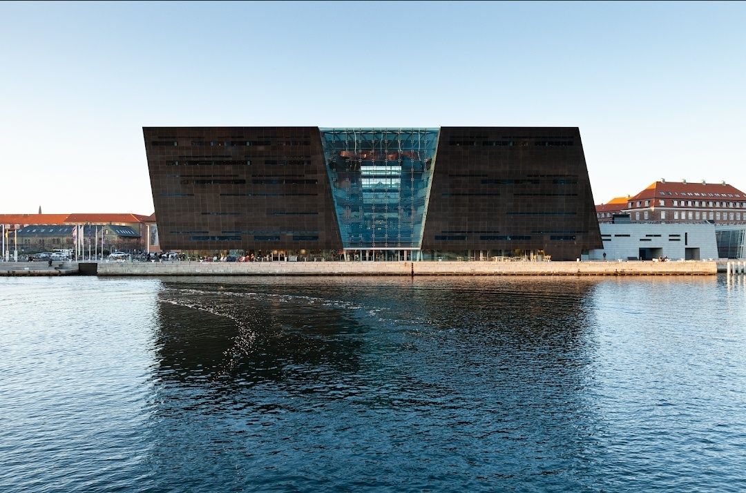
Copenhagen
## Description The **Royal Library in Copenhagen**, also known as **Det Kongelige Bibliotek**, is one of Denmark’s most prestigious cultural landmarks and the largest library in the Nordic countries. Founded in 1648 by King Frederik III, the library houses an extraordinary collection of books, manuscripts, maps, photographs, and historical documents that trace the cultural and intellectual evolution of Denmark and beyond. One of the most striking features of the library is the **Black Diamond**, a modern extension completed in 1999. With its sleek black granite façade reflecting the Copenhagen waterfront, the Black Diamond has become an architectural icon blending tradition with modernity. Inside, visitors find an impressive atrium, reading rooms, exhibition halls, and even a concert hall, making it more than just a library—it is a cultural hub. A little-known fact is that the library holds nearly **all works ever printed in Denmark** since the 17th century, thanks to a legal deposit law. Another fascinating detail is its collection of **rare manuscripts**, including original works by Hans Christian Andersen and Søren Kierkegaard. For book lovers, scholars, and travelers with a passion for culture, the Royal Library offers an unparalleled journey through knowledge and history. ## Location The Royal Library is located in **Copenhagen**, the capital of **Denmark**, situated in the **Zealand region**. The library stands prominently along the **Slotsholmen waterfront**, close to many other historic landmarks, including Christiansborg Palace. Getting there is easy. From the **Copenhagen Central Station**, it’s about a 15-minute walk or a short bus ride. Bicycles are also a popular and convenient option, given the city’s bike-friendly infrastructure. For those arriving by metro, the closest stop is **Christianshavn Station**, which is about a 10-minute walk from the library. Visitors can also arrive by boat, as the Black Diamond has its own harbor bus stop. ## Tips Here are some practical tips to make the most of your visit to the Royal Library in Copenhagen: * **Explore both sections** – Don’t miss the contrast between the historic library building and the modern Black Diamond extension. * **Check exhibitions** – The library frequently hosts exhibitions on art, history, and literature, many of which are free to enter. * **Visit the café** – The Black Diamond Café offers stunning views of the waterfront and is a great spot to relax. * **Attend a concert or lecture** – The library’s concert hall hosts performances and talks, adding an extra cultural dimension to your visit. * **Photography** – While photos are allowed in public spaces, avoid photographing in reading rooms to respect the quiet environment. * **Plan for quiet time** – The library is not just a tourist attraction but also a working library, so visitors should maintain a respectful silence in designated areas. ## Conclusion The **Royal Library in Copenhagen** is more than a place to store books—it is a blend of history, culture, and modern design. With its extensive collections, striking architecture, and cultural events, it offers something for scholars, tourists, and casual visitors alike. Whether you’re drawn by the rare manuscripts, the iconic Black Diamond, or the peaceful reading halls, the Royal Library stands as a testament to Denmark’s dedication to knowledge and cultural heritage. ## FAQ **1. What is the Royal Library in Copenhagen famous for?** It is known for being the largest library in the Nordic countries, housing rare manuscripts, and for its modern Black Diamond extension. **2. Can tourists visit the Royal Library?** Yes, the library is open to the public, and visitors can explore exhibitions, the café, and parts of the building, even without a reader’s card. **3. Is there an entry fee?** General entry is free, though some special exhibitions and events may require a ticket. **4. How much time should I spend at the Royal Library?** A typical visit can take 1–2 hours, though book enthusiasts and exhibition visitors may spend longer. **5. What manuscripts are kept in the Royal Library?** The collection includes works by Hans Christian Andersen, Søren Kierkegaard, medieval manuscripts, and countless rare historical documents. **6. When is the best time to visit?** Weekday mornings are ideal for a quieter experience, while afternoons often bring a livelier atmosphere with events and exhibitions. ## Links * [Royal Library Official Website](https://www.kb.dk) * [Visit Copenhagen – Official Tourism Site](https://www.visitcopenhagen.com)
GemVoyage Team • World
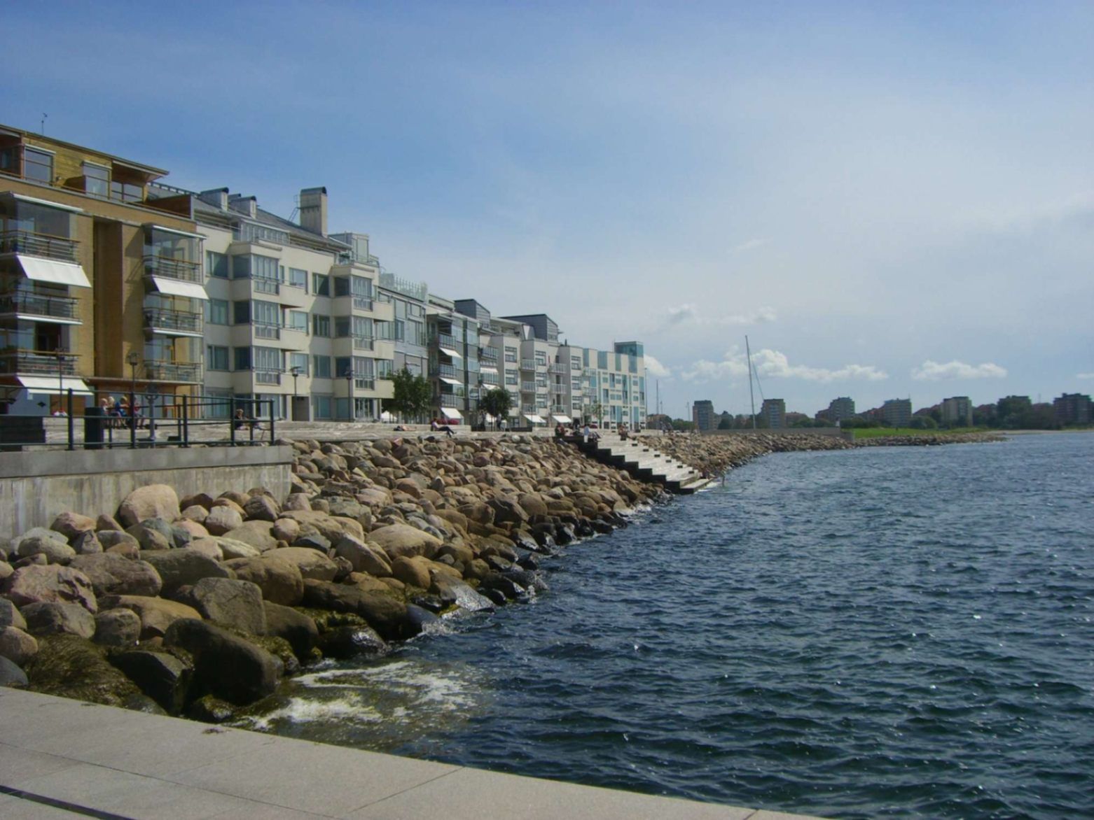
Malmö
## Description Malmö’s promenades—particularly the waterfront walks in areas like **Sundspromenaden** in **Västra Hamnen**—represent a perfect mix of urban design, nature, sea, and Scandinavian minimalist style. These promenades are places to stroll, cycle, relax by the water, take in views across to Denmark, swim, or simply enjoy public space thoughtfully crafted for citizen leisure. What makes them special is how they combine modern architecture, revitalised waterfront land, and ecological awareness. Västra Hamnen itself is a former industrial/harbour area that has been transformed into a sustainable residential and recreational district. The promenade features wooden jetties, platforms for swimming, promenading paths, seating, small cultural touches, and design elements that allow people to use the space in multiple ways—sunbathing, exercising, enjoying views. ([visitsweden.fr][1]) A lesser-known fact: some portions of the promenades have public bathing decks with ladders into the sea, though the water can be quite deep. Also, lighting design (for example, in other Malmö waterfront developments) is intentionally done so that the ambiance at dusk feels safe, warm, and comfortable—even when colder. ([selux.com][2]) ## Location These promenades are located in **Malmö**, a city in **Skåne County** in southern **Sweden**, lying on the coast of the Öresund strait opposite Denmark. Västra Hamnen is the “Western Harbour” district, by the coast. The sundspromenaden waterfront walk is in/near Västra Hamnen. Other promenades like Ribersborg beach promenade are also in the broader coastal edges of Malmö. ([Travelwider][3]) To get there: if you arrive in Malmö by train (e.g. Malmö Central), you can walk, take local buses or tram to Västra Hamnen. Biking is also very good as Malmö is bike-friendly. From Copenhagen, there are trains across the Öresund Bridge; once in Malmö you use local transport or walk depending on which part of the promenade you aim for. ([Erasmusu][4]) ## Tips * **Time your visit for golden hours**: sunrise or sunset bring beautiful light over the water, especially looking toward Öresund and the Öresund Bridge. ([Wanderlog][5]) * **Bring swim gear**: In summer, many promenades have decks, ladders, or stepping points into the sea. If the weather is warm enough, swimming is possible. ([komoot][6]) * **Dress in layers**: The sea breeze can make things cooler, even in summer evenings. For morning walks or late afternoons it might be windy. * **Biking or walking**: Use the paths designed for pedestrians and cyclists. Some stretches are flat and very pleasant. A bike is a great way to cover longer stretches of promenade. * **Check local weather**: Rain or wind can make parts less pleasant; also, sea conditions vary. Be cautious if swimming. * **Explore by sections**: The waterfront promenade isn’t one single piece—various districts (Ribersborg, Västra Hamnen, etc.) offer different vibes (beach-style, urban, architecturally modern). Choose based on what you want: swimming, views, architecture, relaxation. ## Conclusion Malmö’s promenades are a standout example of how a coastal city can turn its sea edges into spaces that are both beautiful and functional. Whether for locals or visitors, they offer calm, recreation, waterfront views, and a chance to experience Malmö’s blend of urban renewal, sustainability, and Scandinavian waterfront charm. A walk here is more than just moving from A to B—it’s an experience of light, water, architecture, and local life. ## FAQ **1. Are the promenades free to access?** Yes, public promenades are free. There is no entrance fee to walk along Västra Hamnen waterfront or to use public seating areas, jetties, etc. **2. Can you swim there?** Yes—in parts. Some sections have bathing platforms, ladders, and wooden jetties. But water can be deep, and conditions (temperature, currents) vary. It’s good to check locally and stay where it’s safe. ([komoot][6]) **3. What is the best time of year to enjoy the promenade?** Late spring through early autumn (May to September) is best, when weather is warm, days are long, and outdoor amenities are most usable. Summer evenings are particularly lovely. Winters are colder and more challenging for outdoor swimming or lounging. **4. Are the promenades suitable for someone with limited mobility or stroller?** Many paths are flat and well-maintained, so promenading/strollers are possible in many places. However, wooden platforms or jetties might have steps or ladders for water access not suitable for all. It’s best to choose accessible sections near Västra Hamnen or Ribersborg. **5. What else can I see or do near the waterfront promenade?** Plenty: architectural highlights like the Turning Torso, cafés and restaurants in Västra Hamnen, parks, local beaches (Ribersborg), views of the Öresund Bridge, outdoor workouts, bike paths, evening walks. The area combines leisure, modern design, and views. **6. How long should I plan to walk to get a good sense of the place?** If you set aside 1-2 hours, you can enjoy a stretch with views, maybe stop for café or swim. For a full exploration of different sections, 3-4 hours or more allows you to experience the variety between Ribersborg, Västra Hamnen, and other promenades. ## Links * [Visit Sweden – Malmö Outdoor & Nature](https://visitsweden.com) * [Malmö City Official Site](https://malmo.se)
GemVoyage Team • World
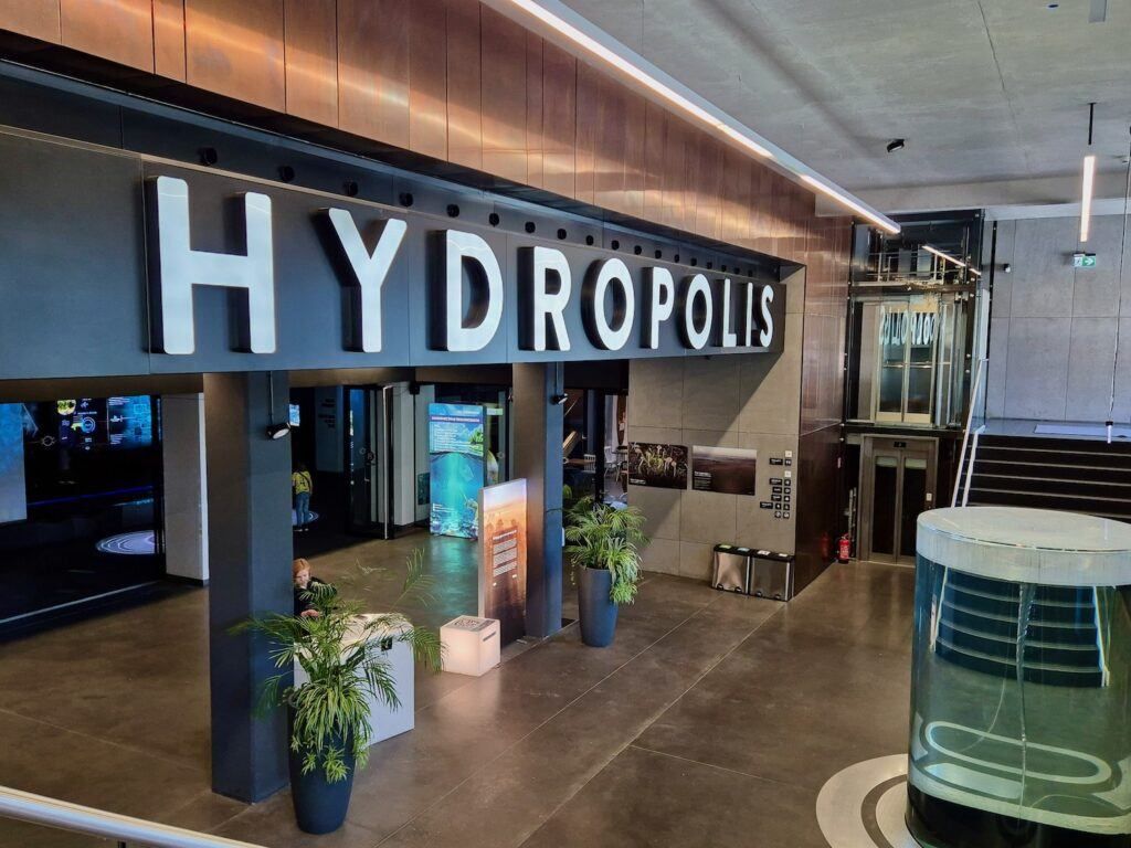
Wroclaw
## Description **Hydropolis** is a modern, science-focused museum in Wrocław dedicated entirely to **water**—its origins, physical properties, role in shaping civilizations, and importance for life on Earth. Opened in 2015, Hydropolis stands out not as a traditional museum of static displays, but as a **fully interactive knowledge center** that combines multimedia installations, scientific exhibits, and immersive environments to explain one of humanity’s most essential resources. Housed inside a **19th-century underground water reservoir**, the museum cleverly connects content and setting. The massive brick structure, once used to store drinking water for the city, now forms a dramatic backdrop for exhibitions that explore oceans, rivers, rainfall, hydraulic engineering, and water management. This reuse of industrial heritage is central to Hydropolis’s identity and adds authenticity to the experience. What makes Hydropolis unique is its **interdisciplinary approach**. Visitors move through themed zones covering topics such as deep-sea exploration, water in the human body, ancient hydraulic systems, modern urban water infrastructure, and global water challenges. High-resolution projections, touchscreens, soundscapes, and scale models keep the content accessible without oversimplifying complex scientific concepts. A lesser-known fact is that the building itself was a **technical masterpiece of its time**, constructed in 1893 and hidden underground to preserve water temperature and pressure. Another interesting detail is that Hydropolis devotes significant space to **Poland’s relationship with water**, including flood control on the Oder River and Wrocław’s long history of bridges, canals, and engineering solutions. Hydropolis appeals to a wide audience: families, students, engineers, and travelers interested in science, sustainability, or innovative museums. ## Location **Country:** Poland **Region:** Lower Silesia **City:** Wrocław Hydropolis is located east of Wrocław’s Old Town, near the **Oder River**, in an area known for cultural institutions and green spaces. ### How to Get There * **By tram:** * Several tram lines stop within walking distance, connecting the site to the Old Town and main railway station. * **By bus:** * City buses serve the surrounding district with frequent service. * **On foot:** * About a 25–30 minute walk from the Market Square (Rynek). * **By car:** * Parking is available nearby, though public transport is often more convenient. ## Tips * **Book tickets in advance:** Time slots can sell out, especially on weekends and during school holidays. * **Allow enough time:** Plan at least **2 to 3 hours** to fully experience all exhibition zones. * **Ideal for families:** Interactive elements are well designed for children and teenagers. * **Read the explanations:** Many exhibits reward careful attention rather than quick browsing. * **Combine with nearby attractions:** The Wrocław Zoo and Centennial Hall are close and make a good same-day itinerary. * **Language accessibility:** Exhibits are available in multiple languages, including English. ## Conclusion Hydropolis is one of Poland’s most innovative museums, transforming a historic water reservoir into a compelling educational space. By blending science, history, and modern technology, it offers a deep yet engaging look at water’s role in shaping the planet and human society, making it a must-visit attraction in Wrocław. ## FAQ **1. What is Hydropolis about?** It is an interactive museum focused entirely on water—its science, history, and global importance. **2. Is Hydropolis suitable for children?** Yes. The exhibits are highly interactive and well-suited for families and school groups. **3. How long does a visit take?** Most visitors spend **2 to 3 hours**. **4. Is there an entrance fee?** Yes. Tickets are required, with discounts for children, students, and families. **5. Is Hydropolis accessible for people with disabilities?** Yes. The facility is designed to be fully accessible. **6. Is it worth visiting if I’m not interested in science?** Yes. The visual design and storytelling make the experience engaging even for non-technical visitors. ## Links * [Official Hydropolis website](https://www.hydropolis.pl) * [Wrocław tourism portal](https://visitwroclaw.eu)
GemVoyage Team • World
Amsterdam
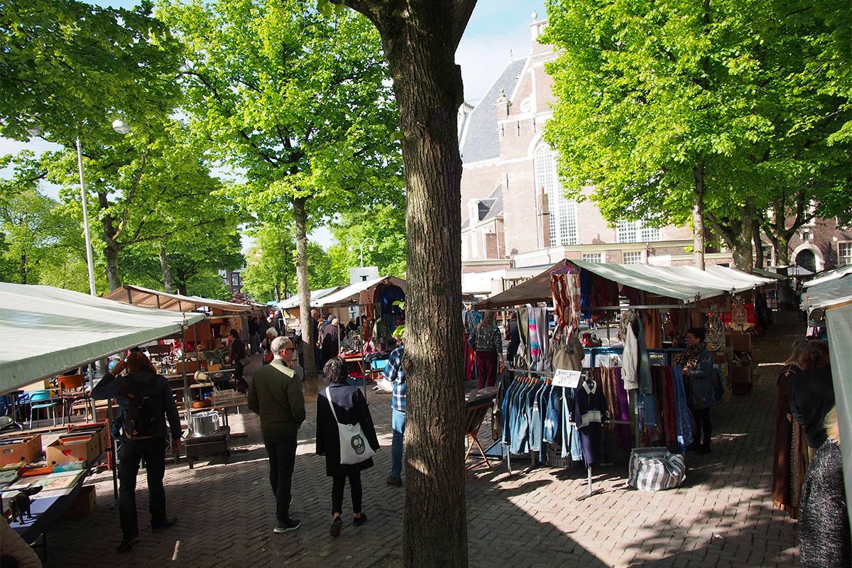
## Description Noordermarkt is one of Amsterdam’s most beloved local market squares, and its reputation comes from how naturally it fits into the fabric of the Jordaan. Rather than feeling like a market created purely for visitors, it feels embedded in neighborhood life. That is a major reason people keep returning. On different days it shifts character: one version is especially known for organic produce, another for antiques and secondhand browsing, but the common thread is a lively, human-scale market atmosphere that reflects Amsterdam at its most practical and convivial. For food travelers, Noordermarkt is a particularly strong stop because the organic market gives you access to fresh, seasonal, and artisanal products in a place that locals actually use. Bakers, cheese sellers, fruit vendors, and farmers bring a quality-first approach that makes browsing feel meaningful rather than transactional. A lesser-known fact is that the square sits beside the Noorderkerk, which means the market occupies a historic urban setting where weekly commerce and neighborhood identity have long been intertwined. Another detail that visitors often appreciate only after arriving is how easy it is to combine market browsing with Jordaan walking routes, canal views, and coffee stops. The atmosphere is relaxed but not sleepy. Noordermarkt has enough energy to feel active, yet it avoids the polished, overproduced feeling that sometimes affects famous market destinations. That is part of its charm. You can browse vegetables, bread, flowers, and prepared foods one moment, then shift to antiques or old objects another day, depending on when you visit. The market is also a good reminder that Amsterdam is a city of local habits, not just major sights. Watching residents shop here tells you something about the city’s pace and values. If you want a market that rewards curiosity and gives you a real sense of the Jordaan, Noordermarkt belongs near the top of your list. ## Location Noordermarkt is located in the Jordaan district of Amsterdam, North Holland, Netherlands, adjacent to the Noorderkerk. The square sits in a central yet neighborhood-oriented part of the city, making it easy to include in a broader day of walking along canals, visiting cafés, and exploring independent shops. Because the Jordaan is one of Amsterdam’s most enjoyable areas on foot, the market works especially well as part of a slow morning or early afternoon route. Getting there is simple by tram, bicycle, or a walk from the historic center. Many visitors find that biking is the most Amsterdam-like way to reach it, though trams and walking are equally practical. Once you arrive, the market is easy to navigate because it is organized around the square and the surrounding streets. If you are interested in the organic market specifically, check the day and time before going, since the square’s character changes across the week. The market is often best in the morning, when produce is freshest and the surroundings still feel animated without being crowded. ## Tips Go early for the best selection, especially if you want produce, bread, or specialty foods. Bring a shopping bag or backpack. The market is ideal for spontaneous purchases, and carrying your own bag makes the experience much easier. Allow time for the neighborhood. Noordermarkt is best when paired with a walk through the Jordaan, so do not treat it as a standalone stop. Be open to seasonal differences. What you find depends heavily on when you visit, and that is part of the appeal. If you enjoy antiques or vintage objects, check whether the day you are visiting aligns with the best browsing opportunities for that side of the market. ## Conclusion Noordermarkt is a classic Amsterdam market with a strong local identity, good food, and a setting that makes it easy to enjoy the Jordaan at a relaxed pace. It is one of the city’s best places to experience daily life with a distinctly neighborhood feel. ## FAQ ### Is Noordermarkt only for tourists? No. It is strongly used by locals, especially for organic produce and everyday shopping, which is a big part of why it feels authentic. ### What can I buy there? Organic food, bread, cheese, flowers, prepared snacks, and on some days antiques or secondhand goods. ### When is the best time to visit? Morning is usually best, particularly if you want the freshest products and a more active market atmosphere. ### Is it easy to combine with sightseeing? Very. Noordermarkt fits naturally into a Jordaan walking route and pairs well with canal-side exploring and nearby cafés. ## Links - [Noordermarkt on Wikipedia](https://en.wikipedia.org/wiki/Noordermarkt)
GemVoyage Team • World
Berlin
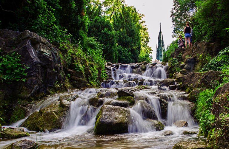
## Description **Viktoriapark** is one of Berlin’s most distinctive urban green spaces, combining **natural elevation, engineered waterfalls, panoramic city views, and national symbolism** within a compact yet dramatic landscape. Unlike Berlin’s vast flat parks such as Tiergarten or Tempelhofer Feld, Viktoriapark stands out because it rises sharply above the surrounding streets, offering one of the **best natural viewpoints in the entire city**. The park is centered around **Kreuzberg Hill**, a 66-meter-high elevation that gives the surrounding district its name. At the summit stands the imposing **National Monument for the Wars of Liberation** (Nationaldenkmal für die Befreiungskriege), a Gothic-style cast-iron monument designed by **Karl Friedrich Schinkel** and completed in 1821. The monument commemorates Prussia’s victory over Napoleon and represents one of the earliest major patriotic memorials in Germany. Its dark, spired form creates a dramatic silhouette against the sky and serves as a visual anchor for the entire park. One of Viktoriapark’s most beloved features is its **artificial waterfall system**, which cascades down the eastern slope of the hill toward Kreuzbergstraße. Built in the late 19th century, the waterfall was designed to mimic alpine mountain streams, bringing the sound, movement, and cooling atmosphere of flowing water into the dense urban fabric. During warm months, these waterfalls become the emotional heart of the park—children play at the base, couples sit on the stone steps, and photographers wait for light to catch the moving water. What makes Viktoriapark particularly compelling is the way it merges **romantic landscape design with political history**. The hill was reshaped during the 19th century to fit the ideals of romantic nationalism, where nature, sacrifice, and monumentality were meant to reinforce each other. The result is a park that feels both organic and highly symbolic at the same time. A little-known fact is that Kreuzberg Hill was once part of a **vine-growing region**, and small-scale wine production existed here in earlier centuries. Even today, a modern vineyard operates on the slope near the monument, producing limited local wine each year. Another lesser-known detail is that the waterfall only runs during the warmer months, meaning many winter visitors never realize that this dramatic feature exists at all. Beyond its historical symbolism, Viktoriapark plays a vital role in everyday neighborhood life. It is a **local refuge** for residents of Kreuzberg, attracting joggers, families, musicians, dog walkers, and sunset watchers. Unlike some of Berlin’s more monumental parks, Viktoriapark maintains a **distinctly neighborhood-driven character**, blending tourism and local daily rhythm without feeling staged. Emotionally, the park shifts moods throughout the day. Mornings are quiet and misty along the lower paths. Afternoons bring activity and movement. Evenings transform the summit into a gathering point for people watching the sun sink behind Berlin’s rooftops. From the top, visitors can often see landmarks such as the **TV Tower (Fernsehturm)** and distant church spires, reinforcing the sense of standing above the city without ever leaving it. ## Location **Viktoriapark** is located in the **Kreuzberg district of central Berlin**, close to the border with Schöneberg. **City:** Berlin **Region:** Berlin (city-state) **Country:** Germany **District:** Kreuzberg (Friedrichshain-Kreuzberg borough) ### How to Get There: * **By U-Bahn:** * **Line U6** to **Platz der Luftbrücke**, then walk about 10 minutes. * **Line U7** to **Mehringdamm**, then walk about 12–15 minutes. * **By bus:** Several bus lines stop along Mehringdamm and Kreuzbergstraße. * **By bicycle:** Well connected by bike lanes and ideal as part of a Kreuzberg cycling route. * **By taxi or ride-hailing apps:** Direct access from anywhere in central Berlin. * **On foot:** Easily reachable from Bergmannkiez and Tempelhofer Damm areas. The park’s elevated position makes it visible from many surrounding streets, acting as a **natural landmark within Kreuzberg**. ## Tips * **Visit near sunset:** The panoramic view from the monument is one of the best free sunset spots in Berlin. * **Check if the waterfall is running:** It is typically active only from spring to autumn. * **Wear comfortable shoes:** The paths include steep inclines and irregular stone steps. * **Bring a light jacket:** Wind at the top can be significantly stronger than street level. * **Combine with Bergmannkiez:** The surrounding neighborhood is full of cafés, bakeries, and local restaurants. * **Avoid peak hours for quiet time:** Late afternoons on weekends can be crowded. * **Respect the monument:** It is a protected historical site, not a climbing structure. * **Photography tip:** Early morning light illuminates the eastern slope and waterfall beautifully. ## Conclusion **Viktoriapark** is a rare Berlin green space where **natural elevation, romantic landscape design, national history, and everyday local life intersect**. From its cascading waterfalls and shaded paths to the solemn monument crowns its summit, the park offers both emotional contrast and visual depth. It is not grand in size, but in **experience, symbolism, and atmosphere**, it ranks among the most memorable outdoor spaces in the city. ## FAQ **1. What is Viktoriapark famous for?** It is best known for its **hilltop national monument, artificial waterfalls, and panoramic city views**. **2. Is Viktoriapark suitable for children?** Yes. Families visit frequently, especially near the lower waterfall areas, though supervision is required due to rocky terrain. **3. Is there an entrance fee?** No. Viktoriapark is **free and open to the public**. **4. Does the waterfall run all year?** No. It usually operates **only during the warmer months**. **5. Can you see major landmarks from Viktoriapark?** Yes. On clear days, you can spot parts of the **Berlin skyline including the TV Tower**. **6. How long should a visit take?** Most visits last **45 minutes to 1.5 hours**, depending on walking pace and time spent at viewpoints. ## Links * [Official Berlin Parks Page](https://www.berlin.de/tourismus/parks-und-gaerten/3560783-1740419-viktoriapark.html)
GemVoyage Team • World

Comments