GemVoyage Team • World
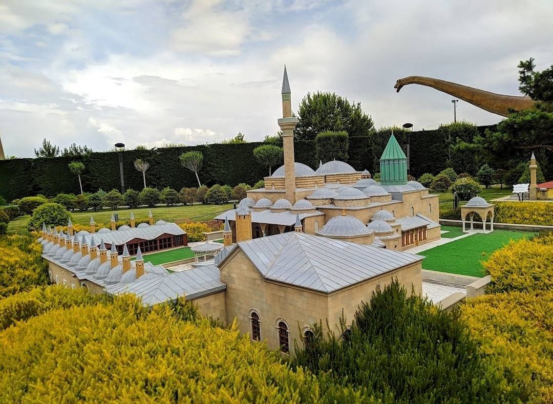
Around the World in 80 Thousands Park, also known as “80 Binde Devr-i Alem Parkı” in Turkish, is one of the most fascinating theme parks in Konya, Turkey. What makes this park truly unique is its concept—it allows visitors to travel across the globe without leaving the city. With miniature models of famous landmarks, dinosaurs, and fairy-tale characters, it blends history, culture, and entertainment into one unforgettable experience.
The park covers an impressive area, showcasing over 120 miniature replicas of iconic monuments from around the world. From the Eiffel Tower to the Great Wall of China, from Taj Mahal to Machu Picchu, visitors get a sense of global travel in just a single day.
A little-known fact about the park is that it also features a dinosaur valley, where life-sized dinosaur models bring prehistoric times to life. Another hidden gem is the children’s fairytale section, where beloved characters like Snow White and the Seven Dwarfs or The Smurfs enchant younger visitors. This combination of world heritage, history, and fantasy makes it enjoyable for all age groups, from kids to adults.
The park is located in Konya, a historic city in the Central Anatolia Region of Turkey. More specifically, it sits in the Selçuklu district of Konya, easily accessible from the city center.
For those visiting from outside Konya, the nearest airport is Konya Airport (KYA), which connects to major cities like Istanbul and Ankara. From the city center, the park can be reached by taxi, car rental, or local public transportation. The most convenient way is by tram or bus heading towards Selçuklu, as the park is well-signposted and located near other cultural attractions.
If you’re coming from Istanbul or Ankara, consider taking the high-speed train to Konya, which is both comfortable and time-saving. Once in Konya, you can combine your visit to the park with a trip to the Mevlana Museum or Alaeddin Hill, both of which are nearby.
To make the most out of your visit to Around the World in 80 Thousands Park, here are some valuable tips:
Around the World in 80 Thousands Park is not just a theme park—it’s an educational and cultural journey across continents, all within Konya. With its blend of global monuments, prehistoric creatures, and fairy-tale wonders, it promises an unforgettable experience for visitors of all ages. Whether you’re traveling with family or exploring solo, this park is a must-see destination in Turkey.
1. What is Around the World in 80 Thousands Park?
It is a theme park in Konya, Turkey, featuring miniature models of world-famous landmarks, a dinosaur valley, and a fairy-tale section.
2. How much time do I need to visit the park?
On average, visitors spend 2–3 hours exploring the park, but families with kids may stay longer.
3. Is the park suitable for children?
Yes, it’s very family-friendly. Kids particularly enjoy the dinosaur area and fairy-tale characters.
4. What is the best way to reach the park from Konya city center?
You can take a bus, tram, or taxi to the Selçuklu district. It’s about a 15–20 minute drive from the center.
5. Are there food and drink facilities inside the park?
Yes, there are small cafes and snack bars inside where you can buy refreshments.
6. Is it open year-round?
Yes, but opening hours may vary depending on the season, so it’s best to check in advance.
Discover more hidden gems you might love.
Tokyo
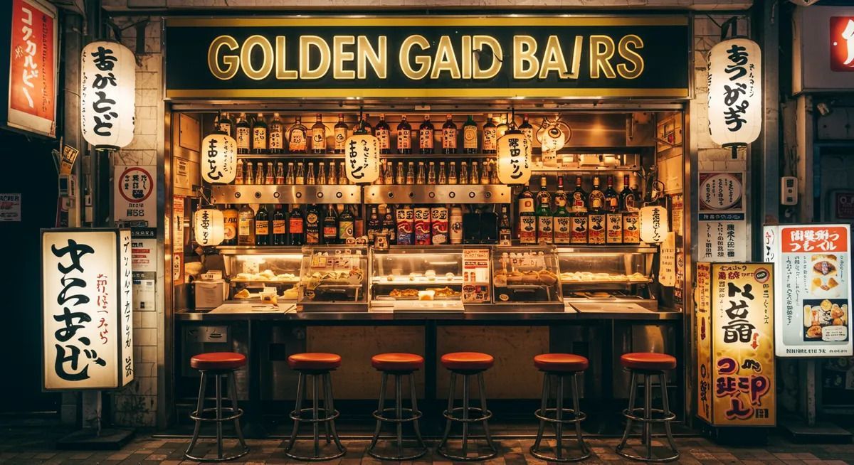
## Description Golden Gai is one of Tokyo's most distinctive nightlife districts, known for its narrow lanes, compact buildings, and dozens of tiny bars packed into a remarkably small area. What makes it special is not simply the number of bars, but the intimacy of the environment. Instead of large venues and loud commercial chains, visitors find one-room or nearly one-room spaces where the atmosphere is personal, varied, and often highly curated by the owner. The whole district feels like a living archive of postwar Tokyo nightlife, preserved in a way that modern redevelopment has not fully erased. Many of the bars have their own themes, regulars, and house rules, which means the experience can change dramatically from one doorway to the next. That unpredictability is part of the appeal. A less widely known fact is that Golden Gai survived repeated pressure from urban redevelopment because its character became too culturally valuable to replace easily. Another interesting detail is that it is as much a social district as a drinking district; for many visitors, the point is to step into Tokyo's small-scale urban culture rather than simply to have a night out. ## Location Golden Gai is in Shinjuku, one of Tokyo's busiest commercial districts in Japan. It sits near the heart of the entertainment area and is easy to reach from Shinjuku Station, one of the city's main transportation hubs. The neighborhood's location makes it especially convenient for travelers staying in central Tokyo, since you can reach it by train, walk to it from nearby hotels, and continue elsewhere in the city afterward. Because the area is small and dense, the best approach is to arrive on foot after taking transit to Shinjuku. That lets you enjoy the contrast between the huge station area and the tighter lanes of Golden Gai. Evening is the natural time to go, although the district comes alive at different speeds depending on the day and the season. ## Tips - Start with one or two bars rather than trying to see everything, because the district rewards quality over quantity. - Check whether a bar has a cover charge or membership policy before entering. - Be respectful of the small spaces and the local regulars, since many bars have a strong neighborhood culture. - Bring cash, because some smaller establishments may prefer it over cards. - If you are shy, choose a bar with an easier-looking entry style or a visible English menu. - Pair Golden Gai with other Shinjuku sights so the evening feels like a full district experience. ## Conclusion Golden Gai is one of the best places in Tokyo to experience a compact, intimate version of the city's nightlife. Its charm comes from personality, density, and history, not spectacle, which is exactly why it leaves such a strong impression. ## FAQ ### Is Golden Gai only for drinking? Mostly, yes, but the experience is broader than drinking alone. Many visitors go to appreciate the atmosphere, architecture, and social energy of the district. Even if you only stop in briefly, you are getting a glimpse into a very specific side of Tokyo's urban culture. ### Is Golden Gai expensive? It can be, especially compared with everyday bars elsewhere in Tokyo. Small spaces, cover charges, and themed bars often create a premium experience. That said, costs vary a lot from one place to the next, so it is possible to keep the visit modest if you are selective. ### Do I need to speak Japanese? Not necessarily. Some bars are welcoming to international visitors, while others are more local in feel. Basic courtesy goes a long way, and a little patience helps. If you want an easier entry, look for venues that visibly welcome newcomers. ### What is the best time to go? Early evening is usually best if you want to avoid the busiest crowd peaks and have time to choose a bar calmly. Later at night can be lively, but the narrow lanes may feel crowded. Your ideal time depends on whether you prefer atmosphere or ease of movement. ### Can I visit Golden Gai without staying long? Yes, and that is common. Some people drop in for a single drink, a brief look around, or a photo walk. Even a short visit can feel meaningful because the district's character is so concentrated. You do not need a long itinerary to appreciate it. ## Links - [Wikipedia](https://en.wikipedia.org/wiki/Golden_Gai)
GemVoyage Team • World
Paris
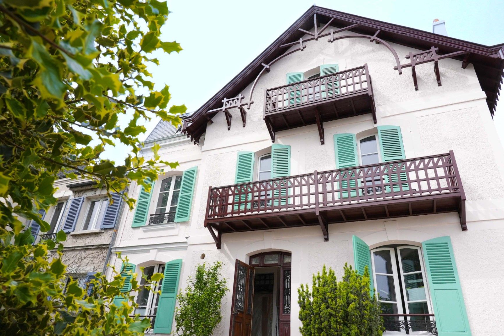
## Description **Maison Impressionniste Claude Monet Argenteuil** is a carefully reconstructed space dedicated to the years when Claude Monet lived and worked in Argenteuil, a suburb northwest of Paris. Although not the original residence, the house functions as a faithful evocation of Monet’s daily environment between 1871 and 1878, a period widely considered formative for the **Impressionist movement**. This is where Monet refined his techniques of capturing light, atmosphere, and everyday scenes, and where he produced some of his most celebrated works, including views of the Seine, gardens, and his own home life. The house is arranged to resemble the domestic context that influenced Monet’s early mastery. Rooms are curated with period furniture, reproductions of key paintings, personal objects, and interpretive displays illustrating how Monet painted outdoors, how he experimented with color, and how Argenteuil became a meeting point for artists such as Renoir, Manet, and Sisley. The staging provides an accessible narrative of Monet as a young pioneer, long before his later fame at Giverny. A little-known fact is that Argenteuil was once a **boating and leisure capital** for Parisians, and Monet frequently painted regattas and pleasure craft from the riverbanks near his home. Another lesser-known detail is that Monet’s time in Argenteuil coincided with substantial urban development, which threatened some of the very landscapes he painted. This tension between modernization and natural beauty appears subtly throughout his Argenteuil canvases. Today, the Maison Impressionniste offers a more intimate and less crowded alternative to major Impressionist institutions in Paris. It gives visitors the chance to walk through reconstructed interiors that feel personal rather than monumental and to understand the roots of what would become Monet’s global artistic influence. ## Location **City:** Argenteuil (Greater Paris area) **Region:** Île-de-France **Country:** France The house is situated in a residential part of Argenteuil, within walking distance of the Seine and the locations that inspired many of Monet’s paintings. ### How to Get There * **By train:** * From **Gare Saint-Lazare** in Paris, take a Transilien J train to **Argenteuil Station**. From there, it is a short walk or a brief bus ride. * **By bus:** * Several suburban bus lines connect Argenteuil with northern districts of Paris. * **By car:** * The area is accessible via the A15 or A86, but parking can be limited in residential streets. * **On foot from the center of Argenteuil:** * A pleasant 10–15 minute walk through town streets leads directly to the museum. ## Tips * **Visit on a weekday** to avoid periods when small tour groups pass through. * **Combine it with a Seine riverside walk**, retracing the landscapes Monet depicted in his Argenteuil period. * **Plan 45–60 minutes**, as the museum is compact but detailed. * **Photography policies may vary**, so check signage before taking photos inside. * **The museum often hosts temporary exhibits** on Impressionism and plein-air painting; check ahead for program changes. * **Bring context:** Reviewing Monet’s Argenteuil works beforehand will enrich the visit, as many are referenced in the interpretive materials. ## Conclusion Maison Impressionniste Claude Monet Argenteuil offers an intimate and historically grounded perspective on Monet’s early Impressionist years. The reconstructed spaces, the focus on daily life, and the proximity to the landscapes that shaped his artistic eye make it a meaningful stop for those seeking a deeper understanding of how Impressionism emerged and matured. ## FAQ **1. Is the house original?** No. It is a faithful reconstruction designed to evoke Monet’s home during his Argenteuil years. **2. How long did Monet live in Argenteuil?** From 1871 to 1878, a key period of his early Impressionist development. **3. Can visitors see original artworks?** The museum primarily displays reproductions and interpretive materials; original works are held in major museums in Paris and abroad. **4. Is the visit suitable for children?** Yes. The rooms are accessible, and the museum offers educational materials for younger visitors. **5. How long should I plan for the visit?** Around 1 hour, depending on reading speed and interest in the exhibits. **6. Is the museum wheelchair accessible?** Accessibility can vary; checking ahead with the museum is recommended. ## Links * [Official tourism information for Argenteuil](https://www.argenteuil.fr)
GemVoyage Team • World
Austin
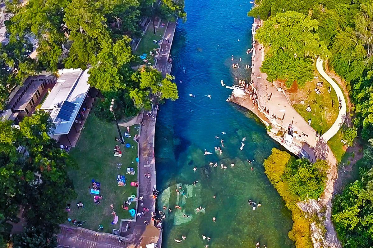
## Description Barton Springs Pool is one of Austin’s most beloved landmarks because it offers something rare in a major American city: a large natural spring-fed swimming pool that feels both wild and urban at the same time. Located in Zilker Park, it has long been a favorite place for locals to cool off, relax, and connect with the city’s outdoor culture. The pool is more than a recreational amenity. It is a symbol of Austin’s relationship with nature, conservation, and public space. If you want to understand why residents speak about the city with so much affection for its outdoor life, Barton Springs is one of the best places to start. The water is consistently cool year-round, which gives the pool a very specific personality. In summer, that feels refreshing and almost miraculous. In cooler months, it feels bracing and memorable. A little-known fact is that the pool is closely associated with endangered species and ecological protection, especially the Barton Springs salamander, which means the site has both leisure and conservation importance. Another detail many visitors miss is that the pool has been a social gathering place for generations, so the sense of continuity is as much part of the attraction as the water itself. What makes Barton Springs especially attractive is its flexibility. Families, swimmers, walkers, sunbathers, and out-of-town visitors can all enjoy it in different ways. Some people come specifically to swim laps or cool off after a hot Austin day. Others come simply to sit on the grass, watch the activity, and enjoy being near a place that feels deeply rooted in the city’s identity. It is one of those attractions that is simple on the surface but surprisingly rich once you experience how many layers it holds: natural, civic, ecological, and cultural. ## Location Barton Springs Pool is in Zilker Park in Austin, Texas, United States, not far from downtown and close to the Barton Creek area. Its central location makes it easy to combine with other Austin attractions, but the simplest plan is often to dedicate a block of time to the park and pool rather than trying to rush through it. Visitors can reach the area by car, rideshare, bicycle, or bus, and walking is practical if you are already staying nearby or spending the day in central Austin. Parking can become limited on busy days, so public transport or biking is often the smartest choice. Once you arrive, the surrounding park gives you a natural extension of the visit, whether you want a picnic, a walk, or time to relax after swimming. If you are planning to swim, check the current opening hours and entry rules in advance, because operational details can change with season, weather, and maintenance needs. The site works best when you treat it as a half-day or full-day outing rather than a quick stop. ## Tips - Go early if you want a calmer experience and easier access. - Bring what you need for swimming, because this is a place to stay a while. - Check current water and entry conditions before leaving your hotel. - Use the surrounding park for a picnic or rest after your swim. - Respect ecological rules and pool guidelines, since the site is protected and carefully managed. - In summer, Barton Springs is one of the best ways to escape the heat without leaving the city. ## Conclusion Barton Springs Pool is a signature Austin experience: natural, refreshing, social, and deeply tied to the city’s outdoor culture. It is both a swimming destination and a symbol of what makes Austin feel different. ## FAQ ### Why is Barton Springs Pool so famous? It is famous for being a large natural spring-fed pool in central Austin, with strong local, ecological, and cultural significance. ### Can you swim there all year? Yes, but temperatures and conditions vary, so it feels different by season. ### Is it family-friendly? Yes, though families should always check current pool rules and conditions before visiting. ### How long should I spend there? Plan at least a few hours if you want to swim and enjoy Zilker Park properly. ## Links - [Austin Parks and Recreation](https://www.austintexas.gov/department/barton-springs-pool) - [Wikipedia](https://en.wikipedia.org/wiki/Barton_Springs_Pool)
GemVoyage Team • World
Seoul
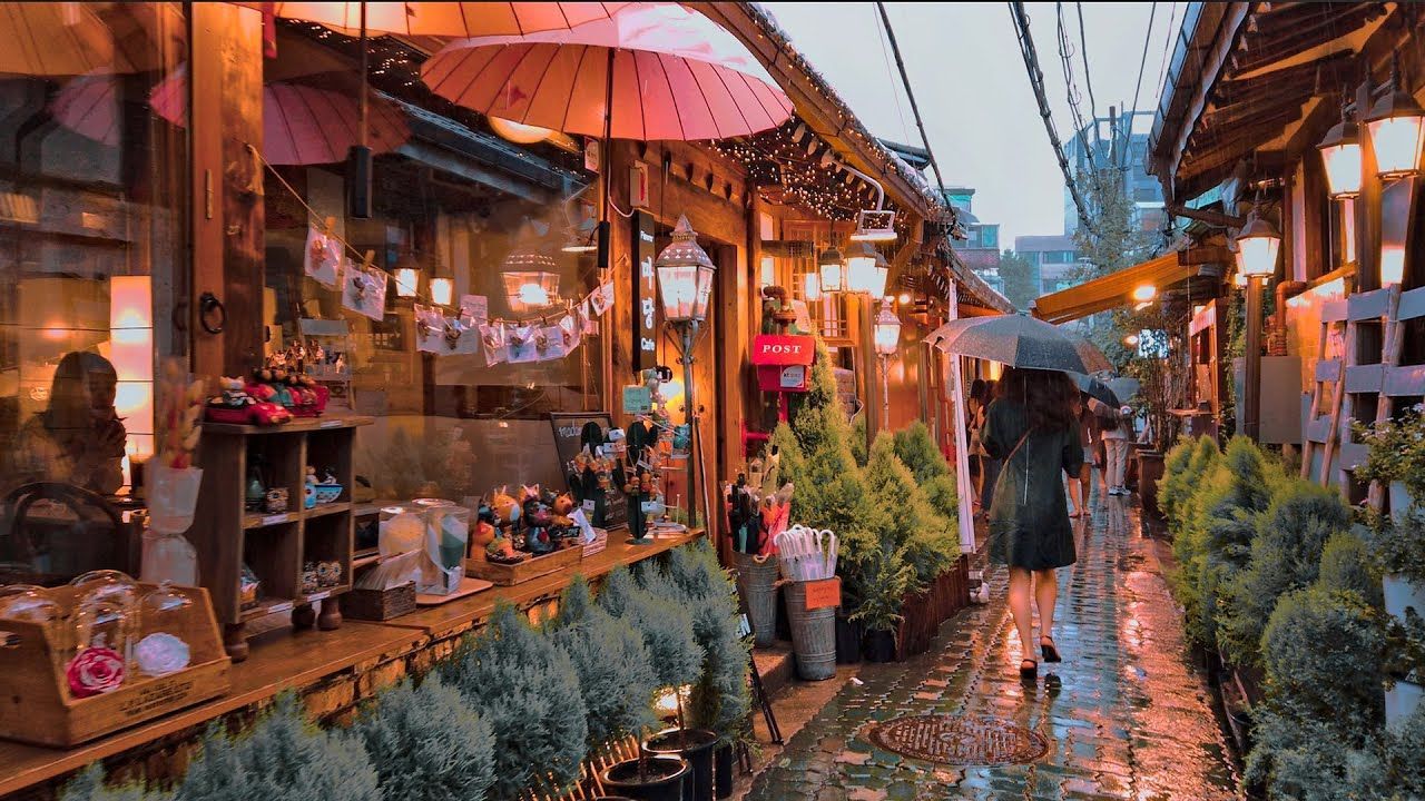
## Description Ikseon-dong Hanok Village is a compact, walkable district of restored traditional Korean houses (hanok) that has quietly become one of Seoul’s most charming destinations for visitors who prefer intimate, offbeat experiences. Narrow alleys thread between low-slung wooden eaves and tiled roofs, leading to a concentration of independently run cafes, craft shops, design ateliers, small restaurants, and boutique guesthouses. What makes Ikseon-dong compelling is its layered character: from a distance it reads as preserved tradition, but up close you’ll find contemporary interiors, modern light fixtures, and bold small-business design that sits harmoniously within historic exteriors. Many of the hanok are careful restorations completed in the last decade, which means you get the visual poetry of old Seoul with the conveniences and comforts of modern hospitality. The neighborhood is an excellent example of sensitive urban revitalization—locals and entrepreneurs have repurposed former residential clusters into a dense network of micro-businesses that reward slow exploration. Ikseon-dong’s scale is part of its appeal: where larger hanok districts can feel staged or touristy, here the alleys are intimate and discoveries are often serendipitous—an influential ceramicist around the corner, a tiny cocktail bar behind a lacquered doorway, a handcrafted stationery shop tucked beneath an old roof. ## Location Ikseon-dong sits in Jongno-gu in central Seoul, a short walk from Jongno 3-ga station and easily combined with visits to nearby cultural anchors like Changdeokgung Palace and Insadong. For many travelers, Ikseon-dong makes a great half-day detour from the palace circuit: it’s compact enough to be explored on foot and centrally located so you can move quickly between historic sites, galleries, and dining options. ## Tips - Explore deliberately: walk slowly, follow side alleys, and allow time to peek into courtyards and small doorways—some of the best cafes and shops are not visible from main lanes. - Try specialty menus: many cafes in Ikseon-dong focus on single-origin coffee, artisanal teas, or themed tasting menus—ask staff for recommendations and seasonal specials. - Respect residents: while the area is visitor-friendly, many hanok still function as private homes or small businesses; be mindful when photographing doorways and courtyards. - Visit at different times: morning light highlights wooden details and offers quieter streets, whereas evenings bring lantern-lit alleys and a more atmospheric café-and-bar scene. - Accessibility note: alleys can be narrow with occasional steps; check individual venues for wheelchair access before visiting. ## Conclusion Ikseon-dong is a delightful micro-neighborhood that reimagines traditional architecture for modern urban culture. It’s ideal for café-hopping, thoughtful shopping, photography, and discovering small-scale craftsmanship. The district rewards curiosity: the more time you give it, the more layered the experience becomes—historic textures, contemporary comforts, and a localized creative energy that feels authentically Seoul. ## FAQ Q: Is Ikseon-dong very touristy? A: It has grown in popularity but remains smaller and more intimate than other hanok districts like Bukchon; mornings are generally quieter. Q: Are there places to stay in Ikseon-dong? A: Yes, a handful of boutique hanok guesthouses and small guest accommodations offer overnight stays—book early for weekends. Q: What’s the best time of day to visit? A: Early morning for quiet exploration and late afternoon into evening for lantern-lit ambiance and café culture. Q: Is it wheelchair accessible? A: The historic alleys have uneven paving and steps in places—accessibility varies by venue; call ahead for specific locations. Q: Can I take photos freely? A: Public areas are fine for photography, but be respectful in private courtyards and ask permission before photographing people or inside shops. ## Links - [Korean Travel Guide](https://english.visitkorea.or.kr)
GemVoyage Team • World
Sanaa
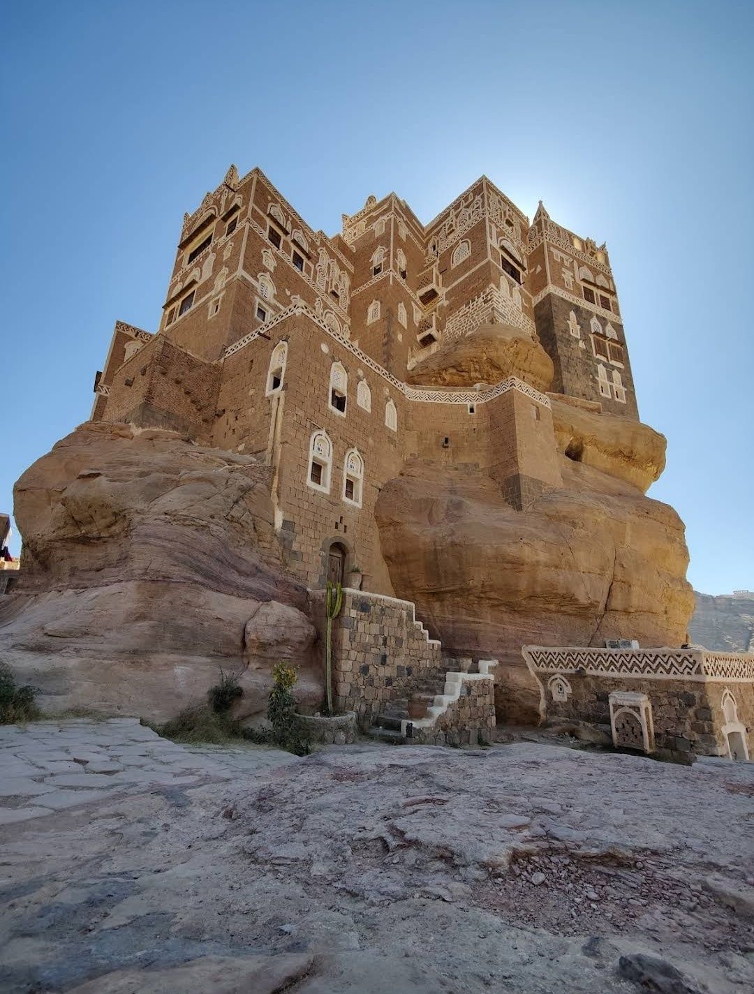
## Description The Stone House in Sanaa is one of the most fascinating architectural wonders in Yemen’s capital. Built entirely from stone, this house reflects the deep-rooted traditions of Yemeni architecture, where natural materials, geometric patterns, and delicate carvings come together in harmony. What makes the Stone House truly unique is its ability to blend strength with elegance—its towering façade is decorated with white gypsum frames and intricate motifs that give it an almost fairy-tale appearance. Unlike many modern buildings, the Stone House is more than just a residence; it represents centuries of history and cultural identity. One little-known fact about this landmark is that it was designed to adapt to the city’s climate: thick stone walls keep the house cool during Yemen’s hot summers and warm during the chilly winter nights. Another fascinating detail is that the windows are often covered with **qamarīyah** (colored stained glass), which not only filters light beautifully but also symbolizes prosperity and protection in Yemeni tradition. ## Location The Stone House is located in **Sanaa**, the capital city of **Yemen**, within the region known as **Old Sanaa**. This UNESCO World Heritage Site is famous for its maze-like alleys, traditional markets (souqs), and iconic high-rise houses made of stone and mud brick. The Stone House is nestled among these historic buildings, making it an essential stop for anyone exploring the old city. To reach Sanaa, international visitors usually arrive via **Sanaa International Airport**. From there, a short drive will take you to Old Sanaa, where most attractions—including the Stone House—are within walking distance. If you are already in the city, taxis are the most convenient way to get there, as public transportation can be limited and sometimes confusing for first-time travelers. ## Tips for Visitors Visiting the Stone House can be an unforgettable experience if you plan properly. Here are some essential tips: * **Best Time to Visit**: The ideal time to explore Sanaa is during the cooler months (October to March), when the weather is more pleasant for walking around the old city. * **Respect Local Culture**: Yemen is a conservative country, so visitors should dress modestly. Women may want to cover their hair with a scarf when entering traditional neighborhoods. * **Hire a Local Guide**: A guide can explain the hidden meanings behind the architecture and help you discover details you might otherwise miss. * **Photography Etiquette**: Always ask before photographing people, especially in residential areas. However, the buildings themselves are a photographer’s dream, so bring a good camera. * **Stay Safe**: Due to Yemen’s political situation, travelers should always check current travel advisories before planning a visit and consider traveling with a trusted tour operator. ## Conclusion The Stone House in Sanaa is more than just an old building—it’s a living symbol of Yemeni history, culture, and artistry. Its unique stone architecture, stained glass windows, and cultural significance make it a must-see destination for travelers interested in heritage and history. Nestled in the heart of Old Sanaa, it offers an authentic glimpse into one of the world’s most remarkable historic cities. ## Frequently Asked Questions (FAQ) **1. What is the Stone House in Sanaa?** The Stone House is a traditional Yemeni building in Old Sanaa, made primarily of stone and decorated with gypsum and stained glass windows. **2. Why is the Stone House important?** It represents Yemeni architectural heritage and showcases how traditional designs were adapted to both climate and culture. **3. Can tourists visit the Stone House?** Yes, visitors can explore it along with other landmarks in Old Sanaa, though it is best to check travel advisories before planning a trip. **4. How old is the Stone House?** While the exact date of construction varies depending on the specific house, most traditional stone houses in Sanaa date back several centuries. **5. Is photography allowed inside the Stone House?** Photography of the building is usually allowed, but always be respectful and ask for permission if entering private areas. **6. How can I reach the Stone House from the airport?** From Sanaa International Airport, it’s about a 30-minute drive to Old Sanaa. Taxis are the most convenient way to get there. ## Useful Links * [UNESCO World Heritage – Old City of Sanaa](https://whc.unesco.org/en/list/385/)
GemVoyage Team • World
Trakai
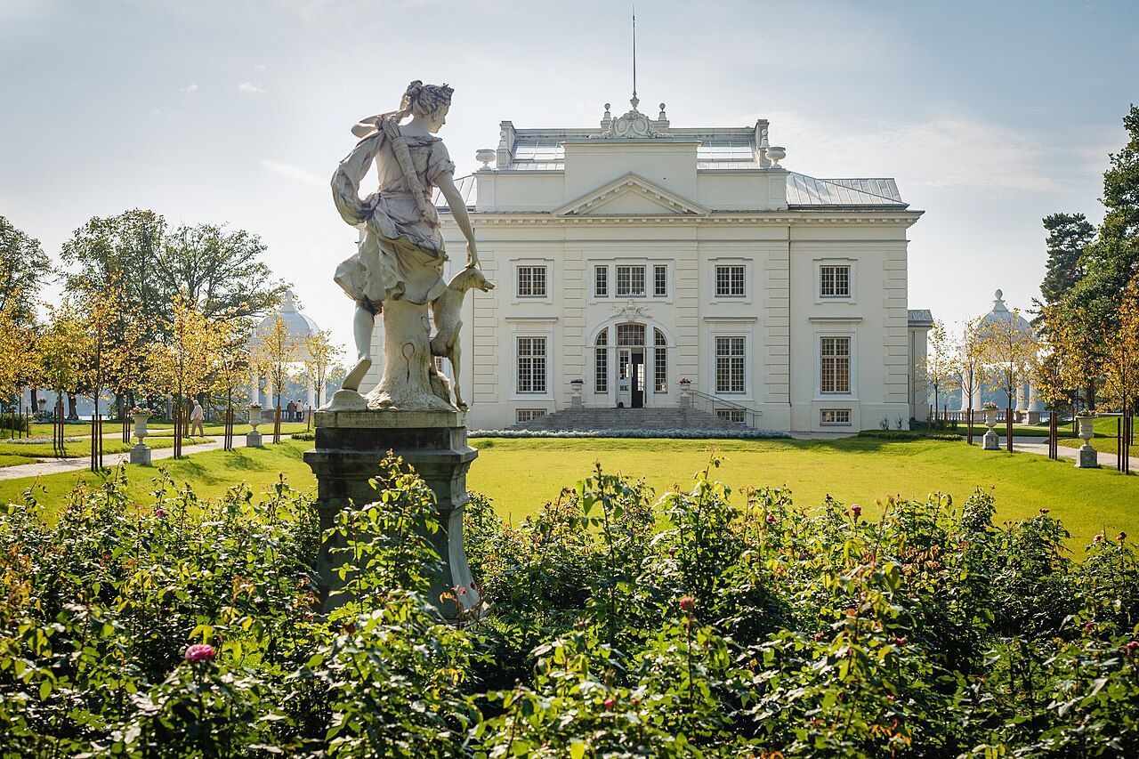
## Description Užutrakis Manor Estate is a graceful, lakeside cultural landscape that combines manicured gardens, classical architecture, and sweeping views over Lake Galvė just outside Trakai. The estate preserves the atmosphere of late 19th– and early 20th-century leisure gardens while adapting to contemporary cultural life: restored terraces, thoughtfully composed alleys, sculptures, and scenic viewpoints frame the manor house and connect the property visually and historically with Trakai’s iconic island castle across the water. What makes Užutrakis special is its dual character as both a preserved historic landscape and an active cultural venue. Garden designers and conservationists have worked to retain the original axes and formal layouts while integrating native plantings that support local biodiversity. The manor’s rooms and exhibition spaces are used seasonally for concerts, art shows, and local festivals, so a visit can feel both reflective and lively depending on the calendar. Photographers prize the vantage points that align with the castle silhouette on Lake Galvė, and landscape enthusiasts appreciate the blending of English-style park elements with Lithuanian plantings. For travelers seeking a slower cultural day trip from Vilnius or Vilnius airport, Užutrakis offers a concentrated experience: well-maintained paths for strolls, benches for long views, and interpretive signage that explains the estate’s history, garden features, and the restoration philosophy. Because it sits a short distance from Trakai’s main attractions, it pairs naturally with a visit to the island castle, allowing visitors to alternate between formal architecture, lakeside walks, and local food options in Trakai town. ## Location Užutrakis Manor sits on the shores of Lake Galvė within Trakai municipality, Vilnius County, central Lithuania. It lies only a short drive, bike ride, or pleasant walk from Trakai town and its famous island castle, making it an easy half-day or day-trip destination from Vilnius (about 28 kilometers away) or from Vilnius International Airport. Getting there is straightforward: regional buses and organized tours run regularly between Vilnius and Trakai, and local taxi services provide short transfers to the estate. For a more scenic approach, boat shuttles operate on Lake Galvė in the warmer months, delivering visitors to various points along the shoreline. Cyclists can combine the manor with a gentle ride around the lake, while visitors staying in Trakai can reach the gardens on foot from the town center depending on seasonal paths and local signage. ## Tips - **Combine with Trakai Castle:** Pair a morning or afternoon at Užutrakis with a visit to Trakai Castle for a varied cultural day of gardens and medieval architecture. - **Check the event calendar:** The manor hosts concerts, seasonal exhibitions, and cultural programs; aligning your visit with an event can add memorable local flavor. - **Wear comfortable shoes:** Gravel paths, terraces, and gentle slopes reward comfortable footwear; bring a light rain layer in changeable weather. - **Bring a camera and binoculars:** The viewpoints toward Trakai Castle and lakeside vistas are signature photo opportunities; binoculars help for birdwatching along the shoreline. - **Mind opening hours and fees:** The estate may have seasonal opening hours and modest fees for house access or special exhibitions. - **Respect the grounds:** Follow paths, avoid trampling sensitive plantings, and observe any interpretive guidance—this helps conserve the restored historic landscape. ## Conclusion Užutrakis Manor Estate is a graceful complement to Trakai’s island castle and regional attractions: a lakeside garden escape rich in architecture, curated views, and seasonal cultural programming. It rewards slow visits—moments of reflection on terraces, an attentive walk through historic lanes, and an appreciation for the interplay of landscape restoration and active cultural life. ## FAQ - **Q: Is there an entrance fee to Užutrakis Manor?** A: There is often a modest fee for access to the manor’s interiors or special exhibitions; garden access may be free or ticketed depending on season. Check the estate’s official site or local tourist information for current rates. - **Q: Can I tour the interior of the manor house?** A: Interior access is seasonal and may be limited during restoration or private events—plan ahead if interior tours are important to your visit. - **Q: Are events held outdoors, and do I need reservations?** A: Seasonal concerts and cultural events commonly occur outdoors; some events require advance booking while smaller activities may accept walk-up visitors. - **Q: Is the manor wheelchair or stroller accessible?** A: Accessibility varies across terraces and historic rooms; the garden paths are generally manageable, but some interior areas may have steps—contact the site for detailed accessibility information. - **Q: How long should I allocate for a visit?** A: Plan 1.5–3 hours to enjoy the gardens, viewpoints, and any small exhibitions; longer if attending a concert or combining with Trakai Castle. - **Q: Are there food options nearby?** A: Trakai town offers cafés and local eateries; pack water and light snacks if you prefer a picnic in the gardens. ## Links -- [Užutrakis Manor (Wikipedia)](https://en.wikipedia.org/wiki/U%C5%BEutrakis_Manor)
GemVoyage Team • World

Comments