Discover extraordinary places shared by our community of travelers
Lisbon
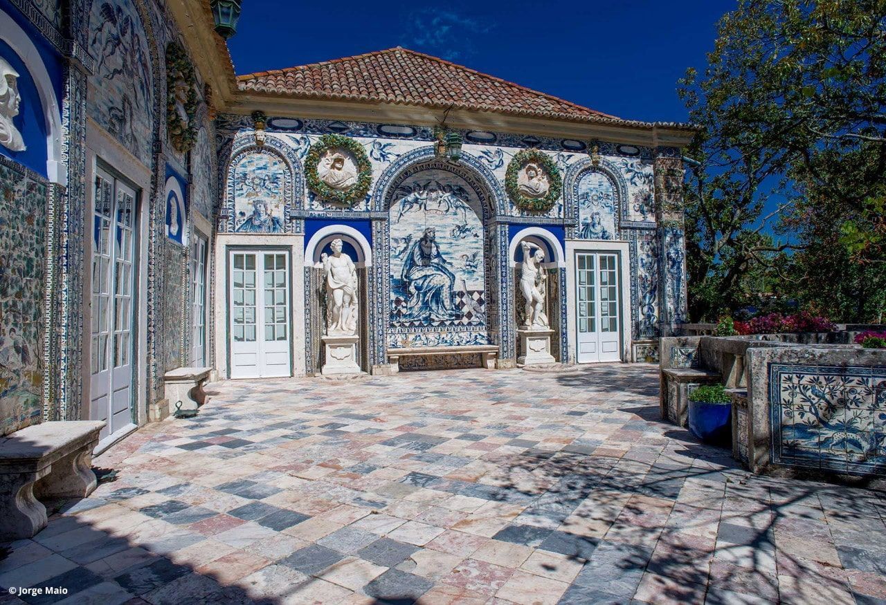
## Description Palácio dos Marqueses de Fronteira is an elegant, family-owned 17th-century estate on the edge of Lisbon that delights visitors with its exceptional azulejo tile panels, intimate museum rooms, and meticulously designed gardens. The palace feels less like a public museum and more like entering a well-preserved private residence that has been lived in and cared for by the same lineage of nobility for centuries. Interiors display an array of period furniture, heirloom portraits, and decorative arts that create a layered sense of domestic aristocratic life. The palace’s defining artistic draw is its azulejo program: large narrative tile panels that record hunting scenes, mythological episodes, allegories, and courtly imagery, executed in the refined blue-and-white and polychrome palettes typical of the 17th and 18th centuries. These tiles cover interior and exterior walls, forming pictorial narratives that reward close looking. Complementing the tiles are frescoes, gilded frames and sculptural elements that reflect Baroque and Rococo tastes adapted to Portuguese sensibilities. The gardens are a major reason to visit. Laid out with geometric hedges, elegant statuary and reflecting pools, they weave Moorish and Renaissance influences into a distinctly Portuguese landscape grammar. Garden rooms framed by clipped yews and boxwood create intimate vistas, while larger terraces open to sweeping views of the surrounding neighborhood. Seasonal plantings and careful maintenance mean the palace is beautiful year-round, although spring and early summer are especially lush. Conservation and stewardship at the palace are noteworthy: the family’s ongoing custodianship has supported careful tile restoration projects and the preservation of original material culture. Many of the conservation interventions have been carried out by local artisans using traditional techniques, preserving not just objects but craft knowledge. Photographic and accessibility note: photographers should plan for a mix of wide-angle shots of garden terraces and close-ups of tile details; early morning light reduces harsh shadows on glazed surfaces. Visitors requiring mobility assistance should contact palace staff ahead of time to arrange the smoothest route through garden paths and to confirm which rooms are accessible. ## Location The palace is located in the Benfica neighborhood of Lisbon, a short drive northwest of central districts like Rossio and Baixa. From the historic center, it typically takes 15–25 minutes by car depending on traffic. Public transit options involve buses and sometimes a combination of tram and bus; travelers should allow extra time for connections and walking to the palace grounds. Getting there: taxis and rideshares are convenient and typically the fastest way for visitors without a car. If using public transport, check current bus routes and schedules and allow for a short walk from the nearest stop to the palace entrance. ## Tips - Book tickets in advance when possible; guided tours are often limited and sell out during peak season. - Wear comfortable shoes: garden paths include gravel and uneven surfaces. - Respect interior rules: certain rooms may be closed or restricted for conservation reasons; photography inside may be limited. - Bring a camera and consider different lenses: a wide-angle captures garden vistas while a close lens helps study tile details. - Time your visit: visit in the morning light for softer photographs and more tranquil garden conditions. - Combine visits: pair the palace with nearby cultural sites such as the National Coach Museum or a walk in Monsanto Forest Park for a varied day. ## Conclusion Palácio dos Marqueses de Fronteira is a quietly grand escape from Lisbon’s busiest tourist routes. It rewards the patient visitor — those who enjoy architectural decoration, tile art and carefully tended gardens — with an intimate glimpse of aristocratic Portuguese life. The palace’s careful preservation and the family’s ongoing care make it a dignified and deeply rewarding stop on a cultural itinerary. ## FAQ Q: Are guided tours available? A: Yes. Guided tours are offered and provide detailed historical context about the palace, its tiles and the family’s history. Check the palace’s official website or local tourism resources for times and booking procedures. Q: Is the palace wheelchair accessible? A: Accessibility is limited in some historic rooms and garden areas due to steps and uneven terrain. Contact the palace in advance to discuss specific access requirements and to learn which sections are accessible. Q: Can I photograph inside the palace and gardens? A: Photography is usually permitted in the gardens; some interior rooms may restrict photography to protect delicate materials. Always follow posted signs and staff instructions. Q: How long should I allow for a visit? A: Plan for 1–2 hours to see the main rooms and stroll the gardens at a relaxed pace. If you are a tile or garden enthusiast, you may wish to allow more time. Q: Are there any special events or seasonal highlights? A: The palace occasionally hosts concerts, temporary exhibitions, or guided thematic tours. Spring and early summer offer peak garden blooms and are popular times to visit. ## Links - [Wikipedia: Palácio dos Marqueses de Fronteira](https://en.wikipedia.org/wiki/Palace_of_the_Marquises_of_Fronteira)
GemVoyage Team • World

San Juan Teotihuacan
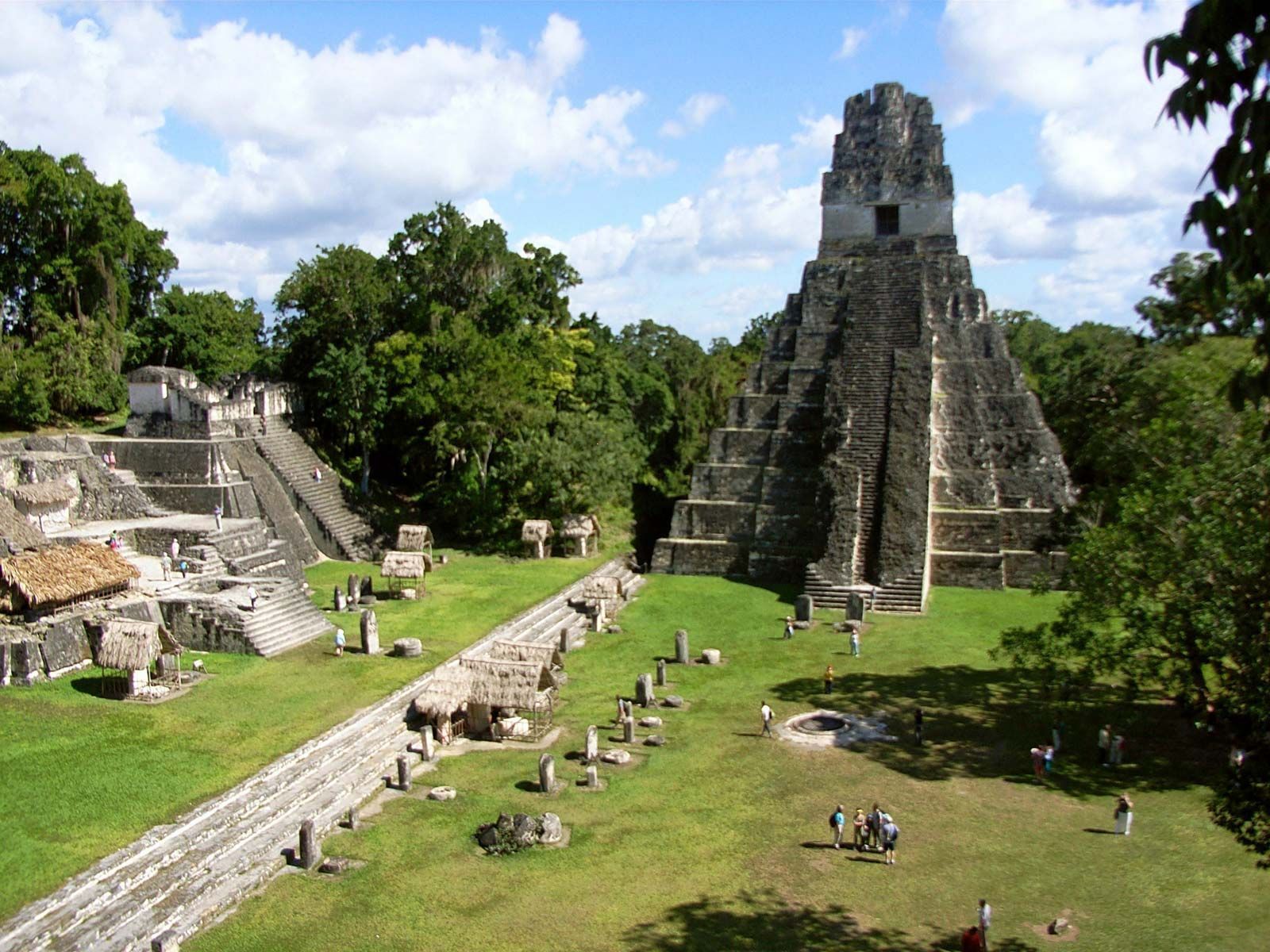
## Description Teotihuacan is a vast pre-Columbian city in central Mexico, dominated by two monumental pyramids — the Pyramid of the Sun and the Pyramid of the Moon — flanking the broad Avenue of the Dead. Once among the largest cities in the ancient world, Teotihuacan’s orthogonal layout, apartment compounds and expansive plazas reflect a complex urban society with far-reaching trade and ritual connections across Mesoamerica. The scale of Teotihuacan is what first seizes visitors: broad causeways, stepped pyramids and the linear discipline of its urban plan. Archaeologists have uncovered multi-storey apartment compounds, market areas and ceremonial platforms that together suggest a dense, highly organized city capable of hosting tens of thousands of residents at its peak. A walk along the Avenue of the Dead reveals architectural rhythms and sightlines intentionally designed to focus processions and ritual movement toward the city’s great pyramids. Climbing the Pyramid of the Sun rewards visitors with sweeping panoramas across the valley and a visceral sense of how the site would have been experienced in antiquity. The Pyramid of the Moon at the northern end of the avenue faces a ceremonial plaza that preserves carved stones and remnants of ritual deposits. Murals and painted architectural fragments found in residential and administrative compounds hint at complex iconography, trade networks reaching into Oaxaca and the Gulf coast, and religious ideas that later influenced the Aztecs. Teotihuacan continues to be a dynamic archaeological landscape: excavations reveal changing construction phases, evidence of craft production zones, and records of trade in obsidian and pottery that tie the city to a broader Mesoamerican world. While key questions remain — notably about the language(s) spoken by Teotihuacanos and the political organization behind the city’s monumental building — continuing research and improved visitor interpretation make Teotihuacan a compelling stop for history-minded travelers. ## Location Teotihuacan lies northeast of Mexico City and is easily accessible by road from the capital; many visitors use organized tours or public buses that run from Mexico City to the archaeological site. The site is about a 45–60 minute drive from the city center depending on traffic, and combined visits with nearby San Juan Teotihuacán village make for a full-day itinerary. ## Tips - **Go early to avoid heat and crowds:** Morning visits are more comfortable and quieter for photography, and the light makes the relief of murals and stonework more legible. - **Wear comfortable shoes and sun protection:** The site is extensive and largely exposed to the sun; pack a hat, sunscreen and plenty of water. - **Hire a licensed guide or join a small-group tour:** Local guides provide archaeological context, point out lesser-known structures and mural fragments, and explain the complex iconography visitors otherwise miss. - **Visit the on-site museum and neighboring sites:** The Museo de Sitio de Teotihuacán houses ceramics, figurines and explanatory panels; pair your visit with nearby craft markets and the ethnographic displays in San Juan Teotihuacán. - **Use public transport or book reliable transfers:** If driving from Mexico City, leave early to avoid congestion and allow time for parking or shuttle transfers. ## Conclusion Teotihuacan’s monumental urban presence offers a powerful sense of ancient civic order and ritual life; its pyramids and avenue remain compelling for history and archaeology enthusiasts alike. Whether you are a casual visitor drawn by striking panoramas or a history lover seeking layered archaeological narratives, Teotihuacan provides a measurable sense of scale, ritual planning and cultural connections that shaped central Mexico for centuries. ## FAQ - **Q: Can you climb the pyramids at Teotihuacan?** A: Access policies change for conservation reasons; sections of the Pyramid of the Sun have been open at times while other monuments may be restricted. Check the site’s official notices before travel and respect closures for preservation. - **Q: How long should I plan for a visit to Teotihuacan?** A: Allocate 3–5 hours for a meaningful visit: climb one pyramid, explore the plaza areas, and visit the on-site museum. Half-day visits are common; a whole day allows more relaxed exploration and time for nearby attractions. - **Q: Is Teotihuacan suitable for families and children?** A: Yes — families will find the wide avenues and open plazas easy to navigate, but bring shade, water, and comfortable walking shoes for younger children. - **Q: Are there good photography spots and when is the best light?** A: Early morning and late afternoon provide the best directional light for texture and color; the area by the Pyramid of the Sun’s summit and viewpoints along the Avenue of the Dead are popular for wide-angle shots. - **Q: What should I know about safety and facilities?** A: The site is generally safe for tourists; basic facilities include restrooms and food stalls near the entrance, but services are limited inside the archaeological zone. Keep valuables secure and follow guidance from official staff. ## Links - [Teotihuacan — Wikipedia](https://en.wikipedia.org/wiki/Teotihuacan)
GemVoyage Team • World
Petén
## Description Tikal is one of the most important archaeological sites of the ancient Maya civilization, located within the dense lowland rainforests of Petén, Guatemala. The city’s towering limestone pyramids and plazas emerge above the jungle canopy, offering dramatic skyline views and a palpable sense of antiquity. During its Classic period, Tikal was a major political and ceremonial center; excavated palaces, stelae and ballcourts tell stories of dynasties, calendrical knowledge and cosmology. Visitors to Tikal are rewarded by a blend of monumental architecture and biodiverse rainforest. The temples and palaces rise through the tree canopy, so that from the tops of several structures you can peer over treetops to see other pyramids peeking through the foliage. This interplay between built environment and ecology is central to Tikal’s power: the jungle both conceals and reveals the city, a dramatic reminder of centuries of abandonment and recovery. Tikal’s primary plaza, monumental ballcourts, and the iconic Temple IV and Temple II complexes preserve stelae with carved inscriptions, verifiable sequences of rulers and artistic programs that speak to the city’s political sophistication. Archaeological work also reveals complex water-management features, reservoirs and causeways that allowed the city to sustain a significant population despite a seasonal tropical climate. Walking among Tikal’s temples at sunrise — when the jungle stirs and howler monkeys call — is an evocative way to connect with a complex culture of architecture, ritual and astronomy. Early morning light transforms the stone into warm tones and dramatically silhouettes the temple profiles against the rising sun, making sunrise a photographer’s favorite. Guides can point out hieroglyphic inscriptions, sacred alignments and the role of celestial observation in Maya ritual life. ## Location Tikal National Park is in Guatemala’s northern Petén department. The site is reachable via a short flight to Flores (Mundo Maya International Airport, FLV) or by road from Flores town, which serves as the usual visitor base. Most visitors use Flores as a staging point and arrange shuttle transfers, guided tours, or independent day trips to the park. ## Tips - **Arrive at dawn for temples and wildlife:** Early mornings provide cooler light, bird activity and quieter conditions before larger tour groups arrive. Dawn visits also let you catch the moment when the jungle wakes up. - **Hire a knowledgeable guide:** Licensed local guides provide historical context, translate glyphs and explain how architecture relates to Maya cosmology — essential for getting more from the site. - **Bring insect repellent and sun protection:** The lowland rainforest environment includes biting insects and strong sunlight in exposed plazas. Lightweight long sleeves and repellent are useful. - **Plan logistics from Flores:** Book shuttle transfers or organized tours in advance during high season, and consider staying overnight near the site for sunset or sunrise experiences. - **Support responsible tourism:** Choose certified guides and operators that follow park rules and contribute to local community economies. ## Conclusion Tikal is both a monumental archaeological treasure and a living jungle experience: temples puncturing the canopy, dawn rituals and carved monuments make it an essential site for understanding Maya civilization. For travelers seeking a mix of natural soundscapes, wildlife encounters and a deep cultural history, Tikal offers an immersive and emotionally resonant experience. ## FAQ - **Q: How long should I spend at Tikal?** A: A full day is ideal to cover the main plazas, climb at least one temple for panoramic views, and explore the northern and central complexes. Two days allow for a slower pace, birding and visiting lesser-known complexes. - **Q: Can visitors climb the temples at Tikal?** A: Access to climbable areas varies — some temples allow limited ascent to designated viewpoints while others are closed to protect fragile structures. Follow current park rules and signage. - **Q: What wildlife might I see at Tikal?** A: Expect to see howler monkeys, toucans, parrots, motmots and a range of tropical birds; early morning is best for birdwatching and animal activity. - **Q: Is it safe for solo travelers and families?** A: The site is generally safe during daylight hours. Follow standard travel precautions: use licensed guides, secure belongings, carry water and avoid isolated areas after dark. - **Q: Are there accommodations near the park?**n+ A: Flores and nearby villages offer a range of lodgings from budget hostels to mid-range hotels; staying in Flores provides easy access to flights and transportation. ## Links - [Tikal — Wikipedia](https://en.wikipedia.org/wiki/Tikal)
GemVoyage Team • World
Lahore
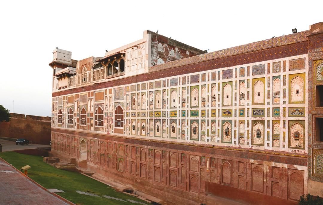
## Description The Walled City of Lahore is one of the most important historic urban districts in South Asia, and it remains one of the best places to understand Lahore beyond its modern boulevards and commercial districts. This is not a museum in the usual sense. It is a living city, layered with Mughal, Sikh, colonial, and contemporary life, where narrow streets, bazaars, mosques, havelis, gates, and food stalls all sit inside a dense and animated urban fabric. Walking here gives travelers a direct sense of how history can still function as everyday geography. What makes the Walled City especially memorable is the density of stories inside a relatively small area. Famous landmarks such as Lahore Fort and the Wazir Khan Mosque are only part of the experience. The streets between them are full of craftsmanship, household life, spices, textile traders, and small businesses that have carried local traditions forward for generations. A little-known fact is that the old city once had multiple gates that structured movement in and out of the historic center, and traces of that gate-based identity still shape how people talk about the district today. Another detail many visitors miss is that the area has been the focus of major restoration work in recent years, which means the old streets are not simply surviving on neglect; they are being actively revived, studied, and reinterpreted. For many travelers, the Walled City is the strongest argument for spending time in Lahore at all. The district makes it easy to move from monumental architecture to street-level life in a matter of minutes. You can stand in front of a grand Mughal monument, turn into a lane with a bakery or metalworker, and then step into a food stall or market that feels intensely contemporary. That overlap is what gives the old city its power. It is historic, but never frozen. It is crowded, but never empty of meaning. ## Location The Walled City of Lahore is in old Lahore, Punjab, Pakistan, centered around the historic core near landmarks such as Lahore Fort, the Badshahi Mosque, Delhi Gate, and the Shahi Guzargah route. It sits in the older part of the city, west of the modern commercial districts and north of several major roads that connect the old center to the rest of Lahore. If you are staying elsewhere in the city, the easiest way to reach it is by taxi, rideshare, or rickshaw. Public transport can help for some parts of the city, but the old city itself is best approached with a direct vehicle drop-off followed by walking. Because the streets are narrow and active, walking is the best way to experience the district once you arrive. It is worth planning the visit carefully rather than trying to see everything at once. Many travelers prefer to enter through a major gate area and then move toward one or two anchor sites rather than forcing a linear route. If possible, use a local guide or an itinerary that combines architecture, street food, and history, since that helps reveal details that are easy to miss on your own. ## Tips - Wear comfortable shoes, because the best way to experience the Walled City is on foot. - Go early or later in the afternoon to avoid the most intense heat and traffic. - Consider hiring a guide if you want the historical layers explained in context. - Dress respectfully, especially if your route includes religious sites. - Keep your schedule flexible, because the district is best enjoyed slowly. - Bring small cash for snacks, tea, and local purchases. ## Conclusion The Walled City of Lahore is a rare historic district that still feels fully alive. It rewards slow exploration, local curiosity, and patience, and it offers one of the richest urban experiences in Pakistan. ## FAQ ### Why is the Walled City of Lahore important? It is one of the oldest and most culturally significant parts of Lahore, with historic gates, monuments, bazaars, and living traditions. ### How much time should I spend there? Half a day is a practical minimum, but a full day is better if you want to include food and major monuments. ### Is it safe to visit with a guide? Yes. Visiting with a knowledgeable local guide can make the experience easier, richer, and more efficient. ### What should I see first? Lahore Fort, Wazir Khan Mosque, Delhi Gate, and the surrounding bazaars are among the most rewarding starting points. ## Links - [Walled City of Lahore Authority](https://walledcitylahore.gop.pk/) - [Wikipedia](https://en.wikipedia.org/wiki/Walled_City_of_Lahore) - [UNESCO Lahore Fort](https://whc.unesco.org/en/list/171/)
GemVoyage Team • World
Paro
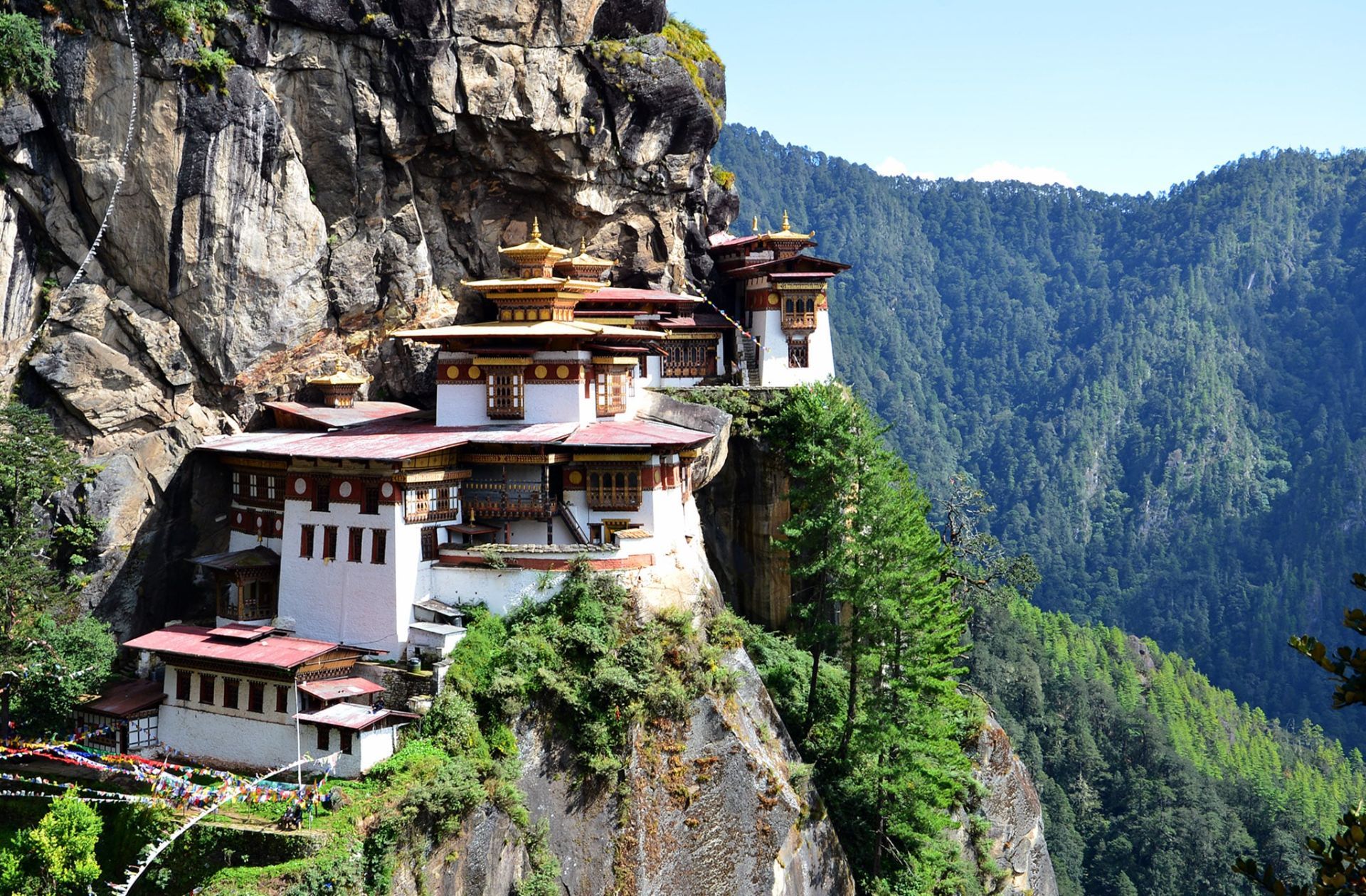
## Description The Tiger’s Nest, or Paro Taktsang, is a cliffside Buddhist monastery in Bhutan dramatically perched on a vertical rock face above the Paro Valley. Dating to the 17th century (with earlier sacred associations to Guru Rinpoche), the complex comprises several temples and hermitages connected by steep steps and narrow paths. The visual impact — whitewashed buildings and golden roofs clinging to granite — is among the most evocative images of Himalayan spiritual architecture. The site is both a pilgrimage destination and a focal point of Bhutanese national identity. Legend holds that Guru Rinpoche (Padmasambhava) arrived on the back of a tigress and meditated in the grottoes that now form part of the monastery complex. The blend of sacred history, dramatic landscape, and living monastic life gives Paro Taktsang deep spiritual resonance for Bhutanese and international visitors alike. SEO-friendly phrases you may use for planning include "Tiger's Nest hike," "Paro Taktsang visit tips," and "Bhutan monastery etiquette." Visitor experience: The descent into the valley and the ascent along forested trails provide a contemplative approach lined with prayer flags, small chortens, and viewpoints. While the most iconic view is from the main lookout before descending to the monastery, many visitors linger to observe ritual offerings, circumambulation of shrines, and the quiet rhythm of monastic routines. Respectful curiosity—asking guides about appropriate behavior and dress—enhances the visit for both guests and residents. ## Location Paro Taktsang sits within Paro valley in western Bhutan, about a 45–60 minute drive from Paro town and its international airport. Access requires a moderate hike of 2–3 hours round-trip depending on pace and stops. How to get there: Most travelers arrange transport through a licensed guide or hotel. Bhutan's regulated tourism policies require foreign visitors to book through licensed operators who manage permits, accommodation, and local guide services. For practical planning, search queries like "book Tiger's Nest guide" or "Paro Taktsang hiking permits" will direct you to authorized providers. Trail notes: The trail rises steadily with sections of stone steps and steeper pitches; resting at teahouses and lookout points is common. Horse rentals are occasionally offered for portions of the route, but check animal welfare practices and trail suitability before choosing this option. ## Tips - **Dress respectfully:** Wear modest clothing for temple visits; remove shoes inside shrines as required and avoid revealing or inappropriate attire. - **Prepare for a strenuous hike:** Bring sturdy footwear, adequate water, sun protection, and allow time for rest stops; altitude and steps make the climb moderately challenging. - **Hire an experienced guide:** Guides explain religious practices, translation of local rituals, and can signal areas off-limits to visitors, creating a more meaningful visit. - **Follow monastery rules:** Photography restrictions inside temples, silence in prayer halls, and specific rituals require compliance; ask before photographing monks or ceremonies. - **Consider timing:** Early morning or late afternoon visits reduce crowding and provide superior photography light, but check seasonal opening hours and local festivals. ## Conclusion Paro Taktsang is both a pilgrimage site and a Himalayan emblem: its precarious position and spiritual resonance make it an unforgettable visit that blends exertion with contemplative reward. When planning, confirm that your tour operator or hotel handles permits and local guidelines; these practical steps help protect the monastery’s sanctity and the visitor’s experience. ## FAQ - **Q: Can foreigners visit Tiger’s Nest independently?** A: Bhutan requires most foreign visitors to travel with licensed operators or registered guides. Booking through authorized tour operators ensures that permits, accommodations, and guide services are in place. - **Q: How long does the hike take?** A: Typical round-trip times range from 3 to 5 hours depending on fitness, stops, and whether you use any horse transport for parts of the ascent. - **Q: Are there age or mobility restrictions?** A: The trail includes steep steps and uneven surfaces and may not be suitable for those with severe mobility limitations. Discuss options with your guide; horse rentals for short segments may be available but evaluate safety and welfare considerations. - **Q: What permits or fees are required?** A: Entry to Bhutan is managed via licensed operators; fees and permit processes vary with season and travel packages. Confirm all costs with your provider in advance. - **Q: Is photography allowed inside the monastery?** A: Many interior temple spaces restrict photography to preserve sacred objects and respect practitioners. Always ask guides or monks before photographing interior or ritual scenes. ## Links - [Paro Taktsang — Wikipedia](https://en.wikipedia.org/wiki/Paro_Taktsang)
GemVoyage Team • World
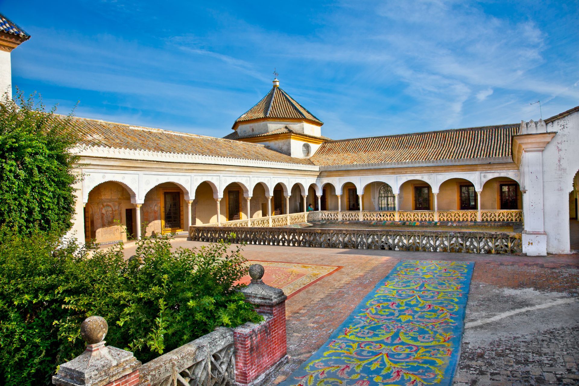
Seville
## Description Casa de Pilatos is one of Seville’s finest palace houses, and it offers a beautifully layered view of Andalusian aristocratic taste. The building combines Mudéjar, Gothic, Renaissance, and classical influences in a way that feels distinctly Seville: elegant, intimate, richly detailed, and full of color. Unlike larger monumental palaces that can feel ceremonial from a distance, Casa de Pilatos is engaging because it feels lived in, even while it displays a carefully composed noble identity. The courtyards, tilework, columns, carved ceilings, and quiet rooms all work together to create an atmosphere of refined domestic power. One of the most attractive features of Casa de Pilatos is the way it rewards close observation. The palace is filled with azulejos, decorative stonework, and interior spaces that look different from one angle to another. A little-known fact is that the house became a model for later aristocratic and historicist taste in Seville, which means its influence extended beyond its own walls. Another detail that many visitors do not realize at first is that the palace reflects a long process of collecting, adapting, and reworking styles over time rather than a single fixed architectural plan. That layering is part of why the house feels so rich: it is a conversation between centuries. The visit is especially satisfying for travelers who enjoy architecture, decorative arts, and quieter historic spaces. Casa de Pilatos does not overwhelm you with scale. Instead, it draws you in with proportion, texture, and detail. If you take your time, you start to notice how the courtyards organize light and shadow, how the tile panels repeat motifs, and how the rooms communicate status through design rather than spectacle. This is the kind of place that stays in memory because it is both elegant and human in scale. ## Location Casa de Pilatos is in central Seville, Andalusia, Spain, in the historic core of the city and not far from the area of Santa Catalina and other well-known old-town streets. Because it is centrally located, it is easy to reach on foot if you are already sightseeing in Seville’s old center. Buses and taxis also work well, but for most visitors a walk is the easiest and most enjoyable option, especially if you want to combine the palace with nearby churches, cafés, and smaller streets. From a practical point of view, the palace fits naturally into a half-day route through the old town. You can visit Casa de Pilatos before or after other central sites without needing a complicated transfer. If you arrive during hot weather, try to come earlier in the day so that the internal courtyards feel cooler and more comfortable. The compact location makes it easy to include, but the richness of the interiors means you should not treat it as a quick pass-through stop. ## Tips - Buy tickets in advance if you are visiting during a busy travel period. - Allow at least an hour so you can appreciate the courtyards and decorative details. - Look up at the ceilings and down at the tilework; the best details are not always at eye level. - Pair the visit with another nearby historic site so you get a fuller sense of Seville’s old center. - Go earlier in the day if you want softer light for photography. - Move slowly through the house, because the beauty here is in the accumulation of small details. ## Conclusion Casa de Pilatos is a refined and memorable palace that shows another side of Seville’s historic richness. It is elegant, quietly dramatic, and ideal for travelers who appreciate architecture and atmosphere. ## FAQ ### Is Casa de Pilatos open to visitors? Yes. It is a visiting palace with public access, though opening hours can vary. ### How long does a visit take? Most visitors need about one hour, though architecture lovers may stay longer. ### Is it suitable for families? Yes, especially if the group enjoys historic buildings and decorative art. ### What makes it different from other Seville palaces? Its blend of styles, intimate scale, and exceptional tile and courtyard details make it especially distinctive. ## Links - [Official website](https://www.fundacionmedinaceli.org/patrimonio/casa-de-pilatos/) - [Wikipedia](https://en.wikipedia.org/wiki/Casa_de_Pilatos) - [Seville tourism information](https://www.visitasevilla.es/en)
GemVoyage Team • World
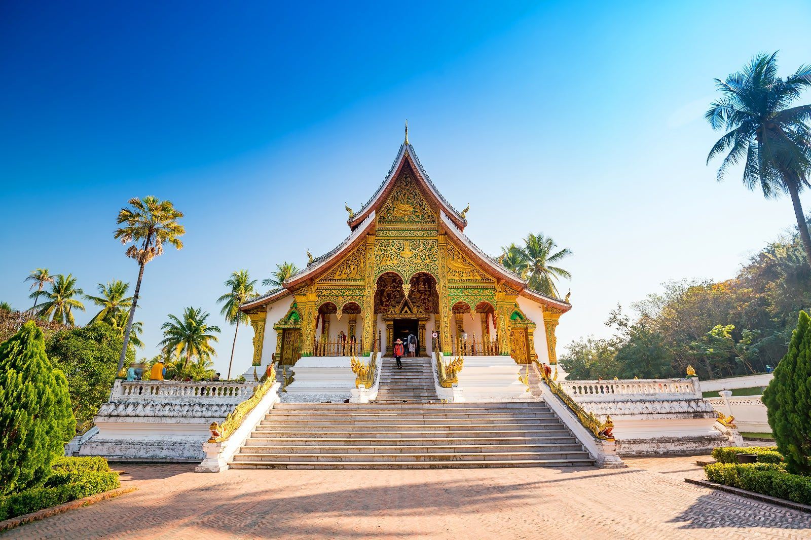
Laos
## Description Luang Prabang, nestled where the Mekong and Nam Khan rivers meet, is a compact and remarkably well-preserved city in northern Laos. Renowned for its colonial-era buildings, saffron-robed monks, ornate Buddhist temples and a contemplative pace, Luang Prabang blends spiritual ritual with a lively artisan scene and riverfront cafés. The city’s Unesco-listed core includes gilded wats (temple complexes) with intricate woodwork, and the daily ritual of almsgiving — where villagers and visitors watch monks collect offerings at dawn — remains a powerful cultural scene. Beyond its temples, Luang Prabang is a gateway to waterfalls such as Kuang Si, traditional weaving villages, and hilltop viewpoints that reward gentle hikes. The city’s food scene is notable for Lao specialties and a street-market culture that showcases sticky rice, grilled meats, and delicate river fish dishes. Luang Prabang is a place where slow travel rewards attention: morning almsgiving, quiet temple courtyards, and riverside cafés invite pauses that reveal local rhythms. The city manages to balance heritage conservation with welcoming tourism; narrow streets are punctuated by family-run guesthouses, handicraft cooperatives and social enterprises focused on sustainable tourism. Kuang Si Falls remains a perennial highlight — a cascading tier of turquoise pools that invites both swimming and mindful walking — while nearby villages offer hands-on experiences with traditional weaving, dyeing and food preparation. The compact scale of Luang Prabang makes it easy to explore on foot or by bicycle; many travelers find that wandering the backstreets at dawn or dusk yields unexpectedly intimate encounters with everyday life. Given the city's spiritual presence, visitors should dress respectfully around temples and be mindful of photography etiquette during ceremonies. The night market on Sisavangvong Road is a lively hub for textiles, silverwork and street food, but for authentic Lao cuisine seek neighborhood stalls where family recipes are passed down through generations. Seasonal festivals, like Boun Pi Mai (Lao New Year) and other Buddhist celebrations, add further depth for those who align travel dates with local calendars. ## Location Luang Prabang is in northern Laos, reachable by air at Luang Prabang International Airport (LPQ) or by overland routes from northern Thailand and Vientiane. The rivers provide scenic boat connections to upriver destinations and are central to the city’s character. Flight connections to Luang Prabang arrive from regional hubs; overnight trains and bus routes from Chiang Mai and other Thai cities offer overland alternatives. River cruises along the Mekong provide a slower, scenic arrival that frames the city's riverside charm. Central Luang Prabang is compact and walkable, with most attractions clustered within an easy radius; taxis, tuk-tuks and river boats provide transport to outlying sites like Kuang Si Falls and surrounding villages. ## Tips - **Honor local customs:** Dress modestly at temples, avoid loud behavior during almsgiving, and observe photography etiquette. - **Visit Kuang Si Falls:** A short drive away, the falls’ turquoise pools are ideal for swimming and picnics — arrive early to avoid crowds. - **Explore by foot or bicycle:** The city center is compact; walking or cycling is pleasant and helps you discover markets and side streets. - **Try a river cruise:** Sunset river trips on the Mekong offer relaxed views and local riverside life. - **Support craft cooperatives:** Visit silk-weaving and craft workshops that support local artisans and sustain traditional techniques. - **Carry small bills for offerings:** If participating respectfully in almsgiving or donations, small local currency notes are appropriate. - **Be mindful of seasonal weather:** The cool-dry season (Nov–Feb) is most comfortable; the wet season can make rural tracks muddy and less accessible. - **Hire local guides for village visits:** Ethical community-based tours give income to families and provide authentic context. - **Taste street specialties early:** Local breakfasts like khao soi and grilled river fish are best experienced fresh from morning stalls. ## Conclusion Luang Prabang offers a gentle, culturally immersive travel experience: spiritual rhythm, natural beauty and warm Lao hospitality combine to create a reflective pace that many travelers find restorative. Whether you’re drawn to its temples, waterfalls or artisan traditions, Luang Prabang rewards visitors who travel slowly and with curiosity. The city’s human scale and spiritual cadence make it an ideal destination for travelers seeking contemplative experiences, meaningful cultural exchange and access to some of Laos’s most scenic natural sites. ## FAQ - **Q: Is Luang Prabang safe for solo travelers?** - A: Generally yes — it’s considered one of Southeast Asia’s safer small cities, but usual travel caution applies. - **Q: When is the best time to visit?** - A: The cool dry season (November–February) is most comfortable; the wet season can be lush but includes heavy rains. - **Q: Are there international flights?** - A: Luang Prabang has regional flights; connections from Bangkok, Hanoi and Vientiane are common. - **Q: How many days are ideal for a first visit?** - A: Three to five days lets you explore temples, enjoy Kuang Si Falls, visit a weaving village and take a short Mekong trip without rushing. - **Q: What should I wear for temple visits?** - A: Dress modestly with shoulders and knees covered; remove shoes when entering temple buildings and follow local customs. - **Q: Can I use ATMs and credit cards?** - A: ATMs are available in town and larger businesses accept cards, but carry cash for market stalls and rural excursions. - **Q: Are there ethical ways to visit villages?** - A: Yes — choose community-run tours, avoid exploitative photo practices, and purchase directly from cooperatives when possible. ## Links - [Luang Prabang — Wikipedia](https://en.wikipedia.org/wiki/Luang_Phrabang)
GemVoyage Team • World
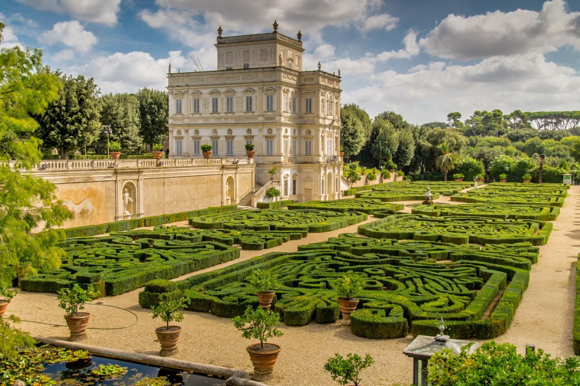
Rome
## Description Villa Doria Pamphili is Rome’s largest landscaped villa park, a sprawling green refuge that stretches across rolling lawns, tree-lined avenues, and layered gardens. The park is a living palimpsest: its design reflects generations of development, blending formal Italianate fragments with later Romantic landscape interventions. Visitors discover broad promenades shaded by mature pines and cypresses, intimate groves, terraced viewpoints, ornamental fountains, and the occasional historic villa or chapel tucked into the greenery. What separates Villa Doria Pamphili from Rome’s better-known manicured gardens is its scale and everyday use: runners training along long straight avenues, families picnicking under broad trees, and musicians gathering informally on sunny afternoons. The park hosts seasonal cultural programs—outdoor concerts, film nights, and neighborhood festivals—yet retains a quiet dignity even during busier times. Its pathways offer both restful, shaded routes and open, sunlit clearings; photographers and nature lovers will appreciate the changing light through the trees and occasional glimpses of Roman rooftops beyond. The park’s history is visible in its layered landscaping: landscaped terraces that once anchored a noble estate, interspersed with woodland patches that feel older and wilder. For those studying garden history, the site provides a satisfying case study of how aristocratic pleasure grounds transitioned to public urban parks. For ordinary visitors, the pleasures are simpler—ample space, restful atmosphere, and a sense of escape from Rome’s denser historic core. ## Location Villa Doria Pamphili occupies a large swathe in western Rome, bordering neighborhoods like Monteverde and Trastevere. It is reachable by bus, taxi, and on foot from several tram and metro stops; the park’s size means different entrances suit different itineraries, so checking a map before you go helps you plan whether to approach from the north, south, or west side. ## Tips - Wear comfortable footwear: the park’s size rewards long walks and exploration across varied surfaces. - Visit on a weekday morning for the quietest experience; weekends attract many local families and picnickers. - Bring a picnic and a blanket—there are many scenic clearings suited to lingering. - Rent a bike or bring a folding bike if you want to cover more ground; some routes are well-suited to casual cycling. - Keep an eye on the events board: the park occasionally stages open-air concerts and screenings, which can be a delightful, low-cost cultural night out. - Respect local rules about barbecues and alcohol: these can be restricted in parts of the park. ## Conclusion Villa Doria Pamphili is an expansive urban refuge offering both active recreation and relaxed contemplation. Its layered history, varied landscapes, and everyday uses make it a revealing place to spend a few hours or an entire afternoon—particularly appealing for travelers seeking outdoor green spaces and a more local side of Rome. ## FAQ Q: Is there an entrance fee? A: No—the park is public and free to enter, which makes it a popular local destination for recreation and relaxation. Q: Are dogs allowed? A: Dogs are usually permitted on-leash in most areas; check local signage for any leash-free zones or restrictions. Q: Can I cycle through the park? A: Yes—many paths are bike-friendly, though some narrower or pedestrian-priority areas may be more suitable for walking. Q: Are there public restrooms and water fountains? A: Basic facilities are available but can be limited; carry some water and check maps for restroom locations during longer visits. Q: Are there guided tours of the park’s history? A: Occasionally local associations offer guided walks focusing on the villa’s history and gardens—look for community announcements or contact local tourism offices. ## Links - [Villa Doria Pamphili (Wikipedia)](https://en.wikipedia.org/wiki/Villa_Doria_Pamphili)
GemVoyage Team • World

Dubysa
## Description Lyduvėnai Bridge is an arresting piece of nineteenth- and twentieth-century engineering that spans the deep, wooded Dubysa River valley near Lyduvėnai. Its soaring iron arches and lattice work combine functional railway engineering with a sculptural presence that is particularly striking when framed by the steep gorge below. Photographers, history enthusiasts and hikers are drawn to the site for the dramatic perspectives it creates—an industrial monument suspended over a wild, verdant canyon. Over time the bridge has required restorations and careful maintenance, and those interventions are part of its layered history. Local preservation efforts have sought to keep the bridge operational while respecting its historical materials and structure. The engineered spans and riveted ironwork tell a story about rail transport, regional development and the craft of steel construction. Beyond its technical merits, Lyduvėnai Bridge sits within a landscape of trails, viewpoints and small rural roads that allow visitors to explore the canyon from multiple angles. Birdsong and river sounds contrast with the bridge’s metallic lines, and seasonal changes—spring greens, autumn foliage—transform the setting dramatically, offering different moods for photographic study. ## Location Lyduvėnai Bridge is located near the village of Lyduvėnai in Raseiniai district municipality, Kaunas County, central-western Lithuania. It spans the Dubysa River in a steep, forested valley that is characteristic of the region’s mixed agricultural and wooded landscape. Access is most convenient by car: follow regional roads from Raseiniai and nearby towns. Public transport to the immediate vicinity is limited, so visitors relying on buses or trains should plan for a taxi or private transfer for the final leg. The rural setting rewards a slower pace—park at designated pullouts or village car parks and follow marked trails toward viewpoints. ## Tips - Photograph at golden hour—early morning or late afternoon—when light sculpts the ironwork and the valley takes on warm tones. - Never walk on active tracks; use official viewpoints and trails to keep a safe distance while still getting dramatic compositions. - Bring sturdy shoes and insect repellant for nearby trails; the area can be steep and overgrown in parts. - Combine the visit with local villages, riverside hikes and birdwatching; pack water and snacks as amenities are sparse. - Check local guidance on accessibility—some viewpoints require steep walks, while others are more level and family-friendly. ## Conclusion Lyduvėnai Bridge is an exemplar of how engineering and landscape can produce a site of compelling beauty. The bridge rewards visitors who slow down to observe structural detail, changing light and the interplay of human craft with natural settings. Whether you come for history, photography or a quiet day outdoors, the bridge and its surrounding valley offer memorable vistas and a distinct slice of regional heritage. ## FAQ Q: Can visitors walk across the bridge? A: No. For safety and legal reasons, do not walk on active railway tracks. Use the designated viewpoints and trails which provide safe vantage points. Q: Is the bridge accessible by car? A: Yes, but roads are rural and sometimes narrow—drive carefully and park only in designated areas or official pullouts. Q: Are there guided tours or information panels on site? A: Information is limited on-site; local heritage groups sometimes publish guides or online materials—check regional tourism resources for up-to-date information. Q: What wildlife might I see in the Dubysa valley? A: The valley supports woodland birds, small mammals and a range of plant life; spring and autumn are best for birdwatching and seasonal flora. Q: Is it possible to photograph the bridge from below? A: Some viewpoints near the riverside allow lower-angle shots, but access may be steep and require caution; respect private property and posted restrictions. ## Links - [Lyduvėnai Bridge](https://militaryheritagetourism.info/en/military/sites/view/800)
GemVoyage Team • World
