GemVoyage Team • World
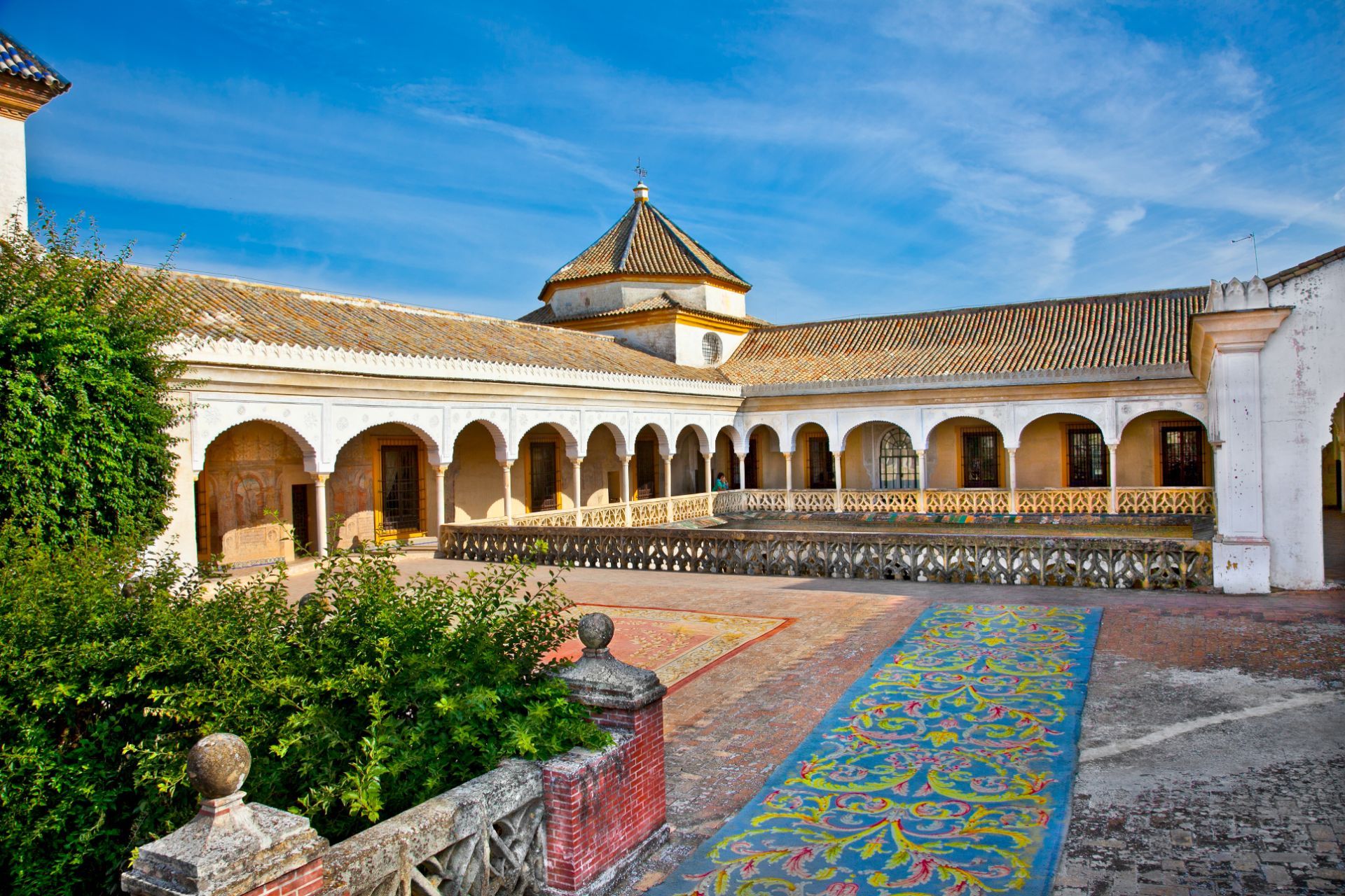
One of the most attractive features of Casa de Pilatos is the way it rewards close observation. The palace is filled with azulejos, decorative stonework, and interior spaces that look different from one angle to another. A little-known fact is that the house became a model for later aristocratic and historicist taste in Seville, which means its influence extended beyond its own walls. Another detail that many visitors do not realize at first is that the palace reflects a long process of collecting, adapting, and reworking styles over time rather than a single fixed architectural plan. That layering is part of why the house feels so rich: it is a conversation between centuries.
The visit is especially satisfying for travelers who enjoy architecture, decorative arts, and quieter historic spaces. Casa de Pilatos does not overwhelm you with scale. Instead, it draws you in with proportion, texture, and detail. If you take your time, you start to notice how the courtyards organize light and shadow, how the tile panels repeat motifs, and how the rooms communicate status through design rather than spectacle. This is the kind of place that stays in memory because it is both elegant and human in scale.
From a practical point of view, the palace fits naturally into a half-day route through the old town. You can visit Casa de Pilatos before or after other central sites without needing a complicated transfer. If you arrive during hot weather, try to come earlier in the day so that the internal courtyards feel cooler and more comfortable. The compact location makes it easy to include, but the richness of the interiors means you should not treat it as a quick pass-through stop.
Discover more hidden gems you might love.
Sanaa
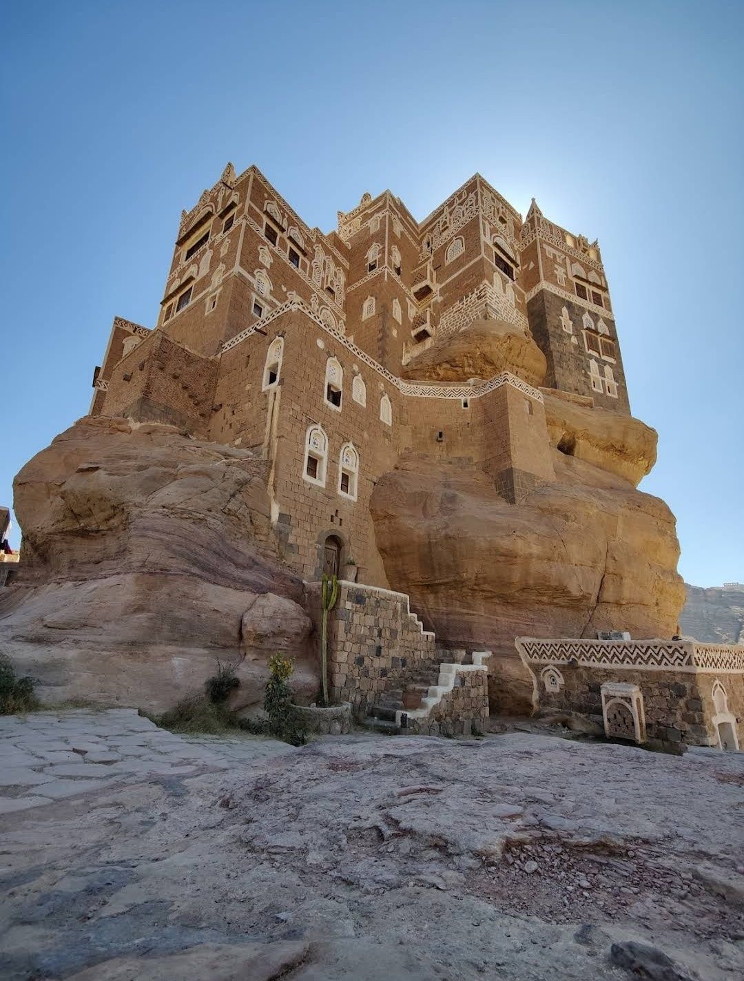
## Description The Stone House in Sanaa is one of the most fascinating architectural wonders in Yemen’s capital. Built entirely from stone, this house reflects the deep-rooted traditions of Yemeni architecture, where natural materials, geometric patterns, and delicate carvings come together in harmony. What makes the Stone House truly unique is its ability to blend strength with elegance—its towering façade is decorated with white gypsum frames and intricate motifs that give it an almost fairy-tale appearance. Unlike many modern buildings, the Stone House is more than just a residence; it represents centuries of history and cultural identity. One little-known fact about this landmark is that it was designed to adapt to the city’s climate: thick stone walls keep the house cool during Yemen’s hot summers and warm during the chilly winter nights. Another fascinating detail is that the windows are often covered with **qamarīyah** (colored stained glass), which not only filters light beautifully but also symbolizes prosperity and protection in Yemeni tradition. ## Location The Stone House is located in **Sanaa**, the capital city of **Yemen**, within the region known as **Old Sanaa**. This UNESCO World Heritage Site is famous for its maze-like alleys, traditional markets (souqs), and iconic high-rise houses made of stone and mud brick. The Stone House is nestled among these historic buildings, making it an essential stop for anyone exploring the old city. To reach Sanaa, international visitors usually arrive via **Sanaa International Airport**. From there, a short drive will take you to Old Sanaa, where most attractions—including the Stone House—are within walking distance. If you are already in the city, taxis are the most convenient way to get there, as public transportation can be limited and sometimes confusing for first-time travelers. ## Tips for Visitors Visiting the Stone House can be an unforgettable experience if you plan properly. Here are some essential tips: * **Best Time to Visit**: The ideal time to explore Sanaa is during the cooler months (October to March), when the weather is more pleasant for walking around the old city. * **Respect Local Culture**: Yemen is a conservative country, so visitors should dress modestly. Women may want to cover their hair with a scarf when entering traditional neighborhoods. * **Hire a Local Guide**: A guide can explain the hidden meanings behind the architecture and help you discover details you might otherwise miss. * **Photography Etiquette**: Always ask before photographing people, especially in residential areas. However, the buildings themselves are a photographer’s dream, so bring a good camera. * **Stay Safe**: Due to Yemen’s political situation, travelers should always check current travel advisories before planning a visit and consider traveling with a trusted tour operator. ## Conclusion The Stone House in Sanaa is more than just an old building—it’s a living symbol of Yemeni history, culture, and artistry. Its unique stone architecture, stained glass windows, and cultural significance make it a must-see destination for travelers interested in heritage and history. Nestled in the heart of Old Sanaa, it offers an authentic glimpse into one of the world’s most remarkable historic cities. ## Frequently Asked Questions (FAQ) **1. What is the Stone House in Sanaa?** The Stone House is a traditional Yemeni building in Old Sanaa, made primarily of stone and decorated with gypsum and stained glass windows. **2. Why is the Stone House important?** It represents Yemeni architectural heritage and showcases how traditional designs were adapted to both climate and culture. **3. Can tourists visit the Stone House?** Yes, visitors can explore it along with other landmarks in Old Sanaa, though it is best to check travel advisories before planning a trip. **4. How old is the Stone House?** While the exact date of construction varies depending on the specific house, most traditional stone houses in Sanaa date back several centuries. **5. Is photography allowed inside the Stone House?** Photography of the building is usually allowed, but always be respectful and ask for permission if entering private areas. **6. How can I reach the Stone House from the airport?** From Sanaa International Airport, it’s about a 30-minute drive to Old Sanaa. Taxis are the most convenient way to get there. ## Useful Links * [UNESCO World Heritage – Old City of Sanaa](https://whc.unesco.org/en/list/385/)
GemVoyage Team • World
Paris
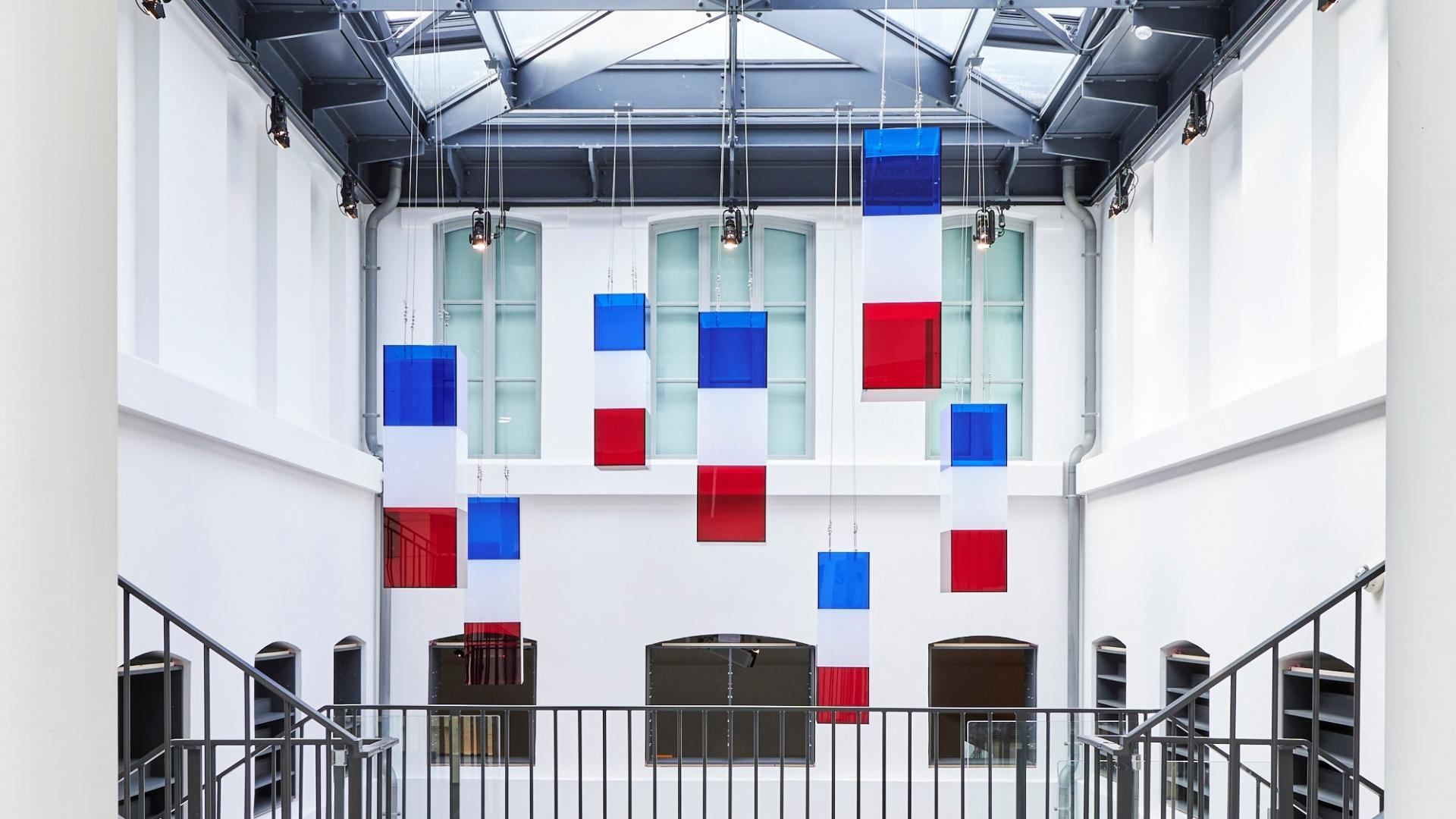
## Description **The Liberation of Paris Museum (Musée de la Libération de Paris – Musée du Général Leclerc – Musée Jean Moulin)** is one of the most important modern history museums in the French capital. Dedicated to the **German occupation of Paris (1940–1944)**, the **French Resistance**, and the **Liberation of Paris**, the museum offers a clear, unsentimental account of how the city endured, resisted, and ultimately reclaimed its freedom during World War II. What distinguishes this museum is its **focus on individuals rather than abstract events**. Through personal letters, photographs, uniforms, clandestine newspapers, and everyday objects, the museum tells the story of ordinary Parisians alongside key historical figures such as **Jean Moulin**, a central figure of the French Resistance, and **General Philippe Leclerc**, commander of the Free French forces that entered Paris in August 1944. The narrative is chronological and grounded, avoiding glorification while emphasizing moral courage and civil resistance. One of the museum’s most striking features is the preserved **underground command bunker** used by Colonel Henri Rol-Tanguy during the final days of the liberation. Visitors can descend into this space, which remains intact, offering a rare and visceral sense of wartime decision-making under pressure. A lesser-known fact is that this bunker was rediscovered relatively late and restored as part of the museum’s redesign. Another notable detail is that the museum relocated in 2019 to its current site to better reflect the historical geography of the liberation events. The museum is immersive without being overwhelming. It balances historical rigor with accessibility, making complex political and military developments understandable without diluting their seriousness. ## Location **Country:** France **Region:** Île-de-France **City:** Paris **Arrondissement:** 14th arrondissement The museum is located on **Place Denfert-Rochereau**, a historically symbolic site connected to resistance activity and wartime infrastructure. ### How to Get There * **By metro:** * Lines 4 and 6 to **Denfert-Rochereau** station. * **By RER:** * RER B stops at Denfert-Rochereau, providing direct access from airports and suburbs. * **By bus:** * Several bus lines stop directly at the square. * **On foot:** * Easily reachable from Montparnasse and surrounding neighborhoods. ## Tips * **Allow sufficient time:** Plan **1.5 to 2 hours** to fully absorb the exhibitions. * **Do not skip the bunker:** Access is limited in capacity but is a core part of the experience. * **Read the personal testimonies:** These provide emotional depth beyond dates and events. * **Visit before or after nearby sites:** The Paris Catacombs and Montparnasse Cemetery are close by. * **Suitable for older children and adults:** Some content may be intense for very young visitors. * **Free entry:** Take advantage of the museum’s permanent free access. ## Conclusion The Liberation of Paris Museum offers a sober, powerful exploration of one of the city’s defining moments. Through personal stories, preserved spaces, and clear historical context, it transforms the liberation of Paris from a symbolic event into a deeply human experience. ## FAQ **1. Is the museum free to visit?** Yes, permanent exhibitions are free for all visitors. **2. How long does the visit take?** Approximately **90 minutes to 2 hours**, depending on interest level. **3. Is the underground bunker accessible?** Yes, but access may be limited at busy times due to space constraints. **4. Is the museum suitable for non-French speakers?** Yes. Exhibits are well-labeled, and much of the content is available in multiple languages. **5. Does the museum focus only on Paris?** Primarily, but it also addresses broader resistance networks and Free French operations. **6. Is photography allowed?** Photography is generally permitted, but flash and tripods may be restricted. ## Links * [City of Paris museums portal](https://www.paris.fr) * [Official Museum Website](https://www.museeliberation-leclerc-moulin.paris.fr/en)
GemVoyage Team • World
Milan
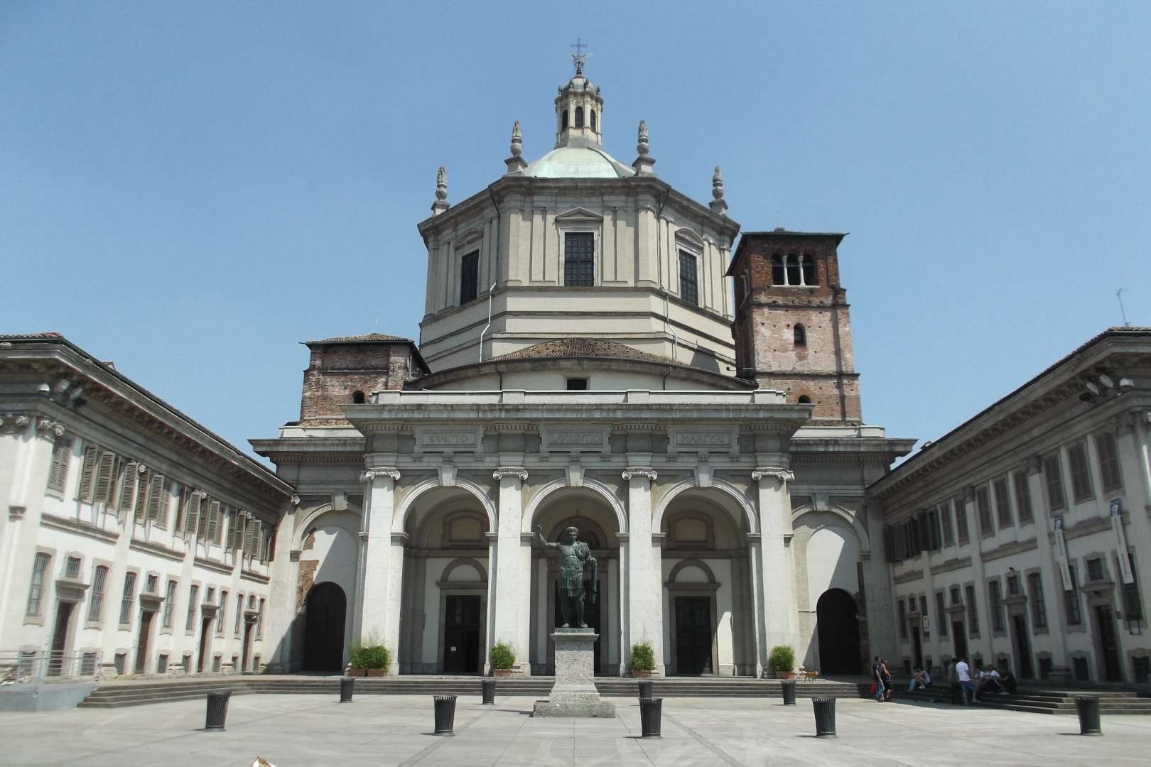
## Description The Basilica of San Lorenzo Maggiore in Milan is one of the city’s oldest and most architecturally intriguing churches, offering a rich tapestry of history, religion, and design. Originally constructed between the late 4th and early 5th centuries, the basilica has undergone numerous reconstructions, resulting in a unique blend of Early Christian, Renaissance, and Baroque styles. Its imposing central dome and symmetrical layout make it a standout among Milan’s ecclesiastical landmarks. What sets San Lorenzo apart is its daring architectural originality. Art historians have noted its resemblance to the great churches of Constantinople, many of which no longer exist. The basilica’s interior features elegant marble columns, intricate mosaics, and the stunning Chapel of Saint Aquilino, which houses 4th-century Byzantine mosaics and remnants of Roman construction materials. Outside, the Colonne di San Lorenzo—sixteen Roman columns dating from the 3rd century—stand as a dramatic prelude to the church and are among the few surviving relics of ancient Mediolanum. A little-known fact: archaeological investigations suggest that the basilica may have been built atop a Roman amphitheater, and some of its foundational materials were repurposed from other Roman sites. Another fascinating detail is that the basilica’s dedication to Saint Lawrence was only confirmed in 590 AD, long after its initial construction. ## Location The Basilica of San Lorenzo Maggiore is located in **Italy**, in the **Lombardy region**, within the **city of Milan**. Its exact address is **Corso di Porta Ticinese, 39**, situated near the medieval Porta Ticinese and within walking distance of the Navigli district and the city center. ### How to Get There - **By Metro**: Take Line M2 to Sant’Ambrogio or Line M3 to Missori, then walk about 10–15 minutes. - **By Tram**: Tram line 3 stops at “Ticinese Molino delle Armi,” just steps from the basilica. - **By Foot**: From the Duomo, it’s a pleasant 15-minute walk through historic streets. - **By Bike or Scooter**: Milan’s bike-sharing and e-scooter services offer a scenic and efficient way to reach the basilica. Its central location makes it easy to include in a day of sightseeing, especially when paired with nearby attractions like the Basilica of Sant’Eustorgio or the Navigli canals. ## Tips - **Visit the Chapel of Saint Aquilino**: Don’t miss this side chapel, which contains some of the oldest mosaics in Milan and offers a glimpse into the city’s Roman past. - **Go Early or Late**: The basilica is less crowded in the morning or late afternoon, allowing for a more peaceful visit. - **Dress Modestly**: As with all religious sites, respectful attire is recommended. - **Explore the Piazza**: The square in front of the basilica is lively and atmospheric, often filled with street performers and locals. - **Check for Mass Times**: If you’re interested in attending a service, consult the basilica’s schedule in advance. - **Photography**: Photos are allowed, but avoid flash and be mindful during services. ## Conclusion Basilica San Lorenzo Maggiore is a captivating blend of ancient history and spiritual heritage. With its Roman columns, Byzantine mosaics, and architectural grandeur, it offers a compelling experience for anyone exploring Milan’s rich cultural landscape. ## FAQ **1. Is there an entrance fee to visit the basilica?** No, entry to the basilica is free. Donations are welcome. **2. What are the opening hours?** Monday to Friday: 8:00 AM – 12:30 PM and 3:00 PM – 6:30 PM Saturday and Sunday: 9:00 AM – 1:00 PM and 3:00 PM – 7:00 PM **3. Can non-Catholics visit the basilica?** Yes, the basilica is open to all visitors, regardless of religious background. **4. Is the basilica wheelchair accessible?** Some areas may be challenging due to steps and uneven flooring, but the main entrance and nave are generally accessible. **5. Are guided tours available?** Yes, some local tour operators include San Lorenzo in their walking tours of Milan’s historic center. **6. What is the best time of year to visit?** Spring and autumn offer mild weather and fewer crowds, making them ideal for sightseeing. ## Links - [Basilica of San Lorenzo – Wikipedia Overview](https://en.wikipedia.org/wiki/Basilica_of_San_Lorenzo,_Milan) - [San Lorenzo Maggiore – Official Website](http://www.sanlorenzomaggiore.com/)
GemVoyage Team • World
.jpg)
Chongqing
## Description Jiefangbei Shopping Street, also known as **Jiefangbei Pedestrian Street**, is one of the most famous commercial districts in China and the beating heart of **Chongqing**. This bustling area is not just a shopping paradise but also a cultural and social hub, attracting millions of visitors every year. It combines luxury boutiques, international brands, local shops, trendy cafés, and street food stalls—all wrapped in the energetic atmosphere of one of China’s fastest-growing cities. At the center of the district stands the **Jiefangbei Monument (Liberation Monument)**, a historic landmark originally built in 1945 to commemorate China’s victory in World War II. Over time, the monument became surrounded by skyscrapers, neon lights, and high-end malls, symbolizing Chongqing’s transformation from a wartime city into a modern metropolis. A little-known fact is that Jiefangbei Shopping Street is often referred to as the **“Times Square of Chongqing”** due to its massive LED screens, vibrant nightlife, and crowds of visitors. Another unique detail is that beneath the pedestrian street lies a **complex underground shopping mall**, where visitors can explore an entire network of shops, restaurants, and entertainment venues. ## Location Jiefangbei Shopping Street is located in the **Yuzhong District of Chongqing, China**, right in the heart of the city’s central business area. Its central location makes it not only a shopping hotspot but also a starting point for exploring Chongqing’s rich culture and modern lifestyle. ### Recommendation on How to Get There The easiest way to reach Jiefangbei is by **metro**. Take **Line 2 or Line 6** of the Chongqing Metro and get off at **Xiaoshizi Station** or **Jiaochangkou Station**, both of which are just a short walk from the monument. Taxis are also widely available, but due to traffic congestion in the area, the metro is often faster and more convenient. For those staying in central hotels, the street is within easy walking distance. ## Tips Here are some useful tips to make the most of your visit to Jiefangbei Shopping Street: * **Shop Smart**: You’ll find everything from international luxury brands to local fashion boutiques. Bargaining is not common in malls but may be possible at smaller shops or street stalls. * **Try the Food**: Don’t miss the chance to taste Chongqing’s famous **spicy hotpot** or sample local street snacks like grilled skewers and spicy noodles. * **Visit at Night**: The area is most impressive in the evening when the neon lights illuminate the skyscrapers and the monument. * **Wear Comfortable Shoes**: The pedestrian street is large, and exploring the underground shopping centers can involve a lot of walking. * **Combine with Sightseeing**: From Jiefangbei, you can easily walk to **Hongya Cave**, a famous riverside complex, or take a short ride to the **Yangtze River Cableway**. * **Stay Aware of Crowds**: The area can get extremely busy, especially on weekends and holidays, so keep an eye on personal belongings. ## Conclusion Jiefangbei Shopping Street is more than just a commercial hub—it’s a cultural and social landmark that reflects Chongqing’s modern energy and historical roots. With its mix of shopping, dining, and entertainment options, along with the iconic Liberation Monument, it offers a truly immersive experience for both locals and tourists. Whether you’re hunting for the latest fashion trends, tasting local delicacies, or simply soaking in the vibrant atmosphere, Jiefangbei is a must-visit destination in southwest China. ## FAQ **1. What is Jiefangbei Shopping Street famous for?** It is famous for its mix of luxury shops, local boutiques, food stalls, and the iconic Liberation Monument. **2. Is it only for shopping?** No, it’s also a cultural and entertainment hub, with restaurants, cafés, cinemas, and nightlife options. **3. When is the best time to visit Jiefangbei?** Evenings are the best, as the neon lights create a lively and colorful atmosphere. **4. How do I get there from Chongqing city center?** The easiest way is by metro, taking Line 2 or Line 6 to Xiaoshizi or Jiaochangkou stations. **5. Is Jiefangbei suitable for families?** Yes, families can enjoy shopping, dining, and sightseeing in the area. However, it can be crowded, so keeping an eye on children is important. **6. Are there hotels near Jiefangbei?** Yes, the area is surrounded by hotels ranging from luxury to budget options, making it convenient for tourists to stay nearby. ## Links * [Official Chongqing Tourism Office](https://www.china-tourism.de/en/provinces/chongqing/)
GemVoyage Team • World
Cologne
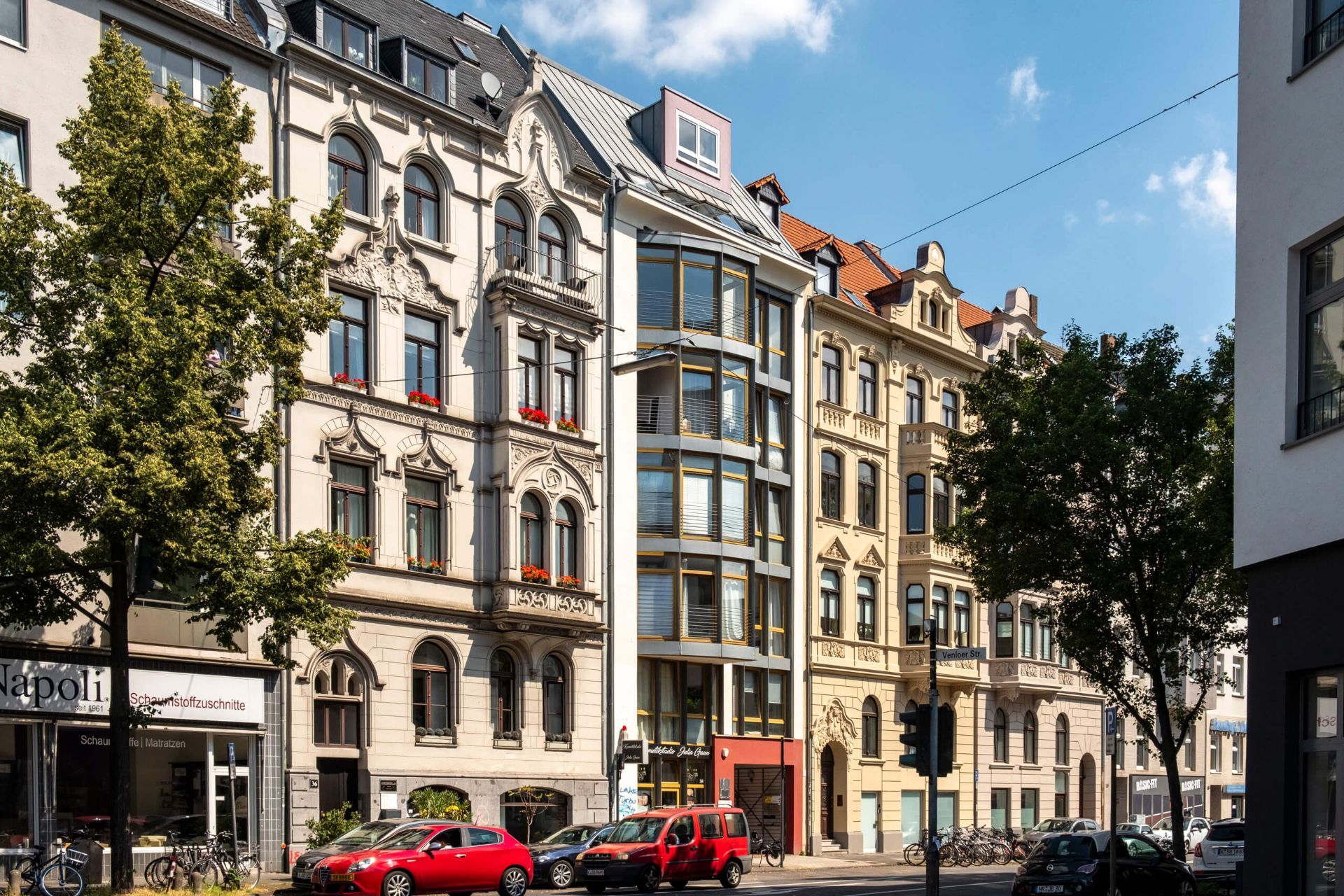
## Description The Belgian Quarter, or Belgisches Viertel, is one of Cologne's most fashionable and creative neighborhoods. Known for its boutiques, galleries, cafes, bars, and attractive residential streets, the district offers a distinctly urban experience that feels polished without becoming impersonal. It is a place where design, food, and everyday city life meet in a compact and walkable area. What distinguishes the Belgian Quarter is its balance of trendiness and livability. Rather than being a single-purpose nightlife zone, it functions as a full neighborhood with shops, apartments, workspaces, and public life. Visitors can browse independent stores, sit at outdoor cafes, look at street art, or simply enjoy the architecture and pace of the streets. The atmosphere is youthful and creative, but not limited to one type of crowd. One lesser-known fact is that the neighborhood's name reflects an old street-naming scheme rather than a strong historical link to Belgium itself. Another is that the area has become a notable center for interior design, fashion, and boutique hospitality, which has helped it develop a reputation as one of Cologne's most style-conscious quarters. That reputation is visible in the carefully curated shopfronts and the relaxed confidence of the streets. The architectural texture of the neighborhood also contributes to its appeal. Tree-lined avenues, classic apartment buildings, and modern retail spaces create an environment that feels pleasant to walk through in almost any season. Because the district is not dominated by one major landmark, the pleasure comes from a series of smaller impressions: a corner cafe, a design store window, a terrace filled with locals, or a low-key bar that becomes lively after dark. For travelers interested in local city culture rather than major monuments, the Belgian Quarter offers a strong sense of Cologne's contemporary lifestyle. It is where people go to meet friends, shop for something unusual, or spend an evening in a setting that feels social but still residential. That gives it a more authentic rhythm than a nightlife strip alone. If you enjoy urban neighborhoods with personality, the Belgian Quarter is one of the best places in Cologne to spend a relaxed afternoon or evening. It is easy to navigate, pleasant to linger in, and rich enough in small details to reward curious travelers. ## Location The Belgian Quarter is located in central Cologne, North Rhine-Westphalia, Germany, just west of the city center. It is easy to reach by tram, bus, or on foot from central Cologne. Once there, the district is best explored on foot because its character depends on browsing, people-watching, and short detours between shops and cafes. ## Tips Go in the afternoon if you want a blend of shopping and cafe culture. If you like design or independent fashion, budget extra time because many stores are worth browsing slowly. Evenings can be lively, but the neighborhood still feels relatively relaxed compared with larger nightlife districts. Combine the visit with a coffee stop or dinner to experience the district's social rhythm. Look beyond the main streets. Some of the best discoveries are one block off the busiest routes. ## Conclusion The Belgian Quarter is one of Cologne's most appealing urban districts, offering a stylish mix of cafes, shops, and neighborhood energy that feels both modern and easygoing. ## FAQ ### Why is it called the Belgian Quarter? The name comes from the street names and the area's historical naming pattern, not from it being a Belgian enclave. ### Is it good for shopping? Yes, especially if you are interested in independent boutiques, design items, and fashion. ### Is the Belgian Quarter touristy? It attracts visitors, but it remains a lived-in neighborhood rather than a purely tourist district. ### What is the best time to visit? Afternoon into evening is ideal if you want to enjoy cafes, shops, and a social atmosphere. ## Links - [Cologne tourism](https://www.cologne-tourism.com/)
GemVoyage Team • World
Brussels
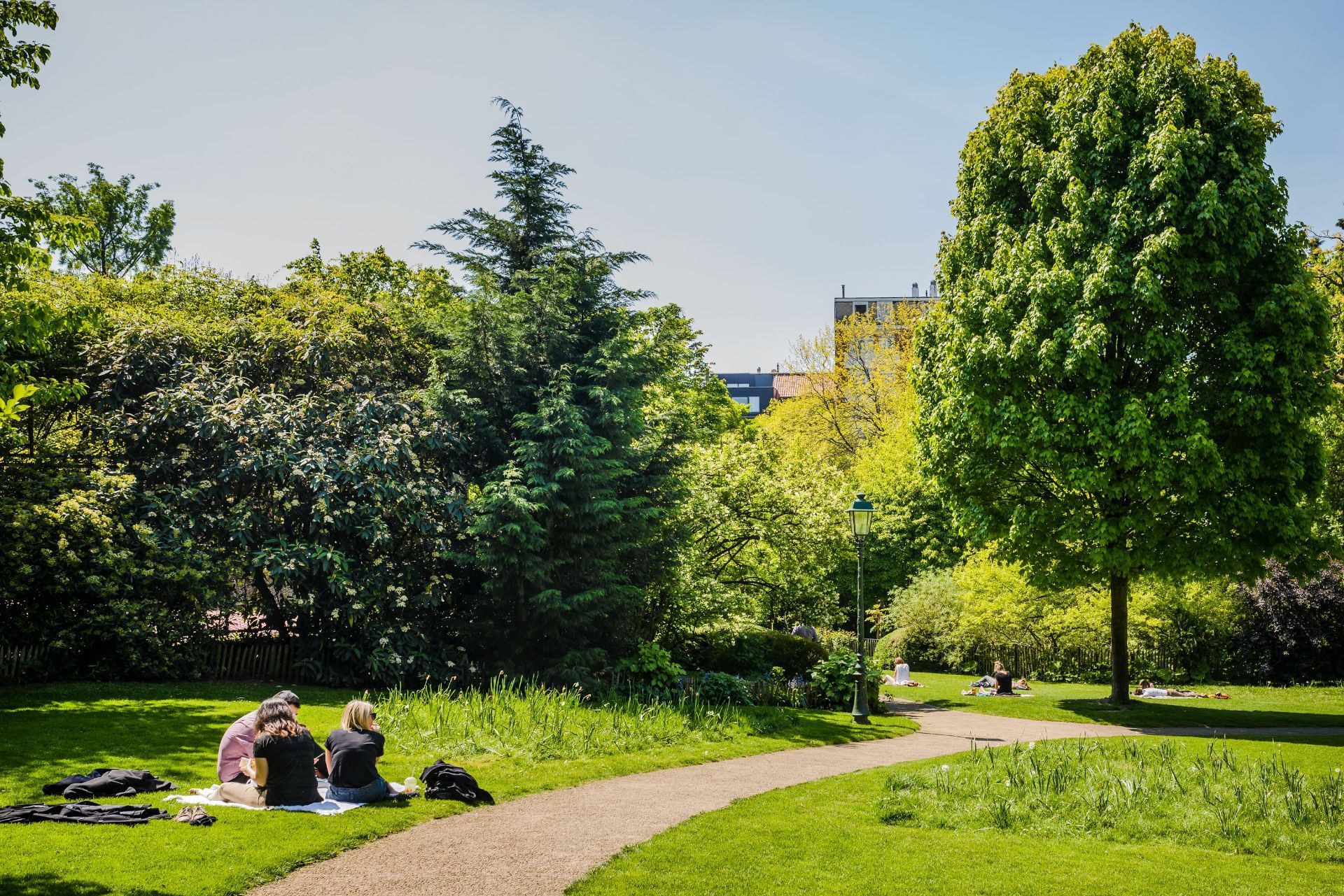
## Description Parc Tenbosch is one of Brussels’ most elegant small parks, and its appeal lies in subtlety rather than spectacle. Located in Ixelles, it offers a calm, leafy space where visitors can slow down, sit under mature trees, and enjoy a more intimate side of the city. For travelers who like parks that feel local rather than monumental, Parc Tenbosch is a strong choice. It is not the kind of place that demands an itinerary slot on its own; instead, it rewards being folded into a neighborhood walk or a café-filled afternoon. What gives the park its character is its sense of quiet design. It has the feel of a carefully tended urban refuge, with winding paths, dense planting, and enough variation in shape and texture to make a simple walk interesting. A lesser-known fact is that the park occupies a site with a layered urban past and was shaped to preserve greenery in a neighborhood that might otherwise have become entirely built up. Another detail many visitors notice only after spending time there is how different it feels from Brussels’ larger public parks: rather than broad ceremonial lawns, it offers an almost garden-like intimacy that makes it feel close to the life of the surrounding streets. For visitors, Parc Tenbosch works best as a pause. It is where you go after lunch, before a museum visit, or between neighborhood explorations. Because Ixelles is one of Brussels’ most varied and walkable districts, the park can fit naturally into a day that also includes Flagey, Avenue Louise, the Châtelain area, or a coffee stop nearby. That flexibility is part of what makes it worthwhile. You are not just visiting a park; you are using it as a calm anchor in one of the city’s busiest residential areas. The park is also a good reminder that urban travel does not always have to revolve around top-tier landmarks. Sometimes the most memorable part of a city is a place where the pace drops, the noise softens, and you get a sense of how residents actually use public space. ## Location Parc Tenbosch is located in Ixelles, Brussels-Capital Region, Belgium. It sits in a central urban setting within easy reach of several popular Brussels neighborhoods, which makes it simple to add to a walking route. The park’s placement in Ixelles means you can approach it from multiple directions depending on where you are staying or what else you want to see in the area. The easiest way to get there is usually on foot, by tram, or by a short taxi or rideshare journey from central Brussels. If you are already exploring Ixelles, the park is one of the simplest green spaces to include along the way. Public transport is convenient if you are coming from farther away, but the park is compact enough that many visitors simply fold it into a wider neighborhood walk. Because it is a neighborhood park, it is best enjoyed at a relaxed pace. Plan a short stop rather than a formal excursion, and let it serve as a quiet counterpoint to the surrounding city. ## Tips Visit when you want to rest your feet. The park is an ideal place to take a break between longer urban walks. Bring a book, snack, or coffee if you want to stay a while. The atmosphere is good for sitting and watching the neighborhood pass by. Keep expectations aligned with the scale of the park. Its charm comes from tranquility and atmosphere, not from grand size or a long list of facilities. Combine it with the surrounding district. Ixelles offers cafés, streets, and cultural stops that pair naturally with a park visit. If the weather is pleasant, go in the afternoon or early evening. That is often when the space feels most welcoming and the light is best for a walk. ## Conclusion Parc Tenbosch is a calm, attractive green refuge in the middle of Brussels’ Ixelles district. It is best for travelers who appreciate smaller urban parks and who want a place to slow down without leaving the city’s most interesting neighborhoods. ## FAQ ### Is Parc Tenbosch worth visiting? Yes, especially if you like neighborhood parks and quiet green spaces. It may not be a headline attraction, but it is rewarding as part of a relaxed Brussels itinerary. ### How long should I stay? Most visitors will spend 20 to 45 minutes, though longer stays are easy if you want to read, rest, or enjoy a picnic. ### Is it easy to combine with other sights? Very. It fits naturally into a route through Ixelles, Flagey, or the nearby café and shopping streets. ### Is the park family-friendly? Yes. Its calm setting and manageable size make it suitable for families, as long as expectations are oriented toward a peaceful urban green space rather than a large recreation park. ## Links - [Brussels parks overview](https://www.visit.brussels/en/visitors/what-to-do/brussels-parks-and-forests)
GemVoyage Team • World

Comments