GemVoyage Team • World
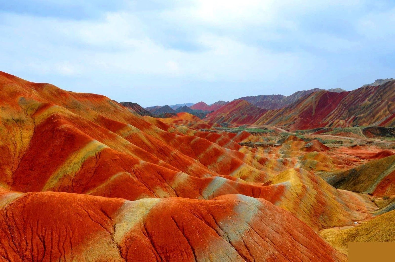
The site is remarkable both for its vivid palette and for the scale of the striations: what from a distance seems like painted canvas resolves into a labyrinth of ridges, gullies and panoramic terraces. A lesser-known detail: the colors vary seasonally and with weather conditions; after rain, the hues often deepen, offering particularly saturated photographic opportunities.
Beyond the immediate visual drama, Zhangye Danxia offers a lesson in geologic time and human-scale interpretation of landscape. The park's boardwalks and viewing platforms were designed to give visitors a range of compositions at different elevations, while interpretive signs explain the processes of sedimentation, uplift and erosion that produced the striking bands. Photographers and landscape enthusiasts often plan their visits around atmospheric conditions: low-angle light during golden hours casts ridges into sharp relief, while overcast or misty days can soften colors and emphasize shapes. The park's scale means that a single viewpoint never fully captures the variety present across the terrain — taking time to traverse multiple platforms yields a richer sense of the formations.
Local infrastructure has expanded to accommodate steady tourism, but many visitors still find quiet corners along lesser-known paths. For those willing to explore beyond the main viewing decks, short hikes and rural lanes reveal unexpected perspectives of the painted cliffs and provide a quieter atmosphere for contemplative study. The town of Zhangye offers practical amenities including hotels, train connections and guided-tour services; most visitors access the geopark via a short drive from the city. When combined with nearby attractions in Gansu province — historic Silk Road sites, oasis towns and desert landscapes — Zhangye Danxia becomes a vivid and contrasting chapter in any northwest China itinerary.
Timetables for trains and regional buses vary seasonally; many travelers arrive by high-speed or conventional rail to Zhangye and then take local shuttle services or taxis to the geopark entrance. The park's layout is linear, with a series of parking lots and platforms that correspond to different photographic viewpoints — plan logistics to avoid backtracking during peak hours. Accommodation in Zhangye ranges from economical guesthouses to mid-range hotels that can arrange guided excursions and private transport.
Visiting Zhangye Danxia is as much an exercise in perception as it is in travel logistics — the colors and forms change with light, season and vantage point, and the most memorable experiences come when you slow down and let the terrain reveal its subtleties. For photographers, geologists and curious travelers, the geopark is a compelling and photogenic stop that pairs well with broader exploration of Gansu’s cultural and natural history.
Discover more hidden gems you might love.
Porto
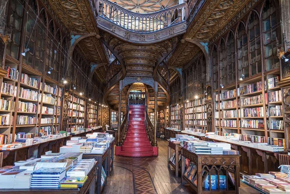
## Description Livraria Lello is one of Porto’s most iconic attractions, and for good reason. Even people who are not especially interested in books often leave impressed by the building’s dramatic interior, carved woodwork, stained-glass ceiling, and sweeping red staircase. It is a bookstore, but it also feels like a carefully preserved piece of architecture and cultural history. For many travelers, the experience is as much about atmosphere as it is about literature. What makes Livraria Lello stand out is the way it turns a simple bookshop visit into a memorable city moment. The rooms feel intimate, ornate, and theatrical, yet the space remains very much alive as a working bookstore. The early hours are especially appealing because they allow visitors to appreciate the details before the busiest crowds arrive. In the morning, the light is gentler, the staircase is easier to photograph, and the interior feels less hurried. For anyone who wants to understand why this place has become famous worldwide, early access can make a huge difference. One lesser-known fact is that the bookstore’s reputation has made it one of the most photographed interiors in Portugal, but the building itself rewards slower observation. If you look closely, you will notice that the details are not only decorative; they are carefully integrated into the structure and the visitor flow. Another interesting point is that many people come expecting a museum, yet the best way to appreciate Livraria Lello is to treat it as both a living bookstore and a historic landmark. That dual identity is part of its charm. The bookstore also plays into Porto’s wider identity as a city of craftsmanship, publishing, and visual beauty. Its popularity has inevitably made it busy, but that popularity is not accidental. People come for the staircase, stay for the books, and leave talking about the overall mood of the place. Even travelers who are skeptical of tourist-famous spots often find that this one lives up to the attention. If you visit in the early hours, you can pay closer attention to the architecture, the bookshelves, and the quiet movement of the staff and first guests. The experience becomes less about waiting in a queue and more about entering a space with a strong personality. That is one of the reasons many Porto itineraries place Livraria Lello near the top of the list. ## Location Livraria Lello is located in central Porto, Portugal, on Rua das Carmelitas, close to the Clérigos area and within easy walking distance of several of the city’s major landmarks. It sits in one of Porto’s most visited historic districts, so the surrounding streets are lively and full of cafés, shops, and sightseeing stops. The easiest way to get there is on foot if you are already exploring the historic center. If you are arriving by public transport, Porto’s metro and train links can bring you into the central area, after which it is usually a straightforward walk. Because the bookstore is popular, arriving early is the best strategy. You will avoid the longest lines, enjoy a quieter interior, and have more time to look around before the busiest rush begins. ## Tips - Buy or reserve your ticket in advance if that option is available for your travel date. - Go as early as possible to enjoy a calmer atmosphere and better photos. - Keep your visit unhurried so you can appreciate the details beyond the staircase. - Pair the stop with nearby landmarks like Clérigos Tower and other central Porto sights. - Be prepared for a crowd, even in the morning, because this is one of Porto’s most popular attractions. ## Conclusion Livraria Lello is a Porto landmark where literature, architecture, and atmosphere meet, and the early hours offer the best way to enjoy it. ## FAQ ### Is Livraria Lello just for book lovers? No. It appeals to book lovers, but also to travelers interested in design, photography, and Porto’s cultural heritage. ### Why visit in the early hours? Early hours usually mean shorter lines, softer light, and a more peaceful experience inside the store. ### Can I buy books there? Yes. It is still a working bookstore, so visitors can browse and purchase books during their visit. ### How long does a visit take? Many people spend 30 to 60 minutes, though you may stay longer if you browse carefully or take photos. ### What else is nearby? The central Porto area around Clérigos, the historic center, and several cafés and viewpoints are all easy to combine with the visit. ## Links - [Official website](https://www.livrarialello.pt/en/) - [Wikipedia article](https://en.wikipedia.org/wiki/Livraria_Lello)
GemVoyage Team • World
Alkmaar
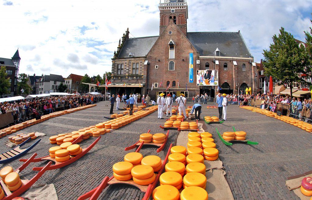
## Description The Alkmaar Cheese Museum is one of the best places to understand why cheese is such an important part of Dutch identity and regional heritage. Located in the historic Waag building, the museum explores the history, production, trade, and cultural significance of cheese in the Netherlands, with special attention to Alkmaar’s long association with the cheese market tradition. It is a compact but engaging museum that helps visitors see cheese not just as food, but as part of a larger economic and social story. One of the museum’s strengths is its accessibility. It presents information in a way that is easy to follow for casual visitors while still giving enough depth to satisfy people interested in local history. The setting matters too: being in a historic weighing house adds a strong sense of place. One lesser-known fact is that Alkmaar’s cheese heritage is linked not only to local farming but also to the broader trading systems that shaped Dutch cities for centuries. Another interesting detail is that the museum helps explain the rituals and practical logistics behind cheese commerce, including how products were measured, moved, and valued in a market town. The museum is also a good reminder that cultural attractions do not have to be large to be effective. Its size makes it easy to fit into a walking day in Alkmaar, and it works especially well when combined with the city’s old streets, canals, and other historic sites. For many visitors, the appeal is partly culinary and partly atmospheric: you learn about cheese, but you also absorb the character of a Dutch market city that built part of its identity around this trade. That makes the museum feel both educational and local. ## Location The Alkmaar Cheese Museum is in the center of Alkmaar, North Holland, the Netherlands, inside the historic Waag building near the city’s old market area. Because it is centrally located, it is easy to reach on foot from most of Alkmaar’s historic core. If you are coming by train, Alkmaar’s station connects well to the city center, and the walk to the museum is straightforward. Visitors arriving from Amsterdam or other nearby cities usually find the trip simple by rail, making it a practical day trip destination. Once in town, the compact center is best explored on foot. ## Tips Combine the museum with a visit to Alkmaar’s historic center for the full experience. If you are interested in the traditional cheese market, check the schedule before your trip so you can align your visit. The museum is a good rainy-day option because it is compact and easy to visit without much planning. Leave room in your itinerary for tasting local cheese or exploring nearby shops. ## Conclusion The Alkmaar Cheese Museum is a small but worthwhile stop that turns the city’s cheese heritage into a clear and enjoyable cultural visit. ## FAQ ### What does the Alkmaar Cheese Museum focus on? It explains the history, trade, and cultural importance of cheese in Alkmaar and the Netherlands. ### Is the museum connected to the cheese market? Yes, it is closely tied to Alkmaar’s famous cheese-trading tradition. ### How much time do I need? A visit usually takes around one hour, depending on how much you read. ### Is it suitable for children? Yes, especially for families that want a short, easy museum visit with a clear theme. ### Can I visit it together with the cheese market? Yes, and that is one of the best ways to experience Alkmaar’s cheese culture. ## Links - [Official website](https://www.kaasmuseum.nl/en/)
GemVoyage Team • World
Utena County
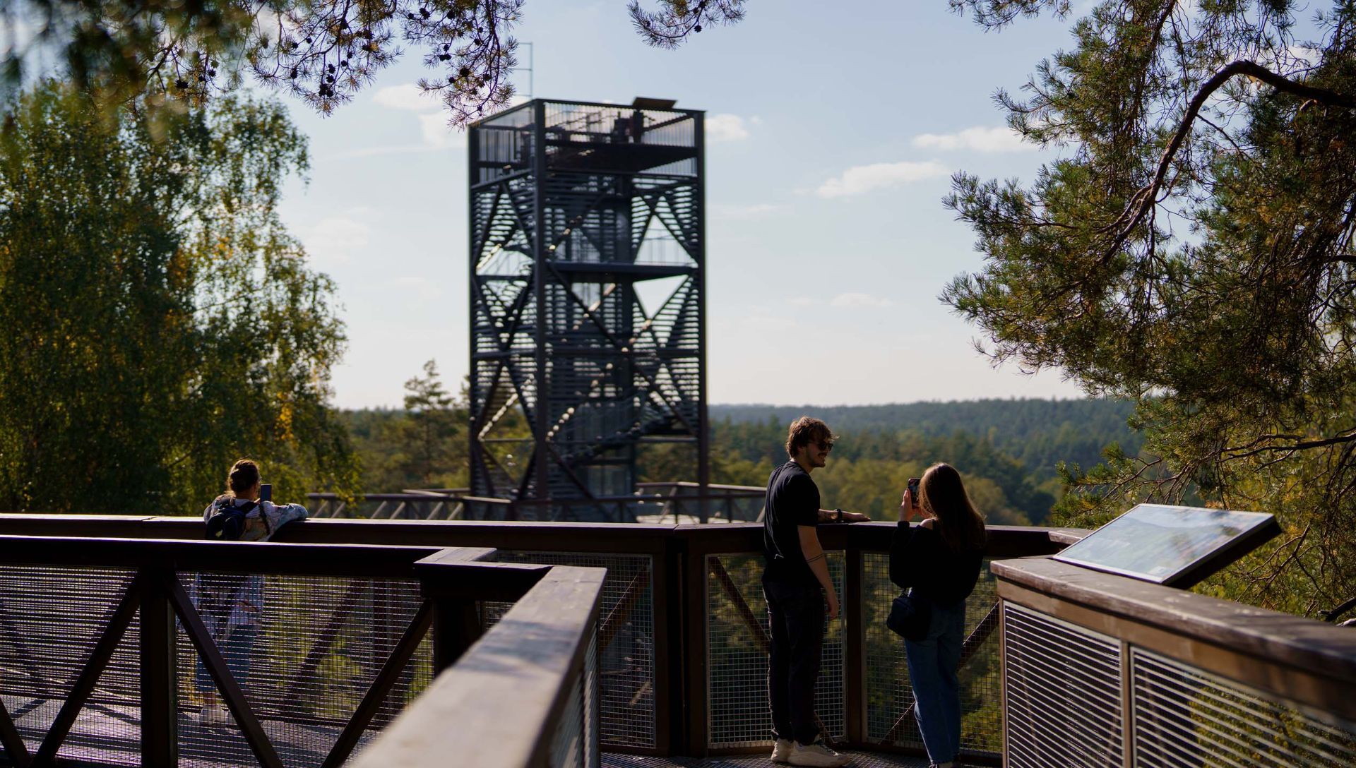
## Description The Anykščiai Treetop Walking Path is an elevated walkway that lifts visitors into the forest canopy near the town of Anykščiai, providing rare, treetop-level perspectives over pine and spruce stands and the winding valley of the Šventoji River. Running across a series of boardwalks and culminating in an observation tower, the path reveals forest structure, understory dynamics, and panoramic views that are otherwise hidden from ground level. What distinguishes this attraction is its combination of accessibility, interpretive design, and conservation-minded construction. The path’s elevated platforms and carefully designed supports minimize soil compaction and root disturbance, protecting vulnerable plant communities below. Along the walkway, interpretive panels introduce visitors to forest ecology, native species, the role of wetlands, and regional conservation initiatives. The experience is both sensory and educational: the canopy’s light, wind, and birdlife offer memorable immersion, while the tower’s panoramic platform rewards visitors with far-reaching vistas of the Šventoji River valley. The path was created with families and broad accessibility in mind—gentle gradients, safety railings, and wide decks make it suitable for many visitors, although final accessibility varies across specific sections. The project reflects a deliberate effort to balance public access, education, and nature protection, making it a model for low-impact environmental tourism. ## Location The Anykščiai Treetop Walking Path is situated near the town of Anykščiai in Utena County, northeastern Lithuania, an area celebrated for its literary history and distinctive wooden architecture. The site is accessible from Vilnius and Kaunas by regional bus services to Anykščiai; local shuttles or taxis can bring visitors the short distance to the trailhead. On-site parking is available during visiting hours, and the town provides dining and accommodation options for longer stays. ## Tips - **Assess height comfort:** The elevated platforms are safe but may be challenging for those with acute fear of heights. Move at your own pace and use railings. - **Bring optics and cameras:** Binoculars and cameras enhance birdwatching and landscape photography from the tower and platforms. - **Visit in warm months:** Late spring through early autumn offers full foliage, active birdlife, and accessible boardwalks; check seasonal opening times for winter closures. - **Dress for the outdoors:** Wear comfortable walking shoes and layered clothing; the canopy can be cooler and windier than the forest floor. - **Combine with Anykščiai cultural sites:** Pair the treetop walk with a visit to the town’s literary museums and wooden architecture for a blended nature-and-culture day. ## Conclusion The Anykščiai Treetop Walking Path is an accessible, interpretive experience that invites visitors to discover forest ecology from a new vantage point. It combines low-impact design, educational materials, and dramatic views—ideal for families, school groups, and nature enthusiasts interested in immersive environmental learning. ## FAQ - **Q: Is the Anykščiai treetop path suitable for wheelchairs or strollers?** A: Some sections are designed to be accessible, but full accessibility can vary—contact the site in advance for details on ramps and platform access. - **Q: How much time should I plan for a visit?** A: Plan 1–2 hours to walk the path, ascend the observation tower, and read interpretive panels; longer if you want to picnic or birdwatch. - **Q: Is there an entrance fee or opening season?** A: Many treetop paths charge a modest fee and operate seasonally—confirm current hours and rates on the official site or local tourist information. - **Q: Are dogs allowed on the treetop path?** A: Policy varies; some paths allow well-controlled dogs on short leashes while others restrict pets to protect wildlife—check rules before bringing pets. - **Q: Can the path be used for school or group education?** A: Yes—interpretive panels and safe design make it ideal for school groups; contact local organizers to arrange guided programs or group rates. - **Q: Is the path safe in wet weather?** A: Walkways can be slippery when wet—use caution and appropriate footwear. Some sections may be closed during severe weather for safety. ## Links -- [Hike Information](https://saugoma.lt/en/objects/objects-the-treetop-walking-path)
GemVoyage Team • World

San Juan Teotihuacan
## Description Teotihuacan is a vast pre-Columbian city in central Mexico, dominated by two monumental pyramids — the Pyramid of the Sun and the Pyramid of the Moon — flanking the broad Avenue of the Dead. Once among the largest cities in the ancient world, Teotihuacan’s orthogonal layout, apartment compounds and expansive plazas reflect a complex urban society with far-reaching trade and ritual connections across Mesoamerica. The scale of Teotihuacan is what first seizes visitors: broad causeways, stepped pyramids and the linear discipline of its urban plan. Archaeologists have uncovered multi-storey apartment compounds, market areas and ceremonial platforms that together suggest a dense, highly organized city capable of hosting tens of thousands of residents at its peak. A walk along the Avenue of the Dead reveals architectural rhythms and sightlines intentionally designed to focus processions and ritual movement toward the city’s great pyramids. Climbing the Pyramid of the Sun rewards visitors with sweeping panoramas across the valley and a visceral sense of how the site would have been experienced in antiquity. The Pyramid of the Moon at the northern end of the avenue faces a ceremonial plaza that preserves carved stones and remnants of ritual deposits. Murals and painted architectural fragments found in residential and administrative compounds hint at complex iconography, trade networks reaching into Oaxaca and the Gulf coast, and religious ideas that later influenced the Aztecs. Teotihuacan continues to be a dynamic archaeological landscape: excavations reveal changing construction phases, evidence of craft production zones, and records of trade in obsidian and pottery that tie the city to a broader Mesoamerican world. While key questions remain — notably about the language(s) spoken by Teotihuacanos and the political organization behind the city’s monumental building — continuing research and improved visitor interpretation make Teotihuacan a compelling stop for history-minded travelers. ## Location Teotihuacan lies northeast of Mexico City and is easily accessible by road from the capital; many visitors use organized tours or public buses that run from Mexico City to the archaeological site. The site is about a 45–60 minute drive from the city center depending on traffic, and combined visits with nearby San Juan Teotihuacán village make for a full-day itinerary. ## Tips - **Go early to avoid heat and crowds:** Morning visits are more comfortable and quieter for photography, and the light makes the relief of murals and stonework more legible. - **Wear comfortable shoes and sun protection:** The site is extensive and largely exposed to the sun; pack a hat, sunscreen and plenty of water. - **Hire a licensed guide or join a small-group tour:** Local guides provide archaeological context, point out lesser-known structures and mural fragments, and explain the complex iconography visitors otherwise miss. - **Visit the on-site museum and neighboring sites:** The Museo de Sitio de Teotihuacán houses ceramics, figurines and explanatory panels; pair your visit with nearby craft markets and the ethnographic displays in San Juan Teotihuacán. - **Use public transport or book reliable transfers:** If driving from Mexico City, leave early to avoid congestion and allow time for parking or shuttle transfers. ## Conclusion Teotihuacan’s monumental urban presence offers a powerful sense of ancient civic order and ritual life; its pyramids and avenue remain compelling for history and archaeology enthusiasts alike. Whether you are a casual visitor drawn by striking panoramas or a history lover seeking layered archaeological narratives, Teotihuacan provides a measurable sense of scale, ritual planning and cultural connections that shaped central Mexico for centuries. ## FAQ - **Q: Can you climb the pyramids at Teotihuacan?** A: Access policies change for conservation reasons; sections of the Pyramid of the Sun have been open at times while other monuments may be restricted. Check the site’s official notices before travel and respect closures for preservation. - **Q: How long should I plan for a visit to Teotihuacan?** A: Allocate 3–5 hours for a meaningful visit: climb one pyramid, explore the plaza areas, and visit the on-site museum. Half-day visits are common; a whole day allows more relaxed exploration and time for nearby attractions. - **Q: Is Teotihuacan suitable for families and children?** A: Yes — families will find the wide avenues and open plazas easy to navigate, but bring shade, water, and comfortable walking shoes for younger children. - **Q: Are there good photography spots and when is the best light?** A: Early morning and late afternoon provide the best directional light for texture and color; the area by the Pyramid of the Sun’s summit and viewpoints along the Avenue of the Dead are popular for wide-angle shots. - **Q: What should I know about safety and facilities?** A: The site is generally safe for tourists; basic facilities include restrooms and food stalls near the entrance, but services are limited inside the archaeological zone. Keep valuables secure and follow guidance from official staff. ## Links - [Teotihuacan — Wikipedia](https://en.wikipedia.org/wiki/Teotihuacan)
GemVoyage Team • World
Los Angeles
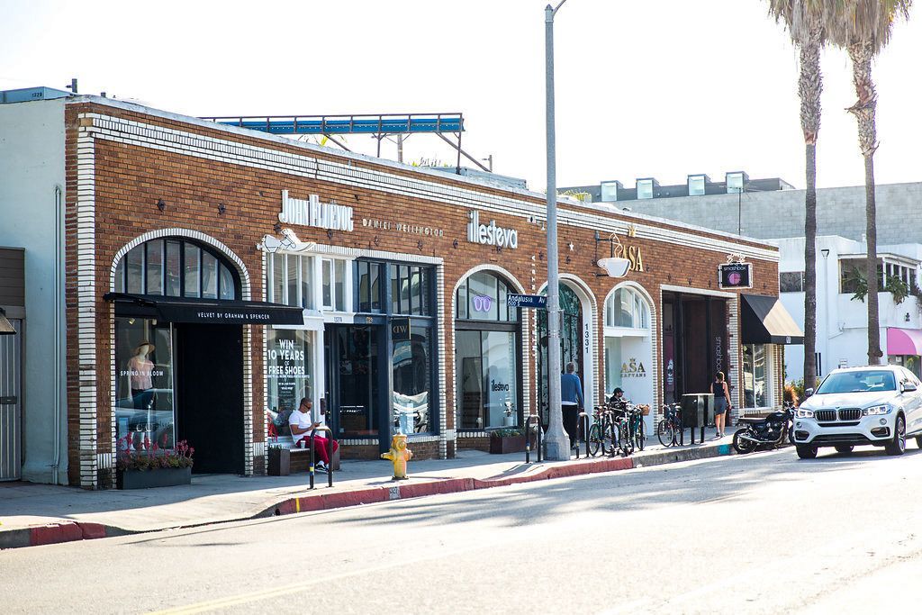
## Description Abbot Kinney Boulevard in Venice, Los Angeles, is a short but influential thoroughfare celebrated for its creative retail scene, independent restaurants, and a distinctive local aesthetic that has become synonymous with modern, small-scale urban cool. Stretching for just a few blocks, Abbot Kinney packs an outsized cultural punch: curated boutiques, artisanal homewares, specialty coffee shops, and innovative dining concepts sit shoulder-to-shoulder with galleries and pop-up markets. The boulevard’s identity is rooted in a "local-first" ethos. Many shops are owner-operated and feature limited-run or locally produced goods, which gives the area an artisanal sensibility that contrasts with more commercial shopping districts. Over the years Abbot Kinney has become a preferred destination for designers, food entrepreneurs and creative-makers who favor a human-scale retail environment where craftsmanship and storytelling matter. Events like "First Fridays" and seasonal street fairs amplify the boulevard’s community mood, with extended shop hours, live music and curated pop-ups that draw both locals and visitors. For food lovers, the avenue is a laboratory of contemporary culinary trends: casual but refined bakeries, modern vegan eateries, and chef-driven bistros can all be found within a short walk. Side streets and upper-floor venues often hide some of the area’s best-kept secrets — intimate bars, tiny galleries, and rooftop patios — rewarding those who slow down and explore. Abbot Kinney also serves as a hub connecting Venice’s broader cultural assets: the nearby beach, historic canals, street art corridors and the bustling Venice Boardwalk are all within easy reach, making the boulevard an ideal stop on a full-day itinerary. Buying categories and sustainability: shoppers can expect to find distinct clusters along the boulevard — homewares and design shops, independent fashion boutiques, specialty food producers, and lifestyle stores focused on wellness. Many retailers emphasize sustainable sourcing and limited production runs; if ethical purchasing matters to you, look for small labels and ask about materials and production methods. ## Location Abbot Kinney Boulevard runs through the Venice neighborhood of Los Angeles, approximately between Ocean Avenue near the beach and Lincoln Boulevard inland. Its central location makes it accessible from Santa Monica, Marina del Rey and other nearby neighborhoods. Getting there: driving is often the fastest option but parking can be limited; consider using parking apps, arrive early, or use nearby paid lots. Multiple bus routes serve Venice, and rideshares or bike rentals are popular alternatives. From Santa Monica or the Marina, cycling along dedicated paths is a pleasant way to arrive and enjoy the waterfront scenery. ## Tips - Visit on weekday mornings for quieter browsing and the best chance to chat with shop owners. - Explore side streets: many of Abbot Kinney’s best cafes and galleries are tucked away from the main strip. - Check store hours: many boutiques open mid-morning and close earlier than big-box retailers, so plan accordingly. - Reserve tables for popular restaurants during weekends and evenings, especially for dinner. - Bring a reusable bag and embrace the local eco-friendly ethos; some shops minimize packaging. - Wear comfortable shoes: although the area is walkable, you’ll want to wander both main and side streets. - Bring a camera and leave space for small, meaningful purchases rather than impulse-heavy shopping. ## Conclusion Abbot Kinney Boulevard distills Venice’s eclectic, creative spirit into a compact, walkable experience. Whether you’re shopping for thoughtful design pieces, sampling new culinary concepts, or simply watching the neighborhood pulse, the boulevard delivers a layered portrait of community-driven urban life. ## FAQ Q: Is Abbot Kinney family-friendly? A: Yes. The area is walkable and casual during the day, with family-friendly cafes and shops. Evening hours can be livelier and more adult-focused, so plan accordingly. Q: How do I find parking near Abbot Kinney? A: Parking is limited on-street; look for paid lots, use parking apps, or consider rideshares and public transit to avoid circling for spaces. Q: When is First Fridays and what is it? A: First Fridays is a monthly event (check local listings for exact dates) where shops extend hours, pop-ups appear and live music is common. It’s a popular time to experience the boulevard’s community energy. Q: Are the shops expensive? A: The mix includes accessible boutiques and higher-end designer stores. Many shops sell locally made, limited-run items that reflect artisanal production which can influence prices. Q: Are dogs welcome? A: Many cafes and stores are dog-friendly, but policies vary; always check individual shop rules before bringing a pet inside. ## Links - [Abbot Kinney Blvd Official Site](https://www.abbotkinneyblvd.com)
GemVoyage Team • World
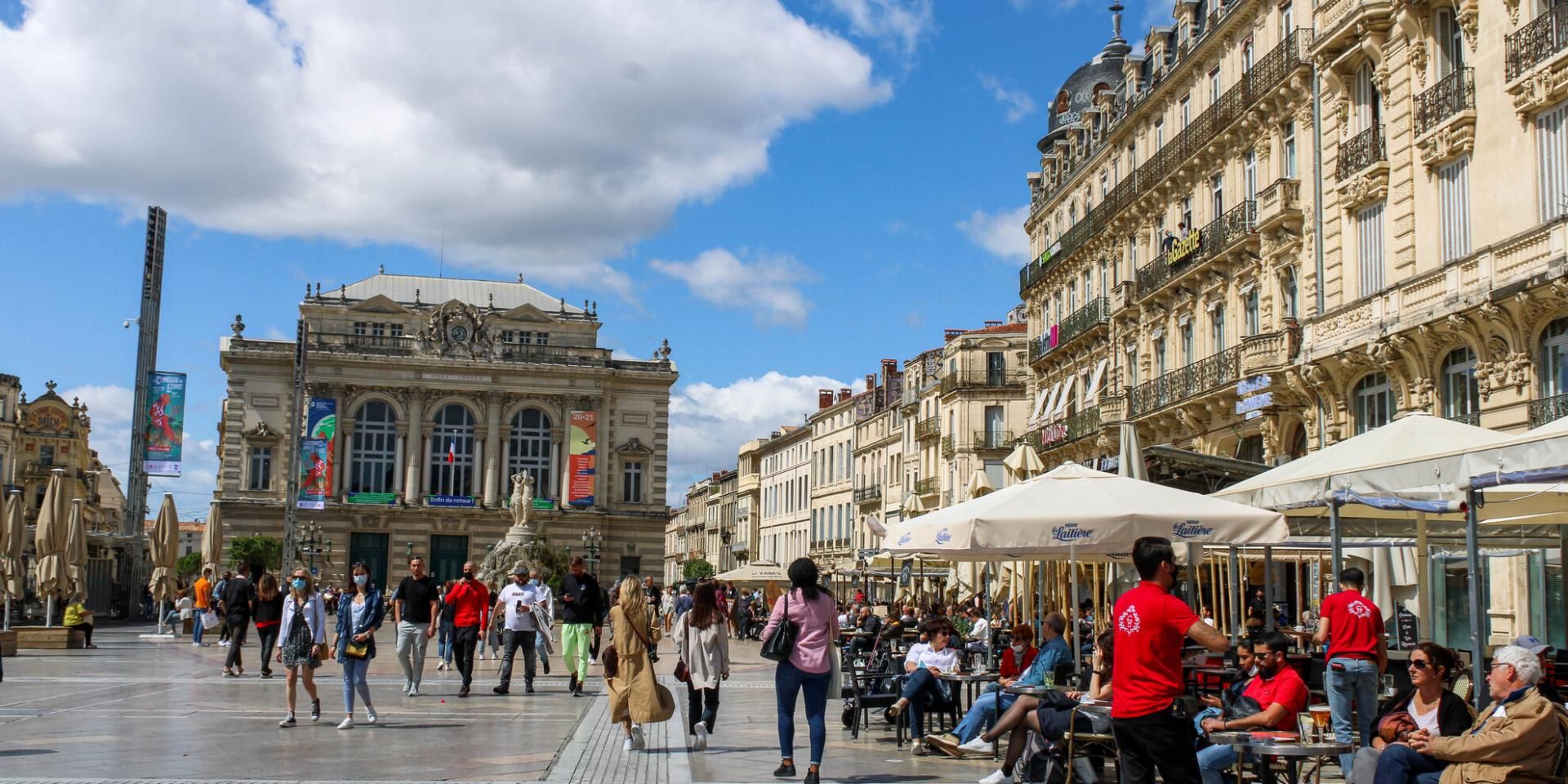
Montpllier
## Description Comedy Square, or **Place de la Comédie**, is the vibrant heart of Montpellier and one of the most iconic squares in southern France. Known locally as *“l’Oeuf”* (The Egg) because of its oval shape, this lively square is a gathering spot for both locals and tourists. It is surrounded by stunning 19th-century Haussmann-style buildings, bustling cafés, and the impressive **Opéra Comédie**, which dominates one side of the square with its grand façade. What makes Comedy Square unique is its **constant energy**—from street performers and musicians to open-air terraces where people enjoy Mediterranean sunshine. It’s not only a cultural hub but also a place to start exploring Montpellier’s historic center. A little-known fact is that the square has been at the core of Montpellier’s social life since the **18th century**, making it one of the oldest urban meeting points in the city. Another interesting detail is the presence of the **Three Graces Fountain**, a beautiful marble sculpture from 1790 that has become a beloved symbol of Montpellier. ## Location Comedy Square is located in **Montpellier, France**, in the **Occitanie region** of southern France. It lies right in the city center, connecting the historic old town with the more modern districts. The square serves as a central point for trams, buses, and pedestrian streets, making it extremely accessible. ### Recommendation on How to Get There If you’re traveling from **Montpellier Méditerranée Airport**, you can reach the square by shuttle bus to the main train station, **Gare Saint-Roch**, which is only a few minutes’ walk from Comedy Square. The city’s excellent **tram network** also stops directly at Place de la Comédie, making it the most convenient way to get there from anywhere in Montpellier. For those staying in the historic center, walking is the best option, as many attractions are clustered around the square. ## Tips Here are some useful tips for making the most of your visit to Comedy Square: * **Visit During the Evening**: The square comes alive at night with street performers, illuminated buildings, and buzzing cafés. * **Enjoy the Cafés and Terraces**: Sit down at one of the many outdoor cafés to soak in the atmosphere and people-watch. * **Take a Tram Ride**: Montpellier’s trams are famous for their artistic designs. Boarding one from the square gives you a unique perspective of the city. * **Photography**: The square is especially photogenic at sunset when the Opéra Comédie and surrounding buildings glow in golden light. * **Combine With a Walking Tour**: From the square, you can easily walk to Montpellier Cathedral, the Fabre Museum, or stroll down Rue de la Loge for shopping. * **Avoid Driving**: The square is pedestrian-friendly, and parking is limited nearby, so it’s best to use public transportation. ## Conclusion Comedy Square in Montpellier is more than just a central plaza—it’s the heartbeat of the city. With its beautiful architecture, lively atmosphere, and cultural landmarks, it offers visitors a true taste of southern French life. Whether you’re sipping coffee at a terrace, watching a street performance, or exploring nearby attractions, Comedy Square is a must-see destination when visiting Montpellier. ## FAQ **1. What is Comedy Square famous for?** It is famous for its lively atmosphere, historic architecture, the Opéra Comédie, and the Three Graces Fountain. **2. Is Comedy Square pedestrian-friendly?** Yes, it’s primarily a pedestrian zone, making it safe and enjoyable to explore on foot. **3. Are there restaurants and cafés in the square?** Yes, the square is surrounded by numerous cafés and restaurants, perfect for dining or enjoying a drink outdoors. **4. How do I get to Comedy Square from the train station?** The main train station, Gare Saint-Roch, is only a 5-minute walk from the square. **5. Is it worth visiting at night?** Absolutely. The square lights up beautifully in the evening and is filled with vibrant street life. **6. Can I take public transport to Comedy Square?** Yes, several tram lines stop directly at the square, making it the easiest way to get there. ## Links * [Official Montpellier Tourism Office](https://www.montpellier-france.com/)
GemVoyage Team • World

Comments