GemVoyage Team • World
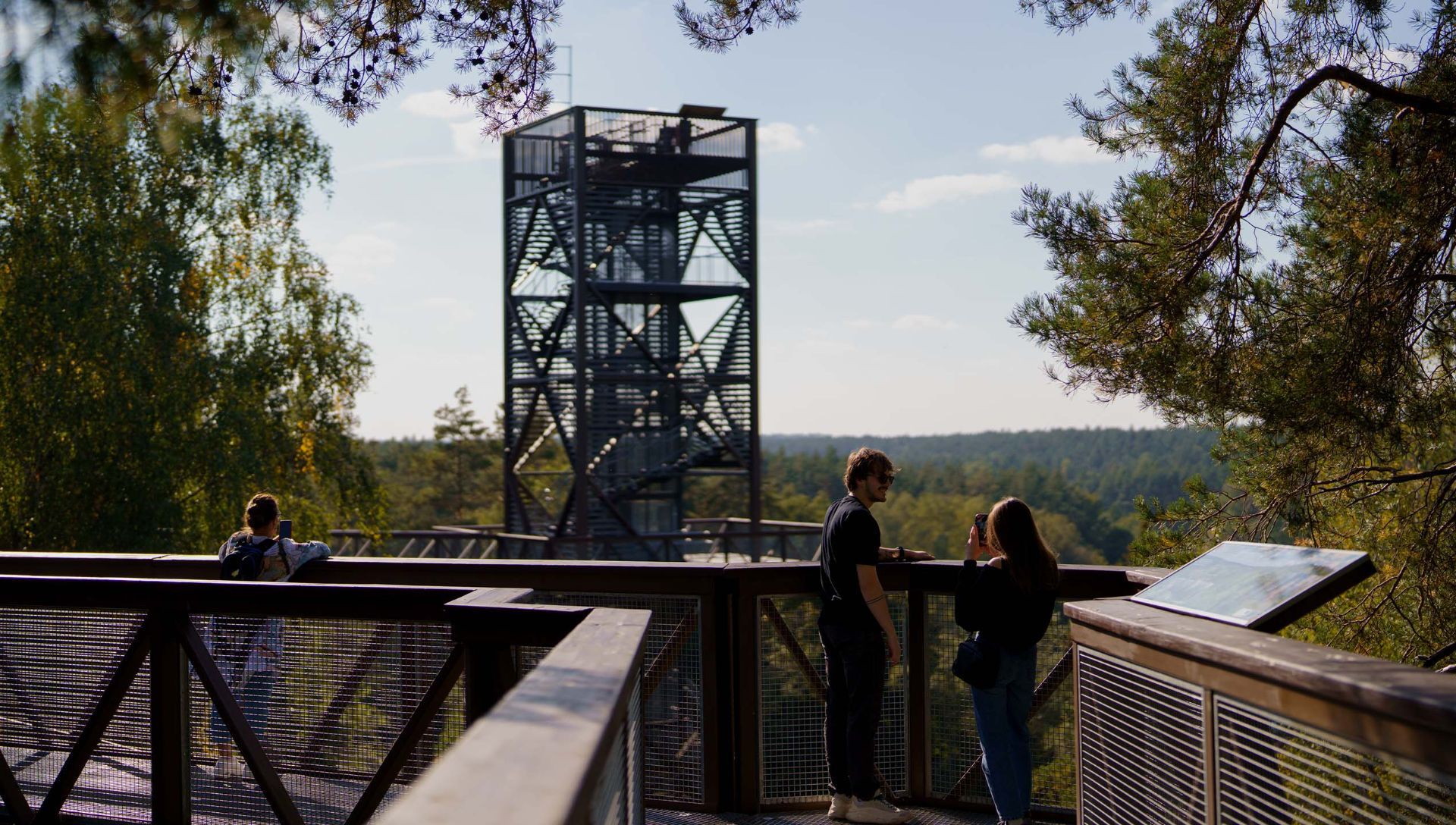
What distinguishes this attraction is its combination of accessibility, interpretive design, and conservation-minded construction. The path’s elevated platforms and carefully designed supports minimize soil compaction and root disturbance, protecting vulnerable plant communities below. Along the walkway, interpretive panels introduce visitors to forest ecology, native species, the role of wetlands, and regional conservation initiatives. The experience is both sensory and educational: the canopy’s light, wind, and birdlife offer memorable immersion, while the tower’s panoramic platform rewards visitors with far-reaching vistas of the Šventoji River valley.
The path was created with families and broad accessibility in mind—gentle gradients, safety railings, and wide decks make it suitable for many visitors, although final accessibility varies across specific sections. The project reflects a deliberate effort to balance public access, education, and nature protection, making it a model for low-impact environmental tourism.
Discover more hidden gems you might love.
.jpg)
Schwerin
## Description Schwerin Castle (Schloss Schwerin) is one of Germany’s most enchanting and architecturally rich palaces, often referred to as the “Neuschwanstein of the North.” Located on an island in Lake Schwerin, this fairytale-like fortress is a masterpiece of Romantic historicism, blending Gothic, Renaissance, and Baroque elements into a harmonious whole. With its golden domes, ornate towers, and intricate façade, the castle appears to rise magically from the water, captivating visitors from every angle. Originally built as a fort in the 10th century by the Slavic Obotrites, the site evolved over centuries into a ducal residence. The current structure was largely completed between 1845 and 1857, designed by a team of renowned architects including Gottfried Semper and Friedrich August Stüler. Today, Schwerin Castle houses the state parliament of Mecklenburg-Vorpommern, a museum showcasing 19th-century art and furnishings, and hosts cultural events such as open-air theatre performances. A little-known fact: Schwerin Castle contains 635 rooms, many of which are lavishly decorated with gilded ceilings, carved woodwork, and elaborate tapestries. Another intriguing detail is the legend of the castle ghost, Petermännchen—a benevolent spirit said to protect the castle and its inhabitants. ## Location Schwerin Castle is located in **Germany**, in the **state of Mecklenburg-Vorpommern**, within the **city of Schwerin**. It sits on a small island in **Lake Schwerin**, connected to the mainland by bridges and surrounded by beautifully landscaped gardens and parkland. ### How to Get There - **By Train**: From Hamburg or Berlin, take a regional train to Schwerin Hauptbahnhof. The castle is a 15-minute walk from the station. - **By Car**: Schwerin is easily accessible via the A14 and A24 motorways. Parking is available near the castle. - **By Bus**: Local buses stop at Schloss Schwerin or nearby Lennéstraße. - **By Foot**: The city center is compact and walkable, making it easy to reach the castle on foot from most hotels and attractions. Its central location makes it ideal for a day trip or a weekend getaway from major northern German cities. ## Tips - **Visit the Museum**: The castle museum spans three floors and includes the Throne Room, Gallery of Ancestors, and opulent living quarters. - **Explore the Gardens**: The surrounding park and gardens are free to enter and offer stunning views of the castle and lake. - **Check Opening Hours**: The museum is open Tuesday to Sunday, with seasonal variations. Last entry is 30 minutes before closing. - **Use an Audioguide**: Available for a small fee, audioguides provide rich historical context and are free for children. - **Attend Cultural Events**: Look out for concerts, exhibitions, and theatrical performances held in the castle courtyard. - **Photography**: The exterior is a photographer’s dream, especially at sunrise or sunset. Interior photography may be restricted in some rooms. ## Conclusion Schwerin Castle is a stunning blend of history, architecture, and natural beauty. With its lakeside setting, lavish interiors, and rich cultural heritage, it offers a magical experience that’s both visually and intellectually rewarding. ## FAQ **1. What are the opening hours of Schwerin Castle?** April to October: Tuesday–Sunday, 10:00 AM–6:00 PM October to April: Tuesday–Sunday, 10:00 AM–5:00 PM **2. What is the entrance fee?** Adults: €8.50 Reduced: €6.50 Children under 18: Free Audioguide: €2.00 (free for children) **3. Is Schwerin Castle suitable for children?** Yes, children are welcome and can enjoy the gardens, museum exhibits, and ghost stories. **4. Can I take photos inside the castle?** Photography is allowed in most areas, but flash and tripods may be restricted. **5. Is the castle wheelchair accessible?** Parts of the museum and gardens are accessible, but some historic areas may have limited access. **6. How long should I plan for a visit?** Allow 2–3 hours to explore the museum and gardens thoroughly. ## Links - [Schwerin Castle – Wikipedia Overview](https://en.wikipedia.org/wiki/Schwerin_Castle) - [Schwerin Castle – Mecklenburg Tourism Guide](https://www.mecklenburg-schwerin.de/en/sights/schwerin-and-schwerin-castle/schwerin-castle/)
GemVoyage Team • World
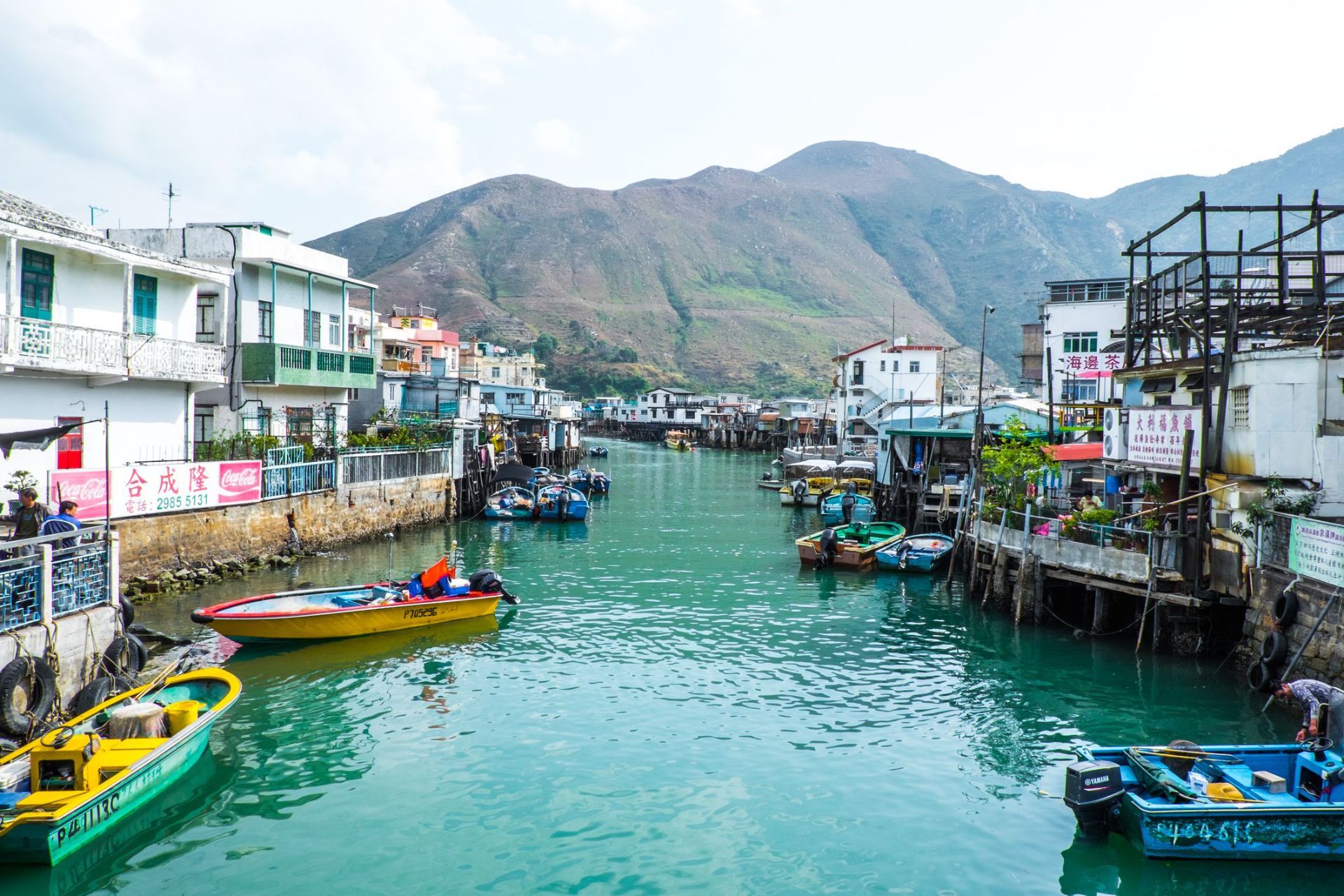
Hong Kong
## Description Tai O Fishing Village is one of the most atmospheric places in Hong Kong because it preserves a way of life that feels very different from the city’s skyscraper identity. Located on the western side of Lantau Island, Tai O is known for its stilt houses, narrow waterways, fishing heritage, and the sense that time moves more slowly here than in Hong Kong's urban core. For travelers looking for a place that combines cultural history, coastal scenery, and a strong local character, Tai O delivers all three in a single visit. The village is especially distinctive because it has kept much of its fishing-community layout, even as Hong Kong developed around it. The stilt houses, built above tidal waters and connected by wooden walkways, create a visual landscape that is unique in the region. Boat traffic still matters here, seafood is still central to the local economy, and the village still feels shaped by the rhythms of sea and tide. In the early morning, Tai O can feel hushed and contemplative. Later in the day, it becomes more animated as day visitors arrive, shops open, and boats move in and out of the channels. A little-known fact is that Tai O has long been associated with salt production and trade, not just fishing. Another detail many visitors miss is the old village fortifications and temple structures that reflect how communities once protected themselves from pirates, storms, and the uncertainties of coastal life. The area is therefore not simply picturesque; it is historically layered and reveals a deeper story about how people adapted to Hong Kong's shoreline before modern development changed the coastline. The food here is another major reason to visit. Dried seafood, shrimp paste, sweet treats, and simple local dishes are part of Tai O’s identity, and they help visitors understand how the village economy worked for generations. Even if you only spend half a day here, Tai O can feel like a complete change of pace from the rest of Hong Kong, offering a mixture of water, heritage, and community that is increasingly rare. ## Location Tai O Fishing Village is on the western side of Lantau Island in the Hong Kong Special Administrative Region of China. It sits in the Islands District, far from the dense business cores of Hong Kong Island and Kowloon, which is part of what preserves its quieter character. Because it is not on a major rail line, getting there takes a little planning, but that is also what helps keep the area special. The usual route is to travel by MTR to Tung Chung and then continue by bus toward Tai O. This combination is the most practical for most visitors and gives you a smooth connection from the city’s main transport network. Ferries and cable car routes may also be part of a longer day trip if you are combining Tai O with other parts of Lantau Island. If you prefer a more relaxed pace, many travelers visit as part of a full-day itinerary that includes Ngong Ping and the Big Buddha before continuing to Tai O in the afternoon. Once you arrive, much of the village is best explored on foot, though local boat rides are a memorable way to see the stilt houses from the water. Because the village is compact, it is easy to cover the main areas without rushing, but you should allow extra time for food stops, photographs, and slow wandering. ## Tips Visit early in the day or late in the afternoon if you want softer light and fewer crowds. Midday can be busy, especially on weekends and public holidays, and the village is at its best when you can move slowly and take in the details. Take a boat ride if your schedule allows. Seeing Tai O from the water gives you a better sense of how the stilt houses, waterways, and fishing infrastructure fit together. It also helps explain why the village developed the way it did. If you only walk the streets, you still get a strong impression, but the boat perspective adds depth. Try local snacks and dried seafood, but do so with curiosity rather than haste. Many travelers rush through Tai O, take a few photos, and leave without understanding the food culture that has shaped the village for years. Sampling something local makes the visit more meaningful. Wear comfortable shoes and bring sun protection. Tai O is relatively easy to walk, but the experience is more enjoyable when you are prepared for heat, humidity, and a fair amount of time outdoors. If the weather looks unstable, check conditions before you go, since coastal villages are more sensitive to storms and heavy rain. ## Conclusion Tai O Fishing Village offers a rare glimpse of Hong Kong's coastal past, with stilt houses, local food, and a slower rhythm that gives the village a memorable sense of place. ## FAQ ### Why is Tai O famous? Tai O is famous for its stilt houses, fishing heritage, scenic waterways, and its reputation as one of the last traditional fishing villages in Hong Kong. ### How long should I spend in Tai O? Most visitors spend half a day to a full day, depending on whether they plan to add boat rides, food stops, or nearby Lantau attractions. ### Is Tai O easy to reach from central Hong Kong? It takes some planning, but it is straightforward by taking the MTR to Tung Chung and then continuing by bus. ### What should I eat in Tai O? Try local seafood snacks, dried seafood products, and village specialties from small shops and street-side vendors. ## Links - [Discover Hong Kong](https://www.discoverhongkong.com/) - [Wikipedia article](https://en.wikipedia.org/wiki/Tai_O)
GemVoyage Team • World
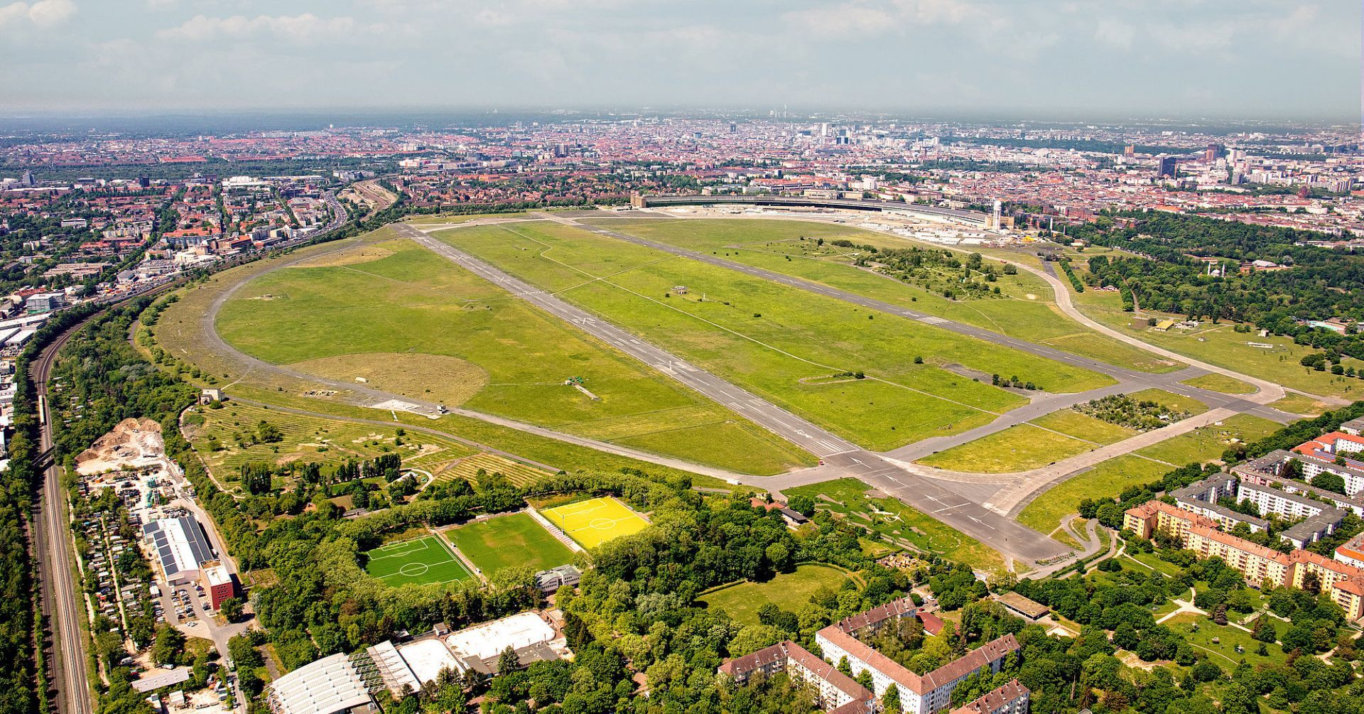
Berlin
## Description Tempelhofer Feld is one of Berlin's most unusual public spaces, and perhaps one of the most extraordinary urban parks in Europe. Built on the site of the former Tempelhof Airport, the area preserves a sense of scale that is rare in any city. Instead of dense landscaping or ornamental design, visitors are met with immense open runways, broad skies, and wide horizons that make the park feel almost cinematic. It is a place where Berlin's history, civic imagination, and appetite for public space come together in a striking way. What makes Tempelhofer Feld unique is how many different activities it can support without ever feeling crowded. Cyclists, skaters, runners, families, kite flyers, gardeners, and people simply sitting in the grass all share the space comfortably because it is so large. The former airport infrastructure is still visible in many places, which adds a sense of industrial memory to the recreational experience. You are not just visiting a park; you are walking through a piece of 20th-century urban history that has been repurposed for contemporary life. One little-known fact is that Tempelhof's runways and hangars helped shape the modern meaning of the site long before it became a park, and the airport itself became a powerful symbol during the Berlin Airlift. Another is that the area is often used for community gardens and events, making it both open and socially active rather than simply passive green space. That mix of openness and civic use is part of why Berliners defend the field so strongly. The atmosphere changes throughout the day. In the morning it can feel calm and almost meditative, with joggers tracing long loops beneath big skies. In the afternoon it becomes more playful, with people flying kites, practicing sports, or meeting friends for picnics. Sunset is particularly memorable because the flat openness gives you an unobstructed view of the light changing across the field. Tempelhofer Feld also tells a broader story about Berlin's identity. The city is often associated with reinvention, and this site embodies that idea without erasing the past. Rather than demolish every trace of the airport, Berlin turned the space into an active commons. For visitors, that means the park is both relaxing and intellectually interesting, especially if you enjoy places where landscape and history overlap. If you want one destination that shows how Berlin handles scale, memory, and public access, Tempelhofer Feld is hard to beat. It is not decorative in the traditional sense, but it is deeply satisfying because it gives you room to move, think, and experience the city in a different register. ## Location Tempelhofer Feld is located in southern-central Berlin, Germany, on the grounds of the former Tempelhof Airport. It lies in the Tempelhof-Schöneberg district and is easy to reach from several parts of the city. The most convenient ways to get there are by U-Bahn, S-Bahn, or bicycle, depending on where you are staying. Several entrances serve the park, and once inside, the flat terrain makes it easy to orient yourself. Because the space is large, choosing the entrance closest to your planned activity can save time. ## Tips Bring water and weather protection. The openness that makes the field special also means it can be windy or exposed to strong sun. If you like cycling or skating, Tempelhofer Feld is one of the best places in Berlin for it because the former runways offer long, smooth stretches. Do not expect a landscaped park with many shaded paths. The design is intentionally open, so plan for a more minimalist experience. Visit during golden hour or sunset if you want the strongest visual impression. Check the park rules before arrival, especially if you plan to use a drone, barbecue, or special equipment. Set aside enough time to walk farther than you think. The scale of the field is part of the experience. ## Conclusion Tempelhofer Feld is a rare urban park that turns a former airport into a vast public landscape, offering freedom, history, and an unmistakably Berlin sense of scale. ## FAQ ### Can you still see the airport at Tempelhofer Feld? Yes, much of the airport's structure and runway layout remains visible, which is part of the site's appeal. ### Is Tempelhofer Feld good for families? Yes, families often enjoy the open space, though you should bring what you need because there are no dense park facilities everywhere. ### Is there an entrance fee? The park itself is generally free to enter. ### What is the best way to experience it? Walking, cycling, or simply spending time on the open grass are all good ways to appreciate the space. ## Links - [Tempelhofer Feld](https://www.tempelhoferfeld.de/)
GemVoyage Team • World
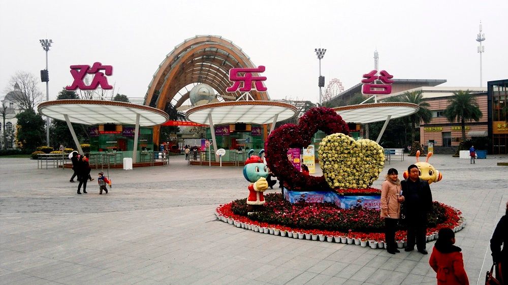
Chengdu
## Description Happy Valley Chengdu, known locally as 成都欢乐谷, is one of the largest and most popular theme parks in western China. Designed to appeal to visitors of all ages, the park combines high-adrenaline rides, family-friendly attractions, live entertainment, and themed zones inspired by global cultures and fantasy worlds. As part of the well-known Happy Valley chain across China, the Chengdu location stands out for its scale, variety, and strong integration of local elements. What makes Happy Valley Chengdu unique is its balance between intense thrill rides and immersive leisure experiences. Roller coasters, giant pendulum rides, and drop towers attract adrenaline seekers, while gentler attractions, parades, and interactive shows cater to families and younger visitors. A little-known fact is that some areas of the park subtly incorporate Sichuan cultural motifs in their design and performances, reflecting the region’s identity beyond the rides themselves. Another lesser-known detail is that Happy Valley Chengdu often hosts large-scale seasonal festivals, such as night-time light events and themed celebrations, which can significantly change the atmosphere of the park depending on when you visit. With its wide range of attractions and polished facilities, Happy Valley Chengdu has become a major entertainment destination not only for tourists but also for residents of Chengdu and neighboring cities. ## Location Happy Valley Chengdu is located in **China**, in **Sichuan Province**, within the city of **Chengdu**. The park sits in the Jinniu District, in the northern part of the city, making it accessible from central Chengdu while still offering a spacious layout. Getting to the park is convenient using public transportation. Visitors can take the Chengdu Metro to **Xipu** or nearby stations depending on current routes, then transfer to a bus or taxi for a short ride to the entrance. Taxis and ride-hailing apps are widely used in Chengdu and provide a straightforward option, especially for families. If traveling by car, the park has designated parking areas, though arriving early is recommended during weekends and holidays. ## Tips * Arrive early in the day to maximize your time and avoid long queues, especially during weekends and public holidays. * Check the park map and show schedules upon arrival to plan your visit efficiently. * Wear comfortable clothing and shoes, as the park is large and involves a lot of walking. * Some of the most popular rides have height or age restrictions, so review requirements in advance if visiting with children. * Visit during weekdays or outside major Chinese holidays for a more relaxed experience. * Stay until evening if possible, as night-time shows and illuminated attractions offer a different atmosphere. ## Conclusion Happy Valley Chengdu is a lively and well-rounded theme park that delivers excitement, entertainment, and memorable experiences for visitors of all ages. Whether you are seeking thrilling rides or relaxed family fun, the park offers a dynamic escape within one of China’s most vibrant cities. ## FAQ **Is Happy Valley Chengdu suitable for young children?** Yes, the park includes many family-friendly rides, play areas, and shows designed specifically for younger visitors. **How long should I plan to spend at Happy Valley Chengdu?** Most visitors spend a full day at the park to experience a wide range of attractions and shows. **Are English signs available in the park?** Some signage includes English, but having a translation app can be helpful for show schedules and ride details. **Is food available inside the park?** Yes, there are numerous food stalls and restaurants offering both Chinese and international options. **When is the best time to visit Happy Valley Chengdu?** Spring and autumn offer the most comfortable weather, while weekdays are best for avoiding crowds. ## Links * [Happy Valley Chengdu Official Website](https://cd.happyvalley.cn/)
GemVoyage Team • World
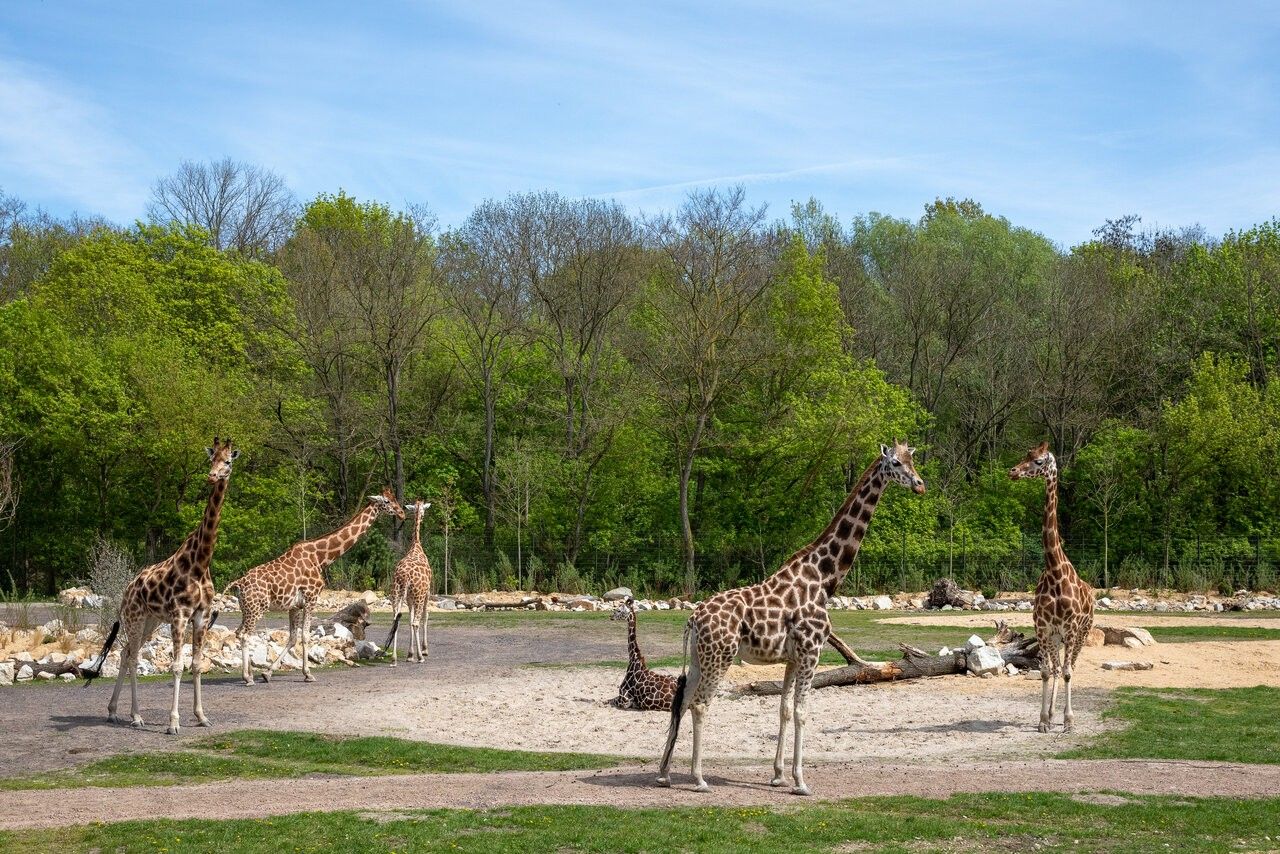
Berlin
## Description Tierpark Berlin is one of the most impressive zoological parks in Europe and a standout attraction in the German capital. Unlike traditional city zoos, Tierpark Berlin is designed as a vast landscape park where animals live in spacious, naturalistic enclosures spread across rolling lawns, wooded areas, and historic parkland. With more than 160 hectares to explore, it offers a relaxed and immersive experience that feels closer to a nature reserve than a conventional zoo. What makes Tierpark Berlin truly unique is its scale and setting. It is the largest zoo in Europe by area, allowing animals such as elephants, giraffes, bison, and big cats to roam in environments that closely resemble their natural habitats. A little-known fact is that the zoo is located on the former grounds of Friedrichsfelde Palace, an 18th-century baroque residence that still stands at the heart of the park and is open to visitors. Another lesser-known detail is that Tierpark Berlin was established in 1955 in what was then East Berlin, serving as the counterpart to Zoo Berlin in the western part of the city during the Cold War. Today, Tierpark Berlin combines animal conservation, education, and leisure, making it especially appealing for families, nature lovers, and visitors seeking a slower-paced zoo experience. ## Location Tierpark Berlin is located in **Germany**, in the city-state of **Berlin**, within the **Lichtenberg** district. It lies in the eastern part of the city, surrounded by residential neighborhoods and green spaces. Getting there is simple using public transportation. The most convenient option is the U-Bahn (metro): take Line U5 to **Tierpark** station, which exits directly in front of the main entrance. Several bus and tram lines also stop nearby. For visitors traveling by car, parking is available close to the entrances, though public transport is generally the easiest and most efficient way to reach the zoo. ## Tips * Allow plenty of time for your visit; exploring Tierpark Berlin properly can take four to six hours or more. * Wear comfortable walking shoes, as distances inside the park are long. * Consider renting a wagon or using the park’s internal transport options if visiting with small children. * Bring snacks or enjoy one of the on-site cafés and restaurants, especially during longer visits. * Visit on weekdays or outside school holidays to enjoy a quieter atmosphere. * Check feeding times and animal talks in advance for a more educational experience. ## Conclusion Tierpark Berlin offers a unique zoo experience defined by space, greenery, and a strong focus on animal welfare. Its combination of wildlife, historic surroundings, and relaxed atmosphere makes it one of Berlin’s most rewarding attractions for visitors of all ages. ## FAQ **How is Tierpark Berlin different from Zoo Berlin?** Tierpark Berlin is much larger and more spacious, focusing on landscape-style enclosures, while Zoo Berlin is more compact and centrally located. **How long does a visit usually take?** Most visitors spend between four and six hours, though a full day is ideal for seeing everything at a relaxed pace. **Is Tierpark Berlin suitable for children?** Yes, it is very family-friendly, with playgrounds, open spaces, and child-focused facilities. **Is the zoo accessible for people with limited mobility?** Yes, the park has wide paths and is generally accessible, though the large size may require planning. **Can I visit Tierpark Berlin year-round?** Yes, the zoo is open throughout the year, with seasonal highlights in every season. ## Links * [Tierpark Berlin Official Website](https://www.tierpark-berlin.de) * [Visit Berlin Official Tourism Website](https://www.visitberlin.de)
GemVoyage Team • World
Vienna
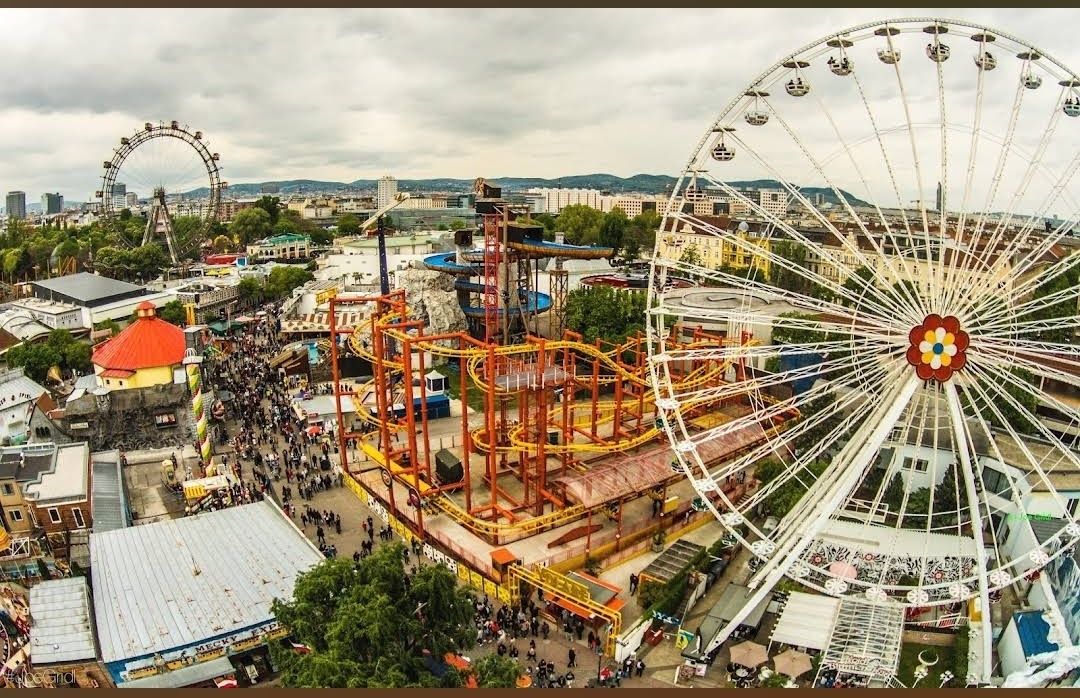
## Description **Prater Funpark** in Vienna, commonly referred to as the **Wurstelprater**, is one of Europe’s most iconic amusement parks and a beloved attraction for both locals and tourists. Nestled within the vast Prater public park, this funfair has been entertaining visitors for over 250 years. It’s a place where history, nostalgia, and modern thrills come together, offering everything from traditional carousels and bumper cars to cutting-edge roller coasters and high-adrenaline rides. What makes the Prater unique is its blend of old-world charm and contemporary entertainment. The park’s symbol, the **Wiener Riesenrad** (Giant Ferris Wheel), dates back to 1897 and is one of Vienna’s most recognized landmarks. Riding the Ferris wheel provides not only fun but also breathtaking panoramic views of the city. At the same time, newer attractions like turbo coasters and virtual reality experiences ensure that thrill-seekers are never bored. **Little-known facts**: * The Prater was originally an imperial hunting ground before being opened to the public in 1766. The amusement park grew organically from stalls, performers, and small rides. * Unlike most theme parks, **entry to the Prater Funpark is free**. Visitors pay only for the rides and attractions they choose, making it a flexible experience for all budgets. --- ## Location Prater Funpark is located in **Vienna**, the capital of **Austria**, within the **Leopoldstadt district**. It sits inside the larger **Prater public park**, a green oasis that stretches over six square kilometers and also includes walking paths, meadows, and sports facilities. ### How to get there: * **By metro**: The fastest way is to take the U1 or U2 subway lines to the station **Praterstern**, which is just a short walk from the park. * **By tram**: Trams 0 and 5 also stop near Prater. * **By foot or bike**: Visitors staying in central Vienna can enjoy a scenic walk or bike ride to the park, as it’s close to the city center. --- ## Tips * **Visit in the evening**: The Prater comes alive after sunset when the rides light up, creating a magical carnival atmosphere. * **Don’t miss the Giant Ferris Wheel**: It’s the park’s most famous attraction and a must for first-time visitors. * **Plan your budget**: Since entry is free but rides are paid individually, decide beforehand how many attractions you’d like to try. Ride prices vary, so bringing cash can be useful. * **Try the local food stalls**: Beyond rides, the park is known for its traditional Austrian snacks like bratwurst, pretzels, and candied nuts. * **Combine with a stroll in the Prater park**: After the excitement of the rides, the surrounding green spaces offer a relaxing contrast. * **Check seasonal events**: The park hosts festivals, concerts, and themed events throughout the year, especially during summer and around Christmas. --- ## Conclusion Prater Funpark in Vienna is more than just an amusement park—it’s a cultural institution that blends history, fun, and nostalgia. With its mix of historic attractions like the Wiener Riesenrad and thrilling modern rides, it offers something for everyone, from families to adrenaline junkies. Whether you go for the rides, the food, or the atmosphere, the Prater promises an unforgettable Viennese experience. --- ## FAQ **1. Is there an entrance fee for Prater Funpark?** No, entrance is free. Visitors only pay for the rides and attractions they choose. **2. What is the most famous ride at Prater?** The **Wiener Riesenrad (Giant Ferris Wheel)** is the park’s most iconic attraction and a symbol of Vienna. **3. When is the best time to visit?** Evenings are particularly magical with illuminated rides, but daytime visits are better for families with young children. **4. How long should I plan to spend at Prater?** Most visitors spend 2–4 hours, though you could easily spend a whole day enjoying the rides and the larger Prater park. **5. Is Prater open year-round?** The park is open all year, but many rides operate seasonally, typically from March to October. The Giant Ferris Wheel and some attractions remain open in winter. **6. Can I find food and drinks inside the park?** Yes, the park is filled with restaurants, snack stalls, and beer gardens serving Austrian and international food. --- ## Links * [Prater Wien – Official Website](https://www.praterwien.com/) * [Wiener Riesenrad – Official Website](https://www.wienerriesenrad.com/)
GemVoyage Team • World

Comments