GemVoyage Team • World
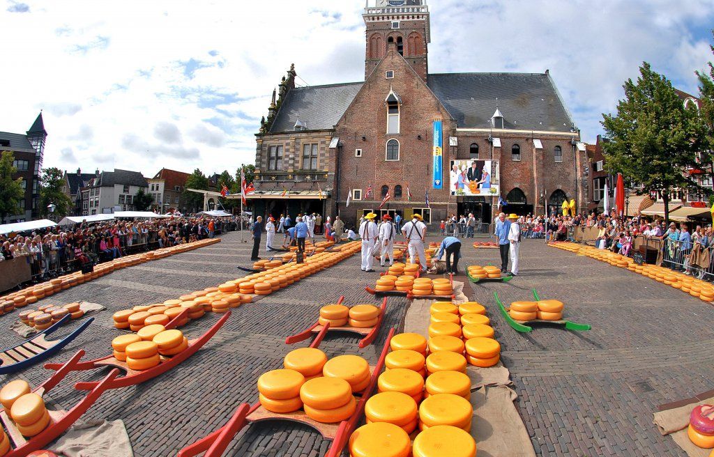
One of the museum’s strengths is its accessibility. It presents information in a way that is easy to follow for casual visitors while still giving enough depth to satisfy people interested in local history. The setting matters too: being in a historic weighing house adds a strong sense of place. One lesser-known fact is that Alkmaar’s cheese heritage is linked not only to local farming but also to the broader trading systems that shaped Dutch cities for centuries. Another interesting detail is that the museum helps explain the rituals and practical logistics behind cheese commerce, including how products were measured, moved, and valued in a market town.
The museum is also a good reminder that cultural attractions do not have to be large to be effective. Its size makes it easy to fit into a walking day in Alkmaar, and it works especially well when combined with the city’s old streets, canals, and other historic sites. For many visitors, the appeal is partly culinary and partly atmospheric: you learn about cheese, but you also absorb the character of a Dutch market city that built part of its identity around this trade. That makes the museum feel both educational and local.
If you are coming by train, Alkmaar’s station connects well to the city center, and the walk to the museum is straightforward. Visitors arriving from Amsterdam or other nearby cities usually find the trip simple by rail, making it a practical day trip destination. Once in town, the compact center is best explored on foot.
If you are interested in the traditional cheese market, check the schedule before your trip so you can align your visit.
The museum is a good rainy-day option because it is compact and easy to visit without much planning.
Leave room in your itinerary for tasting local cheese or exploring nearby shops.
Discover more hidden gems you might love.
Thessaly
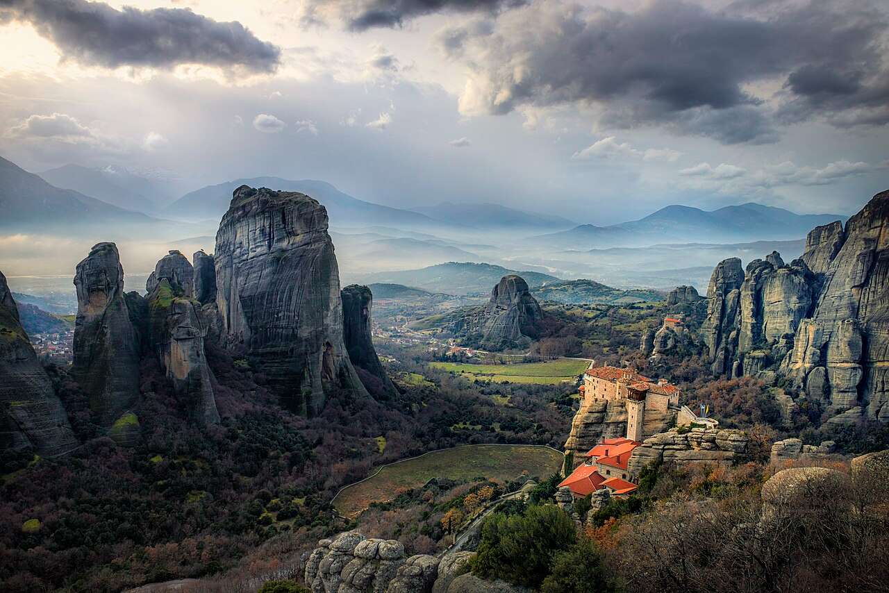
## Description The Meteora is one of Greece’s most awe-inspiring destinations, a place where nature and spirituality converge in dramatic fashion. Towering sandstone pillars rise from the plains of Thessaly, crowned by centuries-old Eastern Orthodox monasteries that seem to defy gravity. The name “Meteora” translates to “suspended in the air,” a fitting description for these monastic retreats perched atop rock formations that reach heights of over 400 meters. The site’s uniqueness lies not only in its geological wonder but also in its spiritual and historical significance. Monks began settling in the area as early as the 11th century, seeking solitude and safety from invading forces. By the 14th century, they had constructed monasteries atop the cliffs, accessible only by rope ladders and winches. Today, six of the original twenty-four monasteries remain active and open to visitors: Great Meteoron, Varlaam, Rousanou, St. Nicholas Anapausas, Holy Trinity, and St. Stephen. A little-known fact: the rock formations of Meteora are composed of sandstone and conglomerate, formed over millions of years from river deposits. Another intriguing detail is that the Monastery of Holy Trinity was featured in the James Bond film “For Your Eyes Only,” adding a touch of cinematic fame to its spiritual legacy. ## Location The Meteora is located in **Greece**, in the **Thessaly region**, near the **town of Kalabaka** and the **village of Kastraki**. It sits at the northwestern edge of the Thessalian Plain, close to the Pindus Mountains. ### How to Get There - **By Train**: From Athens, take a direct train to Kalabaka (approximately 4.5–5 hours). Trains also run from Thessaloniki via Palaiofarsalos. - **By Bus**: Buses connect Athens and Thessaloniki to Trikala, with onward connections to Kalabaka. - **By Car**: Driving from Athens takes about 4–5 hours. The route offers scenic views and flexibility for exploring nearby villages. - **By Tour**: Guided day trips from Athens or Thessaloniki are available and often include transportation, monastery visits, and local insights. Once in Kalabaka, the monasteries are accessible by car, taxi, or hiking trails. ## Tips - **Dress Appropriately**: Modest clothing is required. Men should wear long pants, and women should wear skirts below the knee and cover their shoulders. Some monasteries provide wraps at the entrance. - **Start Early**: Begin your visit in the morning to avoid crowds and enjoy cooler temperatures. - **Check Opening Hours**: Each monastery has its own schedule and may be closed on specific days. Plan accordingly. - **Wear Comfortable Shoes**: Many monasteries require climbing steps or walking on uneven terrain. - **Bring Water and Snacks**: Facilities are limited, especially on hiking trails. - **Explore Beyond the Monasteries**: The surrounding landscape offers excellent hiking, photography, and opportunities to visit traditional villages like Kastraki. ## Conclusion The Meteora is a breathtaking blend of natural grandeur and spiritual heritage. With its towering rock formations and cliff-top monasteries, it offers a profound experience for travelers seeking beauty, history, and tranquility in one of Greece’s most iconic landscapes. ## FAQ **1. How many monasteries can be visited at Meteora?** Six monasteries are open to the public, each with its own unique architecture and history. **2. Is there an entrance fee?** Yes, each monastery charges a small fee (usually around €3–5 per person). **3. Can I hike between the monasteries?** Yes, well-marked trails connect many of the monasteries. Hiking is a popular way to explore the area. **4. Are guided tours available?** Yes, local guides offer walking tours, cultural insights, and transportation options. **5. Is Meteora suitable for children?** Yes, but some monasteries require climbing steep steps, so supervision and physical readiness are important. **6. What is the best time to visit Meteora?** Spring and autumn offer mild weather and fewer crowds. Summer can be hot and busy, while winter is quieter but colder. ## Links - [Meteora – Wikipedia Overview](https://en.wikipedia.org/wiki/Meteora) - [Visit Meteora – Monastery Guide and Tours](https://visitmeteora.travel/meteora-monasteries/)
GemVoyage Team • World
Cairo
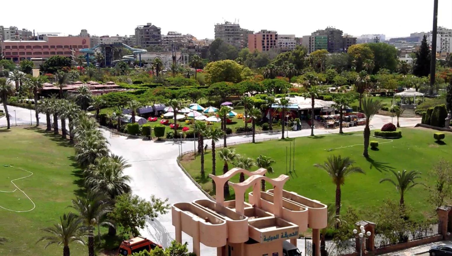
## Description **The International Park (الحديقة الدولية بالقاهرة)** is one of Cairo’s most distinctive public green spaces, designed to showcase a miniature journey through different countries and cultures within a single park. Established in the late 1980s, the park was conceived as a cultural and recreational project where landscaped areas, architectural replicas, and themed gardens represent nations from around the world. While not polished in the way of modern theme parks, its charm lies in its **ambitious concept, open space, and local atmosphere**. What makes the International Park unique is its layout: each section is inspired by a different country, featuring symbolic structures, sculptures, plants, or design elements associated with that nation. Visitors can walk from Asian-inspired pavilions to European-style gardens within minutes. This eclectic mix gives the park an almost nostalgic quality, reflecting Cairo’s vision of internationalism during the late 20th century. A lesser-known fact is that several embassies and cultural institutions contributed ideas or symbolic elements during the park’s early development, even if execution varied over time. Another interesting detail is that the park was once a major venue for **school trips and cultural festivals**, making it an important part of collective memory for many Cairenes who grew up in the 1990s. Today, the park functions primarily as a **family-friendly recreational space**. It is popular for picnics, casual walks, and affordable outings, especially for residents of eastern Cairo. While some areas show signs of aging, the park’s size, greenery, and concept still make it a refreshing escape from the dense urban environment. ## Location **Country:** Egypt **Region:** Greater Cairo **City:** Cairo **District:** Nasr City The International Park is located in **Nasr City**, one of Cairo’s largest residential districts, close to major roads and residential compounds. ### How to Get There * **By taxi or ride-hailing:** * Uber and local taxis are the most convenient option from anywhere in Cairo. * **By car:** * Easily accessible via Nasr City’s main roads, with parking available near the entrance. * **By public transport:** * Microbuses and buses serving Nasr City pass close to the park, though routes can be confusing for first-time visitors. * **From central Cairo:** * Expect a 30–45 minute drive depending on traffic. ## Tips * **Visit in the afternoon:** Late afternoon offers better weather and softer light, especially in warmer months. * **Bring your own food:** Picnic areas are common, and outside food is usually allowed. * **Wear comfortable shoes:** The park is large, and exploring all sections involves significant walking. * **Manage expectations:** Some country sections are more symbolic than detailed replicas. * **Good for children:** Open spaces allow kids to run freely, and the atmosphere is relaxed. * **Avoid peak public holidays:** The park can become crowded during major Egyptian holidays. ## Conclusion The International Park is a spacious, culturally themed green retreat that offers a simple but enjoyable experience for families and casual visitors. Its global concept, combined with its local character, makes it a nostalgic and accessible escape from Cairo’s urban intensity. ## FAQ **1. When was the International Park opened?** It was established in the late 1980s as a cultural and recreational project. **2. Is there an entrance fee?** Yes, there is a low entrance fee, making it affordable for families. **3. How long should I plan for a visit?** Most visitors spend **1.5 to 3 hours**, depending on walking pace and activities. **4. Is the park suitable for tourists?** Yes, especially for those interested in local leisure spaces rather than major monuments. **5. Are there food stalls inside?** Basic snacks may be available, but bringing your own food is recommended. **6. Is it good for photography?** Yes, particularly for casual photography and wide shots of greenery and themed structures. ## Links * [Egyptian tourism portal](https://www.experienceegypt.eg/en)
GemVoyage Team • World
Tunis
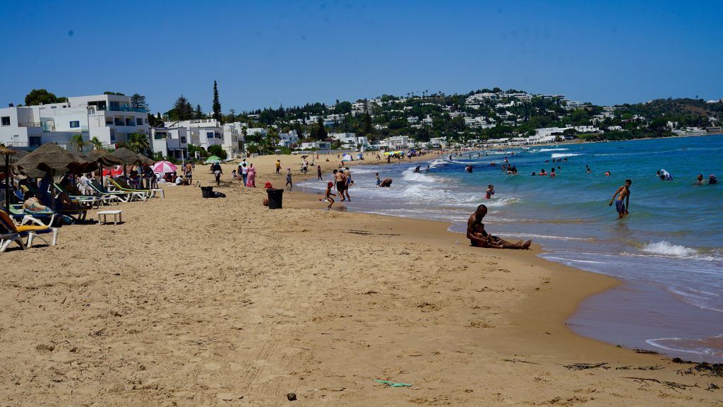
## Description La Marsa Beach is a beloved coastal escape northeast of Tunis that combines Mediterranean charm with an approachable, local atmosphere. Far from the large resort complexes of some Mediterranean destinations, La Marsa offers a more neighborhood-oriented seaside experience: a promenade lined with cafés, bakeries, and small restaurants; stretches of sandy shore where locals swim and sunbathe; and scenic viewpoints that look across the blue Mediterranean. For visitors seeking a short seaside interlude from Tunis’s historic core, La Marsa is an ideal half-day or day-trip destination. The area’s allure stems from its balance of leisure and everyday life. Residents walk their dogs along the promenade, families picnic on the sand, and fishermen haul in their catches at dawn. This authentic feel makes La Marsa attractive to travelers who want to witness contemporary Tunisian coastal life, not just the staged beachfront experience. The neighborhood also contains pockets of cultural interest—small galleries, local bakeries serving traditional pastries, and seasonal markets—that reward time spent wandering. ## Location La Marsa is located along the Mediterranean coast, approximately a 20–40 minute drive from central Tunis depending on traffic. It is part of the larger Tunis metropolitan area and is commonly reached by taxi, rideshare, or regional train in combination with local buses. The promenade and main beach are clustered near the town center, making it easy to combine a seaside visit with cafés or a short walk through residential streets to see local homes and shops. For a relaxed day, arrive mid-morning to stroll the promenade, have a seaside lunch, and enjoy a late-afternoon walk as light softens over the water. If you want to swim, check local conditions—lifeguard presence and sea state vary by season and specific beach segments. ## Tips - Check tide and sea conditions before planning a swim day; calmer days are best for families and casual swimming. - Visit early in the day or later in the afternoon to avoid peak crowds and capture better light for photos. - Bring essentials: water, sun protection, and a towel—some smaller beaches do not have full-service rental facilities. - Sample local cafés and seafood restaurants along the promenade for a taste of Tunisian coastal cuisine. - Pair the beach with cultural stops: a short walk through La Marsa’s streets reveals bakeries, small galleries, and neighborhood markets. - If you prefer quieter spots, walk a little farther from the main promenade where smaller coves and rocky outcrops provide a calmer atmosphere. ## Conclusion La Marsa Beach is an ideal complement to a Tunis itinerary for visitors who want to add gentle sea air to a cultural visit. It offers an accessible, everyday Mediterranean experience that feels comfortably local—and it’s an excellent reminder that Tunisia’s coastline is as varied and alive as its historic medinas. ## FAQ ### Is La Marsa Beach good for a quick escape from Tunis? Yes. It’s one of the closest coastal escapes from the capital and works well for half-day or full-day visits without complicated logistics. ### Is La Marsa only a summer destination? No. While beachgoing peaks in summer, the promenade and cafés are pleasant year-round for walks and dining. ### What facilities are available? Facilities vary by spot: some stretches have cafés and basic rental services, while smaller coves may lack amenities—bring essentials if you’re unsure. ### How do I get there from central Tunis? Taxi or rideshare are the most direct options; regional trains and buses also connect the area but may require short onward transfers. ### Is La Marsa family-friendly? Generally yes—shallow water and promenade facilities make it suitable for families, though conditions vary by season and exact location. ## Links - [Wikipedia](https://en.wikipedia.org/wiki/La_Marsa)
GemVoyage Team • World
Vigo
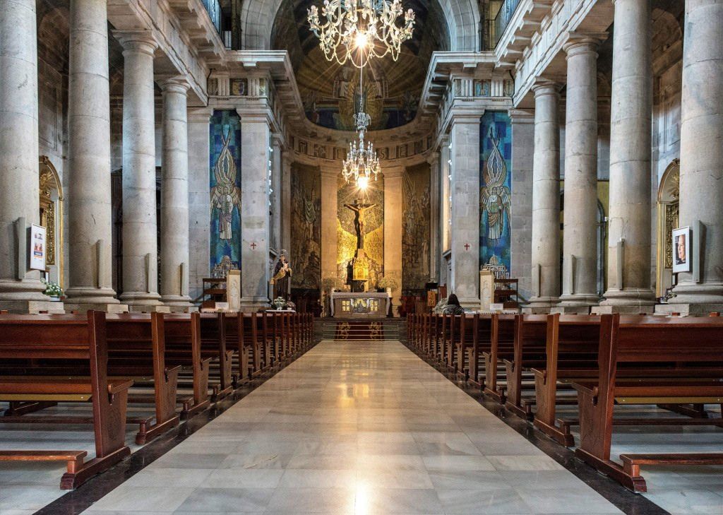
## Description The Concatedral – Basílica de Santa María de Vigo is one of the most important religious and historical monuments in the city of Vigo. Standing prominently in the old town area, this Roman Catholic basilica-concatedral serves as a key symbol of the city’s spiritual heritage and architectural evolution. While Vigo is often associated with its port and modern urban life, this church offers a quieter, more reflective window into its past. What makes the Concatedral – Basílica de Santa María unique is its layered history. The current neoclassical structure, completed in the early 19th century, was built on the remains of earlier Gothic churches destroyed during attacks in the late 16th century. Despite its relatively austere exterior, the interior reveals elegant altarpieces, religious artwork, and a serene atmosphere that contrasts with the bustling streets outside. A little-known fact is that the church holds the image of Cristo de la Victoria, Vigo’s most venerated religious figure, honored every August during one of Galicia’s largest religious processions. Another lesser-known detail is that the building holds the status of both a basilica and a co-cathedral, sharing diocesan importance with the Cathedral of Tui. The Concatedral – Basílica de Santa María is not only a place of worship but also a cornerstone of Vigo’s cultural and communal identity. ## Location The Concatedral – Basílica de Santa María is located in **Spain**, in the autonomous community of **Galicia**, within the city of **Vigo**. It stands in the historic Casco Vello (Old Town), near the waterfront and close to Plaza de la Constitución. The church is easily accessible on foot from central Vigo, especially if you are exploring the old town area. Public buses stop nearby, connecting Casco Vello with other parts of the city. Taxis are also readily available and affordable. Visitors arriving by car should be aware that parking in the old town can be limited, so public transport or walking is recommended. ## Tips * Visit during the morning or early afternoon for a quieter and more contemplative experience. * Dress modestly, especially if attending a service or visiting during religious events. * Take time to explore Casco Vello before or after your visit, as the surrounding streets are rich in history. * If visiting in August, check dates for the Cristo de la Victoria procession, one of Vigo’s most important annual events. * Photography is generally allowed, but flash may be restricted during services. * Check mass times if you wish to experience the church as an active place of worship. ## Conclusion The Concatedral – Basílica de Santa María de Vigo is a meaningful blend of faith, history, and architecture. As both a spiritual center and a historic landmark, it offers visitors a deeper understanding of Vigo beyond its modern image and coastal setting. ## FAQ **Why is it called a co-cathedral?** It shares cathedral status with the Cathedral of Tui within the same diocese, making it a co-cathedral. **Is there an entrance fee?** No, entrance is generally free, though donations are appreciated. **Can tourists visit during mass?** Yes, visitors are welcome, but should remain respectful and quiet during services. **How long does a visit take?** Most visits last between 20 and 40 minutes, depending on interest. **Is the church accessible for people with limited mobility?** Accessibility is limited due to the historic structure, but the main entrance is generally manageable. ## Links * [Diocese of Tui-Vigo Official Website](https://www.diocesetuivigo.org) * [Turismo de Vigo](https://www.turismodevigo.org)
GemVoyage Team • World
Los Angeles
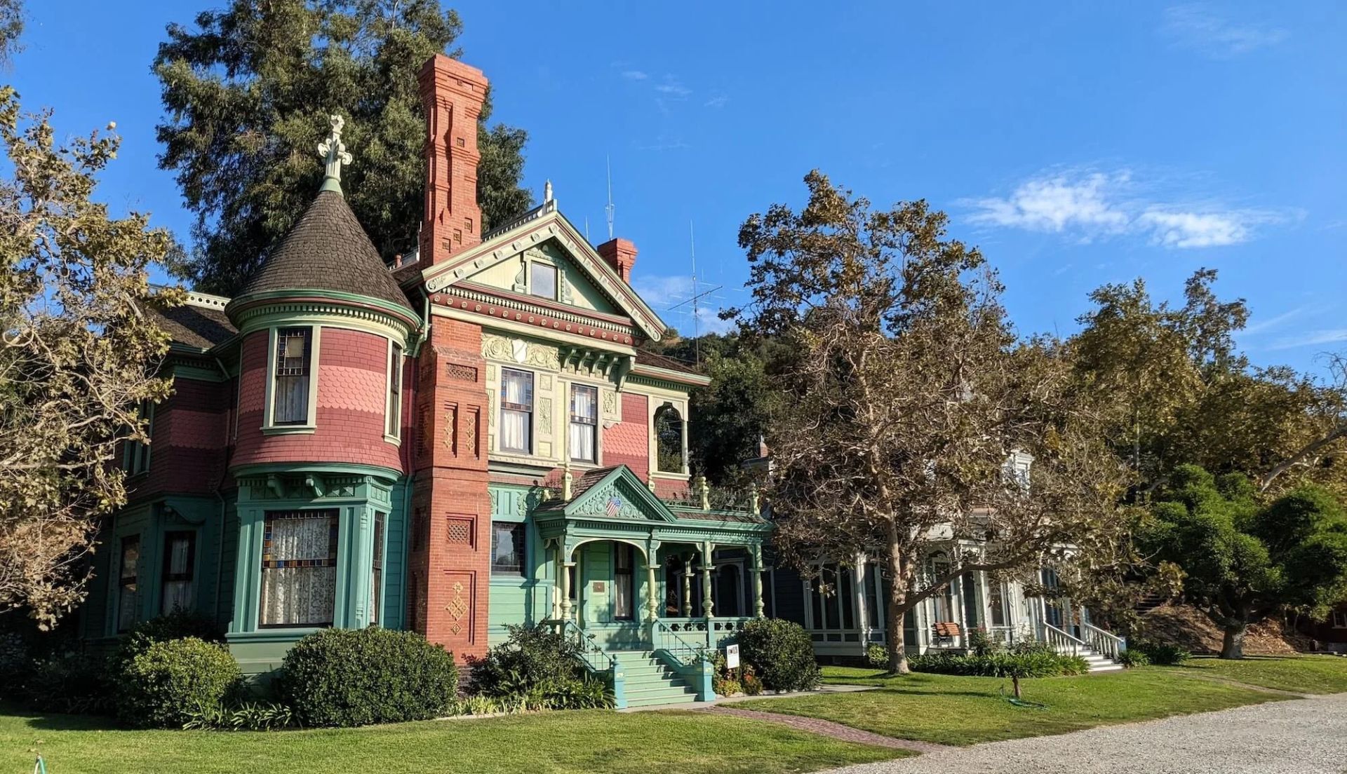
## Description Heritage Square Museum is an extraordinary open-air architectural museum that gathers Victorian and early 20th-century houses and outbuildings within a single historic district to showcase Southern California’s built environment and social history. Each structure has a carefully reconstructed exterior and interpreted interior that reveal the craftsmanship, decorative trends, and daily rhythms of life from a period when Los Angeles was transforming from a frontier town into a burgeoning metropolis. The museum stands out for the authenticity of its fabric: original trim, stained glass, tile, and millwork are preserved or painstakingly restored, and many interiors are furnished with period-appropriate objects to convey domestic stories. Preservation workshops on site keep traditional trades alive—carpentry, plasterwork, and decorative finishes are practiced as living crafts, which both supports ongoing maintenance and educates visitors about restoration techniques. Beyond architecture, Heritage Square interprets social history. Exhibits explore how families lived, worked, and entertained across different socioeconomic strata, and the museum’s programming—guided tours, living history demonstrations, and seasonal festivals—brings these narratives to life. Special events often highlight conservation issues and the ongoing need to protect historic urban fabric in the face of development pressures. For scholars, students, and casual visitors alike, the site offers layered experiences: a close reading of architectural detail, hands-on learning in workshops, and interpretive narratives that connect buildings to broader histories of migration, industry, and urban change. Its role as a rescue repository—structures moved and reassembled to avoid demolition—adds an extra dimension: many buildings carry stories of mid-century urban renewal and community efforts to preserve heritage. ## Location Heritage Square Museum is located in the Montecito Heights neighborhood of Los Angeles, California, a short drive northeast of downtown Los Angeles. The setting—on a hillside with city views—provides a scenic backdrop for exploring an era of American domestic architecture. Getting there: Driving is the most convenient option; limited on-site parking is available. Public transit can be used but often requires transfers and a short walk—check local transit schedules and plan for extra time. Rideshare and local taxis are convenient alternatives. Pair a visit with nearby cultural stops, such as the Huntington Library or local hillside parks, to create a fuller day of exploration. ## Tips - Check the museum’s tour schedule and special-event calendar before you go; guided tours offer the most context and are often led by knowledgeable docents. - Wear comfortable shoes—paths through the outdoor site can be uneven and some properties require short climbs. - Give yourself at least two hours to explore; the combination of interiors, workshops, and outdoor exhibits rewards a relaxed pace. - Bring a camera for exterior architectural photography; observe interior photography rules where posted and respect exhibit boundaries. - If interested in historic trades, inquire about workshop schedules or volunteer opportunities—many preservation skills are demonstrated on site. - Visit in spring or fall for pleasant weather and outdoor events; summer can be warm and winter may bring cooler, wetter days. ## Conclusion Heritage Square Museum preserves an essential chapter of Southern California’s architectural story. By combining rescued structures, conservation workshops, and interpretive programming, it offers a hands-on way to understand historic building crafts and the lives of the people who inhabited these homes. It is an inspiring stop for anyone interested in architecture, preservation, and urban history. ## FAQ Q: Are there guided tours? A: Yes. The museum runs scheduled guided tours and special programs; tours are recommended for first-time visitors to gain historical context and architectural insight. Q: Is the site family-friendly? A: Yes. The museum offers family-oriented programs and activities; children can learn about historic life through interactive demonstrations. Q: Can event spaces be rented? A: Select areas may be rented for private events, though availability and restrictions vary—contact the museum’s events office for details. Q: Are there volunteer opportunities or workshops? A: Yes. The museum often offers volunteer roles, preservation workshops, and demonstrations of traditional trades—check the calendar or volunteer page for current options. Q: Is the site wheelchair accessible? A: Some areas have limited accessibility due to the nature of historic structures and terrain; the museum can provide guidance on accessible routes and accommodations. Q: What’s the best way to learn about restoration techniques demonstrated on site? A: Attend preservation workshops, guided tours that focus on conservation, or scheduled demonstrations—these sessions are designed to explain both craft techniques and the rationale behind repair choices. ## Links - [Heritage Square Museum (official)](https://www.heritagesquare.org) - [Wikipedia: Heritage Square Museum](https://en.wikipedia.org/wiki/Heritage_Square_Museum)
GemVoyage Team • World
Copenhagen
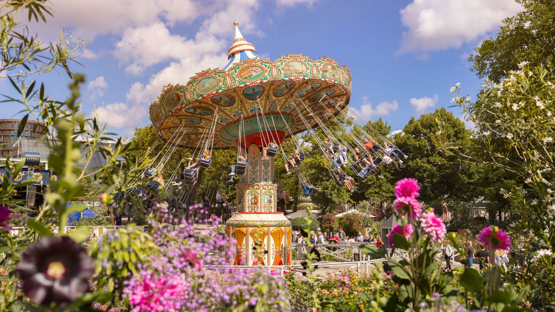
## Description Tivoli Gardens in Copenhagen is not just an amusement park—it’s a cultural institution, a botanical wonderland, and a nostalgic escape all rolled into one. Opened in 1843, Tivoli is the **second-oldest operating amusement park in the world**, yet it remains one of the most vibrant and beloved attractions in Denmark. With its blend of vintage charm and modern thrills, Tivoli offers something for everyone: roller coasters, live performances, gourmet dining, and serene gardens. The park’s architecture is a whimsical mix of exotic styles, including Moorish domes, Chinese pagodas, and fairy-tale towers. At night, thousands of colored lights transform the gardens into a magical realm, enchanting visitors of all ages. Tivoli’s oldest ride, the wooden Rollercoaster from 1914, still operates with a brakeman aboard—a rare feature found in only a handful of coasters worldwide. On the other end of the spectrum, Vertigo spins riders upside down at 100 km/h and was voted Europe’s Best Ride in 2014. A little-known fact: Tivoli inspired Walt Disney to create Disneyland. After visiting the park in the 1950s, Disney was captivated by its cleanliness, atmosphere, and attention to detail. Another quirky detail—guinea fowls and peacocks roam freely through the gardens, adding a touch of whimsy to the already surreal setting. ## Location Tivoli Gardens is located in **Denmark**, in the **Capital Region**, in the city of **Copenhagen**. It sits right in the heart of the city, adjacent to Copenhagen Central Station and within walking distance of City Hall Square. ### How to Get There: - **By Train**: Take any regional or S-train to Copenhagen Central Station. Tivoli’s main entrance is directly across the street. - **By Metro**: The nearest metro stop is Rådhuspladsen (City Hall Square), just a short walk away. - **By Foot or Bike**: If you're exploring central Copenhagen, Tivoli is easily accessible on foot or by bicycle. - **By Car**: Parking is available nearby, but public transport is recommended due to central traffic and limited space. Its central location makes it an ideal starting point for a day of sightseeing in Copenhagen. ## Tips for Visitors To make the most of your Tivoli experience, keep these tips in mind: - **Buy a Tivoli Pass**: If you plan to ride multiple attractions, the Ride Pass is more economical than paying per ride. - **Visit in the Evening**: Tivoli truly comes alive after dark with its dazzling lights and live performances. - **Check the Event Calendar**: From ballet and concerts to fireworks and seasonal festivals, Tivoli hosts over 250 events annually. - **Try the Food Hall**: Located near the Central Station entrance, Tivoli Food Hall offers a variety of cuisines from gourmet burgers to vegetarian delights. - **Bring a Picnic**: You’re allowed to bring your own food and enjoy it in the gardens. - **Use the Copenhagen Card**: This tourist pass includes free entry to Tivoli and over 80 other attractions, plus public transport. ## Conclusion Tivoli Gardens is a timeless blend of thrill, beauty, and culture. Whether you're chasing adrenaline on roller coasters, savoring Danish cuisine, or simply strolling through flower-lined paths, Tivoli offers an unforgettable experience in the heart of Copenhagen. ## FAQ **1. What are Tivoli Gardens’ opening hours?** Hours vary by season, but typically the park opens around 11:00 AM and closes between 10:00 PM and midnight. **2. Is Tivoli suitable for children?** Absolutely. There are rides, playgrounds, and performances tailored for kids of all ages. **3. Do I need to buy tickets in advance?** It’s recommended, especially during holidays and weekends. Online booking can save time and money. **4. Are there seasonal events at Tivoli?** Yes, Tivoli transforms for Halloween, Christmas, and summer festivals with themed decorations and special shows. **5. Can I visit Tivoli without going on rides?** Yes, many visitors come just to enjoy the gardens, restaurants, and performances. **6. Is Tivoli wheelchair accessible?** Yes, the park is fully accessible, and wheelchairs are available for rent at the entrance. ## Links - [Tivoli Gardens Official Website](https://www.tivoli.dk/en) - [Tivoli Gardens – Wikipedia](https://en.wikipedia.org/wiki/Tivoli_Gardens)
GemVoyage Team • World

Comments