GemVoyage Team • World
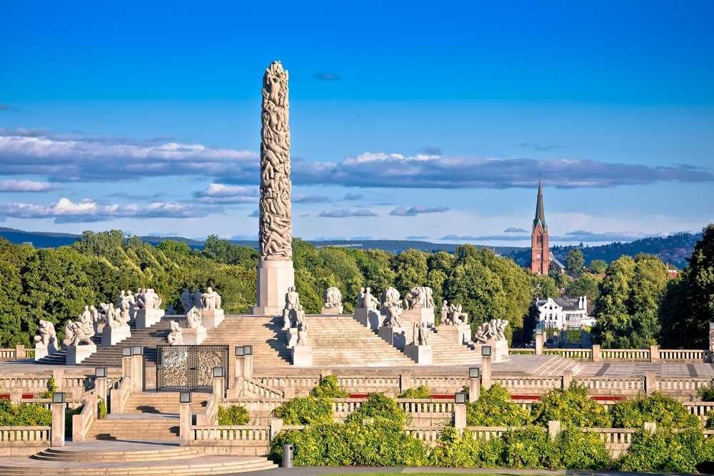
The obvious sculptures draw crowds for good reason, but the park’s subtler areas often show how carefully the whole environment has been designed. Small changes in angle, distance, and elevation can alter how you perceive the figures and the surrounding open space. That means a visit can become a kind of visual study if you take your time. One lesser-known fact is that the park has been shaped around a long artistic vision that extends beyond individual sculptures, which is why the less visited areas still feel coherent rather than secondary. Another interesting point is that weather and light dramatically change the experience, so even a familiar sculpture can feel new when viewed from a quiet side path.
For travelers, the hidden corners are especially appealing if they want to avoid the most crowded photo spots or if they have already seen the park’s main highlights. You do not need to be an art specialist to enjoy this approach; in fact, simply slowing down and paying attention is enough. The hidden areas often reward curiosity more than prior knowledge. That makes them ideal for repeat visitors, photographers, and anyone who prefers an experience that feels slightly less scripted.
The easiest way to get there is by tram, bus, or a walk from central Oslo, followed by time on foot inside the park. Since the best hidden corners are not signposted as a separate attraction, the main strategy is to arrive at the park and then wander with intention. Comfortable walking shoes matter more than anything else.
Do not focus only on the central sculpture axis; the quieter side paths are where the hidden corners reveal themselves.
Bring a camera and spend time looking back toward the main sculptures from different angles.
If you have already visited once, return in another season to see how the mood changes.
Discover more hidden gems you might love.
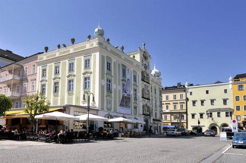
Gmunden
## Description The **Rathaus Gmunden** — the **Town Hall of Gmunden** — is one of Austria’s most charming and picturesque civic buildings, perfectly reflecting the town’s **historic elegance and lakeside serenity**. Standing proudly on the shore of **Traunsee Lake**, surrounded by the scenic peaks of the **Salzkammergut Mountains**, this 16th-century building combines Renaissance architecture, local craftsmanship, and cultural pride in a way few town halls do. Built between **1574 and 1577**, the Rathaus originally served as a **merchant and administrative center** during a period when Gmunden was thriving as a salt-trading hub. Its architecture features a **Renaissance façade** with beautifully arched arcades, intricate window frames, and an elegant clock tower topped with a small bell turret. The building’s exterior is painted in soft pastel hues that harmonize with the lakeside scenery, giving it a warm and inviting appearance. However, what truly makes Rathaus Gmunden stand out — and one of Austria’s most photographed town halls — is its **ceramic carillon** (a set of bells made from Gmunden pottery). Installed in **1961**, this unique feature consists of **24 hand-painted ceramic bells**, crafted by local artisans from the renowned **Gmundner Keramik** workshop, which has been producing distinctive green-flamed pottery since the 17th century. Several times a day, the bells chime melodiously across the old town, filling the air with a sound that has become a symbol of Gmunden’s artistic heritage. Few visitors realize that it is **one of the only ceramic carillons in the world** still in operation — a beautiful fusion of art, music, and tradition. Inside, the Rathaus still functions as the **seat of the local government**, but parts of it are open to visitors, showcasing historical rooms, exhibitions, and cultural displays. The nearby **Rathausplatz (Town Hall Square)** hosts markets, festivals, and outdoor concerts throughout the year, offering a lively glimpse of local life. Whether you visit for its craftsmanship, its lakeside views, or the charm of its daily chimes, Rathaus Gmunden is a small-town treasure that embodies the **soul of the Austrian Alps**. ## Location The **Rathaus Gmunden** is located in the **heart of Gmunden**, a town in **Upper Austria (Oberösterreich)**, on the **northern shore of Lake Traunsee**. **Address:** Rathausplatz 1, 4810 Gmunden, Austria To get there: * **By train:** From **Linz** or **Salzburg**, take an **ÖBB regional train** to **Gmunden Station**, then walk about **10–15 minutes** to the old town. * **By tram:** From the station, you can also take the **Traunseetram**, which stops near Rathausplatz. * **By car:** Easily accessible via the **A1 motorway**, exit **Regau** or **Laakirchen**, with several nearby parking options. * **By boat:** Ferries on **Traunsee Lake** stop at **Gmunden Seebahnhof**, just steps away from the Town Hall. * **By foot or bike:** The promenade around the lake connects the Rathaus to the main attractions of Gmunden, including **Schloss Ort** and the **Esplanade**. ## Tips * **Don’t miss the carillon performance:** The ceramic bells ring several times daily — typically at **11:00 AM**, **3:00 PM**, and **5:00 PM** (check local schedules). * **Visit the Gmundner Keramik Manufaktur:** Just outside town, you can see how the world-famous green-flamed pottery is made — a perfect complement to the Rathaus visit. * **Take photos from the lake promenade:** The Town Hall reflected in the water, with mountains in the background, is one of Austria’s most postcard-worthy views. * **Enjoy the market:** On Fridays, Rathausplatz hosts a **local farmers’ market** selling fresh regional produce, cheese, and crafts. * **Visit nearby Schloss Ort:** A short walk away, this fairytale castle on the lake is another Gmunden highlight. * **Stop for coffee by the lake:** There are several cozy cafés around Rathausplatz with views of the water and the mountains. * **Combine with a boat tour:** Scenic cruises on Traunsee often pass by the Rathaus, offering a new perspective from the lake. ## Conclusion The **Rathaus Gmunden** is far more than a historic building — it’s the **heart of a town steeped in art, tradition, and Alpine beauty**. From its Renaissance architecture to the enchanting ceramic bells that sing across Traunsee, it tells the story of a community that has blended craftsmanship and culture for centuries. Whether you’re exploring the Salzkammergut for its lakes, castles, or peaceful charm, a stop at the Rathaus Gmunden is an experience that captures the very essence of Austrian heritage. ## FAQ **1. When was the Rathaus Gmunden built?** It was constructed between **1574 and 1577** during the height of Gmunden’s salt-trading prosperity. **2. What makes the Rathaus special?** Its **ceramic carillon**, made from locally produced Gmundner pottery, is **one of the few of its kind in the world**. **3. How often does the carillon play?** The bells ring several times daily, typically at **11:00 AM, 3:00 PM, and 5:00 PM**, though times may vary seasonally. **4. Can visitors enter the Rathaus?** Yes, parts of the building are open to visitors, especially during cultural events or exhibitions. **5. Where is Gmunden located?** Gmunden lies on **Lake Traunsee** in **Upper Austria (Oberösterreich)**, roughly halfway between **Linz** and **Salzburg**. **6. Is it easy to reach from Vienna or Salzburg?** Yes — from Vienna or Salzburg, take a train to **Attnang-Puchheim**, then connect to Gmunden via a regional line (total travel time: around **2 hours**). **7. What nearby attractions should I see?** Don’t miss **Schloss Ort**, **Traunsee Lake cruises**, and the **Gmundner Keramik Factory** for a complete cultural experience. ## Links * [Gmunden Tourism Official Website](https://www.gmunden.at)
GemVoyage Team • World
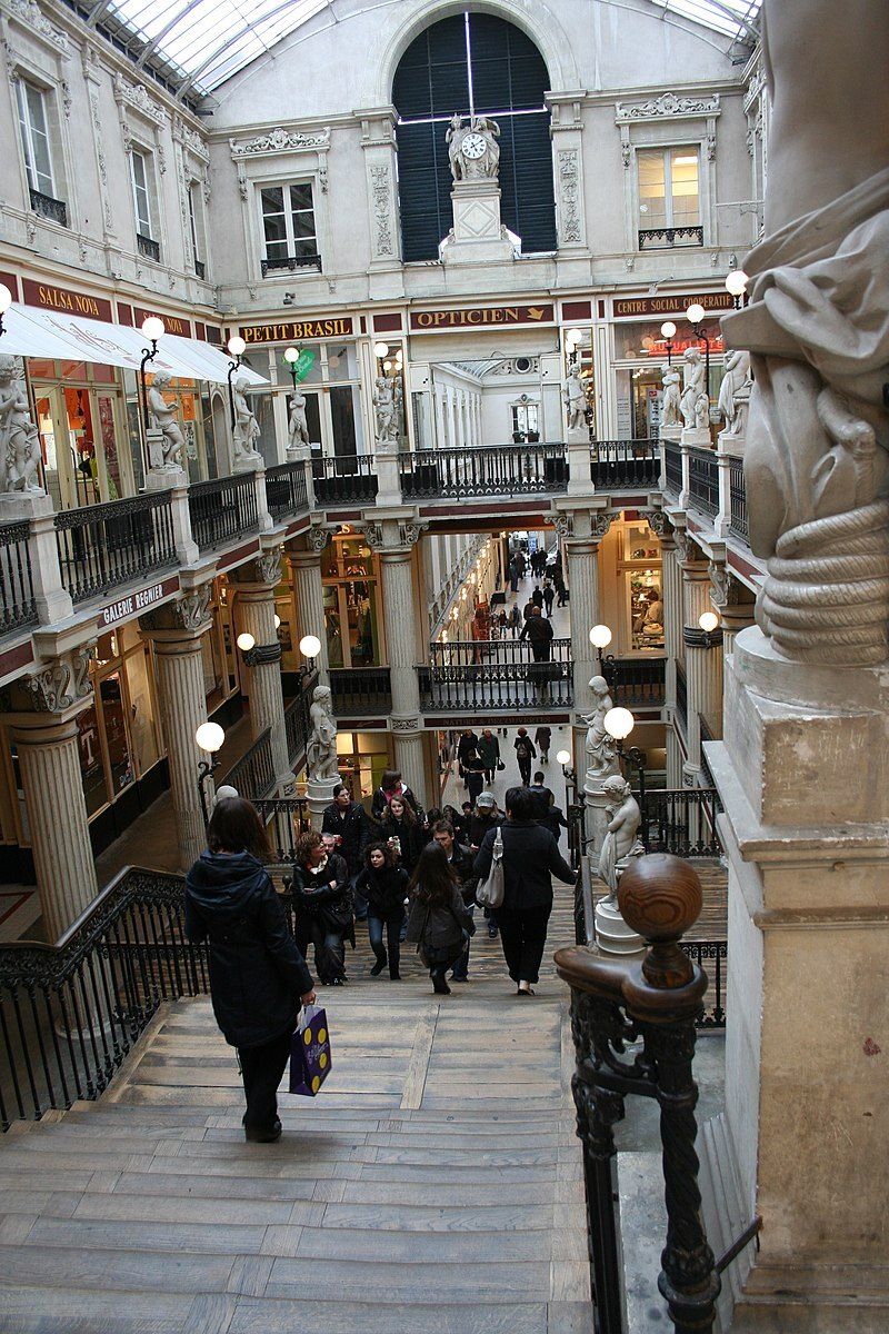
Nantes
## Description The Passage Pommeraye is one of the most striking covered passages in France, and a true architectural masterpiece from the 19th century. Built between 1840 and 1843, it is both a shopping arcade and a monument of historical significance. What sets it apart is its unique three-level structure, which cleverly adapts to the natural slope of the land between Rue de la Fosse and Rue Santeuil. This allows visitors to walk through the gallery while experiencing a gradual elevation, framed by ornate staircases, decorative sculptures, and elegant ironwork. The atmosphere inside is one of timeless sophistication. Light streams in through a glass roof, highlighting neoclassical statues and intricate details that make every corner worth admiring. The arcade houses a variety of boutiques, from luxury shops to independent stores, making it both a shopping destination and a cultural experience. A little-known fact about the Passage Pommeraye is that it was once considered a risky investment. Louis Pommeraye, a local lawyer turned developer, envisioned the arcade as a way to connect two streets of different heights. Many thought the project was too ambitious and doomed to fail. Yet today, it is one of Nantes’ most celebrated landmarks and a symbol of the city’s entrepreneurial spirit. Another fun detail is that the passage has been featured in several films, including Jacques Demy’s *Lola* (1961), cementing its place in French cinematic history. ## Location The Passage Pommeraye is located in **Nantes**, the capital of the **Loire-Atlantique** department in the **Pays de la Loire** region of western **France**. It sits in the heart of the city center, connecting **Rue de la Fosse** with **Rue Crébillon** and **Rue Santeuil**, making it an essential stop for anyone exploring Nantes. Getting there is easy. From the Nantes train station (Gare de Nantes), it’s about a 20-minute walk or a short ride on the city’s efficient tram network—Line 1 to the “Commerce” stop places you within minutes of the passage. Visitors coming from Paris can reach Nantes in just over two hours via high-speed TGV train, making the Passage Pommeraye a convenient and rewarding day-trip highlight. ## Tips * **Take your time:** While you can walk through the passage in minutes, slow down to admire the statues, balustrades, and architectural details. * **Visit on a weekday:** Weekends and holidays can be crowded, especially during sales seasons or Christmas. A weekday visit provides a calmer experience. * **Look up:** The glass roof and decorative sculptures are among the most remarkable elements—don’t miss them while focusing only on the shops. * **Combine with nearby attractions:** The passage is centrally located, close to Place Royale and the Graslin district, where you’ll find theaters, cafés, and other cultural landmarks. * **Enjoy seasonal magic:** During the Christmas period, the arcade is beautifully decorated, creating an enchanting festive atmosphere. * **Photography tip:** Arrive early in the morning to capture the arcade without too many people in the frame. ## Conclusion The Passage Pommeraye is not just a shopping arcade but a masterpiece of 19th-century urban design. With its harmonious blend of architecture, light, and history, it has become one of Nantes’ most treasured sites. Whether for shopping, sightseeing, or simply soaking up the atmosphere, it offers a memorable experience that combines elegance with everyday life. ## FAQ **1. What makes the Passage Pommeraye unique?** Its three-level design that adapts to a sloping street, combined with ornate sculptures and architectural details, makes it one of the most distinctive arcades in Europe. **2. Is the Passage Pommeraye free to enter?** Yes, entry is completely free, and visitors can walk through at any time during opening hours. **3. What kind of shops can be found inside?** The passage features a mix of luxury boutiques, independent shops, jewelry stores, fashion outlets, and cafés. **4. Can I visit the Passage Pommeraye at night?** The shops close in the evening, but the passage itself remains open for walking until later hours, allowing visitors to enjoy its illuminated beauty. **5. How long does a visit usually take?** A casual walk-through might take 15–20 minutes, but to explore shops and enjoy the atmosphere, allow at least an hour. **6. Is the Passage Pommeraye accessible for people with limited mobility?** Yes, elevators have been added in recent years to improve accessibility, although the original staircases remain a prominent feature. ## Links * [Passage Pommeraye](https://en.wikipedia.org/wiki/Passage_Pommeraye)
GemVoyage Team • World
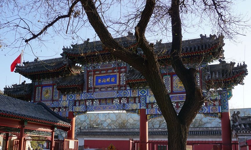
Beijing
## Description The Taoist White Cloud Temple, also known as Baiyun Guan, is one of Beijing’s most important Taoist sites and one of the best places in the city to understand living religious tradition rather than imperial grandeur alone. Unlike the palaces and ceremonial complexes that often dominate Beijing itineraries, White Cloud Temple offers a quieter, more introspective experience centered on worship, ritual practice, and the continuity of Taoist culture in a modern metropolis. It is both a spiritual site and a historic monument, and that combination gives it a distinct atmosphere that feels deeply local. One of the reasons the temple stands out is that it has remained an active religious center for centuries. Visitors are not just looking at preserved architecture; they are entering a place where incense, prayer, and seasonal observance still matter. A lesser-known fact is that Baiyun Guan has long been associated with the Quanzhen school of Taoism, which helped shape its role as a major center for priestly training and ritual life. Another detail many travelers miss is that the temple complex includes multiple courtyards and halls arranged to guide visitors gradually from the street into a more contemplative inner space, which makes the visit feel like a transition rather than a simple sightseeing stop. For travelers, the appeal lies in both scale and texture. The temple is not overwhelming, yet it contains enough detail to reward slow observation. You will see ritual objects, stone inscriptions, prayer spaces, architectural ornament, and the quiet habits of worshippers who come for reasons unrelated to tourism. That authenticity matters. It gives White Cloud Temple a grounded energy that many visitors find memorable precisely because it is not trying to entertain them. Instead, it invites attention, patience, and respect. It is also an excellent introduction to Taoism for visitors who know the tradition only in abstract terms. The site demonstrates how religion, philosophy, architecture, and daily practice can coexist in one living space. In a city famous for imperial landmarks, White Cloud Temple offers a more intimate kind of historical depth. ## Location Taoist White Cloud Temple is located in Xicheng District, Beijing, China, not far from the central part of the city. Its placement makes it accessible without being swallowed by the busiest tourist corridors. Because Beijing is so large, that central-but-not-overcrowded location is a major advantage for visitors who want to combine the temple with other nearby cultural stops. The easiest way to reach the temple is by subway followed by a short walk, although taxis and rideshares are also practical. Public transit is usually the most efficient option in Beijing, especially during heavy traffic. Once you arrive, the temple is straightforward to enter, and the surrounding streets make it easy to transition from city noise into a quieter courtyard environment. If you want to build the visit into a broader Beijing day, it works well as part of a route that includes nearby historic neighborhoods, museums, or old city streets. Morning visits are often the best because the temple feels calm, the light is better for photography, and you are more likely to encounter ritual activity rather than only sightseeing crowds. ## Tips Dress modestly and behave respectfully. This is an active religious site, not just a museum. Arrive early if you want a quieter experience. The temple’s atmosphere is strongest before the day becomes too busy. Look closely at the courtyards and side halls. The most rewarding details are often not in the main entrance area but in the quieter corners. Bring cash or a card depending on current local habits, but do not assume every small purchase or offering will be handled the same way as in a Western museum setting. Take time to observe rather than rush through the complex. Baiyun Guan is best experienced as a slow walk through layered religious space. ## Conclusion The Taoist White Cloud Temple is one of Beijing’s most meaningful spiritual landmarks, combining active worship, historical continuity, and architectural calm. It is especially rewarding for travelers who want a more thoughtful and authentic view of the city. ## FAQ ### Is White Cloud Temple still active? Yes. It remains an active Taoist temple, which is part of what makes the visit so distinctive. ### How much time should I spend there? Most visitors will need 1 to 2 hours, though you can spend longer if you are interested in the history or want to observe the atmosphere more carefully. ### Is photography allowed? Policies can vary by area and current temple rules, so it is best to check on arrival and avoid photographing people without permission. ### Is this a good place for first-time visitors to Beijing? Yes, especially if you want to understand the city beyond its most famous imperial monuments. ## Links - [White Cloud Temple on Wikipedia](https://en.wikipedia.org/wiki/White_Cloud_Temple) - [Beijing official tourism](https://english.beijing.gov.cn/) - [Taoism overview](https://en.wikipedia.org/wiki/Taoism)
GemVoyage Team • World
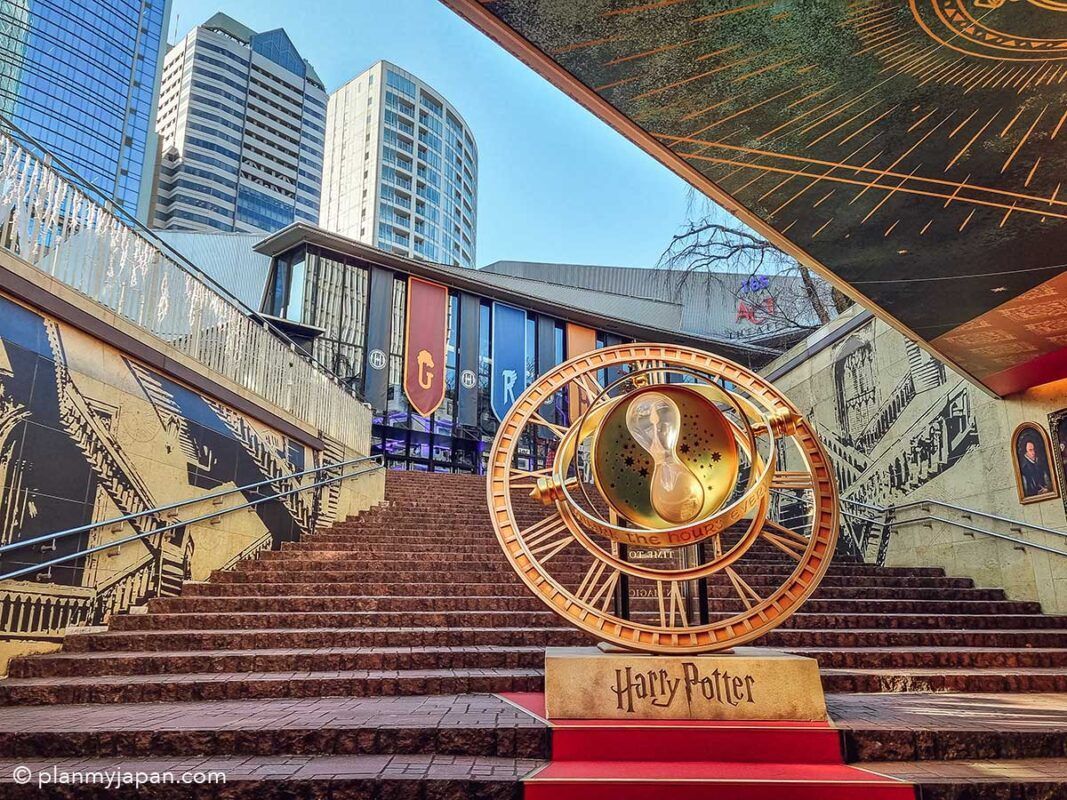
Tokyo
## Description The **Harry Potter Stairs & Time Turner (ハリー・ポッター階段とタイムターナー)** in Tokyo is one of the city’s most popular **pop-culture photo landmarks**, blending cinematic fantasy with modern urban design. This attraction is not a historical monument or a traditional museum—it is a **themed visual installation inspired by the Harry Potter film series**, designed specifically for fans who want to step inside the wizarding world without leaving central Tokyo. The installation recreates two of the most iconic visual elements from the films: the **magical moving staircase of Hogwarts** and **Hermione Granger’s Time Turner** from *Harry Potter and the Prisoner of Azkaban*. The staircase evokes the illusion of shifting directions and hidden passages, while the oversized Time Turner sculpture serves as a symbolic centerpiece representing time travel, destiny, and choice—core themes in the Potter universe. What makes this location truly unique is that it exists **inside a contemporary commercial complex rather than a theme park**. This means visitors do not need to buy expensive tickets or travel to a resort location to enjoy an immersive Harry Potter-themed environment. The installation uses **cinematic lighting, reflective metallic surfaces, stone textures, and enchanted-style typography** to create a convincing atmosphere of fantasy within a very modern architectural setting. The stairs are often used as a **staged photo zone**, where visitors recreate scenes, cosplay as characters, or simulate stepping into a time-loop narrative. The Time Turner sculpture is particularly photogenic when illuminated in the evening, when its rotating rings and glowing accents transform the space into a dramatic visual set piece. Many visitors describe the experience as feeling like walking into a **film trailer set inside a shopping mall**—brief, stylized, and designed for visual impact rather than storytelling depth. A little-known fact is that the stairs and Time Turner installation were part of a **long-term promotional collaboration connected to Warner Bros. Japan and official Harry Potter licensing projects**, timed to coincide with renewed franchise activity in Tokyo. Another lesser-known detail is that the space is frequently **updated with seasonal lighting themes and limited-time character visuals**, which means repeat visits can feel subtly different across the year. Importantly, this site is not meant to replace **The Making of Harry Potter Studio Tour Tokyo**; rather, it acts as a **public teaser-style landmark**, accessible to anyone passing through the district. It attracts an extremely diverse crowd: international tourists, Japanese fans, casual shoppers, cosplayers, couples, and social-media creators all intersect in the same space. The emotional appeal of the installation lies in its ability to deliver **instant recognition and nostalgia**. Even a short visit—often no more than 10 to 15 minutes—can trigger powerful emotional connections for fans who grew up with the books and films. It is, at its core, not a storytelling space but a **symbolic photo experience**, built for visual memory rather than narrative immersion. ## Location The **Harry Potter Stairs & Time Turner** installation is located in **central Tokyo**, inside a major commercial complex in the **Akasaka / Roppongi area**, which has become a hub for large-scale themed entertainment projects. **City:** Tokyo **Region:** Kantō **Country:** Japan **District:** Minato Ward (Akasaka / Roppongi area) ### How to Get There: * **By Tokyo Metro:** * **Chiyoda Line** to **Akasaka Station** * **Hibiya Line or Toei Oedo Line** to **Roppongi Station** * **By JR Train:** Use JR lines to nearby hubs such as **Shinjuku or Tokyo Station**, then transfer to the metro. * **By taxi:** Easy and accurate if you show the Japanese attraction name. * **On foot:** The area is highly walkable and well-connected through underground passages and plazas. The installation is typically integrated into a **shopping, dining, and entertainment complex**, making it easy to combine with cafés, retail stores, and evening nightlife. ## Tips * **Visit in the evening:** The lighting effects are significantly more dramatic after sunset. * **Go on weekdays for clearer photos:** Weekends often bring long lines of people waiting for their turn. * **Bring a small tripod if allowed:** For steady night photos, especially around the Time Turner. * **Do not expect a full “attraction experience”:** This is a **visual installation**, not a ride or museum. * **Cosplay is common:** Light cosplay is generally accepted and often encouraged by visitors. * **Respect queue etiquette:** Japanese photo spots usually operate with informal but strict order. * **Combine with nearby Harry Potter experiences:** If you are a serious fan, this pairs well with the Studio Tour Tokyo. * **Check for seasonal updates:** Lighting schemes and banners occasionally change. ## Conclusion The **Harry Potter Stairs & Time Turner in Tokyo** is a compact yet powerful example of how modern cities translate cinematic fantasy into everyday urban space. It is not a destination for long exploration, but a **precise, visually engineered moment of nostalgia**, crafted for fans who want a tangible connection to the wizarding world without committing an entire day to a theme park. For Harry Potter enthusiasts, it delivers something precise and valuable: **a magical pause inside the rhythm of real city life**. ## FAQ **1. Is the Harry Potter Stairs & Time Turner a real theme park attraction?** No. It is a **public visual installation**, not a ride or ticketed experience. **2. Is it free to visit?** Yes. Access is **free**, as it is located inside a public commercial complex. **3. How long does a visit typically take?** Most visitors spend **10 to 20 minutes**, depending on photo queues. **4. Is it suitable for children?** Yes. It is **family-friendly**, though it can get crowded. **5. Is this the same as the Harry Potter Studio Tour Tokyo?** No. This is a **small themed photo landmark**, whereas the studio tour is a full museum-style experience. **6. Can I take professional photos there?** Casual photography is allowed. **Commercial shoots may require permission** from the property management. ## Links * [Warner Bros. Japan](https://www.warnerbros.co.jp) * [Harry Potter Studio Tour Tokyo](https://www.wbstudiotour.jp)
GemVoyage Team • World
Cairo
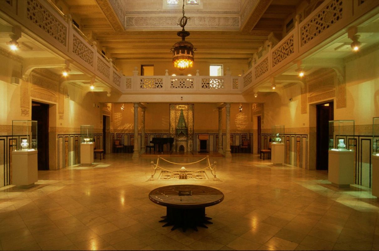
## Description The **Islamic Ceramics Museum (متحف الخزف الإسلامي)** is one of Cairo’s most refined and culturally rich museums, dedicated entirely to the art of **Islamic pottery and ceramics**. It offers visitors a rare opportunity to explore how clay, glaze, and fire were transformed into objects of beauty, science, and daily life across more than **a thousand years of Islamic civilization**. Housed inside the elegant **Palace of Princess Fatma Ismail**, a 19th-century aristocratic residence, the museum blends **architectural elegance with artistic mastery**. The palace itself is a masterpiece of late Ottoman and European-style architecture, featuring **ornate ceilings, stained glass, carved woodwork, and marble staircases**. Even before seeing the exhibits, the building alone is worth the visit. The museum’s collection includes **hundreds of ceramic pieces** from different Islamic periods and regions, including **Egypt, Persia (Iran), Andalusia (Spain), Turkey, Iraq, and Central Asia**. Displays range from **everyday household items**, such as bowls and jars, to **luxury palace ware, mosque tiles, and decorative panels**. Each object tells a story of trade, technological innovation, and artistic expression across the Islamic world. Key highlights include **lusterware ceramics**, known for their metallic shine, developed in medieval Iraq and Egypt; **Iznik tiles from Ottoman Turkey**, famous for their vivid blues and reds; and **Persian underglaze-painted ceramics**, celebrated for their delicate floral and calligraphic designs. Visitors can clearly trace how artistic styles traveled along trade routes and evolved across empires. What makes this museum especially unique is how it connects **science with art**. Islamic potters were pioneers in **chemistry and kiln technology**, developing methods for glazing, coloring, and firing that influenced European ceramics centuries later. The museum explains these processes in an accessible way, making it engaging even for visitors with no background in art or archaeology. A little-known fact is that the museum was originally opened in **1936**, making it one of the **earliest specialized ceramics museums in the Middle East**. Another lesser-known detail is that Princess Fatma Ismail, whose palace now hosts the museum, was the same royal figure who funded the establishment of **Cairo University**, making her a key patron of Egyptian education and culture. Quiet, elegant, and deeply educational, the Islamic Ceramics Museum offers a refined cultural experience that contrasts beautifully with the bustle of central Cairo. ## Location The **Islamic Ceramics Museum** is located in the **Zamalek district** of **Cairo**, Egypt — one of the city’s most upscale and culturally vibrant islands along the Nile. **Address:** 26 Gezira Street, Zamalek, Cairo, Egypt ### How to Get There: * **By metro:** Take Line 2 to **Opera Station**, then walk about 10 minutes toward Gezira/Zamalek. * **By taxi or ride-hailing apps:** Tell the driver “**Mithaf al-Khazaf al-Islami fi Zamalek**.” Most drivers recognize it as a cultural landmark. * **By walking:** If you are already in Zamalek, the museum is centrally located and easily walkable. * **By car:** Limited street parking is available; taxis are generally more convenient. Its location makes it ideal to combine with nearby attractions like the **Cairo Opera House**, **Modern Art Museum**, and **Gezira Art Center**. ## Tips * **Visit on a weekday:** The museum is usually quiet, but weekdays offer an especially peaceful atmosphere. * **Take your time with details:** Many of the finest motifs are small and intricate — slow observation is rewarded. * **Photography:** Allowed in most areas without flash; always confirm current rules at the entrance. * **Read the descriptions:** Many pieces include historical and scientific explanations that enhance appreciation. * **Combine with Zamalek cafés:** After your visit, relax at one of Zamalek’s many riverside cafés or cultural lounges. * **Allow 60–90 minutes:** This is enough time to explore the entire collection without rushing. * **Art lovers should not skip it:** If you appreciate design, geometry, or craftsmanship, this museum is a hidden gem. ## Conclusion The **Islamic Ceramics Museum in Cairo** is a quiet treasure that captures the refinement, innovation, and artistic brilliance of Islamic civilization through one of its most expressive mediums — ceramics. Set inside a royal palace and filled with works that span continents and centuries, the museum offers both **aesthetic pleasure and historical insight**. It is an ideal destination for travelers seeking a calmer, deeper cultural experience beyond Cairo’s monumental landmarks. ## FAQ **1. What is the Islamic Ceramics Museum famous for?** It is known for its extensive collection of **Islamic pottery and ceramic art** from across the Middle East, North Africa, and Central Asia. **2. Where is the museum located?** It is located in **Zamalek**, on Gezira Island in central Cairo. **3. How old is the museum?** It officially opened in **1936**, making it one of the oldest specialized ceramics museums in the region. **4. Who owned the palace originally?** The palace belonged to **Princess Fatma Ismail**, a member of Egypt’s royal family and a major patron of education. **5. How long does a typical visit take?** Most visitors spend between **one to one and a half hours** exploring the museum. **6. Is the museum suitable for children?** Yes, especially for older children interested in history, art, and patterns, though it is a quiet, observation-focused museum. **7. Can I combine it with other museums in the same day?** Yes — it pairs well with visits to the **Cairo Opera House**, **Museum of Modern Egyptian Art**, and **Gezira Art Center**. ## Links * [Egyptian Ministry of Tourism and Antiquities – Museums](https://egymonuments.gov.eg)
GemVoyage Team • World
Shkodër
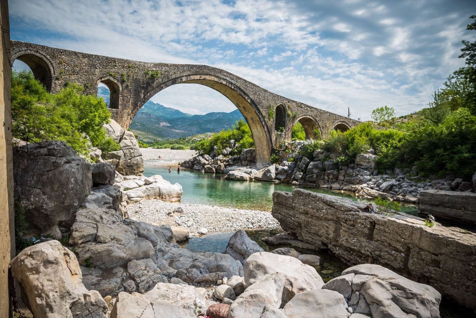
## Description Mesi Bridge (Ura e Mesit), an 18th-century Ottoman-era stone bridge, is one of Albania’s most captivating historical landmarks. Located near the city of Shkodër, this architectural gem spans the Kir River with a graceful series of 13 arches, stretching 108 meters in length. Built around 1770 by Kara Mahmud Bushati, a powerful Ottoman pasha, the bridge was part of a strategic infrastructure project to connect Shkodër with the northern highlands, including the medieval town of Drisht. What makes Mesi Bridge unique is its asymmetrical design and the craftsmanship of its construction. The bridge was built in two phases: the central arch and one adjacent arch were completed first, followed by the remaining eleven. The structure features round river stones and chiseled stone plates, giving it both strength and aesthetic charm. Despite centuries of wear and occasional flooding, the bridge remains remarkably well-preserved and is considered the largest and best-preserved Ottoman bridge in Albania. A little-known fact is that the bridge once formed part of a trade route that extended all the way to Pristina, Kosovo. Another intriguing detail is that the English artist Edward Lear sketched the bridge during his travels in Albania in 1848, captivated by its elegance and the surrounding landscape. ## Location Mesi Bridge is located in **Albania**, in the **Shkodër County**, near the **city of Shkodër**. Specifically, it sits in the village of **Mes**, approximately 5 to 8 kilometers northeast of the city center. ### How to Get There - **By Car**: The most convenient way to reach Mesi Bridge is by car. From Shkodër, follow the road toward the village of Mes. The route is well-marked and passes through scenic countryside. - **By Taxi**: Taxis from Shkodër are affordable and can take you directly to the bridge. - **By Bicycle**: Adventurous visitors can enjoy a leisurely bike ride along quiet rural roads. - **By Public Transport**: Options are limited, so planning ahead is recommended if you’re not driving. The journey itself is part of the experience, offering views of lush greenery, distant mountains, and traditional Albanian villages. ## Tips - **Visit in Spring or Early Summer**: The surrounding landscape is at its most vibrant, and water levels in the Kir River are ideal for photography. - **Wear Comfortable Footwear**: The bridge’s surface is uneven, and exploring nearby trails requires sturdy shoes. - **Bring Water and Sun Protection**: Especially in summer, temperatures can be high and shade is limited. - **Explore Nearby Sites**: Combine your visit with a trip to Drisht Castle or a walk along the Kir Valley. - **Photography**: Early morning or late afternoon offers the best lighting for capturing the bridge and its surroundings. - **Respect the Site**: Though open to the public, the bridge is a protected cultural monument. Avoid climbing on fragile sections. ## Conclusion Mesi Bridge is a stunning example of Ottoman engineering and Albanian heritage. With its elegant arches, historical significance, and picturesque setting, it offers visitors a peaceful and enriching escape just outside Shkodër. ## FAQ **1. Is there an entrance fee to visit Mesi Bridge?** No, the site is free to visit. **2. Can I swim in the Kir River near the bridge?** Yes, swimming is possible, especially in spring and early summer. Water levels may be low in July and August. **3. Is the bridge accessible year-round?** Yes, but heavy rains in winter may make the area muddy or slippery. **4. How long should I plan for the visit?** A visit typically takes 1–2 hours, including time for photos and exploring the surroundings. **5. Is Mesi Bridge suitable for children?** Yes, but supervision is recommended due to uneven surfaces and proximity to the river. **6. Are guided tours available?** Local guides in Shkodër may offer tours that include Mesi Bridge and nearby historical sites. ## Links - [Mesi Bridge – Wikipedia Overview](https://en.wikipedia.org/wiki/Mesi_Bridge) - [VisitShkodër – Mesi Bridge Guide](https://visitshkoder.org/mesi-bridge/)
GemVoyage Team • World

Comments