GemVoyage Team • World
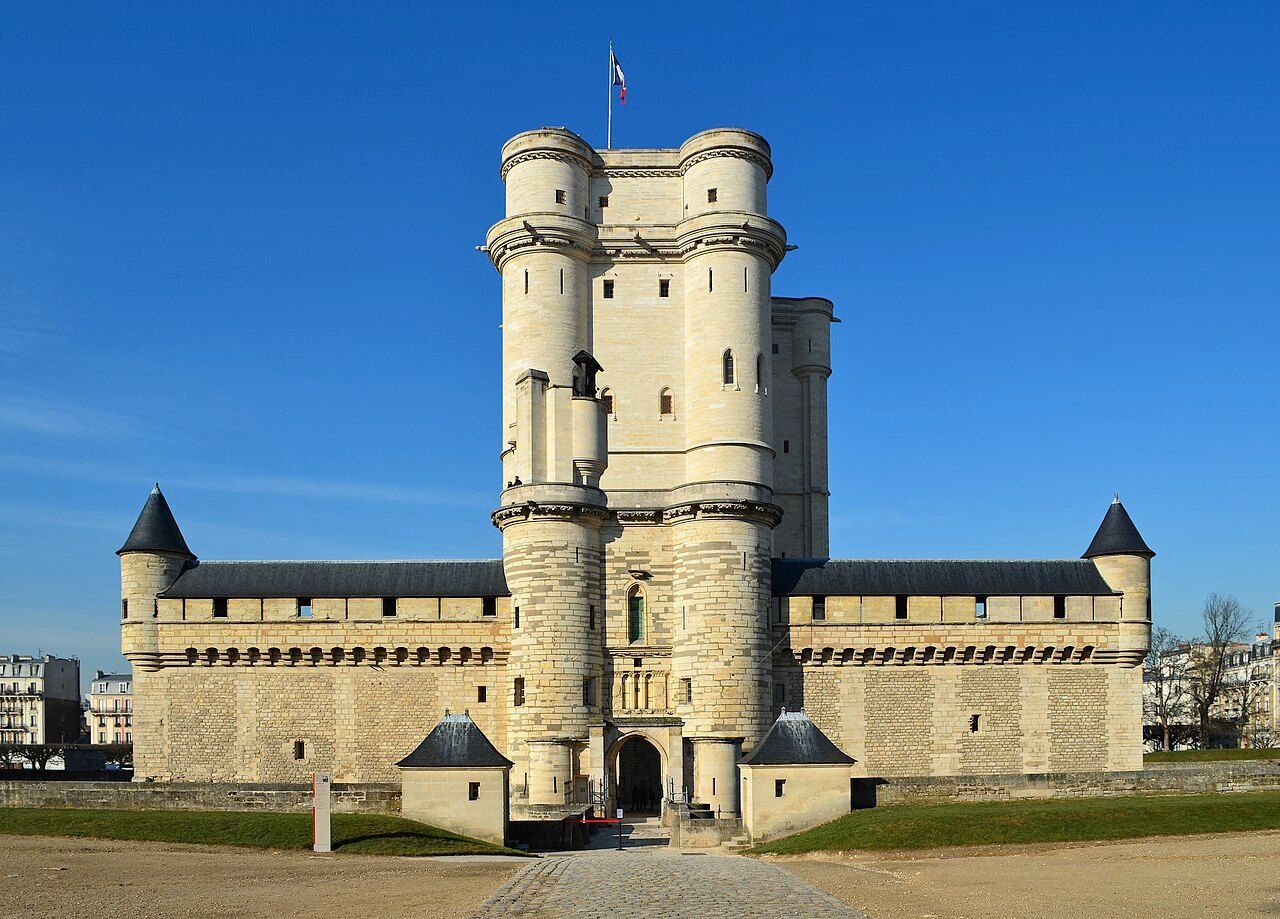
The Château de Vincennes is one of France’s most historically significant royal fortresses and a remarkable example of medieval military architecture in the heart of modern Paris. Located just east of the city, this vast castle stands as a symbol of the power, prestige, and evolution of the French monarchy from the Middle Ages through the Renaissance.
Originally built as a hunting lodge for King Louis VII in the 12th century, the site was transformed into a formidable royal fortress by King Philip VI and King Charles V during the 14th century. The result was one of Europe’s largest and most impressive medieval castles, complete with towering walls, fortified gates, and a majestic 52-meter (170-foot) keep — the tallest medieval fortified tower in Europe.
The keep, surrounded by a deep moat, served as both a royal residence and a symbol of authority. Inside, visitors can explore beautifully preserved royal apartments, chapels, and ceremonial halls that once housed some of France’s most powerful monarchs, including Charles V, Henry IV, and Louis XIV. Before Versailles rose to prominence, Vincennes was the main royal residence of the French crown.
What makes the Château de Vincennes truly unique is its dual character — both royal and defensive. The complex includes a massive curtain wall with nine towers, a drawbridge, and a gothic-style chapel modeled after Sainte-Chapelle in central Paris. Over the centuries, it also served as a royal prison, holding famous figures such as the Marquis de Sade, Denis Diderot, and Mirabeau.
A lesser-known fact is that the castle was occupied by Napoleon Bonaparte’s troops, later used as a military arsenal, and even served as a command center during World War II. Despite its turbulent past, the site remains remarkably well-preserved and offers a fascinating journey through 800 years of French history.
Today, the Château de Vincennes stands as a peaceful yet awe-inspiring monument — less crowded than central Paris landmarks, making it an ideal destination for history enthusiasts seeking authenticity and atmosphere.
The Château de Vincennes is located in the suburb of Vincennes, directly east of central Paris, within the Val-de-Marne (Île-de-France) region. It sits adjacent to the Bois de Vincennes, Paris’s largest public park.
To get there:
The Château de Vincennes is a living testament to the grandeur and endurance of French royal history. With its soaring towers, Gothic chapel, and centuries of royal intrigue, it offers visitors a journey from the medieval era to modern France — all within reach of central Paris. Far less crowded than the city’s major monuments, it’s a place where you can truly feel the power, elegance, and mystery of France’s royal past. Whether you’re fascinated by architecture, military history, or French monarchy, the Château de Vincennes promises an experience both majestic and intimate.
1. When was the Château de Vincennes built?
Construction began in the 14th century under Philip VI and Charles V, though the site dates back to a 12th-century royal hunting lodge.
2. What is the château known for?
It is renowned as France’s largest medieval royal fortress, featuring Europe’s tallest keep and a beautifully preserved Gothic chapel.
3. How can I get there from central Paris?
Take Metro Line 1 directly to Château de Vincennes Station — it’s the last stop on the line and just a few minutes’ walk from the castle.
4. Are guided tours available?
Yes, guided tours in French and English are offered daily and provide detailed insights into the château’s rich history.
5. How long should I plan for a visit?
Allow about 2–3 hours to explore the keep, chapel, and grounds at a comfortable pace.
6. Is it suitable for children?
Yes — children often enjoy exploring the towers and open courtyards, and there are family-friendly tours available.
7. When is the best time to visit?
Spring and early autumn offer pleasant weather and fewer crowds, though the château is open year-round.
Discover more hidden gems you might love.
Milan
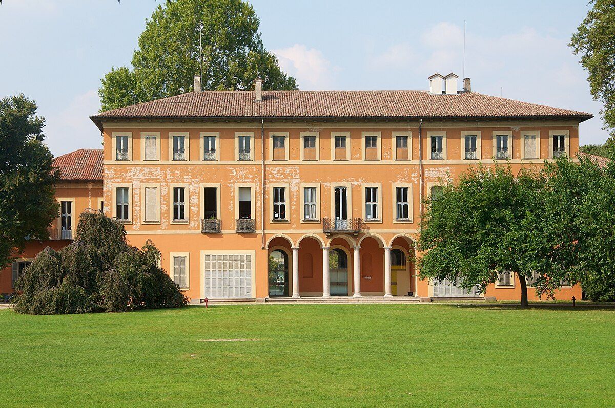
## Description **Villa Litta Modignani** is one of Milan’s most elegant yet underrated historical residences, offering visitors a quiet immersion into aristocratic life from the 18th and 19th centuries. Built in the **late 1700s** and later expanded, the villa is a refined example of **Neoclassical architecture**, characterized by symmetry, restrained decoration, and a strong relationship between the building and its surrounding park. Unlike Milan’s more famous palaces, Villa Litta Modignani retains a residential, almost intimate character that makes it especially appealing to visitors seeking authenticity rather than spectacle. Originally commissioned by the Modignani family and later acquired by the noble **Litta family**, the villa became an important cultural and social hub. Over time, it hosted intellectual gatherings, musical performances, and political discussions during periods of significant transformation in Lombardy. Today, the villa functions as a **public cultural space**, housing municipal offices, exhibition rooms, and community events while preserving its historical interiors and landscaped grounds. One little-known fact is that Villa Litta Modignani once formed part of a much larger rural estate, surrounded by farmland before Milan’s rapid urban expansion absorbed the area. Another lesser-known detail is that the villa’s interiors still preserve original decorative elements, including frescoed ceilings and period stuccoes, which are often overlooked by casual visitors focused only on the exterior. The surrounding **Parco di Villa Litta** enhances the experience significantly. The park combines formal garden layouts with more natural green spaces, making it a popular retreat for locals. The contrast between the villa’s refined architecture and the everyday life unfolding in the park gives the site a living, contemporary relevance that many historic buildings lack. ## Location **Country:** Italy **Region:** Lombardy **City:** Milan **District:** Affori Villa Litta Modignani is located in **northern Milan**, within the Affori district, an area that blends historic residential neighborhoods with modern urban life. ### How to Get There * **By metro:** * Take **Metro Line M3 (Yellow Line)** to **Affori FN** station. From there, the villa is about a 10-minute walk. * **By train:** * Regional trains stopping at **Milano Affori** provide convenient access from other parts of Lombardy. * **By tram or bus:** * Several local lines serve the Affori area and stop near the park entrance. * **By car:** * Accessible via Milan’s northern ring roads, though street parking may be limited during peak hours. ## Tips * **Check for exhibitions or events:** The villa frequently hosts temporary art exhibitions, lectures, and cultural programs. * **Visit during daylight hours:** The interiors and gardens are best appreciated with natural light. * **Combine with a park stroll:** Allow time to explore the surrounding green spaces, especially in spring and early autumn. * **Respect quiet areas:** Parts of the building are used for municipal functions. * **Photography is best outdoors:** Interior photography may be restricted depending on ongoing exhibitions. * **Pair with nearby neighborhoods:** Affori offers traditional cafés and bakeries that reflect local Milanese life. ## Conclusion Villa Litta Modignani is a refined and quietly impressive landmark that reveals a more residential and human-scale side of Milan’s history. Its Neoclassical elegance, layered aristocratic past, and integration into everyday urban life make it an ideal destination for visitors looking beyond the city’s most famous attractions. ## FAQ **1. When was Villa Litta Modignani built?** The villa dates back to the late 18th century, with later expansions in the 19th century. **2. Is the villa open to the public?** Yes, though access to interior spaces may depend on events or exhibitions taking place. **3. Is there an entrance fee?** Access to the park is generally free; exhibitions inside the villa may require a ticket. **4. How long should I plan for a visit?** About **1–2 hours**, including time in the park and any exhibitions. **5. Is the villa suitable for children?** Yes, especially the park, which is popular with families. **6. What is the best time to visit?** Spring and early autumn offer the most pleasant weather and greenery. ## Links * [City of Milan cultural heritage](https://www.comune.milano.it)
GemVoyage Team • World
Tokyo
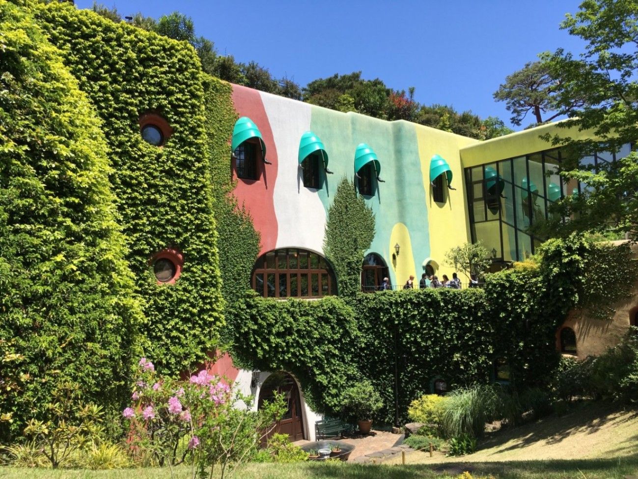
## Description The **Ghibli Museum (三鷹の森ジブリ美術館)** is one of Tokyo’s most enchanting and emotionally resonant cultural attractions. Dedicated to the legendary **Studio Ghibli**, the museum invites visitors into the imaginative universe created by filmmakers **Hayao Miyazaki, Isao Takahata, and their collaborators**—a world defined by wonder, nature, childhood, fantasy, and quiet emotional depth. Unlike traditional museums that focus on static exhibits, the Ghibli Museum is designed as a **fully immersive, experiential environment**, where architecture, animation, sound, and storytelling blend into one continuous journey. From the moment visitors enter, it becomes clear that this is not a conventional institution. The building itself feels like it came from a Ghibli film: **spiral staircases, stained-glass windows, hidden passageways, rooftop gardens, and curved corridors** encourage exploration rather than linear movement. Hayao Miyazaki personally supervised the conceptual design, ensuring that the structure reflects his philosophy that **“children should discover things for themselves.”** There are no fixed routes or arrows—only spaces that invite curiosity. Inside, the museum explores the **art and mechanics of animation** rather than serving as a simple gallery of finished films. Visitors can study original **storyboards, sketches, background paintings, and mechanical animation devices** that demonstrate how movement is created frame by frame. One particularly popular installation shows early zoetrope-style animation, visually explaining how still images transform into motion. One of the museum’s most exclusive features is its **private cinema, the Saturn Theatre**, which screens short original Ghibli films that cannot be seen anywhere else in the world. These short films rotate periodically and often explore experimental themes, new animation techniques, or side stories connected to familiar characters. This makes every visit potentially different from the last. On the rooftop, visitors encounter the **full-scale statue of the Robot Soldier from “Laputa: Castle in the Sky”**, one of the museum’s most photographed landmarks. The surrounding garden offers a quiet, reflective space above the treetops of nearby Inokashira Park, echoing Ghibli’s recurring theme of harmony between humanity and nature. A little-known fact is that **photography is strictly prohibited inside the museum**. This rule is not about control but philosophy: Miyazaki wanted visitors to **experience the space fully, without viewing it through a screen**. Another lesser-known detail is that many of the museum’s architectural elements—iron railings, tiles, and carved wood—were **custom-made by traditional Japanese craftsmen**, turning the museum itself into a handcrafted artwork. Ultimately, the Ghibli Museum is not designed for spectacle or mass tourism. It is a **quiet celebration of imagination, craftsmanship, and emotional storytelling**, appealing as deeply to adults as it does to children. It is a rare space where animation is not treated as entertainment alone, but as **serious art shaped by philosophy, patience, and human sensitivity**. ## Location The **Ghibli Museum** is located in **Mitaka**, a suburban city on the western edge of **Tokyo**, adjacent to the lush **Inokashira Park**. **City:** Mitaka (Tokyo Metropolis) **Region:** Kantō **Country:** Japan ### How to Get There: * **By train:** Take the **JR Chūō Line** from Shinjuku Station to **Mitaka Station** (about 20 minutes). From there, it is a **15–20 minute walk** through Inokashira Park. * **By bus:** A Ghibli-themed shuttle bus runs from Mitaka Station to the museum entrance. * **By taxi:** Convenient from central Tokyo, though more expensive than public transport. * **By bicycle:** Many visitors cycle through Inokashira Park for a scenic approach. The museum’s park-side setting adds to its calm, storybook atmosphere and makes the journey part of the experience. ## Tips * **Tickets must be booked in advance:** There are **no same-day tickets sold at the door**. * **Choose a weekday if possible:** Crowds are lighter, and movement through exhibits feels more fluid. * **Arrive early:** Entry is time-slotted, and arriving on time maximizes your experience. * **Do not expect a traditional museum layout:** Exploration is organic rather than guided. * **No interior photography:** Respect this rule and experience the museum directly. * **Visit the museum shop early:** Many exclusive items sell out quickly. * **Allow at least 2 to 3 hours:** Rushing undermines the emotional and artistic impact. * **Pair your visit with Inokashira Park:** It complements the museum’s atmosphere perfectly. * **Not ideal for travelers in a hurry:** This is a slow, immersive experience, not a quick attraction. ## Conclusion The **Ghibli Museum** is not simply a destination for fans—it is a **philosophical and artistic space** that translates the spirit of Studio Ghibli into physical form. Through architecture, animation, nature, and storytelling, it creates a quiet, powerful encounter with creativity itself. For anyone who values imagination, craftsmanship, and emotional depth, the Ghibli Museum is not just a highlight of Tokyo—it is one of the most meaningful cultural experiences in Japan. ## FAQ **1. What is the Ghibli Museum famous for?** It is famous for being the **official museum of Studio Ghibli**, showcasing original artwork, animation processes, and exclusive short films. **2. Can I buy tickets at the entrance?** No. Tickets must be **purchased in advance** and are strictly controlled. **3. Is photography allowed inside the museum?** No. **Photography is prohibited inside** to preserve immersion and visitor experience. **4. How long does a visit usually take?** Most visitors spend **2 to 3 hours**, depending on crowd levels and interest. **5. Is the museum suitable for adults without children?** Yes. The museum is **equally powerful for adults**, especially fans of art, film, and storytelling. **6. Are the exhibits in English?** Most labels are in **Japanese**, but the visual storytelling makes the experience easy to understand regardless of language. ## Links * [Official Ghibli Museum Website](https://www.ghibli-museum.jp) * [Studio Ghibli Official Site](https://www.ghibli.jp)
GemVoyage Team • World
Ostrava
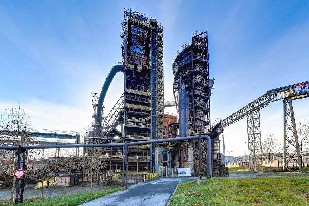
## Description The **Bolt Tower** is one of the most striking symbols of Ostrava, Czech Republic, blending modern architecture with the city’s rich industrial past. Rising from the remains of a former blast furnace at the **Lower Vítkovice industrial complex**, this futuristic structure stands as a testament to the city’s transformation from a coal and steel hub into a vibrant cultural destination. Completed in 2015, the tower was named after legendary Jamaican sprinter **Usain Bolt**, who personally attended the opening ceremony. With its sleek, glass-and-steel design perched atop an old furnace, Bolt Tower symbolizes speed, energy, and forward motion while preserving a strong connection to history. One of the most unique aspects of the tower is that it combines **modern architecture with industrial heritage**—a contemporary structure extending the life of a blast furnace that once powered the region’s economy. Inside, visitors can enjoy a panoramic café, exhibition spaces, and a sky-high observation deck that offers some of the best views in Ostrava. A little-known fact is that Bolt Tower reaches a total height of **77 meters**, making it the highest accessible point in Ostrava. Another interesting detail is that its construction was part of a broader effort to redevelop the Lower Vítkovice complex into a UNESCO-listed cultural and educational center, now hosting concerts, festivals, and exhibitions. ## Location Bolt Tower is located in the **Lower Vítkovice (Dolní Vítkovice) area** of **Ostrava**, the third-largest city in the **Moravian-Silesian Region of the Czech Republic**. The tower sits within the former industrial heart of the city, now transformed into a major cultural attraction. Getting there is straightforward. From **Ostrava’s city center**, the site is only about 2 kilometers away. Visitors can easily take a tram (line 1 or 2) to the **Dolní Vítkovice stop**, which is just a short walk from the tower. If traveling by train, Ostrava’s **hlavní nádraží (main station)** is a quick 10-minute ride by public transport. For international visitors, Ostrava is accessible by train from Prague, Brno, or Kraków, and the **Leoš Janáček Airport** is just 20 kilometers away. ## Tips Here are some helpful tips to make your visit to Bolt Tower more enjoyable: * **Book tickets in advance** – Especially during weekends or events at Lower Vítkovice, the observation deck and café can get busy. * **Visit in the evening** – The city lights at night create a spectacular view, and the tower itself is beautifully illuminated. * **Dress appropriately** – The observation deck is open-air, so it can get windy, especially in autumn and winter. * **Combine with a tour of Lower Vítkovice** – Don’t miss the guided tours of the former blast furnaces and other industrial sites nearby. * **Enjoy the café** – The tower’s café offers not just drinks and snacks, but also a relaxing atmosphere with unbeatable views. * **Check the events calendar** – Lower Vítkovice often hosts concerts, exhibitions, and festivals, which can make your visit even more special. ## Conclusion The **Bolt Tower in Ostrava** is more than just a lookout point—it’s a bold symbol of transformation and renewal. By combining modern design with the remains of a historic blast furnace, it offers visitors a unique perspective on Ostrava’s past and future. Whether you come for the breathtaking views, the cultural experiences, or simply to enjoy a coffee above the city skyline, Bolt Tower is an unmissable highlight of the Czech Republic’s industrial heritage. ## FAQ **1. Why is it called Bolt Tower?** It was named after Usain Bolt, the world-famous sprinter, who attended the opening and symbolized speed and energy. **2. How tall is Bolt Tower?** The tower reaches a total height of 77 meters, making it the highest accessible point in Ostrava. **3. Can I visit the inside of the blast furnace as well?** Yes, guided tours of the Lower Vítkovice blast furnaces and industrial complex are available and highly recommended. **4. Is Bolt Tower family-friendly?** Absolutely. Children can enjoy the observation deck and the impressive industrial setting, though young kids should be supervised due to heights. **5. When is the best time to visit?** Late afternoon or evening is ideal for enjoying both daytime views and the city lights at night. **6. Do I need to buy a separate ticket for the café?** No, access to the café is included with the general admission ticket to Bolt Tower. ## Links * [Visit Ostrava – Tourism Information](https://www.visitostrava.eu)
GemVoyage Team • World
Munich
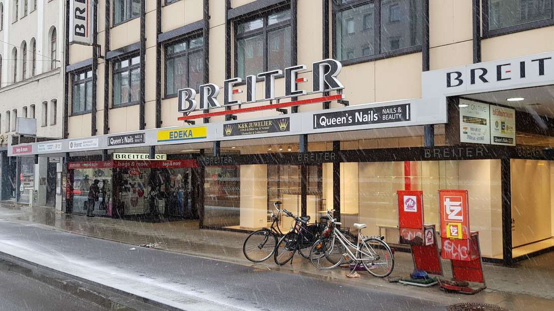
## Description **Breiterhof Passage** is a discreet but culturally significant pedestrian passageway in the heart of Munich’s old town. Unlike the city’s grand squares or monumental avenues, Breiterhof Passage represents a more **intimate layer of urban history**, where commerce, architecture, and everyday life intersect quietly rather than dramatically. The passage dates back to the **postwar reconstruction period**, when Munich rebuilt much of its historic core after World War II. Instead of restoring medieval structures wholesale, planners integrated modern functionality with traditional urban patterns. Breiterhof Passage exemplifies this approach: a short, covered walkway connecting streets while sheltering small shops, cafés, and offices. Its modest scale reflects a deliberate choice to prioritize **human movement and local commerce** over architectural spectacle. What makes Breiterhof Passage unique is its **contrast with Munich’s surrounding grandeur**. Just steps away from busy shopping streets and historic landmarks, the passage offers a slower, enclosed environment that feels almost private. A lesser-known fact is that passages like Breiterhof were designed to maintain pedestrian permeability in dense urban blocks, preserving historic movement patterns even when buildings were rebuilt. Another overlooked detail is that many businesses here are long-standing local operations rather than international chains, giving the space a distinctly Munich character. The passage is not a destination in itself, but a **transitional urban experience**. It rewards attentive visitors who appreciate the city’s smaller architectural gestures and the continuity of everyday life embedded within them. ## Location **Country:** Germany **State:** Bavaria **City:** Munich **District:** Altstadt-Lehel Breiterhof Passage is located in Munich’s historic center, close to major shopping streets and within easy walking distance of Marienplatz. ### How to Get There * **By metro or S-Bahn:** * Travel to **Marienplatz** station, then walk approximately 3–5 minutes. * **By tram:** * Several tram lines stop near the old town perimeter, followed by a short walk. * **On foot:** * Ideal when exploring Altstadt-Lehel, as the passage connects naturally to pedestrian routes. * **By bicycle:** * Bike parking is available nearby, though cycling through the passage itself is not permitted. ## Tips * **Visit during business hours:** The passage is most lively when shops and cafés are open. * **Look beyond storefronts:** Architectural details and spatial proportions are easy to miss if rushed. * **Use it as a shortcut:** It provides a calmer alternative to crowded shopping streets. * **Combine with old town exploration:** It fits naturally into a walking itinerary through central Munich. * **Respect the quiet tone:** This is a working urban space, not a tourist attraction. * **Photography is permitted:** Be mindful of people working or dining inside. ## Conclusion Breiterhof Passage is a subtle reminder that cities are shaped as much by small connective spaces as by major landmarks. Modest, functional, and quietly local, it offers insight into Munich’s postwar urban identity and everyday rhythms. ## FAQ **1. Is Breiterhof Passage a tourist attraction?** No, it is primarily a functional pedestrian passage used by locals. **2. Is there an entrance fee?** No, access is completely free. **3. How long does it take to visit?** Only a few minutes, unless stopping at a café or shop. **4. Is it historically significant?** Yes, as part of Munich’s postwar reconstruction and pedestrian network. **5. Is it suitable for children?** Yes, though there are no child-specific activities. **6. Can it be visited at night?** Access may vary depending on building hours, but daytime visits are recommended. ## Links * [Munich tourism board](https://www.munich.travel)
GemVoyage Team • World
Lima
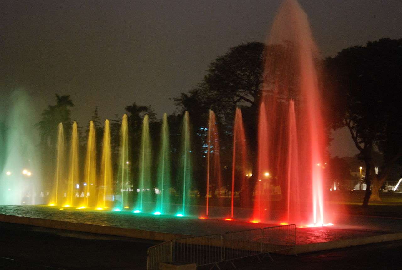
## Description The Magic Water Circuit (Circuito Mágico del Agua) in Lima is a dazzling display of light, music, and water that transforms a traditional city park into a nighttime spectacle. Located in the historic Parque de la Reserva, this attraction features 13 cybernetic fountains that combine cutting-edge technology with artistic choreography. Each fountain is uniquely designed, offering a blend of interactive experiences, visual storytelling, and cultural symbolism. The centerpiece of the park is the Fantasia Fountain, a 130-meter-long installation that hosts nightly multimedia shows. These performances blend water jets, laser lights, and music to create a captivating narrative—often highlighting Peruvian history, landscapes, and folklore. Other notable fountains include the Tunnel of Surprises, a 35-meter-long water tunnel that visitors can walk through, and the Dream Maze, where timing and agility are key to staying dry. A little-known fact: upon its opening in 2007, the Magic Water Circuit was recognized by the Guinness Book of World Records as the largest fountain complex in a public park. Another unique feature is the educational exhibits that occasionally accompany the fountains, such as historical photo displays or water conservation messages, adding depth to the entertainment. ## Location The Magic Water Circuit is located in **Peru**, in the **Lima Region**, within the **city of Lima**. Specifically, it sits in **Parque de la Reserva**, in the downtown district of Cercado de Lima. ### How to Get There - **By Taxi or Ride-Share**: Services like Uber and Cabify are widely available and can drop you off at the main entrance on Jr. Madre de Dios. - **By Public Transport**: The Metropolitano bus system stops nearby at Estación Central. From there, it’s a short walk to the park. - **By Foot**: If you're staying in central Lima, the park is easily accessible on foot from nearby neighborhoods like Jesús María or San Isidro. - **By Car**: Parking is available at the site, with flat rates depending on the lot. Its central location makes it a convenient stop for both tourists and locals exploring Lima’s cultural core. ## Tips - **Visit After Sunset**: The fountain shows begin around 7:15 PM and run multiple times throughout the evening. Arriving after dark ensures you catch the full spectacle. - **Bring a Rain Jacket or Poncho**: Some fountains are interactive, and you may get wet—especially in the maze or tunnel. - **Buy Tickets in Advance**: Entry is affordable (around S/5), but lines can form during weekends and holidays. Booking online or arriving early helps. - **Check for Special Events**: The park occasionally hosts themed shows or cultural exhibitions. Visit the official site for updates. - **Use a Tripod for Photos**: The lighting and water movement make for stunning photography, especially with long exposures. - **Respect the Rules**: Children under 5 enter free with ID, and discounts are available for seniors and people with disabilities. ## Conclusion The Magic Water Circuit in Lima is a vibrant fusion of art, technology, and public space. With its record-breaking fountains, immersive light shows, and family-friendly atmosphere, it offers a memorable evening experience that showcases the creative spirit of Peru’s capital. ## FAQ **1. What are the operating hours of the Magic Water Circuit?** The park is open daily from 3:00 PM to 10:00 PM. Multimedia shows begin at 7:15 PM, 8:15 PM, and 9:10 PM. **2. Is there an entrance fee?** Yes, general admission is S/5. Children under 5 enter free with ID. Discounts are available for seniors and people with disabilities. **3. Is the park suitable for children?** Absolutely. The interactive fountains and colorful displays are especially popular with families. **4. Can I bring food or drinks into the park?** Outside food is discouraged, but there are vendors and kiosks inside offering snacks and refreshments. **5. Are the shows in English or Spanish?** The multimedia shows are primarily visual and musical, with minimal spoken content, making them accessible to all visitors. **6. Is the park wheelchair accessible?** Yes, the park is designed to accommodate visitors with mobility needs, and discounted entry is available with proper ID. ## Links - [Official Magic Water Circuit Website](https://circuitomagicodelagua.pe/)
GemVoyage Team • World
Athens
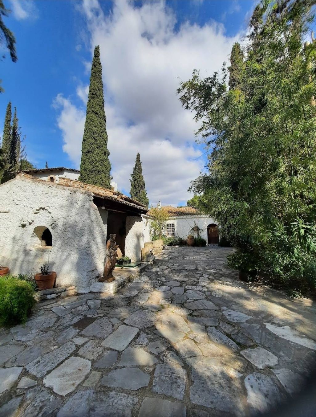
## Description The **Vorres Museum** in Athens is a cultural gem that blends history, tradition, and modernity in a unique way. Established by the Greek art collector and philanthropist Ian Vorres in 1983, the museum offers a fascinating journey through 4,000 years of Greek heritage. It is not only a museum but also a cultural foundation dedicated to preserving and promoting Greek culture. The museum is divided into two main sections: the **contemporary art gallery** and the **folk art museum**. The contemporary section houses over 6,000 works of modern Greek art, including paintings, sculptures, and installations by some of Greece’s most important artists. Meanwhile, the folk art collection showcases traditional artifacts, furniture, ceramics, and everyday objects that bring to life rural Greek culture from the 18th and 19th centuries. What makes the Vorres Museum particularly special is its location inside a beautifully restored 19th-century residence, surrounded by lush gardens filled with Mediterranean flora. The gardens themselves are works of art, featuring sculptures, pathways, and quiet corners that invite visitors to pause and reflect. **Little-known facts:** * Ian Vorres, the founder, studied in Canada and was deeply influenced by both Eastern and Western artistic traditions, which inspired his vision for the museum. * The museum frequently hosts cultural events, concerts, and temporary exhibitions, making it a dynamic space rather than a static collection. --- ## Location The Vorres Museum is located in **Paiania**, a suburb in the eastern region of **Attica**, Greece. Although it is slightly outside central Athens, it is easily accessible and offers visitors a welcome break from the busy city center. ### How to get there: * **By car/taxi**: The museum is about a 25-minute drive from downtown Athens and 15 minutes from Athens International Airport. * **By metro and bus**: Take the metro (Line 3) toward the airport and get off at Doukissis Plakentias station. From there, buses or a short taxi ride will take you to Paiania. * **Recommendation**: Taking a taxi or driving is the most convenient way, especially if you’re visiting with family or on a tight schedule. --- ## Tips * **Check opening hours in advance**: The museum has specific visiting times and may be closed on certain days, so it’s best to confirm before your trip. * **Allow time for the gardens**: Many visitors focus on the indoor collections, but the gardens are just as impressive and provide a tranquil setting. * **Photography**: While photography may be allowed in the gardens, check for any restrictions inside the museum. * **Attend cultural events**: If your visit coincides with one of the museum’s concerts, lectures, or exhibitions, take the opportunity to experience Greek culture in a lively way. * **Combine with nearby attractions**: Since it’s located near the airport, the museum can be part of a half-day trip before or after a flight. --- ## Conclusion The Vorres Museum in Athens is more than just an art museum—it is a cultural experience that bridges Greece’s rich past with its dynamic present. With its diverse collections, peaceful gardens, and dedication to cultural preservation, it is an ideal destination for art lovers, history enthusiasts, and anyone curious about Greek heritage. A visit here provides not only insight into the country’s artistic achievements but also a moment of peace away from the bustle of central Athens. --- ## FAQ **1. What type of art does the Vorres Museum showcase?** The museum features both modern Greek art and traditional folk art, offering a complete view of Greek culture. **2. Is the museum suitable for children?** Yes, the folk art section and gardens are particularly engaging for families with children. **3. How much time should I plan for a visit?** Most visitors spend about 2 hours exploring both the indoor exhibits and the gardens. **4. Is the museum wheelchair accessible?** Parts of the museum are accessible, but since it’s located in a historic building, some areas may have limitations. It’s best to check with the museum before your visit. **5. Are guided tours available?** Yes, the museum often provides guided tours, which enhance the experience by offering deeper insights into the collections. **6. Can I attend cultural events at the museum?** Yes, the museum regularly hosts concerts, lectures, and temporary exhibitions that are open to the public. --- ## Links * [Vorres Museum – Official Website](https://www.vorresmuseum.gr/)
GemVoyage Team • World

Comments