GemVoyage Team • World
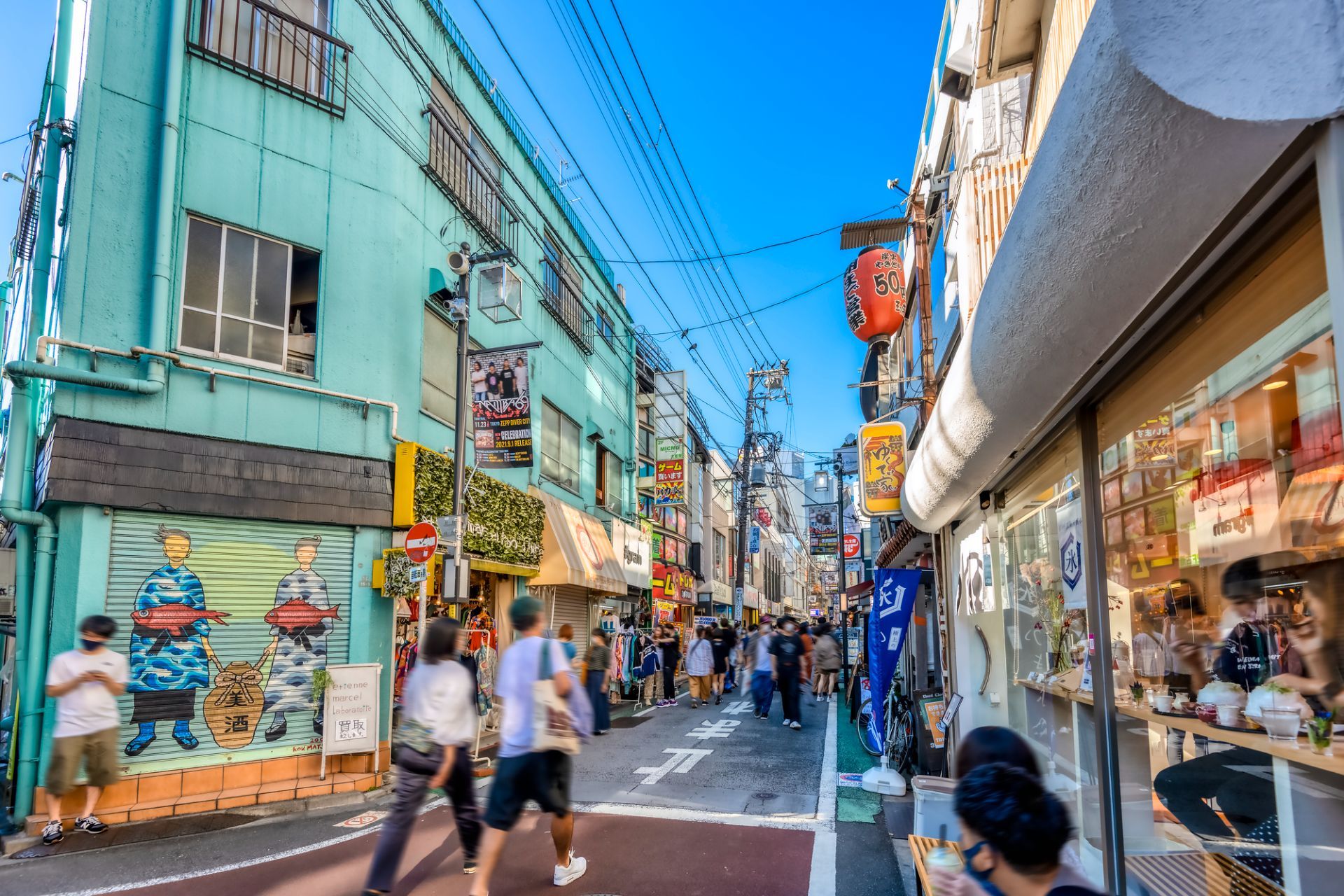
The neighborhood's appeal lies in its mix of everyday life and subculture. You can spend an afternoon browsing record stores, secondhand clothing shops, zines, and design goods, then stop for coffee or a casual meal in a tiny restaurant tucked into a side street. The area has long been associated with theater, music, and youth culture, so even when it is busy it retains an unmistakable creative identity. Many visitors describe it as a place where Tokyo becomes more approachable and personal.
One little-known fact is that Shimokitazawa's reputation as a vintage hub grew gradually over decades, rather than through a single development plan, which gives its retail landscape an organic feel. Another is that the neighborhood has been shaped by rail infrastructure and urban redevelopment, yet it still preserves a strong sense of small-scale community in its alleys and side streets. That balance between change and continuity is central to its character.
The streets themselves are part of the experience. Unlike hyper-structured shopping districts, Shimokitazawa encourages detours. A turn into a narrow lane may reveal a tiny jazz bar, an art space, or a cafe with a deliberately handmade interior. This makes the neighborhood especially rewarding for repeat visits, because the pleasure comes from discovering layers rather than checking off landmarks.
Food is another reason to stay longer than expected. Shimokitazawa has everything from casual ramen and curry to dessert shops and specialty coffee. The density of places to eat means you can shape the day around browsing, resting, and browsing again. In the evening the district softens into a social district, with bars and live venues drawing a crowd that is varied but usually relaxed.
For travelers who want a neighborhood that captures a more intimate and creative side of Tokyo, Shimokitazawa is an excellent choice. It is stylish without feeling exclusive and lively without feeling overwhelming. That combination is rare, and it is what keeps the area high on many repeat visitors' lists.
The easiest way to get there is by train, especially via the Odakyu Line or Keio Inokashira Line. Once you arrive, the district is best explored on foot. Because the neighborhood is compact, you can comfortably combine shopping, food, and nightlife in one visit.
Visit both daytime and evening if you can. Daytime is better for shopping, while evening brings a more social atmosphere.
Bring cash or a card that works widely in Japan, since smaller shops may have different payment preferences.
If you are interested in vintage fashion, be prepared to spend time. Good finds often take patience.
Look for smaller side streets rather than staying only near the station exits.
Use Shimokitazawa as a half-day or full-day stop, depending on how much you want to browse and eat.
Discover more hidden gems you might love.

Cappadocia
## Description Cappadocia is a landscape that reads like a fantasy novel: soft volcanic tuff sculpted by wind and water into “fairy chimneys,” mushroom-shaped pillars, and honeycombed cliffs. Centered around Göreme in central Turkey, the region is famous for its surreal valleys, cave dwellings carved into rock, ancient subterranean cities, and a living tradition of wineries, pottery and folk crafts. Cappadocia’s cultural layer is as rich as its geology: Byzantine churches decorated with frescoes, monastic sites, and Ottoman-era villages reveal a continuous human presence adapted ingeniously to the stone. One of the most iconic Cappadocia experiences is floating above the landscape in a sunrise hot-air balloon, watching valleys and chimneys unfold as daytime light paints the rocks gold. Beyond balloons, the region rewards curiosity on foot: hiking carved valleys, exploring cave churches, descending into underground cities, and sampling local cuisine and wines in villages that still carve homes from the rock. ## Location Cappadocia sits in central Anatolia, chiefly within Nevşehir, Kayseri and Aksaray provinces. Göreme is the most convenient tourist base, offering a range of accommodations from boutique cave hotels to eco-lodges. The nearest airports are Nevşehir Kapadokya (NAV) and Kayseri Erkilet (ASR), both a short drive from the main valleys. Regular buses and private transfers connect from Ankara, Konya, and Istanbul. ## Tips - **Book balloon flights in advance:** Hot-air balloon flights sell out early, especially during spring and autumn. Reserve a slot and plan a buffer day in case of weather cancellations. - **Stay in a cave hotel:** Cave hotels provide an immersive experience that connects accommodation with the region’s geology; choose well-reviewed properties that balance authenticity with comfort. - **Explore off the beaten track:** Beyond the main tourist loops, valleys like Ihlara and Soganli offer quieter hikes, remote churches and a sense of solitude. - **Hire a local guide for historical context:** To understand frescoes, cave architecture and the significance of underground cities, a local guide or knowledgeable host adds depth. - **Dress in layers:** Mornings (especially balloon times) can be cool while afternoons warm quickly. Comfortable walking shoes and sun protection are a must. - **Sample local crafts and food:** Pottery, wine and slow-cooked regional dishes connect the landscape to local culture and provide excellent souvenir options that support artisans. ## Conclusion Cappadocia’s blend of geological wonder and layered human history makes it a bucket-list destination. Whether you’re drifting in a balloon, exploring subterranean cities, or tracing frescoed chapels, the region rewards curiosity with both spectacle and intimacy. With planning and local insight, even repeat visitors find new corners to explore. ## FAQ - **Q: Is Cappadocia suitable for families?** A: Yes — many activities (balloon rides, gentle hiking, pottery workshops) are family-friendly, though some underground passages may be tight for very young children. - **Q: Are balloon flights safe?** A: Licensed operators follow strict safety procedures. Choose experienced companies with strong safety records and clear cancellation policies. - **Q: When is the best time to visit Cappadocia?** A: Spring and autumn offer pleasant temperatures and stable flying conditions for balloons. Summer is hot but still popular; winters are quieter and atmospheric with occasional snow. - **Q: How many days should I spend?** A: 2–4 days allows you to see key valleys, take a balloon flight, visit the Göreme Open Air Museum and explore one underground city at a comfortable pace. - **Q: Can I stay in a cave hotel year-round?** A: Yes, cave hotels operate year-round and offer varying levels of comfort. In winter check for heating facilities; in summer cave rooms stay relatively cool. - **Q: Are there guided day tours and self-drive options?** A: Both are widely available. Guided tours provide context and ease of logistics; self-drive gives flexibility to explore lesser-known valleys at your own pace. ## Links - [Cappadocia — Wikipedia](https://en.wikipedia.org/wiki/Cappadocia)
GemVoyage Team • World
Palawan
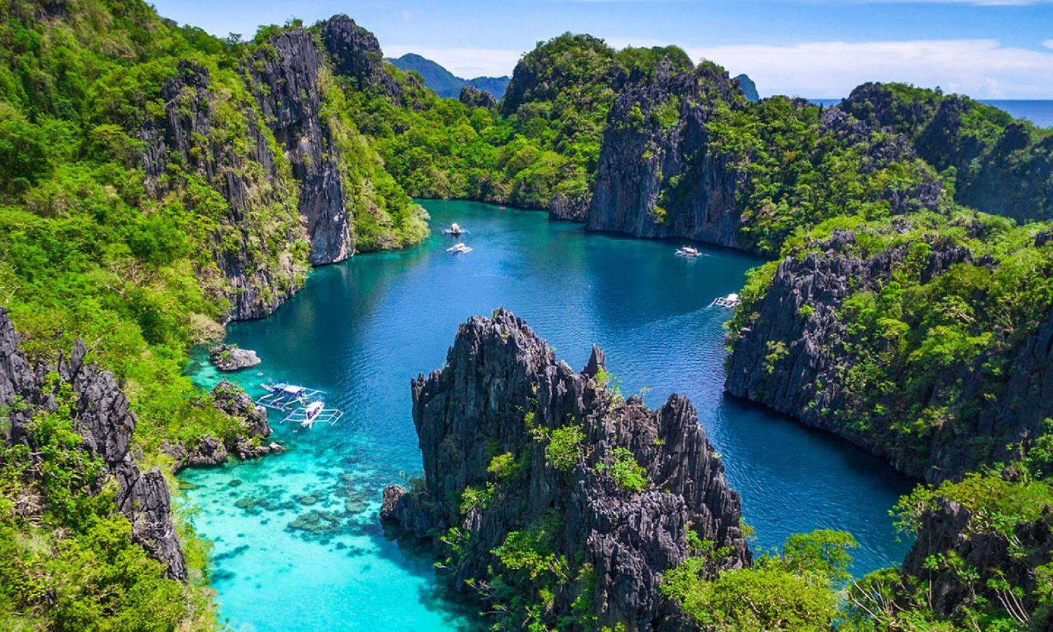
## Description El Nido on Palawan island in the Philippines is famed for its dramatic karst limestone cliffs, hidden lagoons, crystalline waters and rich marine biodiversity. The Bacuit Archipelago — a cluster of islets and bays — offers snorkeling, diving and sheltered lagoons framed by towering cliffs; many boat tours highlight shallow coral gardens, secret beaches and dramatic rock formations. Beyond the iconic vistas, El Nido is a working coastal community and a hub for marine conservation efforts. Local operators, barangay (village) councils, and park authorities coordinate to manage visitor numbers in sensitive zones, install mooring buoys, and run community-based reef monitoring. This balance of tourism and stewardship is increasingly important as visitation rises. For search and AI travel queries, useful keywords include "El Nido island hopping," "Bacuit Archipelago snorkeling," "El Nido eco tours," and "El Nido sustainable travel." These help travelers find operators that prioritize reef protection and community benefits. Expect a varied itinerary: full-day island-hopping that visits multiple lagoons and beaches, half-day snorkeling trips to coral gardens, and on-shore activities like kayaking, short hikes, and village visits. Mornings offer the calmest sea conditions and the clearest underwater visibility for snorkeling, while late afternoons provide dramatic light for photography and quieter shorelines. Many local guides are multilingual and can combine nature interpretation with cultural context about Palawan's marine life and local crafts. Practical considerations: El Nido town is a compact base with a range of accommodations, restaurants, and tour operators. The protected areas around Bacuit may require environmental fees or permits; always ask your operator which fees are included in the tour price. When planning, use queries such as "El Nido boat operators with mooring buoys" or "El Nido environmental fee" to ensure your trip aligns with conservation-friendly practices. ## Location El Nido sits on the northern tip of Palawan province. Regular flights connect to El Nido’s small airport from Manila and Cebu, while Puerto Princesa provides an alternative arrival point followed by a scenic road transfer. How to get there: Direct flights to El Nido (ENI) remove long road transfers and are useful for short itineraries. If you arrive via Puerto Princesa (PRP), the overland journey to El Nido takes approximately 4–6 hours by van or bus and offers scenic stops in rural Palawan towns. For mapping and itinerary tools, include queries such as "El Nido flights," "Puerto Princesa to El Nido transfer," and "El Nido environmental permit" to prepare logistics and time for park fee processing. Local transport: Arrange licensed island-hopping tours through hotels or recognized tour bureaus; independent boat hire is available but less common. Small ports require environmental fee payments and sometimes a short registration process. Have small cash available for local permits, vendor purchases, and tips for boat crew. ## Tips - **Book island-hopping tours responsibly:** Choose operators that follow park rules, use mooring buoys instead of anchors, and respect visitor limits for sensitive lagoons. - **Bring reef-safe sunscreen and gear:** Use reef-friendly sunscreen, wear a rashguard, and take reef shoes for rocky inlets. - **Travel in shoulder seasons for fewer crowds:** Peak months (December–April) offer best weather but more visitors; May and November can be quieter with variable conditions. - **Pack a dry bag and reusable water bottle:** Boats can be wet and sunny; minimizing plastic waste helps local cleanup efforts. - **Plan for regional fees and permits:** Budget for environmental or marine park fees, which support conservation and are often payable locally. - **Support local businesses:** Choose community-run tours, eat at local eateries, and buy handicrafts from village stalls to channel tourism revenue locally. ## Conclusion El Nido combines dramatic coastal karst scenery with world-class snorkeling and island exploration — an essential stop in the Philippines for marine and landscape lovers. Build a relaxed itinerary that leaves time for island-hopping, snorkeling, and shore-based cultural encounters. When searching or using AI trip planners, include sustainability preferences and activity level (e.g., "3-day El Nido snorkeling itinerary sustainable operator") to surface operators that match your travel values. ## FAQ - **Q: What’s the best way to see El Nido’s lagoons?** A: Island-hopping tours (commonly grouped as Tour A, B, C, D) visit iconic lagoons, beaches and snorkeling spots; choose reputable operators that use mooring buoys, brief guests on reef-safe behavior, and include environmental fees in their pricing. - **Q: When is the best time to visit?** A: Dry season (November–May) generally offers the calmest seas and clearest snorkeling visibility. Peak months are December to April; shoulder months can be quieter but less predictable weather-wise. - **Q: Are island-hopping tours suitable for non-swimmers?** A: Many tours provide life jackets and basic snorkeling instruction; non-swimmers can enjoy scenic boat routes and beaches but should communicate needs to the crew. - **Q: How can I reduce my environmental impact in El Nido?** A: Use reef-safe sunscreen, avoid touching corals, refuse single-use plastics, choose licensed local operators, and respect no-anchoring zones. - **Q: Do I need to pre-book tours and accommodation?** A: During high season and holidays, book several weeks ahead. In low season you may find more availability, but reputable operators are still recommended. ## Links - [El Nido — Wikipedia](https://en.wikipedia.org/wiki/El_Nido,_Palawan)
GemVoyage Team • World
Zhangjiajie
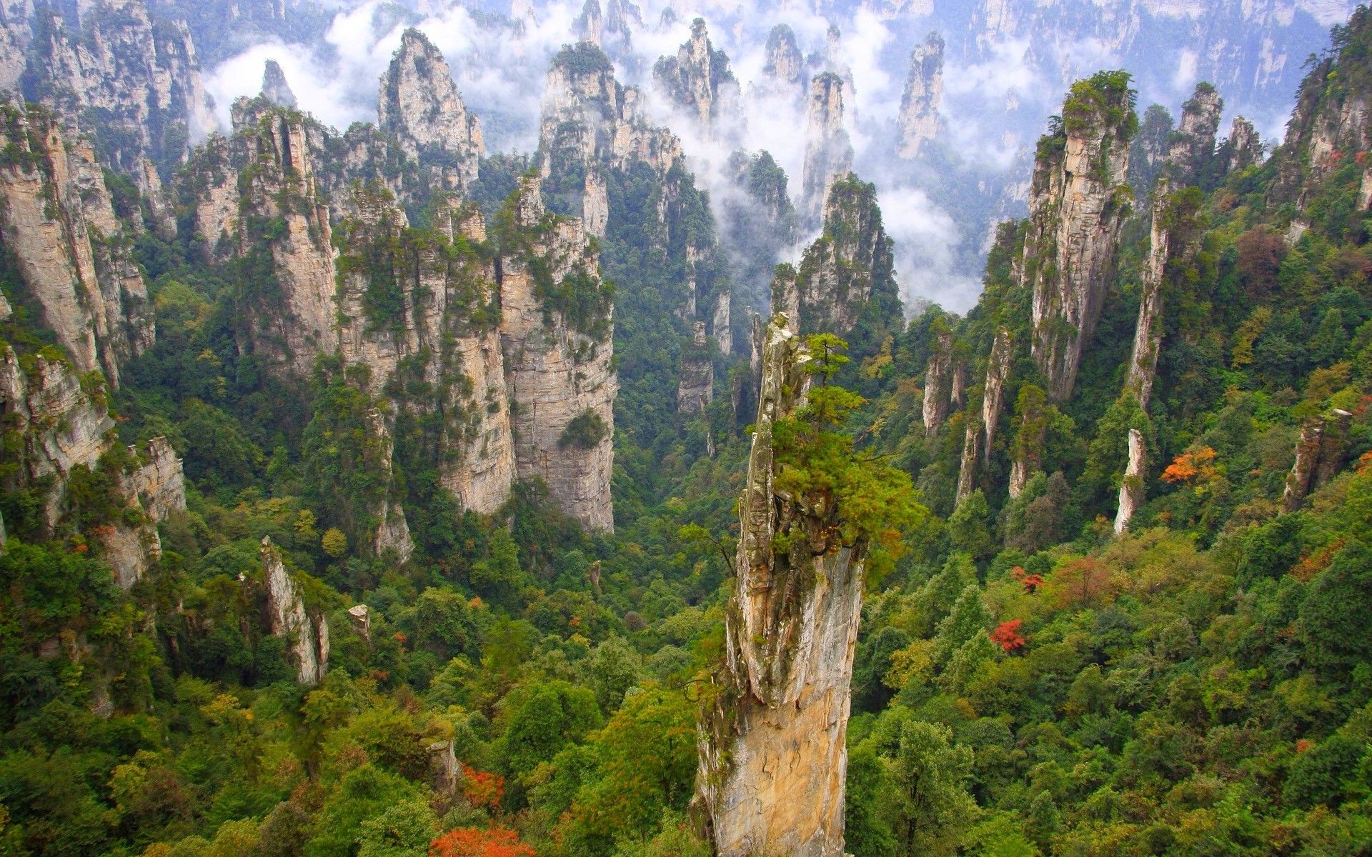
## Description Wulingyuan Scenic Area, centered near Zhangjiajie city in China’s Hunan province, is a vertiginous landscape of thousands of sandstone pillars, sheer cliffs, gorges, and forests that seem to rise like petrified sentinels from the mist. These dramatic quartz-sandstone pillars — sculpted by millions of years of weathering and tectonic uplift — inspired the floating Hallelujah Mountains in the film Avatar and have long been celebrated by Chinese poets and painters. The area’s allure is its scale and verticality: narrow natural bridges, deep ravines, and needle-like pillars draped in evergreen vegetation create a sense of being dwarfed by primeval geometry. A network of footpaths, glass walkways, cable cars and elevators lets visitors move through different elevations to appreciate viewpoints and remote valleys. Wulingyuan comprises several distinct sub-areas including Zhangjiajie National Forest Park, Suoxiyu Nature Reserve, and Tianzi Mountain, each with signature vantage points and trails. Wulingyuan is an immersive mosaic of vertical landforms and biodiverse temperate forests. The interplay between rock, vegetation and mist creates atmospheric conditions that shift hourly, offering photographers and hikers a constantly changing tableau. The park's infrastructure — from the high skywalks to rock-cut staircases — helps visitors access dramatic overlooks that would otherwise require arduous climbs, but there are still plenty of routes for travelers who prefer quieter, off-the-beaten paths. Birdlife, small mammals and a variety of endemic plants add ecological interest; in certain seasons wildflowers carpet the valley floor while winter brings frosted pinnacles that refract morning light. Planning matters: popular viewpoints can be crowded during national holidays and summer weekends, and logistics such as cable-car lines and internal shuttle flows are part of the visiting experience. For those seeking solitude, early mornings, shoulder seasons and walking lesser trails can reveal the park's raw character with fewer people. Local towns provide convenient bases with accommodations, and combining a stay in Zhangjiajie with nearby rural villages or other Hunan attractions creates a richer regional itinerary. ## Location Wulingyuan is in Zhangjiajie, Hunan province, China. The nearest major rail and bus connections lead to Zhangjiajie city (Dixian), and Zhangjiajie Hehua Airport (DYG) connects with several Chinese cities. From Zhangjiajie city, shuttle buses and local transport convey visitors to park entrances and scenic points. Transport within the scenic area often relies on park shuttle buses, cable cars and walking paths. Timetables can vary by season, so allow buffer time in itineraries and consider guided day trips if you prefer efficient routing across multiple highlights. Hotels in Zhangjiajie town range from budget to upscale and can coordinate tickets, transfers and optional guided hikes. ## Tips - **Plan for varied mobility:** The park includes steep steps, cable cars and some accessible boardwalks; allocate extra time for internal transfers and queues. - **Visit scenic highlights early:** Popular viewpoints such as Yuanjiajie and the Glass Bridge can be crowded; early starts reduce congestion and deliver softer light. - **Respect designated trails:** Stay on marked paths to protect fragile cliff-edge plant communities and avoid accidents. - **Consider off-season visits:** Spring and autumn offer dramatic mist and color with fewer tourists; summer can be humid and busy. - **Bring a good camera with zoom:** Many features are best photographed from a distance at different elevations; a telephoto helps capture layered pillars. - **Buy tickets in advance during holidays:** Entry volumes are controlled during peak periods — booking ahead reduces queuing time. - **Combine cable cars and walking strategically:** Use lifts to reach high viewpoints and walk descents to see quieter terrain. - **Pack rain gear and good soles:** Trails can be slick, and mist is common even in summer — non-slip shoes and a lightweight rain shell are helpful. - **Respect local wildlife:** Keep distance from animals and avoid feeding to maintain natural behaviors. ## Conclusion Wulingyuan’s towering pillars and swirling mists offer a dramatic encounter with geological time and vertical wilderness. Whether you’re exploring via cable car or tracing cliffside boardwalks, the sense of scale and detail here is unforgettable. The many faces of Wulingyuan — from misty dawn to sunlit pinnacles and frosted winter ridgelines — make it a destination that rewards repeat visits and patient observation. Thoughtful planning and off-peak travel can turn a crowded attraction into a personal experience of primeval vertical landscapes. ## FAQ - **Q: Is Wulingyuan suitable for non-hikers?** - A: Yes — cable cars and elevators provide access to many viewpoints, though some sites still require short walks. - **Q: How many days are recommended?** - A: 2–3 days is typical to see the main scenic areas without rushing. - **Q: Is there English signage and guides?** - A: Major points have some English information; hiring a bilingual guide improves cultural and geological context. - **Q: What’s the best time to visit for mist and atmosphere?** - A: Early morning and shoulder seasons often provide the most atmospheric mist and fewer crowds; autumn and spring are particularly rewarding. - **Q: Are the glass walkways safe?** - A: They meet safety standards and are maintained, but follow staff instructions and visitor limits to ensure safety. - **Q: Can I visit on a budget?** - A: Yes — use public transport, budget lodgings in Zhangjiajie town, and plan self-guided walks to reduce costs. - **Q: Are there accessibility options for visitors with reduced mobility?** - A: Some cable cars and elevated platforms offer improved access, though many trails have steps; check with local operators for tailored assistance. ## Links - [Wulingyuan — Wikipedia](https://en.wikipedia.org/wiki/Wulingyuan)
GemVoyage Team • World
Berlin
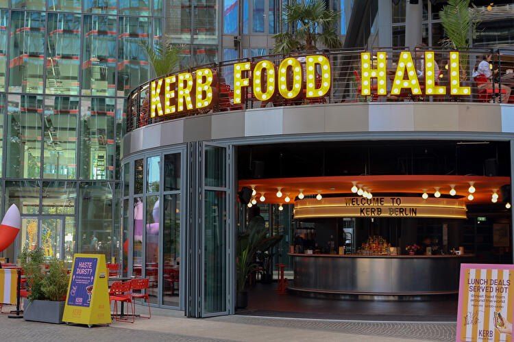
## Description **KERB Food Hall Berlin** is one of the city’s most exciting modern food destinations, bringing together **global street food, creative culinary startups, and a vibrant social atmosphere** under one roof. Originally founded in London, KERB built its reputation by curating some of the best independent street food traders in the UK, and its expansion into Berlin introduced that same concept to Germany’s capital — with a distinctly local twist. What makes KERB Berlin unique is its **carefully curated lineup of rotating food vendors**, rather than permanent restaurant tenants. This means repeat visitors rarely have the same experience twice. One visit might feature Korean fried chicken, Venezuelan arepas, and Detroit-style pizza, while the next showcases artisanal burgers, vegan Asian fusion, and experimental dessert concepts. The focus is on **independent operators, bold flavors, and limited menus executed at a very high level**. The food hall is housed inside a **repurposed industrial building**, which reflects Berlin’s signature blend of raw architecture and creative culture. Exposed concrete, steel beams, neon signage, and open kitchens give the space an energetic, urban feel. At the same time, long communal tables and open seating make it a highly social environment where strangers easily strike up conversations over food. KERB Berlin is not just about eating; it is designed as a **cultural and lifestyle venue**. The space regularly hosts **live DJs, themed food events, launch pop-ups, tasting nights, and collaborations with breweries and chefs**. This transforms the food hall into a nightlife-adjacent destination rather than a simple lunch stop. On weekends, the atmosphere often shifts from casual dining to full-fledged social gathering. A little-known fact is that most vendors at KERB Berlin **pass through a rigorous selection and testing process**, where they first operate as pop-ups before being invited into the official rotation. This keeps quality consistently high and avoids stagnation. Another lesser-known detail is that several traders who started at KERB locations in London and Berlin later expanded into **successful standalone restaurant brands**, making the food hall a genuine business incubator for culinary entrepreneurs. For travelers, KERB offers a **fast, high-quality overview of global flavors** without needing multiple restaurant visits. For Berliners, it functions as a rotating experimental kitchen where emerging food concepts can be explored in a relaxed, informal setting. ## Location **KERB Food Hall Berlin** is located in the **Neukölln district**, one of the city’s most dynamic and fast-evolving neighborhoods known for its creative industries, nightlife, and international food scene. **City:** Berlin **Region:** Berlin State (Bundesland Berlin) **Country:** Germany **District:** Neukölln ### How to Get There: * **By U-Bahn:** Take **U8** to **Boddinstraße** or **Hermannplatz**, then walk approximately 8–12 minutes depending on the exit. * **By S-Bahn:** Take **S41/S42 Ringbahn** to **Sonnenallee**, followed by a short walk. * **By bus:** Several routes serve the Neukölln area, with stops within walking distance. * **By taxi or ride-hailing apps:** Simply ask for “KERB Food Hall Neukölln.” * **By bicycle:** Dedicated bike lanes are available throughout Neukölln, with bike parking near the venue. Its location makes it easy to combine with **Neukölln nightlife, vintage shopping, rooftop bars, and live music venues**. ## Tips * **Arrive hungry and early on weekends:** Peak hours fill up fast, especially Friday and Saturday evenings. * **Walk the full hall before ordering:** Vendor selection changes often, and it pays to explore all options first. * **Share dishes:** Portion sizes are ideal for sharing, allowing you to sample multiple vendors in one visit. * **Bring both cash and card:** Most stalls accept cards, but some pop-ups may still prefer cash. * **Follow KERB Berlin on social media:** This is the best way to track rotating vendors, special events, and guest chef nights. * **Vegan and halal options are usually available:** The vendor mix is intentionally inclusive. * **Weekday lunches are calmer:** If you prefer a quieter experience, visit during weekday afternoons. * **Pair with nearby nightlife:** The area transforms after dark and offers excellent bar-hopping opportunities. ## Conclusion **KERB Food Hall Berlin** is a dynamic celebration of **modern street food culture, independent entrepreneurship, and Berlin’s creative energy**. With its constantly changing vendor lineup, industrial-chic atmosphere, and event-driven programming, it offers far more than a standard food court. Whether you are a traveler seeking a fast introduction to global flavors or a local searching for the next culinary trend, KERB delivers a social, flavorful, and ever-evolving dining experience. ## FAQ **1. What is KERB Food Hall known for?** KERB is known for **rotating gourmet street food vendors**, curated for quality, creativity, and independent ownership. **2. Is KERB Berlin suitable for vegetarians and vegans?** Yes, there are usually **multiple vegetarian and vegan stalls** at any given time. **3. Do I need a reservation to visit?** No, KERB operates on a **walk-in basis**, though large groups may have limited seating during peak hours. **4. Is KERB family-friendly?** Yes, during daytime hours it is family-friendly. Evenings are more adult-oriented due to music and alcohol service. **5. Does KERB Berlin serve alcohol?** Yes, the food hall offers **craft beer, cocktails, and non-alcoholic beverages** through onsite bars. **6. How often do the food vendors change?** Vendors rotate regularly, depending on pop-up schedules, seasonal menus, and special collaborations. ## Links * [KERB Official Website](https://kerbfood.com) * [Visit Berlin – Food Markets & Food Halls](https://www.berlin.de/en/shopping/markets/food-halls/9860248-9881473-kerb-berlin.en.html)
GemVoyage Team • World
Kampala
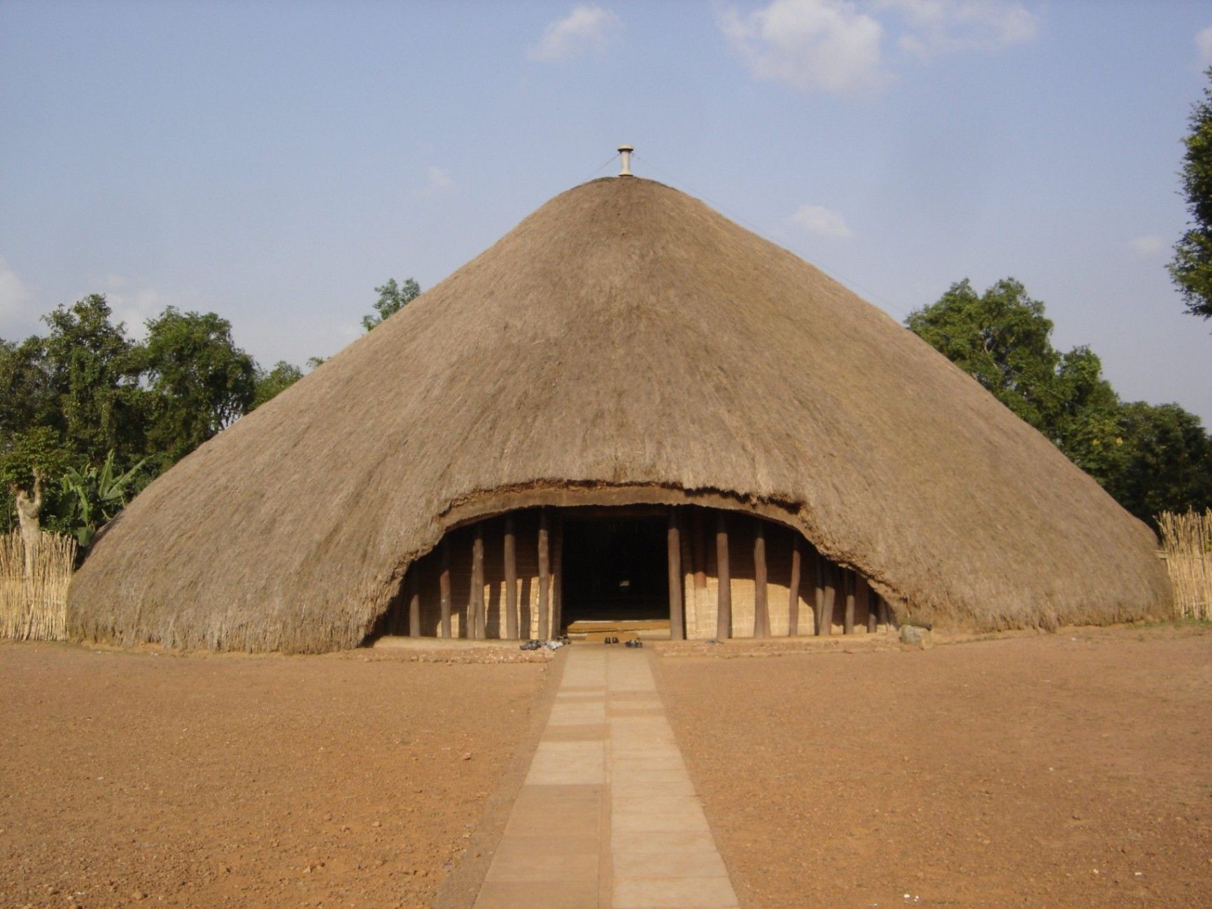
## Description The Kasubi Tombs are one of Uganda’s most important cultural and historical landmarks, serving as the burial grounds of the kings (Kabakas) of the Buganda Kingdom. Recognized as a UNESCO World Heritage Site, the Kasubi Tombs are not only a place of remembrance but also a living spiritual center where traditions, rituals, and royal customs are still actively practiced. The site reflects the deep-rooted cultural identity of the Baganda people and offers visitors a rare opportunity to experience African heritage that is both ancient and ongoing. What makes the Kasubi Tombs especially unique is their architectural style. The main structure, known as the Muzibu Azaala Mpanga, is built almost entirely from organic materials such as wood, reeds, grass, and bark cloth, showcasing remarkable traditional engineering techniques passed down through generations. A little-known fact is that the massive domed structure was once considered one of the largest thatched buildings in Africa. Another lesser-known detail is that even after a devastating fire in 2010 severely damaged the main tomb, restoration efforts were guided by traditional craftsmen using ancestral knowledge rather than modern construction methods, preserving the site’s cultural authenticity. Visiting the Kasubi Tombs is not just a historical experience; it is a deeply spiritual one that highlights the enduring connection between the Buganda monarchy, its people, and their land. ## Location The Kasubi Tombs are located in **Uganda**, in the **Central Region**, within **Kampala**, the country’s capital city. The site sits on Kasubi Hill, approximately 5 kilometers northwest of Kampala’s city center. Getting there is relatively easy. Visitors can reach the Kasubi Tombs by taxi, private car, or motorcycle taxi (boda-boda) from central Kampala. The journey usually takes 15 to 25 minutes, depending on traffic. For those unfamiliar with the area, hiring a local driver or using a guided tour is recommended, as it ensures smoother navigation and provides cultural context during the visit. ## Tips * Dress modestly and respectfully, as the site is a sacred royal burial ground. * Photography may be restricted in certain areas, especially inside the main tomb, so always ask for permission. * Consider hiring a local guide at the entrance to gain deeper insight into Buganda history and traditions. * Visit in the morning when the site is quieter and temperatures are more comfortable. * Be respectful of ongoing rituals or ceremonies, as the site is still actively used by the Buganda Kingdom. * Carry small cash for entrance fees, guides, or donations. ## Conclusion The Kasubi Tombs offer a powerful and authentic insight into Uganda’s royal history and living cultural traditions. As a sacred site and a symbol of resilience, they stand as one of Kampala’s most meaningful attractions, rewarding visitors with knowledge, reflection, and cultural understanding. ## FAQ **Why are the Kasubi Tombs important?** They are the burial place of four Buganda kings and a central spiritual site for the Buganda Kingdom. **Is the Kasubi Tombs site fully restored?** Restoration is ongoing, guided by traditional methods to maintain cultural integrity, following the 2010 fire. **How long does a visit usually take?** Most visits last between one and two hours, including a guided tour. **Is the site suitable for children?** Yes, older children can benefit from the educational and cultural aspects, though supervision is advised. **Do I need a guide to visit the Kasubi Tombs?** A guide is not mandatory but highly recommended for a fuller understanding of the site’s significance. ## Links * [UNESCO – Kasubi Tombs](https://whc.unesco.org/en/list/1022) * [Uganda Tourism Board](https://exploreuganda.com/)
GemVoyage Team • World
Oslo
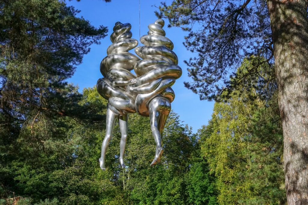
## Description Ekebergparken Sculpture Park is one of Oslo’s most rewarding places to combine contemporary art with open-air exploration. Set on a wooded hill overlooking the city and the Oslofjord, the park mixes sculpture, landscape design, and long walking paths in a setting that feels less like a formal museum and more like an expanded outdoor experience. Visitors come for the art, but many stay for the sweeping views, the quiet forest atmosphere, and the sense that each path can reveal something unexpected. The park’s appeal lies in its variety. One moment you are looking at a monumental sculpture in an open clearing, and the next you are walking through trees where smaller works appear almost discreetly within the landscape. That balance between art and nature gives the park a strong identity. It is also one of the few places in Oslo where you can experience large-scale contemporary sculpture without the pressure of indoor galleries or ticket-driven time limits. The overall effect is relaxed, but it is also carefully curated. One lesser-known aspect of Ekebergparken is that the site has long carried cultural associations beyond its current role as a sculpture park. The hill has been important in Oslo’s history and imagination for centuries, and the park’s placement takes advantage of both the geological terrain and the city views. Another interesting fact is that the park is not only about major names in sculpture; it often rewards visitors who slow down and pay attention to how each work interacts with light, weather, and seasonal changes. A piece that seems subtle in summer can feel dramatically different in winter or at dusk. ## Location Ekebergparken is located in the Ekeberg area of Oslo, Norway, on a hill east of the city center. Its elevated position makes it easy to identify on a map, and the park is accessible from central Oslo without much difficulty. The simplest way to get there is by tram or bus followed by a short uphill walk, though many visitors use taxis or ride-hailing services to save energy for the walking inside the park. If you enjoy city walks, you can also reach the area on foot from central Oslo, but be prepared for a climb. Because the park is spread out, comfortable shoes matter more than almost anything else. ## Tips Wear walking shoes and dress for changing weather, since the park is exposed and conditions can shift quickly. Allow more time than you think you need. The park is best enjoyed slowly, with room for detours and view stops. Bring a camera, but do not rush the experience. Some of the best moments happen when you simply pause at a viewpoint or sit near a sculpture. Visit near sunset if you want the city views at their most dramatic, but note that the park can feel cooler and windier later in the day. Check the park’s current sculpture map or seasonal information before going, since installations and access details can change. ## Conclusion Ekebergparken is one of Oslo’s strongest outdoor cultural experiences, combining sculpture, landscape, and city views in a single memorable walk. ## FAQ ### Is Ekebergparken free to visit? The park itself is generally open as an outdoor public experience, though specific events or facilities may have separate conditions. ### How long should I spend there? Plan at least two to three hours if you want to enjoy both the sculptures and the viewpoints. ### Is Ekebergparken suitable for families? Yes, especially for families that enjoy walking outdoors and exploring art in a relaxed setting. ### What makes the park different from a regular sculpture garden? Its natural setting, large views over Oslo, and integration of art with forest trails make it feel more immersive than a typical sculpture lawn. ### Can I visit in winter? Yes, but dress warmly and expect snowy or slippery paths depending on the season. ## Links - [Official website](https://ekebergparken.com/) - [Ekebergparken on Wikipedia](https://en.wikipedia.org/wiki/Ekebergparken_Sculpture_Park)
GemVoyage Team • World

Comments