GemVoyage Team • World
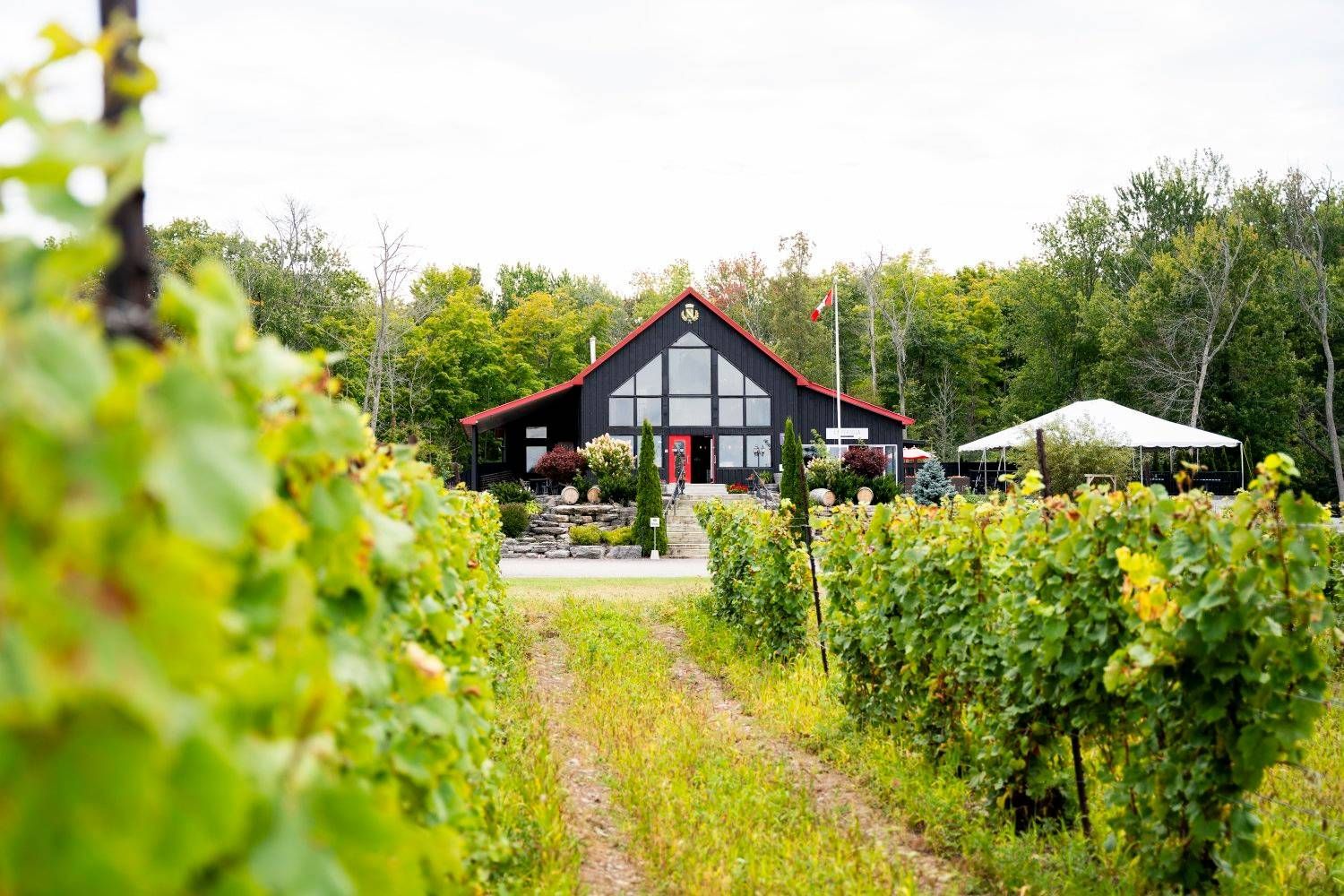
What makes the area special is the relationship between wine and setting. The county’s cool-climate conditions help shape the style of wine produced here, and the region’s open fields and lakeside influence make the scenery especially enjoyable between tastings. Visitors often come for Chardonnay, Pinot Noir, sparkling wine, and other locally produced bottles, but the deeper reward is the way the entire county has developed around small producers, hospitality, and a slower pace of travel.
One little-known fact is that Prince Edward County’s wine scene feels young compared with some global wine regions, yet it has gained a strong reputation because of the quality of its producers and the distinct character of the landscape. Another detail that many first-time visitors notice is how much the county encourages a full-day or weekend rhythm. The wineries are best enjoyed when you allow time for scenic driving, lunch, and perhaps an overnight stay rather than trying to compress everything into a short stop.
The experience also works well for travelers who are not wine experts. You do not need technical knowledge to appreciate the hospitality, the rural atmosphere, and the chance to sample local production in a beautiful setting. Prince Edward County is one of those destinations where the landscape and the tasting room experience strengthen each other. Even travelers who visit mostly for food, photos, or a relaxing escape often come away with a deeper appreciation for Ontario wine country.
Prince Edward County is close enough for a weekend from Toronto or other parts of southern Ontario, but the drive is long enough that many visitors prefer to stay overnight. Doing so gives you a better chance to enjoy tastings responsibly and explore the county’s food, small towns, and lakeside scenery. Once you arrive, winery visits can be paired with restaurants, farm shops, beaches, and scenic routes.
Choose a few wineries instead of trying to do too many. Part of the charm here is slowing down, not racing from one tasting room to the next. A smaller number of thoughtful stops usually gives a better experience than an exhausting checklist.
Book in advance when possible. Popular producers, weekend slots, and special tasting experiences can fill quickly, especially during peak travel seasons. Reservations can make the day smoother and prevent disappointment.
Leave time for food and scenery. The county is as much about the wider setting as the wine itself. Adding lunch, a drive through rural roads, or a short lake-side walk can make the visit feel much more complete.
Discover more hidden gems you might love.
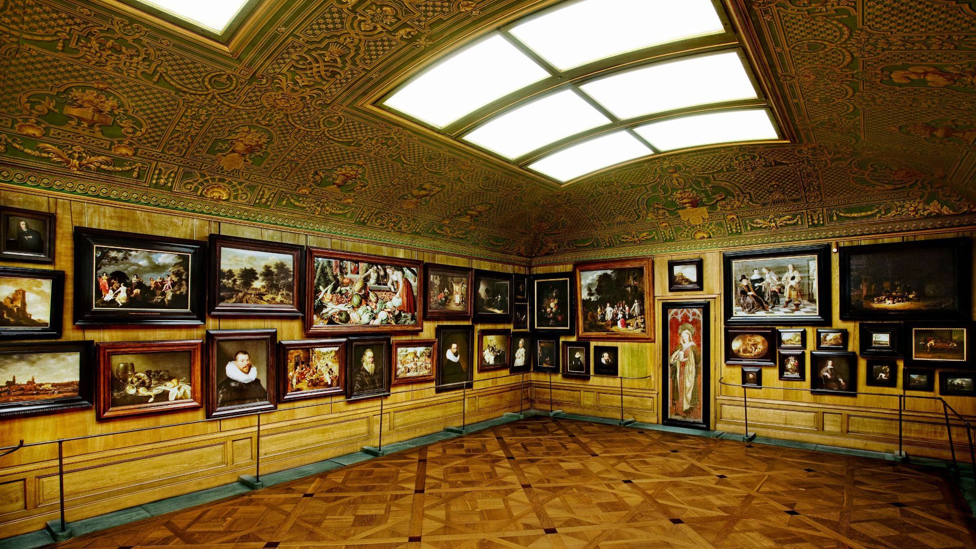
Stockholm
## Description The Hallwyl Museum in Stockholm offers one of the city’s most distinctive historic-house experiences. Housed in the former residence of Count and Countess von Hallwyl, the museum preserves an extraordinary late-nineteenth-century interior filled with art, furniture, decorative objects, and the feeling of a private home that has been carefully maintained rather than transformed into a generic museum. Visiting it is like stepping into a remarkably complete snapshot of upper-class domestic life in Stockholm at the turn of the century. The museum is especially appealing because it balances grandeur and intimacy. Some rooms are richly decorated and formal, while others feel like lived-in domestic spaces, making the whole building feel coherent rather than staged. One little-known fact is that the Hallwyl collection was assembled with unusual care and documentation, giving historians and visitors a detailed view of the household’s contents and routines. Another interesting detail is that the house itself reflects both status and modernity, showing how wealthy Stockholm families adopted new technologies and comforts while still displaying traditional elegance. What makes the museum memorable is the combination of its architecture, interiors, and sense of personal history. Unlike larger national museums, Hallwyl’s charm comes from concentration. Every room, object, and corridor contributes to a specific atmosphere. The visit is ideal for travelers who enjoy historic interiors, design history, or the way private homes can reveal broader social changes. It also fits well into Stockholm’s cultural landscape because it offers a different experience from the city’s more famous royal or maritime attractions. Instead of scale, it offers detail; instead of spectacle, it offers texture. ## Location The Hallwyl Museum is in central Stockholm, Sweden, near the city’s commercial and cultural core. Its location makes it easy to reach from many parts of the city and convenient to combine with shopping streets, other museums, or a broader downtown walk. The simplest way to get there is by public transport or on foot from central Stockholm. Because the city is well connected, visitors staying in the center can usually reach the museum quickly without needing a car. If you are planning a full day in central Stockholm, the museum works well as a quieter stop between busier attractions. ## Tips Take your time in the rooms; the best part of the museum is noticing the details. If you enjoy decorative arts, interiors, or social history, this museum will be especially rewarding. Check the current opening information in advance, since historic-house museums sometimes have schedule variations. Pair the visit with nearby Stockholm attractions to make the most of the central location. ## Conclusion The Hallwyl Museum is a refined and atmospheric historic house that gives visitors a rare, detailed glimpse into Stockholm’s aristocratic past. ## FAQ ### What kind of museum is Hallwyl? It is a historic house museum preserved from a wealthy Stockholm family’s residence. ### Is it good for first-time visitors to Stockholm? Yes, especially if you want a cultural site that is elegant and manageable in size. ### How long should I plan for the visit? Around one to two hours is usually enough. ### Is the museum family-friendly? Yes, though it is especially enjoyable for visitors interested in history and interiors. ### Why is it special compared with other museums? Because it preserves a remarkably complete domestic environment rather than only displaying isolated objects. ## Links - [Official website](https://hallwylskamuseet.se/en/) - [Hallwyl Museum on Wikipedia](https://en.wikipedia.org/wiki/Hallwyl_Museum)
GemVoyage Team • World
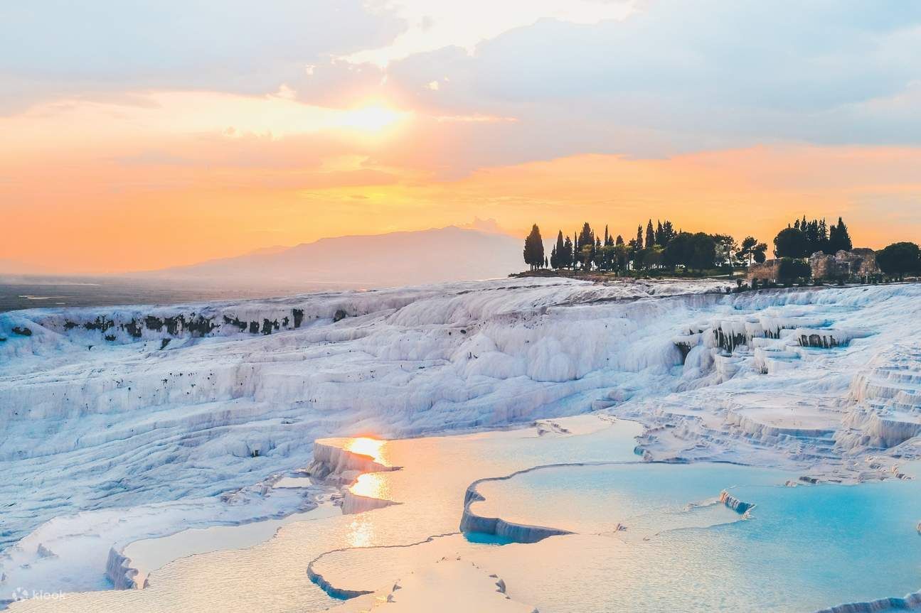
Denizli
## Description Pamukkale — literally “cotton castle” in Turkish — is an otherworldly landscape of gleaming white travertine terraces and thermal pools near Denizli in southwestern Turkey. Formed over millennia by mineral-rich hot springs, the cascading calcium carbonate deposits have created terraced basins that look like frozen waterfalls. Beyond their striking beauty, the terraces have been a center of bathing and healing since antiquity; the nearby Greco-Roman spa city of Hierapolis thrived here and left ruins that add historical depth to the site. What makes Pamukkale unique is this fusion of geology, thermal waters and preserved ancient architecture: you can soak in warm waters while gazing across white steps that sparkle under the Mediterranean sun and then wander through the atmospheric ruins of a Roman necropolis and theatre. Conservation measures have redirected water flows over the decades to protect fragile formations while allowing controlled access for visitors. ## Location Pamukkale is located in Denizli Province, in Turkey’s Aegean region. It sits roughly 20 kilometers north of the city of Denizli and about a 3–4 hour drive from Izmir depending on route. The easiest way to reach Pamukkale is to fly into Denizli Çardak Airport (DNZ) or Izmir Adnan Menderes (ADB) and then take a shuttle, rental car, or bus to Pamukkale town. Many visitors base themselves nearby and make day trips to the terraces and Hierapolis archaeological site. ## Tips - **Visit early or late to avoid crowds:** The terraces are most photogenic in soft morning or late-afternoon light and less crowded at those times. Midday can be busy and harshly lit. - **Follow conservation rules:** Walking barefoot on protected terraces is required in some zones — shoes and grit can damage delicate carbonate layers. Use designated paths and restricted areas to protect the formations. - **Combine with Hierapolis:** Buy a combined ticket to explore the Hierapolis archaeological site and its museum; the ancient thermal bath ruins and the Roman theatre add cultural context to the natural spectacle. - **Bring swimwear and a towel for designated pools:** Some thermal pools and nearby hotel facilities allow bathing. The Cleopatra Pool (within Hierapolis) is an example where supervised bathing is permitted for a fee. - **Protect your skin and eyes:** The bright white terraces reflect intense sunlight. Sunglasses, broad-spectrum sunscreen and a hat are important for comfort and safety. - **Choose comfortable footwear for approaches:** While you may walk barefoot on terraces in protected areas, approaches and surrounding paths benefit from supportive shoes. - **Respect local signage and staff instructions:** Conservation authorities and staff provide guidance to ensure the formations remain intact for future visitors. ## Conclusion Pamukkale is a rare combination of dramatic natural formation and rich archaeological heritage. Whether you come for the thermal waters, the photographic vistas, or the silence of ancient stones, the site offers an unforgettable sensory experience rooted in landscape and history. Visitors who honor conservation measures will help keep these terraces pristine for future generations. ## FAQ - **Q: Is Pamukkale safe to visit?** A: Yes — it’s a well-visited UNESCO World Heritage site with clear conservation rules and tourist facilities. Stay on marked paths and follow signage. - **Q: Can I swim in the terraces?** A: Swimming is allowed only in designated pools and some supervised areas; many terraces are closed to bathing to protect them. The Cleopatra Pool at Hierapolis is one supervised option. - **Q: How long should I plan for a visit?** A: Allocate 2–4 hours to walk the terraces, visit Hierapolis and see the museum — longer if you plan to bathe or explore additional local attractions. - **Q: When is the best time to visit Pamukkale?** A: Spring and autumn offer pleasant temperatures and fewer crowds. Early morning or late afternoon provides the best light for photography and cooler conditions for walking barefoot. - **Q: Are there entrance fees?** A: Yes, entry to the terraces and Hierapolis requires a ticket; combined tickets commonly include both sites and vary by season and operator. - **Q: Is Pamukkale wheelchair accessible?** A: Accessibility is improving in some areas, but many terraces have uneven surfaces and steps. Check current access options with local tourism offices if mobility is a concern. ## Links - [Pamukkale — Wikipedia](https://en.wikipedia.org/wiki/Pamukkale)
GemVoyage Team • World
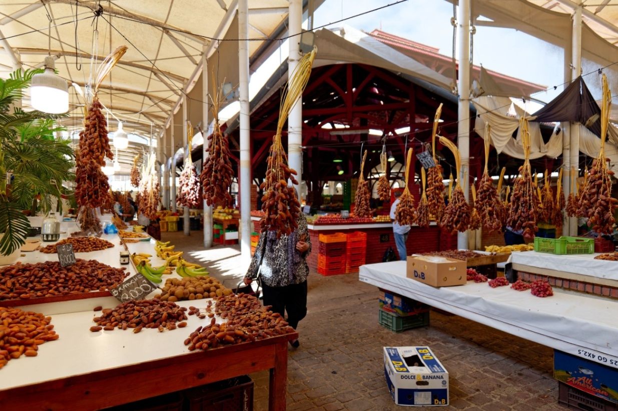
Tunis
## Description The Central Market of Tunis, known locally as السوق المركزية, is one of the most vibrant and authentic places in the Tunisian capital. Serving as a hub for fresh food, spices, and everyday goods, the market offers visitors a vivid introduction to local life and culinary traditions. Bustling, colorful, and full of aromas, the market reflects the rhythms of Tunis far more intimately than many formal tourist attractions. What makes the Central Market of Tunis unique is its impressive variety and organization. Inside its historic iron-and-glass structure, visitors will find separate sections dedicated to fish, meat, fruit and vegetables, spices, flowers, and traditional products. A little-known fact is that the market building dates back to the late 19th century and was constructed during the French protectorate, incorporating European architectural elements with local commercial practices. Another lesser-known detail is that many restaurant owners and chefs from across Tunis still source their ingredients here early in the morning, ensuring the market remains central to the city’s food culture. Beyond shopping, the market is a social space where neighbors meet, bargains are exchanged, and traditions continue daily, making it an essential stop for anyone wishing to understand Tunis from the inside. ## Location The Central Market of Tunis is located in **Tunisia**, in the **Tunis Governorate**, within the city of **Tunis**. It sits just outside the old Medina, near Avenue Habib Bourguiba, one of the city’s main thoroughfares. Reaching the market is easy by public transportation. The Tunis Metro and TGM trains stop nearby, and several bus routes pass through the area. For visitors staying in central Tunis, the market is within walking distance of major hotels and landmarks. Taxis are also affordable and widely available, but walking allows you to experience the surrounding streets and shops. ## Tips * Visit early in the morning to see the market at its busiest and to enjoy the freshest products. * Be prepared for strong smells, especially in the fish and meat sections. * Ask permission before taking photos, particularly of people or individual stalls. * Bring small bills and cash, as many vendors do not accept cards. * Practice polite bargaining where appropriate, especially for non-food items. * Combine your visit with a walk through the nearby Medina for a fuller cultural experience. ## Conclusion The Central Market of Tunis offers an immersive and sensory-rich experience that captures the heart of the city. With its historic setting, diverse products, and lively atmosphere, it provides a genuine glimpse into Tunisian culture and everyday life. ## FAQ **What can I buy at the Central Market of Tunis?** You can find fresh produce, seafood, meat, spices, flowers, and various local products. **Is the Central Market tourist-friendly?** Yes, although it mainly serves locals, visitors are welcome and generally well received. **How long should I spend at the market?** Most visitors spend 45 minutes to 1.5 hours, depending on interest. **Is the market open every day?** The market is typically open daily except Sundays or major holidays, with reduced hours in the afternoon. **Is it safe to visit the Central Market of Tunis?** Yes, it is generally safe, but visitors should remain aware of their belongings in crowded areas. ## Links * [Tunisia Tourism Official Website](https://www.discovertunisia.com)
GemVoyage Team • World
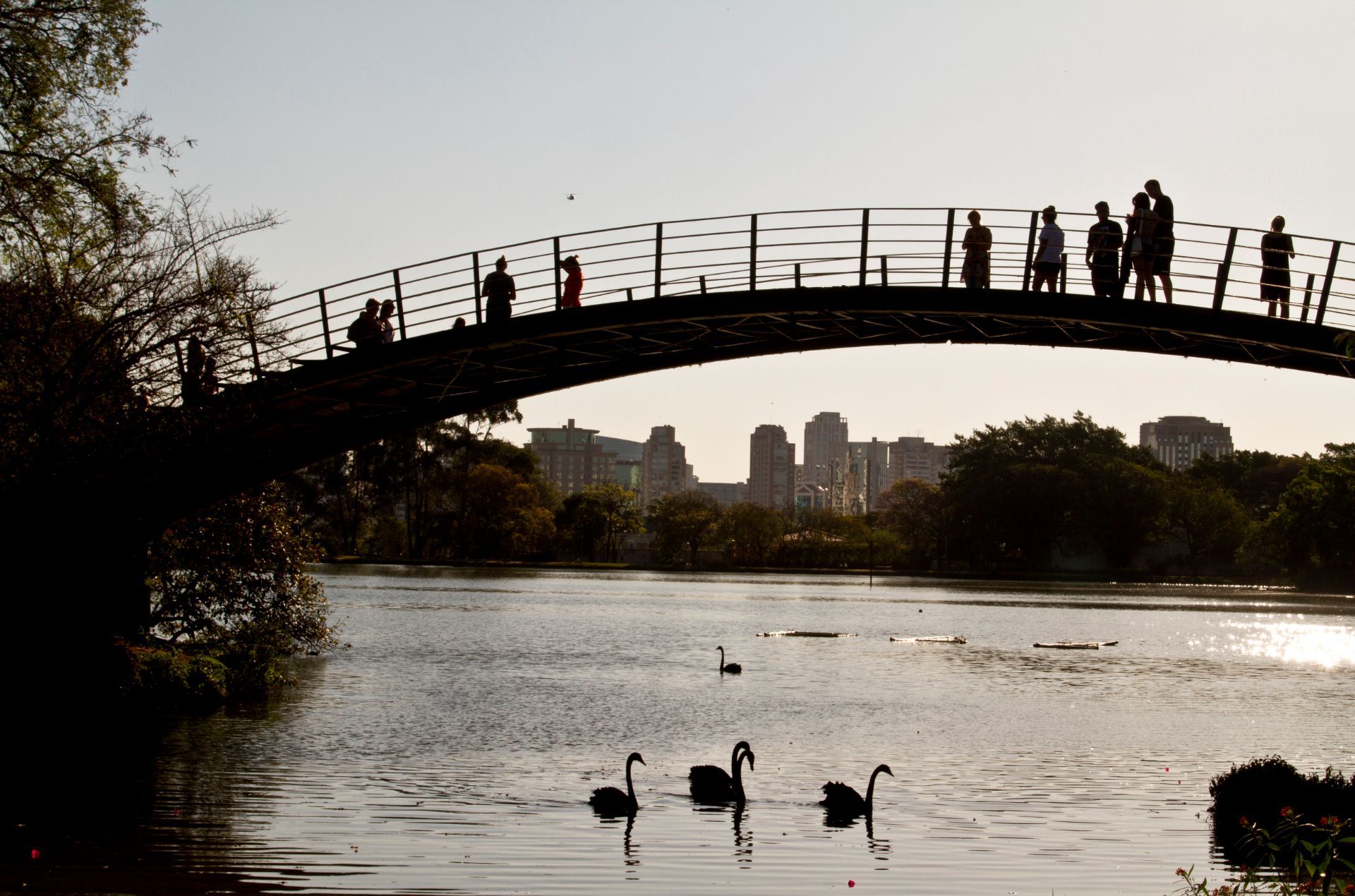
São Paulo
## Description Ibirapuera Park is one of São Paulo’s best-known green spaces, but the real delight for many visitors is not just the major landmarks. It is the quieter corners that reveal why the park matters so much to locals. In a city famous for its intensity, scale, and relentless movement, Ibirapuera provides room to breathe. The park is broad enough to absorb crowds without feeling overwhelming, and its quieter paths, shaded lawns, and tucked-away benches make it easy to find a slower rhythm even on busy days. The park is more than a recreational area. It is a cultural landscape where nature, architecture, exercise, and informal social life come together. You may pass runners, families on blankets, office workers taking breaks, and visitors moving between museums or exhibition spaces. Yet the quieter parts of the park offer a different kind of experience. Instead of chasing the main sights, you can wander into less-trafficked zones, pause under the trees, and notice how the park changes from one pocket of space to another. One little-known fact is that Ibirapuera was designed with major urban ambition in mind, which is why the park feels so integrated with the city rather than separated from it. Another is that the park’s atmosphere can shift dramatically depending on where you stand; some areas feel expansive and ceremonial, while others feel almost hidden and intimate. That contrast is what makes the quieter corners so rewarding. They reveal a softer side of one of Latin America’s great metropolitan parks. For travelers, the appeal lies in balance. You can enjoy famous São Paulo institutions and still have time to sit somewhere calm enough to reflect on the city’s scale. In that sense, Ibirapuera is not only a park but also a reset point. It offers visitors the chance to experience a dense metropolis without being consumed by it. ## Location Ibirapuera Park is located in São Paulo, Brazil, primarily in the southern-central part of the city near neighborhoods such as Vila Mariana and Moema. It is one of the most accessible major parks in São Paulo and sits within reach of both cultural institutions and residential districts, which makes it easy to combine with other city sightseeing. The park is best reached by ride-hailing service, taxi, bus, or a combination of metro and walking depending on where you start. Because the park has multiple entrances and a large footprint, it helps to decide in advance which part you want to visit. If your goal is the quieter side of the park, enter with enough time to wander rather than heading only to one landmark. That way you can move between open lawns, tree-lined paths, and calmer internal areas without feeling rushed. From central São Paulo, travel time varies widely with traffic, so the best strategy is to leave room in your schedule. Mornings and late afternoons are often the most comfortable times to visit because temperatures are milder and the park’s quieter zones feel more spacious. ## Tips - Visit on a weekday if you want the calmest experience. Weekends are lively and fun, but they are also busier. - Bring water, sunscreen, and comfortable shoes. The park is large enough that you will do more walking than expected. - If you want the quietest corners, keep moving away from the most obvious landmarks and main event spaces. - Plan at least part of your visit for sitting and observing instead of only walking. The park’s atmosphere is part of the attraction. - Combine the park with a museum or cultural stop nearby so the day feels balanced between activity and rest. ## Conclusion The quieter corners of Ibirapuera Park show a gentler, more reflective side of São Paulo. It is a place to slow down, recharge, and see how a great city park can feel both grand and personal at the same time. ## FAQ ### Why focus on the quiet corners instead of the park’s main attractions? Because the quieter spaces show a different personality. They are where the park feels restorative, local, and less performative, which can be especially valuable in a city as energetic as São Paulo. ### Is Ibirapuera Park suitable for a short visit? Yes. Even a brief stop can be worthwhile if you know which entrance or area you want to explore. A short visit is enough to enjoy the atmosphere, but longer stays let you appreciate the park’s variety. ### When is the best time to go? Mornings and late afternoons are usually the most pleasant. The light is better, temperatures are easier, and the park’s calmer areas are more enjoyable. ### Can I visit if I am not interested in museums or events? Absolutely. The park works very well as a green urban retreat on its own, especially if you enjoy walking, people-watching, or simply resting in a landscaped setting. ## Links - [Ibirapuera Park official website](https://parqueibirapuera.org/) - [Ibirapuera Park on Wikipedia](https://en.wikipedia.org/wiki/Ibirapuera_Park)
GemVoyage Team • World
Victoria
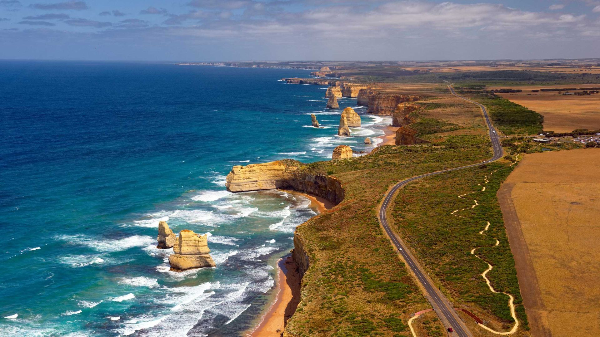
## Description The Great Ocean Road is one of the world’s most celebrated coastal drives, winding along Victoria’s southwestern shoreline past rugged cliffs, surf beaches and sculpted limestone stacks such as the Twelve Apostles. Built by returned WWI soldiers and dedicated as a war memorial, the road combines engineering, natural wonders and seaside towns with cafes, galleries and surf culture. Dramatic viewpoints, rainforest gorges (like Great Otway National Park) and wildlife sightings (koalas, kangaroos and seabirds) make the route a versatile exploration corridor. What distinguishes the route is its dramatic juxtaposition of surf, limestone geology and accessible townscapes. Photographers and road trippers prize the series of staged viewpoints where walking tracks descend to coves and panoramic platforms look out to offshore stacks. Beyond the famous stacks, the route offers fern gullies and waterfalls in the Otways, coastal walks to hidden beaches, and small towns where food and surf culture combine. Many travelers craft multi-day itineraries that combine coastal hikes, wildlife spotting and culinary stops, from coffee in Torquay to seafood in Apollo Bay and heritage-listed lookouts around Port Campbell. The road’s memorial origins also allow visitors to reflect on the engineering feat and the region’s social history while enjoying one of Australia’s most scenic drives. ## Location The Great Ocean Road runs from Torquay to Allansford near Warrnambool in Victoria, Australia, with key stops including Anglesea, Lorne, Apollo Bay and the Twelve Apostles viewpoint at Port Campbell. Melbourne is the primary gateway, roughly a 1.5–3 hour drive to the start depending on traffic. ## Tips - **Avoid peak holiday traffic and plan overnight stops:** The route is popular during Australian school holidays; split the drive into staged stops to avoid fatigue and to enjoy hikes. - **Plan time for short walks and lookout detours:** Many of the best views require small detours and short walks; factor these into your itinerary rather than only driving. - **Mind driving conditions and seasonal weather:** Wind, sea spray and rain can change conditions quickly — watch for strong crosswinds and take care on narrow coastal roads. - **Book accommodation and tours in advance during peak season:** Lorne, Apollo Bay and Port Campbell fill quickly in summer — reserve ahead if travel dates are fixed. - **Pack layers and photography gear:** Coastal light changes quickly; bring windproof layers, a tripod for sunrise/sunset shots and protective gear for salt spray. ## Conclusion The Great Ocean Road pairs dramatic coastal geology with accessible townscapes and outdoor experiences, making it an essential Australian road trip for nature lovers and photographers. Thoughtful pacing and an eye for sidetracks reveal quieter coves, rainforest secrets and local food scenes that complement the iconic seascapes. ## FAQ - **Q: How long does the full drive along the Great Ocean Road take?** A: The direct driving time without stops is around 6–7 hours, but most travelers allocate 2–3 days to properly enjoy walks, viewpoints and coastal towns. - **Q: Can I drive the Great Ocean Road in a single day from Melbourne?** A: You can, but it will be rushed; an overnight stop (or two) allows for sunrise/sunset photography, hikes, and a relaxed pace. - **Q: Are there guided tours, or is it best to self-drive?** A: Both options are common: guided day tours suit short itineraries from Melbourne, while self-driving gives freedom to explore side tracks and lesser-known beaches. - **Q: What wildlife can I expect to see?** A: Look for koalas in eucalyptus stands, kangaroos in paddocks near dusk, seabirds along the cliffs and occasional whales on migration seasons from coastal lookouts. - **Q: Is the route safe for cyclists and motorcyclists?** A: Many cyclists and motorcyclists enjoy sections of the route, but be prepared for narrow lanes, tourist traffic, and windy coastal conditions; follow local safety advice. ## Links - [Great Ocean Road — Wikipedia](https://en.wikipedia.org/wiki/Great_Ocean_Road)
GemVoyage Team • World
Grindavik
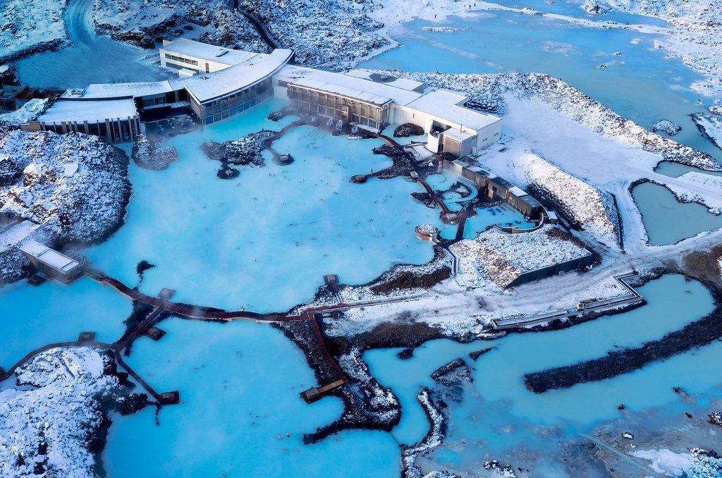
## Description The Blue Lagoon near Grindavík is one of Iceland’s most famous geothermal spas, renowned for its vivid milky-blue waters set against a rugged lava field. The warm seawater is rich in silica, minerals and microalgae, which give it a distinctive color and reputed skin-soothing properties. The man-made lagoon originated from the runoff of a nearby geothermal power plant, and over time it evolved into a carefully managed spa destination with curated bathing experiences, spa treatments and striking architecture integrated into moss-covered lava. What makes the Blue Lagoon feel special is its blend of high-design hospitality and raw volcanic surroundings: sleek facilities, in-water bars and silica mud treatments meet black lava and open sky. The lagoon is also a refined wellness experience — many visitors combine a soak with spa treatments, saunas and skin clinics that use the lagoon’s mineral-rich waters. ## Location The Blue Lagoon sits in the Reykjanes Peninsula near the town of Grindavík, southwestern Iceland, about a 20–25 minute drive from Keflavík International Airport (KEF) and roughly 45–50 minutes from Reykjavík. Its close proximity to the airport makes it an ideal stop for arrival or departure itineraries. Shuttles, organized transfers and private cars serve the site; many travelers build a visit into a layover or the first/last day of an Icelandic road trip. ## Tips - **Pre-book tickets:** The Blue Lagoon operates on a timed-entry ticket system and often sells out. Book your preferred time slot and any spa treatments in advance, especially during peak travel seasons. - **Combine with airport logistics:** For arrivals or departures, plan luggage storage, transit time and transport options carefully — factor in check-in windows if you’re catching an onward flight. - **Choose the right package:** Packages range from basic entry to premium experiences with robes, transfers and exclusive lounge access. Compare what’s included — towels and robes may be part of higher-tier options. - **Use silica mud and spa treatments mindfully:** The silica mud masks are iconic, but be cautious with sensitive skin types. Follow staff guidance and rinse thoroughly after treatment. - **Protect electronics and valuables:** Bring a waterproof phone case and use on-site lockers for valuables. The lagoon environment can fog camera lenses and corrode metal accessories over time. - **Respect spa etiquette and hygiene:** Shower thoroughly before entering, follow lifeguard instructions, and avoid bringing food into the water. Keep noise levels moderate to preserve the spa atmosphere. - **Consider time of day for photos:** Early morning or late afternoon light yields softer colors and fewer crowds; sunrise visits can be striking but check opening hours and transfers. ## Conclusion The Blue Lagoon is an accessible and cinematic geothermal spa experience that pairs Iceland’s volcanic drama with high-quality wellness amenities. Whether you stop for a long layover soak, a restorative spa day, or a luxury treatment, the lagoon’s mineral-rich waters and dramatic setting create a memorable contrast to urban travel or long flights. ## FAQ - **Q: Can I visit the Blue Lagoon on arrival or departure from KEF?** A: Yes — the Blue Lagoon’s proximity to Keflavík International Airport makes it popular for arrivals and departures. Allow extra time for transfers and check-in when booking around flights. - **Q: Do I need to book in advance?** A: Strongly recommended. Timed-entry tickets can sell out, especially in high season. Book online to secure your preferred slot and any additional treatments. - **Q: Is swimming allowed in the lagoon?** A: Bathing in the designated pools is the main activity. Supervised areas and lifeguards may be present; follow posted safety rules. - **Q: Are there age restrictions or family options?** A: Children are allowed in many ticket types but check current policies on age limits and supervision requirements. Family-friendly times and facilities vary by package. - **Q: Is the water natural and safe for skin?** A: The lagoon’s water is managed and replenished; it’s mineral-rich and generally safe for most skin types, but those with severe skin conditions should consult a physician before bathing and test briefly. - **Q: What should I bring?** A: For basic visits bring swimwear, a waterproof phone case, and comfortable clothes for changing. Higher-tier packages may include towels and robes. ## Links - [Blue Lagoon — Official site](https://www.bluelagoon.com)
GemVoyage Team • World

Comments