GemVoyage Team • World
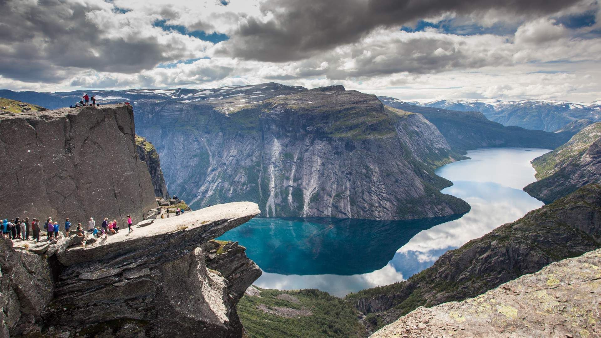
Beyond the photogenic ledge, Trolltunga stands out for its demanding yet accessible backcountry experience. The modern popularity surged through social media; traditionally, this was a remote local hike. Management measures, permits, and local transport services have evolved to handle seasonal traffic while protecting the path and surrounding vegetation.
Seasonality matters: roadside parking and trail access are managed during summer to reduce environmental impact and improve safety. In winter and shoulder seasons the route becomes technical and requires winter mountaineering skills and equipment.
Discover more hidden gems you might love.
Berlin
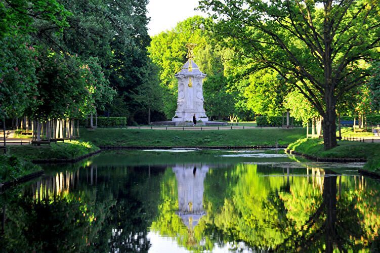
## Description Großer Tiergarten (commonly called the Tiergarten) is Berlin’s largest and most beloved inner-city park—a leafy, varied landscape of walking paths, ponds, monuments, and quiet glades sitting at the historic heart of the city. Once a ducal hunting ground, it evolved over centuries into a landscaped public park designed for civic leisure and grand promenades. Today, the Tiergarten provides a verdant contrast to Berlin’s urban fabric: classical statues, the iconic Victory Column (Siegessäule), and gardened lawns mix with dense tree stands and serene waterways. What distinguishes the Tiergarten is its adaptability: it serves as a place for brisk joggers, picnickers, history buffs, and families alike. Hidden corners contain wartime memorials and modern sculptures, while open meadows host festivals and local gatherings. A lesser-known fact is that parts of the park were extensively redesigned after World War II and partially replanted to counter wartime damage, which explains the deliberate blend of older avenues with mid-20th-century layout decisions. ## Location Großer Tiergarten is located in central Berlin, within the Mitte borough and adjacent to important city landmarks such as the Brandenburg Gate, the Reichstag, and Potsdamer Platz. The park stretches roughly from the Brandenburg Gate in the east toward the Bellevue Palace in the west. Getting there: Tiergarten is highly accessible. Most visitors arrive via Berlin’s U-Bahn or S-Bahn (Brandenburger Tor station, Tiergarten station, or Potsdamer Platz). Buses and trams also serve nearby stops. Cycling is an excellent way to traverse the park—bike rental stations are plentiful, and dedicated paths make for a pleasant ride. If arriving by car, use nearby parking facilities at major crossroads, though public transport is recommended. ## Tips - Plan a walking loop: Combine a visit to the Brandenburg Gate, stroll through the Tiergarten, and finish at the Victory Column or Bellevue Palace. - Rent a bike: The park is large and easier to explore by bicycle; watch for pedestrians on mixed-use paths. - Bring a picnic: Large grassy areas are perfect for relaxing; be mindful of local rules about barbecues and cleanup. - Visit different times: Morning for joggers and birdwatching; late afternoon for softer light and fewer crowds; summer evenings often have informal gatherings or small concerts. - Check memorials and monuments: Allow time to see the Soviet War Memorial, the Bismarck statue, and other historical markers—each has its own backstory worth exploring. - Accessibility: Main routes are generally flat and wheelchair-friendly, but some wooded paths can be uneven. ## Conclusion Großer Tiergarten is a green heart in the center of Berlin: historically layered, naturally restorative, and culturally active. Whether you seek a peaceful walk, a cycling route, or a place to sit and watch Berlin life unfold, Tiergarten delivers a balanced urban park experience with historical depth and modern vitality. ## FAQ Q: Is the Tiergarten safe to visit after dark? A: Central areas and main paths are generally safe, but as with any large park, avoid isolated areas at night and use common-sense precautions. Q: Can I cycle in the Tiergarten? A: Yes. Cycling is popular and convenient with dedicated paths; always yield to pedestrians and follow local cycling rules. Q: Are there guided tours of the Tiergarten? A: Guided walking and bike tours that include Tiergarten are available through various tour operators; check Berlin tourism listings. Q: Is the Victory Column accessible to the public? A: The Victory Column is open to visitors who want to climb to the viewing platform; check opening hours and ticketing information. ## Links - [Visit Berlin – Tiergarten information](https://www.visitberlin.de/en/place/grosser-tiergarten)
GemVoyage Team • World
Faro
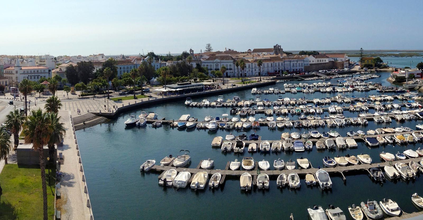
## Description Faro Marina is one of the most picturesque and lively spots in the Algarve region of southern Portugal. Nestled right in the heart of Faro, the marina is a central meeting point where the city’s charm blends seamlessly with its maritime heritage. With a backdrop of palm trees, elegant architecture, and rows of yachts and fishing boats bobbing gently on the water, it’s a place that embodies the relaxed yet vibrant spirit of coastal Portugal. What makes Faro Marina unique is not only its stunning scenery but also its role as a **gateway to the Ria Formosa Natural Park**, one of Portugal’s most beautiful protected lagoons. Many boat tours depart from the marina, offering visitors the chance to explore secluded islands, birdwatch, or enjoy a relaxing cruise at sunset. A little-known fact about Faro Marina is that the **large stork nests perched on lampposts and rooftops** around the harbor are a common sight, adding to its charm and making it a favorite spot for photographers. Another interesting detail is that the marina is often used for cultural events and festivals, turning it into a lively gathering point during summer evenings. ## Location Faro Marina is located in **Faro, the capital of the Algarve region in Portugal**. It sits right by the **city center**, just across from the historic old town and within walking distance of landmarks such as the **Arco da Vila** and **Faro Cathedral**. Its central location makes it a natural starting point for exploring both the city and the Algarve coastline. ### Recommendation on How to Get There From **Faro Airport**, the marina is only about a **10-minute drive** or a 15-minute bus ride on the airport shuttle. If you’re arriving by train or bus, both stations are within a short walking distance of the marina. For those exploring the Algarve by car, Faro is well-connected by road, and public parking is available near the city center. ## Tips Here are some helpful tips to make your visit to Faro Marina memorable: * **Take a Boat Tour**: Don’t miss the opportunity to explore the Ria Formosa islands, such as Ilha Deserta or Ilha do Farol, by booking a boat tour directly from the marina. * **Enjoy a Sunset Drink**: The waterfront is lined with cafés and bars—perfect for enjoying a glass of Portuguese wine or a cocktail while watching the sun go down. * **Photography Spot**: Bring your camera, especially for capturing the boats, the palm-fringed promenade, and the storks nesting nearby. * **Combine With Old Town Visit**: Since the marina is next to Faro’s historic district, combine your visit with a walk through cobbled streets, museums, and churches. * **Best Time to Visit**: Early evening is ideal, as the marina lights up beautifully, and the temperature is more comfortable during warmer months. * **Look Out for Events**: During summer, concerts, markets, and festivals are often held at or near the marina, adding extra vibrancy to your visit. ## Conclusion Faro Marina is more than just a harbor—it’s a cultural and social hub that captures the essence of Faro and the Algarve. With its stunning waterfront views, lively atmosphere, and easy access to natural wonders like the Ria Formosa, it’s a must-visit spot for anyone traveling to southern Portugal. Whether you’re taking a boat tour, enjoying a drink by the water, or simply strolling along the promenade, Faro Marina is sure to leave a lasting impression. ## FAQ **1. What can I do at Faro Marina?** You can enjoy boat tours to the Ria Formosa islands, dine at waterfront cafés, attend local events, or simply relax and admire the views. **2. Is Faro Marina close to the city center?** Yes, it’s located in the heart of Faro and is within walking distance of the historic old town and main transport hubs. **3. Are boat tours available year-round?** Yes, although availability and schedules may vary depending on the season. Summer offers the widest selection of tours. **4. Is it family-friendly?** Absolutely. The marina is pedestrian-friendly and offers plenty of open space, making it great for families with children. **5. Can I see wildlife at the marina?** Yes, you’ll often spot storks nesting nearby, and boat tours will take you to the Ria Formosa lagoon, which is rich in birdlife. **6. How long should I plan to spend at Faro Marina?** A casual visit might take an hour, but if you’re combining it with a boat trip and old town exploration, plan for half a day or more. ## Links * [Official Faro Tourism Office](https://www.faro.pt/en)
GemVoyage Team • World
Taiwan
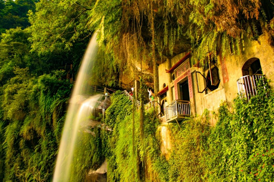
## Description **Yinhe Cave (銀河洞)**, often translated as **“Milky Way Cave” or “Galaxy Cave,”** is one of northern Taiwan’s most atmospheric hidden landmarks. Tucked deep within lush subtropical forest, this small but visually arresting cave temple blends **natural rock formations, cascading waterfalls, and quiet Buddhist spirituality** into a single, almost dreamlike destination. Unlike grand mountain temples or vast cave systems, Yinhe Cave owes its appeal to **intimacy, mystery, and silence** rather than scale. The cave is formed from natural sandstone and has been carved further by flowing water over centuries. A **narrow waterfall flows directly through the entrance of the cave**, spilling over stone steps and into a shallow pool below. Behind the falling water sits a small **Buddhist shrine**, turning the cave into a functioning place of worship rather than a simple geological feature. The constant movement of water creates a soft echo through the rock chamber, giving the space a meditative rhythm that visitors often describe as hypnotic. What makes Yinhe Cave especially unique is the way **human devotion and natural erosion intersect**. The cave was not aggressively reshaped into a large religious complex; instead, the shrine was carefully adapted to the existing stone cavity. This restraint preserves the raw personality of the site. Moss-covered stairways, dripping rock walls, and filtered green light reinforce the sense that the cave is alive rather than decorative. The surrounding environment is just as important as the cave itself. The approach trail winds through **dense forest, bamboo groves, and small wooden bridges**, forming part of a broader hiking network in the hills of New Taipei City. Along the way, visitors pass **streams, vines, singing insects, and occasional distant city noise fading into silence**. This contrast between urban Taiwan and deep forest isolation happens quickly and dramatically, which enhances the emotional impact of arriving at the cave. A little-known fact is that Yinhe Cave was historically used as a **meditation site by local monks**, not as a public tourist attraction. Its popularity grew mainly through hikers and photographers over the last two decades rather than through formal religious promotion. Another lesser-known detail is that the name “Galaxy Cave” does not come from astronomy, but from the way the **waterfall scatters light into mist**, resembling a flowing star field during early morning sunlight. Yinhe Cave is not a place for crowds, performances, or commercial stalls. It is a destination of **low noise, slow movement, and quiet attention**. For travelers seeking spectacle, it may feel understated. But for those seeking **atmosphere and emotional texture**, it delivers something rare: a sacred space formed more by water and time than by human hands. ## Location **Yinhe Cave (銀河洞)** is located in the **Xindian District (新店區)** of **New Taipei City**, in **northern Taiwan**, just south of central Taipei. **City:** New Taipei City **Region:** Northern Taiwan **Country:** Taiwan **District:** Xindian (新店區) ### How to Get There: * **By MRT:** Take the **Green Line (Songshan–Xindian Line)** to **Xindian Station (新店站)**. From there, take a local bus or taxi toward the hiking trail entrance. * **By bus:** Several local buses connect Xindian Station to nearby trailheads leading into the mountains. * **By taxi or ride-hailing apps:** The easiest option for non-Mandarin speakers; request “Yinhe Dong” or show the Chinese characters 銀河洞. * **By car or scooter:** Parking is limited near trail access points; illegal roadside parking is strictly enforced. From the nearest drop-off point, visitors must complete a **moderate forest hike**, typically 30–45 minutes depending on route and pace. ## Tips * **Wear proper hiking shoes:** The stone steps near the cave are often slippery due to constant moisture. * **Visit in dry weather:** Heavy rain increases water flow but also raises safety risks and reduces visibility. * **Go in the early morning:** You’ll encounter fewer hikers, softer light, and more atmospheric mist. * **Bring drinking water:** There are no vendors near the cave itself. * **Respect the shrine:** This is still an **active spiritual site**, not just a photography location. * **Avoid loud music and drones:** Sound echoes intensely inside the cave and disrupts the atmosphere. * **Allow extra time for rest:** The hike is scenic but involves steady climbing. * **Do not expect major facilities:** No cafes, restrooms, or souvenir shops are located at the cave. ## Conclusion **Yinhe Cave (銀河洞)** is a rare blend of **natural erosion, flowing water, and quiet religious presence**, offering one of northern Taiwan’s most atmospheric micro-destinations. It is not a place for spectacle or quick tourism, but for travelers who seek **silence, texture, and emotional contrast**. Hidden just beyond the reach of Taipei’s urban sprawl, Yinhe Cave reveals how quickly modern density can dissolve into spiritual isolation when nature is allowed to lead. ## FAQ **1. What is Yinhe Cave famous for?** It is known for its **waterfall flowing directly through a cave temple**, blending nature and spiritual architecture. **2. Is Yinhe Cave difficult to reach?** Yes. It requires a **moderate forest hike** after reaching the general area by MRT, bus, or taxi. **3. Is Yinhe Cave suitable for children?** Older children with hiking experience can manage it, but the **slippery stairs and uneven terrain** make it unsuitable for very young children. **4. Is there an entrance fee?** No. Yinhe Cave is **free to enter** and open to the public. **5. Can I visit during the rainy season?** Yes, but **extra caution is required**, as trails and stone steps become extremely slick. **6. How long does the full visit typically take?** Most visitors spend **2 to 3 hours total**, including hiking time. ## Links * [New Taipei City Government – Tourism](https://newtaipei.travel/) * [Xindian District Travel Guide](https://www.xindian.ntpc.gov.tw)
GemVoyage Team • World
São Paulo
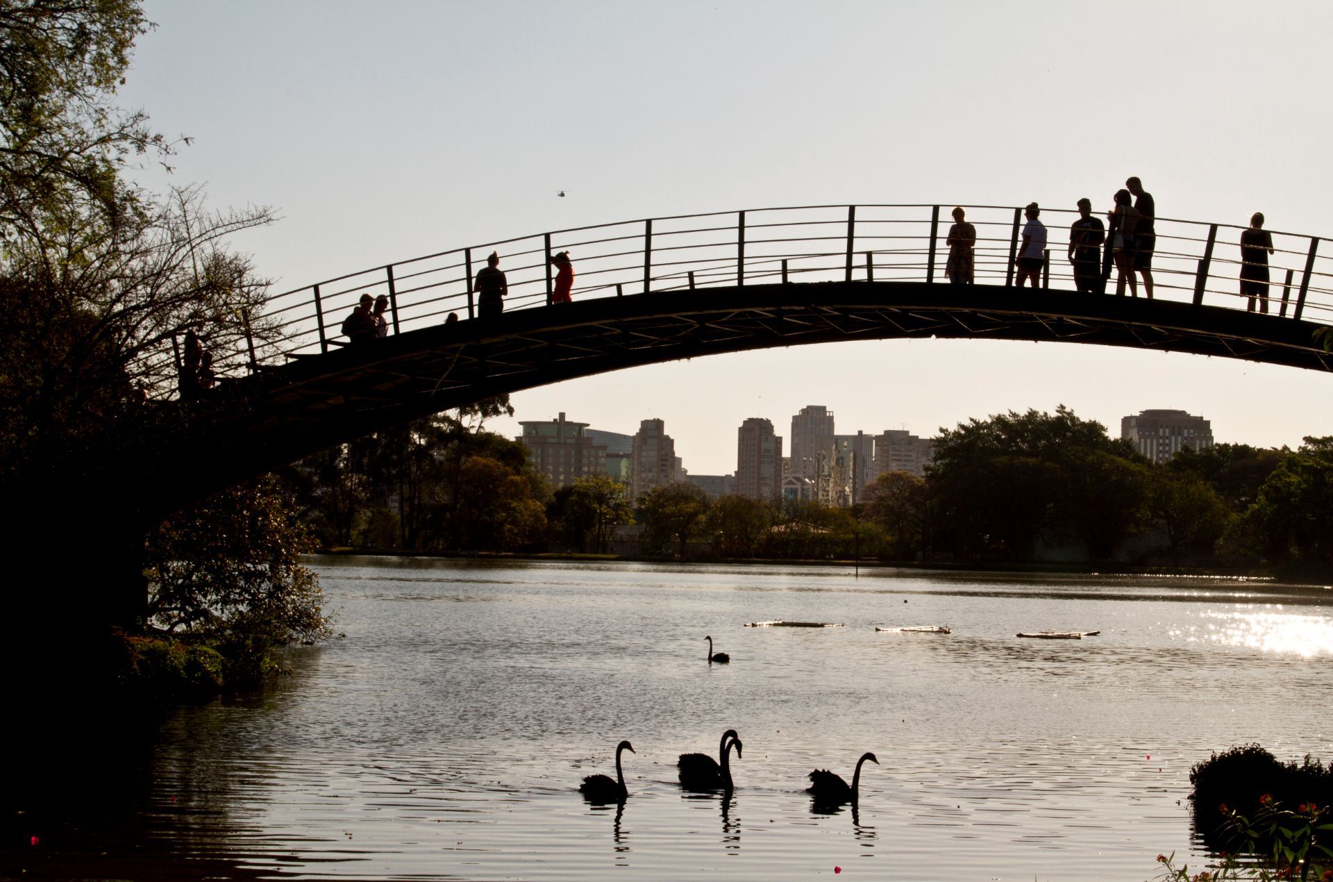
## Description Ibirapuera Park is one of São Paulo’s best-known green spaces, but the real delight for many visitors is not just the major landmarks. It is the quieter corners that reveal why the park matters so much to locals. In a city famous for its intensity, scale, and relentless movement, Ibirapuera provides room to breathe. The park is broad enough to absorb crowds without feeling overwhelming, and its quieter paths, shaded lawns, and tucked-away benches make it easy to find a slower rhythm even on busy days. The park is more than a recreational area. It is a cultural landscape where nature, architecture, exercise, and informal social life come together. You may pass runners, families on blankets, office workers taking breaks, and visitors moving between museums or exhibition spaces. Yet the quieter parts of the park offer a different kind of experience. Instead of chasing the main sights, you can wander into less-trafficked zones, pause under the trees, and notice how the park changes from one pocket of space to another. One little-known fact is that Ibirapuera was designed with major urban ambition in mind, which is why the park feels so integrated with the city rather than separated from it. Another is that the park’s atmosphere can shift dramatically depending on where you stand; some areas feel expansive and ceremonial, while others feel almost hidden and intimate. That contrast is what makes the quieter corners so rewarding. They reveal a softer side of one of Latin America’s great metropolitan parks. For travelers, the appeal lies in balance. You can enjoy famous São Paulo institutions and still have time to sit somewhere calm enough to reflect on the city’s scale. In that sense, Ibirapuera is not only a park but also a reset point. It offers visitors the chance to experience a dense metropolis without being consumed by it. ## Location Ibirapuera Park is located in São Paulo, Brazil, primarily in the southern-central part of the city near neighborhoods such as Vila Mariana and Moema. It is one of the most accessible major parks in São Paulo and sits within reach of both cultural institutions and residential districts, which makes it easy to combine with other city sightseeing. The park is best reached by ride-hailing service, taxi, bus, or a combination of metro and walking depending on where you start. Because the park has multiple entrances and a large footprint, it helps to decide in advance which part you want to visit. If your goal is the quieter side of the park, enter with enough time to wander rather than heading only to one landmark. That way you can move between open lawns, tree-lined paths, and calmer internal areas without feeling rushed. From central São Paulo, travel time varies widely with traffic, so the best strategy is to leave room in your schedule. Mornings and late afternoons are often the most comfortable times to visit because temperatures are milder and the park’s quieter zones feel more spacious. ## Tips - Visit on a weekday if you want the calmest experience. Weekends are lively and fun, but they are also busier. - Bring water, sunscreen, and comfortable shoes. The park is large enough that you will do more walking than expected. - If you want the quietest corners, keep moving away from the most obvious landmarks and main event spaces. - Plan at least part of your visit for sitting and observing instead of only walking. The park’s atmosphere is part of the attraction. - Combine the park with a museum or cultural stop nearby so the day feels balanced between activity and rest. ## Conclusion The quieter corners of Ibirapuera Park show a gentler, more reflective side of São Paulo. It is a place to slow down, recharge, and see how a great city park can feel both grand and personal at the same time. ## FAQ ### Why focus on the quiet corners instead of the park’s main attractions? Because the quieter spaces show a different personality. They are where the park feels restorative, local, and less performative, which can be especially valuable in a city as energetic as São Paulo. ### Is Ibirapuera Park suitable for a short visit? Yes. Even a brief stop can be worthwhile if you know which entrance or area you want to explore. A short visit is enough to enjoy the atmosphere, but longer stays let you appreciate the park’s variety. ### When is the best time to go? Mornings and late afternoons are usually the most pleasant. The light is better, temperatures are easier, and the park’s calmer areas are more enjoyable. ### Can I visit if I am not interested in museums or events? Absolutely. The park works very well as a green urban retreat on its own, especially if you enjoy walking, people-watching, or simply resting in a landscaped setting. ## Links - [Ibirapuera Park official website](https://parqueibirapuera.org/) - [Ibirapuera Park on Wikipedia](https://en.wikipedia.org/wiki/Ibirapuera_Park)
GemVoyage Team • World
Ignalina
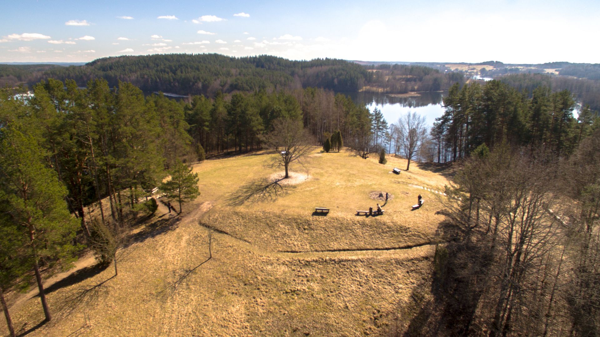
## Description Ladakalnis is a scenic hill in northeastern Lithuania, celebrated for panoramic views that sweep across a chain of lakes, boglands, and mixed forest typical of the Aukštaitija region. The hill’s exposed viewpoints reveal an interlocking pattern of water and woodland that feels deeply characteristic of the Baltic landscape—quiet lakes framed by birch and pine, rippling reed beds, and a largely undeveloped horizon that invites contemplative walks and photography. Beyond its scenic value, Ladakalnis carries cultural resonance. Historically a meeting place and, in local traditions, associated with pre-Christian ritual activities, the hill has hosted small folklore events and seasonal gatherings through the centuries. Modest archaeological traces nearby suggest long-term human use of the area, while modern conservation efforts keep the trails accessible and the ecosystem intact. Visitors come for sunrise and sunset views, birdwatching, and gentle hikes that do not require advanced equipment but repay visitors with memorable vistas. ## Location Ladakalnis sits near the town of Ignalina in Utena County, northeastern Lithuania, within the broader area associated with Aukštaitija National Park and its lakes. The region is popular with nature enthusiasts for its clean waters, preserved shorelines, and well-managed recreational infrastructure. Access is easiest by car from Ignalina or nearby towns; local roads and signage lead to modest parking areas close to the trailhead. Public transport options may include regional buses to Ignalina, after which a short taxi ride or arranged shuttle can bring you to the site. Because the area is rural, plan transfers in advance if you do not have a private vehicle. ## Tips - **Time your visit for light and solitude:** Sunrise and late afternoon provide the best light for photography and the calmest atmosphere. - **Bring optics and field guides:** Binoculars and a basic bird or plant guide enhance the experience for birdwatching and identifying regional flora. - **Wear good footwear:** Paths can be rocky and uneven in places—sturdy shoes or trail runners are recommended. - **Pack essentials:** Carry water, snacks, and weather-appropriate layers; top facilities may be limited. - **Combine with nearby nature activities:** Pair this short hike with a boat excursion, a canoe trip, or additional trails in Aukštaitija National Park for a fuller outdoor itinerary. ## Conclusion Ladakalnis is an inviting short excursion that rewards modest effort with expansive Baltic panoramas. It’s well suited for photographers, families, and hikers seeking a contemplative outdoor experience anchored in both scenic beauty and local tradition. ## FAQ - **Q: How difficult is the hike to the summit?** A: The walk is moderate and accessible to most visitors with basic fitness; trail length and gradient are manageable but wear suitable footwear. - **Q: Are the trails clearly marked?** A: Local paths and signage guide visitors to the viewpoint, though markers can be sparse in places—carry a map or GPS track if you prefer added reassurance. - **Q: Is camping allowed near Ladakalnis?** A: Wild camping is generally discouraged in protected zones—use established campsites in Aukštaitija National Park and follow local regulations. - **Q: When is the best time for birdwatching?** A: Spring migration and early summer offer abundant bird activity; dawn and dusk are particularly productive for raptors and waterbirds. - **Q: Are there restroom or food facilities?** A: Facilities at the top are limited. Plan to bring water and snacks or return to nearby towns for services. ## Links -- [Ladakalnis](https://www.aparkai.lt/en/sightseeing-places/ladakalnis/)
GemVoyage Team • World
Boa Vista
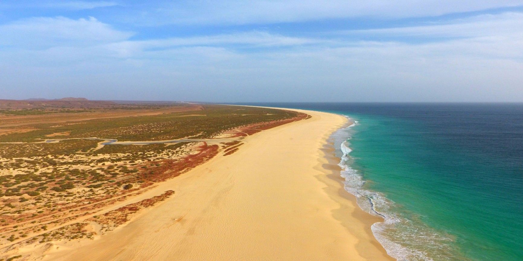
## Description Praia de Santa Mónica is often described as one of the most beautiful beaches in the world—and with good reason. Stretching over 18 kilometers along the southern coast of Boa Vista, Cape Verde, this vast expanse of golden sand and turquoise water remains almost untouched by development. Its name, “Santa Mónica,” was inspired by California’s famous beach, yet its charm lies in its wild and pristine character. The beach is unique because of its sheer size and tranquility. Unlike other popular destinations, Praia de Santa Mónica rarely feels crowded, even during peak travel seasons. Visitors are treated to panoramic views of rolling dunes, crystal-clear waves, and endless horizons. The beach is also known for being a nesting site for sea turtles, particularly the endangered Caretta caretta (loggerhead turtle). During nesting season, guided tours allow travelers to observe these creatures responsibly, making for a truly unforgettable experience. A little-known fact is that the beach is part of the Morro de Areia Nature Reserve, a protected area aimed at conserving both marine and terrestrial biodiversity. This adds an extra layer of significance for those seeking eco-friendly and sustainable travel experiences. ## Location Praia de Santa Mónica is located on the island of **Boa Vista**, one of the ten main islands of **Cape Verde**, an archipelago off the west coast of **Africa** in the Atlantic Ocean. The beach lies on the southwestern coast of Boa Vista, approximately 20 kilometers from the island’s capital, Sal Rei. To reach Praia de Santa Mónica, most visitors first arrive at Aristides Pereira International Airport (BVC) in Boa Vista. From there, taxis or guided tours can take you to the beach in around 40 minutes. Since public transport is limited on the island, arranging private transfers or joining an organized excursion is recommended. Off-road vehicles are often used, as some roads to the beach remain unpaved, adding a sense of adventure to the journey. ## Tips * **Bring essentials:** There are few facilities on-site, so pack water, snacks, sunscreen, and shade if you plan to spend several hours there. * **Swimming caution:** While the water looks inviting, currents can sometimes be strong. Check local conditions before swimming and stick to calmer areas. * **Best time to visit:** Early morning or late afternoon provide not only cooler temperatures but also the most stunning light for photography. * **Turtle watching:** If visiting between June and October, book a guided turtle-watching excursion to witness the nesting or hatching process. These tours are regulated to ensure the animals are not disturbed. * **Respect the environment:** Stay on marked paths to protect dunes and wildlife, and avoid leaving litter behind. * **Combine with a tour:** Many excursions include stops at Santa Mónica along with other highlights of Boa Vista, such as the Viana Desert or the shipwreck of Cabo Santa Maria. ## Conclusion Praia de Santa Mónica in Cape Verde is a destination for those seeking unspoiled beauty, peace, and a connection with nature. With its endless sandy shores, rich biodiversity, and breathtaking views, it offers a paradise-like escape far removed from crowded tourist resorts. For travelers looking to experience Cape Verde at its most authentic, this beach is an absolute must. ## FAQ **1. Is Praia de Santa Mónica suitable for families?** Yes, families can enjoy the wide sandy beach, but parents should monitor children closely when swimming due to occasional strong currents. **2. Are there restaurants or shops nearby?** No, the beach is largely undeveloped. It’s best to bring supplies from Sal Rei or your hotel before heading there. **3. How long should I plan to spend at the beach?** Many visitors spend a half-day to enjoy the scenery and relax, but nature lovers and photographers often stay longer. **4. Is it possible to surf or kiteboard at Santa Mónica?** The beach can offer good waves, but it’s less developed for water sports than other parts of Boa Vista. Consult local guides if you’re looking for surfing or kitesurfing opportunities. **5. Can I see turtles on my own?** For conservation reasons, turtle watching should only be done with licensed guides. This ensures the safety of both the turtles and visitors. **6. What’s the best way to get there?** The easiest way is by booking a taxi or an organized 4x4 tour from Sal Rei or your resort. Public transport does not reach the area. ## Links * [Cape Verde Tourism Official Site](https://www.visit-caboverde.com) * [Boa Vista Tourism Guide](https://www.boavistaofficial.com)
GemVoyage Team • World

Comments