GemVoyage Team • World
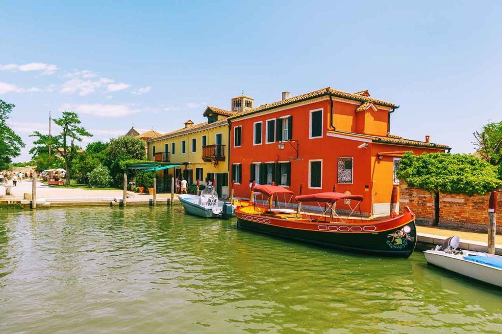
One of the most important sights on the island is the Cathedral of Santa Maria Assunta, known for its remarkable early Christian mosaics. Those mosaics are among the most valuable artistic treasures in the lagoon and are a major reason historians and art lovers make the trip. Another detail many visitors find surprising is that Torcello was once far more important than it is today; it played a key role in the region long before many other lagoon settlements rose to prominence. That history gives the island a haunting, almost forgotten beauty.
The best way to get there is by combining the visit with Burano or another nearby lagoon island. That makes the transit feel efficient and gives you a better sense of the lagoon geography. Torcello is not a place you rush through by car or taxi; the slower ferry rhythm is part of its charm.
Discover more hidden gems you might love.

Socotra
## Description Socotra Island feels like a fragment of another planet — a remote, windswept archipelago in the northwest Indian Ocean whose flora and landscapes defy easy comparison. Part of Yemen’s Socotra Archipelago, the island is famed for its unique biodiversity: roughly one-third of its plant species are endemic, meaning they occur nowhere else on Earth. The emblematic dragon’s blood tree (Dracaena cinnabari) with its umbrella-like silhouette and deep red sap has become a symbol of Socotra’s otherworldly charm. Across the island, landscapes alternate between bizarre limestone plateaus, dramatic sea cliffs, windswept sand flats and pristine white-sand beaches framed by coral reefs. The experience of Socotra is defined by its isolation. Thousands of years of relative climatic stability have allowed life to evolve along separate lines, producing a cast of plants and small reptiles adapted to arid conditions and shallow soils. Visitors remark on the sculptural shapes and strange textures of the vegetation: bulbous succulents, twisted bottle trees, and dense thorny thickets that host endemic birds and invertebrates. This is a place for slow observation — botanizing on rock-strewn plateaus, watching seabirds along cliffs, and learning how local communities have adapted pastoral and fishing traditions to the island’s rhythms. Beyond flora and fauna, Socotra offers an immersive cultural layer. The island’s towns and villages, led by the main hub of Hadibo, display a traditional way of life that blends Bedouin pastoralism with fishing and small-scale commerce. Over the past decade eco-tourism has grown carefully: small guesthouses and locally guided tours emphasize conservation and community benefit. For the adventurous traveler the island’s remote tracks, sea caves and beaches promise solitude and dramatic light, perfect for landscape photography, contemplative walking and quiet wildlife encounters. ## Location Socotra is located in the northwest Indian Ocean, administratively part of Yemen, lying closer to the Horn of Africa than to the Arabian mainland. The island’s primary settlement and logistical hub is Hadibo (sometimes spelled Hadibu) on the northern coast. Historically, reaching Socotra has required careful planning: flights are limited and schedules change with political and logistical conditions. When available, small charter flights connect Socotra with mainland Yemen and, occasionally, regional hubs; sea access — via carefully arranged boat charters or local vessels — is an alternative for those with flexible timing. Because access can be intermittent, most independent travelers book through experienced operators who handle permits, inter-island travel, and local liaison. Visitors should check visa requirements and entry permits well in advance, and factor in contingency days for travel delays. Once on the island, Hadibo serves as the staging point for day trips inland to the Dixam Plateau, the Hagghier Mountains, and coastal excursions to remote beaches and snorkeling sites. ## Tips - **Check travel advisories and logistics:** Socotra’s access and safety status can change with regional developments. Before planning, consult official travel advisories, contact tour operators, and verify flight or sea schedules. Leave buffer days in your itinerary for unexpected delays. - **Use licensed local guides and operators:** Knowledgeable local guides are essential for navigating rocky tracks, interpreting plant life, and arranging transport to remote sites. Hiring local guide services supports the economy and ensures respectful interaction with communities. - **Respect fragile ecosystems:** Much of Socotra’s ecology is fragile. Stick to established tracks, avoid trampling vegetation, do not remove plants or geological material, and use minimal-impact camping practices. - **Pack for varied conditions:** Inland plateaus and mountains can be hot and dry during the day and chilly at night; coastal winds can be strong. Bring sun protection, sturdy hiking boots, a light windproof layer, and a reusable water bottle with a reliable purification method. - **Plan photography and drone use carefully:** Drones may be restricted to protect wildlife and privacy. Always ask local guides about regulations and cultural sensitivities before using camera equipment. - **Health and safety:** Medical facilities on Socotra are basic. Carry a well-stocked first-aid kit, any personal medications, and consider travel insurance with emergency evacuation coverage. Be up to date on routine vaccinations and check for recommended travel vaccines. - **Support local communities:** Choose guesthouses and guides that employ local staff, buy produce and crafts locally, and respect local dress and customs in villages. ## Conclusion Socotra is a destination for travelers who seek radical otherness and ecological rarity. Its alien plant forms, remote beaches, and quiet villages offer an experience both humbling and exhilarating — a reminder of how geographic isolation shapes life in remarkable ways. Thoughtful visitors who arrive well-prepared will find a landscape rich with photographic opportunities, quiet hiking routes, and meaningful encounters with local people and culture. Above all, Socotra rewards patience: time spent watching a dragon’s blood tree silhouette against the sky, or exploring a limestone plateau at dusk, lingers long after the trip ends. ## FAQ - **Q: Is Socotra safe to visit?** A: Safety and access can vary with regional and political conditions. Check up-to-date government travel advisories, consult experienced operators who run tours to Socotra, and register your travel plans with your embassy when appropriate. - **Q: How long should I spend on Socotra?** A: A well-paced visit typically runs 6–10 days. This allows time to explore the Dixam Plateau, the Hagghier Mountains, coastal beaches and a few village visits without feeling rushed. - **Q: When is the best time to visit Socotra?** A: The most comfortable travel window is during the cooler months, roughly October through April. Monsoon-related weather and hot summer temperatures can make travel more difficult in other months. - **Q: Can I arrange independent travel or do I need a tour operator?** A: Because flights and permits are limited, most travelers use reputable operators who arrange logistics, guides and permits. Independent travel is possible but requires local contacts and contingency planning. - **Q: What should I bring for wildlife and landscape photography?** A: Bring a mid-range zoom lens, a wide-angle for landscapes, a sturdy tripod for low-light work, spare batteries and memory cards, and neutral-density filters for coastal long exposures. - **Q: Are there accommodations and food options on the island?** A: Hadibo has small guesthouses and basic restaurants; expect simple but hearty local meals. For remote camping or multi-day excursions, operators typically supply food and equipment — confirm details beforehand. ## Links - [Socotra — Wikipedia](https://en.wikipedia.org/wiki/Socotra)
GemVoyage Team • World

Uyuni
## Description The Salar de Uyuni in Bolivia is the world’s largest salt flat — an immense expanse of white crust stretching to the horizon. In the dry season it becomes a seemingly endless plain of hexagonal salt polygons; during the wet season, thin water turns the surface into a giant mirror that reflects sky and clouds in breathtaking panoramas. The flats’ surreal scale creates optical illusions that photographers exploit for creative forced-perspective shots and astronomical impressions. Uyuni’s uniqueness stems from its scale and seasonal transformation: an austere white desert that alternates between reflective glass and textured salt crust. Beneath the crust lie rich lithium brines that have become geopolitically important, and the region supports unique high-altitude wildlife including flamingos in nearby lagoons and vicuñas on the surrounding altiplano. A lesser-known feature is the train cemetery near Uyuni town, whose rusting locomotives echo the area’s industrial past against the vast natural backdrop. Visitors experience two very different seasons: the wet months (roughly December–April) turn the flats into a seamless mirror where the horizon disappears, producing surreal photographic opportunities; the dry months (May–November) reveal the networked hexagonal salt polygons and easier vehicle travel across firmer crust. Both seasons offer remarkable visual experiences, but logistics and vehicle access differ significantly. ## Location Salar de Uyuni is in southwest Bolivia near the town of Uyuni in Potosí Department. Most visitors begin in Uyuni and travel by 4x4 tours that range from day-trips to multi-day circuits visiting colored lagoons, hot springs, high-altitude deserts and remote salt hotels. ## Tips - **Choose season based on photographic goals:** Wet season for mirror reflections and dynamic sky photography; dry season for crisp salt polygons and easier driving conditions. - **Acclimatize and dress for altitude:** Uyuni sits over 3,600 m above sea level—allow time to adjust, stay hydrated and use sun protection. Nights are cold; warm layers are essential. - **Book reputable 4x4 operators and confirm vehicle safety:** Select experienced guides who understand remote driving, fuel logistics and high-altitude first aid. - **Plan for basic accommodations on multi-day tours:** Many overnight stops are simple lodges or salt hotels; bring essentials and respect eco-guidelines. - **Protect camera gear from salt and dust:** Use protective coverings, and clean equipment carefully after excursions to avoid salt corrosion. ## Conclusion Salar de Uyuni is an elemental landscape that redefines scale and reflection: a place where sky, salt and solitude combine to produce unforgettable visual experiences. Whether you chase inverted skies in the wet season or striding across crystalline salt in the dry months, Uyuni offers some of the planet’s most surreal and photogenic landscapes. ## FAQ - **Q: Can visitors drive across the Salar de Uyuni themselves?** A: Self-driving is possible but not recommended for first-time visitors—conditions vary, and poorly marked hazards or seasonal flooding can be dangerous. Use experienced local operators who know safe routes. - **Q: When is the best time for mirror reflections?** A: The wet season (roughly December–April) after rains produces the mirror effect; brighter skies and calm days improve reflections. - **Q: Will I experience altitude sickness at Uyuni?** A: Many travelers experience mild altitude effects; acclimatize in Uyuni or nearby towns, avoid heavy exertion on the first day and consider consulting a doctor if you have pre-existing health concerns. - **Q: Are there eco or cultural concerns to be aware of?** A: Respect fragile ecosystems and local communities; use operators who practice sustainable tourism and avoid leaving waste on the salt crust. - **Q: How many days do I need to appreciate the area?** A: Day trips are possible, but 3–4 day circuits are recommended to reach colored lagoons, hot springs and the Eduardo Avaroa reserve, giving a fuller, less rushed experience. ## Links - [Salar de Uyuni — Wikipedia](https://en.wikipedia.org/wiki/Salar_de_Uyuni)
GemVoyage Team • World
Stockholm
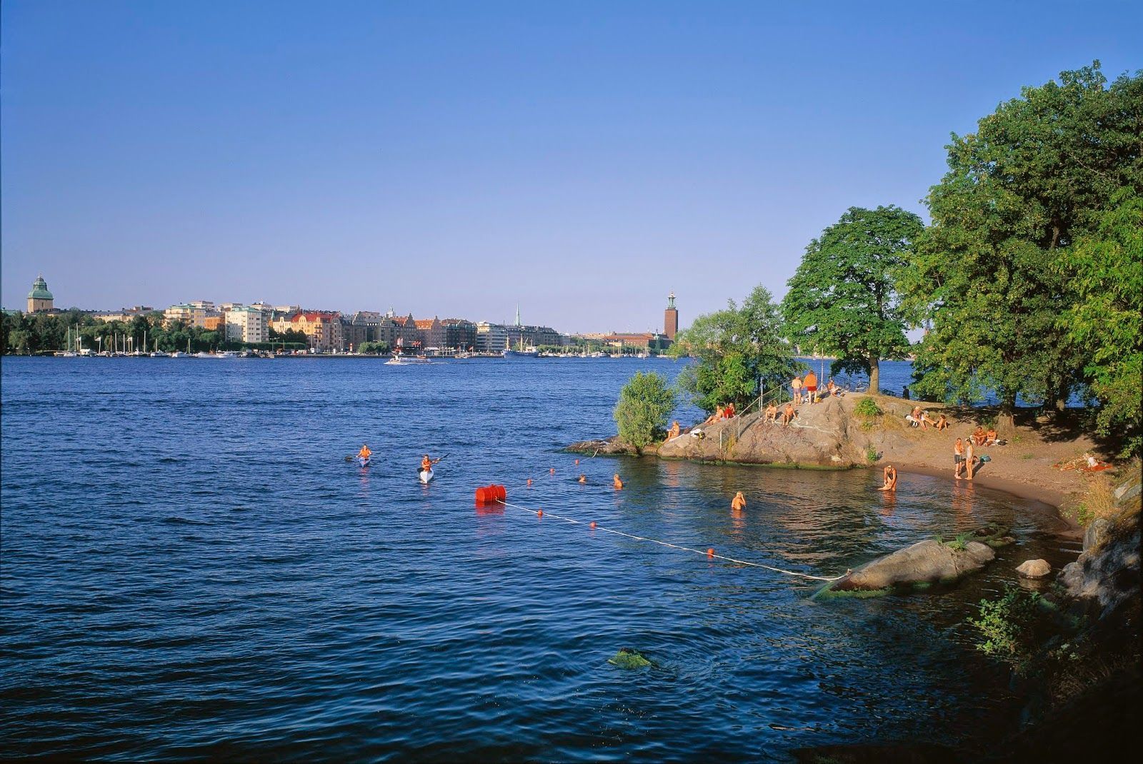
## Description Långholmen Island Beach is one of Stockholm’s most appealing summer spots because it combines waterfront relaxation with the unusual character of an island that has shifted through different uses over time. Visitors come for swimming, sunbathing, walking, and the easygoing atmosphere, but the experience is richer than a simple beach stop. The setting itself is part of the attraction: you are on an island close to the city, surrounded by water, greenery, and reminders of Stockholm’s layered history. What makes Långholmen stand out is that it feels local rather than overly polished. It is a place where residents and visitors mingle in warm weather, where people arrive with towels, picnic food, and a plan to stay for a while. It is not a tropical beach and does not try to be one; instead, it offers a distinctly Scandinavian urban waterfront experience. One lesser-known fact is that Långholmen has had very different historical roles before becoming a leisure destination, which gives the island an added sense of depth. Another interesting detail is that the area’s appeal changes dramatically by season, making it a true summer favorite in a city where outdoor life depends heavily on weather. The beach is also a good example of how Stockholm uses its water environment. Rather than separating city life from the shoreline, the city often integrates swimming and walking areas into the urban fabric. Långholmen captures that idea perfectly. You can spend time on the beach, wander nearby paths, and still feel close to the city center. For travelers, that makes it a convenient and memorable place to balance sightseeing with rest. ## Location Långholmen is a small island in central Stockholm, Sweden, connected to the city by bridges and easy to access from the Södermalm side and other central districts. Because it is so close to the urban core, it is one of the easiest island experiences in Stockholm. The simplest way to get there is by walking from nearby central neighborhoods or using public transport and then continuing on foot. Cycling also works well in Stockholm, and the island fits nicely into a bike-friendly itinerary. Once there, most of the movement is best done on foot so you can enjoy the shoreline and the surrounding green areas at an unhurried pace. ## Tips This is best visited in warm weather, especially in late spring and summer. Bring swimwear if you want to use the beach properly, but also bring a layer for cooler winds. Combine the visit with a walk around the island so you see more than just the main swimming area. Arrive earlier on sunny days if you want a quieter spot near the water. ## Conclusion Långholmen Island Beach is a relaxed city escape that gives Stockholm a rare but very welcome summer beach mood. ## FAQ ### Is Långholmen a real beach? Yes, though it is a city beach rather than a large natural seaside beach. ### Is it good for swimming? Yes, it is one of Stockholm’s popular places for summer swimming. ### How do I get there from central Stockholm? Walk, bike, or use public transport and then cross to the island on foot. ### Is it busy in summer? It can be, especially on warm weekends and sunny afternoons. ### Can I visit outside summer? Yes, but it is most enjoyable as a beach destination in the warmer months. ## Links - [Stockholm official visitor information](https://www.visitstockholm.com/) - [Långholmen on Wikipedia](https://en.wikipedia.org/wiki/Långholmen)
GemVoyage Team • World
Hong Kong
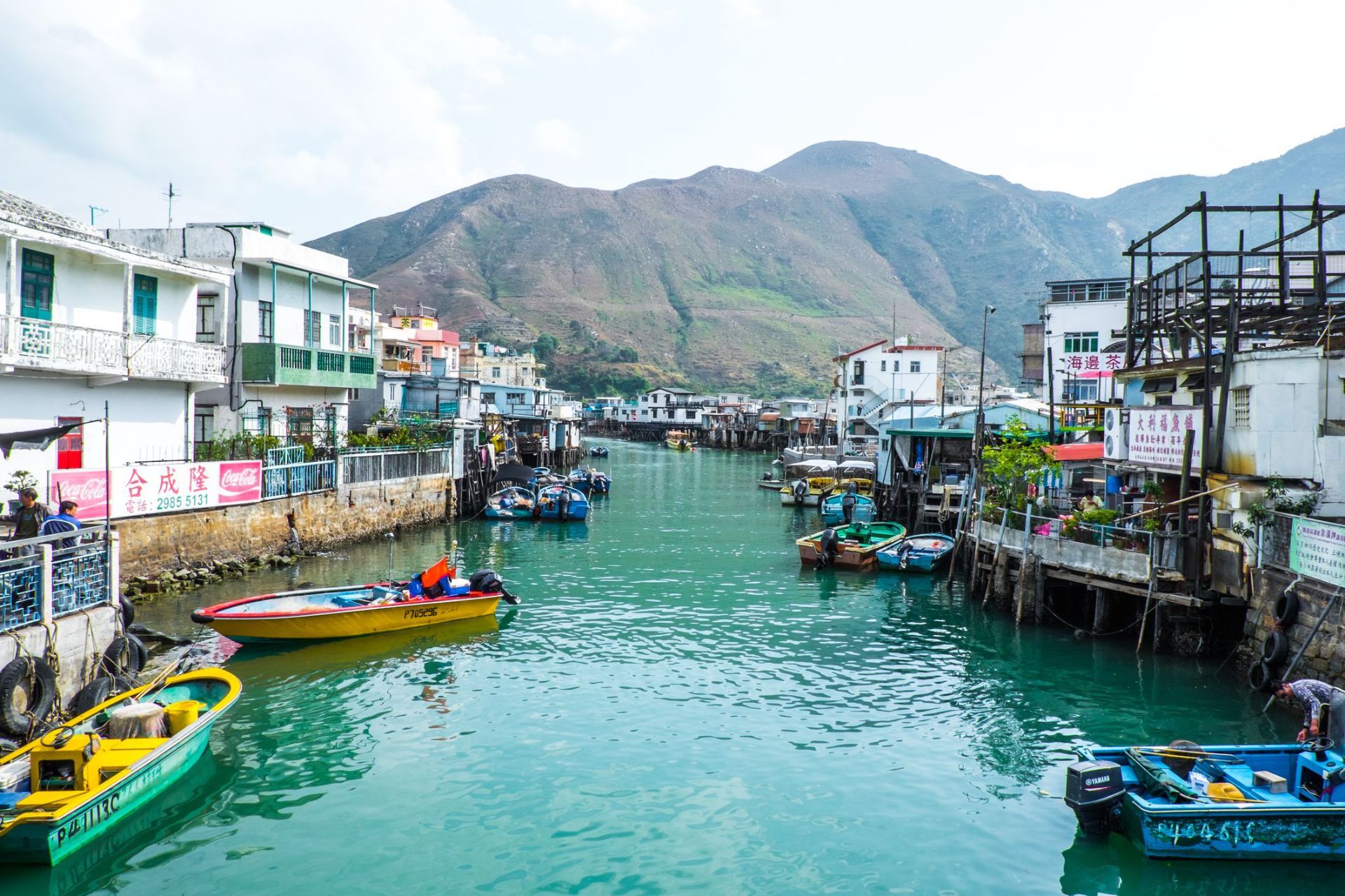
## Description Tai O Fishing Village is one of the most atmospheric places in Hong Kong because it preserves a way of life that feels very different from the city’s skyscraper identity. Located on the western side of Lantau Island, Tai O is known for its stilt houses, narrow waterways, fishing heritage, and the sense that time moves more slowly here than in Hong Kong's urban core. For travelers looking for a place that combines cultural history, coastal scenery, and a strong local character, Tai O delivers all three in a single visit. The village is especially distinctive because it has kept much of its fishing-community layout, even as Hong Kong developed around it. The stilt houses, built above tidal waters and connected by wooden walkways, create a visual landscape that is unique in the region. Boat traffic still matters here, seafood is still central to the local economy, and the village still feels shaped by the rhythms of sea and tide. In the early morning, Tai O can feel hushed and contemplative. Later in the day, it becomes more animated as day visitors arrive, shops open, and boats move in and out of the channels. A little-known fact is that Tai O has long been associated with salt production and trade, not just fishing. Another detail many visitors miss is the old village fortifications and temple structures that reflect how communities once protected themselves from pirates, storms, and the uncertainties of coastal life. The area is therefore not simply picturesque; it is historically layered and reveals a deeper story about how people adapted to Hong Kong's shoreline before modern development changed the coastline. The food here is another major reason to visit. Dried seafood, shrimp paste, sweet treats, and simple local dishes are part of Tai O’s identity, and they help visitors understand how the village economy worked for generations. Even if you only spend half a day here, Tai O can feel like a complete change of pace from the rest of Hong Kong, offering a mixture of water, heritage, and community that is increasingly rare. ## Location Tai O Fishing Village is on the western side of Lantau Island in the Hong Kong Special Administrative Region of China. It sits in the Islands District, far from the dense business cores of Hong Kong Island and Kowloon, which is part of what preserves its quieter character. Because it is not on a major rail line, getting there takes a little planning, but that is also what helps keep the area special. The usual route is to travel by MTR to Tung Chung and then continue by bus toward Tai O. This combination is the most practical for most visitors and gives you a smooth connection from the city’s main transport network. Ferries and cable car routes may also be part of a longer day trip if you are combining Tai O with other parts of Lantau Island. If you prefer a more relaxed pace, many travelers visit as part of a full-day itinerary that includes Ngong Ping and the Big Buddha before continuing to Tai O in the afternoon. Once you arrive, much of the village is best explored on foot, though local boat rides are a memorable way to see the stilt houses from the water. Because the village is compact, it is easy to cover the main areas without rushing, but you should allow extra time for food stops, photographs, and slow wandering. ## Tips Visit early in the day or late in the afternoon if you want softer light and fewer crowds. Midday can be busy, especially on weekends and public holidays, and the village is at its best when you can move slowly and take in the details. Take a boat ride if your schedule allows. Seeing Tai O from the water gives you a better sense of how the stilt houses, waterways, and fishing infrastructure fit together. It also helps explain why the village developed the way it did. If you only walk the streets, you still get a strong impression, but the boat perspective adds depth. Try local snacks and dried seafood, but do so with curiosity rather than haste. Many travelers rush through Tai O, take a few photos, and leave without understanding the food culture that has shaped the village for years. Sampling something local makes the visit more meaningful. Wear comfortable shoes and bring sun protection. Tai O is relatively easy to walk, but the experience is more enjoyable when you are prepared for heat, humidity, and a fair amount of time outdoors. If the weather looks unstable, check conditions before you go, since coastal villages are more sensitive to storms and heavy rain. ## Conclusion Tai O Fishing Village offers a rare glimpse of Hong Kong's coastal past, with stilt houses, local food, and a slower rhythm that gives the village a memorable sense of place. ## FAQ ### Why is Tai O famous? Tai O is famous for its stilt houses, fishing heritage, scenic waterways, and its reputation as one of the last traditional fishing villages in Hong Kong. ### How long should I spend in Tai O? Most visitors spend half a day to a full day, depending on whether they plan to add boat rides, food stops, or nearby Lantau attractions. ### Is Tai O easy to reach from central Hong Kong? It takes some planning, but it is straightforward by taking the MTR to Tung Chung and then continuing by bus. ### What should I eat in Tai O? Try local seafood snacks, dried seafood products, and village specialties from small shops and street-side vendors. ## Links - [Discover Hong Kong](https://www.discoverhongkong.com/) - [Wikipedia article](https://en.wikipedia.org/wiki/Tai_O)
GemVoyage Team • World
Varėna
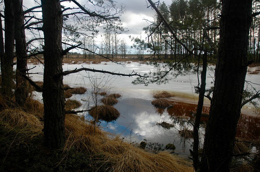
## Description Čepkeliai Raised Bog is among Lithuania’s most important peatland reserves, an expansive raised bog that feels at once remote and intimate. Its surface is a subtle patchwork of sphagnum hummocks, shallow pools, and scattered stunted pines; that patterning creates a fragile, otherworldly landscape that changes color and mood with the light. For naturalists and quiet travelers the bog offers a concentration of specialized habitats where rare mosses, sedges, and lichens flourish alongside insect life and bird species adapted to waterlogged peat. Beyond its visible beauty, Čepkeliai is scientifically invaluable. The peat layers here have accumulated over millennia, trapping pollen, seeds, and macrofossils that give researchers a continuous record of past vegetation and climate. That archive helps reconstruct regional environmental history and informs conservation decisions today. The bog’s intact hydrology—its network of raised surfaces and water-filled hollows—supports unique ecological processes, from specialized plant communities to breeding cycles for rare birds. Although the terrain looks invitingly wild, it’s also extremely fragile. Walking off designated paths can crush sphagnum carpets and disturb microhabitats that take decades to recover. To balance access with protection, visitation in Čepkeliai is carefully managed: boardwalks, observation platforms, and tightly controlled trails concentrate human presence on durable surfaces and minimize harm. This measured approach preserves the bog’s ecological integrity while still allowing people to experience its unusual beauty and quiet drama. For photographers, botanists, and birdwatchers the bog offers intimate encounters with species and textures rarely seen outside specialized reserves. In spring and summer, sunlit pools mirror cloudscapes and dragonflies patrol the grassy margins. Autumn brings a palette of muted reds, golds, and moss greens; winter covers the place in a hush of snow and ice that highlights the bog’s sculptural shapes. Guided walks—often led by local naturalists—are invaluable for understanding the subtle signs of bog life and the reasons for strict protection. ## Location Čepkeliai Bog is located in southern Lithuania, near the town of Varėna in Alytus County, within the larger Dzūkija region. It sits in a sparsely populated, forested landscape that reinforces the sense of remoteness. The reserve forms part of Lithuania’s system of protected areas and is managed to conserve both its natural features and the scientific information contained within its peat layers. How to get there: the most practical route for independent travelers is to drive from Varėna, following local roads into the reserve’s access points. Some conservation organizations and local guides run organized excursions from Varėna and nearby towns; these are often the best option if you don’t have a car. Public transport options are limited and may require additional local transfers and walking; if you rely on buses, plan carefully and allow extra time. In many cases, visiting with an experienced guide not only eases logistics but also improves the interpretive experience—guides can point out rare species and explain the bog’s geological story. ## Tips - Stay on boardwalks, platforms, and marked trails—stepping onto soft peat damages the vegetation and disrupts hydrology. - Wear waterproof, sturdy footwear; some approaches are muddy even in summer, and the boardwalks can be damp. - Bring binoculars and a field guide (plants, birds, insects) to make the most of wildlife spotting opportunities. - Visit in the early morning or late afternoon for the best light and more active bird life; midday can be quieter for wildlife. - Book guided walks where available—local guides provide historical and ecological context and reduce your impact. - Respect seasonal closures and nesting zones; some areas close during bird breeding seasons to protect sensitive species. - Travel light and pack out any litter; even biodegradable waste can alter nutrient cycles in peat ecosystems. ## Conclusion Čepkeliai Raised Bog rewards visitors who slow down and look closely. It is a living archive and sanctuary where the physical landscape—peat layers, patterned pools, and sphagnum carpets—holds stories of centuries of changing vegetation and climate. Visiting responsibly, on boardwalks and under guidance, reveals a quiet world of specialized life and an ecological history that connects modern conservation to deep time. ## FAQ Q: Can I walk freely in the bog? A: No. To protect delicate peat and the species that depend on it, walking is restricted to boardwalks and designated trails. Off-trail access is prohibited in many areas. Q: Are guided tours available? A: Yes. Organized guided nature walks are often offered by conservation groups or local guides; they improve the experience and reduce ecological impact. Q: When is the best time to visit for wildlife viewing? A: Spring and early summer are excellent for bird activity and insect life; early morning and late afternoon offer better sightings and softer light for photography. Q: Is the bog safe for solo visitors? A: The area is generally safe, but the remoteness and fragile terrain mean solo visits are best for experienced, well-prepared hikers; joining a guided walk is recommended for most visitors. Q: Can I take photographs or drones in the reserve? A: Photography from boardwalks and platforms is usually permitted; drones are commonly restricted to prevent disturbance—check reserve rules in advance. Q: Are there facilities nearby? A: Facilities are limited; plan for basic needs (water, layers, footwear) and expect minimal infrastructure near the main access points. ## Links - [Čepkeliai (Wikipedia)](https://en.wikipedia.org/wiki/%C4%8Cepkeliai)
GemVoyage Team • World
Ontario
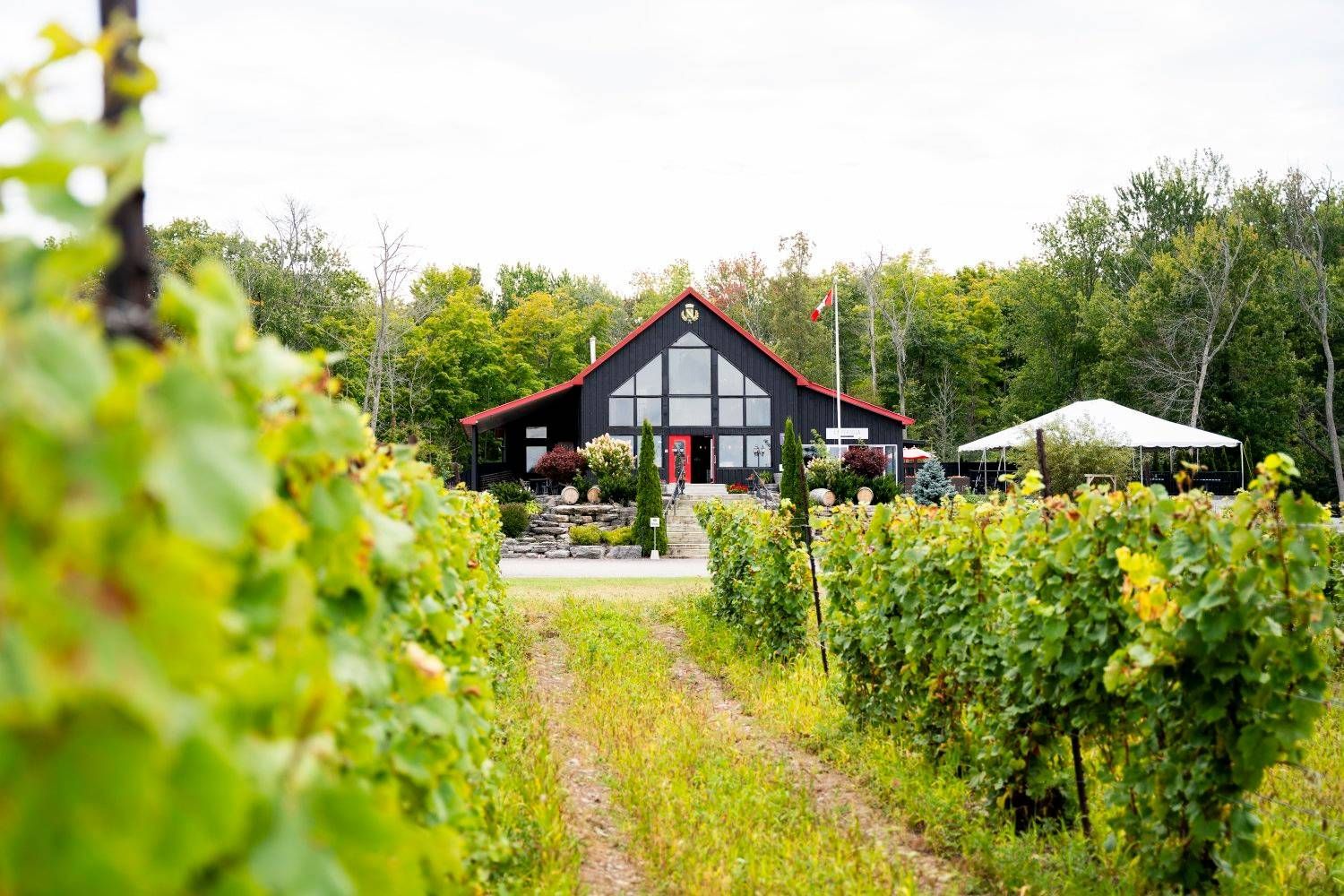
## Description Prince Edward County has become one of Ontario’s most appealing wine destinations, and its wineries are a major reason travelers now plan weekends and day trips to the region. The county combines vineyards, rural roads, lake air, farm landscapes, and a growing food culture into an experience that feels refined without losing its laid-back provincial charm. Unlike a single attraction, the wineries of Prince Edward County function as a connected landscape, where each stop contributes to a broader sense of place. What makes the area special is the relationship between wine and setting. The county’s cool-climate conditions help shape the style of wine produced here, and the region’s open fields and lakeside influence make the scenery especially enjoyable between tastings. Visitors often come for Chardonnay, Pinot Noir, sparkling wine, and other locally produced bottles, but the deeper reward is the way the entire county has developed around small producers, hospitality, and a slower pace of travel. One little-known fact is that Prince Edward County’s wine scene feels young compared with some global wine regions, yet it has gained a strong reputation because of the quality of its producers and the distinct character of the landscape. Another detail that many first-time visitors notice is how much the county encourages a full-day or weekend rhythm. The wineries are best enjoyed when you allow time for scenic driving, lunch, and perhaps an overnight stay rather than trying to compress everything into a short stop. The experience also works well for travelers who are not wine experts. You do not need technical knowledge to appreciate the hospitality, the rural atmosphere, and the chance to sample local production in a beautiful setting. Prince Edward County is one of those destinations where the landscape and the tasting room experience strengthen each other. Even travelers who visit mostly for food, photos, or a relaxing escape often come away with a deeper appreciation for Ontario wine country. ## Location The wineries are spread throughout Prince Edward County in Ontario, Canada, an island-like peninsula region on Lake Ontario northeast of Toronto. The county is most practical to visit by car, since the wineries are dispersed and the enjoyment comes from moving between them at your own pace. Public transport is limited for this type of trip, so driving is by far the most convenient option. Prince Edward County is close enough for a weekend from Toronto or other parts of southern Ontario, but the drive is long enough that many visitors prefer to stay overnight. Doing so gives you a better chance to enjoy tastings responsibly and explore the county’s food, small towns, and lakeside scenery. Once you arrive, winery visits can be paired with restaurants, farm shops, beaches, and scenic routes. ## Tips Plan transportation carefully if you intend to taste multiple wines. Designate a driver, book a tour, or arrange another safe transportation method before you begin. The county is spread out enough that responsible planning matters. Choose a few wineries instead of trying to do too many. Part of the charm here is slowing down, not racing from one tasting room to the next. A smaller number of thoughtful stops usually gives a better experience than an exhausting checklist. Book in advance when possible. Popular producers, weekend slots, and special tasting experiences can fill quickly, especially during peak travel seasons. Reservations can make the day smoother and prevent disappointment. Leave time for food and scenery. The county is as much about the wider setting as the wine itself. Adding lunch, a drive through rural roads, or a short lake-side walk can make the visit feel much more complete. ## Conclusion Prince Edward County’s wineries offer one of Ontario’s most rewarding rural travel experiences, blending quality wine, scenic landscapes, and a relaxed pace. It is a destination that works best when you give it time. ## FAQ ### Do I need to be a wine expert to visit? No. The region is welcoming to casual visitors, and many people enjoy the experience simply as a scenic tasting trip. ### Is one day enough? One day can work for a focused visit, but an overnight stay usually makes the trip much more enjoyable and less rushed. ### Are the wineries family-friendly? Many are welcoming to daytime visitors, but policies vary. It is best to check individual winery rules before bringing children. ### What kinds of wine is the region known for? Prince Edward County is especially respected for cool-climate styles, including sparkling wine and elegant white and red wines. ### Can I visit without a car? It is possible through tours and arranged transport, but a car is the most practical way to see the region’s dispersed wineries. ## Links - [Wikipedia](https://en.wikipedia.org/wiki/Prince_Edward_County,_Ontario)
GemVoyage Team • World

Comments