GemVoyage Team • World
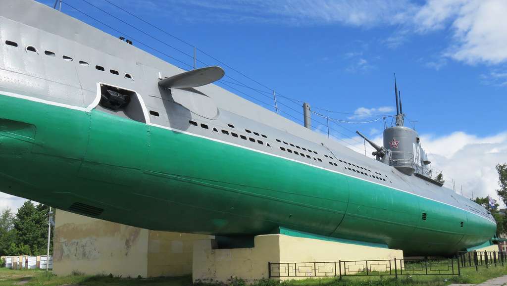
The Narodovolets D-2 Submarine Museum in St. Petersburg is a compelling and immersive tribute to Russia’s naval history, offering visitors a rare opportunity to step inside a real Soviet-era submarine. Commissioned into the Baltic Fleet in 1931, the Narodovolets was one of the first submarines built by the Soviet Union and played a significant role during World War II. It completed four combat missions, launched twelve torpedo attacks, and successfully sank four enemy vessels—an impressive record for its time.
Today, the submarine is mounted in concrete near the Shkiperskiy Canal and serves as a branch of the Central Naval Museum. Visitors can explore its authentic interiors, including the torpedo launcher compartment, engine room, crew quarters, and command center. The museum offers a hands-on experience of life aboard a submarine in the early 20th century, complete with original equipment and detailed exhibits.
A little-known fact: the Narodovolets was named after the revolutionary sailors of the cruiser Aurora, symbolizing the spirit of Soviet naval resilience. Another fascinating detail is that the submarine was preserved and turned into a museum in 1993, making it one of the few surviving vessels of its kind open to the public.
The Narodovolets Submarine Museum is located in Russia, in the Northwestern Federal District, within the city of St. Petersburg. It sits on Vasilyevsky Island, at 10 Shkiperskiy Protok, near the waterfront and within walking distance of the Gulf of Finland.
Its location on Vasilyevsky Island makes it a great addition to a day of exploring St. Petersburg’s maritime and industrial heritage.
The Narodovolets Submarine Museum is a unique and historically rich attraction in St. Petersburg, offering a rare glimpse into Soviet naval warfare and life aboard a WWII-era submarine. With its authentic interiors and compelling exhibits, it’s a must-visit for history enthusiasts and curious travelers alike.
1. What are the opening hours of the Narodovolets Submarine Museum?
The museum is open daily from 10:00 AM to 6:00 PM, except on Mondays and Tuesdays.
2. What is the entrance fee?
Admission is RUB 350 for adults and RUB 200 for students. Photography is free.
3. Is the museum suitable for children?
Children are welcome, but supervision is recommended due to the submarine’s tight spaces and steep ladders.
4. Can I book a guided tour?
Yes, guided tours are available and can be arranged on-site or through the Central Naval Museum.
5. Is the museum wheelchair accessible?
No, the submarine’s design makes it inaccessible for wheelchair users or those with mobility impairments.
6. How long should I plan for a visit?
A typical visit lasts 45 minutes to an hour, depending on whether you join a guided tour.
Discover more hidden gems you might love.
Laos
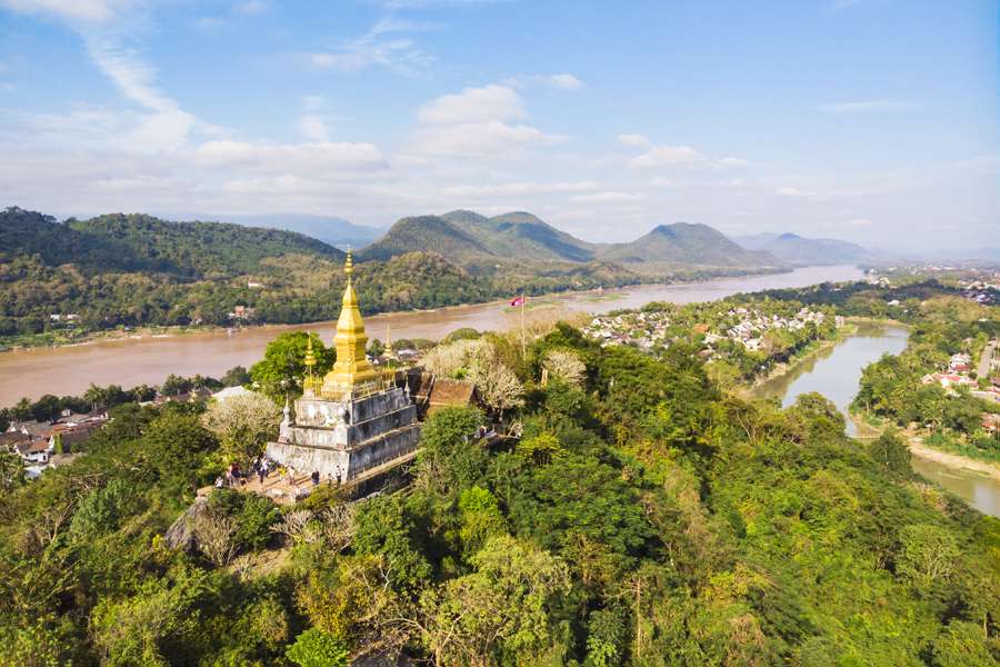
## Description Phou Si, often referred to as Mount Phou Si or Phu Si, is a sacred hill that rises 100 meters above the UNESCO World Heritage city of Luang Prabang in Laos. It’s not just a geographical landmark—it’s a spiritual and cultural centerpiece that offers panoramic views, serene temples, and a glimpse into the soul of Lao Buddhism. The name “Phou Si” translates to “Sacred Hill,” and true to its name, it’s dotted with shrines, Buddha statues, and two prominent temples: Wat Tham Phou Si halfway up, and Wat Chom Si at the summit. The climb to the top involves ascending over 300 steps, but the reward is a breathtaking 360-degree view of Luang Prabang, the Mekong and Nam Khan rivers, and the surrounding jungle-clad mountains. Along the way, saffron-robed monks stroll the leafy paths, incense drifts through the air, and small altars invite quiet reflection. A little-known fact: legend has it that a powerful Naga (a mythical serpent deity) once lived on the hill, adding a mystical layer to its spiritual significance. Another hidden treasure is a small chapel said to house a footprint of the Buddha, tucked along one of the stairways—a detail often missed by hurried visitors. ## Location Phou Si is located in **Laos**, within the **Luang Prabang Province**, in the city of **Luang Prabang**. It sits in the heart of the old town peninsula, bordered by the Mekong River on one side and the Nam Khan River on the other. ### How to Get There: - **By Foot**: Most visitors reach Phou Si by walking from nearby attractions like the Royal Palace Museum or the Night Market. The two main stairways are accessible from Sisavangvong Road and Thanon Phousi. - **By Tuk-Tuk**: If you're staying farther out, a tuk-tuk can drop you off at either entrance. - **By Bicycle**: Luang Prabang is bike-friendly, and cycling to the base of Phou Si is a scenic option. Its central location makes it an easy and essential stop on any Luang Prabang itinerary. ## Tips for Visitors To make the most of your visit to Phou Si, consider these tips: - **Go for Sunset**: The summit offers one of the best sunset views in Laos. Arrive early to secure a good spot—it's popular! - **Bring Water**: The climb can be steep and humid, especially in the afternoon. Hydration is key. - **Wear Comfortable Shoes**: The stairways are uneven in places, so sturdy footwear is recommended. - **Respect the Sacredness**: Dress modestly and be mindful of local customs. Offerings like incense and flowers are available for purchase along the way. - **Explore Both Routes**: Ascend via the Nam Khan side for scenic statues and descend via the Royal Palace side for a shorter walk. - **Entrance Fee**: Expect to pay around 20,000 Kip (~$2.50 USD), collected halfway up the hill. ## Conclusion Phou Si is more than just a viewpoint—it’s a spiritual journey, a cultural experience, and a photographer’s dream. With its sacred temples, mythical legends, and sweeping vistas, it captures the essence of Luang Prabang and offers a moment of peace above the city’s gentle bustle. ## FAQ **1. How many steps are there to reach the top of Phou Si?** There are over 300 steps, depending on the route you take—328 from the Royal Palace side and 355 from the Nam Khan side. **2. What is the best time to visit Phou Si?** Sunset is the most popular time, but early morning offers tranquility and cooler temperatures. **3. Is there an entrance fee?** Yes, the fee is approximately 20,000 Kip, payable halfway up the hill. **4. Can children climb Phou Si?** Yes, but supervision is recommended due to the steep stairways. **5. Are there restrooms or shops at the summit?** No facilities at the top, but vendors sell drinks and offerings near the base. **6. Is Phou Si wheelchair accessible?** Unfortunately, due to the stair-only access, it is not suitable for visitors with mobility issues. ## Links - [Mount Phou Si – Wikipedia](https://en.wikipedia.org/wiki/Phou_Si)
GemVoyage Team • World
Pakistan
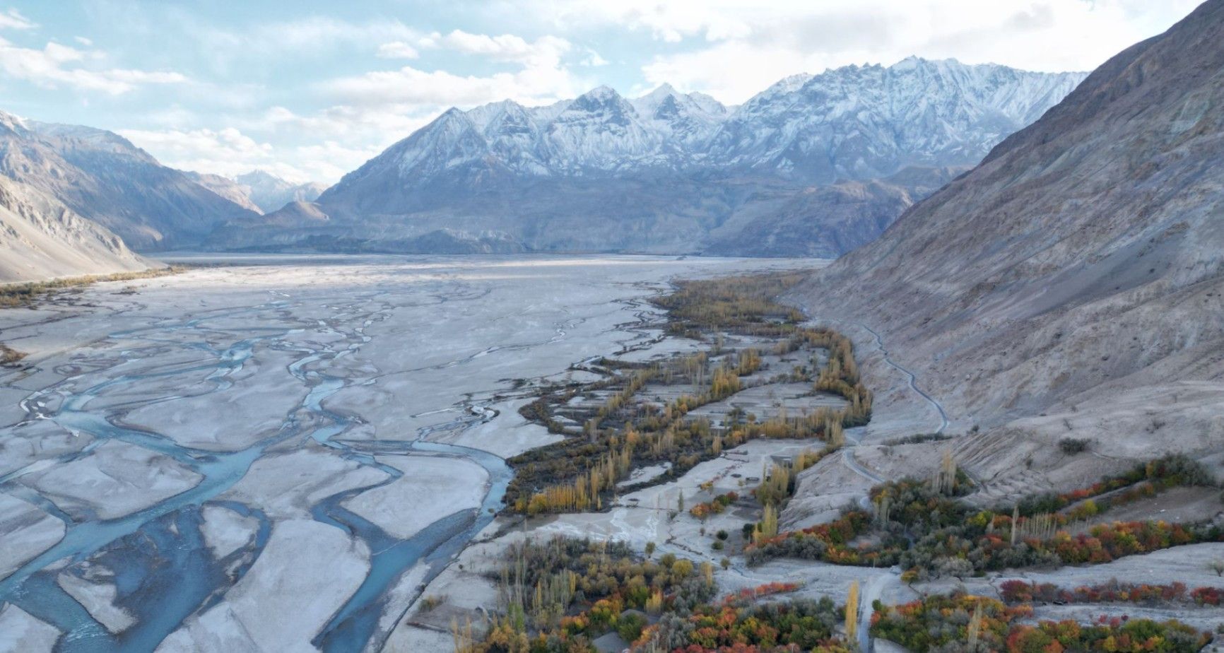
## Description **Nangma Valley**, located in northern Pakistan’s Gilgit-Baltistan region, is a breathtaking alpine valley that remains one of the country’s best-kept secrets. Renowned for its majestic granite spires, lush meadows, and pristine alpine landscapes, Nangma Valley is a paradise for trekkers, climbers, and photographers. What sets Nangma Valley apart is its untouched natural beauty and relative seclusion compared to more famous destinations like Hunza or Skardu. The valley is dotted with soaring rock towers—some over **5,000 meters** high—making it one of the premier destinations for **rock climbing and mountaineering** in Pakistan. Peaks such as **K7**, **K6**, and **Amin Brakk (the “Great Tower”)** have attracted world-class climbers from around the globe, yet the area still retains its peaceful, uncommercialized character. A lesser-known fact about Nangma Valley is that it is often referred to as **the “Yosemite of Pakistan”**, thanks to its sheer granite walls and the way sunlight paints the cliffs golden at dawn and dusk. The valley is also home to small Balti villages, where visitors can experience traditional hospitality and life in one of the most remote corners of the world. ## Location Nangma Valley lies in **Gilgit-Baltistan**, in the **Karakoram Range** of **northern Pakistan**, near the town of **Hushe** in the **Ghangche District**. It is about 130 kilometers east of **Skardu**, the main gateway to the region. To reach Nangma Valley, travelers first fly or drive to **Skardu**—flights from Islamabad are the most common route, taking about an hour (weather permitting). From Skardu, a scenic drive of approximately 5–6 hours leads to Hushe Village, from where the trek to Nangma Valley begins. The trek itself is moderate and usually takes around **3–4 hours** on foot, passing through alpine pastures and along a clear glacial stream. ## Tips * **Best time to visit:** The valley is most accessible between **June and September**, when the weather is mild, and the snow has melted. * **Pack for mountain weather:** Even in summer, temperatures can drop sharply at night. Warm layers and a sleeping bag are essential. * **Bring proper trekking gear:** Good hiking boots, walking poles, and waterproof clothing are highly recommended. * **Hire local guides and porters:** The Balti guides are knowledgeable about routes, weather, and local customs, and hiring them supports the local economy. * **Camping:** There are several scenic camping sites, such as at the base of Amin Brakk and near the Nangma Glacier. Always follow Leave No Trace principles. * **Photography:** Sunrise and sunset offer the best light for photographing the granite spires and surrounding peaks. * **Acclimatize properly:** Even though Nangma Valley is not at extreme altitude, gradual acclimatization helps prevent altitude sickness. ## Conclusion **Nangma Valley** is a hidden gem for those seeking adventure, solitude, and awe-inspiring mountain scenery. Its towering granite peaks, green meadows, and crystal-clear streams make it one of the most spectacular yet underexplored trekking destinations in Pakistan. Whether you’re an experienced climber or a nature lover looking for tranquility, Nangma Valley promises a journey deep into the heart of the Karakoram’s beauty and serenity. ## FAQ **1. Where is Nangma Valley located?** It’s in Gilgit-Baltistan, near Hushe Village in the Ghangche District, approximately 130 km from Skardu. **2. How do I reach Nangma Valley from Islamabad?** You can fly to Skardu (around 1 hour) or take a 20–22 hour drive via the Karakoram Highway. From Skardu, continue by jeep to Hushe and then trek into the valley. **3. Do I need a trekking permit?** No official permit is required for Nangma Valley itself, but registering with local authorities or the Hushe tourism office is recommended. **4. Is the trek difficult?** The trek to the main campsites is moderate, suitable for most fit travelers. Climbers aiming for higher peaks will need advanced equipment and experience. **5. Can I find accommodation nearby?** Basic guesthouses are available in Hushe Village. In the valley, visitors usually camp or stay in tents arranged by local guides. **6. Is Nangma Valley safe for tourists?** Yes. The valley is peaceful, and local communities are known for their warm hospitality. However, it’s best to travel with a guide and inform authorities of your plans. ## Links * [Pakistan Tourism Development Corporation](https://www.tourism.gov.pk) * [Adventure Pakistan – Trekking and Expeditions](https://www.adventurepakistan.com)
GemVoyage Team • World
Munich
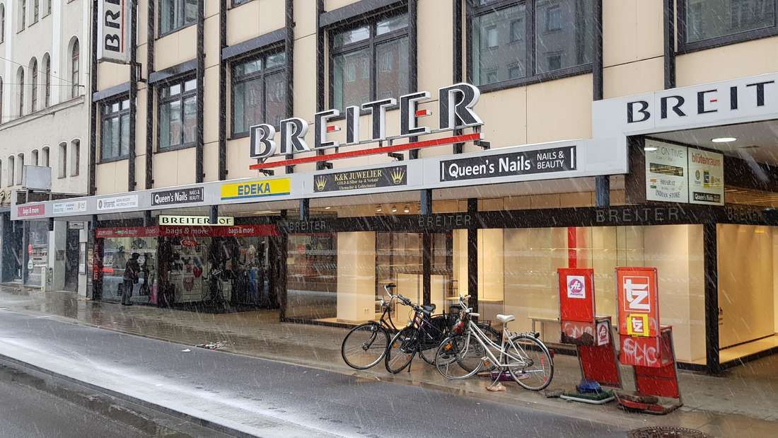
## Description **Breiterhof Passage** is a discreet but culturally significant pedestrian passageway in the heart of Munich’s old town. Unlike the city’s grand squares or monumental avenues, Breiterhof Passage represents a more **intimate layer of urban history**, where commerce, architecture, and everyday life intersect quietly rather than dramatically. The passage dates back to the **postwar reconstruction period**, when Munich rebuilt much of its historic core after World War II. Instead of restoring medieval structures wholesale, planners integrated modern functionality with traditional urban patterns. Breiterhof Passage exemplifies this approach: a short, covered walkway connecting streets while sheltering small shops, cafés, and offices. Its modest scale reflects a deliberate choice to prioritize **human movement and local commerce** over architectural spectacle. What makes Breiterhof Passage unique is its **contrast with Munich’s surrounding grandeur**. Just steps away from busy shopping streets and historic landmarks, the passage offers a slower, enclosed environment that feels almost private. A lesser-known fact is that passages like Breiterhof were designed to maintain pedestrian permeability in dense urban blocks, preserving historic movement patterns even when buildings were rebuilt. Another overlooked detail is that many businesses here are long-standing local operations rather than international chains, giving the space a distinctly Munich character. The passage is not a destination in itself, but a **transitional urban experience**. It rewards attentive visitors who appreciate the city’s smaller architectural gestures and the continuity of everyday life embedded within them. ## Location **Country:** Germany **State:** Bavaria **City:** Munich **District:** Altstadt-Lehel Breiterhof Passage is located in Munich’s historic center, close to major shopping streets and within easy walking distance of Marienplatz. ### How to Get There * **By metro or S-Bahn:** * Travel to **Marienplatz** station, then walk approximately 3–5 minutes. * **By tram:** * Several tram lines stop near the old town perimeter, followed by a short walk. * **On foot:** * Ideal when exploring Altstadt-Lehel, as the passage connects naturally to pedestrian routes. * **By bicycle:** * Bike parking is available nearby, though cycling through the passage itself is not permitted. ## Tips * **Visit during business hours:** The passage is most lively when shops and cafés are open. * **Look beyond storefronts:** Architectural details and spatial proportions are easy to miss if rushed. * **Use it as a shortcut:** It provides a calmer alternative to crowded shopping streets. * **Combine with old town exploration:** It fits naturally into a walking itinerary through central Munich. * **Respect the quiet tone:** This is a working urban space, not a tourist attraction. * **Photography is permitted:** Be mindful of people working or dining inside. ## Conclusion Breiterhof Passage is a subtle reminder that cities are shaped as much by small connective spaces as by major landmarks. Modest, functional, and quietly local, it offers insight into Munich’s postwar urban identity and everyday rhythms. ## FAQ **1. Is Breiterhof Passage a tourist attraction?** No, it is primarily a functional pedestrian passage used by locals. **2. Is there an entrance fee?** No, access is completely free. **3. How long does it take to visit?** Only a few minutes, unless stopping at a café or shop. **4. Is it historically significant?** Yes, as part of Munich’s postwar reconstruction and pedestrian network. **5. Is it suitable for children?** Yes, though there are no child-specific activities. **6. Can it be visited at night?** Access may vary depending on building hours, but daytime visits are recommended. ## Links * [Munich tourism board](https://www.munich.travel)
GemVoyage Team • World
Misiones
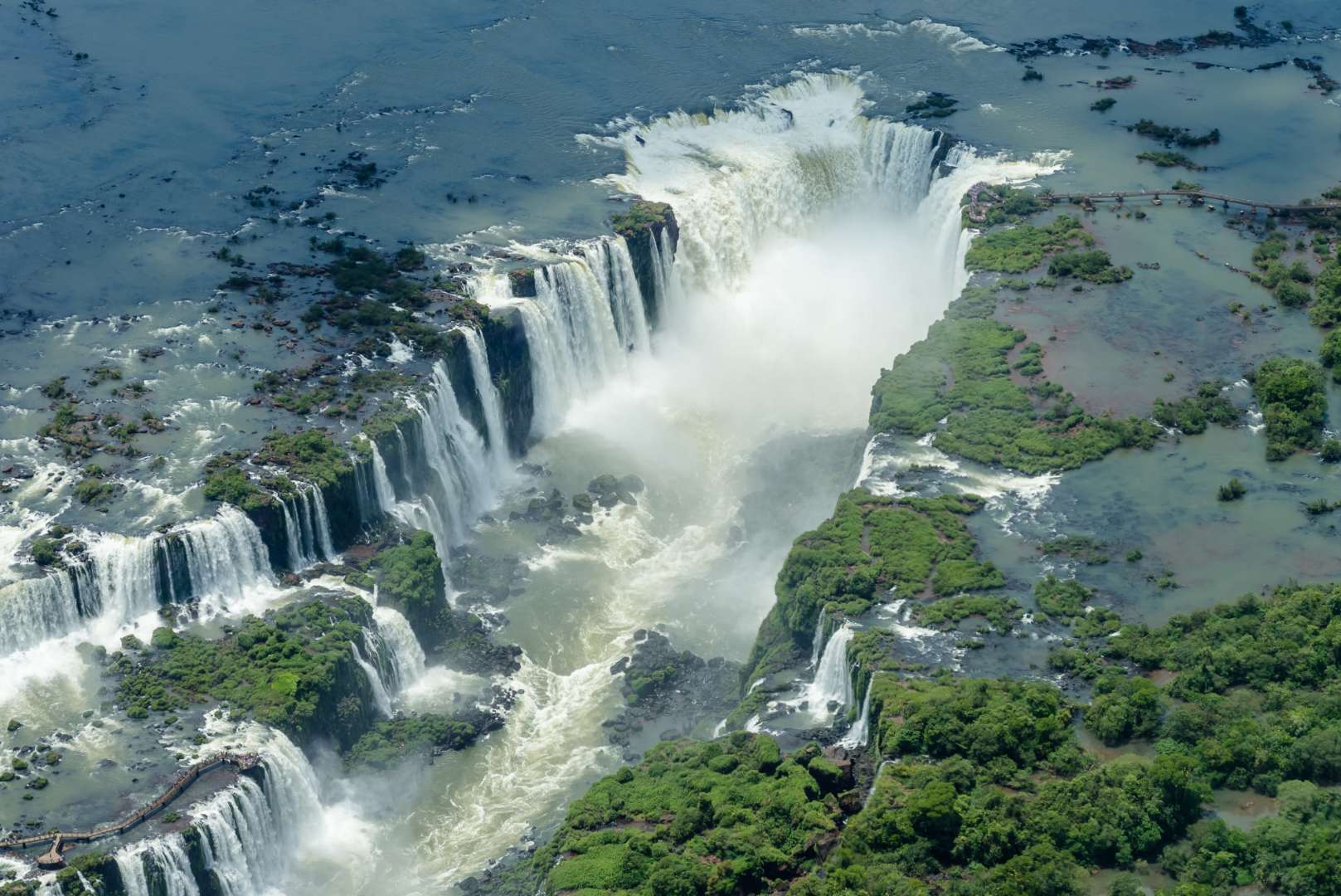
## Description Iguazú Falls (Cataratas del Iguazú) is one of the most awe-inspiring natural wonders on Earth, a sprawling system of waterfalls that straddles the border between Argentina and Brazil. Located within the lush confines of the Iguazú National Park, the falls consist of 275 individual cascades stretching nearly 2.7 kilometers across the Iguazú River. With drops ranging from 60 to 82 meters, the thunderous roar and misty spray of the falls create an unforgettable sensory experience. The crown jewel of the site is the **Devil’s Throat (Garganta del Diablo)**, a U-shaped chasm where half the river’s flow plunges into a dramatic abyss. Standing on the viewing platform above this torrent is both humbling and exhilarating. The surrounding subtropical rainforest is teeming with wildlife, including toucans, coatis, butterflies, and even jaguars, making the area a paradise for nature lovers and photographers. A little-known fact: Eleanor Roosevelt reportedly exclaimed “Poor Niagara!” upon seeing Iguazú Falls, a testament to its staggering scale and beauty. Another fascinating detail is that the falls were formed by a volcanic eruption that left a large crack in the earth, allowing the river to tumble over the edge and create this natural spectacle. ## Location Iguazú Falls is located in **Argentina**, within the **Misiones Province**, near the city of **Puerto Iguazú**. The falls are part of the **Iguazú National Park**, a UNESCO World Heritage Site recognized for its ecological importance and breathtaking scenery. ### How to Get There: - **By Air**: The easiest way to reach the falls is by flying into **Cataratas del Iguazú International Airport (IGR)**, located about 20 minutes from Puerto Iguazú. Direct flights are available from Buenos Aires and other major cities. - **By Bus**: Long-distance buses run from Buenos Aires and other regional hubs to Puerto Iguazú, though the journey can take 18–20 hours. - **By Car**: Renting a car offers flexibility, especially if you plan to visit both the Argentine and Brazilian sides of the falls. From Puerto Iguazú, shuttle buses and taxis can take you directly to the entrance of the national park. ## Tips for Visitors To make the most of your Iguazú Falls adventure, keep these tips in mind: - **Visit Both Sides**: The Argentine side offers immersive trails and close-up views, while the Brazilian side provides panoramic vistas. If possible, explore both. - **Start Early**: Arrive when the park opens to avoid crowds and enjoy cooler temperatures. - **Wear Waterproof Gear**: The mist from the falls can soak you—bring a poncho or quick-dry clothing. - **Take the Ecological Train**: This scenic ride through the jungle leads to key trailheads, including the Devil’s Throat. - **Book a Boat Tour**: For thrill-seekers, speedboat rides take you right under the falls—prepare to get drenched. - **Respect Wildlife**: Coatis may look cute, but they can be aggressive if provoked. Don’t feed or approach them. ## Conclusion Iguazú Falls is a breathtaking blend of raw power and serene beauty. With its towering cascades, rich biodiversity, and immersive trails, it offers a once-in-a-lifetime experience for travelers seeking nature at its most majestic. ## FAQ **1. What is the best time to visit Iguazú Falls?** The falls are spectacular year-round, but April to September offers cooler weather and fewer crowds. **2. How long should I plan to stay?** At least two full days—one for the Argentine side and one for the Brazilian side. **3. Is the park accessible for people with disabilities?** Yes, many trails and viewing platforms are wheelchair accessible, and the ecological train accommodates mobility needs. **4. Can I swim near the falls?** Swimming is not allowed near the main falls due to strong currents, but nearby areas like Isla San Martín may offer safe spots depending on conditions. **5. Are guided tours available?** Yes, both private and group tours are offered, including bilingual guides and eco-tours. **6. Do I need a visa to cross into Brazil?** Visa requirements vary by nationality. Check with your embassy before planning a cross-border visit. ## Links - [Iguazú Falls – Wikipedia Overview](https://en.wikipedia.org/wiki/Iguazu_Falls) - [Iguazú Argentina – Official Park Site](https://iguazuargentina.com/en/)
GemVoyage Team • World
Wroclaw
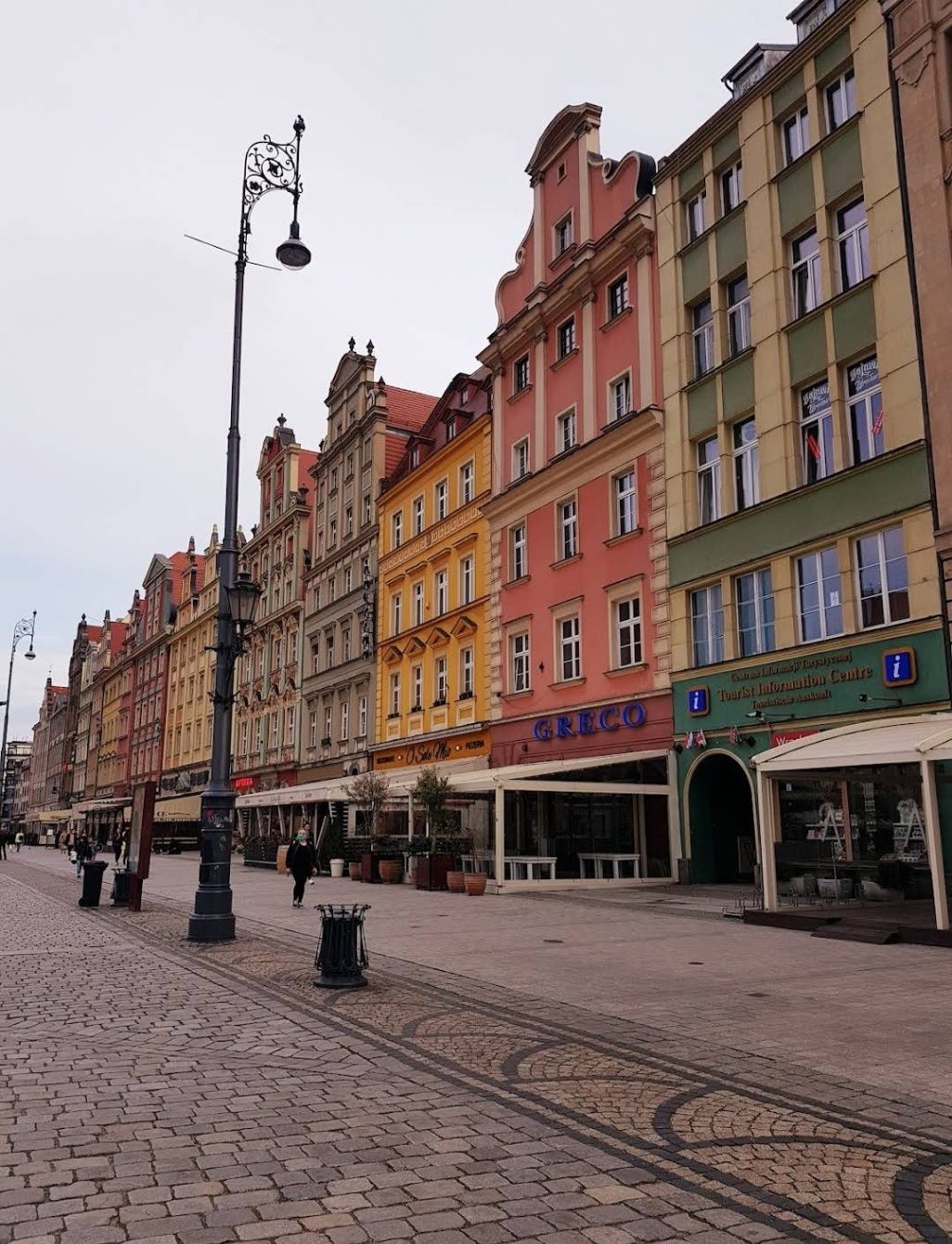
## Description The **Old City of Wroclaw**, also known as **Stare Miasto**, is one of the most enchanting historic centers in Poland. With its cobblestone streets, Gothic and Baroque architecture, and vibrant market square, the Old City blends centuries of history with modern-day charm. Visitors are greeted by the **Rynek (Market Square)**, one of the largest medieval squares in Europe, surrounded by colorful townhouses, cafés, and cultural landmarks. At its heart stands the **Wroclaw Town Hall**, a masterpiece of Gothic architecture that has been a symbol of the city since the 13th century. What makes Old City Wroclaw especially unique is its blend of influences. Throughout history, Wroclaw was ruled by Poland, Bohemia, Austria, Prussia, and Germany before finally becoming part of modern Poland after World War II. This rich mix is reflected in its architecture, traditions, and even cuisine. A little-known fact about Wroclaw is its population of **over 600 small bronze gnome statues**, scattered throughout the Old City. Known as **Krasnale**, these whimsical figures began as a symbol of resistance during the Communist era and have since become a beloved cultural attraction. Another interesting detail is that parts of the Old City were almost completely destroyed during the war but meticulously rebuilt, making it both a symbol of resilience and a living museum of Polish heritage. ## Location The Old City is located in **Wroclaw**, the capital of the **Lower Silesia region in southwestern Poland**. The historic district lies along the **Oder River**, with the Market Square as its central landmark. Reaching Wroclaw is simple. The **Wroclaw Copernicus Airport** connects the city to many European destinations, and from there, the Old City is just a 20–30 minute drive. For domestic travelers, Wroclaw is well connected by train and bus networks, with the main railway station (**Wrocław Główny**) located about 15 minutes from the Old Town by tram or taxi. Walking is the best way to explore once you arrive, as most attractions are within a compact, pedestrian-friendly area. ## Tips To make the most of your visit to Old City Wroclaw, keep these tips in mind: * **Start at the Market Square** – It’s the perfect hub for exploring nearby attractions, shops, and restaurants. * **Look for the gnomes** – Spotting the tiny bronze statues is a fun activity for visitors of all ages. * **Visit Ostrów Tumski** – The Cathedral Island, just outside the Old City, is the oldest part of Wroclaw and offers stunning views of Gothic churches and gas lantern-lit streets. * **Try local food** – Don’t miss pierogi, żurek (sour rye soup), and Wroclaw’s famous craft beers. * **Join a walking tour** – Guided tours provide fascinating insights into the city’s multicultural past and hidden corners. * **Enjoy the nightlife** – The Old City is lively after dark, with pubs, jazz clubs, and cafés filling the medieval streets with energy. ## Conclusion The **Old City of Wroclaw** is a place where history, culture, and modern life come together in perfect harmony. From its magnificent Market Square and medieval landmarks to its quirky gnomes and vibrant atmosphere, the Old City offers something for every traveler. Whether you’re exploring its Gothic churches, enjoying local delicacies, or simply soaking in the atmosphere of its charming streets, Wroclaw’s Old Town is a must-see gem in Poland. ## FAQ **1. What is Old City Wroclaw best known for?** It is famous for its medieval Market Square, Gothic Town Hall, colorful architecture, and unique gnome statues. **2. Can you walk around the Old City in one day?** Yes, most of the attractions are within walking distance, but spending at least two days allows for a deeper experience. **3. What are the gnomes in Wroclaw?** They are small bronze statues known as **Krasnale**, originally a symbol of resistance against communism, now a fun cultural attraction. **4. Is Old City Wroclaw expensive to visit?** Compared to many European cities, Wroclaw is affordable, with budget-friendly food, accommodations, and attractions. **5. When is the best time to visit Wroclaw?** Spring and summer are ideal for outdoor exploration, while December is magical thanks to the Christmas market in the Old Town Square. **6. Is the Old City family-friendly?** Yes, children especially enjoy searching for the gnome statues, and the pedestrian-friendly streets make it safe for families. ## Links * [Visit Wroclaw – Official Tourism Website](https://www.visitwroclaw.eu)
GemVoyage Team • World
Kampala
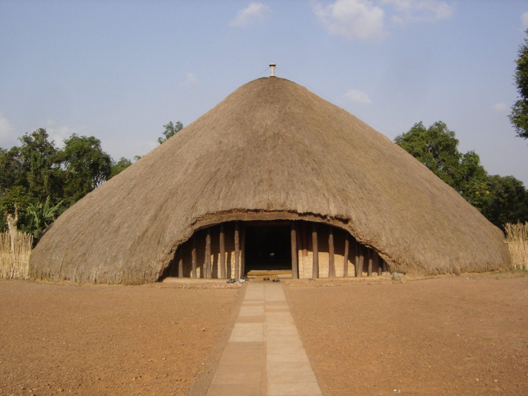
## Description The Kasubi Tombs are one of Uganda’s most important cultural and historical landmarks, serving as the burial grounds of the kings (Kabakas) of the Buganda Kingdom. Recognized as a UNESCO World Heritage Site, the Kasubi Tombs are not only a place of remembrance but also a living spiritual center where traditions, rituals, and royal customs are still actively practiced. The site reflects the deep-rooted cultural identity of the Baganda people and offers visitors a rare opportunity to experience African heritage that is both ancient and ongoing. What makes the Kasubi Tombs especially unique is their architectural style. The main structure, known as the Muzibu Azaala Mpanga, is built almost entirely from organic materials such as wood, reeds, grass, and bark cloth, showcasing remarkable traditional engineering techniques passed down through generations. A little-known fact is that the massive domed structure was once considered one of the largest thatched buildings in Africa. Another lesser-known detail is that even after a devastating fire in 2010 severely damaged the main tomb, restoration efforts were guided by traditional craftsmen using ancestral knowledge rather than modern construction methods, preserving the site’s cultural authenticity. Visiting the Kasubi Tombs is not just a historical experience; it is a deeply spiritual one that highlights the enduring connection between the Buganda monarchy, its people, and their land. ## Location The Kasubi Tombs are located in **Uganda**, in the **Central Region**, within **Kampala**, the country’s capital city. The site sits on Kasubi Hill, approximately 5 kilometers northwest of Kampala’s city center. Getting there is relatively easy. Visitors can reach the Kasubi Tombs by taxi, private car, or motorcycle taxi (boda-boda) from central Kampala. The journey usually takes 15 to 25 minutes, depending on traffic. For those unfamiliar with the area, hiring a local driver or using a guided tour is recommended, as it ensures smoother navigation and provides cultural context during the visit. ## Tips * Dress modestly and respectfully, as the site is a sacred royal burial ground. * Photography may be restricted in certain areas, especially inside the main tomb, so always ask for permission. * Consider hiring a local guide at the entrance to gain deeper insight into Buganda history and traditions. * Visit in the morning when the site is quieter and temperatures are more comfortable. * Be respectful of ongoing rituals or ceremonies, as the site is still actively used by the Buganda Kingdom. * Carry small cash for entrance fees, guides, or donations. ## Conclusion The Kasubi Tombs offer a powerful and authentic insight into Uganda’s royal history and living cultural traditions. As a sacred site and a symbol of resilience, they stand as one of Kampala’s most meaningful attractions, rewarding visitors with knowledge, reflection, and cultural understanding. ## FAQ **Why are the Kasubi Tombs important?** They are the burial place of four Buganda kings and a central spiritual site for the Buganda Kingdom. **Is the Kasubi Tombs site fully restored?** Restoration is ongoing, guided by traditional methods to maintain cultural integrity, following the 2010 fire. **How long does a visit usually take?** Most visits last between one and two hours, including a guided tour. **Is the site suitable for children?** Yes, older children can benefit from the educational and cultural aspects, though supervision is advised. **Do I need a guide to visit the Kasubi Tombs?** A guide is not mandatory but highly recommended for a fuller understanding of the site’s significance. ## Links * [UNESCO – Kasubi Tombs](https://whc.unesco.org/en/list/1022) * [Uganda Tourism Board](https://exploreuganda.com/)
GemVoyage Team • World

Comments