GemVoyage Team • World
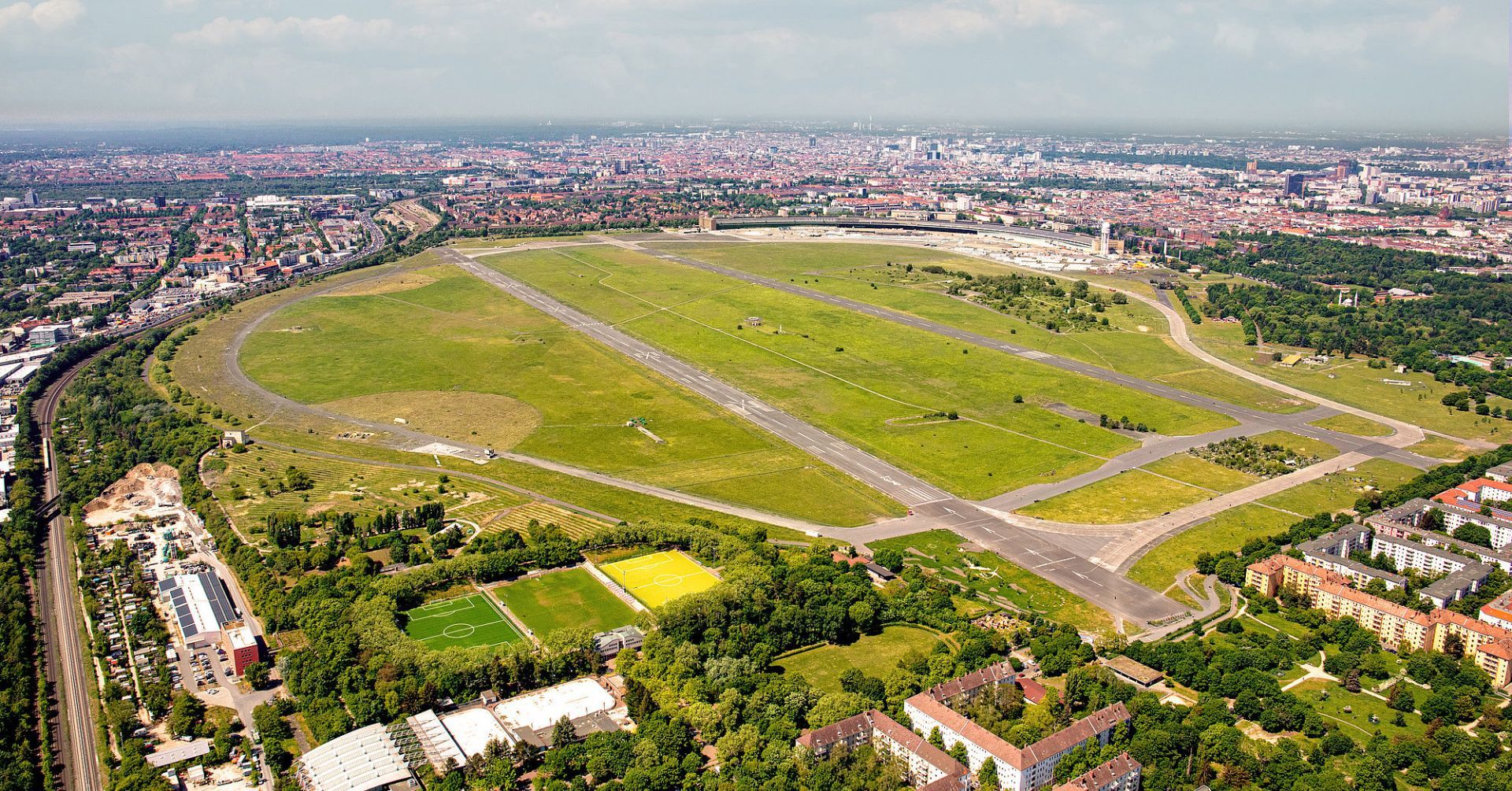
What makes Tempelhofer Feld unique is how many different activities it can support without ever feeling crowded. Cyclists, skaters, runners, families, kite flyers, gardeners, and people simply sitting in the grass all share the space comfortably because it is so large. The former airport infrastructure is still visible in many places, which adds a sense of industrial memory to the recreational experience. You are not just visiting a park; you are walking through a piece of 20th-century urban history that has been repurposed for contemporary life.
One little-known fact is that Tempelhof's runways and hangars helped shape the modern meaning of the site long before it became a park, and the airport itself became a powerful symbol during the Berlin Airlift. Another is that the area is often used for community gardens and events, making it both open and socially active rather than simply passive green space. That mix of openness and civic use is part of why Berliners defend the field so strongly.
The atmosphere changes throughout the day. In the morning it can feel calm and almost meditative, with joggers tracing long loops beneath big skies. In the afternoon it becomes more playful, with people flying kites, practicing sports, or meeting friends for picnics. Sunset is particularly memorable because the flat openness gives you an unobstructed view of the light changing across the field.
Tempelhofer Feld also tells a broader story about Berlin's identity. The city is often associated with reinvention, and this site embodies that idea without erasing the past. Rather than demolish every trace of the airport, Berlin turned the space into an active commons. For visitors, that means the park is both relaxing and intellectually interesting, especially if you enjoy places where landscape and history overlap.
If you want one destination that shows how Berlin handles scale, memory, and public access, Tempelhofer Feld is hard to beat. It is not decorative in the traditional sense, but it is deeply satisfying because it gives you room to move, think, and experience the city in a different register.
The most convenient ways to get there are by U-Bahn, S-Bahn, or bicycle, depending on where you are staying. Several entrances serve the park, and once inside, the flat terrain makes it easy to orient yourself. Because the space is large, choosing the entrance closest to your planned activity can save time.
If you like cycling or skating, Tempelhofer Feld is one of the best places in Berlin for it because the former runways offer long, smooth stretches.
Do not expect a landscaped park with many shaded paths. The design is intentionally open, so plan for a more minimalist experience.
Visit during golden hour or sunset if you want the strongest visual impression.
Check the park rules before arrival, especially if you plan to use a drone, barbecue, or special equipment.
Set aside enough time to walk farther than you think. The scale of the field is part of the experience.
Discover more hidden gems you might love.
Pakistan
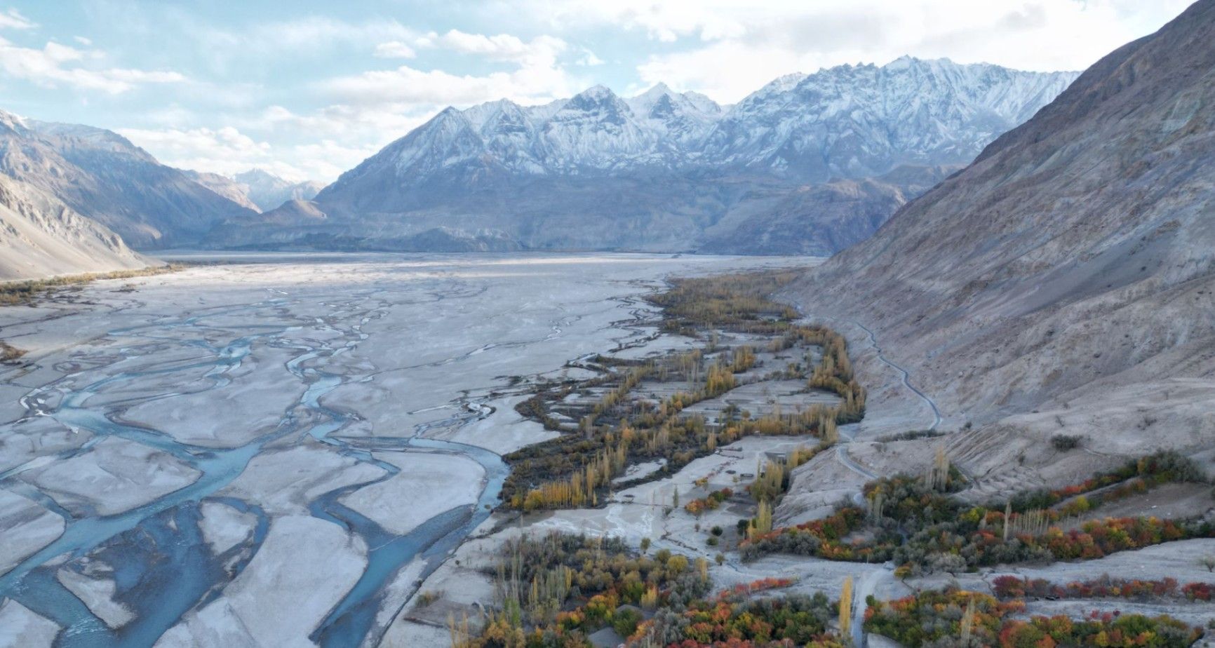
## Description **Nangma Valley**, located in northern Pakistan’s Gilgit-Baltistan region, is a breathtaking alpine valley that remains one of the country’s best-kept secrets. Renowned for its majestic granite spires, lush meadows, and pristine alpine landscapes, Nangma Valley is a paradise for trekkers, climbers, and photographers. What sets Nangma Valley apart is its untouched natural beauty and relative seclusion compared to more famous destinations like Hunza or Skardu. The valley is dotted with soaring rock towers—some over **5,000 meters** high—making it one of the premier destinations for **rock climbing and mountaineering** in Pakistan. Peaks such as **K7**, **K6**, and **Amin Brakk (the “Great Tower”)** have attracted world-class climbers from around the globe, yet the area still retains its peaceful, uncommercialized character. A lesser-known fact about Nangma Valley is that it is often referred to as **the “Yosemite of Pakistan”**, thanks to its sheer granite walls and the way sunlight paints the cliffs golden at dawn and dusk. The valley is also home to small Balti villages, where visitors can experience traditional hospitality and life in one of the most remote corners of the world. ## Location Nangma Valley lies in **Gilgit-Baltistan**, in the **Karakoram Range** of **northern Pakistan**, near the town of **Hushe** in the **Ghangche District**. It is about 130 kilometers east of **Skardu**, the main gateway to the region. To reach Nangma Valley, travelers first fly or drive to **Skardu**—flights from Islamabad are the most common route, taking about an hour (weather permitting). From Skardu, a scenic drive of approximately 5–6 hours leads to Hushe Village, from where the trek to Nangma Valley begins. The trek itself is moderate and usually takes around **3–4 hours** on foot, passing through alpine pastures and along a clear glacial stream. ## Tips * **Best time to visit:** The valley is most accessible between **June and September**, when the weather is mild, and the snow has melted. * **Pack for mountain weather:** Even in summer, temperatures can drop sharply at night. Warm layers and a sleeping bag are essential. * **Bring proper trekking gear:** Good hiking boots, walking poles, and waterproof clothing are highly recommended. * **Hire local guides and porters:** The Balti guides are knowledgeable about routes, weather, and local customs, and hiring them supports the local economy. * **Camping:** There are several scenic camping sites, such as at the base of Amin Brakk and near the Nangma Glacier. Always follow Leave No Trace principles. * **Photography:** Sunrise and sunset offer the best light for photographing the granite spires and surrounding peaks. * **Acclimatize properly:** Even though Nangma Valley is not at extreme altitude, gradual acclimatization helps prevent altitude sickness. ## Conclusion **Nangma Valley** is a hidden gem for those seeking adventure, solitude, and awe-inspiring mountain scenery. Its towering granite peaks, green meadows, and crystal-clear streams make it one of the most spectacular yet underexplored trekking destinations in Pakistan. Whether you’re an experienced climber or a nature lover looking for tranquility, Nangma Valley promises a journey deep into the heart of the Karakoram’s beauty and serenity. ## FAQ **1. Where is Nangma Valley located?** It’s in Gilgit-Baltistan, near Hushe Village in the Ghangche District, approximately 130 km from Skardu. **2. How do I reach Nangma Valley from Islamabad?** You can fly to Skardu (around 1 hour) or take a 20–22 hour drive via the Karakoram Highway. From Skardu, continue by jeep to Hushe and then trek into the valley. **3. Do I need a trekking permit?** No official permit is required for Nangma Valley itself, but registering with local authorities or the Hushe tourism office is recommended. **4. Is the trek difficult?** The trek to the main campsites is moderate, suitable for most fit travelers. Climbers aiming for higher peaks will need advanced equipment and experience. **5. Can I find accommodation nearby?** Basic guesthouses are available in Hushe Village. In the valley, visitors usually camp or stay in tents arranged by local guides. **6. Is Nangma Valley safe for tourists?** Yes. The valley is peaceful, and local communities are known for their warm hospitality. However, it’s best to travel with a guide and inform authorities of your plans. ## Links * [Pakistan Tourism Development Corporation](https://www.tourism.gov.pk) * [Adventure Pakistan – Trekking and Expeditions](https://www.adventurepakistan.com)
GemVoyage Team • World
New York
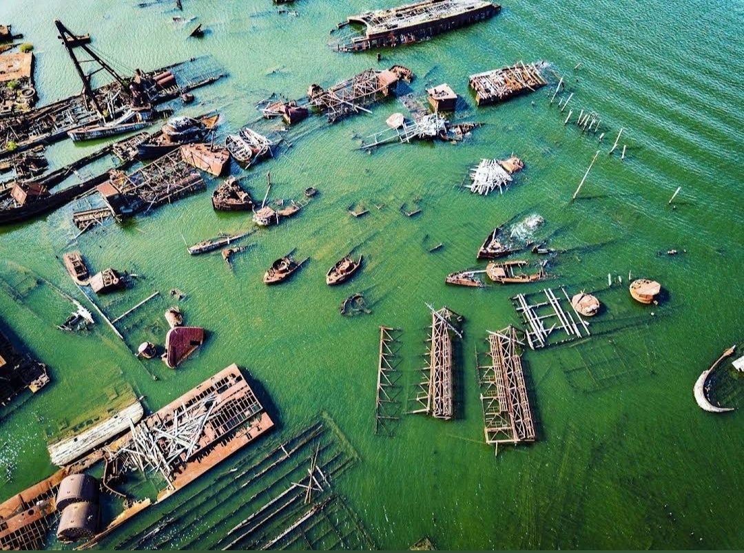
## Description The **Staten Island Boat Graveyard**, officially known as the **Witte Marine Scrap Yard**, is one of New York’s most unusual and fascinating attractions. Nestled along the Arthur Kill waterway, this hidden site is where dozens of decommissioned ships were brought to rest, creating an eerie yet captivating scene. Rusting hulls, half-sunken tugboats, and skeletal remains of vessels stretch across the shoreline, making the boat graveyard a dreamlike place for urban explorers, history buffs, and photographers alike. What makes the site particularly unique is the way nature and industry intertwine. Over decades, the corroding metal has blended with the marshland environment, creating a haunting landscape that feels frozen in time. Unlike a museum display, the graveyard is raw, untouched, and authentic—a piece of living maritime history slowly dissolving into the tide. **Little-known facts**: * The site was founded in the 1930s by John J. Witte, who originally intended it as a marine salvage yard rather than a tourist attraction. Today, it is still an active scrapyard, though parts of it have become a de facto maritime graveyard. * The boat graveyard is sometimes called the “**Tugboat Graveyard**” because many of the vessels abandoned here were tugboats that once served New York Harbor. --- ## Location The Staten Island Boat Graveyard is located in **Staten Island, New York City**, within the state of **New York**, USA. It sits along the Arthur Kill waterway near the neighborhood of Rossville, on the western shore of Staten Island. ### How to get there: * **By car**: The easiest way is to drive, as the site is relatively remote. Visitors can park nearby on Arthur Kill Road and walk toward the shoreline. * **By public transit**: It’s possible, though less convenient, to take an MTA bus (such as the S74 or S78) from the Staten Island Ferry terminal and walk the rest of the way. * **Guided tours**: Some local tour operators and photography groups organize visits to the graveyard, which can be a safer and more informative way to experience the site. --- ## Tips * **Wear sturdy shoes**: The area around the graveyard can be muddy, uneven, and slippery, especially after rain. * **Respect private property**: The scrapyard is privately owned, so visitors should avoid trespassing and stick to public access points along the shore. * **Bring a camera**: The rusting vessels, changing tides, and dramatic light make for excellent photography opportunities. * **Visit at low tide**: More ships and details are visible when the tide is out, allowing for better exploration and photos. * **Stay safe**: The boats themselves are unstable and dangerous to climb. Admire them from a distance rather than attempting to board. * **Go in daylight**: The graveyard is isolated and not well lit, so daytime visits are recommended for safety and visibility. --- ## Conclusion The Staten Island Boat Graveyard is a hauntingly beautiful site where history, decay, and nature converge. It’s not a polished tourist attraction, but that’s what makes it so special—its authenticity, its mystery, and its ability to transport visitors into another era of New York’s maritime past. For those who enjoy off-the-beaten-path destinations, this hidden corner of Staten Island offers a rare and unforgettable experience. --- ## FAQ **1. What is the Staten Island Boat Graveyard?** It’s a marine scrapyard where decommissioned vessels, especially tugboats, have been abandoned over decades along the Arthur Kill waterway. **2. Can I visit the graveyard legally?** Yes, but since it is on private property, visitors should only view it from public access points along the shoreline and avoid trespassing into the scrapyard itself. **3. Is the site safe to explore?** The surrounding area is generally safe, but climbing onto the ships is dangerous and not recommended due to rust, sharp edges, and unstable structures. **4. When is the best time to visit?** Low tide during daylight hours is ideal, as more ships are visible and lighting conditions are better for photography. **5. Do I need special equipment to visit?** No, just wear comfortable shoes and bring a camera. Binoculars can also enhance the experience if you want a closer look at distant vessels. **6. Is it worth visiting for non-photographers?** Absolutely. Even without a camera, the graveyard offers a unique and atmospheric glimpse into New York’s maritime history.
GemVoyage Team • World
Chicago
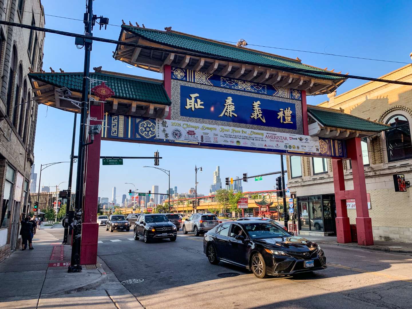
## Description Chicago’s Chinatown is a vibrant, historic neighborhood that offers a rich tapestry of culture, cuisine, and community. Established in its current location in 1912, Chinatown is one of the oldest and most dynamic Chinese-American enclaves in the United States. Located on the South Side of Chicago, it’s a place where tradition meets modernity—where you can sip bubble tea in a sleek café and then step into a century-old herbal shop just down the street. The neighborhood is anchored by the iconic Chinatown Gate on Wentworth Avenue, a symbol of welcome and cultural pride. Beyond the gate lies a bustling corridor filled with dim sum restaurants, bakeries, gift shops, and grocery stores stocked with imported goods. Chinatown Square, a two-level outdoor mall inspired by Chinese imperial architecture, features statues of the twelve zodiac animals and hosts seasonal performances and festivals. A little-known fact: the design of the Chinatown Gate was inspired by a gate in Beijing and was completed in 1975. Another hidden gem is the Chinese American Museum of Chicago, housed in a former grocery store and offering exhibits on immigration, community history, and cultural heritage. ## Location Chicago Chinatown is located in the **United States**, in the **state of Illinois**, within the **city of Chicago**. It sits in the **Armour Square** community area, primarily along **South Wentworth Avenue**, between **Cermak Road** and **W. 26th Street**. ### How to Get There: - **By Train**: Take the CTA Red Line to Cermak-Chinatown Station. The entrance to Chinatown is just steps away. - **By Bus**: Several CTA bus routes, including the 24 and 62, stop near Chinatown. - **By Car**: Parking is available in designated lots and metered spots, but public transit is recommended due to limited space. - **By Water Taxi**: In warmer months, you can take a scenic water taxi from downtown to Ping Tom Memorial Park, located in Chinatown. Its accessibility and proximity to downtown Chicago make it a convenient and rewarding destination for locals and tourists alike. ## Tips for Visitors To make the most of your visit to Chicago Chinatown, consider these tips: - **Come Hungry**: The neighborhood is a culinary paradise. Try dim sum at MingHin Cuisine or hand-pulled noodles at Lao Sze Chuan. - **Explore Chinatown Square**: This open-air plaza is perfect for shopping, dining, and snapping photos with zodiac statues. - **Visit Ping Tom Memorial Park**: A peaceful riverside park with skyline views, ideal for a picnic or a stroll. - **Check the Calendar**: Chinatown hosts vibrant events like the Lunar New Year Parade and the Summer Fair. - **Take a Walking Tour**: The Chicago Chinese Cultural Institute offers guided tours that delve into the neighborhood’s history and architecture. - **Bring Cash**: While many places accept cards, some smaller shops and eateries prefer cash. ## Conclusion Chicago Chinatown is a dynamic blend of history, culture, and flavor. Whether you're indulging in authentic cuisine, learning about Chinese-American heritage, or simply soaking in the atmosphere, this neighborhood offers a memorable experience that reflects the spirit of its community. ## FAQ **1. Is Chicago Chinatown safe to visit?** Yes, it’s generally safe and welcoming. As with any urban area, stay aware of your surroundings. **2. What is the best time to visit Chinatown?** Weekends offer the most energy and activity, especially during festivals. Weekdays are quieter and ideal for relaxed exploration. **3. Are there vegetarian or vegan options in Chinatown?** Yes, many restaurants offer plant-based dishes, especially tofu and vegetable stir-fries. **4. Is Chinatown family-friendly?** Absolutely. Kids will enjoy the colorful shops, parks, and cultural events. **5. Can I find souvenirs in Chinatown?** Yes, from traditional teas and ceramics to novelty gifts and zodiac-themed items. **6. Is there parking available?** Limited street parking and paid lots are available, but public transit is often more convenient. ## Links - [Chicago Chinatown – Wikipedia Overview](https://en.wikipedia.org/wiki/Chinatown,_Chicago)
GemVoyage Team • World

Bratislava
## Description Martinus bookstore in Bratislava isn’t just an ordinary shop—it’s a cultural landmark that has become a beloved meeting point for book lovers, coffee enthusiasts, and curious travelers. As one of Slovakia’s largest and most famous bookstores, Martinus has transformed the simple act of buying a book into a memorable experience. What makes Martinus unique is its combination of literature, culture, and community. Visitors can browse through thousands of titles in different languages, enjoy a freshly brewed cup of coffee at the attached café, and even attend book signings or literary events. The bookstore is designed to feel warm and welcoming, with cozy corners that invite you to sit down, relax, and get lost in a book. A little-known fact about Martinus is that it started as a small family-owned bookstore in the town of Martin, Slovakia, in the early 1990s. Today, it has grown into the country’s largest online and offline bookseller while still keeping its friendly and personal atmosphere. Another interesting detail is that the Bratislava branch often collaborates with local artists and hosts cultural evenings, making it much more than just a shop, it’s a living cultural hub. ## Location Martinus bookstore is located in **Bratislava, the capital city of Slovakia**, in the Bratislava Region. The main branch sits on **Obchodná Street**, one of the busiest and most vibrant streets in the city, just a short walk from the Old Town and the iconic Michael’s Gate. Getting there is simple. If you’re staying in Bratislava’s historic center, you can easily walk to Martinus in less than 10 minutes. For those coming from further away, public transportation is very convenient—several trams and buses stop nearby at **Poštová–Martinus** station, which is practically at the bookstore’s doorstep. If you’re driving, parking may be tricky on Obchodná Street itself, so it’s recommended to park in nearby garages and continue on foot. ## Tips for Visitors To make the most of your visit to Martinus bookstore in Bratislava, here are some useful tips: * **Explore both the books and the café**: The in-house café is the perfect spot to sit down with your new book and enjoy a relaxed afternoon. * **Check the event calendar**: Martinus frequently organizes book signings, lectures, and cultural evenings. If you’re lucky, you might catch a live event during your visit. * **Browse the English section**: While most books are in Slovak, the store has a good selection of English and other foreign-language books. * **Use the free Wi-Fi**: If you need a break from sightseeing, Martinus provides a cozy atmosphere to recharge, both mentally and digitally. * **Visit during weekdays**: The bookstore is often busier on weekends, so for a quieter experience, go during the week. ## Conclusion Martinus bookstore in Bratislava is far more than just a place to buy books. It’s a cultural space where literature, coffee, and community come together in a cozy and inspiring environment. Whether you’re a tourist exploring the city or a local looking for a peaceful escape, Martinus offers an unforgettable experience that reflects the creative spirit of Bratislava. ## FAQ **1. What makes Martinus bookstore in Bratislava special?** Martinus is unique because it combines a large book selection with a welcoming café, cultural events, and a warm, community-focused atmosphere. **2. Can I find English books at Martinus bookstore?** Yes, Martinus offers a good range of English-language books, along with titles in Slovak and other languages. **3. Does Martinus bookstore have a café?** Absolutely. The bookstore has a cozy café where you can enjoy coffee, tea, and pastries while reading. **4. Is Martinus bookstore family-friendly?** Yes, it’s a great place for families, with children’s books available and a friendly atmosphere suitable for all ages. **5. How do I get to Martinus bookstore in Bratislava?** It’s located on Obchodná Street in the city center. You can walk from the Old Town, take public transportation to Poštová–Martinus station, or park nearby and walk. ## Useful Links * [Official Martinus Website](https://www.martinus.sk) * [Visit Bratislava – Official Tourism Website](https://www.visitbratislava.com)
GemVoyage Team • World
Osun
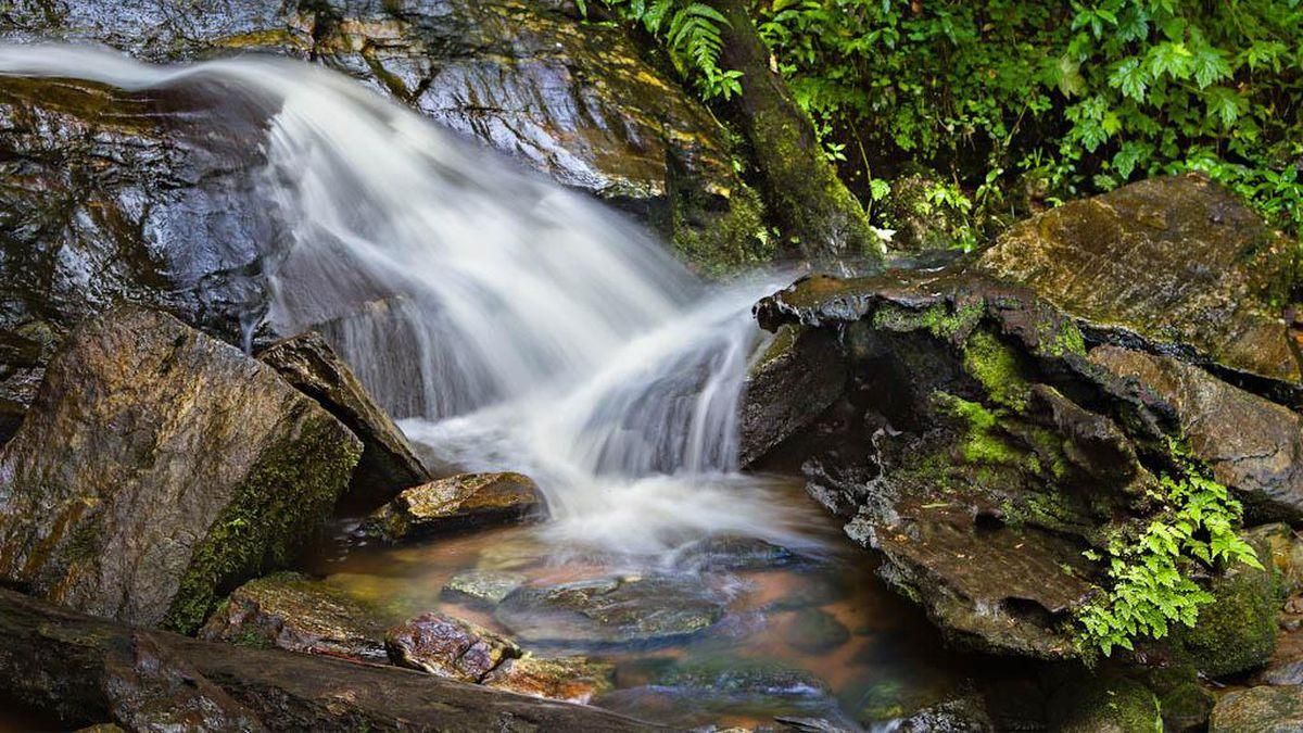
## Description **Erin Ijesha Waterfall**, also known as **Olumirin Waterfall**, is one of Nigeria’s most spectacular natural attractions. Located in Osun State, the waterfall is renowned for its **seven cascading levels**, each offering a different landscape, atmosphere, and difficulty level for visitors. The experience goes beyond a simple waterfall viewing; it is a physical ascent through layered natural terraces, tropical vegetation, and rocky pathways that reveal the geology and biodiversity of southwestern Nigeria. What makes Erin Ijesha Waterfall particularly unique is the **progression of the levels**. The first and second levels are accessible and refreshing, ideal for casual visitors. As you climb higher, the environment becomes cooler, the terrain more dramatic, and the views increasingly rewarding. The final levels lead to a plateau historically associated with ancient settlements and spiritual practices. According to oral traditions, some of these upper areas served as **refuge sites for migrating groups** and locations for community gatherings during the pre-colonial period. A little-known fact is that the waterfall has long been connected to Yoruba mythology. Local lore suggests that the waters were believed to possess cleansing qualities, and that early communities viewed the entire waterfall system as a **symbol of renewal and protection**. Another interesting detail is that the upper levels were once used as strategic vantage points due to their height and difficult access, helping local groups monitor surrounding valleys. The blend of nature, culture, and mild adventure makes Erin Ijesha Waterfall a standout destination for hikers, photographers, and anyone interested in the lesser-explored regions of Nigeria. ## Location **Country:** Nigeria **Region:** Southwest Nigeria **State:** Osun State **Nearest Town:** Ijesha (near Erin Ijesha community) The waterfall sits within a lush forested area about an hour from major towns like Ilesa. ### How to Get There * **By car:** * The most reliable method. From Ilesa or Osogbo, follow the highway toward Erin Ijesha. The entrance to the waterfall is clearly marked, and parking is available. * **By public transportation:** * Local buses and shared taxis connect Ilesa to Erin Ijesha, followed by a short walk to the site. * **By tour service:** * Some tour operators from Lagos, Ibadan, or Osogbo include the waterfall in day-trip itineraries. ## Tips * **Wear sturdy shoes:** The climb is steep in places, and water splashes make some rocks slippery. * **Bring water and stay hydrated:** The ascent to the upper levels can be physically demanding, especially in warm weather. * **Start early:** Morning visits provide cooler temperatures, softer light, and fewer crowds. * **Expect to get wet:** Mist rises from the falls, especially near the lower levels. * **Fitness level matters:** The higher levels are not recommended for visitors with mobility issues. * **Consider hiring a local guide:** They can help you navigate the steeper paths and share the historical context tied to the site. * **Avoid visiting during heavy rain:** The water flow becomes intense and pathways can become hazardous. ## Conclusion Erin Ijesha Waterfall is one of Nigeria’s most rewarding natural attractions, offering a combination of adventure, cultural history, and scenic beauty. Its seven distinct levels provide a progressively immersive experience, making it suitable for both casual travelers and more ambitious climbers. For anyone exploring southwestern Nigeria, the waterfall stands as a must-see landmark. ## FAQ **1. How many levels does Erin Ijesha Waterfall have?** The waterfall has **seven levels**, each with its own landscape and difficulty. **2. Is swimming allowed?** Light splashing and dipping are common at the lower levels, but deeper swimming is not typical due to rocky terrain. **3. How long does the hike take?** Reaching the upper levels can take **1 to 2 hours**, depending on fitness and pace. **4. Is there an entrance fee?** Yes. A modest fee is typically required for maintenance and site management. **5. Are guides available at the site?** Yes. Local guides can be hired at the entrance. **6. What is the best time to visit?** Dry season or early rainy season when the paths are safe and the water flow is strong but manageable. ## Links * [Osun State tourism info](https://www.osunstate.gov.ng)
GemVoyage Team • World
Rome
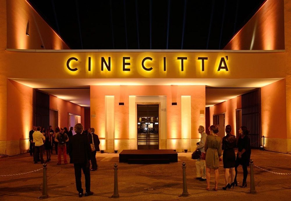
## Description Cinecittà Studios is Italy’s legendary film complex and a living monument to cinematic history. Since its founding in 1937, Cinecittà has hosted major Italian auteurs and international productions, shaping genres from neorealism to epic historical spectacles. Today it functions as both a working studio and a public-facing cultural institution: visitors can explore set reconstructions, costume archives, interactive exhibits, and occasional behind-the-scenes tours that illuminate how films are made. Part of Cinecittà’s allure is its scale and continuity. The studio once housed elaborate built environments—a Roman forum, full-scale palaces and desert landscapes—used in grand historical epics. Though some of those sets were temporary, many props, set fragments and costume pieces have been preserved and curated for public display. The institution also showcases technical crafts that are often invisible to audiences: model making, matte painting, lighting rigs, and costume workshops. For film students and enthusiasts, Cinecittà is a place to see the physical processes that support cinematic imagination. What visitors often remember most are tactile encounters: seeing original costumes under museum lighting, stepping onto a reconstructed soundstage, or viewing archival footage that places modern films in a long lineage of Italian cinema. Temporary exhibitions frequently spotlight famous directors, film movements, or technical achievements, and festival programming can add screenings, talks and workshops to the calendar. Educational programs and bookings: Cinecittà runs occasional workshops, masterclasses and educational programs aimed at students and emerging filmmakers. If you are visiting as part of a study group or with professional interest, contact the studio’s education office to explore scheduling options and group rates. ## Location Cinecittà Studios is southeast of central Rome in the Cinecittà district, easily reached from Termini station and other central hubs. The nearest metro stop is Cinecittà on Line A, which provides a straightforward public transit route for visitors. Getting there: take Metro Line A to Cinecittà station and follow signage, or use buses that serve the district. Taxis and rideshares are convenient if you’re carrying equipment or traveling in a group. Many visitors pair a Cinecittà visit with nearby cultural routes such as the Appian Way or archeological tours of ancient Rome. ## Tips - Book tickets and special tours in advance: popular guided tours and temporary exhibitions can sell out during peak tourist months. - Arrive early to enjoy quieter galleries and to join early guided tours or screenings. - Check the events calendar for film festivals, masterclasses and special exhibits that may offer unique access or programming. - Wear comfortable shoes and be prepared for walking between lots; some areas are outdoor or semi-covered. - Ask about audio guides or guided tours led by studio personnel for a more technical view of production processes. - If you're a student or industry professional, check for discounted or specialized access with proof of affiliation. ## Conclusion Cinecittà Studios uniquely blends cinematic heritage and active production. It provides a rare opportunity to understand filmmaking as collaborative craft—an encounter with the material culture of cinema, from ateliers and props to full-scale set design. Whether you're a cinephile, student, or casual visitor, Cinecittà offers insights into how film history and contemporary production practice meet. ## FAQ Q: Can visitors tour actual soundstages? A: Many guided tours include access to selected soundstages and set reconstructions, but availability depends on production schedules and conservation needs. Booking in advance improves your chances of stage access. Q: Is there an on-site museum and what does it display? A: Yes. Cinecittà’s museum displays costumes, props, archival photographs and multimedia exhibits that trace Italian and international film history. Q: Are tours available in English? A: Yes—guided tours and audioguides are typically offered in multiple languages, including English. Verify language options when booking. Q: How long should I plan for a visit? A: Depending on whether you take a guided tour or explore exhibitions independently, allocate 2–4 hours to comfortably enjoy the museum and studio areas. Q: Can I visit if a film production is underway? A: Public access can be limited during active productions. Check the studio’s schedule and tour availability when planning your visit. ## Links - [Cinecittà Studios (official)](https://www.cinecitta.com) - [Wikipedia: Cinecittà](https://en.wikipedia.org/wiki/Cinecitt%C3%A0)
GemVoyage Team • World

Comments