GemVoyage Team • World
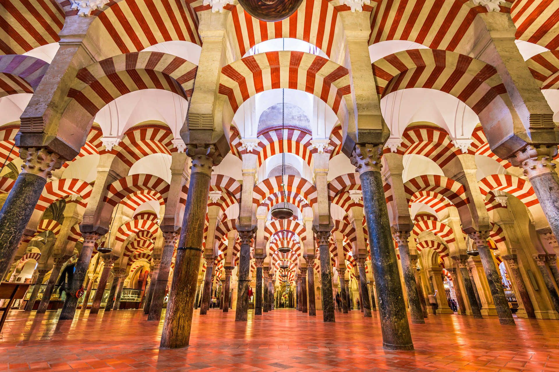
Little-known facts: the current cathedral nave was inserted into the mosque in the 16th century after repeated political and religious negotiations, leaving a striking contrast between the Muslim prayer hall and a centrally placed Christian choir. Another subtle detail is that several columns were recycled from nearby Roman and Visigothic ruins, embedding older materials into this Islamic monument.
Getting there: Córdoba is on Spain’s high-speed rail network (AVE) with frequent trains from Madrid (about 1 hour 45 minutes) and Seville (about 45 minutes). From Córdoba’s main train station (Estación Córdoba Central), the Mezquita is a 15–20 minute walk through the old town; taxis and local buses are also available. If you’re driving, look for parking near Avenida del Alcázar; from there the old town is a short walk. Once inside the historic center, much is best experienced on foot.
Q: How long should I plan to visit?
A: Expect 1.5–3 hours to explore the main areas and enjoy nearby streets. Add more time if visiting exhibitions or local museums.
Q: Are photography and flash allowed?
A: Photography is usually allowed without flash; however, rules can change for certain ceremonies or exhibitions—follow posted signs.
Q: Is the Mezquita accessible for visitors with reduced mobility?
A: Parts of the site have limited accessibility due to historic flooring and narrow passages; check official accessibility information and consider contacting the site before arrival.
Discover more hidden gems you might love.
Beijing
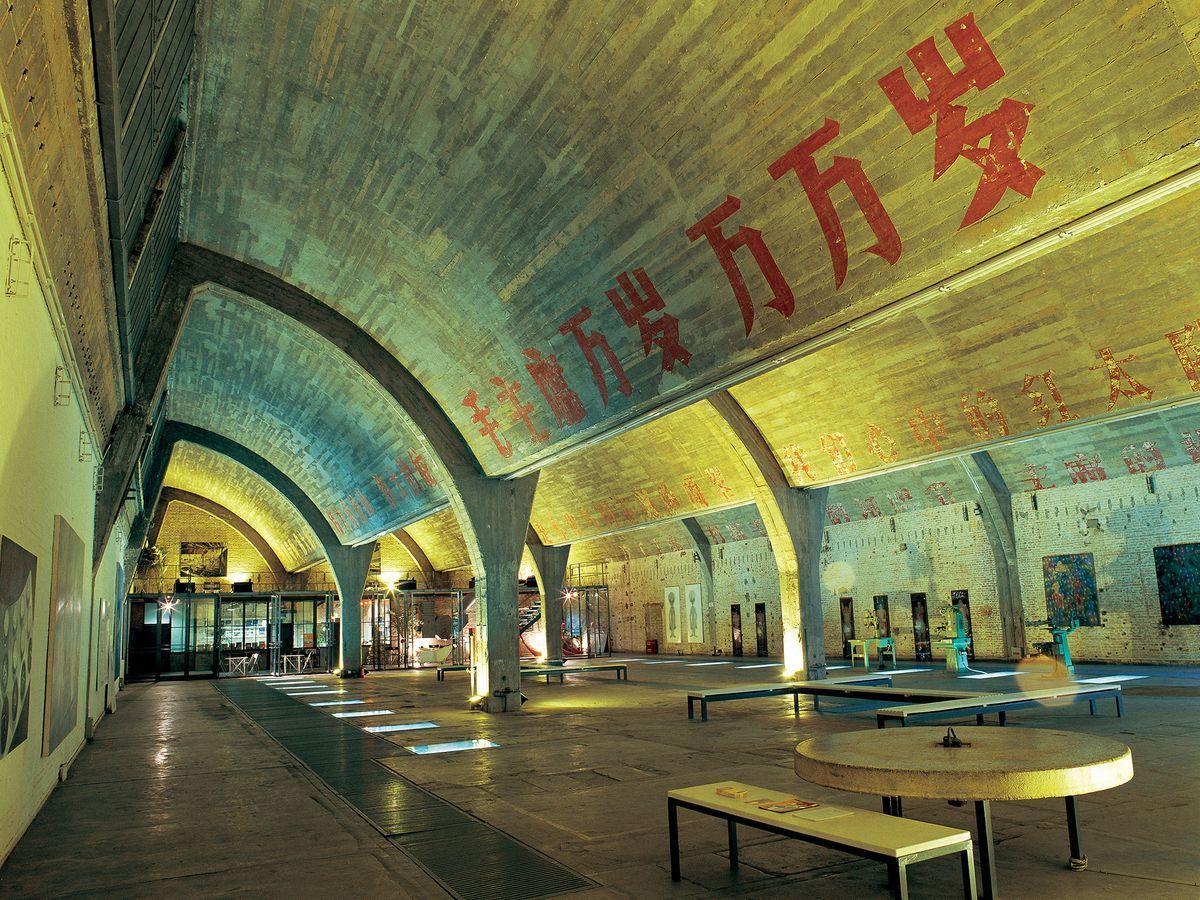
## Description Tucked in the northeastern corner of Beijing, the 798 Art District is one of the most compelling destinations in all of China. What was once a sprawling complex of military and industrial factories has been transformed into a world-class hub for contemporary art, design studios, galleries, cafes, and cultural institutions. The district draws millions of visitors each year, from seasoned art collectors to curious travelers who simply want to walk through one of Asia's most visually striking urban landscapes. The complex was originally built in the 1950s with assistance from East German engineers, and the architecture reflects that influence heavily. The Bauhaus-inspired buildings, with their distinctive sawtooth roofs designed to let in consistent northern light, still stand largely intact. They now house some of the most important contemporary art galleries in Asia. Walking through the district feels like moving through layers of history: Cold War-era industrial slogans still painted on the walls sit side by side with bold modern installations and cutting-edge sculpture. One little-known fact about 798 is that it was artists and designers who moved in illegally during the late 1990s and early 2000s, attracted by the cheap rent and massive open spaces, before the government formally recognized it as a cultural zone in 2006. Another lesser-known detail is that the district is named after Factory 798, which was just one of many factories in the complex known collectively as the 718 Joint Factory, originally built as part of China's first Five-Year Plan. Today, the 798 Art District is home to over 200 galleries and art spaces, including branches of internationally recognized institutions. The streets between buildings are filled with large-scale outdoor sculptures and murals, making even a casual stroll through the area feel like a walk through an open-air museum. Annual events like the Beijing International Art Biennale and 798 Art Festival bring the district's creative energy to its peak. ## Location The 798 Art District is located in the Chaoyang District of Beijing, China, in an area called Dashanzi. It sits in the northeastern part of the city, not far from the Beijing Capital International Airport and within reasonable distance of major city landmarks. The most convenient way to get there is by taking the Beijing Subway to Line 14 and exiting at Jiangtai Station, from which the district is about a 10 to 15 minute walk or a short taxi ride. Alternatively, many visitors take a taxi or use a ride-hailing app like DiDi directly to the 798 Art District entrance. Buses also serve the area, with several routes stopping near Dashanzi. Despite being somewhat off the typical tourist trail, it is well connected to the rest of the city. For those staying in central Beijing near Sanlitun or the CBD area, the journey by taxi typically takes 20 to 30 minutes depending on traffic. ## Tips - **Go on a weekday if possible.** Weekends, especially during festivals and national holidays, can see very large crowds. Visiting on a Tuesday or Wednesday will give you a quieter, more contemplative experience. - **Wear comfortable shoes.** The district is large and most of the experience involves walking on uneven ground, past industrial spaces and outdoor installations. Good walking shoes make a considerable difference. - **Allocate at least half a day.** There is far more to see here than most people expect. A proper visit to even a fraction of the galleries and outdoor spaces takes a minimum of three to four hours. - **Many galleries are free.** While some exhibitions charge entrance fees, a large number of the galleries in 798 are free to enter. Always check at the door before assuming you need to purchase a ticket. - **Bring cash as well as a card.** Some smaller cafes, shops, and studios may not accept international credit cards. Having some Chinese yuan on hand is always helpful. - **Visit in spring or autumn.** Beijing's summers are hot and humid, and winters are extremely cold. The spring months of April and May and the autumn months of September and October offer the most comfortable conditions for exploring the outdoor areas. - **Check the event calendar in advance.** The district hosts rotating exhibitions, openings, and festivals that can significantly enhance your visit. Checking what is on before you go is always worthwhile. ## Conclusion The 798 Art District is far more than a tourist attraction. It is a living, breathing creative community that offers a genuine window into contemporary Chinese culture and the global art world. Its unique combination of preserved industrial architecture, international-caliber art, and vibrant street life makes it unlike anywhere else in Beijing or, indeed, in the world. Whether you are an art enthusiast, a photographer, a design professional, or simply a curious traveler, the 798 Art District deserves a place near the top of your Beijing itinerary. ## FAQ **What are the opening hours of the 798 Art District?** The outdoor streets and public areas of the district are accessible at all hours, but most individual galleries and studios are open from around 10:00 AM to 6:00 PM. Hours can vary by gallery, and some are closed on Mondays. It is advisable to check specific gallery websites if you have particular venues in mind. **Is the 798 Art District free to visit?** Entry to the district itself is free. Many of the galleries and outdoor installations are also free. However, some exhibitions and events charge admission fees. Budget a small amount in case anything you want to enter requires a ticket. **How much time should I spend in the 798 Art District?** Most visitors find that three to five hours is ideal for a satisfying visit. If you are a serious art enthusiast or plan to visit multiple galleries in depth, a full day is not excessive. **Is the 798 Art District suitable for children?** Yes, in general the district is suitable for families. The outdoor sculptures and the visual spectacle of the space tend to engage younger visitors. Some contemporary art exhibitions may contain mature themes, so parents should use their discretion when entering individual galleries. **Are there places to eat and drink in the district?** Yes, there is a good variety of cafes, restaurants, and small eateries scattered throughout the district. Options range from local Chinese food stalls to international cafes and upscale dining. The area is well suited for a leisurely lunch or a coffee break between gallery visits. **How large is the 798 Art District?** The district covers an area of approximately 60,000 square meters. It contains hundreds of galleries, studios, shops, and eating establishments across a network of streets and converted industrial buildings. ## Links - [798 Art District on Wikipedia](https://en.wikipedia.org/wiki/798_Art_Zone) - [Beijing Tourism Official Website](https://www.visitbeijing.com.cn)
GemVoyage Team • World
Arequipa
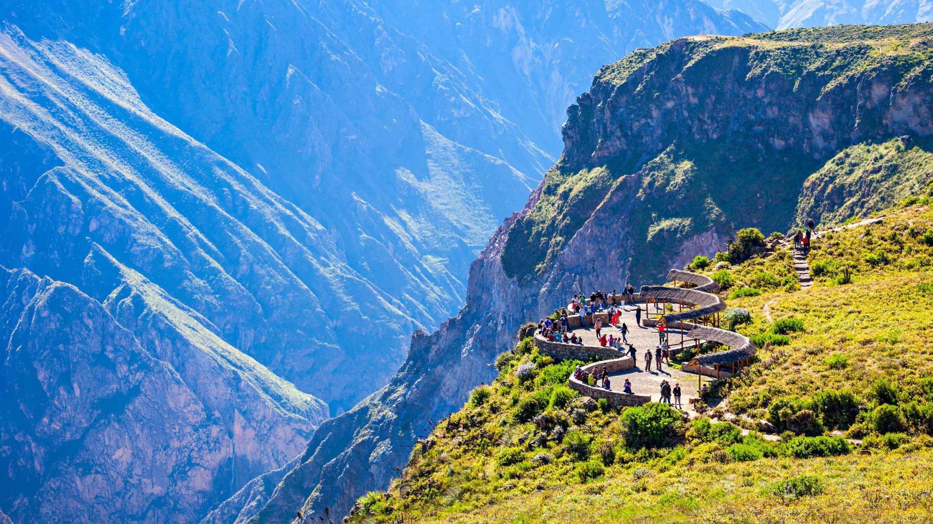
## Description Colca Canyon in southern Peru is one of the world’s deepest and most dramatic canyons, carved by the Colca River through folded volcanic and sedimentary rocks. Terraced agriculture clings to canyon walls and reflects centuries of pre-Columbian and colonial land-use systems. The canyon is famed for condor-watching at viewpoints such as Cruz del Cóndor, where giant Andean condors ride thermal updrafts above layered ridges and terraced fields. Beyond the condors, Colca’s cultural landscape includes traditional villages where residents manage terraces, raise llamas and alpacas, and produce woven textiles. Travelers can combine wildlife viewing with multi-day treks, hot-spring relaxation, and market visits to towns like Chivay for local crafts and regional cuisine. For planning and indexing, useful phrases include "Colca Canyon trek routes," "Cruz del Condor sunrise," and "Colca homestay lodges." Ecological and cultural stewardship: Local communities practice terrace maintenance and rotational agriculture that preserves soil stability and biodiversity. Sustainable tourism operators contribute to local economies through guide employment, community lodges, and cultural exchanges—seek providers who collaborate directly with village associations. ## Location Colca Canyon lies west of Arequipa city in southern Peru; the closest base towns are Chivay and Cabanaconde. Most visitors travel from Arequipa by bus or private transfer, often overnighting to catch morning condor flights. How to get there: Overnight buses and private transfers from Arequipa are common options; the journey includes scenic highland landscapes and stops at viewpoints and small towns. For multi-day treks, many itineraries begin from Cabanaconde or Sangalle (the oasis), and local guides provide route knowledge, porters, and camp logistics when necessary. Use search queries like "Arequipa to Colca Canyon bus" or "Cabanaconde trek guide" to find up-to-date transport and trekking services. Altitude and health: The Colca region ranges above 3,000 meters—allow time to acclimatize in Arequipa or the highlands, stay hydrated, and moderate exertion to reduce altitude-related risks. Cold nights are common; pack suitably warm layers for overnight treks or village stays. ## Tips - **Arrive early for condors:** Dawn and early morning hours produce the most reliable thermals and large condor flight displays at Cruz del Cóndor. - **Consider multi-day treks:** The canyon supports multi-day hikes with village homestays, campsites, and lodges for immersive experiences beyond the main lookout points. - **Hire local guides:** Guides provide route safety, cultural context, and community support; choose operators that compensate villages and porters fairly. - **Visit local markets and hot springs:** Chivay offers markets for textiles and crafts, while nearby hot springs provide a relaxing complement to trekking. - **Acclimatize to altitude:** Spend at least a night in Arequipa or another high-altitude town before strenuous activities and avoid rapid ascent. - **Respect cultural protocols:** Ask permission before photographing people or domestic rituals and buy crafts directly from artisan cooperatives when possible. ## Conclusion Colca Canyon combines a spectacular natural theater with enduring human landscapes—terraced agriculture, weaving traditions, and the Andean condor spectacle create a layered experience for travelers seeking wildlife, culture, and trekking. When planning, use targeted searches like "Colca Canyon 3-day trek" or "best condor viewpoints" to shape an itinerary that balances adventure with community benefits. ## FAQ - **Q: What’s the best time to see condors?** A: Early morning as thermals form (shortly after sunrise) is when condors are most active; clear weather improves visibility but conditions vary seasonally. - **Q: Are guided treks recommended?** A: Yes — local guides know safe routes, campsites, and cultural protocols, and hiring them supports village economies and improves the overall experience. - **Q: How long do treks in Colca Canyon usually take?** A: Treks range from single-day hikes to 2–4 day itineraries depending on route, overnight choices, and walking pace; many travelers choose a 2–3 day loop to visit Sangalle (the oasis) and return via village trails. - **Q: Is the canyon suitable for beginners?** A: Parts of the canyon are approachable for fit beginners with a guide; steep descents and ascents make some routes challenging—assess fitness, acclimatize, and choose routes accordingly. - **Q: How should I prepare for altitude?** A: Allow time in Arequipa or intermediate towns to acclimatize, hydrate, rest, and avoid heavy exertion on the first day at altitude; consult health professionals if you have concerns. ## Links - [Colca Canyon — Wikipedia](https://en.wikipedia.org/wiki/Colca_Canyon)
GemVoyage Team • World

Milan
## Description Villa Tittoni Traversi, also known as Villa Cusani Tittoni Traversi, is an elegant neoclassical villa that represents an important chapter in the architectural and cultural history of the Milan area. Originally conceived as a noble residence, the villa stands out for its refined design, harmonious proportions, and its close relationship with the surrounding landscape. Today, it serves as a cultural venue, hosting exhibitions, events, and public activities that keep its historical legacy alive. What makes Villa Tittoni Traversi unique is its artistic pedigree. The villa was redesigned in the early 19th century by the renowned architect Giuseppe Piermarini, the same architect behind Milan’s Teatro alla Scala. Its interior spaces were later enriched with frescoes and decorative elements that reflect the tastes of Lombard aristocracy. A lesser-known fact is that the villa’s park was influenced by early landscape garden concepts, blending formal and naturalistic elements. Another interesting detail is that the building has passed through the hands of several prominent families, including the Cusani and Tittoni families, each leaving their mark on its design and function. The villa offers a refined yet approachable atmosphere, making it appealing to visitors interested in history, architecture, and cultural life outside Milan’s most crowded attractions. ## Location Villa Tittoni Traversi is located in **Italy**, in the **Lombardy** region, near the city of **Milan**, in the town of **Desio**, north of the city center. Although often associated with Milan due to its proximity, the villa is technically within Desio, making it an easy and worthwhile day trip from the city. Reaching the villa is convenient. Visitors can take a regional train from Milan to **Desio Station**, which is well connected and only a short walk from the villa. Several bus routes also serve the area. For those driving, Desio is easily accessible by road, and parking is generally available near the villa and its park. ## Tips * Check the villa’s event schedule in advance, as exhibitions and cultural programs vary throughout the year. * Take time to explore the surrounding park, which is ideal for relaxing walks and photography. * Guided tours may be available on specific days and can offer deeper insight into the villa’s history. * Visit on weekdays for a quieter experience, especially if events are taking place on weekends. * Combine your visit with a stroll through Desio’s historic center or nearby green spaces. * Wear comfortable shoes, particularly if you plan to explore both the interior and the park. ## Conclusion Villa Tittoni Traversi is a graceful example of Lombard neoclassical architecture and cultural heritage. Its blend of history, art, and green space makes it a rewarding destination for visitors seeking a more intimate and refined experience near Milan. ## FAQ **Is Villa Tittoni Traversi open to the public?** Yes, the villa is open to the public during exhibitions, events, and scheduled visiting hours. **How long does a visit usually take?** Most visits last between one and two hours, depending on exhibitions and time spent in the park. **Is there an entrance fee?** Entrance fees may apply during special exhibitions or events, while access to the park is often free. **Is the villa suitable for families?** Yes, the open park and cultural events make it suitable for families, though children should be supervised indoors. **Can the villa be reached easily from Milan?** Yes, it is easily accessible by train or car from Milan in under an hour. ## Links * [Villa Tittoni Official Website](https://villatittoni.it/)
GemVoyage Team • World
Düsseldorf
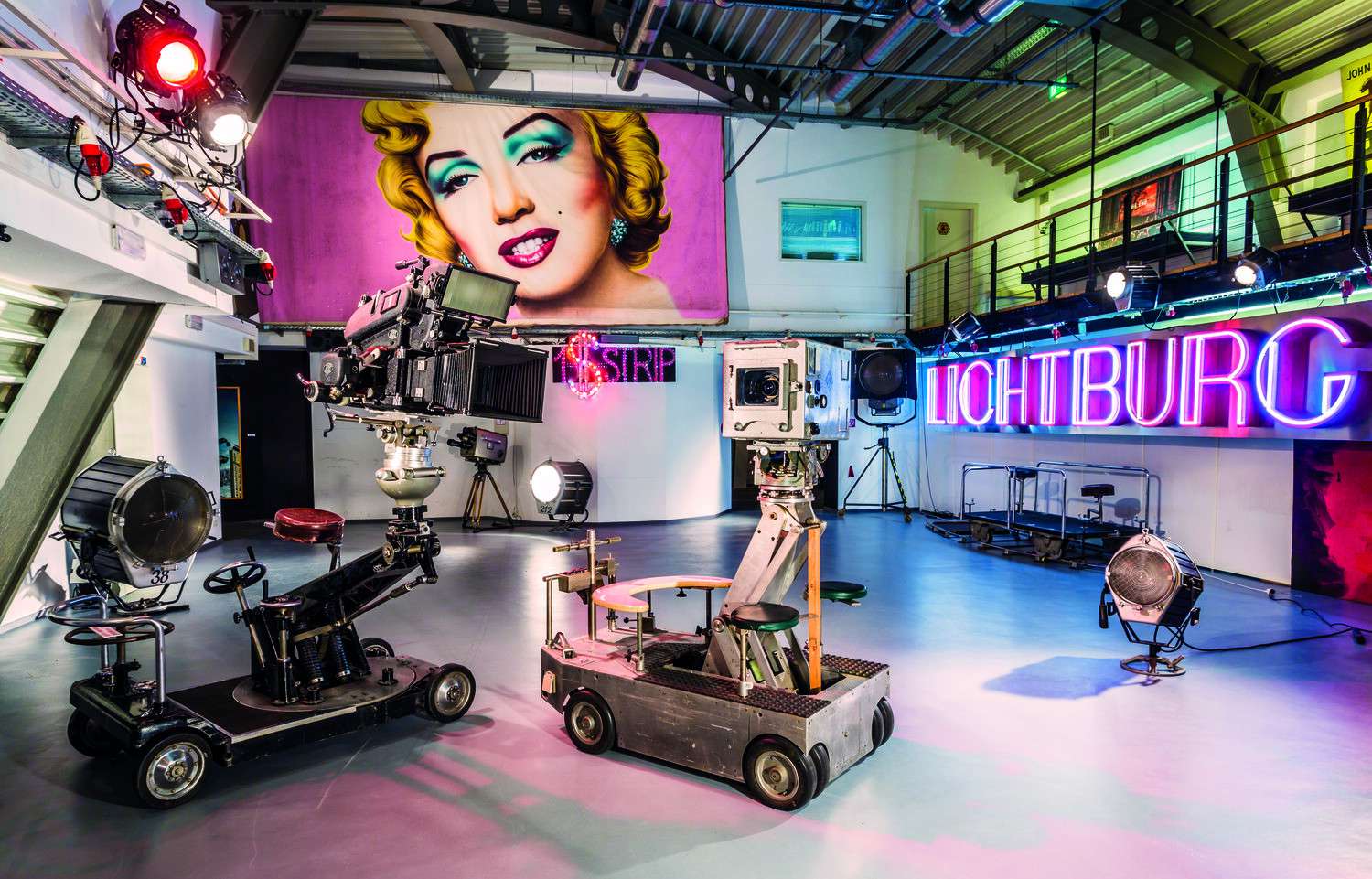
## Description The Film Museum in Düsseldorf (Filmmuseum Düsseldorf) is a captivating destination for cinephiles, history buffs, and curious travelers alike. Located in the heart of the city’s Altstadt (Old Town), this museum offers a deep dive into the evolution of cinema—from the earliest moving images to modern-day blockbusters. Spread across four floors and 2,200 square meters, the museum showcases the art, technology, and cultural impact of film in a way that’s both educational and immersive. Visitors can explore a wide range of exhibits, including vintage cameras, lighting equipment, costumes, props, and set designs. One of the highlights is a reconstructed film studio where guests can get hands-on experience with the filmmaking process. The museum also features interactive displays on special effects, animation, and sound design, making it a dynamic learning environment for all ages. A little-known fact: the museum houses the archives of Fritz Genandt, a local cinema pioneer whose nitrofilm collection is one of the oldest in Germany. Another hidden gem is the “Black Box” cinema located within the museum, which screens classic films, retrospectives, and experimental cinema—often featuring rare or hard-to-find titles. ## Location The Film Museum is located in **Germany**, in the **North Rhine-Westphalia** region, in the city of **Düsseldorf**. Its exact address is Schulstraße 4, 40213 Düsseldorf, right in the Altstadt district. ### How to Get There: - **By Public Transport**: Take the U-Bahn to Heinrich-Heine-Allee station. From there, it’s a short walk to the museum. - **By Car**: Parking is available nearby, but the Altstadt can be busy—public transport is recommended. - **By Foot or Bike**: If you're exploring the Old Town, the museum is easily accessible on foot or by bicycle. Its central location makes it a perfect stop during a day of sightseeing in Düsseldorf. ## Tips for Visitors To make the most of your visit to the Film Museum, keep these tips in mind: - **Visit on a Sunday or Friday**: Admission is free on Sundays and for visitors under 21 on Fridays. - **Check the Black Box Schedule**: The in-house cinema offers a rotating program of films—some screenings include Q&A sessions or guest speakers. - **Explore All Four Floors**: Each level covers a different aspect of film history, from production to distribution to exhibition. - **Use the Museum Library**: With over 33,000 media items, the library is a treasure trove for researchers and film students. - **Attend a Workshop**: The museum regularly hosts seminars and workshops for all ages, including animation and screenwriting. - **Shop for Souvenirs**: The museum store offers unique film-related merchandise and memorabilia. ## Conclusion The Film Museum in Düsseldorf is a vibrant tribute to the magic of cinema. With its rich collection, interactive exhibits, and historic setting, it offers a compelling journey through the world of film—from its humble beginnings to its modern-day marvels. Whether you're a casual moviegoer or a dedicated film buff, this museum is a must-visit. ## FAQ **1. What are the opening hours of the Film Museum?** The museum is open Tuesday to Sunday, typically from 11:00 AM to 6:00 PM. It’s closed on Mondays. **2. Is there an entrance fee?** Yes, general admission is €5 for adults and €2.50 for reduced tickets. Entry is free on Sundays and for visitors under 21 on Fridays. **3. Can I watch films at the museum?** Yes, the museum includes the Black Box cinema, which screens a variety of films throughout the year. **4. Is the museum suitable for children?** Absolutely. Interactive exhibits and workshops make it engaging for younger visitors. **5. Is the museum accessible for people with disabilities?** Yes, the museum is certified for accessibility and offers on-site mobility support. **6. Are guided tours available?** Yes, guided tours can be booked in advance for groups and educational visits. ## Links - [Official Website of Filmmuseum Düsseldorf](https://www.duesseldorf.de/filmmuseum/) - [Wikipedia – Filmmuseum Düsseldorf](https://de.wikipedia.org/wiki/Filmmuseum_D%C3%BCsseldorf)
GemVoyage Team • World
Stockholm
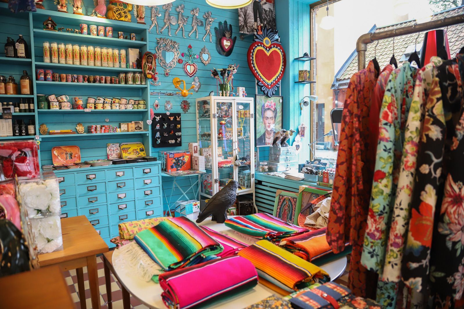
## Description Södermalm has a reputation as one of Stockholm’s most creative and self-assured districts, and its vintage shops are a big part of that identity. The area draws people who like fashion with history, pieces with character, and browsing that feels more like discovery than consumption. Unlike retail zones built around uniform shopping streets, Södermalm’s vintage scene is scattered through a district that already feels interesting to walk through. That means the shopping experience is inseparable from the neighborhood itself. The appeal of Södermalm vintage shops is not only the clothes. It is the curation, the neighborhood energy, and the sense that the area has a long memory. Stockholm’s relationship with design, sustainability, and thoughtful consumption makes secondhand shopping feel especially natural here. You can find everything from well-preserved Scandinavian basics to statement pieces, accessories, workwear, and occasional design objects. Some shops specialize tightly; others feel like treasure hunts where the best finds appear when you least expect them. One little-known fact is that Södermalm’s secondhand culture is closely tied to the district’s broader reputation for indie creativity and alternative style. Another is that many visitors underestimate how pleasant the neighborhood is for walking between shops. Even when one store is busy, the next street might feel calm, which keeps the experience relaxed and exploratory rather than transactional. For travelers who enjoy fashion but dislike generic mall shopping, this is an especially good environment. There is also a practical advantage. Vintage shopping in Södermalm can be combined with cafés, viewpoints, galleries, and neighborhood walks, so the district never feels like a single-purpose retail stop. It becomes part shopping outing, part urban exploration, and part cultural snapshot of Stockholm itself. The result is a richer visit than simply buying clothes. You are also seeing how locals shape style, reuse, and everyday city life. ## Location The vintage shops are located across Södermalm, an island district in central Stockholm, Sweden. Södermalm sits south of Gamla Stan and is one of the easiest central areas of Stockholm to explore on foot. The shopping spots are spread through several streets and pockets of the district, so the experience works best when you treat it as a neighborhood walk rather than a fixed single destination. The easiest way to reach Södermalm is by Stockholm’s metro system, bus network, or on foot from the city center. Medborgarplatsen, Slussen, and other nearby stations are practical starting points depending on which part of the district you want to explore. Because the best finds are often spread out, a comfortable pair of shoes helps more than a tightly scheduled plan. If you are visiting in winter, plan for shorter daylight hours and use indoor stops such as cafés to break up the walk. In warmer months, the district is especially pleasant because moving between shops feels almost like a mini city tour in itself. ## Tips - Start with a broad walk through the district before committing to specific shops. That helps you understand the neighborhood layout. - Look for quality as much as price. The best vintage pieces in Stockholm often stand out because of condition, cut, and timeless design. - Bring a reusable bag or extra room in your luggage if you plan to buy clothing or small home items. - Pair shopping with coffee or lunch so you can pace yourself and avoid rushed decisions. - Visit more than one shop style. A good vintage outing in Södermalm usually mixes curated boutiques, thrift stores, and neighborhood secondhand spots. ## Conclusion Södermalm’s vintage shops offer more than shopping. They give you a stylish way to experience one of Stockholm’s most characterful districts while discovering clothing and objects that feel personal, sustainable, and distinctly local. ## FAQ ### Is Södermalm good for vintage shopping even if I am not a fashion expert? Yes. The neighborhood is easy to browse casually, and many stores are approachable even if you are not hunting for something specific. The pleasure is as much in the atmosphere as in the purchase. ### Are the shops expensive? Prices vary a lot. Some stores are highly curated and price pieces accordingly, while others are more affordable. Stockholm generally has a reputation for quality over bargain-bin pricing. ### How much time should I set aside? At least a few hours if you want to enjoy the area properly. The best experience comes from mixing browsing with time for walking, coffee, and neighborhood exploration. ### Can I combine vintage shopping with other sightseeing? Definitely. Södermalm is close to scenic viewpoints, restaurants, and central Stockholm landmarks, so it fits easily into a larger city day. ## Links - [Södermalm on Wikipedia](https://en.wikipedia.org/wiki/S%C3%B6dermalm) - [Visit Stockholm](https://www.visitstockholm.com/)
GemVoyage Team • World
Tunis
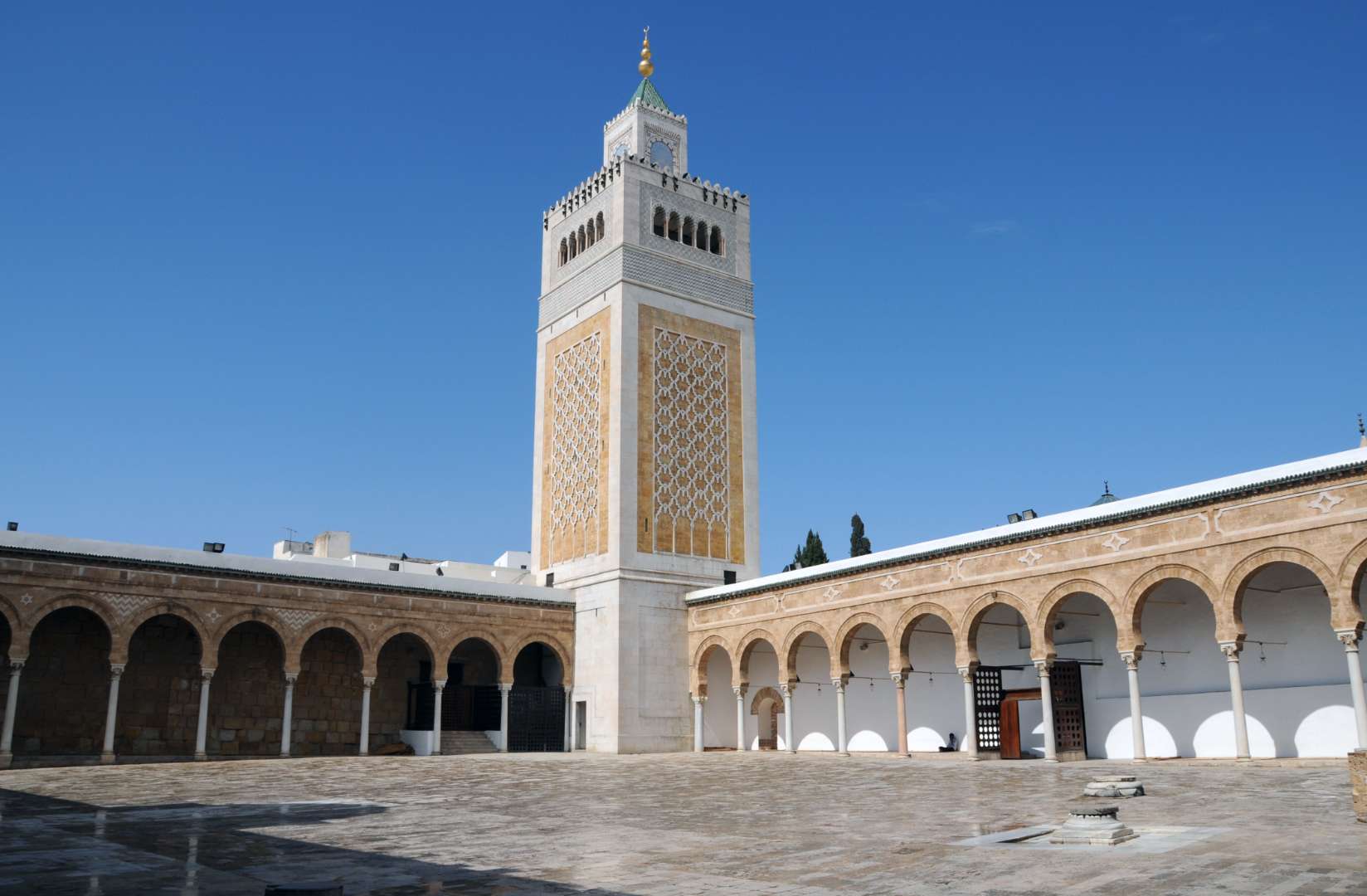
## Description Al Zaytouna Mosque, also known as Ez-Zitouna or the Mosque of the Olive, is the spiritual and intellectual heart of Tunis, Tunisia. Founded in the late 7th or early 8th century and reconstructed in the 9th century during the Aghlabid dynasty, it is the oldest mosque in Tunis and one of the most historically significant in North Africa. The mosque is not only a place of worship but also a symbol of Islamic scholarship, having served as the foundation for the University of Ez-Zitouna—one of the earliest centers of higher learning in the Muslim world. Covering an area of approximately 5,000 square meters, the mosque features nine entrances, a vast rectangular prayer hall, and a trapezoidal courtyard framed by arcades resting on over 160 ancient columns, many of which were repurposed from the ruins of Carthage. Its architecture reflects a blend of Moorish, Fatimid, and Ottoman influences, with a striking 43-meter-high minaret that echoes the design of Almohad minarets. A little-known fact: archaeological investigations in the 20th century revealed that the mosque was built atop a Byzantine-era structure, possibly a Christian basilica or fortification. Another intriguing detail is the presence of a sundial in the courtyard, historically used to determine prayer times—a rare feature in Islamic architecture. ## Location Al Zaytouna Mosque is located in **Tunisia**, in the **Tunis Governorate**, within the **city of Tunis**. It sits at the center of the historic Medina, a UNESCO World Heritage Site known for its labyrinthine alleys, traditional souks, and centuries-old buildings. ### How to Get There - **By Metro**: Take the Tunis light rail to the “Place de Barcelone” station, then walk northeast into the Medina. - **By Taxi**: Taxis are widely available in Tunis and can drop you off near the Medina’s main gates. - **By Foot**: If you're staying in central Tunis, the mosque is easily accessible on foot through the Medina’s winding streets. - **By Tour**: Many guided walking tours of the Medina include a stop at Al Zaytouna Mosque, often with historical commentary. Its central location makes it a perfect starting point for exploring the cultural and architectural treasures of old Tunis. ## Tips - **Dress Modestly**: Visitors should wear clothing that covers shoulders and knees. Women may be asked to cover their hair. - **Visit During Non-Prayer Hours**: Non-Muslim visitors are typically allowed to enter the courtyard but not the prayer hall. Visiting outside prayer times ensures a more relaxed experience. - **Hire a Local Guide**: A knowledgeable guide can provide deeper insights into the mosque’s history, architecture, and scholarly legacy. - **Explore the Surrounding Medina**: The mosque is surrounded by vibrant souks, artisan shops, and historic buildings—perfect for a half-day cultural excursion. - **Respect the Space**: As an active place of worship, visitors should maintain a quiet and respectful demeanor. - **Photography**: Photos are allowed in the courtyard, but avoid photographing worshippers or entering restricted areas. ## Conclusion Al Zaytouna Mosque is a cornerstone of Tunisian heritage, blending religious significance with architectural grandeur and scholarly tradition. Whether you're drawn by its historical depth or its serene beauty, the mosque offers a profound glimpse into the soul of Tunis. ## FAQ **1. Is there an entrance fee to visit Al Zaytouna Mosque?** No, entry is free, though donations are appreciated. Access may be limited for non-Muslims. **2. Can non-Muslims enter the mosque?** Non-Muslims are generally allowed in the courtyard but not the prayer hall. It’s best to check with local guides or signage. **3. What are the mosque’s opening hours?** The mosque is open daily, but access for visitors is typically restricted to non-prayer times, usually mid-morning to late afternoon. **4. Is the mosque wheelchair accessible?** The Medina’s narrow and uneven streets may pose challenges, but the mosque’s courtyard is relatively flat. **5. Are guided tours available?** Yes, many local guides offer tours of the Medina that include Al Zaytouna Mosque. **6. What is the best time to visit?** Early morning or late afternoon offers cooler temperatures and fewer crowds. ## Links - [Al-Zaytuna Mosque – Wikipedia Overview](https://en.wikipedia.org/wiki/Al-Zaytuna_Mosque) - [Al-Zaytouna – Britannica Entry](https://www.britannica.com/topic/Al-Zaytunah)
GemVoyage Team • World

Comments