GemVoyage Team • World
The Quadrilatero del Silenzio is one of Milan’s most refined and least touristy architectural districts, a compact residential enclave where Art Nouveau elegance, early 20th-century symbolism, and aristocratic discretion converge. Unlike Milan’s grand monumental zones such as the Duomo or Brera, this area is defined by silence, privacy, and restrained beauty. It feels less like a destination and more like a secret revealed only to those who actively search for it.
The name “Quadrilatero del Silenzio” loosely translates to “The Quadrilateral of Silence”, referencing both its four bordering streets and the notable absence of commercial noise and mass tourism. The district dates primarily to the early 1900s, when Milan was undergoing rapid modernization and wealthy families commissioned architects to design villas and palazzi inspired by Liberty style, Italy’s version of Art Nouveau.
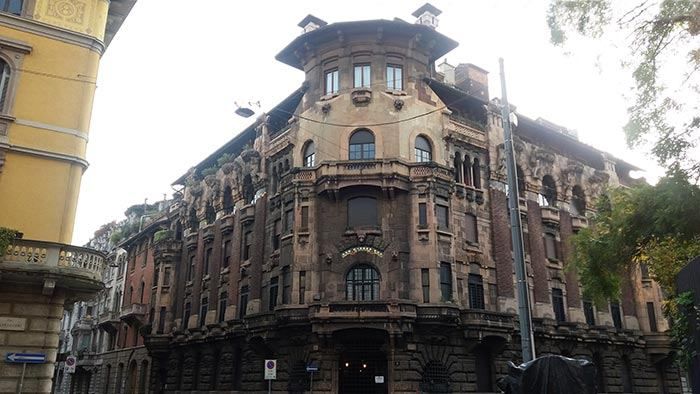
Among the district’s architectural highlights are Casa Galimberti, Casa Guazzoni, and Palazzo Berri-Meregalli. These buildings showcase extraordinary decorative detail: floral ironwork, painted ceramic tiles, sculpted balconies, symbolic reliefs, and richly textured façades. Casa Galimberti in particular stands as one of the most complete Art Nouveau residential structures in Italy, with its exterior entirely clad in painted ceramic panels depicting allegorical scenes and classical figures.
What makes the Quadrilatero del Silenzio especially distinctive is its spiritual and symbolic undercurrent. Palazzo Berri-Meregalli, one of the most visually dramatic buildings in the area, incorporates mystical and occult motifs, skulls, grotesque faces, and symbolic sculptures linked to esoteric traditions. This hidden symbolic language contrasts sharply with the district’s otherwise calm residential purpose, adding a layer of intrigue beneath the formal elegance.
The neighborhood’s emotional atmosphere is measured and withdrawn. Tree-lined streets, soft façades, and limited vehicle traffic create a mood unlike the rest of central Milan. There are no major shops, cafés, or attractions competing for attention. Instead, visitors move slowly, examining balconies, doorways, tiled surfaces, and wrought-iron gates just meters from inhabited private homes. This blurs the boundary between museum-like observation and daily life.
A little-known fact is that Casa Guazzoni’s balcony sculptures were among the earliest experiments with reinforced concrete sculpture in Milan, hidden beneath their decorative surfaces. Another lesser-known detail is that much of the district was deliberately zoned as high-end residential from the outset, preventing later commercial overdevelopment and preserving its original function for more than a century.
Unlike Milan’s fashion districts or historic centers, the Quadrilatero del Silenzio does not sell an experience. It offers stillness. It rewards visitors who pay attention to surface texture, ornamental language, and architectural storytelling rather than spectacle. This makes it particularly appealing to architects, photographers, design students, and travelers who prefer subtlety over highlights.
The district is not large, and it does not aim to be. Its power lies in concentration rather than scale. Within a few blocks, it condenses many of the ideals of Milan’s early modern identity: wealth, experimentation, decorative craftsmanship, and discreet urban living.
The Quadrilatero del Silenzio is located in the eastern part of central Milan, just outside the city’s main historical core.
City: Milan
Region: Lombardy (Lombardia)
Country: Italy
Main Streets Defining the Area:
* Line M1 (red line) to Porta Venezia Station, then a 5–8 minute walk.
The area is ideal to combine with nearby attractions such as Porta Venezia, Indro Montanelli Public Gardens, and Corso Buenos Aires.
The Quadrilatero del Silenzio is one of Milan’s most understated yet culturally dense districts. It reveals a side of the city built not for spectacle but for craft, symbolism, and quiet luxury. Through its Art Nouveau façades, discreet streets, and hidden esoteric details, it tells a story of Milan at the dawn of modernity, preserved in a state of rare urban restraint.
1. What is the Quadrilatero del Silenzio?
It is a small residential architectural district in Milan known for its Art Nouveau buildings and quiet atmosphere.
2. Why is it called “del Silenzio”?
Because of its low traffic, lack of commercial noise, and calm residential character.
3. Is it free to visit?
Yes. It is a public neighborhood with no entrance fee.
4. How long does a visit usually take?
Most visitors spend 30 to 60 minutes walking through the area.
5. Is it good for photography?
Yes, especially for architectural and detail photography, though discretion is expected.
6. Is it suitable for families?
Yes, but it is better suited to slow walking and observation rather than activities for children.
Discover more hidden gems you might love.
Stockholm
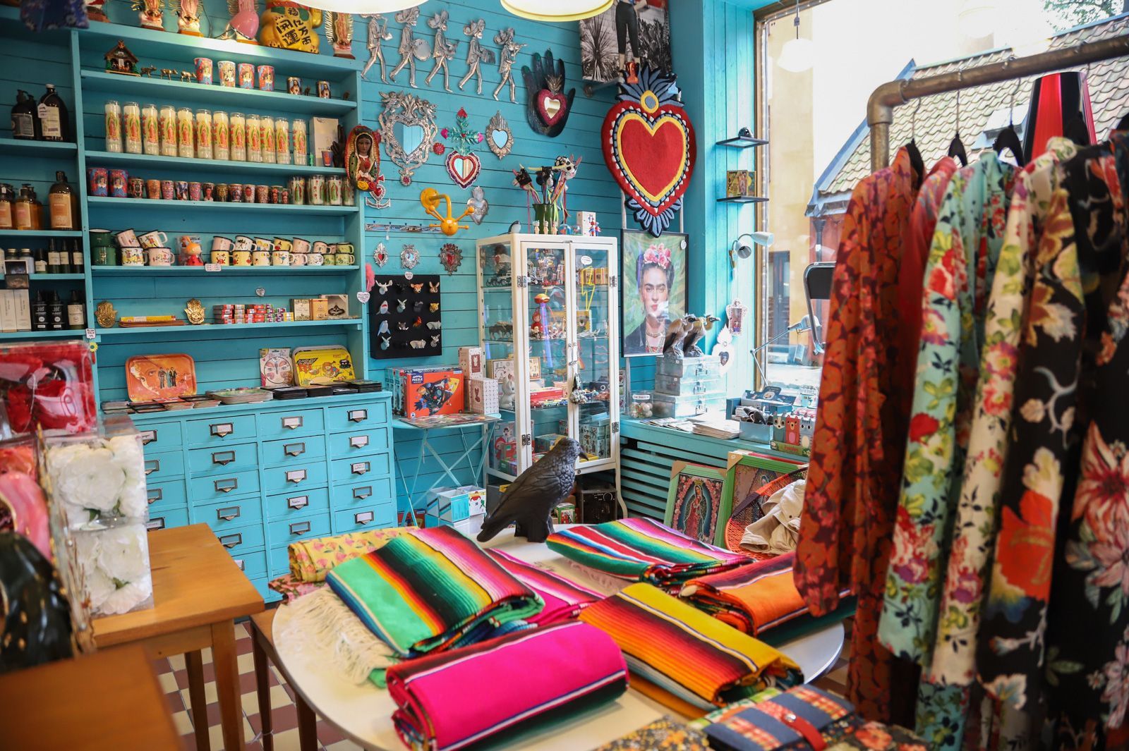
## Description Södermalm has a reputation as one of Stockholm’s most creative and self-assured districts, and its vintage shops are a big part of that identity. The area draws people who like fashion with history, pieces with character, and browsing that feels more like discovery than consumption. Unlike retail zones built around uniform shopping streets, Södermalm’s vintage scene is scattered through a district that already feels interesting to walk through. That means the shopping experience is inseparable from the neighborhood itself. The appeal of Södermalm vintage shops is not only the clothes. It is the curation, the neighborhood energy, and the sense that the area has a long memory. Stockholm’s relationship with design, sustainability, and thoughtful consumption makes secondhand shopping feel especially natural here. You can find everything from well-preserved Scandinavian basics to statement pieces, accessories, workwear, and occasional design objects. Some shops specialize tightly; others feel like treasure hunts where the best finds appear when you least expect them. One little-known fact is that Södermalm’s secondhand culture is closely tied to the district’s broader reputation for indie creativity and alternative style. Another is that many visitors underestimate how pleasant the neighborhood is for walking between shops. Even when one store is busy, the next street might feel calm, which keeps the experience relaxed and exploratory rather than transactional. For travelers who enjoy fashion but dislike generic mall shopping, this is an especially good environment. There is also a practical advantage. Vintage shopping in Södermalm can be combined with cafés, viewpoints, galleries, and neighborhood walks, so the district never feels like a single-purpose retail stop. It becomes part shopping outing, part urban exploration, and part cultural snapshot of Stockholm itself. The result is a richer visit than simply buying clothes. You are also seeing how locals shape style, reuse, and everyday city life. ## Location The vintage shops are located across Södermalm, an island district in central Stockholm, Sweden. Södermalm sits south of Gamla Stan and is one of the easiest central areas of Stockholm to explore on foot. The shopping spots are spread through several streets and pockets of the district, so the experience works best when you treat it as a neighborhood walk rather than a fixed single destination. The easiest way to reach Södermalm is by Stockholm’s metro system, bus network, or on foot from the city center. Medborgarplatsen, Slussen, and other nearby stations are practical starting points depending on which part of the district you want to explore. Because the best finds are often spread out, a comfortable pair of shoes helps more than a tightly scheduled plan. If you are visiting in winter, plan for shorter daylight hours and use indoor stops such as cafés to break up the walk. In warmer months, the district is especially pleasant because moving between shops feels almost like a mini city tour in itself. ## Tips - Start with a broad walk through the district before committing to specific shops. That helps you understand the neighborhood layout. - Look for quality as much as price. The best vintage pieces in Stockholm often stand out because of condition, cut, and timeless design. - Bring a reusable bag or extra room in your luggage if you plan to buy clothing or small home items. - Pair shopping with coffee or lunch so you can pace yourself and avoid rushed decisions. - Visit more than one shop style. A good vintage outing in Södermalm usually mixes curated boutiques, thrift stores, and neighborhood secondhand spots. ## Conclusion Södermalm’s vintage shops offer more than shopping. They give you a stylish way to experience one of Stockholm’s most characterful districts while discovering clothing and objects that feel personal, sustainable, and distinctly local. ## FAQ ### Is Södermalm good for vintage shopping even if I am not a fashion expert? Yes. The neighborhood is easy to browse casually, and many stores are approachable even if you are not hunting for something specific. The pleasure is as much in the atmosphere as in the purchase. ### Are the shops expensive? Prices vary a lot. Some stores are highly curated and price pieces accordingly, while others are more affordable. Stockholm generally has a reputation for quality over bargain-bin pricing. ### How much time should I set aside? At least a few hours if you want to enjoy the area properly. The best experience comes from mixing browsing with time for walking, coffee, and neighborhood exploration. ### Can I combine vintage shopping with other sightseeing? Definitely. Södermalm is close to scenic viewpoints, restaurants, and central Stockholm landmarks, so it fits easily into a larger city day. ## Links - [Södermalm on Wikipedia](https://en.wikipedia.org/wiki/S%C3%B6dermalm) - [Visit Stockholm](https://www.visitstockholm.com/)
GemVoyage Team • World
Cawdor
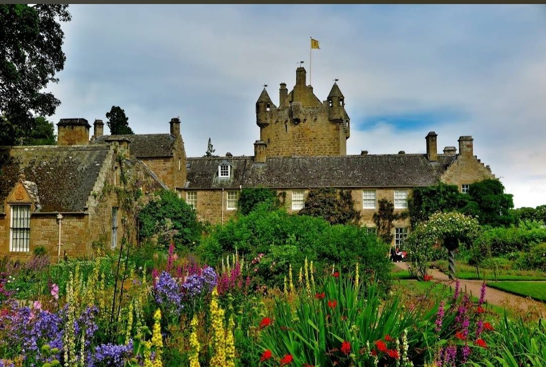
## Description **Cawdor Castle** is one of Scotland’s most enchanting castles, steeped in history, myth, and natural beauty. Built around a legendary holly tree in the late 14th century, the castle has been home to the Cawdor family for over 600 years. With its picturesque stone towers, ornate rooms, and beautifully landscaped gardens, it offers visitors a fascinating journey through Scottish heritage. The castle is famously associated with Shakespeare’s *Macbeth*. While the historical Macbeth never lived here, the castle has become linked to the play because of its title, the Thane of Cawdor. This literary connection, combined with the castle’s authentic medieval charm, makes it an especially intriguing stop for literature lovers and history enthusiasts alike. Inside, visitors can explore grand drawing rooms, antique furniture, fine art collections, and centuries-old tapestries. Outside, the estate features three distinct gardens: the **Walled Garden**, the **Flower Garden**, and the **Wild Garden**, each showcasing Scotland’s flora in different styles and seasons. A little-known fact is that the castle’s origin story is tied to a prophecy. According to legend, the Thane of Cawdor dreamed he should build his castle where a donkey lay down to rest under a tree. That tree still stands today in the castle’s cellar, preserved as a unique piece of history. Another hidden gem is the castle’s woodland trails, which cover over 100 acres and are home to wildlife such as red squirrels and roe deer. ## Location Cawdor Castle is located in the **Scottish Highlands**, about **12 miles east of Inverness**, in the **village of Cawdor, Nairnshire, Scotland**. Its Highland setting adds to its charm, with rolling landscapes, ancient forests, and nearby rivers. The easiest way to reach Cawdor Castle is from **Inverness**, which has good road, rail, and air connections. From Inverness, the castle is just a 25–30 minute drive by car via the A96 and B9090 roads. Visitors without a car can take a train to **Nairn** and then a short taxi ride to the castle. For international travelers, **Inverness Airport** is located only about 15 minutes away, making the castle very accessible as part of a Highland tour. ## Tips To enjoy your visit to Cawdor Castle to the fullest, keep these tips in mind: * **Check seasonal opening times** – The castle is usually open to visitors from late April to early October, so plan accordingly. * **Book tickets online** – During peak tourist season, advance booking is recommended to avoid queues. * **Take your time in the gardens** – Each garden offers a different experience, so don’t rush. Spring and summer are especially beautiful. * **Explore the woodlands** – The nature trails are less crowded and perfect for a quiet walk surrounded by Highland wildlife. * **Photography** – While photos are allowed outside, check the guidelines for indoor photography, as some rooms may restrict it. * **Combine with nearby attractions** – Cawdor Castle can be paired with a visit to Culloden Battlefield or Loch Ness for a full day of Highland history and scenery. ## Conclusion **Cawdor Castle in Scotland** is a captivating blend of history, legend, and natural beauty. With its ties to Shakespeare, legendary holly tree, and stunning gardens, it offers visitors a truly unique Scottish experience. Whether you’re drawn by literature, heritage, or landscapes, this Highland treasure is well worth the journey. ## FAQ **1. Is Cawdor Castle connected to Shakespeare’s Macbeth?** While the historical Macbeth never lived here, the castle is famously linked to the play because Macbeth is given the title “Thane of Cawdor.” **2. When is the best time to visit?** Late spring and summer are ideal for enjoying the gardens in full bloom, though autumn also brings beautiful colors in the surrounding woodlands. **3. How long should I plan for a visit?** Most visitors spend 2–3 hours exploring the castle interiors, gardens, and woodland trails. **4. Are guided tours available?** Yes, guided tours are often available and provide deeper insights into the castle’s history, legends, and architecture. **5. Can children visit Cawdor Castle?** Absolutely. The gardens and woodlands make it family-friendly, and children can enjoy exploring the outdoor spaces. **6. Is the castle accessible for visitors with mobility issues?** The gardens and some areas are accessible, but due to the historic structure, certain parts of the castle may be difficult to reach. It’s best to check accessibility details in advance. ## Links * [Official Cawdor Castle Website](https://www.cawdorcastle.com) * [Visit Scotland – Cawdor Castle](https://www.visitscotland.com)
GemVoyage Team • World
Brussels
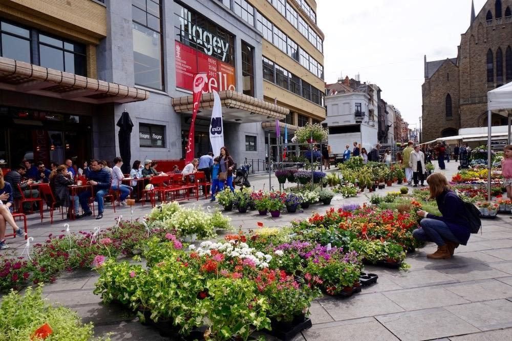
## Description Flagey Square Market is one of the most characterful weekly markets in Brussels, and it feels less like a simple shopping stop than a snapshot of the city’s everyday rhythm. Set around the wide, lively Place Flagey in Ixelles, the market brings together fresh produce, flowers, cheeses, baked goods, spices, and the kind of seasonal local ingredients that reveal how Brussels really eats. For visitors, its appeal is not just what is sold but how the place works as a social scene: neighbors catch up over coffee, families fill baskets for the week, and travelers get a direct taste of the city beyond the usual museum circuit. What makes Flagey Square Market especially memorable is the contrast between its practical purpose and its setting. Place Flagey is bordered by elegant urban architecture and sits near the ponds of Ixelles, which means a trip to the market can easily turn into a broader walk through one of Brussels’ most attractive districts. A lesser-known detail is that the square is closely associated with Brussels’ cultural life, so the market often feels like it belongs to a wider neighborhood ecosystem of design, music, and café culture rather than standing alone as a tourist attraction. Another advantage is the market’s pace: it is big enough to be interesting, but not so overwhelming that it loses its local feel. If you are interested in food travel, Flagey Square Market is a place to observe small but revealing habits. Look for vendors selling regional cheeses from Wallonia, seasonal fruit that reflects the calendar rather than a global supermarket standard, and flowers that are often carried home by residents heading back to nearby apartments. The best markets are the ones where the transaction is only part of the experience, and this one excels because it invites lingering, tasting, and people-watching in equal measure. You can come away with ingredients for a picnic, a gift for someone back home, or simply a better understanding of Brussels as a lived-in city. It is also a strong choice for travelers who prefer neighborhoods over monuments. The market gives you a reason to spend time in Ixelles, an area with a cosmopolitan reputation but also a distinctly Brussels identity. That balance of local routine and cosmopolitan variety is what makes Flagey Square Market worth including in any city itinerary. ## Location Flagey Square Market is located at Place Flagey in Ixelles, Brussels-Capital Region, Belgium. The square sits in the southeastern part of central Brussels, close to the Ixelles Ponds and within easy reach of the city’s main cultural and dining areas. It is one of the most walkable parts of Brussels, and that is part of the attraction: the market can be paired with a stroll around the ponds, a coffee in the Flagey neighborhood, or a longer walk toward Avenue Louise and the surrounding streets. Getting there is straightforward. From central Brussels, the easiest route is often public transport, especially trams or buses that connect the square with major districts and the city center. If you are staying in Ixelles or near the European Quarter, a taxi or rideshare is simple, but public transport usually provides the most efficient and authentic option. Walking is also realistic if you like to explore Brussels on foot, though the distance will depend on your starting point. Cycling can work well too, especially on a good weather day, since the neighborhood is relatively bike-friendly by urban standards. If your goal is to visit the market at its best, aim for a morning arrival. That is when the produce is freshest and the atmosphere is most active, with enough local shoppers to create energy without making the aisles feel crowded. Pairing the market with the nearby ponds is one of the smartest ways to structure a half-day in Brussels. ## Tips Arrive early if you want the widest choice of fruit, bread, cheese, and prepared foods. Later in the day you may still find good items, but the market is more rewarding when stock is full and the pace is relaxed. Bring a reusable bag or two. Markets like this are at their best when you can buy a few things spontaneously, and having a bag makes it easy to leave with snacks, picnic ingredients, or a small bouquet of flowers. Carry some cash, even if many vendors accept cards. Markets are practical places, but payment habits can vary from stall to stall, and cash can save time when you are buying a small item. Do not rush. Flagey Square Market is not only about shopping; it is also about atmosphere. Stop for coffee, ask vendors what is in season, and pay attention to the products locals reach for most often. That is often the best guide to quality. If the weather is pleasant, plan to continue to the Ixelles Ponds after the market. That small extension turns a food stop into a genuinely enjoyable neighborhood outing. ## Conclusion Flagey Square Market is one of Brussels’ best places to experience local life at street level. It combines food, neighborhood character, and a pleasant urban setting in a way that feels genuine rather than staged. For travelers who want a market that reflects the city’s daily rhythm, it is an excellent stop. ## FAQ ### When is Flagey Square Market open? Market days can vary by season and local scheduling, so it is best to check current opening times before you go. In general, the busiest and most rewarding hours are in the morning, when produce selection is strongest and the atmosphere feels most lively. ### Is Flagey Square Market good for tourists? Yes. It is especially good for visitors who want to see a neighborhood market that locals actually use. It is also easy to combine with nearby walks, cafés, and the Ixelles Ponds, so it fits naturally into a city day. ### What should I buy there? Fresh fruit, bread, cheese, flowers, and seasonal snacks are the most reliable purchases. If you want a taste of Brussels, look for local dairy products, pastries, or ingredients that are clearly tied to the season. ### How long should I spend there? Most visitors will enjoy 45 minutes to 2 hours, depending on whether they want to shop, eat, and explore the surrounding neighborhood. If you plan a full brunch or picnic outing, you may want even longer. ## Links - [Flagey](https://www.flagey.be/en) - [Place Flagey on Visit Brussels](https://visit.brussels/en/place/place-flagey)
GemVoyage Team • World
Stockholm
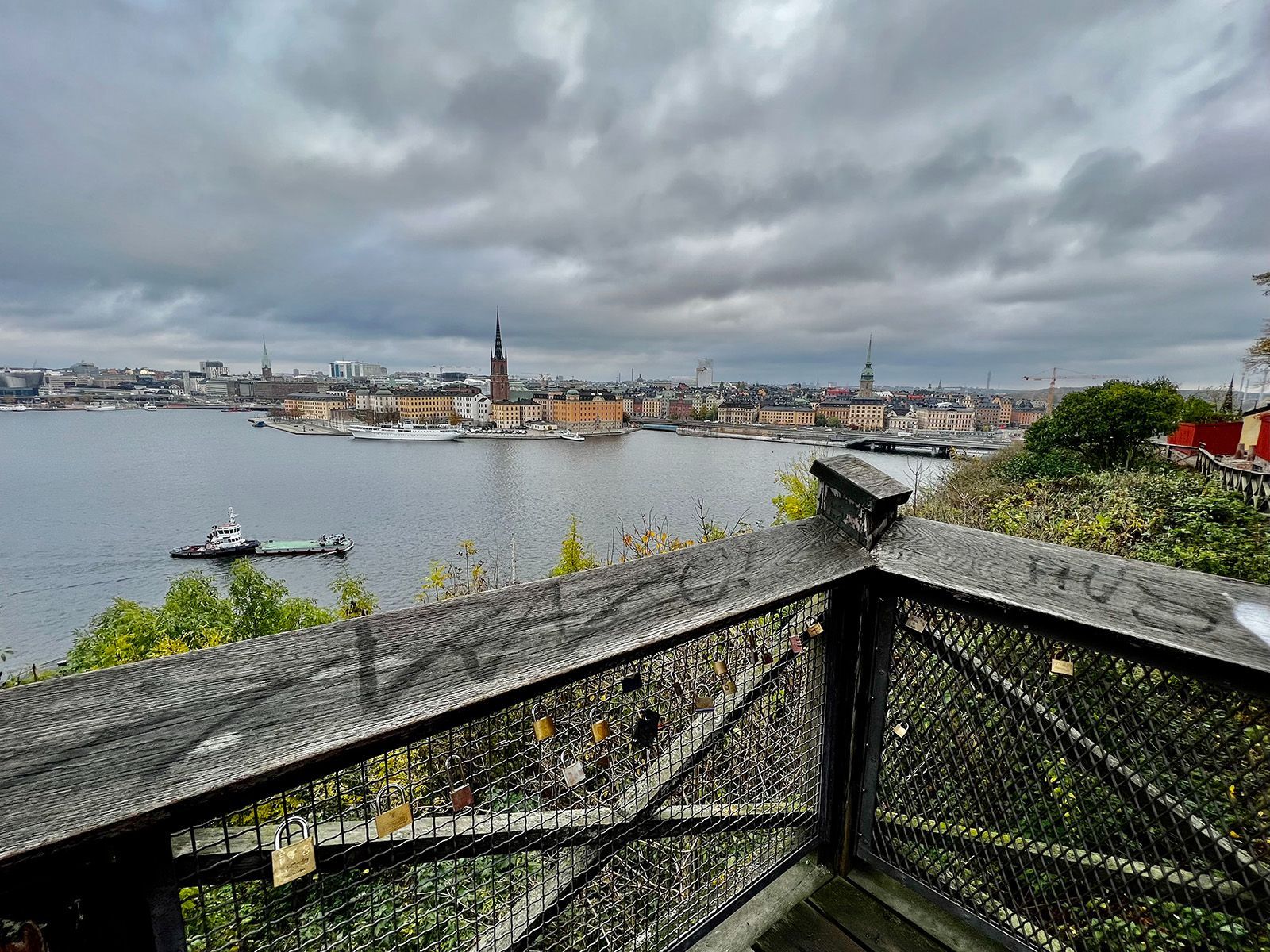
## Description Monteliusvägen is one of Stockholm’s most beloved viewpoint walks because it offers a remarkable amount of scenery for very little effort. Stretching along Mariaberget in Södermalm, the path gives visitors panoramic views over Riddarfjärden, City Hall, and the water and skyline that define Stockholm’s visual identity. It is a place where walking becomes part of the sightseeing itself, and where the city looks especially elegant in changing light. The viewpoint’s appeal lies in its mixture of accessibility and atmosphere. You do not need to climb a mountain or travel far from the center to get a memorable outlook. Instead, you can step into a residential and elevated part of the city and find a broad view that feels almost theatrical. One little-known fact is that Monteliusvägen is particularly admired by locals for how reliably it delivers a strong skyline view without the crowds associated with more obvious tourist stops. Another is that the path changes character with the seasons; winter can make the scenery crisp and graphic, while summer brings long, luminous evenings and a more relaxed mood. What also makes Monteliusvägen special is that it combines motion and pause. As you walk, the city opens and closes in layers. You might pass benches, low walls, and quiet residential details, then suddenly find a view that feels worthy of a postcard. That rhythm encourages visitors to slow down rather than rush through. It is a great place to arrive without a fixed plan, because the reward comes from both the walk and the destination. For photographers and casual visitors alike, the viewpoint is one of Stockholm’s most satisfying urban experiences. It captures the city’s relation to water, its elegant low-rise skyline, and its subtle balance between nature and urban form. A sunset visit can be particularly memorable, but the viewpoint works at many times of day because the geometry of the city and the water remains compelling even in flat light. ## Location Monteliusvägen is located on Mariaberget in Södermalm, Stockholm, Sweden, overlooking the waters of central Stockholm. It is very close to the city core, which makes it easy to include in a broader city walk. Because it sits on a ridge above the water, the route includes some uphill movement, but the climb is short and manageable. The easiest access is via Stockholm’s metro system to nearby stations such as Slussen, followed by a walk through Södermalm. From there, signage and local navigation are usually straightforward enough for most visitors to find the viewpoint. Since the area is so central, it is simple to pair it with a coffee stop, dinner, or a longer Södermalm exploration. If you want the best photo conditions, go near sunset or during the soft light of early morning. For a quieter experience, avoid peak sightseeing hours when possible. ## Tips - Go at sunset if you want the most dramatic light on the water and skyline. - Wear comfortable shoes because the approach includes some uphill walking. - Bring a jacket or layer, especially if you stay after sunset when wind can feel cooler. - Walk slowly and stop more than once. The viewpoint changes as you move along it. - Combine Monteliusvägen with another Södermalm stop so the outing feels complete. ## Conclusion Monteliusvägen is one of Stockholm’s most rewarding short walks, offering a classic view of the city with little logistical effort. It is simple, beautiful, and especially strong at sunset. ## FAQ ### Is Monteliusvägen worth it if I have only one day in Stockholm? Yes. It is one of the quickest ways to get a memorable city view without a complicated excursion. ### How long is the walk? The walking stretch is fairly short, but you will likely spend more time stopping to enjoy the views than actually moving. ### Is it very crowded? It can be popular, especially around sunset, but it still often feels calmer than the most famous Stockholm viewpoints. ### Is it family-friendly? Yes, as long as everyone is comfortable with a little uphill walking and staying attentive near ridge-edge paths. ## Links - [Visit Stockholm](https://www.visitstockholm.com/)
GemVoyage Team • World
Beijing
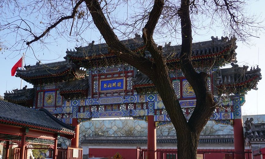
## Description The Taoist White Cloud Temple, also known as Baiyun Guan, is one of Beijing’s most important Taoist sites and one of the best places in the city to understand living religious tradition rather than imperial grandeur alone. Unlike the palaces and ceremonial complexes that often dominate Beijing itineraries, White Cloud Temple offers a quieter, more introspective experience centered on worship, ritual practice, and the continuity of Taoist culture in a modern metropolis. It is both a spiritual site and a historic monument, and that combination gives it a distinct atmosphere that feels deeply local. One of the reasons the temple stands out is that it has remained an active religious center for centuries. Visitors are not just looking at preserved architecture; they are entering a place where incense, prayer, and seasonal observance still matter. A lesser-known fact is that Baiyun Guan has long been associated with the Quanzhen school of Taoism, which helped shape its role as a major center for priestly training and ritual life. Another detail many travelers miss is that the temple complex includes multiple courtyards and halls arranged to guide visitors gradually from the street into a more contemplative inner space, which makes the visit feel like a transition rather than a simple sightseeing stop. For travelers, the appeal lies in both scale and texture. The temple is not overwhelming, yet it contains enough detail to reward slow observation. You will see ritual objects, stone inscriptions, prayer spaces, architectural ornament, and the quiet habits of worshippers who come for reasons unrelated to tourism. That authenticity matters. It gives White Cloud Temple a grounded energy that many visitors find memorable precisely because it is not trying to entertain them. Instead, it invites attention, patience, and respect. It is also an excellent introduction to Taoism for visitors who know the tradition only in abstract terms. The site demonstrates how religion, philosophy, architecture, and daily practice can coexist in one living space. In a city famous for imperial landmarks, White Cloud Temple offers a more intimate kind of historical depth. ## Location Taoist White Cloud Temple is located in Xicheng District, Beijing, China, not far from the central part of the city. Its placement makes it accessible without being swallowed by the busiest tourist corridors. Because Beijing is so large, that central-but-not-overcrowded location is a major advantage for visitors who want to combine the temple with other nearby cultural stops. The easiest way to reach the temple is by subway followed by a short walk, although taxis and rideshares are also practical. Public transit is usually the most efficient option in Beijing, especially during heavy traffic. Once you arrive, the temple is straightforward to enter, and the surrounding streets make it easy to transition from city noise into a quieter courtyard environment. If you want to build the visit into a broader Beijing day, it works well as part of a route that includes nearby historic neighborhoods, museums, or old city streets. Morning visits are often the best because the temple feels calm, the light is better for photography, and you are more likely to encounter ritual activity rather than only sightseeing crowds. ## Tips Dress modestly and behave respectfully. This is an active religious site, not just a museum. Arrive early if you want a quieter experience. The temple’s atmosphere is strongest before the day becomes too busy. Look closely at the courtyards and side halls. The most rewarding details are often not in the main entrance area but in the quieter corners. Bring cash or a card depending on current local habits, but do not assume every small purchase or offering will be handled the same way as in a Western museum setting. Take time to observe rather than rush through the complex. Baiyun Guan is best experienced as a slow walk through layered religious space. ## Conclusion The Taoist White Cloud Temple is one of Beijing’s most meaningful spiritual landmarks, combining active worship, historical continuity, and architectural calm. It is especially rewarding for travelers who want a more thoughtful and authentic view of the city. ## FAQ ### Is White Cloud Temple still active? Yes. It remains an active Taoist temple, which is part of what makes the visit so distinctive. ### How much time should I spend there? Most visitors will need 1 to 2 hours, though you can spend longer if you are interested in the history or want to observe the atmosphere more carefully. ### Is photography allowed? Policies can vary by area and current temple rules, so it is best to check on arrival and avoid photographing people without permission. ### Is this a good place for first-time visitors to Beijing? Yes, especially if you want to understand the city beyond its most famous imperial monuments. ## Links - [White Cloud Temple on Wikipedia](https://en.wikipedia.org/wiki/White_Cloud_Temple) - [Beijing official tourism](https://english.beijing.gov.cn/) - [Taoism overview](https://en.wikipedia.org/wiki/Taoism)
GemVoyage Team • World
Istanbul
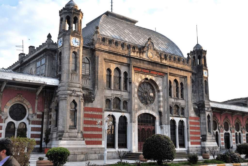
## Description The Istanbul Railway Museum (İstanbul Demiryolu Müzesi) is a hidden gem tucked inside the historic Sirkeci Terminal, once the eastern terminus of the legendary Orient Express. Opened in 2005 and operated by Turkish State Railways (TCDD), the museum offers a nostalgic journey through Turkey’s railway history, showcasing the evolution of train travel from the Ottoman era to the modern age. What makes this museum truly special is its location—Sirkeci Station itself is a masterpiece of 19th-century architecture, built in 1888 and opened in 1890. The museum occupies a modest 145 square meters, but within that space, it houses over 300 historical artifacts. Visitors can explore vintage station equipment, elegant silverware from dining cars, manufacturer plates from historic locomotives, and even the driver’s cab of an electric suburban train. A little-known fact: the museum includes original warning signs and clocks from stations across Turkey, offering a rare glimpse into the operational side of railway life. Another quirky detail—some of the furniture on display was used in the Orient Express, adding a touch of international glamour to the collection. ## Location The Istanbul Railway Museum is located in **Turkey**, within the **Marmara Region**, in the city of **Istanbul**. Specifically, it sits inside the **Sirkeci Terminal** in the **Fatih district**, a stone’s throw from the Bosphorus and the historic Sultanahmet area. ### How to Get There: - **By Tram**: Take the T1 tram line to Sirkeci Station. The museum is inside the terminal building. - **By Metro**: From Marmaray Sirkeci Station, it’s a short walk to the museum. - **By Foot**: If you're exploring Sultanahmet, the museum is easily reachable on foot—just a 10-minute walk from Hagia Sophia or Topkapı Palace. - **By Taxi or Ride-Hailing**: Services like BiTaksi or Uber can drop you off directly at the station entrance. Its central location makes it an ideal stop for tourists exploring Istanbul’s historic peninsula. ## Tips for Visitors To make the most of your visit to the Istanbul Railway Museum, consider these tips: - **Visit on Weekdays**: The museum is open Tuesday to Saturday, from 9:00 AM to 5:00 PM. It’s closed on Sundays and Mondays. - **Admission is Free**: No ticket required, making it a budget-friendly cultural stop. - **Combine with Nearby Attractions**: Pair your visit with a trip to the Spice Bazaar, Galata Bridge, or the Basilica Cistern. - **Photography**: Photos are allowed, but be respectful of the space and avoid flash photography. - **Short and Sweet**: The museum is compact—plan for 30 to 45 minutes. It’s perfect for a quick cultural detour. - **Ask Questions**: Staff are knowledgeable and often happy to share stories behind the exhibits. ## Conclusion The Istanbul Railway Museum is a compact yet captivating tribute to Turkey’s rail history, housed in one of the city’s most iconic train stations. With its rich collection of artifacts and its connection to the Orient Express, it offers a unique blend of nostalgia and historical insight—perfect for train enthusiasts and curious travelers alike. ## FAQ **1. What are the opening hours of the Istanbul Railway Museum?** The museum is open Tuesday to Saturday, from 9:00 AM to 5:00 PM. It’s closed on Sundays and Mondays. **2. Is there an entrance fee?** No, admission is free for all visitors. **3. How long does a visit typically take?** Most visitors spend about 30 to 45 minutes exploring the museum. **4. Is the museum suitable for children?** Yes, children interested in trains and history will enjoy the exhibits, though supervision is recommended due to fragile artifacts. **5. Can I take photos inside the museum?** Yes, photography is allowed, but flash should be avoided to protect the exhibits. **6. Is the museum accessible for people with disabilities?** Accessibility may be limited due to the historic nature of the building. It’s best to contact the museum in advance for specific accommodations. ## Links - [Istanbul Railway Museum – Wikipedia](https://en.wikipedia.org/wiki/Istanbul_Railway_Museum)
GemVoyage Team • World

Comments