GemVoyage Team • World
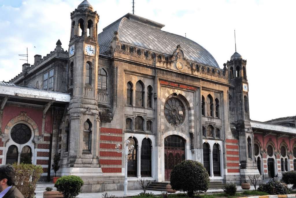
The Istanbul Railway Museum (İstanbul Demiryolu Müzesi) is a hidden gem tucked inside the historic Sirkeci Terminal, once the eastern terminus of the legendary Orient Express. Opened in 2005 and operated by Turkish State Railways (TCDD), the museum offers a nostalgic journey through Turkey’s railway history, showcasing the evolution of train travel from the Ottoman era to the modern age.
What makes this museum truly special is its location—Sirkeci Station itself is a masterpiece of 19th-century architecture, built in 1888 and opened in 1890. The museum occupies a modest 145 square meters, but within that space, it houses over 300 historical artifacts. Visitors can explore vintage station equipment, elegant silverware from dining cars, manufacturer plates from historic locomotives, and even the driver’s cab of an electric suburban train.
A little-known fact: the museum includes original warning signs and clocks from stations across Turkey, offering a rare glimpse into the operational side of railway life. Another quirky detail—some of the furniture on display was used in the Orient Express, adding a touch of international glamour to the collection.
The Istanbul Railway Museum is located in Turkey, within the Marmara Region, in the city of Istanbul. Specifically, it sits inside the Sirkeci Terminal in the Fatih district, a stone’s throw from the Bosphorus and the historic Sultanahmet area.
Its central location makes it an ideal stop for tourists exploring Istanbul’s historic peninsula.
To make the most of your visit to the Istanbul Railway Museum, consider these tips:
The Istanbul Railway Museum is a compact yet captivating tribute to Turkey’s rail history, housed in one of the city’s most iconic train stations. With its rich collection of artifacts and its connection to the Orient Express, it offers a unique blend of nostalgia and historical insight—perfect for train enthusiasts and curious travelers alike.
1. What are the opening hours of the Istanbul Railway Museum?
The museum is open Tuesday to Saturday, from 9:00 AM to 5:00 PM. It’s closed on Sundays and Mondays.
2. Is there an entrance fee?
No, admission is free for all visitors.
3. How long does a visit typically take?
Most visitors spend about 30 to 45 minutes exploring the museum.
4. Is the museum suitable for children?
Yes, children interested in trains and history will enjoy the exhibits, though supervision is recommended due to fragile artifacts.
5. Can I take photos inside the museum?
Yes, photography is allowed, but flash should be avoided to protect the exhibits.
6. Is the museum accessible for people with disabilities?
Accessibility may be limited due to the historic nature of the building. It’s best to contact the museum in advance for specific accommodations.
Discover more hidden gems you might love.
Beijing
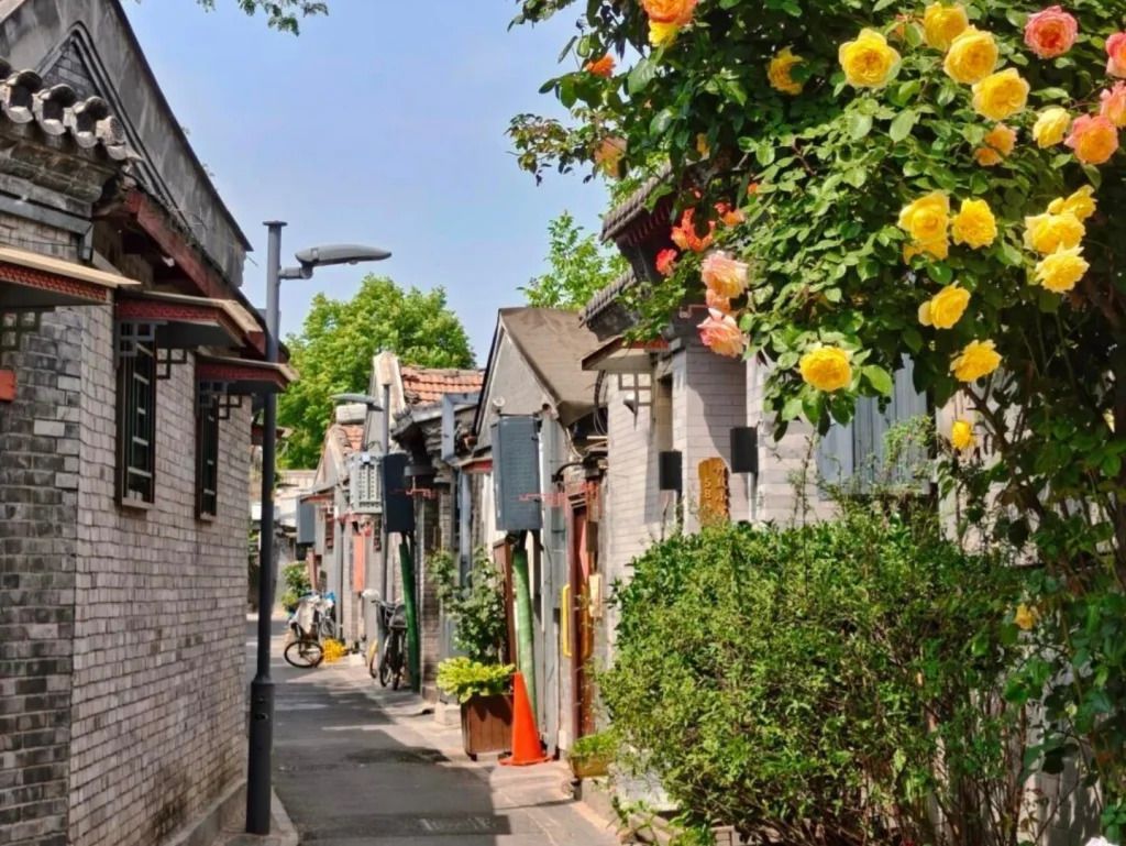
## Description Qinhuangdao Alley Hutongs, as a travel idea, points to one of Beijing’s most rewarding urban experiences: moving through the city’s traditional hutong lanes and seeing how historic residential fabric still shapes everyday life. Hutongs are not grand monuments in the usual sense. They are narrow lanes, courtyard-house networks, and neighborhood corridors that preserve a more intimate view of Beijing than the city’s large avenues and famous landmarks. That is exactly why they remain so compelling. They let visitors step into the scale of older Beijing, where community, domestic life, and street activity sit in close proximity. The appeal of the hutong experience lies in its texture. Instead of one single iconic object, you get layered details: gray brick walls, courtyard entrances, hand-painted signs, hidden cafés, neighborhood shops, bicycles, small temples, and the daily rhythm of residents going about ordinary routines. A lesser-known fact is that hutongs are not just tourist curiosities; they are living urban forms that have survived because they still support local life, even as some areas have changed dramatically. Another overlooked detail is that many of the most interesting hutong walks reveal small architectural differences from lane to lane, including gate styles, courtyard layouts, and adaptations made over time to fit modern use. If you are traveling in Beijing for the first time, hutongs can be one of the most useful experiences you choose because they explain the city in a human-scale way. They show how neighborhoods are organized, how people move, and how history remains present without always announcing itself loudly. Unlike large museums, the hutong district does not ask you to stand still. It invites you to wander, notice, and compare. That makes it especially rewarding for slow travelers, photographers, architecture lovers, and anyone who prefers atmosphere over checklist sightseeing. The name “Qinhuangdao Alley Hutongs” may be used locally or descriptively, but the broader experience belongs firmly to Beijing’s historic center. Rather than approaching it as a single fenced attraction, think of it as a neighborhood exploration. That mindset will help you appreciate it much more fully. ## Location The hutong experience is centered in Beijing Municipality, China, especially in the older districts of Dongcheng and Xicheng where historic lanes remain most visible. Depending on the exact lane or alley you plan to visit, you may be close to landmarks such as Shichahai, Nanluoguxiang, the Bell and Drum Towers, or other traditional neighborhoods. Because hutongs are embedded in the city’s fabric, their location is best understood as a district-level experience rather than a single destination pin. Getting there is usually easiest by subway, followed by a short walk. Beijing’s public transit network is efficient for reaching the historic core, and once you exit the station, the pleasure comes from entering the smaller lanes on foot. Taxis and rideshares are also practical, but traffic can make them slower than the metro during busy hours. If you prefer a more immersive approach, combine subway access with a walking route that allows for detours into side streets. Because the exact lanes can be harder to define than a single monument, it helps to visit with an open itinerary. Choose a starting point in a known hutong district and then let the side alleys guide your exploration. That approach usually produces the most interesting results. ## Tips Walk slowly. Hutongs reward attention to detail, and many of their best moments are found between the obvious sights. Respect private space. These are living neighborhoods, not theme park sets, so it is important to be considerate when taking photos or peering into courtyards. Visit at a comfortable time of day. Morning and late afternoon often feel more pleasant for walking, with softer light and a calmer pace. Combine the walk with food. Small noodle shops, tea spots, and casual eateries can turn a simple stroll into a much richer cultural experience. Do not try to “finish” the hutongs. The value is in wandering a manageable section well, not in covering everything. ## Conclusion The hutongs of Beijing offer one of the most atmospheric ways to understand the city. They are historic, living, and quietly beautiful, with enough variation to reward curiosity at every turn. For travelers who want Beijing beyond its headline monuments, this is an essential experience. ## FAQ ### What is a hutong? A hutong is a traditional Beijing alley or lane, usually linked to courtyard-house neighborhoods. The form reflects older patterns of urban life and remains an important part of the city’s identity. ### Are hutongs still inhabited? Yes. Many hutong areas are still lived in, even though some have been renovated, adapted, or repurposed for commerce and tourism. ### Is this more of a walking experience than a fixed attraction? Exactly. Hutongs are best understood as a walkable neighborhood environment rather than a single enclosed site. ### How long should I spend there? A focused walk might take 1 to 2 hours, but a more rewarding visit can easily stretch longer if you stop for food, tea, or photography. ## Links - [Hutong on Wikipedia](https://en.wikipedia.org/wiki/Hutong) - [Beijing official tourism](https://english.beijing.gov.cn/)
GemVoyage Team • World
Turin
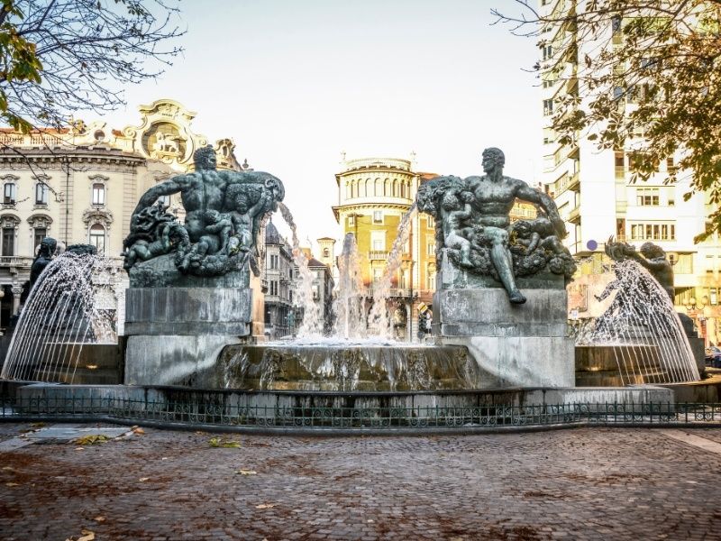
## Description Piazza Solferino is one of Turin’s most elegant and historically significant squares, offering a refined blend of architecture, green spaces, and local life. Located in the city center, the square serves as a calm yet vibrant meeting point where residents and visitors alike come to stroll, relax, or enjoy a coffee nearby. Unlike some of Turin’s more monumental piazzas, Piazza Solferino feels intimate and lived-in, making it an excellent place to experience the city at a slower pace. What makes Piazza Solferino unique is its layered history. The square is named after the Battle of Solferino (1859), a key event in Italian unification, and it stands close to sites connected to important political and cultural moments. A lesser-known fact is that the nearby area played a role in the birth of the Red Cross movement, inspired by the aftermath of the Battle of Solferino. Another interesting detail is the presence of subtle architectural transitions around the square, reflecting Turin’s shift from baroque influences to more modern urban planning during the 19th and early 20th centuries. With its central gardens, mature trees, and surrounding cafés and offices, Piazza Solferino offers a peaceful contrast to the busier shopping streets just steps away. ## Location Piazza Solferino is located in **Italy**, in the **Piedmont** region, within the city of **Turin (Torino)**. It sits in the historic center, between Corso Re Umberto and Via Cernaia, making it a natural crossroads for both locals and visitors. The square is easy to reach on foot from many major attractions, including Piazza Castello and Via Roma. Public transportation is also convenient, with multiple bus and tram lines stopping nearby. The closest metro station is **Re Umberto** on Line 1, which is just a short walk away. For visitors staying in central Turin, Piazza Solferino is often best reached by walking, allowing you to enjoy the surrounding streets and architecture. ## Tips * Visit in the morning or late afternoon to enjoy the square at its most relaxed and atmospheric. * Take a moment to sit on a bench in the central garden area and observe daily life in Turin. * Nearby cafés are ideal for a traditional Italian coffee or aperitivo after exploring the area. * Combine your visit with nearby attractions such as the Egyptian Museum or Piazza Castello. * The square often hosts small local events or gatherings, especially on weekends. * Bring a camera, as the surrounding architecture and greenery offer excellent photo opportunities. ## Conclusion Piazza Solferino is a refined and welcoming urban space that reflects Turin’s history, elegance, and everyday rhythm. Its central location, historical significance, and peaceful atmosphere make it a rewarding stop for anyone exploring the city. ## FAQ **Is Piazza Solferino worth visiting for tourists?** Yes, especially for those interested in local atmosphere, history, and architecture rather than major monuments alone. **Are there restaurants and cafés nearby?** Yes, the surrounding streets offer a wide range of cafés, restaurants, and bars. **How much time should I spend at Piazza Solferino?** Most visitors spend 20 to 40 minutes, though it can easily be longer if you stop for coffee or relaxation. **Is Piazza Solferino family-friendly?** Yes, the open space and central garden make it suitable for families and casual visits. **Does the square host events?** Occasionally, small cultural or community events take place, particularly during warmer months. ## Links * [Turismo Torino Official Website](https://www.turismotorino.org)
GemVoyage Team • World
Osun
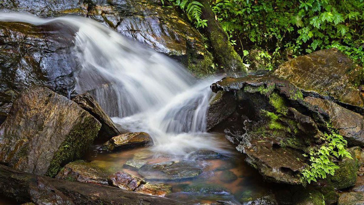
## Description **Erin Ijesha Waterfall**, also known as **Olumirin Waterfall**, is one of Nigeria’s most spectacular natural attractions. Located in Osun State, the waterfall is renowned for its **seven cascading levels**, each offering a different landscape, atmosphere, and difficulty level for visitors. The experience goes beyond a simple waterfall viewing; it is a physical ascent through layered natural terraces, tropical vegetation, and rocky pathways that reveal the geology and biodiversity of southwestern Nigeria. What makes Erin Ijesha Waterfall particularly unique is the **progression of the levels**. The first and second levels are accessible and refreshing, ideal for casual visitors. As you climb higher, the environment becomes cooler, the terrain more dramatic, and the views increasingly rewarding. The final levels lead to a plateau historically associated with ancient settlements and spiritual practices. According to oral traditions, some of these upper areas served as **refuge sites for migrating groups** and locations for community gatherings during the pre-colonial period. A little-known fact is that the waterfall has long been connected to Yoruba mythology. Local lore suggests that the waters were believed to possess cleansing qualities, and that early communities viewed the entire waterfall system as a **symbol of renewal and protection**. Another interesting detail is that the upper levels were once used as strategic vantage points due to their height and difficult access, helping local groups monitor surrounding valleys. The blend of nature, culture, and mild adventure makes Erin Ijesha Waterfall a standout destination for hikers, photographers, and anyone interested in the lesser-explored regions of Nigeria. ## Location **Country:** Nigeria **Region:** Southwest Nigeria **State:** Osun State **Nearest Town:** Ijesha (near Erin Ijesha community) The waterfall sits within a lush forested area about an hour from major towns like Ilesa. ### How to Get There * **By car:** * The most reliable method. From Ilesa or Osogbo, follow the highway toward Erin Ijesha. The entrance to the waterfall is clearly marked, and parking is available. * **By public transportation:** * Local buses and shared taxis connect Ilesa to Erin Ijesha, followed by a short walk to the site. * **By tour service:** * Some tour operators from Lagos, Ibadan, or Osogbo include the waterfall in day-trip itineraries. ## Tips * **Wear sturdy shoes:** The climb is steep in places, and water splashes make some rocks slippery. * **Bring water and stay hydrated:** The ascent to the upper levels can be physically demanding, especially in warm weather. * **Start early:** Morning visits provide cooler temperatures, softer light, and fewer crowds. * **Expect to get wet:** Mist rises from the falls, especially near the lower levels. * **Fitness level matters:** The higher levels are not recommended for visitors with mobility issues. * **Consider hiring a local guide:** They can help you navigate the steeper paths and share the historical context tied to the site. * **Avoid visiting during heavy rain:** The water flow becomes intense and pathways can become hazardous. ## Conclusion Erin Ijesha Waterfall is one of Nigeria’s most rewarding natural attractions, offering a combination of adventure, cultural history, and scenic beauty. Its seven distinct levels provide a progressively immersive experience, making it suitable for both casual travelers and more ambitious climbers. For anyone exploring southwestern Nigeria, the waterfall stands as a must-see landmark. ## FAQ **1. How many levels does Erin Ijesha Waterfall have?** The waterfall has **seven levels**, each with its own landscape and difficulty. **2. Is swimming allowed?** Light splashing and dipping are common at the lower levels, but deeper swimming is not typical due to rocky terrain. **3. How long does the hike take?** Reaching the upper levels can take **1 to 2 hours**, depending on fitness and pace. **4. Is there an entrance fee?** Yes. A modest fee is typically required for maintenance and site management. **5. Are guides available at the site?** Yes. Local guides can be hired at the entrance. **6. What is the best time to visit?** Dry season or early rainy season when the paths are safe and the water flow is strong but manageable. ## Links * [Osun State tourism info](https://www.osunstate.gov.ng)
GemVoyage Team • World
Venice
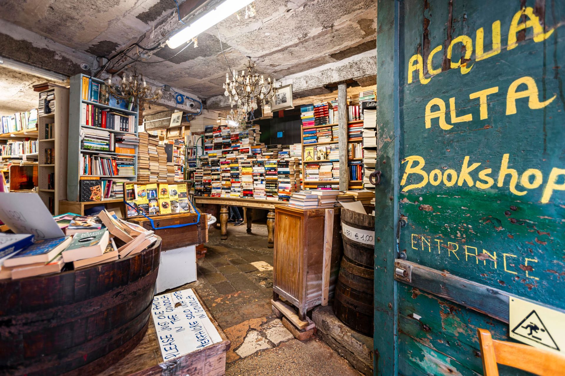
## Description Libreria Acqua Alta is one of Venice’s most distinctive and charming attractions because it turns a practical problem into part of the visitor experience. Venice is famously vulnerable to flooding, and this bookstore responds to that reality in a way that is both inventive and visually unforgettable. Books are stored in bathtubs, gondolas, waterproof containers, and other elevated or repurposed objects so they can survive the periodic rise of water. As a result, the shop feels less like a regular bookstore and more like a whimsical survival strategy made into an aesthetic. The appeal of Libreria Acqua Alta goes far beyond novelty. It has the atmosphere of a place assembled over time by someone who loves books, Venice, and improvisation. Visitors come for the stacks, but they stay because the shop feels like a small labyrinth of discovery. Narrow passages, uneven piles, old printed matter, comic visual arrangements, and hidden corners make it feel more like an exploratory space than a retail environment. It is the kind of place where you do not simply browse; you wander, pause, and notice details that would never appear in a standard chain bookstore. One little-known fact is that the shop has become famous not only among tourists but also among photographers and design-minded travelers who appreciate its unusual composition. Another is that the bookstore reflects a broader Venetian reality: people in the city have long adapted to water rather than pretending it does not shape daily life. That makes the store culturally resonant. It is not just cute. It is a visible expression of Venice’s ongoing negotiation with its environment. Another reason it resonates with visitors is that it is surprisingly layered. You can find secondhand books, old editions, postcards, and visual quirks that reward slow attention. There is also a cat-like, lived-in quality to the place, which makes it feel personal rather than curated to the point of sterility. That balance between charm and clutter is part of why it has become so beloved. For travelers, the experience is best approached with no rush. It is not a place to simply tick off a list. You should allow yourself time to look through the space, enjoy the odd arrangements, and accept that the entire point is to be slightly lost in it. That is very much part of the Venetian mood. The bookstore also shows how Venice often turns constraint into character. Flooding, narrow streets, and dense historic fabric all create real limitations, but the city’s best places tend to respond with ingenuity rather than correction. Libreria Acqua Alta fits that pattern perfectly. It is funny, beautiful, and a little chaotic, but the chaos is meaningful. For visitors who enjoy places with personality, it is one of Venice’s most rewarding small stops. ## Location Libreria Acqua Alta is in Venice, Italy, in the historic center not far from the quieter inner streets and canals rather than the largest tourist squares. Its location is central enough to fit into a normal Venice walking itinerary, but it still feels tucked away. The best way to get there is on foot. Venice is a walking city, and the bookstore is easiest to reach by navigating slowly through the lanes with a map or navigation app. Depending on your starting point, you may arrive from the Rialto or San Marco area and continue through smaller streets. That walking approach is part of the fun, because the route itself helps set the atmosphere before you even reach the shop. If you are arriving by vaporetto, use a nearby stop and continue on foot. Because the streets can be confusing, give yourself more time than you think you need so you do not arrive feeling rushed. ## Tips Go outside peak hours if you want a calmer experience. The bookstore is popular and can become crowded, especially midday. Bring a camera or phone, but be respectful while photographing. The shop is visually rich, but it is still a working bookstore and not just a set piece. Do not expect a big, organized retail layout. The joy is in the disorder and surprise, so the more relaxed your expectations, the better the visit will feel. If you enjoy books, browse carefully for unusual editions or visual treasures. Even if you do not buy anything, the atmosphere makes the stop worthwhile. ## Conclusion Libreria Acqua Alta is one of Venice’s most memorable small attractions, combining books, water, and creative improvisation into a uniquely local experience. It is ideal for travelers who enjoy places with character and a strong sense of place. ## FAQ **Why is Libreria Acqua Alta so famous?** It is famous for its unusual book storage methods and its imaginative response to Venice’s flooding. **Can you buy books there?** Yes. It is a functioning bookstore with a range of used and new items. **Is it easy to find?** It can take a bit of navigating, so walking slowly with a map is best. **How much time should I allow?** Around thirty to sixty minutes is usually enough, though book lovers may stay longer. **Is it worth visiting even if I am not a big reader?** Yes. The setting alone makes it one of Venice’s most unusual and photogenic stops. ## Links - [Official website](https://www.libreriacqualta.it/)
GemVoyage Team • World
Misiones
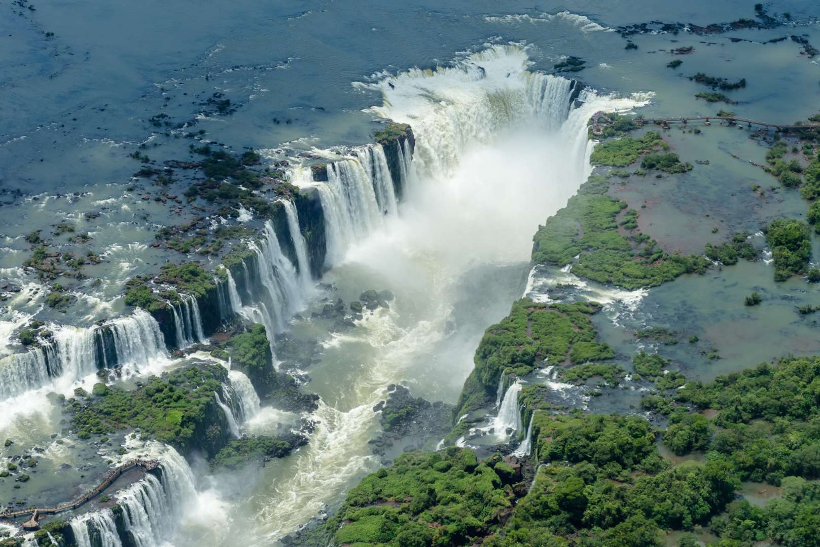
## Description Iguazú Falls (Cataratas del Iguazú) is one of the most awe-inspiring natural wonders on Earth, a sprawling system of waterfalls that straddles the border between Argentina and Brazil. Located within the lush confines of the Iguazú National Park, the falls consist of 275 individual cascades stretching nearly 2.7 kilometers across the Iguazú River. With drops ranging from 60 to 82 meters, the thunderous roar and misty spray of the falls create an unforgettable sensory experience. The crown jewel of the site is the **Devil’s Throat (Garganta del Diablo)**, a U-shaped chasm where half the river’s flow plunges into a dramatic abyss. Standing on the viewing platform above this torrent is both humbling and exhilarating. The surrounding subtropical rainforest is teeming with wildlife, including toucans, coatis, butterflies, and even jaguars, making the area a paradise for nature lovers and photographers. A little-known fact: Eleanor Roosevelt reportedly exclaimed “Poor Niagara!” upon seeing Iguazú Falls, a testament to its staggering scale and beauty. Another fascinating detail is that the falls were formed by a volcanic eruption that left a large crack in the earth, allowing the river to tumble over the edge and create this natural spectacle. ## Location Iguazú Falls is located in **Argentina**, within the **Misiones Province**, near the city of **Puerto Iguazú**. The falls are part of the **Iguazú National Park**, a UNESCO World Heritage Site recognized for its ecological importance and breathtaking scenery. ### How to Get There: - **By Air**: The easiest way to reach the falls is by flying into **Cataratas del Iguazú International Airport (IGR)**, located about 20 minutes from Puerto Iguazú. Direct flights are available from Buenos Aires and other major cities. - **By Bus**: Long-distance buses run from Buenos Aires and other regional hubs to Puerto Iguazú, though the journey can take 18–20 hours. - **By Car**: Renting a car offers flexibility, especially if you plan to visit both the Argentine and Brazilian sides of the falls. From Puerto Iguazú, shuttle buses and taxis can take you directly to the entrance of the national park. ## Tips for Visitors To make the most of your Iguazú Falls adventure, keep these tips in mind: - **Visit Both Sides**: The Argentine side offers immersive trails and close-up views, while the Brazilian side provides panoramic vistas. If possible, explore both. - **Start Early**: Arrive when the park opens to avoid crowds and enjoy cooler temperatures. - **Wear Waterproof Gear**: The mist from the falls can soak you—bring a poncho or quick-dry clothing. - **Take the Ecological Train**: This scenic ride through the jungle leads to key trailheads, including the Devil’s Throat. - **Book a Boat Tour**: For thrill-seekers, speedboat rides take you right under the falls—prepare to get drenched. - **Respect Wildlife**: Coatis may look cute, but they can be aggressive if provoked. Don’t feed or approach them. ## Conclusion Iguazú Falls is a breathtaking blend of raw power and serene beauty. With its towering cascades, rich biodiversity, and immersive trails, it offers a once-in-a-lifetime experience for travelers seeking nature at its most majestic. ## FAQ **1. What is the best time to visit Iguazú Falls?** The falls are spectacular year-round, but April to September offers cooler weather and fewer crowds. **2. How long should I plan to stay?** At least two full days—one for the Argentine side and one for the Brazilian side. **3. Is the park accessible for people with disabilities?** Yes, many trails and viewing platforms are wheelchair accessible, and the ecological train accommodates mobility needs. **4. Can I swim near the falls?** Swimming is not allowed near the main falls due to strong currents, but nearby areas like Isla San Martín may offer safe spots depending on conditions. **5. Are guided tours available?** Yes, both private and group tours are offered, including bilingual guides and eco-tours. **6. Do I need a visa to cross into Brazil?** Visa requirements vary by nationality. Check with your embassy before planning a cross-border visit. ## Links - [Iguazú Falls – Wikipedia Overview](https://en.wikipedia.org/wiki/Iguazu_Falls) - [Iguazú Argentina – Official Park Site](https://iguazuargentina.com/en/)
GemVoyage Team • World
Rome
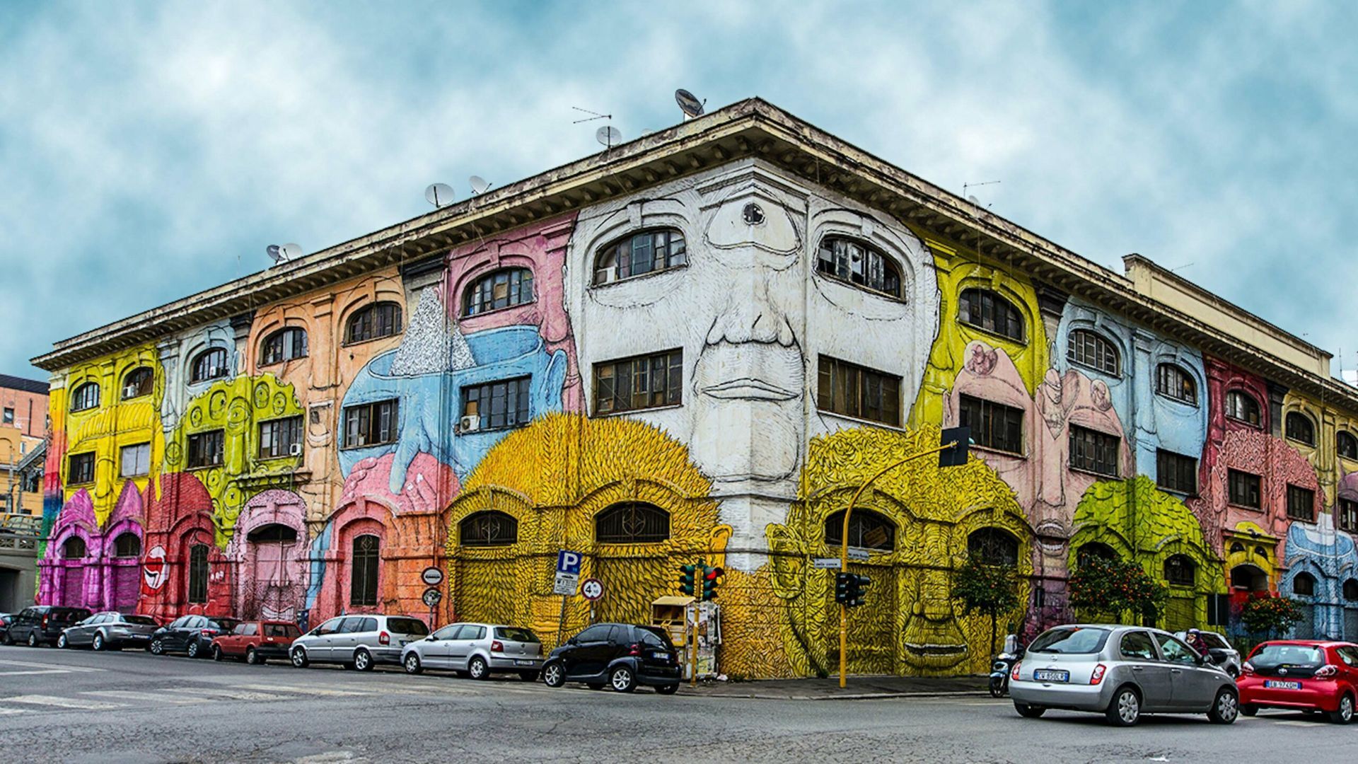
## Description Ostiense in Rome is a neighborhood that quietly combines industrial history, creative reinvention, and a growing street-art scene. Long overlooked in favor of the city’s classical core, Ostiense has become a canvas for large-scale murals, community art projects, and cultural venues that repurpose former warehouses and factories. The area’s atmosphere is energetic and contemporary—the kind of place where gritty, working-class textures meet curated cafes, design-driven restaurants, and cultural centers. One lesser-known detail: many of the murals and public artworks here are the result of organized collaborations between international and Italian artists, local associations, and municipal regeneration programs, meaning the pieces often reflect a distinct local voice rather than random tagging. Ostiense is also notable for nearby cultural institutions such as Centrale Montemartini—an arresting museum that juxtaposes classical sculpture with industrial architecture—as well as evolving food halls and waterfront promenades that add to the neighborhood’s appeal. The daily rhythm here is different from Rome’s historic center: it’s more local, less hurried, and often the setting for pop-up markets, gallery openings, and late-night dining. ## Location Ostiense lies south of Rome’s historic center, adjacent to Stazione Ostiense and the Gasometro area. The neighborhood is easily reachable by metro (Piramide station on Line B), regional trains, and buses, making it convenient for travelers who want to pair a visit with nearby attractions or evening dining options. ## Tips - Walk the streets deliberately and allow time for visual discoveries—large murals and hidden installations are often tucked down industrial lanes. - Consider a guided street-art tour to gain context on the murals, the artists, and the local regeneration efforts that funded them. - Combine visits with cultural stops: Centrale Montemartini, the former Gasometro, and nearby food markets offer a rounded itinerary. - Respect private property and photograph from public sidewalks—some murals occupy private building facades. - Best times: weekday afternoons for quieter explorations, and early evenings for the dining scene; weekends may have markets and events. ## Conclusion Ostiense offers a living gallery of contemporary street art woven into an urban tapestry of industrial heritage and modern cultural life. For travelers who appreciate street art, creative urban renewal, and a less-touristed side of Rome, Ostiense is a rewarding stop that captures both local momentum and adventurous city-making. ## FAQ Q: Are Ostiense’s murals permanent? A: Many are long-term projects, but street art can be transient—check local galleries or tour operators for the most current highlights. Q: Are guided street-art tours available? A: Yes; several local guides and cultural organizations run walking tours that explain the art, artists, and history behind the works. Q: Is Ostiense safe to visit at night? A: Generally yes—areas around the train station and main streets are lively at night, though standard urban caution is advised in quieter lanes. Q: Can I photograph the murals? A: Absolutely; murals in public spaces are typically fine to photograph—avoid obstructing traffic or private entrances while shooting. Q: What else is nearby to pair with an Ostiense visit? A: Centrale Montemartini, food halls, and the riverside promenade are excellent nearby additions. ## Links - [Ostiense](https://www.partir-a-rome.com/quartiers-rome/ostiense-tor-marancia)
GemVoyage Team • World

Comments