GemVoyage Team • World
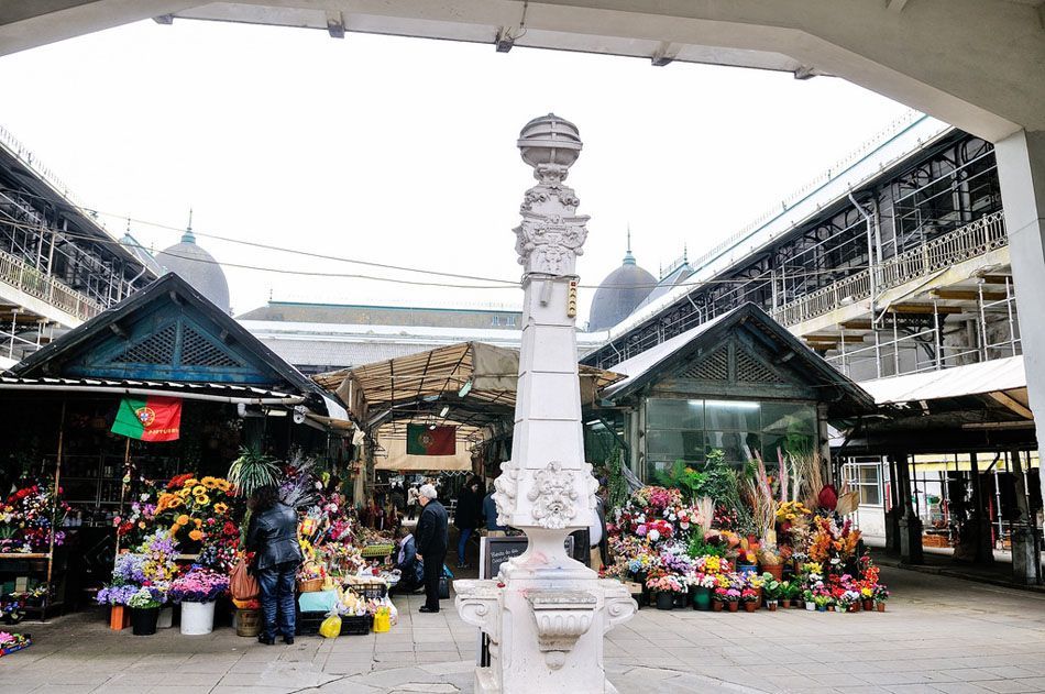
The building's atmosphere is one of its main attractions. The ironwork, tiled details, and open interior create a space that feels both grand and intimate. Unlike polished gourmet halls that can feel detached from the streets around them, Bolhão keeps its edges rough enough to remain authentic. The market is especially rewarding for visitors who like places with character and texture: the sound of sellers calling out prices, the smell of fresh herbs and coffee, and the sight of baskets filled with seasonal produce all contribute to an experience that is easy to remember long after the visit ends.
One little-known fact is that the market's identity has always been closely linked to Porto's working-class neighborhoods. It was never designed only as a showcase; it grew out of the practical needs of the city and its surrounding farms. Another detail many visitors miss is that the surrounding streets are just as interesting as the market itself. The area around Bolhão contains old shopfronts, traditional pastry shops, and some of the best places to observe the contrast between old Porto and the city’s newer pace.
The renovated market also reflects Porto's ability to preserve heritage while adapting to modern urban life. For travelers, that balance is part of the appeal. You can buy fruit, flowers, or a snack in a space that feels historic, yet still active and relevant. If you enjoy markets that tell you how a city lives rather than simply what it sells, Mercado do Bolhão is one of the most compelling places in Porto.
For visitors exploring Porto on foot, the market is a natural stop between shopping streets, cafés, and older residential blocks. You can combine it with a visit to Rua de Santa Catarina, the Chapel of Souls, or the central avenues around Aliados. If you are arriving from the riverfront or Ribeira district, allow time for a pleasant uphill walk through the city grid, which gives a clearer sense of Porto's daily life than a direct transfer would.
The best recommendation for getting there is to use public transport or walk if you are already in the city center. Driving is possible but less convenient because the area is busy and street parking is limited. A morning visit is ideal, since the market is most energetic when local shoppers are doing their daily purchases and the produce stands are fullest.
Bring cash or a payment method accepted by small vendors, and do not rush your visit. The market rewards slow observation: look at what people are buying, ask vendors what is in season, and if you plan to eat there, choose items that reflect local ingredients rather than generic snacks. This is one of the best places in Porto to try traditional flavors in an unpretentious setting.
If you enjoy photography, be respectful and avoid treating the market as a stage set. The best photos come from catching details: stacked oranges, handwritten prices, old tile work, and expressions of conversation between buyers and sellers. You will get a better result if you move quietly and observe rather than interrupting.
It is also smart to combine the market with nearby food stops. Porto is a city where culinary culture matters, and Bolhão gives you a strong starting point for understanding what locals cook, buy, and value. If you have limited time, spend at least an hour inside the market and another hour exploring the surrounding streets.
Discover more hidden gems you might love.
Salto
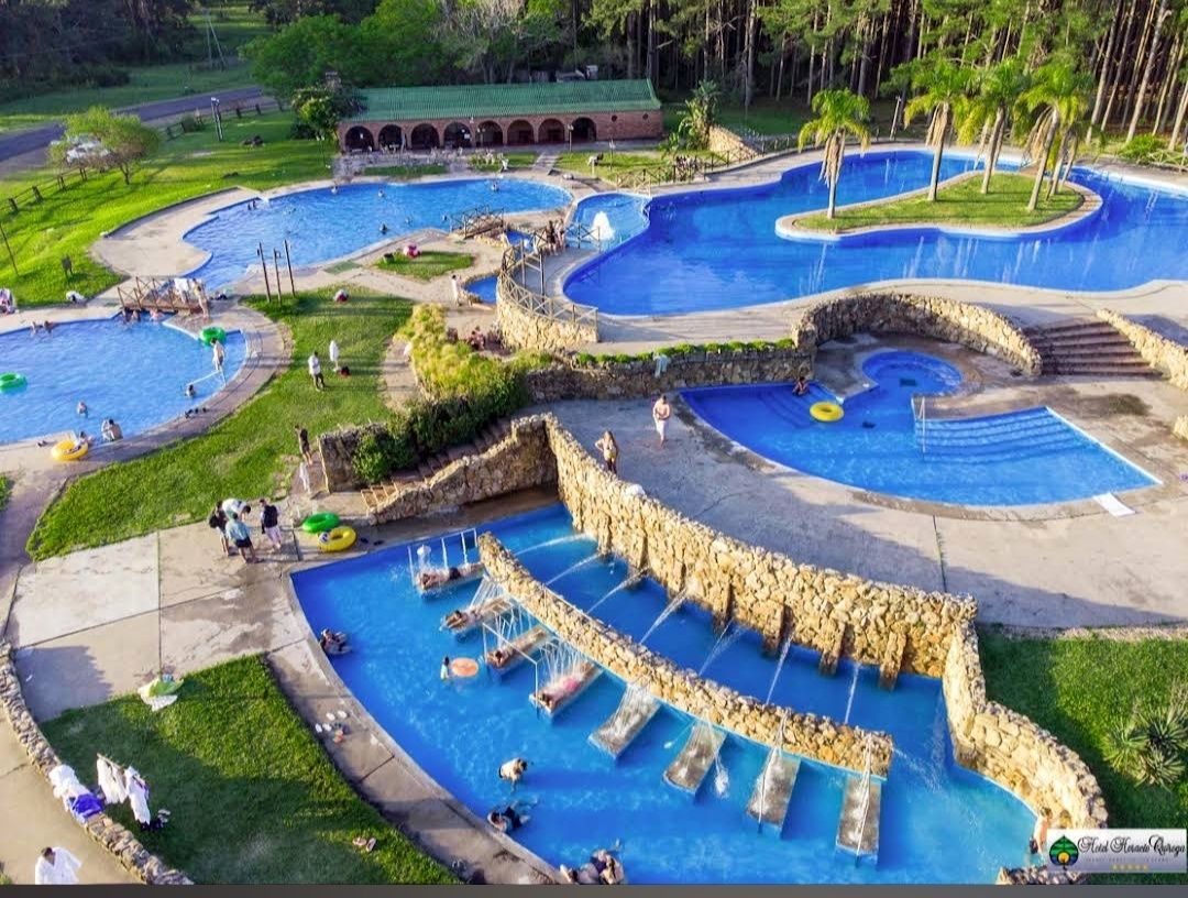
## Description **Parque Aquático Termas de Salto Grande** is one of Uruguay’s most popular thermal water parks, offering a unique blend of relaxation, recreation, and family fun. Located near the Salto Grande Dam, the park is famous for its naturally heated pools, which are fed by underground hot springs rich in minerals. These thermal waters are believed to have therapeutic properties, making the park not just an entertainment venue but also a wellness destination. The park features a variety of attractions, including outdoor and indoor pools, water slides, jacuzzis, and dedicated children’s areas. Families can enjoy thrilling rides while others unwind in the warm, soothing waters. The design of the park strikes a balance between leisure and adventure, making it suitable for visitors of all ages. **Little-known facts**: * The thermal waters in Salto reach temperatures of **38–46°C**, perfect for relaxation and health benefits. They are said to help with circulation, joint pain, and stress relief. * The park is part of the larger **Salto Grande hot springs circuit**, which is considered one of the most important in Uruguay and the entire Río de la Plata region. --- ## Location Parque Aquático Termas de Salto Grande is located in the **city of Salto**, in **northwestern Uruguay**, within the **Salto Department**. The park lies just a few kilometers from the **Salto Grande Dam**, which sits on the Uruguay River and borders Argentina. ### How to get there: * From **Salto city center**, the park is around 10 kilometers away. Taxis, local buses, or rental cars are convenient options. * Visitors traveling from **Montevideo** (about 500 kilometers away) can reach Salto by long-distance bus or a domestic flight. From there, it’s a short drive to the park. * If coming from **Argentina**, the park is easily accessible through the Concordia–Salto International Bridge, making it a popular cross-border attraction. --- ## Tips * **Bring swimwear and sandals**: Comfortable water-friendly clothing is essential, and sandals are useful for walking around hot pavements. * **Plan a full day**: With multiple pools, slides, and relaxation areas, you’ll want plenty of time to enjoy everything. * **Visit on weekdays**: The park can get very crowded on weekends and holidays, so weekdays are more peaceful. * **Stay hydrated**: The warm thermal waters can dehydrate you faster than you might expect, so drink plenty of water. * **Combine with nearby attractions**: The Salto region offers other hot spring complexes, like Termas del Daymán, and cultural attractions in Salto city itself. --- ## Conclusion Parque Aquático Termas de Salto Grande combines the thrill of a water park with the healing benefits of natural hot springs. Whether you’re seeking wellness, family fun, or just a relaxing escape, the park delivers an experience that is both entertaining and rejuvenating. With its unique thermal waters, diverse facilities, and prime location near Salto Grande, it’s one of Uruguay’s standout destinations. --- ## FAQ **1. What makes Parque Aquático Termas de Salto Grande special?** Its natural thermal pools, therapeutic waters, and mix of fun attractions like slides and jacuzzis make it a unique destination in Uruguay. **2. Is it family-friendly?** Yes, the park has areas designed specifically for children, making it a great choice for families. **3. What is the water temperature in the pools?** The thermal water ranges between 38°C and 46°C, depending on the pool. **4. Do I need to bring my own food?** The park has on-site restaurants and snack bars, but visitors can also bring their own food if they prefer. **5. Can I visit from Argentina?** Yes, the park is very close to the border with Argentina, and many visitors come via the Concordia–Salto bridge. **6. How much time should I plan for my visit?** Most visitors spend at least half a day, but a full day allows you to enjoy both relaxation and water attractions. --- ## Links * [Salto Tourism – Official Website](https://www.salto.gub.uy/) * [Uruguay Natural – Official Tourism Site](https://www.uruguaynatural.com/)
GemVoyage Team • World
Bonn
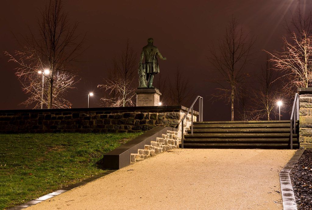
## Description Alter Zoll is one of Bonn’s most pleasant viewpoints and a place where the city’s relationship with the Rhine becomes immediately visible. It is not a grand mountain lookout or an elaborate tourist platform; instead, it is a compact, atmospheric place where people gather to enjoy river views, sunsets, and the steady movement of life along the waterfront. The setting feels calm and slightly elevated, which gives it a natural break from the surrounding city streets. The appeal of Alter Zoll lies in its simplicity. You come for the view, but you stay for the mood. The Rhine stretches out in front of you, the city feels more open, and the location invites a pause rather than a checklist-style visit. One little-known fact is that the name carries a historical reference to customs and toll-related functions, reminding visitors that this scenic spot once belonged to a much more practical urban landscape. Another interesting detail is how the viewpoint changes depending on weather and season; a bright afternoon, a misty morning, and a golden evening all create very different experiences from the same small terrace. Alter Zoll is especially good for travelers who appreciate places that are easy to reach but still memorable. It works well as a short stop during a walking tour of Bonn, but it can also become a destination in its own right if you want to sit and watch the river. The combination of history, landscape, and calm makes it one of those understated places that can end up being a trip highlight precisely because it does not try too hard. It is a classic urban viewpoint with a distinctly Rhine-region personality. ## Location Alter Zoll is in Bonn, North Rhine-Westphalia, Germany, near the Rhine riverfront and close to the city’s central area. Its position makes it an easy addition to any city walk. The best way to get there is on foot from central Bonn, since the viewpoint is close enough to downtown streets and riverside routes. If you are using public transport, get to the center and then continue walking toward the river. Because the area is compact, there is no need for a special transfer once you are in the city. ## Tips Go near sunset if you want the best light over the Rhine. Bring a coffee or snack and linger; this is a place designed for slow enjoyment. Combine it with a riverside walk so the viewpoint is part of a broader Bonn experience. Check the weather before you go, because visibility and atmosphere make a big difference here. ## Conclusion Alter Zoll is a small but memorable Bonn viewpoint that delivers one of the city’s best Rhine panoramas in a calm, historic setting. ## FAQ ### What is Alter Zoll known for? It is known for its riverside views over the Rhine and its pleasant city-center atmosphere. ### Is it a difficult place to reach? No. It is easy to reach on foot from central Bonn. ### Is it worth visiting for a short stop? Yes. It is one of the best quick scenic breaks in the city. ### When is the best time to go? Late afternoon and sunset are especially rewarding. ### Can I combine it with other attractions? Absolutely. It fits naturally into a Bonn walking itinerary. ## Links - [Bonn tourism information](https://www.bonn.de/) - [Alter Zoll on Wikipedia](https://en.wikipedia.org/wiki/Alter_Zoll)
GemVoyage Team • World
Barcelona
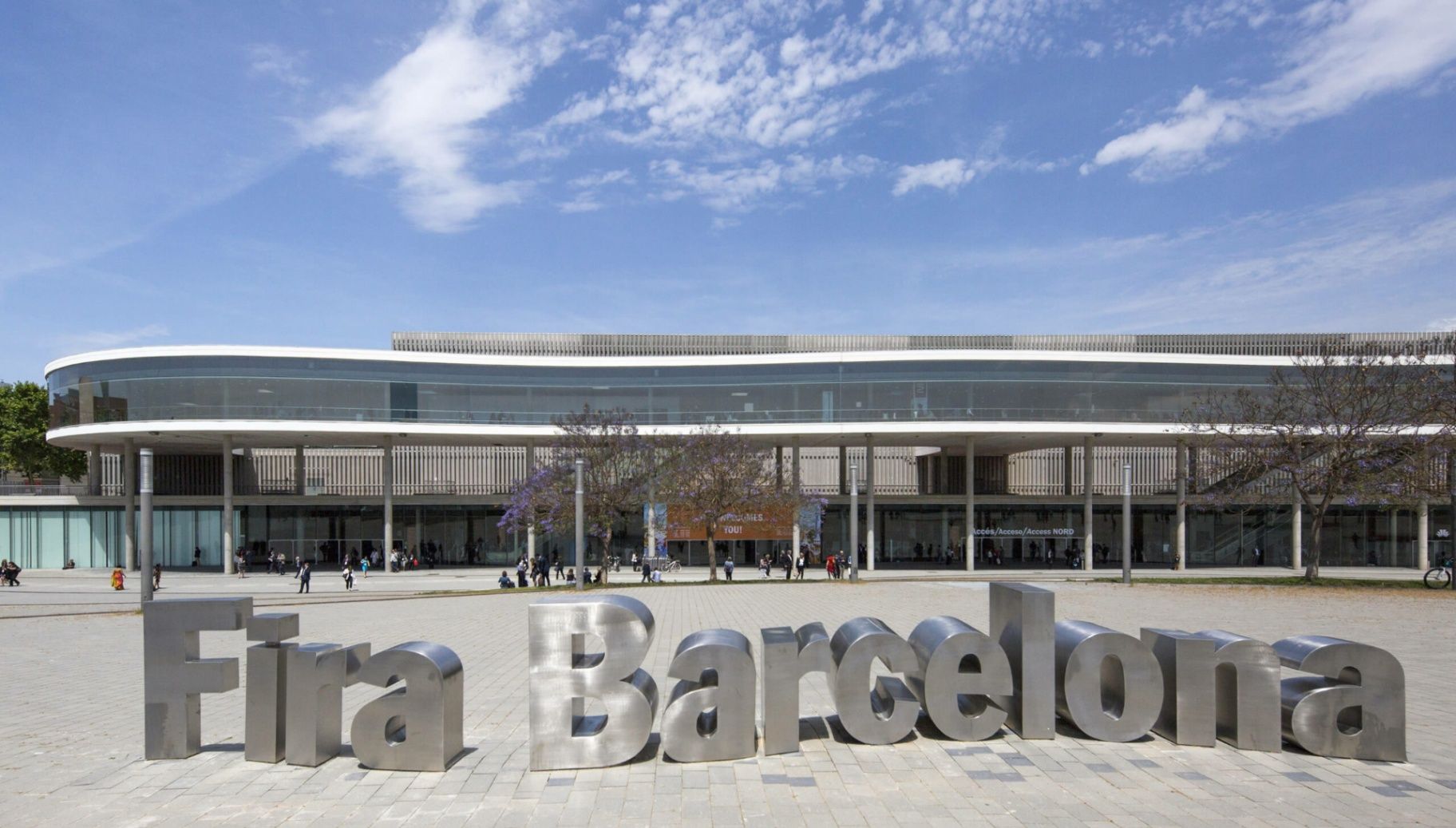
## Description **Fira Barcelona Gran Via** is one of the **largest and most advanced exhibition venues in Europe**, designed to host the world’s leading trade fairs, technology summits, medical congresses, and industrial expos. While Barcelona is often associated with beaches, historic quarters, and Gaudí architecture, Gran Via represents a different identity of the city: **global business, logistics precision, and large-scale innovation**. Opened in **2007**, the Gran Via venue was designed by renowned Japanese architect **Toyo Ito**, whose concept blends **minimalism, flow, and industrial elegance**. The complex consists of **eight massive exhibition halls**, interconnected by long glazed corridors, suspended walkways, and natural light shafts. The layout prioritizes **efficiency of movement**, allowing tens of thousands of visitors to circulate at once without congestion. What truly sets Fira Gran Via apart is its **sheer operational scale**. With more than **240,000 square meters of exhibition space**, it regularly hosts events that attract **over 100,000 visitors per edition**. Among its most famous recurring events are the **Mobile World Congress (MWC)**, one of the largest technology exhibitions on the planet, as well as major shows for pharmaceuticals, logistics, industrial automation, construction, and smart cities. Architecturally, Gran Via does not rely on decorative spectacle. Instead, it emphasizes **clean geometry, steel and glass contrasts, towering vertical volumes, and the rhythmic repetition of light and shadow**. The result is a building that feels futuristic without being extravagant. A striking visual feature is the **continuous covered spine** that links the halls like a central artery, functioning both as a navigation axis and as a social circulation zone between events. Beyond trade fairs, the venue also serves as a **global meeting point for governments, corporate leaders, scientists, and innovators**. International policy discussions on digital transformation, sustainability, healthcare systems, and future mobility frequently take place within its walls. In this sense, Fira Gran Via is not simply an exhibition space, but a **temporary city of global decision-making** that comes alive several times each year. A little-known fact is that during the design phase, the orientation of the halls was carefully calculated to **maximize diffused daylight while minimizing heat gain**, reducing energy consumption across the massive structure. Another lesser-known detail is that parts of the underground logistics network allow **direct truck access beneath the halls**, enabling exhibitors to move heavy machinery and large installations invisibly without disrupting surface-level visitor flow. Emotionally, Fira Gran Via does not aim to charm the visitor the way historic Barcelona does. Instead, its impact is one of **scale, order, and momentum**. It feels like standing inside an infrastructure built for the future. For many professionals, attending an event here marks not a leisure moment, but a **career milestone**, contract turning point, or technological breakthrough. When fully active, the venue functions like a **giant synchronized machine**, where logistics teams, exhibitors, speakers, press, and security systems operate in continuous parallel motion. Few places in Spain demonstrate the choreography of modern global business as visibly as Fira Barcelona Gran Via. ## Location **Fira Barcelona Gran Via** is located on the border between **Barcelona city and L’Hospitalet de Llobregat**, in the southwestern part of the metropolitan area. **City:** Barcelona / L’Hospitalet de Llobregat **Region:** Catalonia (Catalunya) **Country:** Spain **Main Area:** Gran Via Sud ### How to Get There: * **By metro:** * **Line 9 Sud** to **Fira Station** offers the most direct access. * **By bus:** Several city and regional bus lines serve Gran Via Sud. * **By taxi or ride-hailing:** Widely used during major international events. * **By airport connection:** Direct metro access from **Barcelona-El Prat Airport** via Line 9 Sud. * **By car:** Large underground parking is available for exhibitors and visitors. Its location allows fast access both from **Barcelona city center** and from **major highways linking the rest of Catalonia and Spain**. ## Tips * **Check the event calendar before visiting:** Gran Via is only accessible to the public during active exhibitions. * **Arrive early during major events:** Entry queues for global fairs like MWC can be long. * **Wear comfortable shoes:** Distances inside the halls are significant. * **Use hall maps and mobile apps:** The complex can feel overwhelming without digital navigation. * **Expect high food and drink prices during major exhibitions.** * **Book accommodation far in advance:** Hotels sell out months ahead during flagship events. * **Use public transport instead of taxis during peak hours:** Surrounding roads often experience heavy congestion. * **Allow buffer time for badge collection and security checks.** ## Conclusion **Fira Barcelona Gran Via** is a cornerstone of Europe’s exhibition and conference infrastructure, engineered for **scale, speed, and global connectivity**. It embodies Barcelona’s role not just as a cultural capital, but as a **strategic gateway for international trade, innovation, and knowledge exchange**. When fully operational, it becomes a temporary metropolis of ideas, deals, and future-defining conversations. ## FAQ **1. What is Fira Barcelona Gran Via used for?** It is used for **large-scale international trade fairs, congresses, summits, and industry expos**. **2. Is Fira Gran Via open to the general public?** Only during **active exhibitions or public-access events**. Otherwise, it is closed. **3. What is the biggest event held at Gran Via?** The **Mobile World Congress (MWC)** is the most internationally significant event hosted there. **4. How large is the venue?** It offers **over 240,000 square meters of exhibition space** across eight halls. **5. Is there direct access from the airport?** Yes. **Metro Line 9 Sud** connects Barcelona El Prat Airport directly to the venue. **6. Is Fira Gran Via accessible for people with reduced mobility?** Yes. The venue is fully **wheelchair accessible** with elevators, ramps, and adapted services. ## Links * [Fira Barcelona Official Website](https://www.firabarcelona.com/en/)
GemVoyage Team • World
Copenhagen
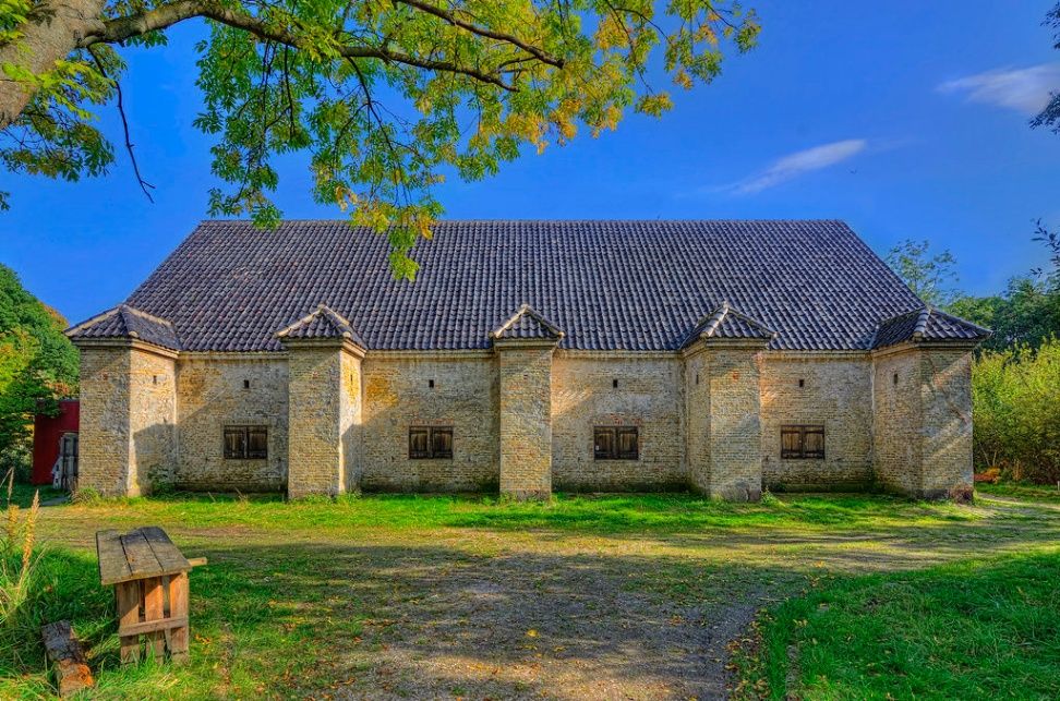
## Description **Frederiks Bastion** is one of the preserved defensive structures within Copenhagen’s historic system of coastal fortifications. Located near **Kastellet**, but distinct from it, Frederiks Bastion represents a smaller, quieter, and more understated element of Denmark’s centuries-old defensive architecture. While it lacks the scale and iconic star shape of Kastellet, its importance lies in its **strategic coastal placement**, its role in Copenhagen’s layered defense network, and its value as a surviving example of **early modern military engineering**. The bastion dates back to the era when Copenhagen’s security depended heavily on a combination of earthworks, ramparts, and coastal batteries designed to deter naval incursions. These fortifications once formed a continuous defense line protecting the harbor and the eastern approach to the city. Frederiks Bastion served primarily as a **gun emplacement**, providing a vantage point over surrounding waters and contributing to overlapping fields of fire with neighboring bastions. Unlike the more polished tourist sites in Copenhagen, Frederiks Bastion retains a **raw and authentic** military character. Much of its structure is defined by **grass-covered embankments, sturdy earthworks, and low-profile defensive shapes** that reflect 18th–19th century military design principles. Visitors who look closely can still identify the geometry of the ramparts, the angles optimized to deflect cannon fire, and the remnants of pathways used for transporting artillery and supplies. One of the most interesting aspects of Frederiks Bastion is the juxtaposition of its **military past with Copenhagen’s modern urban waterfront**. The surrounding area is now a mix of neighborhoods, harborside promenades, and cultural venues, yet the bastion remains a quiet green space that reveals how the city once prepared for siege and conflict. While many visitors overlook it on their way to more famous landmarks, those who stop here gain a deeper understanding of Copenhagen’s historical defensive logic and the engineering strategies that shaped its coastline. The atmosphere is surprisingly serene. Rather than dramatic architectural flourishes, the bastion offers a sense of **openness, subtlety, and historical layering**. It is a place where you can walk along the embankments, observe the water, and imagine the era when Copenhagen was fortified against European naval powers. The simplicity is part of its charm: no over-curated displays, no commercialized setups, just a preserved piece of functional design. Today, Frederiks Bastion is appreciated for its **heritage value**, its role in Copenhagen’s larger defensive narrative, and its suitability for contemplative waterfront walks. For urban explorers, history enthusiasts, and travelers who enjoy discovering non-touristy sites, it offers a quiet, historically charged vantage point within one of the city's most visited districts. ## Location Frederiks Bastion is located near the Copenhagen waterfront, east of the city center, not far from Kastellet and the harbor promenade. **City:** Copenhagen **Area:** Østerbro / Waterfront near Kastellet **Country:** Denmark ### How to Get There * **By metro:** * M3 or M4 to **Østerport Station**, then a short walk. * **By bus:** Several city buses stop along the harbor and near the surrounding parks. * **On foot:** Easily accessible from **Kastellet**, **Langelinie**, and the **Little Mermaid** area. * **By bicycle:** The waterfront has excellent cycling paths, making it one of the easiest ways to reach the bastion. ## Tips * **Pair it with a visit to Kastellet:** The two sites complement each other historically and geographically. * **Ideal for peaceful walks:** This is a low-traffic, quiet spot even during peak tourist season. * **Good for photography:** Particularly at sunrise or late afternoon when the light hits the embankments. * **Wear comfortable shoes:** The terrain includes grassy slopes and uneven surfaces. * **No major facilities:** Bring water or snacks if you plan to stay for a while. * **Learn the context before visiting:** Understanding its role enhances the experience, since signage onsite is minimal. ## Conclusion Frederiks Bastion is a modest but meaningful piece of Copenhagen’s military heritage. It offers insight into the city’s coastal defense strategy and provides a calm, lightly visited alternative to the larger and more structured fortifications nearby. Its earthworks, geometry, and position along the waterfront allow visitors to experience a genuine historical environment without crowds or distractions. ## FAQ **1. Is Frederiks Bastion the same as Kastellet?** No. It is a separate bastion located nearby, part of a wider defensive network. **2. Is there an entrance fee?** No. The area is freely accessible year-round. **3. How long does a visit take?** Most visitors spend **20 to 40 minutes**, often combined with a walk in the surrounding harbor area. **4. Is it family-friendly?** Yes, but keep an eye on children near steep embankments. **5. Are there views of the water?** Yes. The bastion offers clear sightlines toward the harbor and neighboring fortifications. **6. Are there signs or exhibitions?** Minimal. It’s more of a preserved outdoor site than a curated museum. ## Links * [Copenhagen Visitor Portal](https://www.visitcopenhagen.com)
GemVoyage Team • World

San Juan Teotihuacan
## Description Teotihuacan is a vast pre-Columbian city in central Mexico, dominated by two monumental pyramids — the Pyramid of the Sun and the Pyramid of the Moon — flanking the broad Avenue of the Dead. Once among the largest cities in the ancient world, Teotihuacan’s orthogonal layout, apartment compounds and expansive plazas reflect a complex urban society with far-reaching trade and ritual connections across Mesoamerica. The scale of Teotihuacan is what first seizes visitors: broad causeways, stepped pyramids and the linear discipline of its urban plan. Archaeologists have uncovered multi-storey apartment compounds, market areas and ceremonial platforms that together suggest a dense, highly organized city capable of hosting tens of thousands of residents at its peak. A walk along the Avenue of the Dead reveals architectural rhythms and sightlines intentionally designed to focus processions and ritual movement toward the city’s great pyramids. Climbing the Pyramid of the Sun rewards visitors with sweeping panoramas across the valley and a visceral sense of how the site would have been experienced in antiquity. The Pyramid of the Moon at the northern end of the avenue faces a ceremonial plaza that preserves carved stones and remnants of ritual deposits. Murals and painted architectural fragments found in residential and administrative compounds hint at complex iconography, trade networks reaching into Oaxaca and the Gulf coast, and religious ideas that later influenced the Aztecs. Teotihuacan continues to be a dynamic archaeological landscape: excavations reveal changing construction phases, evidence of craft production zones, and records of trade in obsidian and pottery that tie the city to a broader Mesoamerican world. While key questions remain — notably about the language(s) spoken by Teotihuacanos and the political organization behind the city’s monumental building — continuing research and improved visitor interpretation make Teotihuacan a compelling stop for history-minded travelers. ## Location Teotihuacan lies northeast of Mexico City and is easily accessible by road from the capital; many visitors use organized tours or public buses that run from Mexico City to the archaeological site. The site is about a 45–60 minute drive from the city center depending on traffic, and combined visits with nearby San Juan Teotihuacán village make for a full-day itinerary. ## Tips - **Go early to avoid heat and crowds:** Morning visits are more comfortable and quieter for photography, and the light makes the relief of murals and stonework more legible. - **Wear comfortable shoes and sun protection:** The site is extensive and largely exposed to the sun; pack a hat, sunscreen and plenty of water. - **Hire a licensed guide or join a small-group tour:** Local guides provide archaeological context, point out lesser-known structures and mural fragments, and explain the complex iconography visitors otherwise miss. - **Visit the on-site museum and neighboring sites:** The Museo de Sitio de Teotihuacán houses ceramics, figurines and explanatory panels; pair your visit with nearby craft markets and the ethnographic displays in San Juan Teotihuacán. - **Use public transport or book reliable transfers:** If driving from Mexico City, leave early to avoid congestion and allow time for parking or shuttle transfers. ## Conclusion Teotihuacan’s monumental urban presence offers a powerful sense of ancient civic order and ritual life; its pyramids and avenue remain compelling for history and archaeology enthusiasts alike. Whether you are a casual visitor drawn by striking panoramas or a history lover seeking layered archaeological narratives, Teotihuacan provides a measurable sense of scale, ritual planning and cultural connections that shaped central Mexico for centuries. ## FAQ - **Q: Can you climb the pyramids at Teotihuacan?** A: Access policies change for conservation reasons; sections of the Pyramid of the Sun have been open at times while other monuments may be restricted. Check the site’s official notices before travel and respect closures for preservation. - **Q: How long should I plan for a visit to Teotihuacan?** A: Allocate 3–5 hours for a meaningful visit: climb one pyramid, explore the plaza areas, and visit the on-site museum. Half-day visits are common; a whole day allows more relaxed exploration and time for nearby attractions. - **Q: Is Teotihuacan suitable for families and children?** A: Yes — families will find the wide avenues and open plazas easy to navigate, but bring shade, water, and comfortable walking shoes for younger children. - **Q: Are there good photography spots and when is the best light?** A: Early morning and late afternoon provide the best directional light for texture and color; the area by the Pyramid of the Sun’s summit and viewpoints along the Avenue of the Dead are popular for wide-angle shots. - **Q: What should I know about safety and facilities?** A: The site is generally safe for tourists; basic facilities include restrooms and food stalls near the entrance, but services are limited inside the archaeological zone. Keep valuables secure and follow guidance from official staff. ## Links - [Teotihuacan — Wikipedia](https://en.wikipedia.org/wiki/Teotihuacan)
GemVoyage Team • World
Aswan
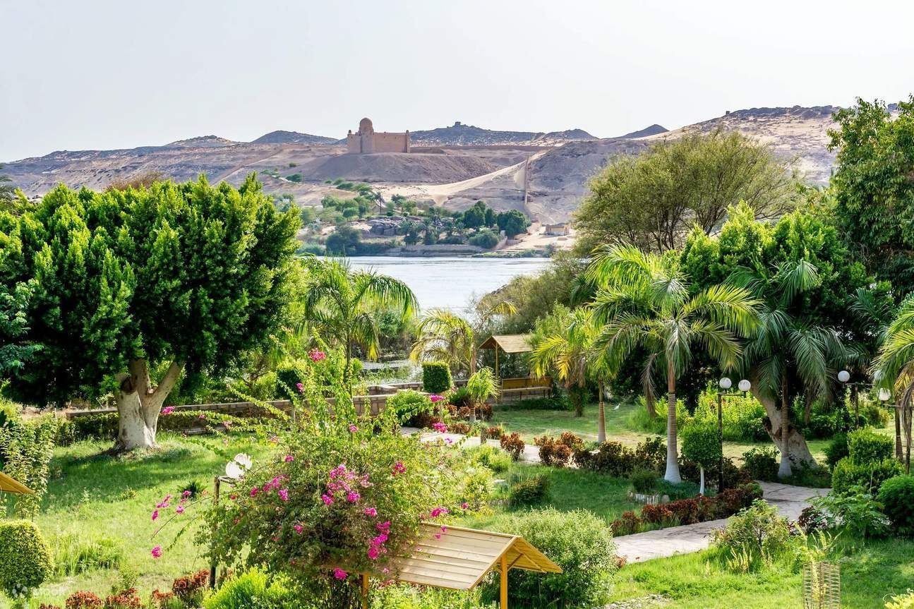
## Description The Aswan Botanical Garden is an unexpectedly verdant refuge on an island in the Nile, offering a cool, contemplative counterpoint to the monumental temples and quarries that dominate Upper Egypt’s tourism landscape. Its charm comes from a careful mix of cultivated plantings, winding pathways, and island vistas: palms, exotic trees, shaded pavilions, and thoughtfully placed seating invite visitors to slow down and enjoy the river breeze. For travelers who have spent mornings at temples and archaeological sites, the garden offers precisely the restorative pause many itineraries lack. Beyond leisure, the garden holds botanical and historical interest. Many plantings were introduced during the nineteenth and early twentieth centuries as part of botanical exchanges, and the site has long been associated with collection and study. The island location amplifies the sense of escape—the short boat journey from Aswan’s riverfront feels intentional and contributes to the visit’s narrative: you leave the bustling riverbank and step into a quieter, greener world. Birdlife, moving water, and the light across the Nile all combine to create a sensory experience that changes throughout the day. ## Location The garden is located on Kitchener’s Island (sometimes referred to historically in guidebooks), a short boat ride from Aswan’s main waterfront. Boat crossings take only a few minutes and are typically arranged through local boat operators, hotels, or Nile tour companies. Because the garden lies close to the city center, it can be combined easily with other Nile-side visits, including the Philae Temple boat ride or a felucca sail. Plan your visit for the morning or late afternoon when temperatures are milder and light is most flattering for photography. Midday in Upper Egypt can be intense, and shade is limited along some paths despite tree cover. ## Tips - Go in the cooler parts of the day—early morning or late afternoon are best for walks and photos. - Bring water, sunscreen, and a hat; shade is available but the sun can still be strong. - Arrange a reliable boat transfer—ask at your hotel or book through a reputable local operator. - Wear comfortable shoes: paths are mostly easy but can be uneven in places. - Combine the garden visit with nearby Nile-side sites to make the crossing feel part of a fuller river day. - Look for framed views through the trees toward the Nile; they make excellent photo opportunities and quiet spots to sit. ## Conclusion The Aswan Botanical Garden is a welcome respite for travelers who want a gentler pace amid an itinerary of temples and island tours. Its island setting, curated plantings, and tranquil riverside atmosphere create an appealing, low-effort stop that rewards slow exploration and quiet observation. ## FAQ ### Why visit a botanical garden in Aswan? It offers a distinctly different experience from archaeological sites: shade, plant variety, birdlife, and a slower pace that complements temple visits. ### How do I get there? Visitors reach the island by a short boat transfer from Aswan’s riverfront; boats are easy to arrange locally and typically take only a few minutes. ### Is it suitable for families? Yes. Wide paths and gentle walking conditions make the garden family-friendly, though bring water and sunscreen for young children. ### How much time should I spend there? One to two hours is usually enough for a relaxed visit; more time is pleasant for photography and lingering breaks. ### What should I bring for the visit? Comfortable shoes, water, hat, and sun protection; a camera and a small notebook are useful for nature observation. ## Links - [Wikipedia](https://en.wikipedia.org/wiki/Aswan_Botanical_Garden)
GemVoyage Team • World

Comments