GemVoyage Team • World
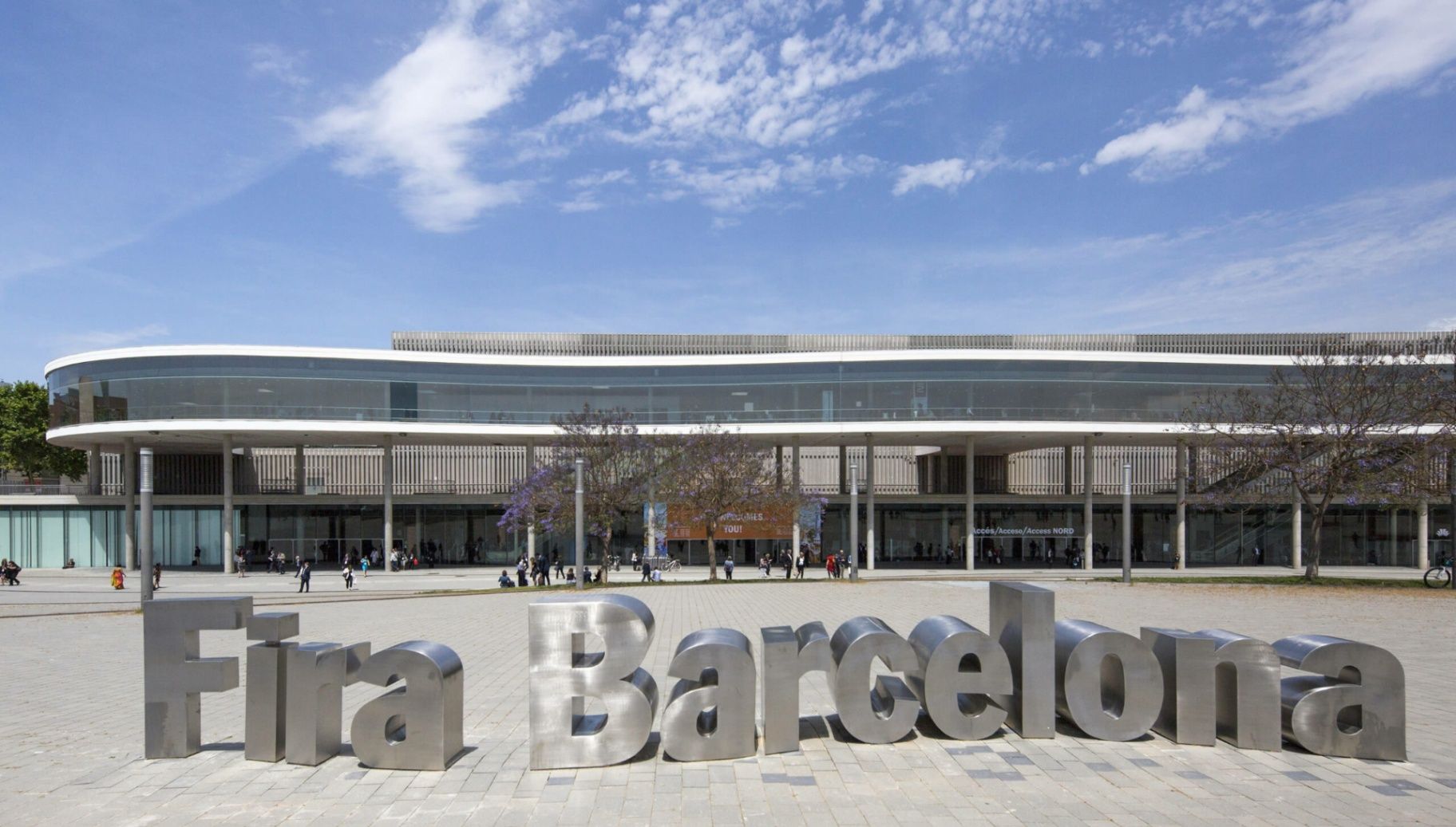
Fira Barcelona Gran Via is one of the largest and most advanced exhibition venues in Europe, designed to host the world’s leading trade fairs, technology summits, medical congresses, and industrial expos. While Barcelona is often associated with beaches, historic quarters, and Gaudí architecture, Gran Via represents a different identity of the city: global business, logistics precision, and large-scale innovation.
Opened in 2007, the Gran Via venue was designed by renowned Japanese architect Toyo Ito, whose concept blends minimalism, flow, and industrial elegance. The complex consists of eight massive exhibition halls, interconnected by long glazed corridors, suspended walkways, and natural light shafts. The layout prioritizes efficiency of movement, allowing tens of thousands of visitors to circulate at once without congestion.
What truly sets Fira Gran Via apart is its sheer operational scale. With more than 240,000 square meters of exhibition space, it regularly hosts events that attract over 100,000 visitors per edition. Among its most famous recurring events are the Mobile World Congress (MWC), one of the largest technology exhibitions on the planet, as well as major shows for pharmaceuticals, logistics, industrial automation, construction, and smart cities.
Architecturally, Gran Via does not rely on decorative spectacle. Instead, it emphasizes clean geometry, steel and glass contrasts, towering vertical volumes, and the rhythmic repetition of light and shadow. The result is a building that feels futuristic without being extravagant. A striking visual feature is the continuous covered spine that links the halls like a central artery, functioning both as a navigation axis and as a social circulation zone between events.
Beyond trade fairs, the venue also serves as a global meeting point for governments, corporate leaders, scientists, and innovators. International policy discussions on digital transformation, sustainability, healthcare systems, and future mobility frequently take place within its walls. In this sense, Fira Gran Via is not simply an exhibition space, but a temporary city of global decision-making that comes alive several times each year.
A little-known fact is that during the design phase, the orientation of the halls was carefully calculated to maximize diffused daylight while minimizing heat gain, reducing energy consumption across the massive structure. Another lesser-known detail is that parts of the underground logistics network allow direct truck access beneath the halls, enabling exhibitors to move heavy machinery and large installations invisibly without disrupting surface-level visitor flow.
Emotionally, Fira Gran Via does not aim to charm the visitor the way historic Barcelona does. Instead, its impact is one of scale, order, and momentum. It feels like standing inside an infrastructure built for the future. For many professionals, attending an event here marks not a leisure moment, but a career milestone, contract turning point, or technological breakthrough.
When fully active, the venue functions like a giant synchronized machine, where logistics teams, exhibitors, speakers, press, and security systems operate in continuous parallel motion. Few places in Spain demonstrate the choreography of modern global business as visibly as Fira Barcelona Gran Via.
Fira Barcelona Gran Via is located on the border between Barcelona city and L’Hospitalet de Llobregat, in the southwestern part of the metropolitan area.
City: Barcelona / L’Hospitalet de Llobregat
Region: Catalonia (Catalunya)
Country: Spain
Main Area: Gran Via Sud
* Line 9 Sud to Fira Station offers the most direct access.
Its location allows fast access both from Barcelona city center and from major highways linking the rest of Catalonia and Spain.
Fira Barcelona Gran Via is a cornerstone of Europe’s exhibition and conference infrastructure, engineered for scale, speed, and global connectivity. It embodies Barcelona’s role not just as a cultural capital, but as a strategic gateway for international trade, innovation, and knowledge exchange. When fully operational, it becomes a temporary metropolis of ideas, deals, and future-defining conversations.
1. What is Fira Barcelona Gran Via used for?
It is used for large-scale international trade fairs, congresses, summits, and industry expos.
2. Is Fira Gran Via open to the general public?
Only during active exhibitions or public-access events. Otherwise, it is closed.
3. What is the biggest event held at Gran Via?
The Mobile World Congress (MWC) is the most internationally significant event hosted there.
4. How large is the venue?
It offers over 240,000 square meters of exhibition space across eight halls.
5. Is there direct access from the airport?
Yes. Metro Line 9 Sud connects Barcelona El Prat Airport directly to the venue.
6. Is Fira Gran Via accessible for people with reduced mobility?
Yes. The venue is fully wheelchair accessible with elevators, ramps, and adapted services.
Discover more hidden gems you might love.
Lisbon
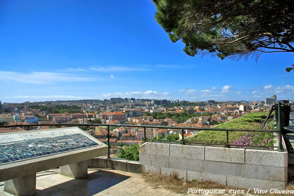
## Description Miradouro da Senhora do Monte is one of Lisbon’s most beloved viewpoints, offering a tranquil perch with unrestricted vistas across the city’s red rooftops, the Tagus River and landmarks like São Jorge Castle and the historic downtown. Tucked in the Graça neighborhood, the miradouro (viewpoint) is less crowded than some of Lisbon’s better-known terraces, making it a favorite among locals seeking a peaceful panorama and photographers hunting for unobstructed compositions. The small chapel of Senhora do Monte adds a devotional nuance to the setting, while benches and shaded nooks invite lingering. The viewpoint’s orientation gives particularly broad views to the east and south of the city, and because it is elevated, light at sunrise and sunset can be spectacular. Little-known facts: Miradouro da Senhora do Monte sits at one of the city’s highest natural points and was historically used to monitor the Tagus approaches; its quieter reputation owes partly to steeper approaches that keep the most casual visitors away. ## Location Miradouro da Senhora do Monte is located in the Graça parish of Lisbon, in the Lisbon District, Portugal. The viewpoint occupies a hilltop position above the Alfama and Graça neighborhoods and is within walking distance of São Vicente hill and several historic lanes. Getting there: The easiest ways are a short uphill walk through Graça from the tram 28 route or a ride to the Largo da Graça and a brief ascent. Tram 28 passes through Alfama and Graça and is a scenic option; buses also serve nearby stops. If using a taxi or rideshare, ask to be dropped at Largo da Senhora do Monte or the small square near the chapel. Wear comfortable shoes for the short climb. ## Tips - Timing: Sunrise and sunset are prime times for soft, warm light; sunrise is quieter and ideal for photographers. Weekday mornings are the least busy. - Safety & comfort: The area is generally safe and frequented by locals; standard precautions suffice. Bring water in warmer months and a light jacket in evenings. - Accessibility: The viewpoint involves steep streets and steps; it’s less accessible for visitors with limited mobility. - Neighborhood exploration: Combine the visit with a walk through Graça and Alfama’s lanes, sample local cafés and pastelarias nearby. - Respectful behavior: The chapel is a place of worship; observe quiet respect if services occur. ## Conclusion Miradouro da Senhora do Monte is an essential Lisbon experience for those seeking scenic calm and panoramic perspectives without the crowds of more famous terraces. Its high vantage point, local atmosphere and exceptional light conditions make it ideal for reflective moments, photography, and absorbing Lisbon’s layered skyline. ## FAQ Q: Is the miradouro crowded? A: It’s quieter than many Lisbon viewpoints but can be busy at sunset on weekends. Q: Are there cafés nearby? A: Yes, Graça and Alfama have several small cafés and bakeries within a short walk. Q: Does public transport reach it? A: Yes — Tram 28 and several buses serve the Graça area; from stops expect a short uphill walk. Q: Is there a fee to visit? A: No. The viewpoint and surrounding terraces are free and open to the public. ## Links [Detailed Guide](https://lisbonlisboaportugal.com/Alfama-Lisbon/miradouro-da-senhora-do-monte-lisbon.html)
GemVoyage Team • World
Druskininkai
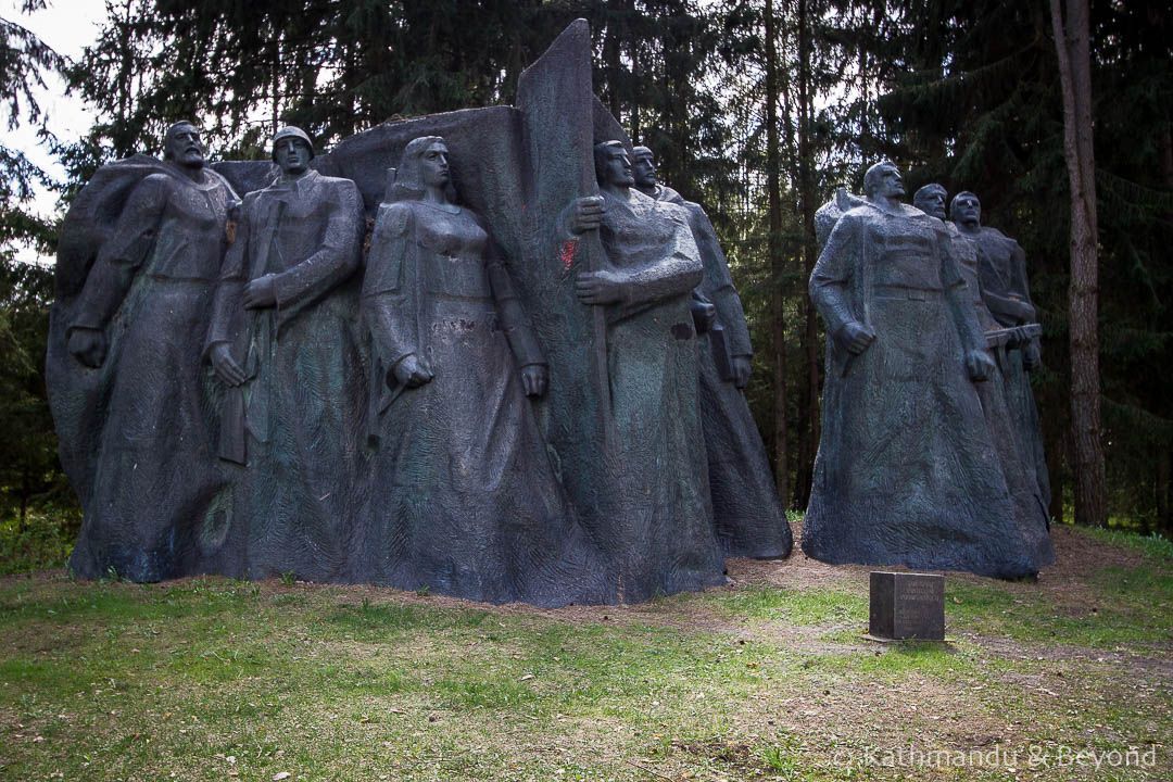
## Description Grūtas Park, often labeled the Soviet Sculpture Park, is a distinctive open-air museum near Druskininkai that preserves monumental artifacts from Lithuania’s Soviet period. Established by collectors and curators who sought to gather statues and relics removed from public squares after Lithuania regained independence, the park assembles these pieces within a designed landscape that encourages critical reflection rather than uncritical nostalgia. The park’s collection includes busts, full-figure monuments, bas-reliefs, and civic emblems that once dominated urban spaces under Soviet rule. What distinguishes Grūtas Park is its curatorial framing: statues are not simply re-installed as aesthetic objects but are placed within an interpretive environment that raises questions about ideology, power, and public memory. Complementing the sculptures are reconstructed Soviet kiosks, everyday artifacts, period signage, and a small indoor museum that provides historical context and archival material. The layout intentionally references the scale and dramatic sightlines of Soviet monumentalism, creating a spatial dialogue between past and present. Visitors often find Grūtas Park both educational and emotionally resonant. Plaques and guided tours unpack the histories behind the monuments, the artists who made them, and the social circumstances that led to their removal and relocation. The park fosters discussion about how societies remember oppressive histories, the ethics of preserving controversial monuments, and creative approaches to public history. ## Location Grūtas Park is located just outside the spa town of Druskininkai in southern Lithuania’s Alytus County, within easy driving distance of Vilnius and Kaunas. The park sits near major regional roads and is well signposted. Travel options include driving by car (the most flexible), regional buses that connect Druskininkai to surrounding towns, and organized day trips from Vilnius or Kaunas. Many visitors combine Grūtas Park with the spa facilities and cultural attractions of Druskininkai for a varied day trip. ## Tips - **Allow sufficient time:** Allocate 1.5–3 hours to walk the outdoor sculpture trails, visit the small museum, and absorb the interpretive materials. - **Use audio guides or join a guided tour:** Contextual information deepens understanding far beyond a walk-by view of statues—learn about the artists, the historical narratives, and the curatorial choices. - **Prepare for emotional responses:** The park’s material can be confronting. Read curator notes and plaques to frame the objects within a critical history of occupation and memory. - **Combine with Druskininkai activities:** Pair the visit with spa treatments, local museums, or nature walks to vary the day’s tone. - **Respect interpretive rules:** Photography is usually allowed for personal use, but check signage for restricted areas or displays. ## Conclusion Grūtas Park offers a unique encounter with Lithuania’s Soviet past: a landscaped gallery of monumental relics curated to foster reflection rather than nostalgia. Whether you are a history buff, art enthusiast, or traveler seeking thoughtful cultural experiences, the park provides a powerful case study in how societies can engage with difficult heritage. ## FAQ - **Q: Is Grūtas Park suitable for families with children?** A: The park is accessible to families, but the themes and imagery can be disturbing to very young children. Parents should prepare to explain historical context and may prefer guided tours that provide age-appropriate framing. - **Q: Are the sculptures authentic originals?** A: Many of the monuments on display were relocated from public squares and municipal collections across Lithuania; in several cases these are original works by mid-20th-century artists. - **Q: Can I take photographs at Grūtas Park?** A: Photography for personal use is generally allowed across the outdoor exhibits; check for any restricted areas or special installations where signage limits photography. - **Q: How much time should I plan for a visit?** A: Plan 1.5–3 hours to experience both the outdoor sculpture trail and the indoor exhibits, and longer if you want to read detailed materials or join a guided program. - **Q: Is there an admission fee?** A: Yes, the park charges an entry fee that helps support maintenance and interpretive programming—confirm current prices on the park’s official site. - **Q: Does the park host temporary exhibitions or events?** A: Grūtas Park occasionally runs temporary exhibitions, film screenings, and guided talks—check the calendar if you want to coincide with special programming. ## Links -- [Grūtas Park (Wikipedia)](https://en.wikipedia.org/wiki/Gr%C5%ABtas_Park)
GemVoyage Team • World
Rome
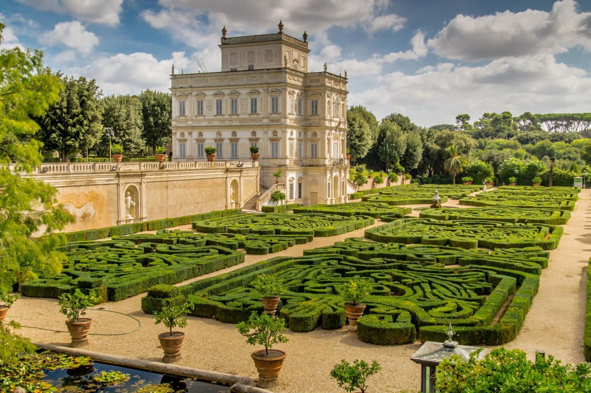
## Description Villa Doria Pamphili is Rome’s largest landscaped villa park, a sprawling green refuge that stretches across rolling lawns, tree-lined avenues, and layered gardens. The park is a living palimpsest: its design reflects generations of development, blending formal Italianate fragments with later Romantic landscape interventions. Visitors discover broad promenades shaded by mature pines and cypresses, intimate groves, terraced viewpoints, ornamental fountains, and the occasional historic villa or chapel tucked into the greenery. What separates Villa Doria Pamphili from Rome’s better-known manicured gardens is its scale and everyday use: runners training along long straight avenues, families picnicking under broad trees, and musicians gathering informally on sunny afternoons. The park hosts seasonal cultural programs—outdoor concerts, film nights, and neighborhood festivals—yet retains a quiet dignity even during busier times. Its pathways offer both restful, shaded routes and open, sunlit clearings; photographers and nature lovers will appreciate the changing light through the trees and occasional glimpses of Roman rooftops beyond. The park’s history is visible in its layered landscaping: landscaped terraces that once anchored a noble estate, interspersed with woodland patches that feel older and wilder. For those studying garden history, the site provides a satisfying case study of how aristocratic pleasure grounds transitioned to public urban parks. For ordinary visitors, the pleasures are simpler—ample space, restful atmosphere, and a sense of escape from Rome’s denser historic core. ## Location Villa Doria Pamphili occupies a large swathe in western Rome, bordering neighborhoods like Monteverde and Trastevere. It is reachable by bus, taxi, and on foot from several tram and metro stops; the park’s size means different entrances suit different itineraries, so checking a map before you go helps you plan whether to approach from the north, south, or west side. ## Tips - Wear comfortable footwear: the park’s size rewards long walks and exploration across varied surfaces. - Visit on a weekday morning for the quietest experience; weekends attract many local families and picnickers. - Bring a picnic and a blanket—there are many scenic clearings suited to lingering. - Rent a bike or bring a folding bike if you want to cover more ground; some routes are well-suited to casual cycling. - Keep an eye on the events board: the park occasionally stages open-air concerts and screenings, which can be a delightful, low-cost cultural night out. - Respect local rules about barbecues and alcohol: these can be restricted in parts of the park. ## Conclusion Villa Doria Pamphili is an expansive urban refuge offering both active recreation and relaxed contemplation. Its layered history, varied landscapes, and everyday uses make it a revealing place to spend a few hours or an entire afternoon—particularly appealing for travelers seeking outdoor green spaces and a more local side of Rome. ## FAQ Q: Is there an entrance fee? A: No—the park is public and free to enter, which makes it a popular local destination for recreation and relaxation. Q: Are dogs allowed? A: Dogs are usually permitted on-leash in most areas; check local signage for any leash-free zones or restrictions. Q: Can I cycle through the park? A: Yes—many paths are bike-friendly, though some narrower or pedestrian-priority areas may be more suitable for walking. Q: Are there public restrooms and water fountains? A: Basic facilities are available but can be limited; carry some water and check maps for restroom locations during longer visits. Q: Are there guided tours of the park’s history? A: Occasionally local associations offer guided walks focusing on the villa’s history and gardens—look for community announcements or contact local tourism offices. ## Links - [Villa Doria Pamphili (Wikipedia)](https://en.wikipedia.org/wiki/Villa_Doria_Pamphili)
GemVoyage Team • World
Berlin
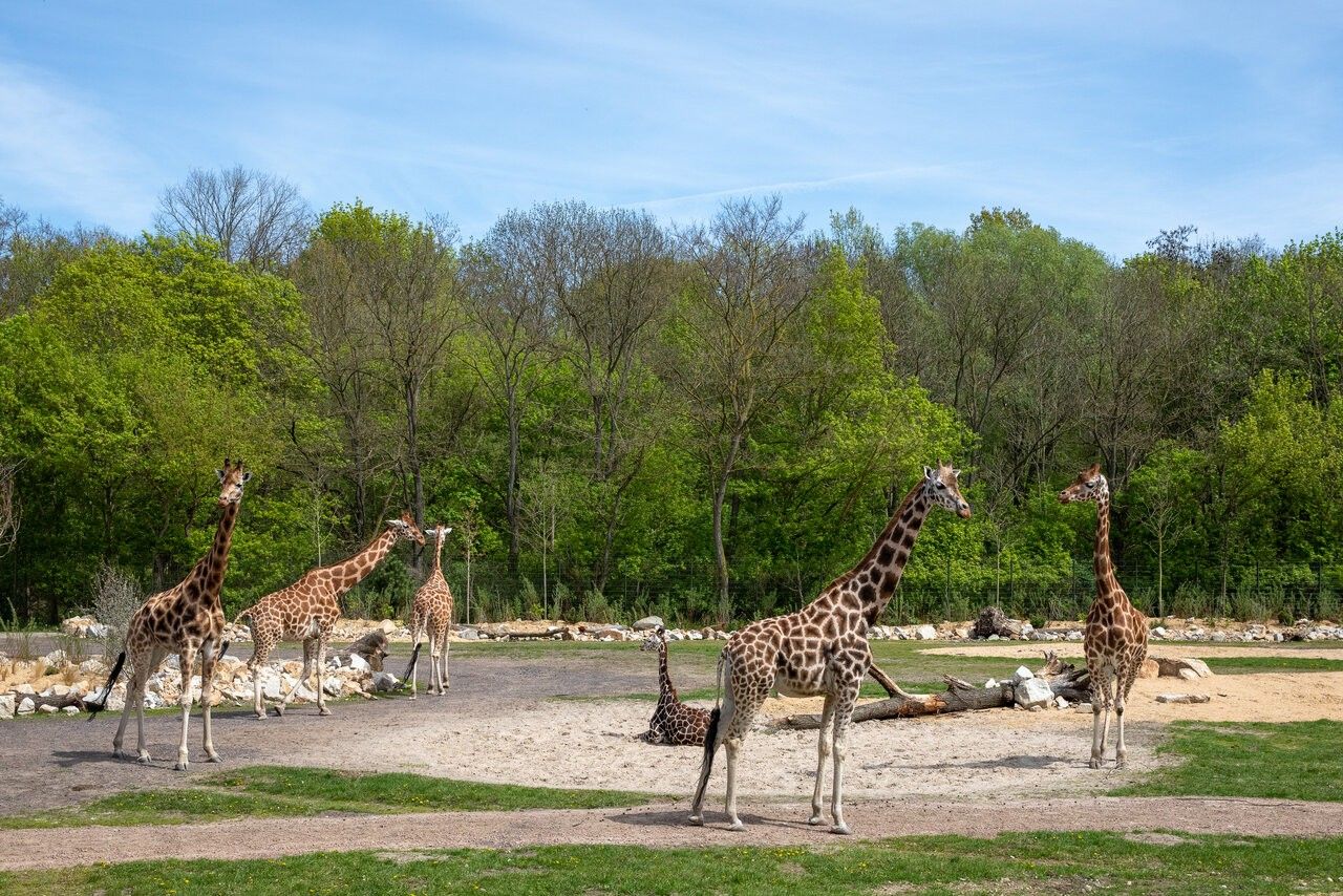
## Description Tierpark Berlin is one of the most impressive zoological parks in Europe and a standout attraction in the German capital. Unlike traditional city zoos, Tierpark Berlin is designed as a vast landscape park where animals live in spacious, naturalistic enclosures spread across rolling lawns, wooded areas, and historic parkland. With more than 160 hectares to explore, it offers a relaxed and immersive experience that feels closer to a nature reserve than a conventional zoo. What makes Tierpark Berlin truly unique is its scale and setting. It is the largest zoo in Europe by area, allowing animals such as elephants, giraffes, bison, and big cats to roam in environments that closely resemble their natural habitats. A little-known fact is that the zoo is located on the former grounds of Friedrichsfelde Palace, an 18th-century baroque residence that still stands at the heart of the park and is open to visitors. Another lesser-known detail is that Tierpark Berlin was established in 1955 in what was then East Berlin, serving as the counterpart to Zoo Berlin in the western part of the city during the Cold War. Today, Tierpark Berlin combines animal conservation, education, and leisure, making it especially appealing for families, nature lovers, and visitors seeking a slower-paced zoo experience. ## Location Tierpark Berlin is located in **Germany**, in the city-state of **Berlin**, within the **Lichtenberg** district. It lies in the eastern part of the city, surrounded by residential neighborhoods and green spaces. Getting there is simple using public transportation. The most convenient option is the U-Bahn (metro): take Line U5 to **Tierpark** station, which exits directly in front of the main entrance. Several bus and tram lines also stop nearby. For visitors traveling by car, parking is available close to the entrances, though public transport is generally the easiest and most efficient way to reach the zoo. ## Tips * Allow plenty of time for your visit; exploring Tierpark Berlin properly can take four to six hours or more. * Wear comfortable walking shoes, as distances inside the park are long. * Consider renting a wagon or using the park’s internal transport options if visiting with small children. * Bring snacks or enjoy one of the on-site cafés and restaurants, especially during longer visits. * Visit on weekdays or outside school holidays to enjoy a quieter atmosphere. * Check feeding times and animal talks in advance for a more educational experience. ## Conclusion Tierpark Berlin offers a unique zoo experience defined by space, greenery, and a strong focus on animal welfare. Its combination of wildlife, historic surroundings, and relaxed atmosphere makes it one of Berlin’s most rewarding attractions for visitors of all ages. ## FAQ **How is Tierpark Berlin different from Zoo Berlin?** Tierpark Berlin is much larger and more spacious, focusing on landscape-style enclosures, while Zoo Berlin is more compact and centrally located. **How long does a visit usually take?** Most visitors spend between four and six hours, though a full day is ideal for seeing everything at a relaxed pace. **Is Tierpark Berlin suitable for children?** Yes, it is very family-friendly, with playgrounds, open spaces, and child-focused facilities. **Is the zoo accessible for people with limited mobility?** Yes, the park has wide paths and is generally accessible, though the large size may require planning. **Can I visit Tierpark Berlin year-round?** Yes, the zoo is open throughout the year, with seasonal highlights in every season. ## Links * [Tierpark Berlin Official Website](https://www.tierpark-berlin.de) * [Visit Berlin Official Tourism Website](https://www.visitberlin.de)
GemVoyage Team • World
Copenhagen
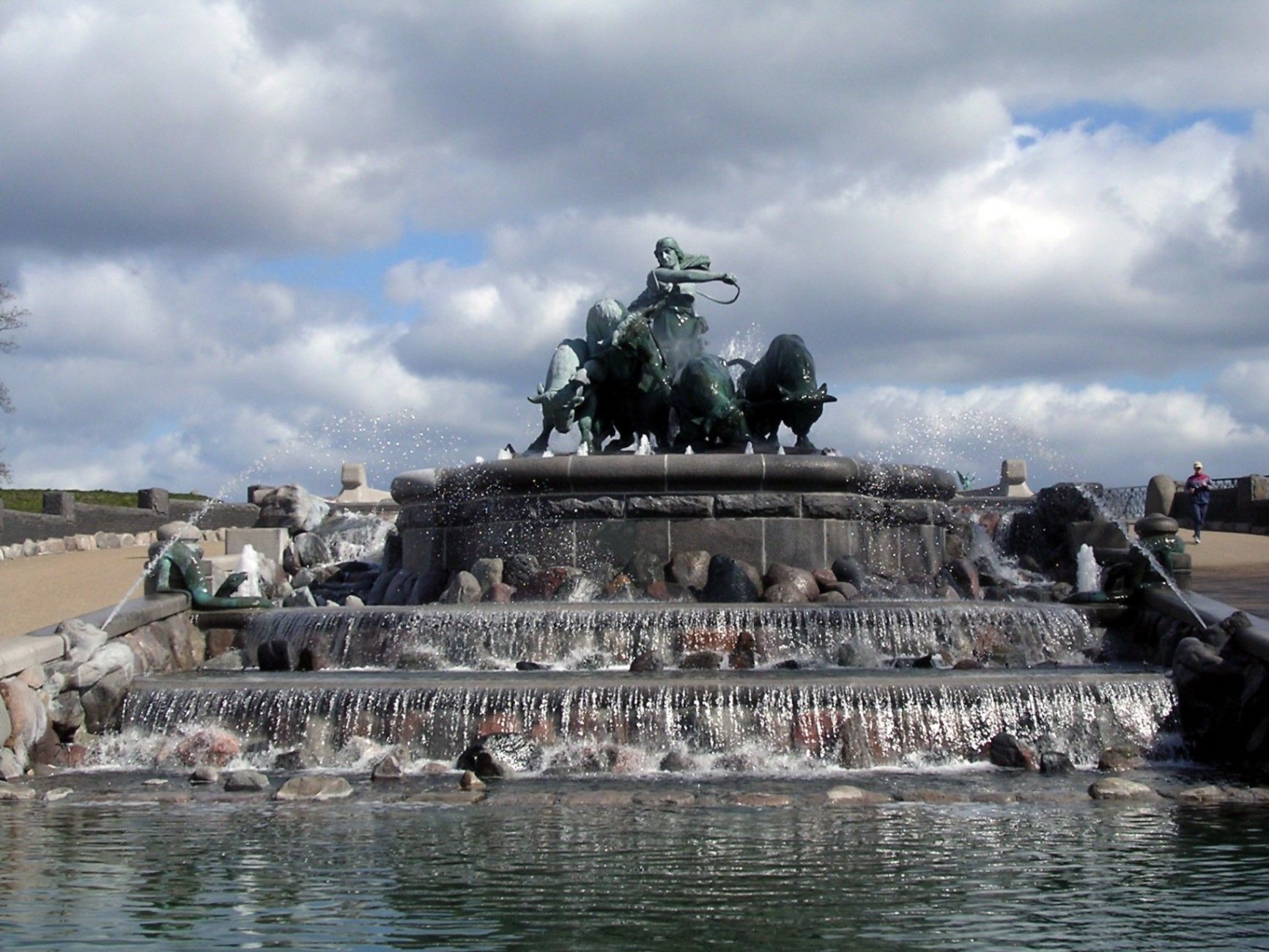
## Description The **Gefion Fountain (Gefionspringvandet)** is one of **Copenhagen’s most iconic landmarks**, combining stunning sculpture, mythological symbolism, and the serene beauty of its waterfront setting. Unveiled in **1908**, the fountain depicts the **Norse goddess Gefion**, a figure from ancient Scandinavian mythology, driving a group of **powerful oxen** as they pull the land that became the island of **Zealand (Sjælland)** — where Copenhagen stands today — from the depths of the sea. Designed by **Danish sculptor Anders Bundgaard**, the fountain is both a **monumental work of art** and a **celebration of Danish legend and identity**. The dynamic bronze figures, set atop a granite basin, capture the dramatic moment of transformation: Gefion’s oxen straining against their harnesses, water surging around them, and the goddess commanding them with divine strength. The story behind the sculpture comes from **Norse mythology**, where Gefion tricks the Swedish king **Gylfi** into granting her as much land as she can plow in one night. Transforming her four sons into oxen, she plows through the earth and casts the land into the sea — forming the island of Zealand. The resulting lake in Sweden, **Lake Vänern**, is said to match Zealand’s shape. What makes the Gefion Fountain unique is not only its **artistic detail and mythological depth** but also its **location** — it sits between **Kastellet Fortress** and **Langelinie Promenade**, surrounded by lush greenery and views of the **harbor** and **The Little Mermaid statue** nearby. The fountain is especially magical when illuminated at night, with the flowing water and shimmering bronze giving it an ethereal glow. A lesser-known fact is that the fountain was originally commissioned by the **Carlsberg Foundation** to celebrate the brewery’s 50th anniversary and was gifted to the city of Copenhagen. Another interesting detail: the granite blocks forming the base came from **Sweden**, a subtle nod to the myth that connects the two lands. ## Location The **Gefion Fountain** is located in **Churchillparken (Churchill Park)** near **Langelinie**, in the **central harbor area of Copenhagen**, **Denmark**. It sits just east of **Amalienborg Palace** and north of the **Kastellet (The Citadel)** fortress. To get there: * **By metro:** Take the **M3 (City Circle Line)** to **Marmorkirken Station**, then walk about **10 minutes** northeast toward the harbor. * **By bus:** Several local buses, including routes **26** and **27**, stop nearby at **Esplanaden**. * **By foot or bike:** The fountain is part of a popular **walking and cycling route** that connects **Amalienborg**, **The Little Mermaid**, and **Kastellet**. * **By car:** Limited parking is available nearby, though walking or cycling is more convenient in this area. ## Tips * **Visit in the morning or late evening:** The light at sunrise and sunset enhances the sculpture’s bronze tones and reflections. * **Combine with nearby landmarks:** The **Little Mermaid**, **Kastellet Fortress**, and **Amalienborg Palace** are all within walking distance. * **Evening illumination:** Visit after dark to see the fountain beautifully lit — a favorite spot for photographers. * **Learn the mythology:** Understanding the legend of Gefion adds depth to your visit; many plaques around the site explain the story. * **Bring a camera:** The fountain’s movement, water effects, and sculptural detail make it a fantastic subject for photos. * **Relax nearby:** The surrounding park offers benches and green spaces perfect for a quiet break during a city walk. * **Visit year-round:** While the fountain operates mainly in warmer months, the sculptures remain accessible and impressive throughout the year. ## Conclusion The **Gefion Fountain** is much more than a beautiful monument — it’s a vivid connection between Denmark’s ancient mythology and its modern identity. With its stunning artistry, powerful symbolism, and scenic harbor location, it perfectly embodies Copenhagen’s blend of **history, legend, and elegance**. Whether you’re tracing the city’s cultural landmarks, enjoying a peaceful stroll through Churchill Park, or exploring Norse mythology, the Gefion Fountain offers a moment of reflection and wonder that captures the timeless spirit of Denmark. ## FAQ **1. What does the Gefion Fountain represent?** It depicts the Norse goddess **Gefion** plowing the land that became the island of **Zealand (Sjælland)**, symbolizing the creation of Denmark’s largest island. **2. Who designed the fountain?** The fountain was created by **Anders Bundgaard**, one of Denmark’s most celebrated sculptors, and unveiled in **1908**. **3. Where is the Gefion Fountain located?** In **Churchillparken**, near **Langelinie Promenade** and **Kastellet Fortress**, in central **Copenhagen**, Denmark. **4. Is it near other attractions?** Yes — it’s just a short walk from **The Little Mermaid**, **Amalienborg Palace**, and the **harborfront**. **5. When does the fountain operate?** The fountain usually runs from **April to October**, depending on weather conditions. The sculptures can be viewed year-round. **6. Is there an entrance fee?** No — visiting the Gefion Fountain is **free of charge**. **7. Can I visit at night?** Yes, and it’s highly recommended. The **evening lighting** creates a beautiful, almost mythical atmosphere. ## Links * [Official Visit Copenhagen – Gefion Fountain](https://www.visitcopenhagen.com/)
GemVoyage Team • World
Düsseldorf
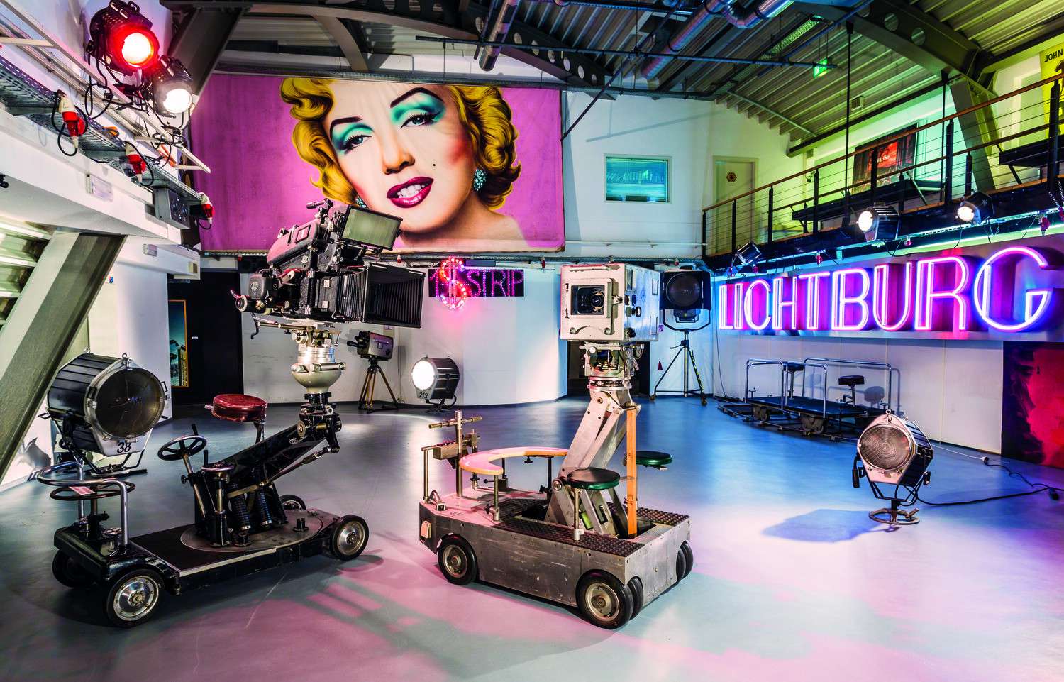
## Description The Film Museum in Düsseldorf (Filmmuseum Düsseldorf) is a captivating destination for cinephiles, history buffs, and curious travelers alike. Located in the heart of the city’s Altstadt (Old Town), this museum offers a deep dive into the evolution of cinema—from the earliest moving images to modern-day blockbusters. Spread across four floors and 2,200 square meters, the museum showcases the art, technology, and cultural impact of film in a way that’s both educational and immersive. Visitors can explore a wide range of exhibits, including vintage cameras, lighting equipment, costumes, props, and set designs. One of the highlights is a reconstructed film studio where guests can get hands-on experience with the filmmaking process. The museum also features interactive displays on special effects, animation, and sound design, making it a dynamic learning environment for all ages. A little-known fact: the museum houses the archives of Fritz Genandt, a local cinema pioneer whose nitrofilm collection is one of the oldest in Germany. Another hidden gem is the “Black Box” cinema located within the museum, which screens classic films, retrospectives, and experimental cinema—often featuring rare or hard-to-find titles. ## Location The Film Museum is located in **Germany**, in the **North Rhine-Westphalia** region, in the city of **Düsseldorf**. Its exact address is Schulstraße 4, 40213 Düsseldorf, right in the Altstadt district. ### How to Get There: - **By Public Transport**: Take the U-Bahn to Heinrich-Heine-Allee station. From there, it’s a short walk to the museum. - **By Car**: Parking is available nearby, but the Altstadt can be busy—public transport is recommended. - **By Foot or Bike**: If you're exploring the Old Town, the museum is easily accessible on foot or by bicycle. Its central location makes it a perfect stop during a day of sightseeing in Düsseldorf. ## Tips for Visitors To make the most of your visit to the Film Museum, keep these tips in mind: - **Visit on a Sunday or Friday**: Admission is free on Sundays and for visitors under 21 on Fridays. - **Check the Black Box Schedule**: The in-house cinema offers a rotating program of films—some screenings include Q&A sessions or guest speakers. - **Explore All Four Floors**: Each level covers a different aspect of film history, from production to distribution to exhibition. - **Use the Museum Library**: With over 33,000 media items, the library is a treasure trove for researchers and film students. - **Attend a Workshop**: The museum regularly hosts seminars and workshops for all ages, including animation and screenwriting. - **Shop for Souvenirs**: The museum store offers unique film-related merchandise and memorabilia. ## Conclusion The Film Museum in Düsseldorf is a vibrant tribute to the magic of cinema. With its rich collection, interactive exhibits, and historic setting, it offers a compelling journey through the world of film—from its humble beginnings to its modern-day marvels. Whether you're a casual moviegoer or a dedicated film buff, this museum is a must-visit. ## FAQ **1. What are the opening hours of the Film Museum?** The museum is open Tuesday to Sunday, typically from 11:00 AM to 6:00 PM. It’s closed on Mondays. **2. Is there an entrance fee?** Yes, general admission is €5 for adults and €2.50 for reduced tickets. Entry is free on Sundays and for visitors under 21 on Fridays. **3. Can I watch films at the museum?** Yes, the museum includes the Black Box cinema, which screens a variety of films throughout the year. **4. Is the museum suitable for children?** Absolutely. Interactive exhibits and workshops make it engaging for younger visitors. **5. Is the museum accessible for people with disabilities?** Yes, the museum is certified for accessibility and offers on-site mobility support. **6. Are guided tours available?** Yes, guided tours can be booked in advance for groups and educational visits. ## Links - [Official Website of Filmmuseum Düsseldorf](https://www.duesseldorf.de/filmmuseum/) - [Wikipedia – Filmmuseum Düsseldorf](https://de.wikipedia.org/wiki/Filmmuseum_D%C3%BCsseldorf)
GemVoyage Team • World

Comments