GemVoyage Team • World
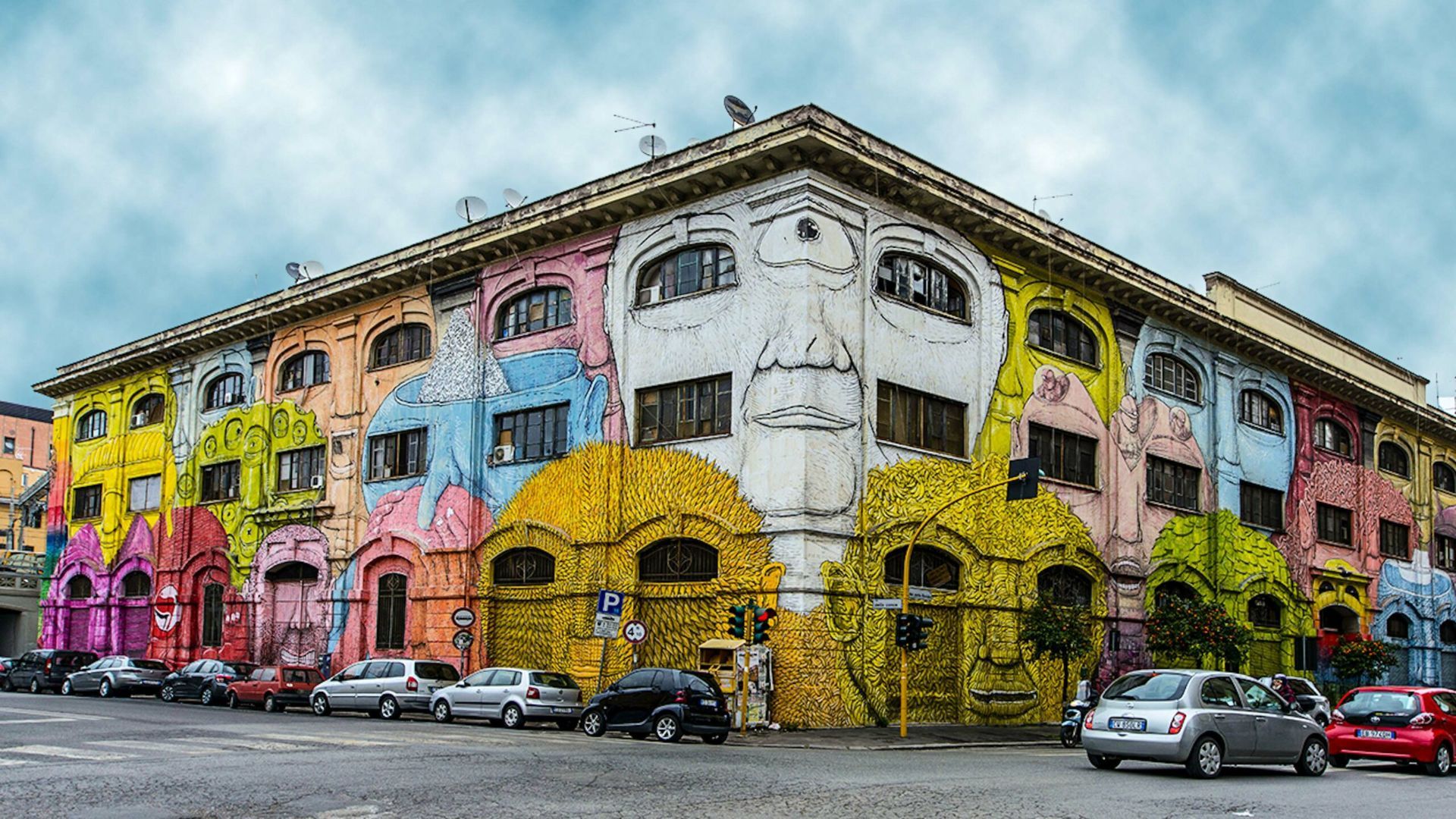
Ostiense is also notable for nearby cultural institutions such as Centrale Montemartini—an arresting museum that juxtaposes classical sculpture with industrial architecture—as well as evolving food halls and waterfront promenades that add to the neighborhood’s appeal. The daily rhythm here is different from Rome’s historic center: it’s more local, less hurried, and often the setting for pop-up markets, gallery openings, and late-night dining.
Q: Are guided street-art tours available?
A: Yes; several local guides and cultural organizations run walking tours that explain the art, artists, and history behind the works.
Q: Is Ostiense safe to visit at night?
A: Generally yes—areas around the train station and main streets are lively at night, though standard urban caution is advised in quieter lanes.
Q: Can I photograph the murals?
A: Absolutely; murals in public spaces are typically fine to photograph—avoid obstructing traffic or private entrances while shooting.
Q: What else is nearby to pair with an Ostiense visit?
A: Centrale Montemartini, food halls, and the riverside promenade are excellent nearby additions.
Discover more hidden gems you might love.

Cairo
## Description **The Umm Kulthum Museum (متحف أم كلثوم)** is a cultural institution dedicated to the life, career, and enduring influence of **Umm Kulthum**, widely regarded as the greatest singer in Arabic music history. More than a traditional museum, it functions as a space of collective memory, honoring an artist whose voice shaped Arab identity, politics, and emotional life throughout the 20th century. The museum traces Umm Kulthum’s journey from her rural childhood in the Nile Delta to her rise as an international cultural icon. Exhibits include original concert dresses, handwritten song lyrics, personal letters, musical instruments, photographs, and rare recordings. These objects illustrate not only her artistic evolution but also her role in Egypt’s political and social life, particularly during the mid-20th century when her songs became symbols of unity and resilience. One lesser-known fact is that Umm Kulthum maintained strict control over her performances, including acoustics, orchestra placement, and radio broadcasts, contributing to the unique emotional intensity of her concerts. Another interesting detail is that her monthly live radio performances once caused streets across the Arab world to empty, as listeners gathered around radios to hear her sing in real time. The museum also emphasizes her collaboration with major composers and poets, such as **Riad Al-Sunbati** and **Ahmed Rami**, highlighting how her success was the result of a disciplined artistic network rather than solo fame. Audio stations throughout the museum allow visitors to experience her music in context, making the visit immersive rather than purely visual. ## Location **Country:** Egypt **Region:** Greater Cairo **City:** Cairo **District:** Old Cairo (Manial area) The museum is located within the **Manasterly Palace complex** on **Roda Island**, overlooking the Nile. ### How to Get There * **By taxi or ride-hailing:** * Uber and local taxis are the most convenient way to reach Roda Island. * **By metro:** * Take Line 1 to **Sayeda Zeinab** station, followed by a short taxi ride. * **By car:** * Accessible via bridges connecting Roda Island to central Cairo. * **On foot (limited):** * Walking access is possible from nearby neighborhoods, but distances can be long. ## Tips * **Allow time for listening stations:** The audio exhibits are essential to the experience. * **Combine with Manial Palace:** Both sites are in the same complex and complement each other well. * **Visit on a weekday:** The museum is quieter and more contemplative. * **Background knowledge helps:** Familiarity with Umm Kulthum’s music enhances the visit, but it’s not required. * **Photography rules vary:** Check signage before taking photos inside. * **Best for mature visitors:** The museum is most appreciated by those interested in cultural history and music. ## Conclusion The Umm Kulthum Museum preserves the legacy of a voice that transcended music to become a cultural force. Through personal artifacts, recordings, and historical context, it offers a deep and respectful exploration of an artist who shaped generations across the Arab world. ## FAQ **1. Who was Umm Kulthum?** She was an Egyptian singer and cultural icon whose influence extended across the Arab world for decades. **2. Is the museum suitable for non-Arabic speakers?** Yes. Visual displays and contextual explanations make the visit accessible, though understanding Arabic lyrics adds depth. **3. How long does a visit take?** Around **60 to 90 minutes**. **4. Is there an entrance fee?** Yes, a modest fee is charged. **5. Are guided tours available?** Occasionally, especially for cultural groups. **6. Can I buy music or souvenirs there?** Limited merchandise may be available within the palace complex. ## Links * [Cairo tourism portal](https://www.experienceegypt.eg/en)
GemVoyage Team • World
Munich
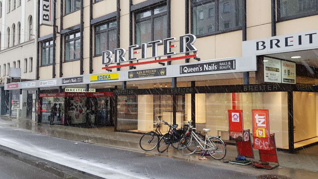
## Description **Breiterhof Passage** is a discreet but culturally significant pedestrian passageway in the heart of Munich’s old town. Unlike the city’s grand squares or monumental avenues, Breiterhof Passage represents a more **intimate layer of urban history**, where commerce, architecture, and everyday life intersect quietly rather than dramatically. The passage dates back to the **postwar reconstruction period**, when Munich rebuilt much of its historic core after World War II. Instead of restoring medieval structures wholesale, planners integrated modern functionality with traditional urban patterns. Breiterhof Passage exemplifies this approach: a short, covered walkway connecting streets while sheltering small shops, cafés, and offices. Its modest scale reflects a deliberate choice to prioritize **human movement and local commerce** over architectural spectacle. What makes Breiterhof Passage unique is its **contrast with Munich’s surrounding grandeur**. Just steps away from busy shopping streets and historic landmarks, the passage offers a slower, enclosed environment that feels almost private. A lesser-known fact is that passages like Breiterhof were designed to maintain pedestrian permeability in dense urban blocks, preserving historic movement patterns even when buildings were rebuilt. Another overlooked detail is that many businesses here are long-standing local operations rather than international chains, giving the space a distinctly Munich character. The passage is not a destination in itself, but a **transitional urban experience**. It rewards attentive visitors who appreciate the city’s smaller architectural gestures and the continuity of everyday life embedded within them. ## Location **Country:** Germany **State:** Bavaria **City:** Munich **District:** Altstadt-Lehel Breiterhof Passage is located in Munich’s historic center, close to major shopping streets and within easy walking distance of Marienplatz. ### How to Get There * **By metro or S-Bahn:** * Travel to **Marienplatz** station, then walk approximately 3–5 minutes. * **By tram:** * Several tram lines stop near the old town perimeter, followed by a short walk. * **On foot:** * Ideal when exploring Altstadt-Lehel, as the passage connects naturally to pedestrian routes. * **By bicycle:** * Bike parking is available nearby, though cycling through the passage itself is not permitted. ## Tips * **Visit during business hours:** The passage is most lively when shops and cafés are open. * **Look beyond storefronts:** Architectural details and spatial proportions are easy to miss if rushed. * **Use it as a shortcut:** It provides a calmer alternative to crowded shopping streets. * **Combine with old town exploration:** It fits naturally into a walking itinerary through central Munich. * **Respect the quiet tone:** This is a working urban space, not a tourist attraction. * **Photography is permitted:** Be mindful of people working or dining inside. ## Conclusion Breiterhof Passage is a subtle reminder that cities are shaped as much by small connective spaces as by major landmarks. Modest, functional, and quietly local, it offers insight into Munich’s postwar urban identity and everyday rhythms. ## FAQ **1. Is Breiterhof Passage a tourist attraction?** No, it is primarily a functional pedestrian passage used by locals. **2. Is there an entrance fee?** No, access is completely free. **3. How long does it take to visit?** Only a few minutes, unless stopping at a café or shop. **4. Is it historically significant?** Yes, as part of Munich’s postwar reconstruction and pedestrian network. **5. Is it suitable for children?** Yes, though there are no child-specific activities. **6. Can it be visited at night?** Access may vary depending on building hours, but daytime visits are recommended. ## Links * [Munich tourism board](https://www.munich.travel)
GemVoyage Team • World
Albania
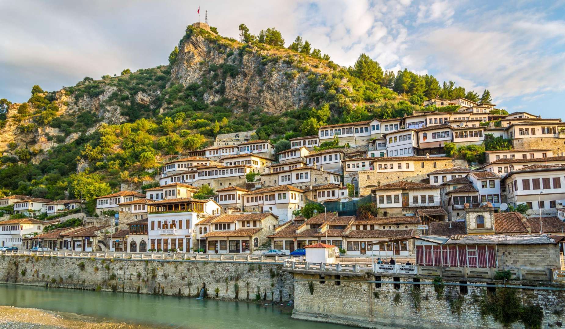
## Description Old Town Berat, often called the “City of a Thousand Windows,” is one of Albania’s most captivating historical destinations. Recognized as a UNESCO World Heritage Site, Berat is a living museum of Ottoman architecture, Byzantine churches, and layered cultural heritage. The town’s name is believed to derive from the Slavic “Beligrad,” meaning “white city,” and its origins trace back to the 6th century BC as the Illyrian settlement of Antipatrea. What makes Old Town Berat unique is its harmonious blend of religious and architectural diversity. The town is divided into three main quarters: Kala (the castle district), Mangalem (the Muslim quarter), and Gorica (the Christian quarter). Each area offers a distinct character, yet together they form a cohesive and picturesque whole. The iconic white Ottoman houses, stacked on the hillsides with large windows facing outward, give the town its poetic nickname and create a stunning visual symmetry. A little-known fact: Berat Castle is still inhabited. Unlike many European castles that serve solely as tourist attractions, locals live within its ancient walls, maintaining a vibrant community among Byzantine churches and Ottoman mosques. Another fascinating detail is the Onufri Museum, housed in the Church of the Dormition of St. Mary, which showcases the works of Onufri, a 16th-century Albanian iconographer known for his vivid use of color and gold. ## Location Old Town Berat is located in **Albania**, in the **Berat County**, within the **city of Berat**. It lies in central Albania, nestled along the banks of the Osum River and surrounded by the Tomorr Mountains. ### How to Get There - **By Bus**: From Tirana, minibuses depart regularly from the South and North Bus Terminals. The journey takes about 2.5 to 3 hours. - **By Car**: Driving from Tirana or other major cities is straightforward, with well-marked roads leading to Berat. The drive offers scenic views of the Albanian countryside. - **By Tour**: Many day tours from Tirana include transportation and guided visits to Berat’s key attractions. - **By Foot**: Once in Berat, the Old Town is best explored on foot. Cobblestone streets and narrow alleys connect the historic quarters. Its central location makes Berat an ideal base for exploring southern Albania’s natural and cultural sites. ## Tips - **Wear Comfortable Shoes**: The cobbled streets and steep paths, especially in the castle district, require sturdy footwear. - **Visit Early or Late**: To avoid crowds and enjoy the best light for photography, explore the Old Town in the morning or late afternoon. - **Stay Overnight**: Spending a night in a traditional guesthouse allows you to experience the town’s quiet charm after day-trippers leave. - **Try Local Cuisine**: Berat is known for its hearty Albanian dishes. Don’t miss specialties like stuffed peppers, lamb with yogurt, and homemade raki. - **Respect Religious Sites**: Many churches and mosques are still active. Dress modestly and ask before taking photos inside. - **Explore Beyond the Town**: Nearby attractions like Osum Canyon and Bogove Waterfall make excellent day trips. ## Conclusion Old Town Berat is a timeless blend of history, architecture, and cultural harmony. With its layered past, stunning vistas, and welcoming atmosphere, it offers a deeply enriching experience for travelers seeking authenticity in Albania. ## FAQ **1. Is there an entrance fee to visit Old Town Berat?** No, the Old Town itself is free to explore. Specific sites like the Onufri Museum or Berat Castle may charge small entrance fees. **2. How long should I spend in Berat?** A full day is enough to see the highlights, but staying overnight allows for a more relaxed and immersive experience. **3. Is Berat suitable for children?** Yes, though supervision is needed in areas with steep paths and uneven terrain. **4. Are guided tours available?** Yes, local guides offer walking tours that include historical insights and visits to key landmarks. **5. What is the best time of year to visit?** Spring and autumn offer mild weather and fewer crowds. Summer is popular but can be hot. **6. Can I stay inside the castle?** Yes, some guesthouses are located within the castle walls, offering a unique lodging experience. ## Links - [Old Town Berat – Albania Turism Overview](https://albaniaturism.com/old-town-berat-unesco-discovery/)
GemVoyage Team • World
Beijing
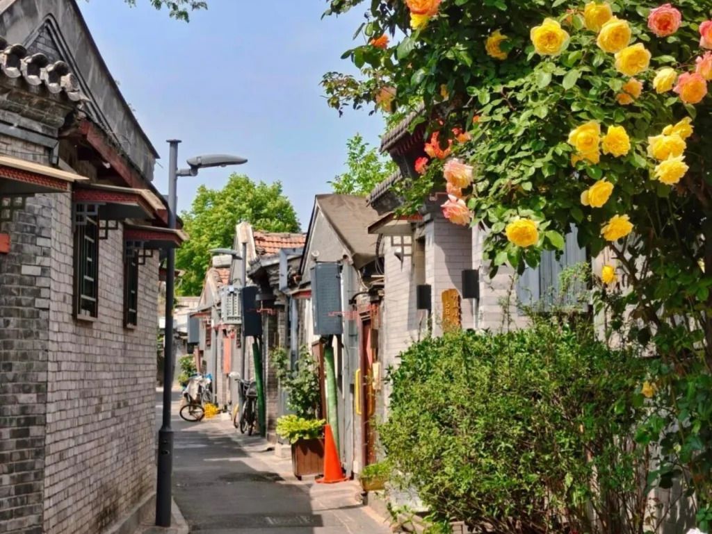
## Description Qinhuangdao Alley Hutongs, as a travel idea, points to one of Beijing’s most rewarding urban experiences: moving through the city’s traditional hutong lanes and seeing how historic residential fabric still shapes everyday life. Hutongs are not grand monuments in the usual sense. They are narrow lanes, courtyard-house networks, and neighborhood corridors that preserve a more intimate view of Beijing than the city’s large avenues and famous landmarks. That is exactly why they remain so compelling. They let visitors step into the scale of older Beijing, where community, domestic life, and street activity sit in close proximity. The appeal of the hutong experience lies in its texture. Instead of one single iconic object, you get layered details: gray brick walls, courtyard entrances, hand-painted signs, hidden cafés, neighborhood shops, bicycles, small temples, and the daily rhythm of residents going about ordinary routines. A lesser-known fact is that hutongs are not just tourist curiosities; they are living urban forms that have survived because they still support local life, even as some areas have changed dramatically. Another overlooked detail is that many of the most interesting hutong walks reveal small architectural differences from lane to lane, including gate styles, courtyard layouts, and adaptations made over time to fit modern use. If you are traveling in Beijing for the first time, hutongs can be one of the most useful experiences you choose because they explain the city in a human-scale way. They show how neighborhoods are organized, how people move, and how history remains present without always announcing itself loudly. Unlike large museums, the hutong district does not ask you to stand still. It invites you to wander, notice, and compare. That makes it especially rewarding for slow travelers, photographers, architecture lovers, and anyone who prefers atmosphere over checklist sightseeing. The name “Qinhuangdao Alley Hutongs” may be used locally or descriptively, but the broader experience belongs firmly to Beijing’s historic center. Rather than approaching it as a single fenced attraction, think of it as a neighborhood exploration. That mindset will help you appreciate it much more fully. ## Location The hutong experience is centered in Beijing Municipality, China, especially in the older districts of Dongcheng and Xicheng where historic lanes remain most visible. Depending on the exact lane or alley you plan to visit, you may be close to landmarks such as Shichahai, Nanluoguxiang, the Bell and Drum Towers, or other traditional neighborhoods. Because hutongs are embedded in the city’s fabric, their location is best understood as a district-level experience rather than a single destination pin. Getting there is usually easiest by subway, followed by a short walk. Beijing’s public transit network is efficient for reaching the historic core, and once you exit the station, the pleasure comes from entering the smaller lanes on foot. Taxis and rideshares are also practical, but traffic can make them slower than the metro during busy hours. If you prefer a more immersive approach, combine subway access with a walking route that allows for detours into side streets. Because the exact lanes can be harder to define than a single monument, it helps to visit with an open itinerary. Choose a starting point in a known hutong district and then let the side alleys guide your exploration. That approach usually produces the most interesting results. ## Tips Walk slowly. Hutongs reward attention to detail, and many of their best moments are found between the obvious sights. Respect private space. These are living neighborhoods, not theme park sets, so it is important to be considerate when taking photos or peering into courtyards. Visit at a comfortable time of day. Morning and late afternoon often feel more pleasant for walking, with softer light and a calmer pace. Combine the walk with food. Small noodle shops, tea spots, and casual eateries can turn a simple stroll into a much richer cultural experience. Do not try to “finish” the hutongs. The value is in wandering a manageable section well, not in covering everything. ## Conclusion The hutongs of Beijing offer one of the most atmospheric ways to understand the city. They are historic, living, and quietly beautiful, with enough variation to reward curiosity at every turn. For travelers who want Beijing beyond its headline monuments, this is an essential experience. ## FAQ ### What is a hutong? A hutong is a traditional Beijing alley or lane, usually linked to courtyard-house neighborhoods. The form reflects older patterns of urban life and remains an important part of the city’s identity. ### Are hutongs still inhabited? Yes. Many hutong areas are still lived in, even though some have been renovated, adapted, or repurposed for commerce and tourism. ### Is this more of a walking experience than a fixed attraction? Exactly. Hutongs are best understood as a walkable neighborhood environment rather than a single enclosed site. ### How long should I spend there? A focused walk might take 1 to 2 hours, but a more rewarding visit can easily stretch longer if you stop for food, tea, or photography. ## Links - [Hutong on Wikipedia](https://en.wikipedia.org/wiki/Hutong) - [Beijing official tourism](https://english.beijing.gov.cn/)
GemVoyage Team • World
Madagascar
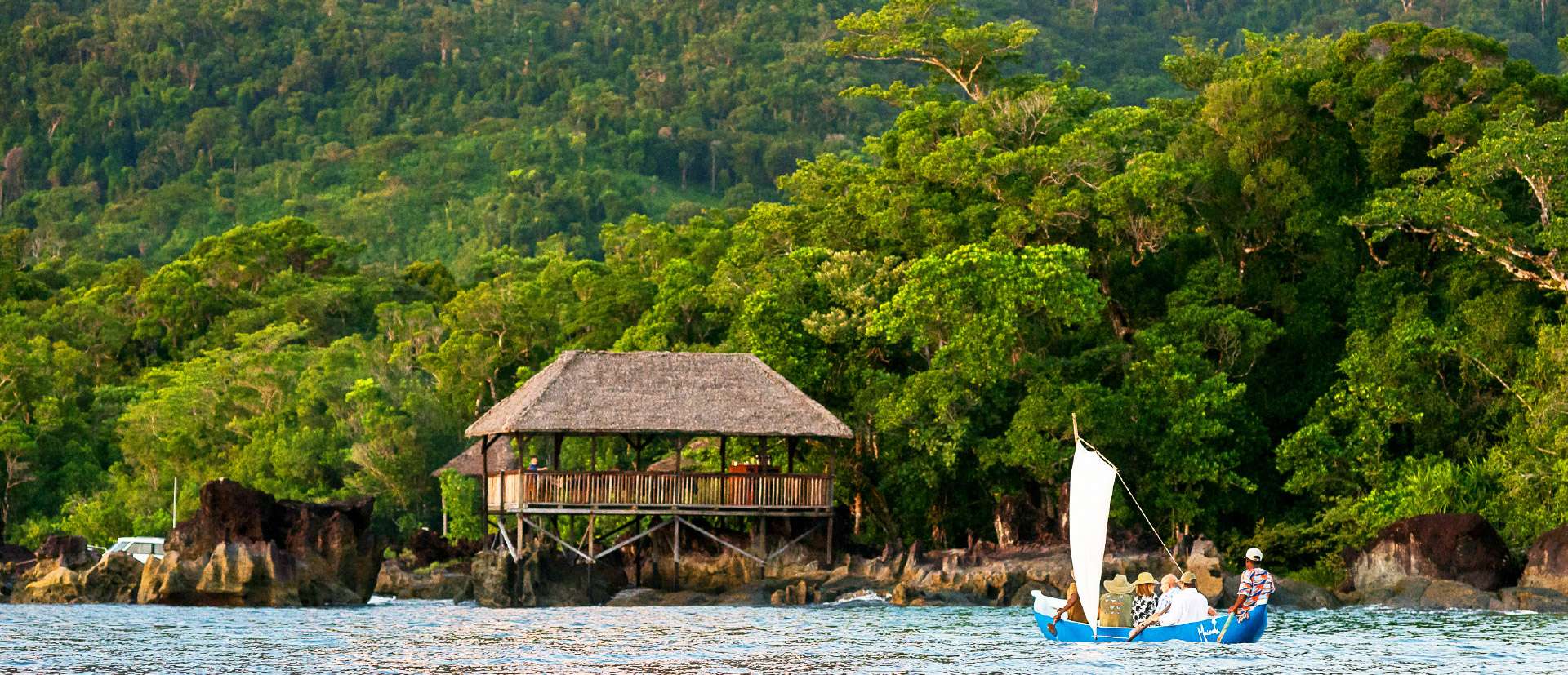
## Description Masoala National Park is Madagascar’s largest and most ecologically diverse protected area, a true Eden for nature lovers and adventurers. Located on the Masoala Peninsula in the northeast of the island, the park spans over 2,300 square kilometers of pristine rainforest and an additional 100 square kilometers of marine reserves. It’s one of the few places on Earth where lush jungle meets coral-rich coastline, creating a rare blend of terrestrial and marine biodiversity. The park is home to an astonishing array of wildlife, much of it endemic to Madagascar. Among its most famous residents is the red-ruffed lemur, found only in this region. Visitors may also encounter the elusive aye-aye, leaf-tailed geckos, tomato frogs, and over 60 species of reptiles. Birdwatchers flock to Masoala to spot rare species like the helmet vanga and the Madagascar red owl. Offshore, the marine parks protect vibrant coral reefs and host humpback whales during their migration from July to September. A little-known fact: the name “Masoala” translates to “eyes of the forest,” a poetic reference to the glowing eyes of the nocturnal aye-aye. Another fascinating detail is that the Madagascar serpent eagle, once thought extinct, was rediscovered in Masoala and now thrives in its dense canopy. ## Location Masoala National Park is located in **Madagascar**, within the **Sava Region**, near the coastal city of **Maroantsetra**. A portion of the park also extends into the **Analanjirofo Region**, making it a vast and varied landscape of rainforest, mangroves, and coral reefs. ### How to Get There: - **By Air**: Fly from Antananarivo to Maroantsetra Airport. Flights are limited, so booking in advance is essential. - **By Boat**: From Maroantsetra, the park is accessible via a 2–3 hour boat ride across Antongil Bay. This scenic journey offers glimpses of dolphins and coastal villages. - **By Tour**: Many eco-tour operators offer guided packages that include transport, accommodation, and park entry. Due to its remote location, Masoala is best visited with the help of local guides or tour companies familiar with the terrain and logistics. ## Tips for Visitors To make the most of your Masoala adventure, keep these tips in mind: - **Visit During Dry Season**: The best time to visit is from June to November. Avoid January to March due to heavy rains and cyclone risk. - **Pack Smart**: Bring waterproof gear, insect repellent, sturdy hiking shoes, and lightweight clothing. The rainforest is humid and unpredictable. - **Hire a Guide**: Local guides enhance the experience with wildlife spotting and cultural insights. Guides are mandatory for most trails. - **Explore Nosy Mangabe**: This nearby island reserve is part of the park and offers excellent chances to see the aye-aye and ancient tombs. - **Respect Wildlife**: Night walks are restricted to protect sensitive species like the aye-aye. Always follow park rules. - **Try Kayaking or Snorkeling**: The marine parks—Tampolo, Ambodilaitry, and Ifaho—are perfect for exploring coral reefs and spotting sea turtles. ## Conclusion Masoala National Park is a sanctuary of biodiversity and natural wonder. With its rare wildlife, untouched rainforest, and vibrant marine life, it offers a truly immersive experience for those seeking Madagascar’s wild heart. ## FAQ **1. What is the entrance fee for Masoala National Park?** The fee is approximately 45,000 Ariary (~16 EUR) for adults and 25,000 Ariary (~6 EUR) for children. **2. How many lemur species are found in Masoala?** The park hosts over 10 species, including the red-ruffed lemur and aye-aye. **3. Can I camp inside the park?** Yes, designated camping areas are available, especially on Nosy Mangabe Island. Guided tours often include camping options. **4. Is Masoala suitable for families?** Yes, but due to its remote location and rugged terrain, it’s best for families with older children who enjoy nature and hiking. **5. Are there accommodations near the park?** Eco-lodges and guesthouses are available in Maroantsetra and near the park’s entrance. Booking ahead is recommended. **6. What marine activities are available?** Snorkeling, kayaking, and whale watching are popular in the park’s marine reserves, especially from July to September. ## Links - [Masoala National Park – Wikipedia Overview](https://en.wikipedia.org/wiki/Masoala_National_Park) - [Masoala National Park – Official GANP Page](https://national-parks.org/madagascar/masoala)
GemVoyage Team • World
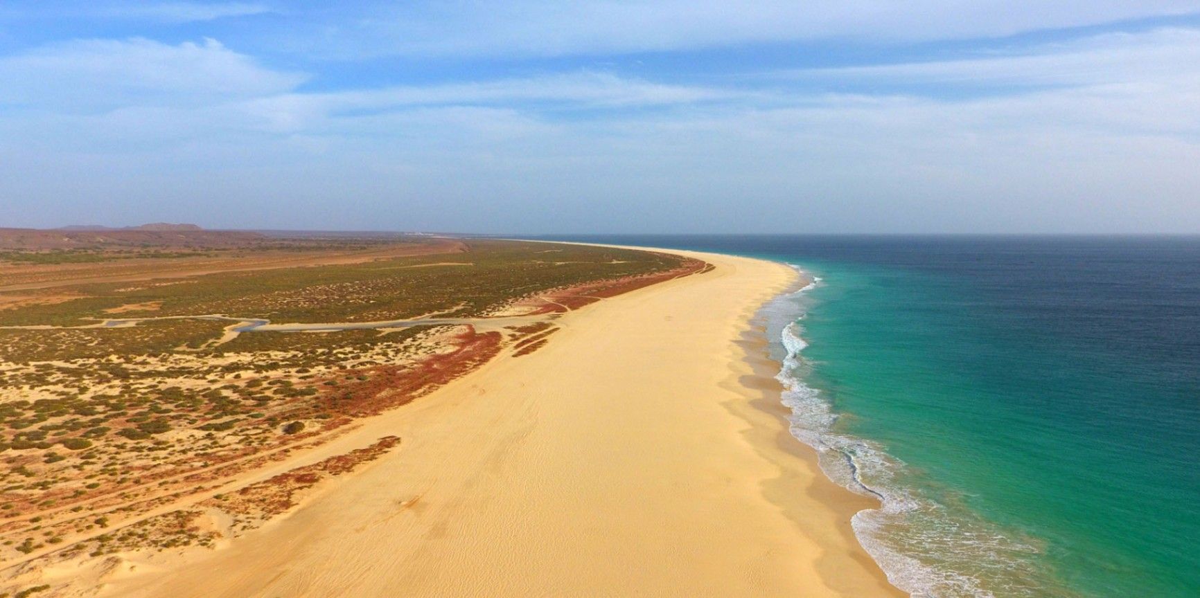
Boa Vista
## Description Praia de Santa Mónica is often described as one of the most beautiful beaches in the world—and with good reason. Stretching over 18 kilometers along the southern coast of Boa Vista, Cape Verde, this vast expanse of golden sand and turquoise water remains almost untouched by development. Its name, “Santa Mónica,” was inspired by California’s famous beach, yet its charm lies in its wild and pristine character. The beach is unique because of its sheer size and tranquility. Unlike other popular destinations, Praia de Santa Mónica rarely feels crowded, even during peak travel seasons. Visitors are treated to panoramic views of rolling dunes, crystal-clear waves, and endless horizons. The beach is also known for being a nesting site for sea turtles, particularly the endangered Caretta caretta (loggerhead turtle). During nesting season, guided tours allow travelers to observe these creatures responsibly, making for a truly unforgettable experience. A little-known fact is that the beach is part of the Morro de Areia Nature Reserve, a protected area aimed at conserving both marine and terrestrial biodiversity. This adds an extra layer of significance for those seeking eco-friendly and sustainable travel experiences. ## Location Praia de Santa Mónica is located on the island of **Boa Vista**, one of the ten main islands of **Cape Verde**, an archipelago off the west coast of **Africa** in the Atlantic Ocean. The beach lies on the southwestern coast of Boa Vista, approximately 20 kilometers from the island’s capital, Sal Rei. To reach Praia de Santa Mónica, most visitors first arrive at Aristides Pereira International Airport (BVC) in Boa Vista. From there, taxis or guided tours can take you to the beach in around 40 minutes. Since public transport is limited on the island, arranging private transfers or joining an organized excursion is recommended. Off-road vehicles are often used, as some roads to the beach remain unpaved, adding a sense of adventure to the journey. ## Tips * **Bring essentials:** There are few facilities on-site, so pack water, snacks, sunscreen, and shade if you plan to spend several hours there. * **Swimming caution:** While the water looks inviting, currents can sometimes be strong. Check local conditions before swimming and stick to calmer areas. * **Best time to visit:** Early morning or late afternoon provide not only cooler temperatures but also the most stunning light for photography. * **Turtle watching:** If visiting between June and October, book a guided turtle-watching excursion to witness the nesting or hatching process. These tours are regulated to ensure the animals are not disturbed. * **Respect the environment:** Stay on marked paths to protect dunes and wildlife, and avoid leaving litter behind. * **Combine with a tour:** Many excursions include stops at Santa Mónica along with other highlights of Boa Vista, such as the Viana Desert or the shipwreck of Cabo Santa Maria. ## Conclusion Praia de Santa Mónica in Cape Verde is a destination for those seeking unspoiled beauty, peace, and a connection with nature. With its endless sandy shores, rich biodiversity, and breathtaking views, it offers a paradise-like escape far removed from crowded tourist resorts. For travelers looking to experience Cape Verde at its most authentic, this beach is an absolute must. ## FAQ **1. Is Praia de Santa Mónica suitable for families?** Yes, families can enjoy the wide sandy beach, but parents should monitor children closely when swimming due to occasional strong currents. **2. Are there restaurants or shops nearby?** No, the beach is largely undeveloped. It’s best to bring supplies from Sal Rei or your hotel before heading there. **3. How long should I plan to spend at the beach?** Many visitors spend a half-day to enjoy the scenery and relax, but nature lovers and photographers often stay longer. **4. Is it possible to surf or kiteboard at Santa Mónica?** The beach can offer good waves, but it’s less developed for water sports than other parts of Boa Vista. Consult local guides if you’re looking for surfing or kitesurfing opportunities. **5. Can I see turtles on my own?** For conservation reasons, turtle watching should only be done with licensed guides. This ensures the safety of both the turtles and visitors. **6. What’s the best way to get there?** The easiest way is by booking a taxi or an organized 4x4 tour from Sal Rei or your resort. Public transport does not reach the area. ## Links * [Cape Verde Tourism Official Site](https://www.visit-caboverde.com) * [Boa Vista Tourism Guide](https://www.boavistaofficial.com)
GemVoyage Team • World

Comments