GemVoyage Team • World
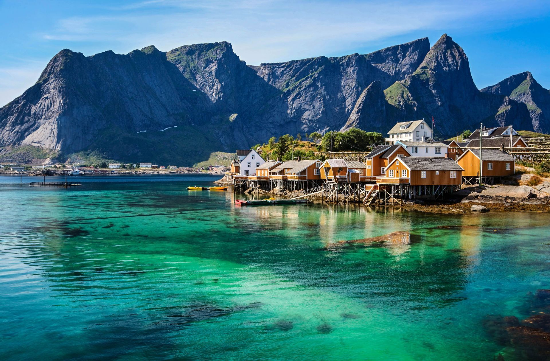
Lofoten’s distinctiveness lies in the proximity of ocean and mountain: trails often ascend steep ridges that drop into crystal-clear water, and small fishing villages serve as intimate bases for outdoor activities. A lesser-known feature: the islands host significant seabird colonies and seasonal fisheries that have influenced local cuisine and traditions for centuries.
Lofoten is not only a visual spectacle but also a destination that rewards slow travel and careful planning. The archipelago's human scale — low-lying villages, narrow winding roads and tiny harbors — means that experiences are tactile and immediate: you can start your day with fresh cod straight from a quay, follow a narrow trail to a windswept summit by afternoon, and end it watching the sea change color as the light shifts. For photographers and naturalists the islands offer a year-round curriculum: in spring and early summer, migrant birds and seals become active along the coastline; in high summer the midnight sun extends golden-hour conditions for long landscape sessions; in autumn the first snows highlight ridgelines and create vivid contrasts; and in winter the long nights are ideal for aurora hunting, provided the skies are clear and weather windows allow.
Trail conditions vary widely: some classic hikes like Reinebringen and Kvalvika require stout footwear and a head for exposure, while many coastal walks are family-friendly and can be combined with ferry hops and short drives. Sea-based activities are equally compelling — kayaking through sheltered fjords, joining local fishing trips, or chartering a boat for wildlife watching. Local cultural experiences add texture: museums documenting the seasonal cod fisheries, small artisan shops selling wool and salt-dried fish, and community-run cafés where fishermen swap stories. Food culture in Lofoten remains rooted in the sea; besides stockfish and cod, you’ll encounter local sheep cheeses, cloudberry desserts and a surprisingly well-developed craft-beer scene in a few towns.
Practicalities matter in Lofoten. Roads are scenic but narrow, and in winter they can be affected by snow and wind; a flexible itinerary is wise. While many visitors cluster in Reine and Svolvær, quieter pockets such as Henningsvær, Nusfjord and Vinstad reward those who linger. Conservation-minded travel is important: stay on marked trails, respect nesting birds (especially during spring), and support locally owned businesses. Small details like packing waterproof layers, carrying a reliable map or GPS, and learning a few Norwegian phrases will enhance safety and interpersonal encounters. Taken together, these elements make Lofoten an unforgettable destination where dramatic geology, maritime culture and luminous Arctic light combine into a deeply memorable travel experience.
The islands are most commonly reached via the E10 highway, which threads the archipelago and connects ferries and causeways. Travelers flying in usually connect through Bodø, which provides ferry and road links, or land at Evenes (near Harstad/Narvik) then drive west. Several regional ferries link the mainland with islands and provide excellent photo opportunities; during summer months additional tourist ferry routes and charter options operate between hotspots like Reine and Svolvær. Car rental is widely available in nearby towns and airports, but public transport is a viable option for those who prefer not to drive, with buses and select ferries serving the larger settlements.
Whether you come for the light, the mountains, or the cultural textures of fishing villages, Lofoten rewards curiosity and careful pacing. The islands invite both active exploration and quiet observation — a place to test your kit on rugged trails or simply watch tides and light shift over a year of weathered harbor wood. For travelers prioritizing sustainable, small-scale tourism, Lofoten offers a rich palette of experiences that connect landscape, livelihood and seasonal rhythms.
Discover more hidden gems you might love.
London
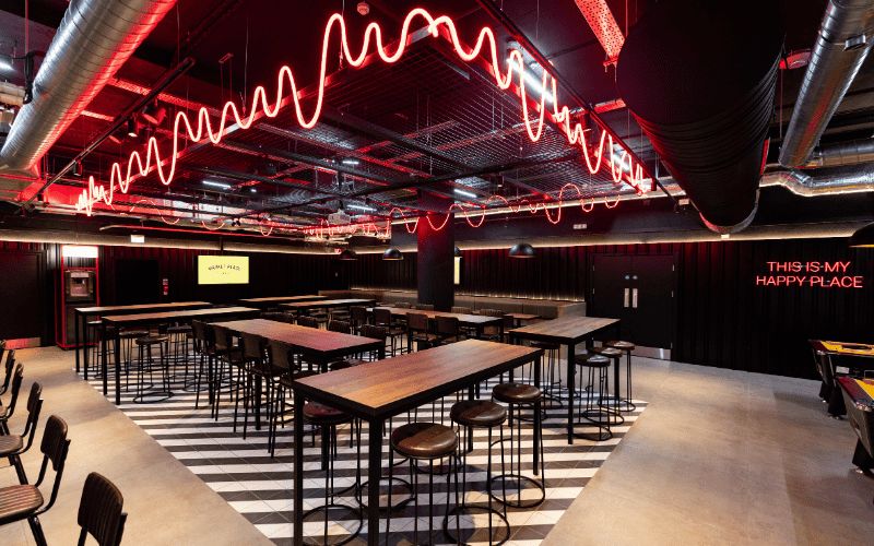
## Description Marketplace Food Hall St. Paul is a vibrant dining destination in the heart of London that brings together a carefully curated selection of food vendors under one roof. Unlike traditional restaurants, this food hall celebrates **variety and community**, offering everything from international street food to locally sourced dishes prepared by passionate chefs. Whether you’re in the mood for gourmet burgers, Asian fusion, plant-based delicacies, or freshly baked desserts, Marketplace Food Hall has something to suit every palate. What makes it unique is its **dynamic atmosphere**—visitors can mix and match dishes from different vendors, creating a personalized dining experience. It’s not just about eating; it’s about exploring flavors from around the world while enjoying the social energy of a shared space. A little-known fact is that Marketplace Food Hall also hosts **special events and live music nights**, turning a casual meal into a cultural experience. Another detail that sets it apart is its **focus on sustainability**, with many vendors prioritizing eco-friendly packaging and locally sourced produce. ## Location Marketplace Food Hall St. Paul is located in **London, England**, specifically near **St. Paul’s Cathedral** in the **City of London district**. Its central location makes it a popular stop for both tourists exploring the cathedral and professionals working in the area who want a quick yet high-quality meal. ### Recommendation on How to Get There The easiest way to reach Marketplace Food Hall is by public transportation. The closest station is **St. Paul’s Underground Station** (Central Line), which is only a short walk away. Other nearby stations include **Mansion House** and **Bank**, offering convenient access via the District, Circle, and Northern Lines. Buses also run frequently in the area, and for those exploring on foot, the food hall is just a few minutes from iconic landmarks such as the Millennium Bridge and Tate Modern. ## Tips Here are some practical tips to make the most out of your visit to Marketplace Food Hall St. Paul: * **Go During Off-Peak Hours**: Lunchtime on weekdays can be very busy due to office crowds, so consider visiting earlier or later in the afternoon. * **Bring Friends**: The variety of cuisines makes it ideal for groups with different tastes. Everyone can choose their own meal and sit together. * **Check Event Listings**: The food hall occasionally hosts live music, tasting nights, and seasonal events, so check in advance for special happenings. * **Save Room for Dessert**: Many visitors focus on main dishes but overlook the artisanal desserts and baked goods offered by select vendors. * **Payment**: Most stalls accept card payments, but it’s always handy to carry a little cash just in case. * **Take Advantage of the Location**: Combine your meal with a visit to St. Paul’s Cathedral or a walk along the River Thames. ## Conclusion Marketplace Food Hall St. Paul is more than just a place to grab a bite—it’s an experience that blends food, culture, and community. With its diverse selection of vendors, lively atmosphere, and unbeatable location near St. Paul’s Cathedral, it’s a must-visit spot for food lovers in London. Whether you’re a tourist, a professional on your lunch break, or simply someone who enjoys discovering new flavors, this food hall is guaranteed to leave you satisfied. ## FAQ **1. What kind of food can I find at Marketplace Food Hall St. Paul?** You can find a wide range of cuisines including burgers, Asian fusion, Mediterranean dishes, vegan options, and desserts. **2. Is it family-friendly?** Yes, the food hall welcomes families, and the casual atmosphere makes it a comfortable place for kids as well. **3. Do I need to make a reservation?** No, reservations are usually not required. It operates on a first-come, first-served basis. **4. How expensive is it?** Prices vary depending on the vendor, but overall, it offers good value for high-quality food in central London. **5. Is it open in the evenings?** Yes, Marketplace Food Hall typically stays open into the evening, making it a great spot for after-work meals or casual dinners. **6. Does the food hall accommodate dietary needs?** Absolutely—there are plenty of vegetarian, vegan, and gluten-free options available. ## Links * [Official Marketplace Food Hall website](https://www.marketplacefoodhall.com/)
GemVoyage Team • World
Rome
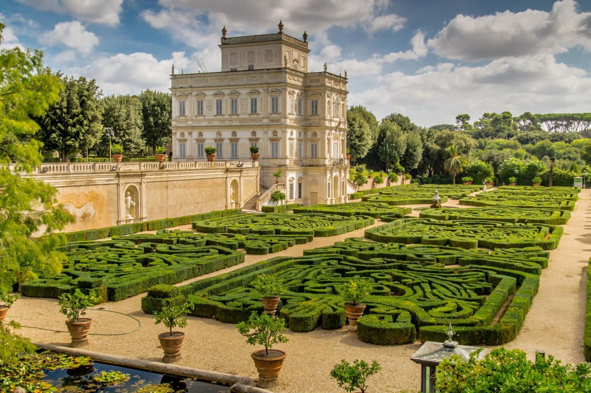
## Description Villa Doria Pamphili is Rome’s largest landscaped villa park, a sprawling green refuge that stretches across rolling lawns, tree-lined avenues, and layered gardens. The park is a living palimpsest: its design reflects generations of development, blending formal Italianate fragments with later Romantic landscape interventions. Visitors discover broad promenades shaded by mature pines and cypresses, intimate groves, terraced viewpoints, ornamental fountains, and the occasional historic villa or chapel tucked into the greenery. What separates Villa Doria Pamphili from Rome’s better-known manicured gardens is its scale and everyday use: runners training along long straight avenues, families picnicking under broad trees, and musicians gathering informally on sunny afternoons. The park hosts seasonal cultural programs—outdoor concerts, film nights, and neighborhood festivals—yet retains a quiet dignity even during busier times. Its pathways offer both restful, shaded routes and open, sunlit clearings; photographers and nature lovers will appreciate the changing light through the trees and occasional glimpses of Roman rooftops beyond. The park’s history is visible in its layered landscaping: landscaped terraces that once anchored a noble estate, interspersed with woodland patches that feel older and wilder. For those studying garden history, the site provides a satisfying case study of how aristocratic pleasure grounds transitioned to public urban parks. For ordinary visitors, the pleasures are simpler—ample space, restful atmosphere, and a sense of escape from Rome’s denser historic core. ## Location Villa Doria Pamphili occupies a large swathe in western Rome, bordering neighborhoods like Monteverde and Trastevere. It is reachable by bus, taxi, and on foot from several tram and metro stops; the park’s size means different entrances suit different itineraries, so checking a map before you go helps you plan whether to approach from the north, south, or west side. ## Tips - Wear comfortable footwear: the park’s size rewards long walks and exploration across varied surfaces. - Visit on a weekday morning for the quietest experience; weekends attract many local families and picnickers. - Bring a picnic and a blanket—there are many scenic clearings suited to lingering. - Rent a bike or bring a folding bike if you want to cover more ground; some routes are well-suited to casual cycling. - Keep an eye on the events board: the park occasionally stages open-air concerts and screenings, which can be a delightful, low-cost cultural night out. - Respect local rules about barbecues and alcohol: these can be restricted in parts of the park. ## Conclusion Villa Doria Pamphili is an expansive urban refuge offering both active recreation and relaxed contemplation. Its layered history, varied landscapes, and everyday uses make it a revealing place to spend a few hours or an entire afternoon—particularly appealing for travelers seeking outdoor green spaces and a more local side of Rome. ## FAQ Q: Is there an entrance fee? A: No—the park is public and free to enter, which makes it a popular local destination for recreation and relaxation. Q: Are dogs allowed? A: Dogs are usually permitted on-leash in most areas; check local signage for any leash-free zones or restrictions. Q: Can I cycle through the park? A: Yes—many paths are bike-friendly, though some narrower or pedestrian-priority areas may be more suitable for walking. Q: Are there public restrooms and water fountains? A: Basic facilities are available but can be limited; carry some water and check maps for restroom locations during longer visits. Q: Are there guided tours of the park’s history? A: Occasionally local associations offer guided walks focusing on the villa’s history and gardens—look for community announcements or contact local tourism offices. ## Links - [Villa Doria Pamphili (Wikipedia)](https://en.wikipedia.org/wiki/Villa_Doria_Pamphili)
GemVoyage Team • World
Laos
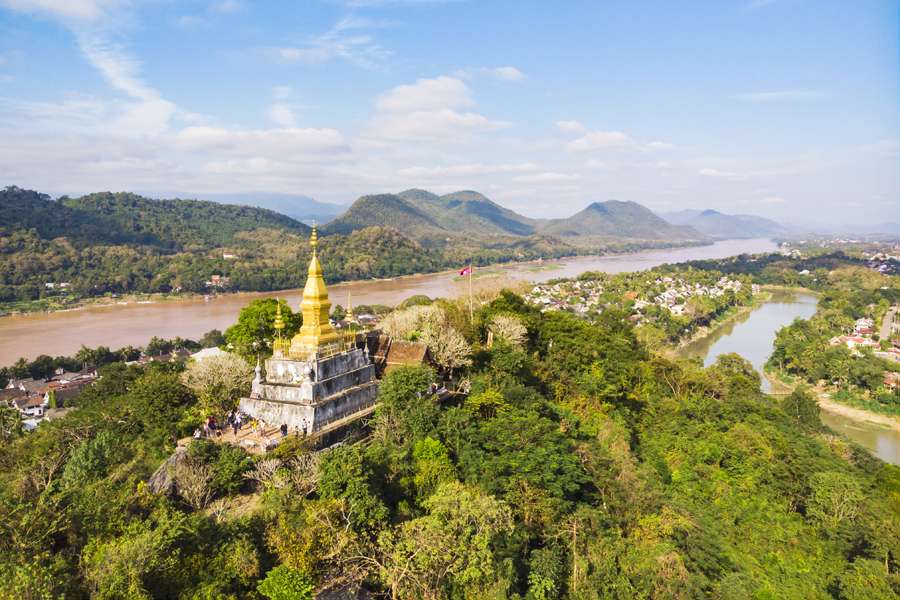
## Description Phou Si, often referred to as Mount Phou Si or Phu Si, is a sacred hill that rises 100 meters above the UNESCO World Heritage city of Luang Prabang in Laos. It’s not just a geographical landmark—it’s a spiritual and cultural centerpiece that offers panoramic views, serene temples, and a glimpse into the soul of Lao Buddhism. The name “Phou Si” translates to “Sacred Hill,” and true to its name, it’s dotted with shrines, Buddha statues, and two prominent temples: Wat Tham Phou Si halfway up, and Wat Chom Si at the summit. The climb to the top involves ascending over 300 steps, but the reward is a breathtaking 360-degree view of Luang Prabang, the Mekong and Nam Khan rivers, and the surrounding jungle-clad mountains. Along the way, saffron-robed monks stroll the leafy paths, incense drifts through the air, and small altars invite quiet reflection. A little-known fact: legend has it that a powerful Naga (a mythical serpent deity) once lived on the hill, adding a mystical layer to its spiritual significance. Another hidden treasure is a small chapel said to house a footprint of the Buddha, tucked along one of the stairways—a detail often missed by hurried visitors. ## Location Phou Si is located in **Laos**, within the **Luang Prabang Province**, in the city of **Luang Prabang**. It sits in the heart of the old town peninsula, bordered by the Mekong River on one side and the Nam Khan River on the other. ### How to Get There: - **By Foot**: Most visitors reach Phou Si by walking from nearby attractions like the Royal Palace Museum or the Night Market. The two main stairways are accessible from Sisavangvong Road and Thanon Phousi. - **By Tuk-Tuk**: If you're staying farther out, a tuk-tuk can drop you off at either entrance. - **By Bicycle**: Luang Prabang is bike-friendly, and cycling to the base of Phou Si is a scenic option. Its central location makes it an easy and essential stop on any Luang Prabang itinerary. ## Tips for Visitors To make the most of your visit to Phou Si, consider these tips: - **Go for Sunset**: The summit offers one of the best sunset views in Laos. Arrive early to secure a good spot—it's popular! - **Bring Water**: The climb can be steep and humid, especially in the afternoon. Hydration is key. - **Wear Comfortable Shoes**: The stairways are uneven in places, so sturdy footwear is recommended. - **Respect the Sacredness**: Dress modestly and be mindful of local customs. Offerings like incense and flowers are available for purchase along the way. - **Explore Both Routes**: Ascend via the Nam Khan side for scenic statues and descend via the Royal Palace side for a shorter walk. - **Entrance Fee**: Expect to pay around 20,000 Kip (~$2.50 USD), collected halfway up the hill. ## Conclusion Phou Si is more than just a viewpoint—it’s a spiritual journey, a cultural experience, and a photographer’s dream. With its sacred temples, mythical legends, and sweeping vistas, it captures the essence of Luang Prabang and offers a moment of peace above the city’s gentle bustle. ## FAQ **1. How many steps are there to reach the top of Phou Si?** There are over 300 steps, depending on the route you take—328 from the Royal Palace side and 355 from the Nam Khan side. **2. What is the best time to visit Phou Si?** Sunset is the most popular time, but early morning offers tranquility and cooler temperatures. **3. Is there an entrance fee?** Yes, the fee is approximately 20,000 Kip, payable halfway up the hill. **4. Can children climb Phou Si?** Yes, but supervision is recommended due to the steep stairways. **5. Are there restrooms or shops at the summit?** No facilities at the top, but vendors sell drinks and offerings near the base. **6. Is Phou Si wheelchair accessible?** Unfortunately, due to the stair-only access, it is not suitable for visitors with mobility issues. ## Links - [Mount Phou Si – Wikipedia](https://en.wikipedia.org/wiki/Phou_Si)
GemVoyage Team • World
Seoul
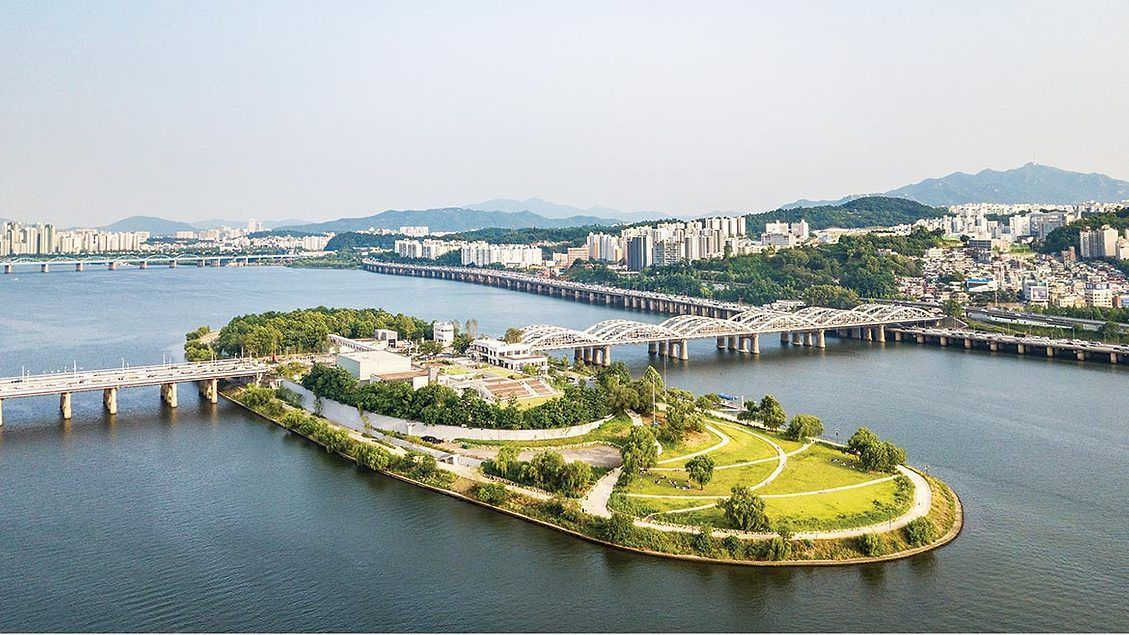
## Description Nodeul Island is a compact cultural complex on the Han River offering performance spaces, green areas, and a music-focused programming lineup. More than just a riverside park, Nodeul is a deliberate cultural experiment: its architecture and programming weave public space, live performance, and small-scale festivals into a compact, walkable site. The island hosts live concerts ranging from acoustic singer-songwriters to electronic sets, pop-up book fairs, artist talks, workshops, and rotating markets. Its landscaped terraces and shaded lawns are deliberately designed to encourage lingering, informal performances, and community gatherings. Nodeul has become known for spotlighting emerging Korean musicians and experimental performers alongside established acts, making it an attractive place for music lovers who want to catch fresh talent in an intimate setting. The island’s mix of architecture, open-air stages, and sheltered rooms means events happen year-round—outdoor stages run during warmer months while smaller indoor spaces host talks and exhibitions in cooler seasons. For photographers and writers looking for evocative urban scenes, Nodeul’s riverside vistas, evening concert lighting, and the soft hum of Seoul traffic across the water make for compelling subjects. The island also supports small food vendors and seasonal stalls that bring a local flavor to the cultural programming. From a practical standpoint, Nodeul is a model for how urban design can activate a riverside edge: pedestrian bridges and plazas, varied seating, and clear sightlines to performance areas keep programming accessible and family-friendly. The island’s public calendar is updated frequently, and local arts organizations often collaborate with the site to pilot new formats—outdoor listening sessions, experimental pop-up shows, and community workshops are common. Whether you’re planning an evening concert or a daytime literature event, Nodeul’s programming rewards repeat visits: familiar artists return, and new creative experiments appear each season. ## Location Nodeul Island sits on the Han River close to the Noryangjin and Yeouido areas of Seoul, reachable by subway and a short walk across a well-maintained pedestrian bridge from the south bank. The nearest major subway stops provide easy access for visitors staying anywhere in central Seoul, and the island’s signage in English and Korean helps international visitors orient themselves quickly. Because the island sits on the river, walking routes from nearby neighborhoods are scenic and often used by locals for jogging and evening strolls. ## Tips - Check the events calendar ahead of time: Nodeul’s draw is its programming, and many of the best concerts and markets are pre-announced online. Booking tickets in advance for popular shows avoids disappointment. - Arrive early for evening concerts to claim good riverside seating; bring a small blanket or foldable chair if you prefer more comfortable seating on the grass. - Visit at sunset for the best photo opportunities: the interplay of river light, concert lights, and Seoul’s skyline creates a memorable atmosphere. - Pack layers—a light jacket is wise for open-air evening events when the river breeze picks up, even in summer. - Explore the island’s perimeter paths before events; quiet spots and viewpoints are often less crowded than main plazas. - Support local vendors: seasonal food stalls and nearby cafés help sustain small operators who participate in Nodeul’s pop-up markets. - If you’re interested in emerging music, follow local promoters and Nodeul’s newsletter for surprise showcases and free programs. ## Conclusion Nodeul Island is a compact cultural destination that combines live music, community programming, and riverside relaxation in Seoul. It succeeds as a place where design, sound, and community converge—ideal for travelers who want to experience contemporary Korean culture beyond mainstream tourist stops. With a packed calendar, accessible layout, and an emphasis on new voices in music and the arts, Nodeul rewards curious visitors and repeat explorers alike. ## FAQ Q: Is there an admission fee? A: Many daytime activities and free concerts are available without charge, while larger evening shows or special events may require purchased tickets—check the event listing. Q: How do I get there by public transport? A: Use the nearest subway stations (check local maps), then follow pedestrian signage to the river bridge that leads to Nodeul; buses and taxis also serve the area. Q: Are events kid-friendly? A: Yes—many daytime workshops and family-oriented performances are suitable for children, though some late-night concerts may be more adult-focused. Q: Can I bring food and drink? A: Outside food and non- alcoholic drinks are generally allowed; licensed vendors operate during larger events—always check event-specific rules. Q: Is the island wheelchair accessible? A: The site offers accessible paths and ramps, but some elevated terraces may have limited access—consult the venue map for specific event locations. ## Links - [Seoul Travel Guide](https://www.visitseoul.net/)
GemVoyage Team • World
Osun
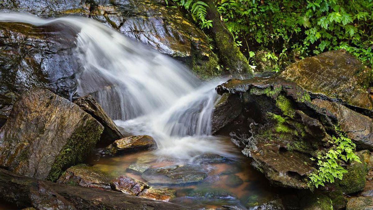
## Description **Erin Ijesha Waterfall**, also known as **Olumirin Waterfall**, is one of Nigeria’s most spectacular natural attractions. Located in Osun State, the waterfall is renowned for its **seven cascading levels**, each offering a different landscape, atmosphere, and difficulty level for visitors. The experience goes beyond a simple waterfall viewing; it is a physical ascent through layered natural terraces, tropical vegetation, and rocky pathways that reveal the geology and biodiversity of southwestern Nigeria. What makes Erin Ijesha Waterfall particularly unique is the **progression of the levels**. The first and second levels are accessible and refreshing, ideal for casual visitors. As you climb higher, the environment becomes cooler, the terrain more dramatic, and the views increasingly rewarding. The final levels lead to a plateau historically associated with ancient settlements and spiritual practices. According to oral traditions, some of these upper areas served as **refuge sites for migrating groups** and locations for community gatherings during the pre-colonial period. A little-known fact is that the waterfall has long been connected to Yoruba mythology. Local lore suggests that the waters were believed to possess cleansing qualities, and that early communities viewed the entire waterfall system as a **symbol of renewal and protection**. Another interesting detail is that the upper levels were once used as strategic vantage points due to their height and difficult access, helping local groups monitor surrounding valleys. The blend of nature, culture, and mild adventure makes Erin Ijesha Waterfall a standout destination for hikers, photographers, and anyone interested in the lesser-explored regions of Nigeria. ## Location **Country:** Nigeria **Region:** Southwest Nigeria **State:** Osun State **Nearest Town:** Ijesha (near Erin Ijesha community) The waterfall sits within a lush forested area about an hour from major towns like Ilesa. ### How to Get There * **By car:** * The most reliable method. From Ilesa or Osogbo, follow the highway toward Erin Ijesha. The entrance to the waterfall is clearly marked, and parking is available. * **By public transportation:** * Local buses and shared taxis connect Ilesa to Erin Ijesha, followed by a short walk to the site. * **By tour service:** * Some tour operators from Lagos, Ibadan, or Osogbo include the waterfall in day-trip itineraries. ## Tips * **Wear sturdy shoes:** The climb is steep in places, and water splashes make some rocks slippery. * **Bring water and stay hydrated:** The ascent to the upper levels can be physically demanding, especially in warm weather. * **Start early:** Morning visits provide cooler temperatures, softer light, and fewer crowds. * **Expect to get wet:** Mist rises from the falls, especially near the lower levels. * **Fitness level matters:** The higher levels are not recommended for visitors with mobility issues. * **Consider hiring a local guide:** They can help you navigate the steeper paths and share the historical context tied to the site. * **Avoid visiting during heavy rain:** The water flow becomes intense and pathways can become hazardous. ## Conclusion Erin Ijesha Waterfall is one of Nigeria’s most rewarding natural attractions, offering a combination of adventure, cultural history, and scenic beauty. Its seven distinct levels provide a progressively immersive experience, making it suitable for both casual travelers and more ambitious climbers. For anyone exploring southwestern Nigeria, the waterfall stands as a must-see landmark. ## FAQ **1. How many levels does Erin Ijesha Waterfall have?** The waterfall has **seven levels**, each with its own landscape and difficulty. **2. Is swimming allowed?** Light splashing and dipping are common at the lower levels, but deeper swimming is not typical due to rocky terrain. **3. How long does the hike take?** Reaching the upper levels can take **1 to 2 hours**, depending on fitness and pace. **4. Is there an entrance fee?** Yes. A modest fee is typically required for maintenance and site management. **5. Are guides available at the site?** Yes. Local guides can be hired at the entrance. **6. What is the best time to visit?** Dry season or early rainy season when the paths are safe and the water flow is strong but manageable. ## Links * [Osun State tourism info](https://www.osunstate.gov.ng)
GemVoyage Team • World
Hurghada
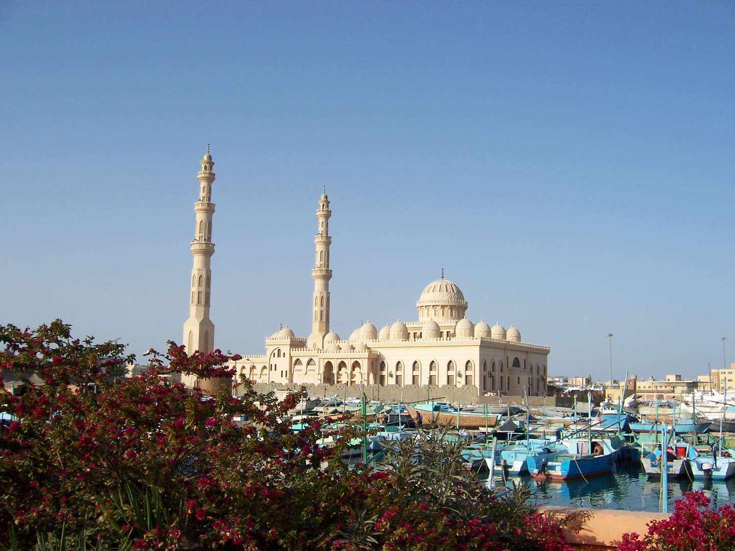
## Description Al Mina Mosque, also known as El Mina Masjid or the Grand Mosque of Hurghada, is one of the most striking religious landmarks on Egypt’s Red Sea coast. Completed in 2012, this architectural gem blends traditional Islamic design with modern elegance, making it a must-see for visitors seeking cultural depth beyond the beaches and resorts. With its gleaming white marble façade, towering minarets, and intricately carved domes, the mosque stands as a symbol of spiritual devotion and artistic craftsmanship. The mosque features two minarets that rise 40 meters into the sky and a central dome that reaches 25 meters in height. Inside, visitors are greeted by a serene prayer hall adorned with ornate chandeliers, engraved walls, and geometric patterns that reflect centuries of Islamic art. The mosque can accommodate up to 10,000 worshippers, making it the largest in the Red Sea Governorate. A little-known fact: Al Mina Mosque was built on an 8,000-square-meter site adjacent to Hurghada’s harbor, and its name—“Al Mina”—translates to “The Port,” referencing its proximity to the sea. The mosque also houses an Islamic cultural center that offers lectures and educational materials in multiple languages, aimed at fostering interfaith understanding and dialogue. ## Location Al Mina Mosque is located in **Egypt**, in the **Red Sea Governorate**, within the **city of Hurghada**. It sits directly on the waterfront near the Hurghada Marina and the city’s main harbor, making it easily accessible from both the old town (El Dahar) and the newer resort areas. ### How to Get There - **By Taxi**: Taxis are readily available throughout Hurghada and can take you directly to the mosque entrance. - **By Foot**: If you’re staying near the Marina or Sheraton Road, the mosque is within walking distance. - **By Tour**: Many city tours include a stop at Al Mina Mosque, often paired with visits to local markets and cultural sites. - **By Public Transport**: Minibuses and shared taxis frequently pass through the area, though they may require some navigation. Its central location makes it an ideal stop during a day of sightseeing or evening stroll along the harbor. ## Tips - **Visit Outside Prayer Times**: Non-Muslim visitors are welcome to explore the mosque during non-prayer hours. Avoid visiting during Friday prayers or religious holidays. - **Dress Modestly**: Women should cover their hair, shoulders, and knees. Men should avoid shorts. Scarves and robes may be provided at the entrance. - **Photography**: While exterior photography is encouraged, ask permission before taking photos inside, especially during prayer times. - **Respect the Space**: This is an active place of worship. Maintain a quiet and respectful demeanor. - **Combine with Nearby Attractions**: After visiting the mosque, explore the Hurghada Marina, local bazaars, or enjoy a meal at one of the waterfront restaurants. - **Check for Cultural Events**: The mosque’s Islamic center occasionally hosts lectures and exhibitions open to the public. ## Conclusion Al Mina Mosque is a serene and visually stunning destination that offers a glimpse into Egypt’s Islamic heritage. With its majestic architecture, peaceful ambiance, and central location, it’s a rewarding stop for anyone exploring Hurghada beyond the beach. ## FAQ **1. What are the opening hours of Al Mina Mosque?** The mosque is open daily from 9:00 AM to 5:00 PM, except during prayer times. **2. Is there an entrance fee?** No, entry is free. Donations to the mosque or its cultural center are welcome but not required. **3. Can non-Muslims visit the mosque?** Yes, non-Muslims are welcome during non-prayer hours and are encouraged to learn about the mosque’s history and architecture. **4. Is the mosque wheelchair accessible?** Yes, the mosque has ramps and accessible entrances for visitors with mobility needs. **5. Are guided tours available?** Some local guides offer cultural tours that include the mosque. The Islamic center also provides multilingual materials and lectures. **6. Is it safe to visit the mosque with children?** Yes, families are welcome. Children should be supervised and respectful of the prayer areas. ## Links - [Al Mina Mosque Visitor Guide – Hurghada Day](https://hurghadaday.com/things-to-do/al-mina-mosque/)
GemVoyage Team • World

Comments