GemVoyage Team • World
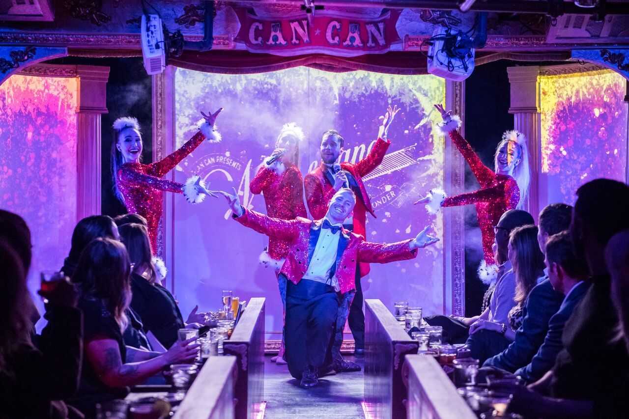
Can Can Culinary Cabaret is a celebrated dinner theatre nestled inside Seattle's historic Pike Place Market. Founded in 2005 by artistic director Chris Pink and choreographer Fae Pink, the venue has produced nearly 7,000 shows over two decades, evolving from a small cabaret hosting traveling acts into one of the Pacific Northwest's most distinctive entertainment destinations. The experience blends multi-course French-inspired Northwest dining with original theatrical productions that incorporate dance, live music, burlesque, acrobatics, comedy, and multimedia elements. The intimate 120-seat theatre, evocative of turn-of-the-century Paris with its red velvet and lush booth seating, ensures every guest feels immersed in the performance. Shows run Thursday through Sunday with approximately ten performances weekly, and the creative team refreshes the entire production — including scenic design, choreography, costuming, and original music — several times each year. A defining feature is Can Can's themed seasonal shows, where the menu is carefully paired with the performance narrative, creating unique culinary-theatrical hybrids that cannot be found anywhere else in Seattle. Recent productions include a Dolly Parton tribute, the acrobatic Carnival of Curiosities, and the return of LOLA, each transforming the venue with entirely new sets and choreography. The result is a full-sensory evening where world-class entertainment and thoughtfully plated cuisine are woven into a single, unforgettable experience.
Can Can Culinary Cabaret is located at 95 Pine Street, Seattle, WA 98101, inside the iconic Pike Place Market — one of the oldest continuously operated public farmers' markets in the United States, drawing over ten million visitors annually. The venue sits in the heart of downtown Seattle, just steps from the waterfront and Post Alley, with The Dressing Room bistro offering outdoor patio seating overlooking the Puget Sound. Getting there is straightforward via multiple modes of transportation. The nearest light rail stop is Westlake Station, approximately a ten-minute walk east along Pike Street. Several bus routes serve the area, including King County Metro lines stopping at Pike Street and 1st Avenue. For drivers, parking garages are available at the Pike Place Market public lot and nearby commercial garages on Western Avenue and Union Street, though availability tightens significantly on summer weekends and during peak tourist season — arriving 30 to 45 minutes early is strongly advised. Rideshare drop-offs are seamless at the Pine Street entrance. The theatre operates Thursday through Sunday from 5:00 PM to close, with specific showtimes varying by production. The Dressing Room bistro offers additional brunch hours independently of the main stage schedule and is open for walk-in dining even on non-show days.
Can Can Culinary Cabaret stands as a singular gem in Seattle's vibrant entertainment landscape — a place where theatrical ambition and culinary craft converge with remarkable results. Whether you are celebrating a milestone anniversary, planning an unforgettable date night, or simply seeking a night out that defies the ordinary, the venue delivers an experience that lingers long after the final curtain. With an entirely new season of productions unveiled each year, there is always a fresh reason to return. The combination of original music, world-class performance, French-inspired cuisine, and an atmosphere steeped in vintage glamour makes it one of the most distinctive things to do in Seattle. Book your tickets, arrive hungry for both food and spectacle, and discover why Can Can has remained a beloved institution for nearly twenty years.
Discover more hidden gems you might love.
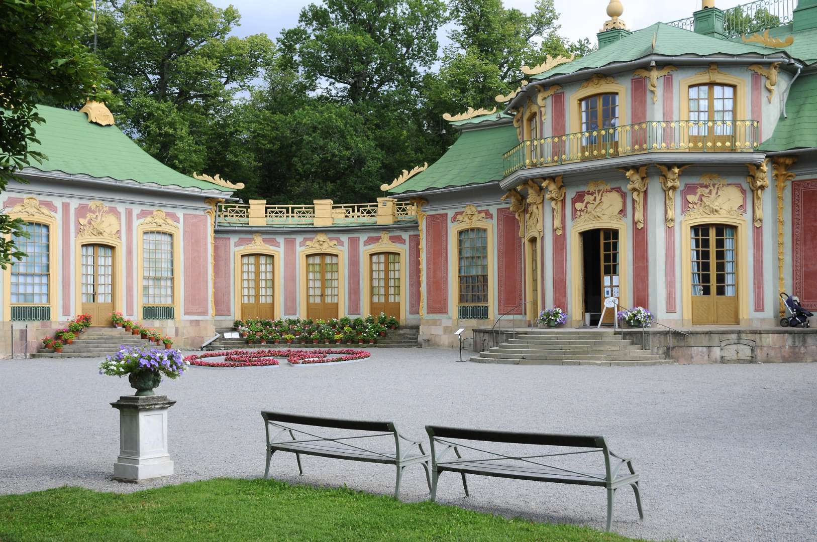
Stockholm
## Description The Chinese Pavilion (Swedish: Kina slott) in Stockholm is a whimsical and elegant slice of 18th-century European fascination with the East. Nestled within the lush grounds of Drottningholm Palace Park, this royal summer retreat was commissioned in 1753 by King Adolf Fredrik as a surprise birthday gift for Queen Lovisa Ulrika. The pavilion is a stunning example of **Chinoiserie**, a European artistic style that romanticized and imitated Chinese design, blending it with Rococo elements to create a fairy-tale-like structure. What makes the Chinese Pavilion truly unique is its blend of imported Chinese artifacts and Swedish craftsmanship. Inside, you’ll find original Chinese silk and paper wall coverings, lacquered screens, porcelain vases, and stained glass windows. Swedish Rococo furniture inspired by Chinese motifs adds a local twist to the exotic aesthetic. The pavilion’s interiors were designed by Jean Eric Rehn, the royal court’s chief supervisor, and many of the decorative objects were brought in by the Swedish East India Company. A little-known fact: the original pavilion was prefabricated in Stockholm and assembled in Drottningholm in secret, making it one of the earliest examples of modular architecture in Sweden. Another quirky detail—during the pavilion’s unveiling, the young Crown Prince Gustav (later King Gustav III) presented the Queen with a golden key while dressed as a Chinese mandarin. ## Location The Chinese Pavilion is located in **Sweden**, within the **Stockholm County** region, specifically in the **Ekerö Municipality** on the grounds of **Drottningholm Palace**, a UNESCO World Heritage Site. ### How to Get There: - **By Public Transport**: Take the metro to Brommaplan, then transfer to bus 176 or 177 toward Drottningholm. The pavilion is a short walk from the palace. - **By Boat**: During summer, ferries run from central Stockholm to Drottningholm—a scenic and relaxing option. - **By Car**: It’s about a 30-minute drive from downtown Stockholm. Parking is available near the palace grounds. Once you arrive at Drottningholm, follow the signs through the park to reach the Chinese Pavilion. ## Tips for Visitors To make the most of your visit to the Chinese Pavilion, consider these helpful tips: - **Visit in Summer**: The pavilion is open from May to September. Plan your visit during this period to access the interiors. - **Combine with Drottningholm Palace**: Make it a full-day outing by exploring both the palace and the pavilion. - **Guided Tours**: Opt for a guided tour to learn about the history, architecture, and royal anecdotes tied to the pavilion. - **Photography**: The exterior and gardens are perfect for photos, but interior photography may be restricted. - **Wear Comfortable Shoes**: The pavilion is located within a large park, so expect some walking. - **Check for Events**: Occasionally, cultural events and exhibitions are held in the pavilion—check the schedule in advance. ## Conclusion The Chinese Pavilion in Stockholm is a captivating blend of East and West, fantasy and history. With its ornate design, rich backstory, and tranquil setting, it offers visitors a unique glimpse into Sweden’s royal past and its 18th-century fascination with Chinese art and culture. ## FAQ **1. When is the Chinese Pavilion open to visitors?** It’s open seasonally from May to September. Exact dates may vary each year. **2. Is the Chinese Pavilion part of Drottningholm Palace?** Yes, it’s located within the Drottningholm Palace Park and is considered part of the Royal Domain. **3. Can I visit the pavilion without a guided tour?** Yes, self-guided visits are allowed, but guided tours provide deeper insight into its history and design. **4. Is photography allowed inside the pavilion?** Photography is generally restricted inside. You can take pictures of the exterior and gardens. **5. How long should I plan for the visit?** Allocate at least 1–2 hours to explore the pavilion and surrounding park, or more if combining with Drottningholm Palace. **6. Is the pavilion accessible for people with mobility issues?** Accessibility is limited due to the historic nature of the building. Contact the site in advance for specific accommodations. ## Links - [Official Chinese Pavilion Page – Royal Palaces of Sweden](https://www.kungligaslotten.se/english/royal-palaces-and-sites/the-chinese-pavilion.html) - [Visit Stockholm – Chinese Pavilion](https://www.visitstockholm.com/o/the-chinese-pavilion/)
GemVoyage Team • World
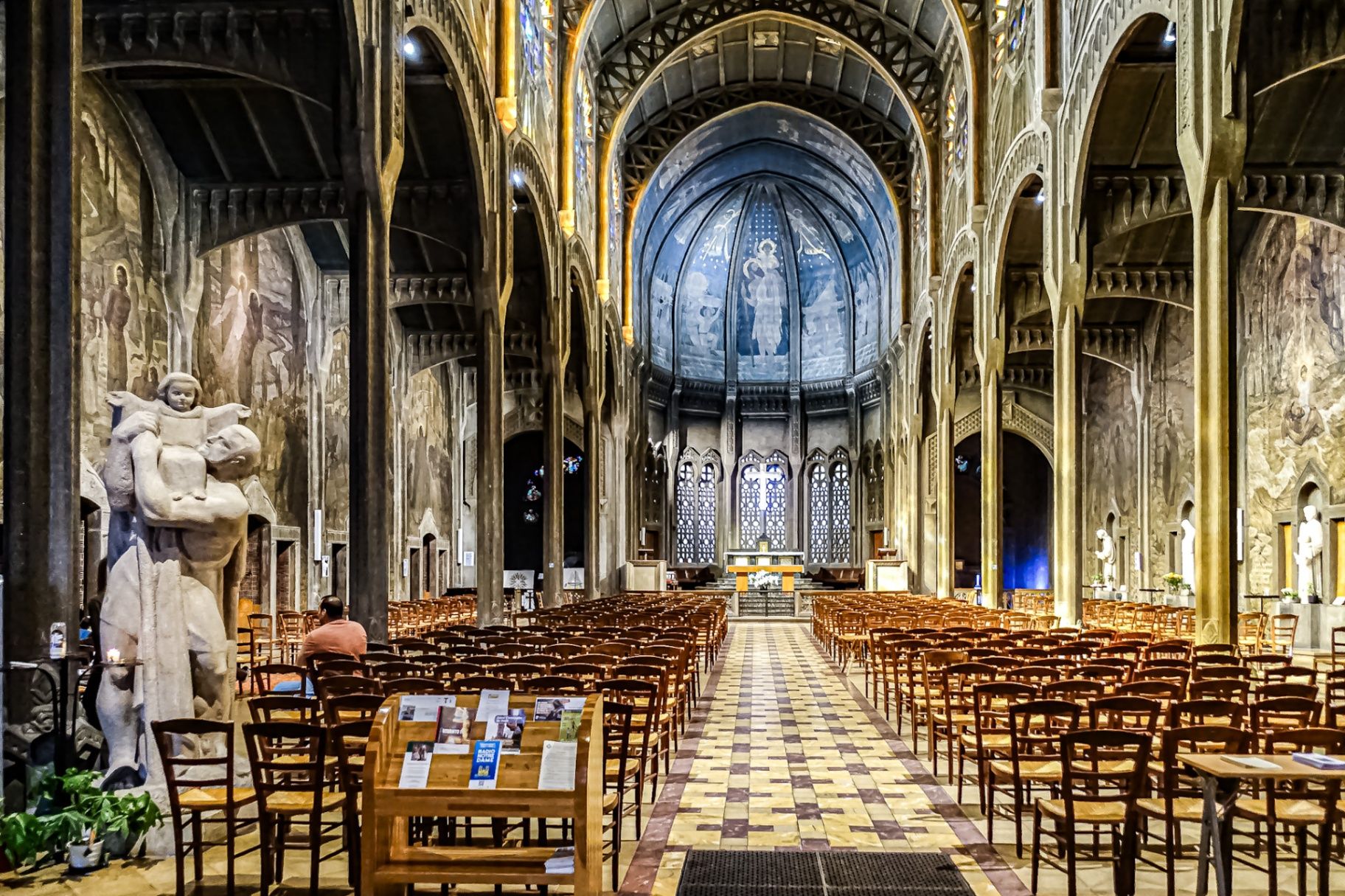
Paris
## Description The **Église Saint-Christophe-de-Javel** is one of Paris’s most striking and unconventional churches, standing as a powerful statement of **modernist religious architecture in the early 20th century**. Unlike the Gothic cathedrals and Baroque churches that dominate the Parisian religious landscape, Saint-Christophe-de-Javel was built using **reinforced concrete**, embracing industrial materials and architectural modernity at a time when such choices were still considered radical for sacred buildings. Constructed between **1926 and 1930**, the church was designed to serve the rapidly expanding working-class population of the **Javel district**, which had become a major industrial zone dominated by factories, workshops, and labor housing. The church’s architectural identity reflects this environment: **solid, functional, stripped of excess ornament**, yet deeply symbolic through proportion, light, and structure. The most defining feature is the **massive concrete nave**, whose exposed structural elements create a sense of raw strength and vertical ascension. Rather than relying on traditional stone vaulting, the church uses **modern engineering principles** to achieve its spacious interior. This gives the building a powerful, almost monumental atmosphere that feels both spiritual and industrial at the same time. Inside, the mood shifts dramatically through the use of **colored stained glass**, designed by **Marguerite Huré**, a pioneer of abstract religious glass art. Instead of depicting traditional figurative biblical scenes, many of the windows focus on **symbolic color composition and geometric light patterns**, allowing light itself to become the primary spiritual medium. The church is dedicated to **Saint Christopher**, the patron saint of travelers and workers—an especially fitting dedication for a parish built in an industrial transport district along the Seine. The building served not only as a religious space, but also as a **social anchor for factory workers and their families**, reinforcing its identity as a church of the modern urban age. A little-known fact is that Saint-Christophe-de-Javel was among the **first churches in France to fully embrace reinforced concrete as its primary structural material**, decades before such construction would become common in religious architecture. Another lesser-known detail is that the project was influenced by the ideas of **Dom Paul Bellot**, a Benedictine monk-architect famous for merging modern materials with sacred geometry—making this church part of a broader European movement to redefine how faith could be expressed through contemporary form. Today, Saint-Christophe-de-Javel remains both a functioning parish church and a **quiet architectural landmark**, largely overlooked by mass tourism. For visitors interested in architecture, urban history, and modern religious design, it offers a rare opportunity to see how spirituality was reinterpreted through the language of concrete, geometry, and light. ## Location **Église Saint-Christophe-de-Javel** is located in the **15th arrondissement of Paris**, along the **left bank of the Seine**, near the **Pont Mirabeau** and the former industrial zones of Javel. **City:** Paris **Region:** Île-de-France **Country:** France **Arrondissement:** 15th **Area:** Javel ### How to Get There: * **By metro:** Take **Line 10** to **Javel–André Citroën Station**, then walk about 5 minutes. * **By RER:** Use **RER C** to **Javel Station**, then walk along the Seine. * **By bus:** Several bus lines serve the Javel and Beaugrenelle area. * **By taxi or ride-hailing apps:** A direct and convenient option from anywhere in Paris. * **By bicycle:** The riverside bike path along the Seine leads directly past the church. The location makes it easy to combine the visit with **Parc André Citroën, Beaugrenelle shopping district, and a scenic Seine river walk**. ## Tips * **Visit during daylight hours:** Natural light through the stained glass is essential to the interior atmosphere. * **Check parish opening times:** As an active church, visiting hours may differ from service times. * **Silence is expected:** This is not a tourist-heavy site and remains a place of worship. * **Architecture lovers should bring binocular vision:** The scale and proportions are best appreciated from multiple viewpoints inside the nave. * **Combine with a Seine stroll:** The contrast between riverside leisure and industrial-modern architecture is striking. * **Do not expect ornate decoration:** This church speaks through structure and light, not sculpture and gold. * **Photography is usually permitted without flash:** Always confirm locally. ## Conclusion The **Église Saint-Christophe-de-Javel** is a compelling example of how **modern materials and industrial aesthetics were fused with sacred architecture** in early 20th-century Paris. Built for workers, shaped by concrete, and illuminated by abstract stained glass, the church stands as a quiet monument to faith in the age of machines. It is a destination for those who seek architecture with depth, restraint, and historical purpose rather than visual excess. ## FAQ **1. What makes Saint-Christophe-de-Javel unique among Paris churches?** It is constructed primarily from **reinforced concrete**, making it one of the earliest modernist churches in Paris. **2. Is the church still active?** Yes. It remains an **active Catholic parish** with regular services. **3. Who was the church built for?** It was built to serve the **industrial working-class population of the Javel district**. **4. Are there famous artworks inside?** Yes. The **stained-glass windows by Marguerite Huré** are especially significant in the history of abstract religious art. **5. Is there an entrance fee?** No. Entry is **free**, as the building functions as a public parish church. **6. How long does a visit typically take?** Most visitors spend **20 to 40 minutes**, depending on interest in architecture and photography. ## Links * [Visit Paris](https://parisjetaime.com/eng/)
GemVoyage Team • World
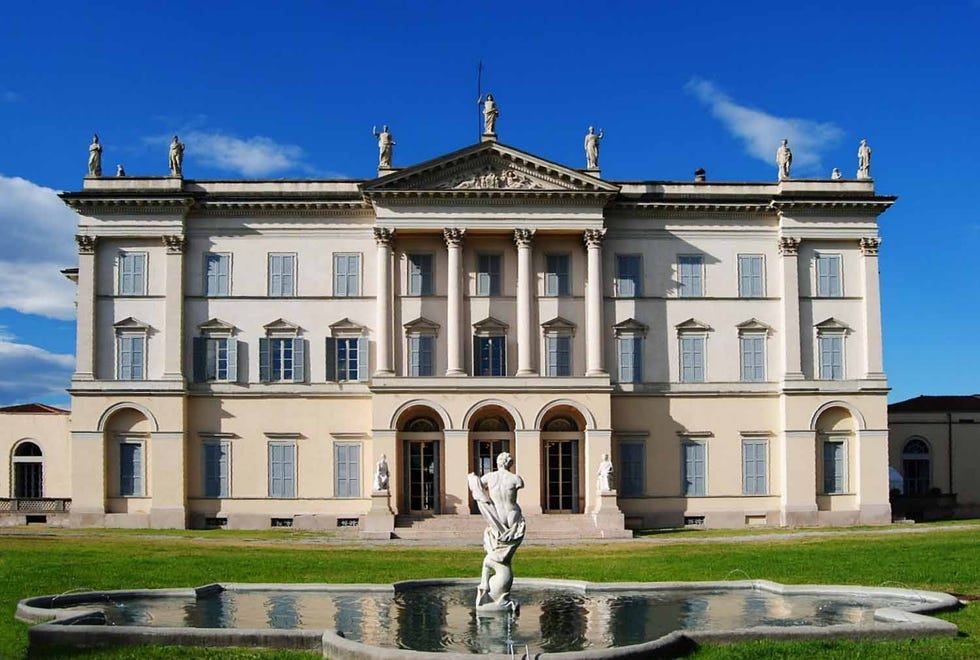
Milan
## Description Villa Tittoni Traversi, also known as Villa Cusani Tittoni Traversi, is an elegant neoclassical villa that represents an important chapter in the architectural and cultural history of the Milan area. Originally conceived as a noble residence, the villa stands out for its refined design, harmonious proportions, and its close relationship with the surrounding landscape. Today, it serves as a cultural venue, hosting exhibitions, events, and public activities that keep its historical legacy alive. What makes Villa Tittoni Traversi unique is its artistic pedigree. The villa was redesigned in the early 19th century by the renowned architect Giuseppe Piermarini, the same architect behind Milan’s Teatro alla Scala. Its interior spaces were later enriched with frescoes and decorative elements that reflect the tastes of Lombard aristocracy. A lesser-known fact is that the villa’s park was influenced by early landscape garden concepts, blending formal and naturalistic elements. Another interesting detail is that the building has passed through the hands of several prominent families, including the Cusani and Tittoni families, each leaving their mark on its design and function. The villa offers a refined yet approachable atmosphere, making it appealing to visitors interested in history, architecture, and cultural life outside Milan’s most crowded attractions. ## Location Villa Tittoni Traversi is located in **Italy**, in the **Lombardy** region, near the city of **Milan**, in the town of **Desio**, north of the city center. Although often associated with Milan due to its proximity, the villa is technically within Desio, making it an easy and worthwhile day trip from the city. Reaching the villa is convenient. Visitors can take a regional train from Milan to **Desio Station**, which is well connected and only a short walk from the villa. Several bus routes also serve the area. For those driving, Desio is easily accessible by road, and parking is generally available near the villa and its park. ## Tips * Check the villa’s event schedule in advance, as exhibitions and cultural programs vary throughout the year. * Take time to explore the surrounding park, which is ideal for relaxing walks and photography. * Guided tours may be available on specific days and can offer deeper insight into the villa’s history. * Visit on weekdays for a quieter experience, especially if events are taking place on weekends. * Combine your visit with a stroll through Desio’s historic center or nearby green spaces. * Wear comfortable shoes, particularly if you plan to explore both the interior and the park. ## Conclusion Villa Tittoni Traversi is a graceful example of Lombard neoclassical architecture and cultural heritage. Its blend of history, art, and green space makes it a rewarding destination for visitors seeking a more intimate and refined experience near Milan. ## FAQ **Is Villa Tittoni Traversi open to the public?** Yes, the villa is open to the public during exhibitions, events, and scheduled visiting hours. **How long does a visit usually take?** Most visits last between one and two hours, depending on exhibitions and time spent in the park. **Is there an entrance fee?** Entrance fees may apply during special exhibitions or events, while access to the park is often free. **Is the villa suitable for families?** Yes, the open park and cultural events make it suitable for families, though children should be supervised indoors. **Can the villa be reached easily from Milan?** Yes, it is easily accessible by train or car from Milan in under an hour. ## Links * [Villa Tittoni Official Website](https://villatittoni.it/)
GemVoyage Team • World
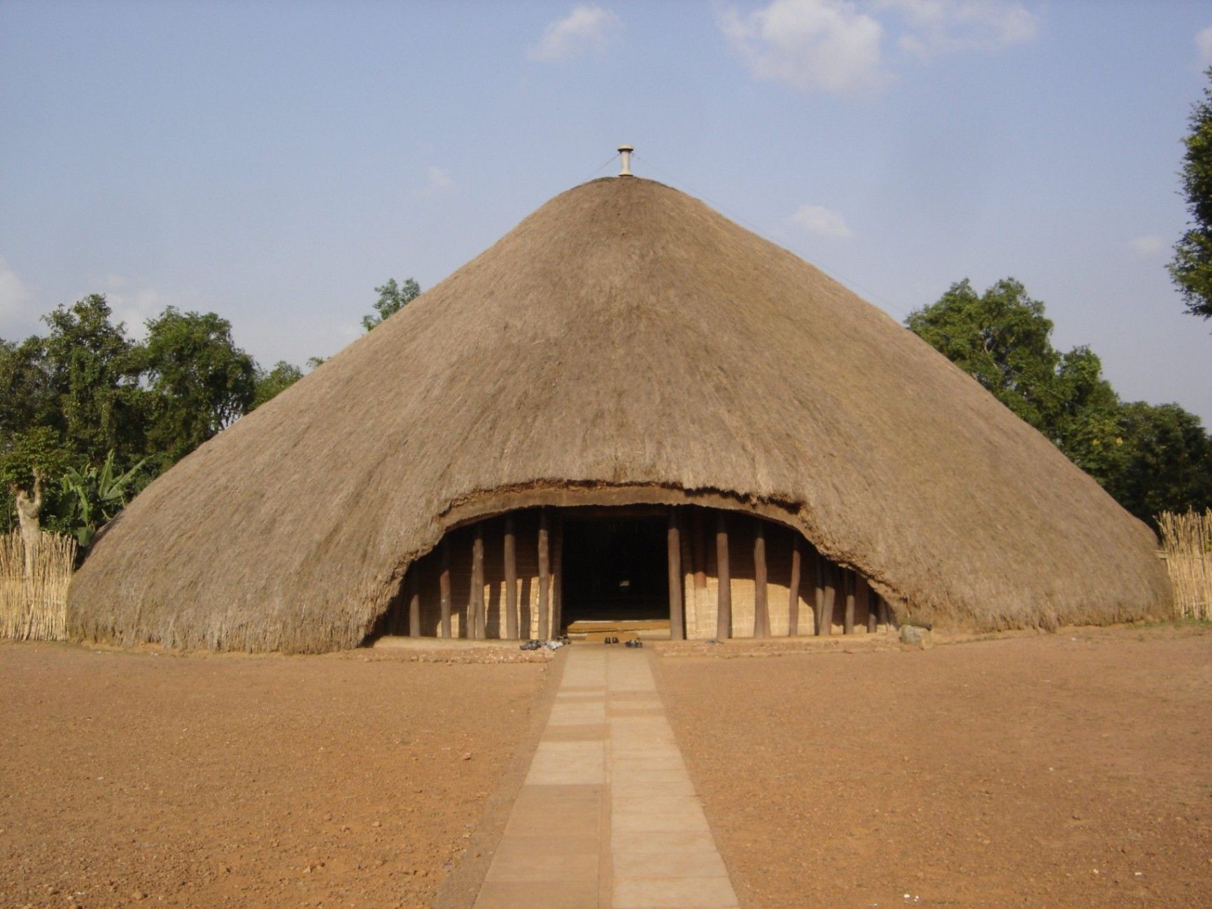
Kampala
## Description The Kasubi Tombs are one of Uganda’s most important cultural and historical landmarks, serving as the burial grounds of the kings (Kabakas) of the Buganda Kingdom. Recognized as a UNESCO World Heritage Site, the Kasubi Tombs are not only a place of remembrance but also a living spiritual center where traditions, rituals, and royal customs are still actively practiced. The site reflects the deep-rooted cultural identity of the Baganda people and offers visitors a rare opportunity to experience African heritage that is both ancient and ongoing. What makes the Kasubi Tombs especially unique is their architectural style. The main structure, known as the Muzibu Azaala Mpanga, is built almost entirely from organic materials such as wood, reeds, grass, and bark cloth, showcasing remarkable traditional engineering techniques passed down through generations. A little-known fact is that the massive domed structure was once considered one of the largest thatched buildings in Africa. Another lesser-known detail is that even after a devastating fire in 2010 severely damaged the main tomb, restoration efforts were guided by traditional craftsmen using ancestral knowledge rather than modern construction methods, preserving the site’s cultural authenticity. Visiting the Kasubi Tombs is not just a historical experience; it is a deeply spiritual one that highlights the enduring connection between the Buganda monarchy, its people, and their land. ## Location The Kasubi Tombs are located in **Uganda**, in the **Central Region**, within **Kampala**, the country’s capital city. The site sits on Kasubi Hill, approximately 5 kilometers northwest of Kampala’s city center. Getting there is relatively easy. Visitors can reach the Kasubi Tombs by taxi, private car, or motorcycle taxi (boda-boda) from central Kampala. The journey usually takes 15 to 25 minutes, depending on traffic. For those unfamiliar with the area, hiring a local driver or using a guided tour is recommended, as it ensures smoother navigation and provides cultural context during the visit. ## Tips * Dress modestly and respectfully, as the site is a sacred royal burial ground. * Photography may be restricted in certain areas, especially inside the main tomb, so always ask for permission. * Consider hiring a local guide at the entrance to gain deeper insight into Buganda history and traditions. * Visit in the morning when the site is quieter and temperatures are more comfortable. * Be respectful of ongoing rituals or ceremonies, as the site is still actively used by the Buganda Kingdom. * Carry small cash for entrance fees, guides, or donations. ## Conclusion The Kasubi Tombs offer a powerful and authentic insight into Uganda’s royal history and living cultural traditions. As a sacred site and a symbol of resilience, they stand as one of Kampala’s most meaningful attractions, rewarding visitors with knowledge, reflection, and cultural understanding. ## FAQ **Why are the Kasubi Tombs important?** They are the burial place of four Buganda kings and a central spiritual site for the Buganda Kingdom. **Is the Kasubi Tombs site fully restored?** Restoration is ongoing, guided by traditional methods to maintain cultural integrity, following the 2010 fire. **How long does a visit usually take?** Most visits last between one and two hours, including a guided tour. **Is the site suitable for children?** Yes, older children can benefit from the educational and cultural aspects, though supervision is advised. **Do I need a guide to visit the Kasubi Tombs?** A guide is not mandatory but highly recommended for a fuller understanding of the site’s significance. ## Links * [UNESCO – Kasubi Tombs](https://whc.unesco.org/en/list/1022) * [Uganda Tourism Board](https://exploreuganda.com/)
GemVoyage Team • World

Bernese Oberland
## Description Niesen Mountain, often referred to as the “Swiss Pyramid,” is one of Switzerland’s most visually striking peaks. Its near-perfect triangular shape resembles the iconic Egyptian pyramids, making it a favorite subject for artists like Paul Klee and Ferdinand Hodler. Rising to an elevation of 2,362 meters (7,749 feet), Niesen offers panoramic views over Lake Thun, the Bernese Alps, and the Simmen and Kander valleys. What makes Niesen truly unique isn’t just its shape—it’s the experience of getting to the summit. Visitors can ascend via the **Niesenbahn**, a historic funicular railway that’s been operating since 1910. The ride itself is a scenic journey, taking just 30 minutes to reach the top. But here’s a little-known fact: running alongside the funicular is the **world’s longest stairway**, with a staggering 11,674 steps. While it’s not open to the public for regular use, it hosts an annual stair run event that draws athletes from around the globe. Another charming detail? The mountain’s original name was “Yesen,” derived from the yellow gentian flower, which still blooms on its slopes today. ## Location Niesen is located in **Switzerland**, within the **Canton of Bern**, specifically in the **Bernese Oberland** region. The mountain overlooks **Lake Thun** and lies between the municipalities of **Wimmis** and **Reichenbach im Kandertal**. ### How to Get There: - **By Train**: Take a train to **Mülenen**, a small village that serves as the base station for the Niesenbahn funicular. - **By Car**: Mülenen is accessible via the A6 motorway. Parking is available near the funicular station. - **By Public Transport**: Swiss Travel Pass holders enjoy discounted fares on the funicular, making it an ideal choice for tourists. Once in Mülenen, hop on the funicular for a scenic ride to the summit. ## Tips for Visitors To make the most of your visit to Niesen, consider the following tips: - **Time Your Visit**: The mountain is open from mid-April to mid-November. For the most breathtaking views, aim for a sunrise or sunset trip—overnight stays at the Berghaus Niesen Kulm offer this magical experience. - **Book Ahead**: The funicular and restaurant can get busy during peak season. Booking tickets and meals in advance is highly recommended. - **Dress Appropriately**: Weather can change quickly at high altitudes. Bring layers, even in summer. - **Photography**: Don’t forget your camera—the glass pavilion at the summit offers unobstructed views perfect for landscape shots. - **Dining**: Try the full-moon dinner or breakfast buffet at the summit restaurant for a truly memorable culinary experience. - **Family Friendly**: Story rides and cultural events make Niesen a great destination for kids too. ## Conclusion Niesen Mountain is more than just a scenic peak—it’s a blend of natural beauty, historical charm, and cultural significance. Whether you're drawn by its pyramid shape, the thrill of the funicular ride, or the serenity of alpine views, Niesen offers an unforgettable Swiss experience. ## FAQ **1. What is the elevation of Niesen Mountain?** Niesen stands at 2,362 meters (7,749 feet) above sea level. **2. How do I reach the summit?** You can take the Niesenbahn funicular from Mülenen, which takes about 30 minutes to reach the top. **3. Is the stairway open to the public?** No, the 11,674-step stairway is only accessible during the annual Niesen stair run event. **4. When is the best time to visit Niesen?** Between mid-April and mid-November. Sunrise and sunset visits are especially stunning. **5. Are there accommodations at the summit?** Yes, the Berghaus Niesen Kulm offers cozy rooms and dining options with spectacular views. **6. Is Niesen suitable for children?** Absolutely. There are story rides and cultural activities designed for families. ## Links - [Official Niesen Website](https://www.niesen.ch/en/) - [Switzerland Tourism – Niesen](https://www.myswitzerland.com/en-us/destinations/niesen/)
GemVoyage Team • World
Seoul
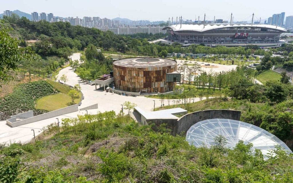
## Description Oil Tank Culture Park is an inventive urban redevelopment project that transforms obsolete oil storage tanks near Hapjeong into a layered cultural complex. The site is notable for its adaptive reuse approach: industrial silos and tanks were structurally preserved and repurposed as galleries, performance spaces, and community areas. The result is a tactile mix of heavy industrial surfaces and light-filled cultural rooms—an atmospheric contrast that frequently features in discussions about sustainable urban design and creative placemaking. Programming at the Oil Tank Culture Park combines curated exhibitions with community-driven activities. The large circular tanks are used for immersive installations and concerts; smaller adjacent spaces host workshops, film screenings, and local markets. The park’s outdoor terraces and green roofs provide vantage points for both the site itself and views across nearby neighborhoods, creating a sequence of experiences that shift between enclosed, resonant tanks and open, landscaped terraces. For visitors interested in architecture, industrial heritage, or contemporary culture, the site offers multiple points of fascination. Preservation choices—retaining the tanks’ raw metal texture, exposing concrete rings, and inserting slender circulation elements—make the site legible as both a former industrial hub and a cultural incubator. The park’s programming often foregrounds sustainability themes, community participation, and experimental performance formats. ## Location The Oil Tank Culture Park is located in Mapo-gu, Seoul, close to Hapjeong station and within walking distance of the World Cup Stadium area. It is well served by subway lines and local buses, and its signage makes it straightforward for international visitors to find. The park is frequently combined in itineraries with nearby Hongdae’s nightlife and Mangwon’s markets. ## Tips - Check the cultural calendar before visiting—special exhibitions and ticketed concerts are common and may require advance booking. - Wear comfortable shoes and expect varying surfaces: pathways range from concrete tank platforms to landscaped terraces. - Bring a light layer for rooftop areas and evening events—the wind can be brisk on exposed terraces. - Combine a visit with nearby Hongdae for dinner or an evening out; the area offers many small restaurants and cafés. - Respect installation boundaries and photography rules within exhibition spaces—some shows restrict flash or tripod use. ## Conclusion Oil Tank Culture Park is a striking example of how industrial heritage can be repurposed into vibrant public culture. It rewards visitors with a mix of dramatic industrial architecture, innovative programming, and a neighborhood-friendly atmosphere—ideal for architecture enthusiasts, cultural explorers, and people who enjoy offbeat urban sites. ## FAQ Q: Are events free? A: Some events and exhibitions are free to the public; larger performances, immersive shows, and special exhibitions may require tickets—check each event’s listing. Q: Is the site wheelchair accessible? A: The park includes ramps and accessible routes, though some older industrial areas may present challenges—contact the venue for detailed accessibility maps. Q: Can I photograph the tanks and installations? A: General photography is usually allowed in public spaces, but specific exhibitions may restrict photography—always check signage or ask staff. Q: Are there food and drink options on-site? A: Occasional pop-up vendors and nearby cafés supply food and drink during events; full-service restaurants are more common in surrounding neighborhoods. Q: Is there parking? A: On-site parking is limited; public transport is the recommended way to visit. ## Links - [Oil Tank Culture Park](https://www.theseoulguide.com/oil-tank-culture-park/)
GemVoyage Team • World

Comments