Discover extraordinary places shared by our community of travelers
Cairo
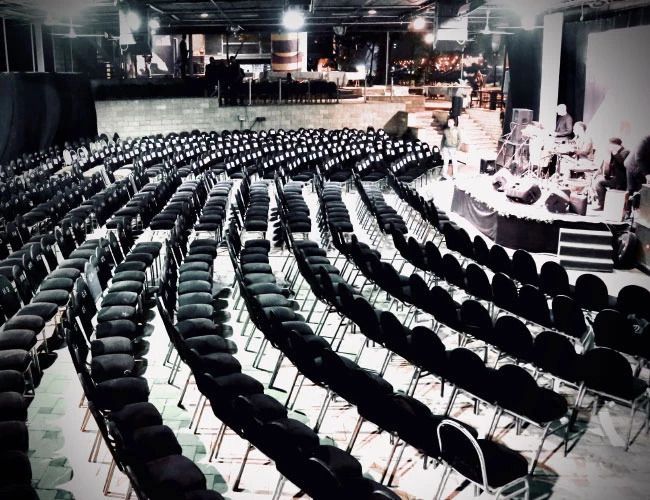
## Description El Sawy Culturewheel (often written as Sawy Cultural Wheel) is a dynamic cultural center in Cairo known for its eclectic program of theater, music, workshops, literary evenings, and community arts activities. Established by Egyptian cultural entrepreneur Mohamed El-Sawy, the center was conceived as a grassroots venue that supports independent artists, nurtures emerging talents, and brings diverse audiences together. The venue’s programming ranges from experimental theater and jazz nights to film discussions and children’s arts workshops, creating an urban cultural laboratory distinctly different from state-run institutions. What sets the Culturewheel apart is its commitment to accessibility and community engagement. It frequently offers affordable events, artists’ talks, and interdisciplinary collaborations that reflect contemporary Egyptian cultural life. A less obvious feature is the center’s role as a networking node—many artists and creative collectives in Cairo trace early collaborations back to events hosted at El Sawy, making it a quiet engine of the city’s cultural ecosystem. ## Location El Sawy Culturewheel is based on Gezira Island in the Zamalek district of central Cairo, Egypt, near the Nile’s western bank. Its central location on Gezira makes it easy to reach from many Cairo neighborhoods. Getting there: From downtown Cairo (Tahrir Square, downtown hotels) a short taxi or ride-share trip reaches Zamalek in under 20 minutes depending on traffic. Some visitors prefer the tram or river ferry options when available; walking across the Qasr El Nil bridge and heading into Zamalek is also feasible for those staying nearby. Parking can be limited during busy events, so public transport or a ride-hailing service is often most convenient. ## Tips - Check the schedule in advance: The Culturewheel’s program changes frequently; review upcoming events on their official channels or social pages to secure tickets for popular shows. - Arrive early: Some events are small and seat availability is limited; arriving early ensures a good seat and time to meet artists or buy refreshments. - Explore related venues: Zamalek has galleries, bookstores, and cafes; make an evening of it by combining a performance with dinner or a gallery visit. - Language: Many performances are in Arabic; however, cultural evenings often include bilingual presentations, translations, or summaries for international visitors—check event details if language is a concern. - Bring cash for smaller events and local craft stalls; bigger performances may accept card or online booking. ## Conclusion El Sawy Culturewheel is Cairo’s pulse for grassroots cultural life—an energetic space where performance, dialogue, and creativity intersect. For visitors interested in contemporary Egyptian arts or seeking a local, community-centered experience, the Culturewheel offers an accessible, varied, and memorable cultural program. ## FAQ Q: What kind of events are held at the Culturewheel? A: The center hosts theater, live music, film nights, literary readings, workshops, and children’s activities. Q: Is there an official timetable? A: Yes. Events are scheduled regularly—check the Culturewheel’s official announcement channels for the latest listings. Q: Are events in English? A: Many events are primarily in Arabic, but there are occasional bilingual events and programs aimed at international audiences. Q: Is the venue family-friendly? A: The center runs children’s workshops and family-oriented events—review event descriptions to verify suitability. ## Links - [Wikipedia: El Sawy Culturewheel](https://en.wikipedia.org/wiki/El_Sawy_Culturewheel) - [El Sawy Culturewheel official website](https://www.culturewheel.com/en)
GemVoyage Team • World
Boa Vista
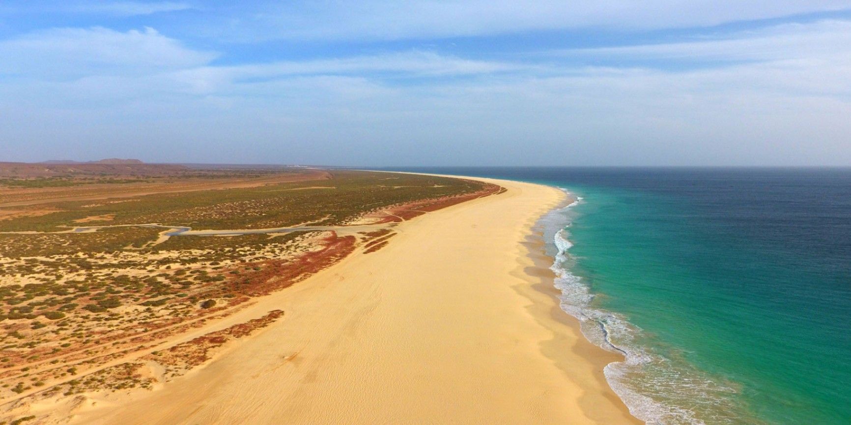
## Description Praia de Santa Mónica is often described as one of the most beautiful beaches in the world—and with good reason. Stretching over 18 kilometers along the southern coast of Boa Vista, Cape Verde, this vast expanse of golden sand and turquoise water remains almost untouched by development. Its name, “Santa Mónica,” was inspired by California’s famous beach, yet its charm lies in its wild and pristine character. The beach is unique because of its sheer size and tranquility. Unlike other popular destinations, Praia de Santa Mónica rarely feels crowded, even during peak travel seasons. Visitors are treated to panoramic views of rolling dunes, crystal-clear waves, and endless horizons. The beach is also known for being a nesting site for sea turtles, particularly the endangered Caretta caretta (loggerhead turtle). During nesting season, guided tours allow travelers to observe these creatures responsibly, making for a truly unforgettable experience. A little-known fact is that the beach is part of the Morro de Areia Nature Reserve, a protected area aimed at conserving both marine and terrestrial biodiversity. This adds an extra layer of significance for those seeking eco-friendly and sustainable travel experiences. ## Location Praia de Santa Mónica is located on the island of **Boa Vista**, one of the ten main islands of **Cape Verde**, an archipelago off the west coast of **Africa** in the Atlantic Ocean. The beach lies on the southwestern coast of Boa Vista, approximately 20 kilometers from the island’s capital, Sal Rei. To reach Praia de Santa Mónica, most visitors first arrive at Aristides Pereira International Airport (BVC) in Boa Vista. From there, taxis or guided tours can take you to the beach in around 40 minutes. Since public transport is limited on the island, arranging private transfers or joining an organized excursion is recommended. Off-road vehicles are often used, as some roads to the beach remain unpaved, adding a sense of adventure to the journey. ## Tips * **Bring essentials:** There are few facilities on-site, so pack water, snacks, sunscreen, and shade if you plan to spend several hours there. * **Swimming caution:** While the water looks inviting, currents can sometimes be strong. Check local conditions before swimming and stick to calmer areas. * **Best time to visit:** Early morning or late afternoon provide not only cooler temperatures but also the most stunning light for photography. * **Turtle watching:** If visiting between June and October, book a guided turtle-watching excursion to witness the nesting or hatching process. These tours are regulated to ensure the animals are not disturbed. * **Respect the environment:** Stay on marked paths to protect dunes and wildlife, and avoid leaving litter behind. * **Combine with a tour:** Many excursions include stops at Santa Mónica along with other highlights of Boa Vista, such as the Viana Desert or the shipwreck of Cabo Santa Maria. ## Conclusion Praia de Santa Mónica in Cape Verde is a destination for those seeking unspoiled beauty, peace, and a connection with nature. With its endless sandy shores, rich biodiversity, and breathtaking views, it offers a paradise-like escape far removed from crowded tourist resorts. For travelers looking to experience Cape Verde at its most authentic, this beach is an absolute must. ## FAQ **1. Is Praia de Santa Mónica suitable for families?** Yes, families can enjoy the wide sandy beach, but parents should monitor children closely when swimming due to occasional strong currents. **2. Are there restaurants or shops nearby?** No, the beach is largely undeveloped. It’s best to bring supplies from Sal Rei or your hotel before heading there. **3. How long should I plan to spend at the beach?** Many visitors spend a half-day to enjoy the scenery and relax, but nature lovers and photographers often stay longer. **4. Is it possible to surf or kiteboard at Santa Mónica?** The beach can offer good waves, but it’s less developed for water sports than other parts of Boa Vista. Consult local guides if you’re looking for surfing or kitesurfing opportunities. **5. Can I see turtles on my own?** For conservation reasons, turtle watching should only be done with licensed guides. This ensures the safety of both the turtles and visitors. **6. What’s the best way to get there?** The easiest way is by booking a taxi or an organized 4x4 tour from Sal Rei or your resort. Public transport does not reach the area. ## Links * [Cape Verde Tourism Official Site](https://www.visit-caboverde.com) * [Boa Vista Tourism Guide](https://www.boavistaofficial.com)
GemVoyage Team • World
Oslo
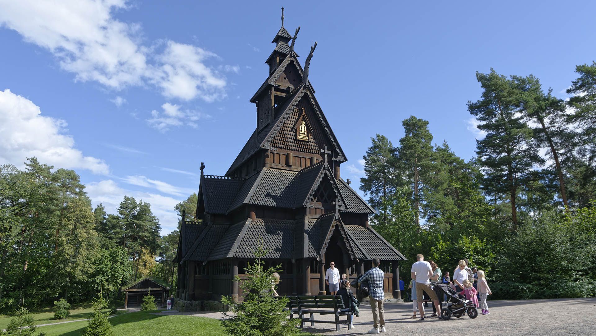
## Description **Gol Stave Church (Gol stavkirke)** is one of Norway’s most significant surviving examples of medieval wooden church architecture and a powerful symbol of the country’s cultural heritage. Originally built around the **late 12th century** in the town of Gol, the church represents the stave church tradition, a uniquely Scandinavian architectural form constructed almost entirely of timber using vertical load-bearing posts, or “staves.” What makes Gol Stave Church particularly remarkable is not only its age, but its **story of survival**. By the 19th century, many stave churches were being demolished due to changing religious practices and maintenance costs. Gol Stave Church was dismantled in the 1880s and narrowly avoided destruction thanks to the intervention of King Oscar II, who recognized its historical value. The church was carefully relocated and reconstructed on the Bygdøy peninsula in Oslo, where it stands today as a centerpiece of Norway’s architectural memory. Architecturally, the church combines Christian symbolism with **Viking-era decorative traditions**. Carved dragon heads, interlacing wood patterns, and animal motifs reflect pre-Christian Norse art, subtly integrated into a Christian sacred structure. This blending of belief systems is one of the most fascinating aspects of stave churches and offers insight into Norway’s transition from paganism to Christianity. A lesser-known fact is that much of what visitors see today is based on **meticulous historical reconstruction**, informed by archaeological studies, surviving stave churches, and medieval building techniques. Another interesting detail is that Gol Stave Church was never intended to function as an active parish church in Oslo; its role is primarily educational and cultural, serving as a reference model for lost stave churches across Norway. Gol Stave Church is not large, but its craftsmanship, symbolism, and historical weight give it a presence that far exceeds its physical scale. ## Location **Country:** Norway **Region:** Eastern Norway **City:** Oslo **Area:** Bygdøy Peninsula Gol Stave Church is located within the grounds of the **Norwegian Museum of Cultural History (Norsk Folkemuseum)**, an open-air museum dedicated to Norway’s cultural and architectural history. ### How to Get There * **By bus:** * Bus lines from central Oslo (such as from Nationaltheatret or Jernbanetorget) run directly to Bygdøy. * **By ferry (seasonal):** * Ferries operate from the Oslo harbor to Bygdøy, offering a scenic approach during warmer months. * **By bicycle:** * A pleasant option in good weather, with dedicated cycling routes leading to the peninsula. * **By taxi:** * Easily accessible by taxi from central Oslo. ## Tips * **Combine with the open-air museum:** Gol Stave Church is part of a much larger cultural complex; allow enough time to explore. * **Visit during daylight hours:** Natural light enhances the carved details and wood textures. * **Read the interpretive panels:** They explain stave church construction and symbolism clearly. * **Expect authenticity, not luxury:** Interiors are simple and atmospheric rather than ornate. * **Dress for the weather:** Much of the surrounding museum is outdoors. * **Photography rules apply:** Interior photography may be restricted. ## Conclusion Gol Stave Church is a rare and powerful reminder of medieval Norway’s craftsmanship, belief systems, and architectural ingenuity. Its careful preservation and relocation allow visitors to experience a building type that once defined Norwegian religious life but has nearly vanished. ## FAQ **1. Is Gol Stave Church still an active church?** No, it functions as a historical exhibit rather than a place of worship. **2. How old is the church?** It dates back to approximately the late 1100s. **3. Is it an original building or a replica?** It is a reconstructed original, assembled using historic materials and techniques. **4. How much time should I plan for the visit?** Plan **1.5 to 3 hours** if combining it with the surrounding museum. **5. Is it suitable for children?** Yes, especially for children interested in history and Viking culture. **6. Can you see other stave churches nearby?** There are no other original stave churches in Oslo, but several exist elsewhere in Norway. ## Links * [Visit Oslo official tourism site](https://www.visitoslo.com) * [Official Website](https://www.stavechurch.com/gol-stave-church/?lang=en)
GemVoyage Team • World
Karachi
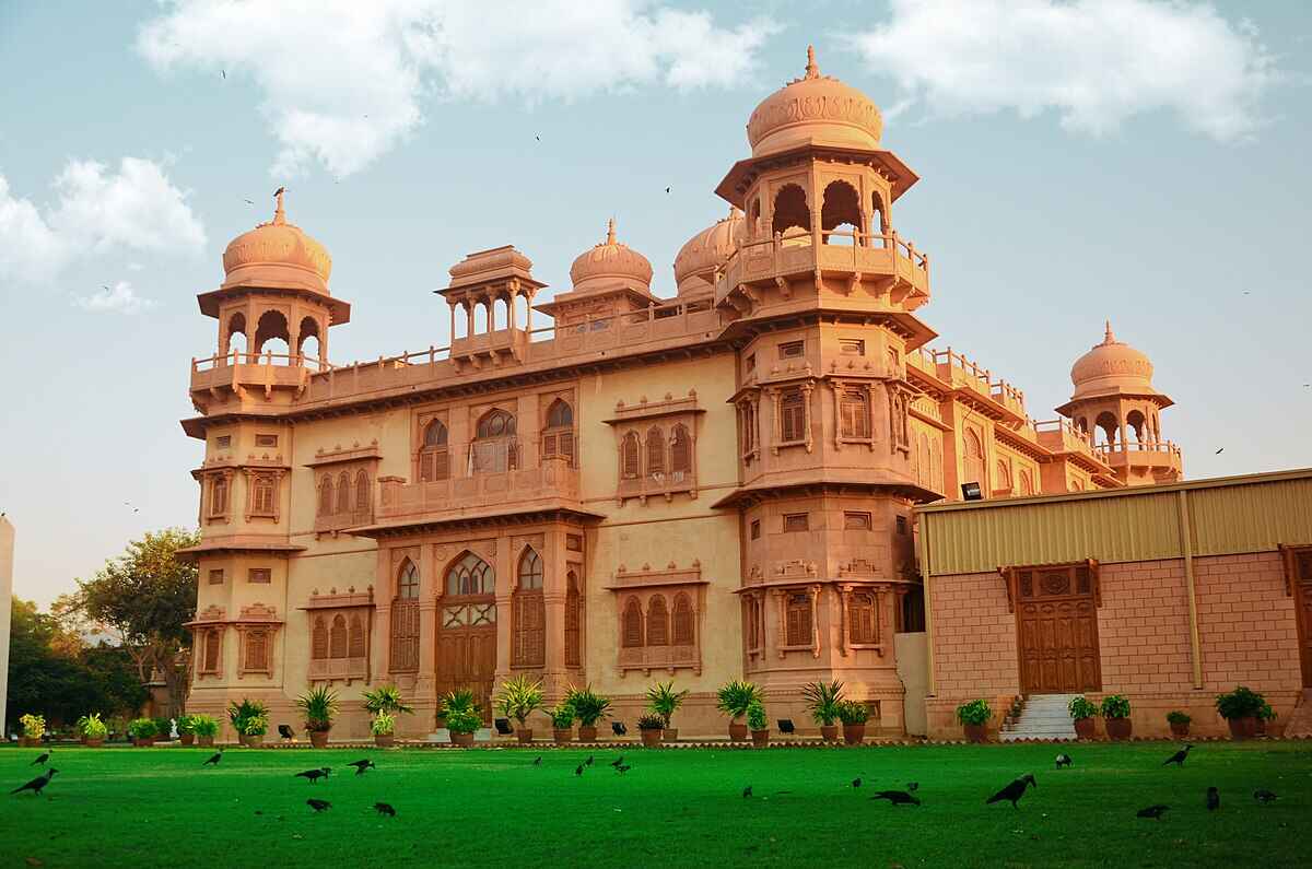
## Description Mohatta Palace is one of Karachi’s most iconic architectural gems, blending history, culture, and artistry into a single breathtaking experience. Built in 1927 by Shivratan Chandraratan Mohatta, a wealthy Hindu Marwari businessman, the palace was originally intended as a summer retreat. Designed by architect Agha Ahmed Hussain, it showcases the Indo-Saracenic style, combining elements of Mughal and Rajasthani architecture. The structure is made of pink Jodhpur stone and local yellow Gizri stone, giving it a warm, regal glow that stands out in the heart of Clifton. The palace spans over 18,500 square feet and features nine domes, intricately carved windows, floral motifs, and a grand central dome that crowns the building. Inside, visitors find polished teak wood staircases, long corridors, and stately rooms that once hosted lavish gatherings. Today, Mohatta Palace functions as a museum, hosting exhibitions that celebrate Pakistan’s rich artistic and cultural heritage—from miniature paintings and textiles to contemporary art installations. A little-known fact: the palace once housed a private temple dedicated to Lord Shiva on its rooftop terrace, a quiet reminder of its original owner's spiritual life. Another intriguing detail is the presence of secret underground tunnels, rumored to have been used for discreet movement during political unrest—though these remain closed to the public. ## Location Mohatta Palace is located in **Karachi**, the largest city in **Pakistan**, within the **Sindh** province. Specifically, it sits in the upscale neighborhood of **Old Clifton**, at 7 Hatim Alvi Road, Block 5. ### How to Get There: - **By Car**: Easily accessible via Shahrah-e-Faisal or the Clifton Bridge. Parking is available nearby. - **By Public Transport**: Local buses and ride-hailing services like Careem and Uber can drop you off directly at the entrance. - **From Jinnah International Airport**: The palace is about a 45-minute drive depending on traffic. For tourists, hiring a local guide or joining a heritage tour can enhance the experience with historical context and insider stories. ## Tips for Visitors To make the most of your visit to Mohatta Palace, keep these tips in mind: - **Check Exhibition Schedules**: The museum hosts rotating exhibitions, so check ahead to catch something that aligns with your interests. - **Photography**: While photography is allowed in the gardens, it’s restricted inside the museum. Ask staff for permission if you're documenting your visit. - **Dress Comfortably**: The palace grounds are expansive, and Karachi’s climate can be warm—light clothing and comfortable shoes are recommended. - **Visit Early**: Arriving early helps avoid crowds and gives you time to explore the gardens and nearby attractions. - **Guided Tours**: Opt for a guided tour to uncover stories and architectural details you might otherwise miss. - **Cultural Etiquette**: Respect the museum’s quiet ambiance and avoid loud conversations or disruptive behavior. ## Conclusion Mohatta Palace is more than a historical building—it’s a living museum that bridges the past and present of Pakistan’s cultural identity. With its stunning architecture, rich history, and vibrant exhibitions, it offers a unique and enriching experience for anyone visiting Karachi. ## FAQ **1. What are the opening hours of Mohatta Palace?** Typically, the museum is open from 11:00 AM to 6:00 PM, Tuesday to Sunday. It’s closed on Mondays and public holidays. **2. Is there an entry fee?** Yes, a nominal fee is charged for entry. Discounts may be available for students and groups. **3. Can I take photos inside the palace?** Photography is allowed in the gardens but restricted inside the museum. Always check with staff before taking pictures. **4. Are guided tours available?** Yes, guided tours are available and highly recommended for a deeper understanding of the palace’s history and exhibitions. **5. Is Mohatta Palace wheelchair accessible?** Accessibility is limited due to the historic nature of the building. It’s best to contact the museum in advance for specific accommodations. **6. What kind of exhibitions are held at Mohatta Palace?** Exhibitions range from traditional arts and crafts to contemporary visual art, often highlighting themes of heritage, identity, and social change. ## Links - [Mohatta Palace Official Website](https://mohattapalacemuseum.org/) - [Wikipedia – Mohatta Palace](https://en.wikipedia.org/wiki/Mohatta_Palace)
GemVoyage Team • World
Paris
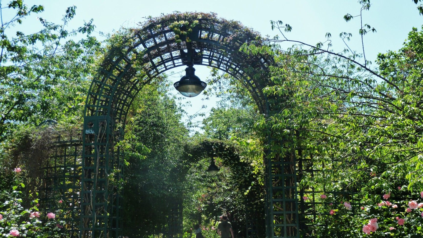
## Description The **Coulée Verte René-Dumont** is one of Paris’s most quietly transformative urban landscapes: a **4.7-kilometer elevated green corridor** built on a former 19th-century railway viaduct. Long before New York’s High Line became famous, Paris had already pioneered the idea of reclaiming industrial infrastructure and turning it into a **linear park suspended above city streets**. Opened in **1993**, the Coulée Verte stretches across eastern Paris, offering a continuous ribbon of trees, gardens, pergolas, tunnels, and walkways that float above neighborhoods, rooftops, and traffic. Rather than being a monumental tourist attraction, its strength lies in its **subtle intimacy**. The path winds between apartment balconies, over narrow streets, through shaded cuttings, and across stone viaducts, allowing visitors to experience Paris from an **unexpected vertical perspective**. The design philosophy of the park is deeply rooted in **soft landscaping rather than formal symmetry**. Instead of wide lawns or dramatic vistas, the Coulée Verte contains **layered vegetation, winding paths, seasonal flowers, bamboo groves, climbing roses, and shaded benches**. This makes it feel more like a secret garden than a grand urban park. One of the most remarkable architectural features of the route is the **Viaduc des Arts**, where the park runs along a series of brick arches originally built for railway use. Beneath these arches now sit artisan workshops, design studios, galleries, instrument makers, and boutique craftspeople. This dual-level experience—**green tranquility above and creative commerce below**—is one of the Coulée Verte’s defining identities. Unlike Paris’s grand axial parks such as the Tuileries or Luxembourg Gardens, the Coulée Verte offers a **continuously shifting urban narrative**. At one point, you are enclosed in forest-like silence; minutes later, you emerge into balcony-lined streets where residents drink coffee just meters away from your path. This creates an emotional tension between **privacy and exposure**, urban density and botanical escape. A little-known fact is that the park is named after **René Dumont**, a pioneering French agronomist and environmentalist who was also **France’s first Green Party presidential candidate**. The naming itself reinforces the park’s identity not just as a recreational space, but as a **symbol of ecological urban thinking**. Another little-known detail is that parts of the route pass directly behind residential buildings at eye level, leading to long-standing unspoken etiquette between walkers and residents regarding privacy. Today, the Coulée Verte is used daily by **joggers, dog walkers, commuters, couples, photographers, and elderly residents**, each group engaging with the space differently depending on time of day. Mornings are quiet and rhythmical. Afternoons bring families and visitors. Evenings soften into slow movement, conversation, and golden-hour light filtering through leaves onto brick and stone. The Coulée Verte does not dominate Paris visually or symbolically. Instead, it **slips through the city like a green seam**, quietly stitching nature into urban density. ## Location The **Coulée Verte René-Dumont** runs through the **12th arrondissement of Paris**, beginning near **Opéra Bastille** and extending eastward toward the **Périphérique (city ring road)**. **City:** Paris **Region:** Île-de-France **Country:** France **Primary Arrondissement:** 12th **Main Entrance Area:** Near Bastille and Avenue Daumesnil ### How to Get There: * **By metro:** * **Line 1, 5, or 8** to **Bastille Station** * **Line 6 or 8** to **Daumesnil Station** * **By RER:** **RER A** to **Nation Station**, then walk. * **By bus:** Multiple lines serve Avenue Daumesnil and the surrounding streets. * **By bicycle:** Easy access from eastern Paris cycle lanes. * **On foot:** Ideal as part of a walking route between Bastille, Bercy, and Nation. Multiple staircases and ramps provide access at different points along the route. ## Tips * **Walk the full length if possible:** The character of the park changes dramatically from west to east. * **Visit in spring or early autumn:** Vegetation is at its best and temperatures are comfortable. * **Early mornings are best for solitude:** Especially on weekdays. * **Evenings are best for atmosphere:** Soft lighting and slower rhythms dominate. * **Respect residential privacy:** Some sections run directly past apartment windows. * **Combine with Viaduc des Arts shopping:** The artisan shops beneath the arches are worth exploring. * **Bring water:** There are few vendors directly on the elevated path. * **Not ideal for fast cycling:** The path is narrow and shared heavily with pedestrians. ## Conclusion The **Coulée Verte René-Dumont** is not loud, monumental, or iconic in the traditional Parisian sense. Its power lies in **subversion and continuity**—a quiet green artery that transforms obsolete railway infrastructure into a flowing garden above the city. It offers a Paris of **movement, transition, and subtle beauty**, experienced not through grand monuments, but through shifting light, layered leaves, and elevated urban silence. ## FAQ **1. What is the Coulée Verte René-Dumont?** It is an **elevated linear park** built on an abandoned railway line in eastern Paris. **2. Is the Coulée Verte free to access?** Yes. It is **completely free and open to the public**. **3. How long does it take to walk the full route?** A full walk typically takes **1 to 1.5 hours** at a relaxed pace. **4. Is it similar to the High Line in New York?** Yes in concept, but the Coulée Verte is **older, greener, and more intimate** in character. **5. Is the park suitable for children?** Yes. It is widely used by families, though supervision is required in elevated or narrow sections. **6. Are there cafés or shops along the route?** Not directly on the path, but many cafés and bakeries are located at street level nearby. ## Links * [Paris City Guide](https://parisjetaime.com/eng/)
GemVoyage Team • World
Barcelona
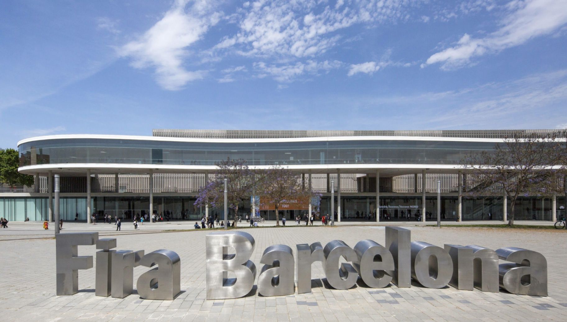
## Description **Fira Barcelona Gran Via** is one of the **largest and most advanced exhibition venues in Europe**, designed to host the world’s leading trade fairs, technology summits, medical congresses, and industrial expos. While Barcelona is often associated with beaches, historic quarters, and Gaudí architecture, Gran Via represents a different identity of the city: **global business, logistics precision, and large-scale innovation**. Opened in **2007**, the Gran Via venue was designed by renowned Japanese architect **Toyo Ito**, whose concept blends **minimalism, flow, and industrial elegance**. The complex consists of **eight massive exhibition halls**, interconnected by long glazed corridors, suspended walkways, and natural light shafts. The layout prioritizes **efficiency of movement**, allowing tens of thousands of visitors to circulate at once without congestion. What truly sets Fira Gran Via apart is its **sheer operational scale**. With more than **240,000 square meters of exhibition space**, it regularly hosts events that attract **over 100,000 visitors per edition**. Among its most famous recurring events are the **Mobile World Congress (MWC)**, one of the largest technology exhibitions on the planet, as well as major shows for pharmaceuticals, logistics, industrial automation, construction, and smart cities. Architecturally, Gran Via does not rely on decorative spectacle. Instead, it emphasizes **clean geometry, steel and glass contrasts, towering vertical volumes, and the rhythmic repetition of light and shadow**. The result is a building that feels futuristic without being extravagant. A striking visual feature is the **continuous covered spine** that links the halls like a central artery, functioning both as a navigation axis and as a social circulation zone between events. Beyond trade fairs, the venue also serves as a **global meeting point for governments, corporate leaders, scientists, and innovators**. International policy discussions on digital transformation, sustainability, healthcare systems, and future mobility frequently take place within its walls. In this sense, Fira Gran Via is not simply an exhibition space, but a **temporary city of global decision-making** that comes alive several times each year. A little-known fact is that during the design phase, the orientation of the halls was carefully calculated to **maximize diffused daylight while minimizing heat gain**, reducing energy consumption across the massive structure. Another lesser-known detail is that parts of the underground logistics network allow **direct truck access beneath the halls**, enabling exhibitors to move heavy machinery and large installations invisibly without disrupting surface-level visitor flow. Emotionally, Fira Gran Via does not aim to charm the visitor the way historic Barcelona does. Instead, its impact is one of **scale, order, and momentum**. It feels like standing inside an infrastructure built for the future. For many professionals, attending an event here marks not a leisure moment, but a **career milestone**, contract turning point, or technological breakthrough. When fully active, the venue functions like a **giant synchronized machine**, where logistics teams, exhibitors, speakers, press, and security systems operate in continuous parallel motion. Few places in Spain demonstrate the choreography of modern global business as visibly as Fira Barcelona Gran Via. ## Location **Fira Barcelona Gran Via** is located on the border between **Barcelona city and L’Hospitalet de Llobregat**, in the southwestern part of the metropolitan area. **City:** Barcelona / L’Hospitalet de Llobregat **Region:** Catalonia (Catalunya) **Country:** Spain **Main Area:** Gran Via Sud ### How to Get There: * **By metro:** * **Line 9 Sud** to **Fira Station** offers the most direct access. * **By bus:** Several city and regional bus lines serve Gran Via Sud. * **By taxi or ride-hailing:** Widely used during major international events. * **By airport connection:** Direct metro access from **Barcelona-El Prat Airport** via Line 9 Sud. * **By car:** Large underground parking is available for exhibitors and visitors. Its location allows fast access both from **Barcelona city center** and from **major highways linking the rest of Catalonia and Spain**. ## Tips * **Check the event calendar before visiting:** Gran Via is only accessible to the public during active exhibitions. * **Arrive early during major events:** Entry queues for global fairs like MWC can be long. * **Wear comfortable shoes:** Distances inside the halls are significant. * **Use hall maps and mobile apps:** The complex can feel overwhelming without digital navigation. * **Expect high food and drink prices during major exhibitions.** * **Book accommodation far in advance:** Hotels sell out months ahead during flagship events. * **Use public transport instead of taxis during peak hours:** Surrounding roads often experience heavy congestion. * **Allow buffer time for badge collection and security checks.** ## Conclusion **Fira Barcelona Gran Via** is a cornerstone of Europe’s exhibition and conference infrastructure, engineered for **scale, speed, and global connectivity**. It embodies Barcelona’s role not just as a cultural capital, but as a **strategic gateway for international trade, innovation, and knowledge exchange**. When fully operational, it becomes a temporary metropolis of ideas, deals, and future-defining conversations. ## FAQ **1. What is Fira Barcelona Gran Via used for?** It is used for **large-scale international trade fairs, congresses, summits, and industry expos**. **2. Is Fira Gran Via open to the general public?** Only during **active exhibitions or public-access events**. Otherwise, it is closed. **3. What is the biggest event held at Gran Via?** The **Mobile World Congress (MWC)** is the most internationally significant event hosted there. **4. How large is the venue?** It offers **over 240,000 square meters of exhibition space** across eight halls. **5. Is there direct access from the airport?** Yes. **Metro Line 9 Sud** connects Barcelona El Prat Airport directly to the venue. **6. Is Fira Gran Via accessible for people with reduced mobility?** Yes. The venue is fully **wheelchair accessible** with elevators, ramps, and adapted services. ## Links * [Fira Barcelona Official Website](https://www.firabarcelona.com/en/)
GemVoyage Team • World
Milan
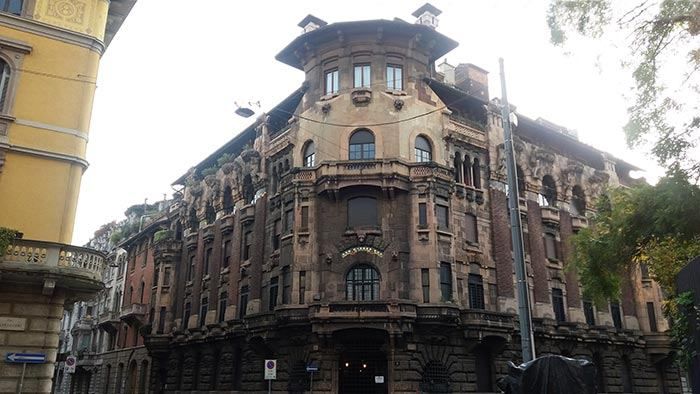
## Description The **Quadrilatero del Silenzio** is one of Milan’s most refined and least touristy architectural districts, a compact residential enclave where **Art Nouveau elegance, early 20th-century symbolism, and aristocratic discretion** converge. Unlike Milan’s grand monumental zones such as the Duomo or Brera, this area is defined by **silence, privacy, and restrained beauty**. It feels less like a destination and more like a secret revealed only to those who actively search for it. The name “Quadrilatero del Silenzio” loosely translates to **“The Quadrilateral of Silence”**, referencing both its **four bordering streets** and the **notable absence of commercial noise and mass tourism**. The district dates primarily to the **early 1900s**, when Milan was undergoing rapid modernization and wealthy families commissioned architects to design villas and palazzi inspired by **Liberty style**, Italy’s version of Art Nouveau. Among the district’s architectural highlights are **Casa Galimberti, Casa Guazzoni, and Palazzo Berri-Meregalli**. These buildings showcase extraordinary decorative detail: floral ironwork, painted ceramic tiles, sculpted balconies, symbolic reliefs, and richly textured façades. Casa Galimberti in particular stands as one of the **most complete Art Nouveau residential structures in Italy**, with its exterior entirely clad in painted ceramic panels depicting allegorical scenes and classical figures. What makes the Quadrilatero del Silenzio especially distinctive is its **spiritual and symbolic undercurrent**. Palazzo Berri-Meregalli, one of the most visually dramatic buildings in the area, incorporates **mystical and occult motifs**, skulls, grotesque faces, and symbolic sculptures linked to esoteric traditions. This hidden symbolic language contrasts sharply with the district’s otherwise calm residential purpose, adding a layer of intrigue beneath the formal elegance. The neighborhood’s emotional atmosphere is **measured and withdrawn**. Tree-lined streets, soft façades, and limited vehicle traffic create a mood unlike the rest of central Milan. There are no major shops, cafés, or attractions competing for attention. Instead, visitors move slowly, examining balconies, doorways, tiled surfaces, and wrought-iron gates just meters from inhabited private homes. This blurs the boundary between **museum-like observation and daily life**. A little-known fact is that Casa Guazzoni’s balcony sculptures were among the **earliest experiments with reinforced concrete sculpture in Milan**, hidden beneath their decorative surfaces. Another lesser-known detail is that much of the district was deliberately zoned as **high-end residential from the outset**, preventing later commercial overdevelopment and preserving its original function for more than a century. Unlike Milan’s fashion districts or historic centers, the Quadrilatero del Silenzio does not sell an experience. It **offers stillness**. It rewards visitors who pay attention to surface texture, ornamental language, and architectural storytelling rather than spectacle. This makes it particularly appealing to architects, photographers, design students, and travelers who prefer subtlety over highlights. The district is not large, and it does not aim to be. Its power lies in **concentration rather than scale**. Within a few blocks, it condenses many of the ideals of Milan’s early modern identity: wealth, experimentation, decorative craftsmanship, and discreet urban living. ## Location The **Quadrilatero del Silenzio** is located in the **eastern part of central Milan**, just outside the city’s main historical core. **City:** Milan **Region:** Lombardy (Lombardia) **Country:** Italy **Main Streets Defining the Area:** * Via Cappuccini * Via Serbelloni * Via Mozart * Via Malpighi ### How to Get There: * **By metro:** * **Line M1 (red line)** to **Porta Venezia Station**, then a 5–8 minute walk. * **By tram:** Several tram lines run through Corso Venezia and Porta Venezia. * **By taxi or ride-hailing:** Direct access with easy drop-off near Via Mozart or Via Cappuccini. * **On foot:** A pleasant walk from the fashion district or the Natural History Museum. The area is ideal to combine with nearby attractions such as **Porta Venezia, Indro Montanelli Public Gardens, and Corso Buenos Aires**. ## Tips * **Visit during daylight:** Architectural details are best visible in natural light. * **Keep voices low:** It is a residential area known for its quiet character. * **Photography is allowed, but be discreet:** Many buildings are private homes. * **No cafés inside the core area:** Plan coffee stops in nearby Porta Venezia. * **Look up as much as you look forward:** Balconies and upper façades hold the most details. * **Best for architecture lovers:** It is not a shopping or entertainment zone. * **Pair it with a museum visit:** The Natural History Museum nearby fits the reflective mood. * **Avoid peak commuter hours:** Traffic is limited but narrow streets amplify sound. ## Conclusion The **Quadrilatero del Silenzio** is one of Milan’s most understated yet culturally dense districts. It reveals a side of the city built not for spectacle but for **craft, symbolism, and quiet luxury**. Through its Art Nouveau façades, discreet streets, and hidden esoteric details, it tells a story of Milan at the dawn of modernity, preserved in a state of rare urban restraint. ## FAQ **1. What is the Quadrilatero del Silenzio?** It is a **small residential architectural district** in Milan known for its Art Nouveau buildings and quiet atmosphere. **2. Why is it called “del Silenzio”?** Because of its **low traffic, lack of commercial noise, and calm residential character**. **3. Is it free to visit?** Yes. It is a **public neighborhood with no entrance fee**. **4. How long does a visit usually take?** Most visitors spend **30 to 60 minutes** walking through the area. **5. Is it good for photography?** Yes, especially for **architectural and detail photography**, though discretion is expected. **6. Is it suitable for families?** Yes, but it is better suited to **slow walking and observation** rather than activities for children. ## Links * [Comune di Milano – Urban Heritage](https://www.comune.milano.it)
GemVoyage Team • World
Copenhagen
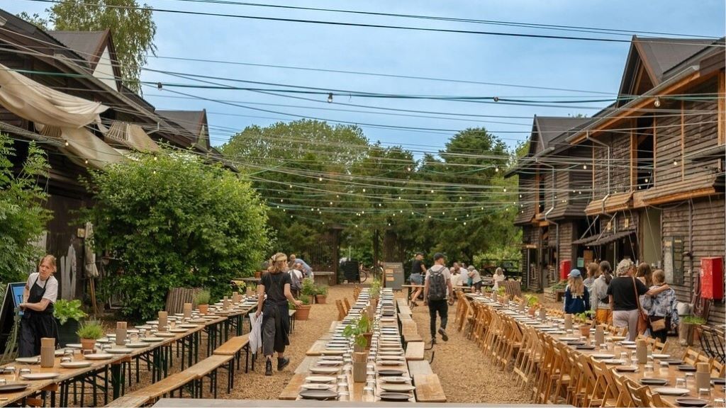
## Description **Banegaarden** is one of Copenhagen’s most compelling examples of **urban regeneration through food, culture, and sustainability**. Built inside a former railway maintenance area, this vibrant cluster of wooden buildings, green courtyards, bakeries, breweries, eateries, and cultural spaces has been transformed into a **community-driven gastronomic village** that blends industrial heritage with contemporary Nordic creativity. What makes Banegaarden truly distinctive is its **organic, low-rise village layout** rather than a typical food hall or marketplace structure. Ten restored wooden railway buildings form the heart of the site, connected by gravel paths, gardens, fire pits, and outdoor seating areas. Instead of polished glass and steel, the visual language here is **raw wood, brick remnants, reclaimed beams, and soft green landscaping**. The result feels more like a countryside craft settlement dropped into the city than a traditional urban development. Food is the central magnet, but Banegaarden is not built around fast consumption. Many of its kitchens focus on **seasonal Nordic ingredients, organic produce, fermented foods, sourdough baking, slow-roasted meats, and local craft beer and natural wine**. Several of the food operators also function as production spaces, meaning visitors can see bread baked, beer brewed, and ingredients processed on-site. This transparency reinforces the project’s emphasis on **craft, traceability, and sustainability**. Equally important is Banegaarden’s **cultural layer**. The site frequently hosts live music, vinyl listening sessions, workshops, farmers’ markets, food talks, and small festivals. These activities transform the area from a dining destination into a **living social platform** that evolves with the seasons. Summer brings long outdoor evenings around communal tables, while winter focuses on indoor gatherings, candles, and fire-lit courtyards. A key characteristic of Banegaarden is its **anti-commercial atmosphere**. There is no corporate branding dominance, no chain restaurants, and no sterile shopping-mall layout. Instead, it operates more like a **curated creative ecosystem** where craftsmen, chefs, farmers, brewers, musicians, and designers coexist. This gives the place an authenticity that is difficult to manufacture and easy to lose in large-scale redevelopment projects. A little-known fact is that the site originally functioned as a **railway service yard for inspecting and repairing trains**, not as a public passenger area. Even today, parts of the old rail infrastructure remain subtly integrated into the landscape. Another lesser-known detail is that many of the wooden buildings were **physically relocated and reconstructed on-site**, rather than built entirely from new materials, making Banegaarden as much a recycling project as a cultural one. Emotionally, Banegaarden appeals to people who seek **slowness inside an efficient city**. Copenhagen is known for streamlined design and functional modernism, but Banegaarden celebrates imperfection, texture, and informal gathering. It attracts food lovers, families, cyclists, creatives, and visitors who want to experience something that feels **local rather than curated for mass tourism**. It is not a place to rush through. Banegaarden rewards lingering: coffee in the morning, shared lunch under trees, beer at sunset, and live music after dark. Its true value lies not in any single vendor, but in the **collective energy created by people, food, sound, fire, and reclaimed wood**. ## Location **Banegaarden** is located in the **Vesterbro district of Copenhagen**, close to one of the city’s major transport hubs. **City:** Copenhagen **Region:** Capital Region of Denmark (Hovedstaden) **Country:** Denmark **District:** Vesterbro **Nearby Landmark:** Dybbølsbro Station ### How to Get There: * **By S-train:** Take the S-train to **Dybbølsbro Station**, then walk about 5 minutes. * **By bicycle:** One of the easiest and fastest ways to reach Banegaarden from central Copenhagen. * **By bus:** Multiple routes serve the Vesterbro and Dybbølsbro area. * **By taxi or ride-hailing apps:** Quick access from anywhere in the city. * **On foot:** Approximately 20–25 minutes from Copenhagen Central Station. Its location makes it easy to combine with visits to **Meatpacking District (Kødbyen), Vesterbro cafés, and Copenhagen’s waterfront areas**. ## Tips * **Visit on weekends for atmosphere:** That’s when markets, music, and social gatherings are most active. * **Arrive early in summer:** Popular seating areas fill up fast on sunny days. * **Dress for outdoor time:** Much of the experience takes place outside, even in cooler weather. * **Bring cash and card:** Most vendors accept cards, but small pop-ups may prefer mobile payments. * **Not a fast-food stop:** Plan to spend time exploring, eating slowly, and socializing. * **Family-friendly during the day:** Evenings are more focused on adult dining and drinks. * **Seasonal variation matters:** Winter is cozy and intimate, summer is expansive and social. * **Respect the space:** It is community-driven and functions best when visitors treat it like a shared backyard, not a tourist spectacle. ## Conclusion **Banegaarden** is a rare urban space where **sustainability, food culture, craftsmanship, and social design intersect without feeling forced**. By transforming old railway buildings into a creative village, Copenhagen has gained a destination that feels alive, textured, and deeply human. It is not about spectacle or scale, but about **atmosphere, community, and the quiet power of thoughtful reuse**. ## FAQ **1. What is Banegaarden exactly?** It is a **food, culture, and craft village** built in repurposed railway buildings in Vesterbro. **2. Is there an entrance fee?** No. **Entry is free**, and you only pay for food, drinks, or events you attend. **3. Is Banegaarden open year-round?** Yes. It operates in all seasons, though **activity levels peak in warmer months**. **4. Is Banegaarden good for tourists?** Yes, especially for travelers who want a **local, non-touristy Copenhagen experience**. **5. Can children visit Banegaarden?** Yes. It is **family-friendly during daytime hours**. **6. How long should I plan to stay?** Most visitors spend **1.5 to 3 hours**, depending on meals and events. ## Links * [Banegaarden Official Website](https://www.banegaarden.com/)
GemVoyage Team • World
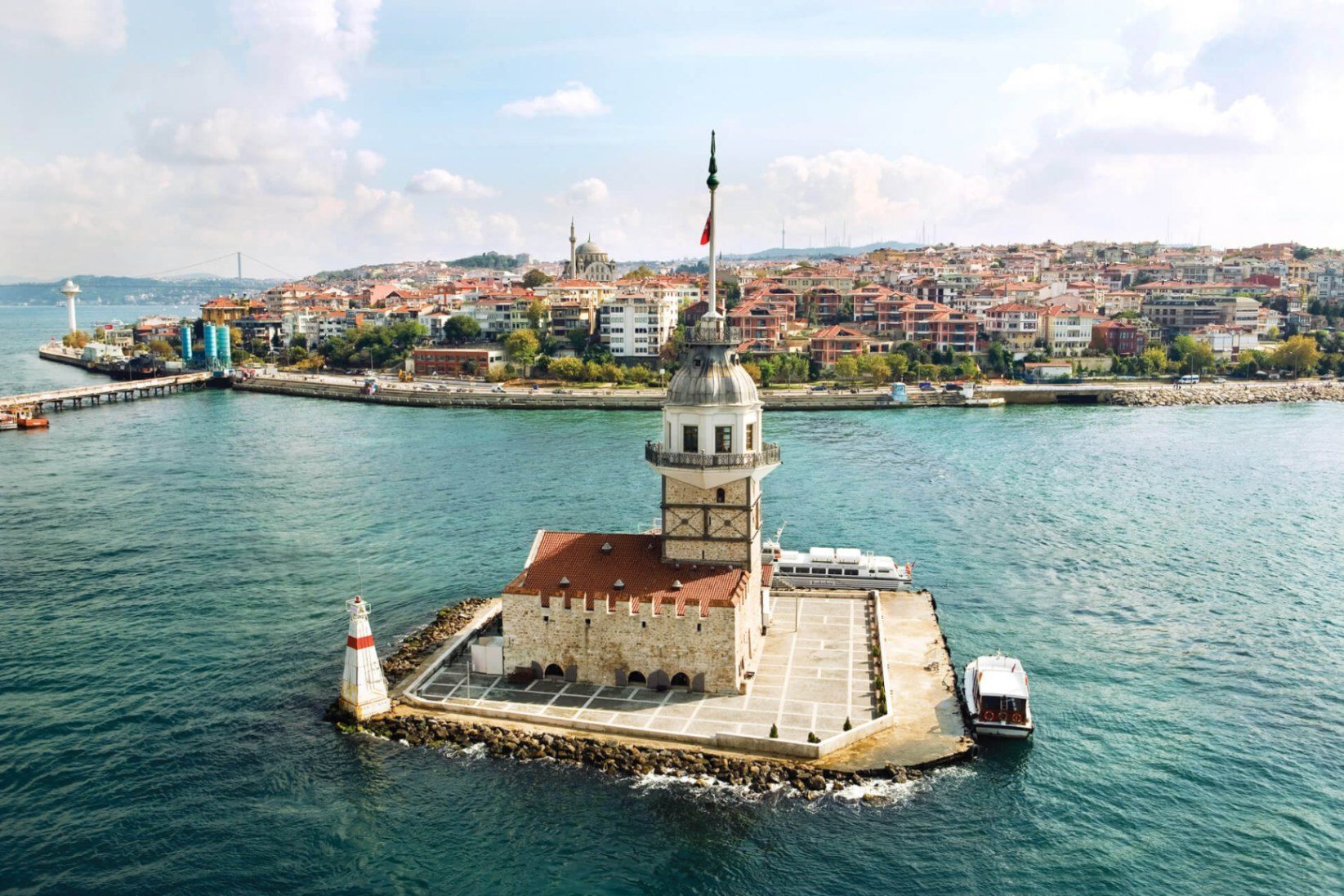
Istanbul
## Description **Maiden’s Tower (Kız Kulesi)** is one of Istanbul’s most recognizable and symbolically charged landmarks, standing alone on a small islet in the Bosphorus Strait. Neither fully Asian nor European in spirit, the tower embodies Istanbul’s identity as a city suspended between worlds. Its silhouette, visible from both shores, has inspired legends, poetry, paintings, and countless interpretations over centuries. The structure’s history stretches back to **antiquity**, with the earliest known use dating to the 5th century BCE, when it functioned as a defensive outpost controlling maritime traffic entering the Bosphorus. Over time, the tower has served many roles: lighthouse, customs checkpoint, quarantine station, watchtower, and even a radio transmission point. Each era left its mark, making the tower less a single-purpose monument and more a **layered historical artifact**. What truly distinguishes Maiden’s Tower is the **mythology surrounding it**. The most famous legend tells of a princess locked inside the tower to protect her from a prophecy foretelling her death by snakebite—only for the prophecy to come true regardless. Another lesser-known tale connects the tower to **Hero and Leander**, linking it symbolically to tragic love stories from classical antiquity. These narratives, though not historically verifiable, have become inseparable from the site’s identity. A little-known fact is that the tower has been **rebuilt multiple times**, most recently during the Ottoman period and again in modern restorations, meaning what visitors see today is the result of careful reconstruction rather than a single intact ancient structure. Another overlooked detail is that its strategic placement allowed it to work in tandem with towers on both shores, forming a maritime control system rather than functioning in isolation. Today, Maiden’s Tower operates primarily as a cultural and leisure site, offering exhibitions, a café, and panoramic views that rival any viewpoint in the city. ## Location **Country:** Turkey **Region:** Marmara **City:** Istanbul **District:** Üsküdar **Waterway:** Bosphorus Strait The tower sits just off the Asian shore of Istanbul, opposite the historic peninsula and close to Üsküdar’s coastline. ### How to Get There * **By ferry or boat:** * Small boats depart regularly from **Üsküdar** and sometimes from **Kabataş** on the European side. * **By public transport:** * Take Marmaray, metro, or ferry lines to Üsküdar, then walk to the departure pier. * **By taxi:** * Taxi to Üsküdar waterfront, then transfer by boat. Access to the tower is only possible by boat; swimming or private access is prohibited. ## Tips * **Visit near sunset:** The views of the Bosphorus and historic skyline are at their best. * **Check restoration status:** Access may vary due to maintenance or cultural programming. * **Book in advance during peak seasons:** Boats and entry slots can fill quickly. * **Dress for wind:** The tower is exposed, especially on upper levels. * **Combine with Üsküdar exploration:** The surrounding district offers mosques, promenades, and cafés. * **Manage expectations:** The tower is small; the experience is about atmosphere, not scale. ## Conclusion Maiden’s Tower is less about architectural grandeur and more about symbolism, location, and continuity. Standing alone in the Bosphorus, it captures Istanbul’s layered history and enduring fascination better than almost any other single structure. ## FAQ **1. Is Maiden’s Tower ancient?** Its origins date back over 2,000 years, but the current structure reflects multiple reconstructions. **2. Can you go inside the tower?** Yes, when open to the public, visitors can enter via boat. **3. How long does a visit take?** Typically **30 to 60 minutes**, excluding boat travel. **4. Is there an entrance fee?** Yes, pricing varies depending on exhibitions and services. **5. Is it better to visit during the day or evening?** Evening visits are more atmospheric, especially around sunset. **6. Is the tower wheelchair accessible?** Accessibility is limited due to stairs and the historic structure. ## Links * [Istanbul official tourism portal](https://istanbul.com)
GemVoyage Team • World
