GemVoyage Team • World
Banegaarden is one of Copenhagen’s most compelling examples of urban regeneration through food, culture, and sustainability. Built inside a former railway maintenance area, this vibrant cluster of wooden buildings, green courtyards, bakeries, breweries, eateries, and cultural spaces has been transformed into a community-driven gastronomic village that blends industrial heritage with contemporary Nordic creativity.
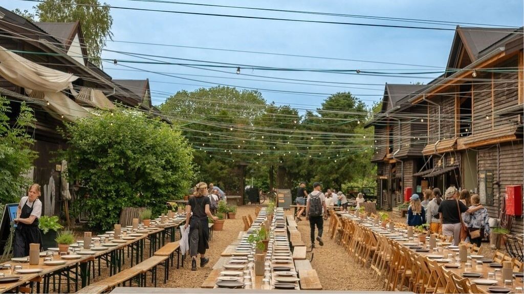
What makes Banegaarden truly distinctive is its organic, low-rise village layout rather than a typical food hall or marketplace structure. Ten restored wooden railway buildings form the heart of the site, connected by gravel paths, gardens, fire pits, and outdoor seating areas. Instead of polished glass and steel, the visual language here is raw wood, brick remnants, reclaimed beams, and soft green landscaping. The result feels more like a countryside craft settlement dropped into the city than a traditional urban development.
Food is the central magnet, but Banegaarden is not built around fast consumption. Many of its kitchens focus on seasonal Nordic ingredients, organic produce, fermented foods, sourdough baking, slow-roasted meats, and local craft beer and natural wine. Several of the food operators also function as production spaces, meaning visitors can see bread baked, beer brewed, and ingredients processed on-site. This transparency reinforces the project’s emphasis on craft, traceability, and sustainability.
Equally important is Banegaarden’s cultural layer. The site frequently hosts live music, vinyl listening sessions, workshops, farmers’ markets, food talks, and small festivals. These activities transform the area from a dining destination into a living social platform that evolves with the seasons. Summer brings long outdoor evenings around communal tables, while winter focuses on indoor gatherings, candles, and fire-lit courtyards.
A key characteristic of Banegaarden is its anti-commercial atmosphere. There is no corporate branding dominance, no chain restaurants, and no sterile shopping-mall layout. Instead, it operates more like a curated creative ecosystem where craftsmen, chefs, farmers, brewers, musicians, and designers coexist. This gives the place an authenticity that is difficult to manufacture and easy to lose in large-scale redevelopment projects.
A little-known fact is that the site originally functioned as a railway service yard for inspecting and repairing trains, not as a public passenger area. Even today, parts of the old rail infrastructure remain subtly integrated into the landscape. Another lesser-known detail is that many of the wooden buildings were physically relocated and reconstructed on-site, rather than built entirely from new materials, making Banegaarden as much a recycling project as a cultural one.
Emotionally, Banegaarden appeals to people who seek slowness inside an efficient city. Copenhagen is known for streamlined design and functional modernism, but Banegaarden celebrates imperfection, texture, and informal gathering. It attracts food lovers, families, cyclists, creatives, and visitors who want to experience something that feels local rather than curated for mass tourism.
It is not a place to rush through. Banegaarden rewards lingering: coffee in the morning, shared lunch under trees, beer at sunset, and live music after dark. Its true value lies not in any single vendor, but in the collective energy created by people, food, sound, fire, and reclaimed wood.
Banegaarden is located in the Vesterbro district of Copenhagen, close to one of the city’s major transport hubs.
City: Copenhagen
Region: Capital Region of Denmark (Hovedstaden)
Country: Denmark
District: Vesterbro
Nearby Landmark: Dybbølsbro Station
Its location makes it easy to combine with visits to Meatpacking District (Kødbyen), Vesterbro cafés, and Copenhagen’s waterfront areas.
Banegaarden is a rare urban space where sustainability, food culture, craftsmanship, and social design intersect without feeling forced. By transforming old railway buildings into a creative village, Copenhagen has gained a destination that feels alive, textured, and deeply human. It is not about spectacle or scale, but about atmosphere, community, and the quiet power of thoughtful reuse.
1. What is Banegaarden exactly?
It is a food, culture, and craft village built in repurposed railway buildings in Vesterbro.
2. Is there an entrance fee?
No. Entry is free, and you only pay for food, drinks, or events you attend.
3. Is Banegaarden open year-round?
Yes. It operates in all seasons, though activity levels peak in warmer months.
4. Is Banegaarden good for tourists?
Yes, especially for travelers who want a local, non-touristy Copenhagen experience.
5. Can children visit Banegaarden?
Yes. It is family-friendly during daytime hours.
6. How long should I plan to stay?
Most visitors spend 1.5 to 3 hours, depending on meals and events.
Discover more hidden gems you might love.
Alexandria
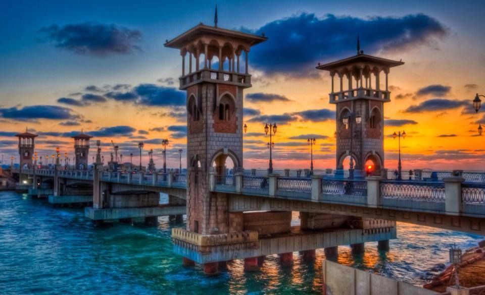
## Description The Stanley Bridge Corniche Walk is one of the most enjoyable ways to experience Alexandria’s seaside character because it brings together a famous city landmark and the broader rhythm of the Mediterranean waterfront. Stanley Bridge itself is a recognizable symbol of modern Alexandria, but what makes the area memorable is not only the bridge as an object. It is the surrounding promenade, the sea air, the movement of people, the views toward the coastline, and the way the corniche helps connect the city’s urban life with its maritime setting. For visitors, this is the kind of place that turns a simple walk into an experience of atmosphere. The bridge and the walkway around it are especially appealing because they capture Alexandria’s layered identity. The city has ancient roots, but much of its contemporary charm comes from places where residents and visitors mix along the water. A lesser-known fact is that the Stanley area is relatively modern compared with Alexandria’s ancient core, yet it has become one of the city’s most photographed and recognizable places because of its coastal setting and architectural profile. Another detail worth noticing is how the area changes across the day: morning brings a softer, more reflective mood, while evening often becomes livelier as people come out for a breezy promenade. For travelers, the walk is rewarding because it offers a sense of place without requiring a formal agenda. You can simply move along the corniche, stop for photos, watch traffic and waves, and enjoy the city unfolding in layers. The bridge frames the sea and the shoreline in a way that feels distinctly Alexandrian, and the surrounding area is often a pleasant place to pause, drink something cold, or continue toward nearby stretches of the waterfront. That flexibility is exactly why this walk belongs in an Alexandria itinerary. The best part may be how accessible it feels. You do not need special preparation to appreciate it. The waterfront itself does the work, offering changing light, open views, and a strong sense of local daily life. ## Location Stanley Bridge Corniche Walk is located in Alexandria, Egypt, along the city’s Mediterranean waterfront in the Stanley district. The walk sits on the Corniche, Alexandria’s main coastal boulevard, which makes it easy to locate and simple to fold into a broader day in the city. Because it is part of the public waterfront, the area is easy to approach and does not require special ticketing or entrance procedures. Getting there is usually easiest by taxi, rideshare, or local transport depending on where you are staying in Alexandria. Walking is ideal if you are already nearby, since the whole point of the experience is to enjoy the seafront at a human pace. If you are planning a longer sightseeing route, Stanley works well as a connecting point between central Alexandria and other coastal areas. The best way to enjoy it is to arrive with enough time to linger. A short pass-through is fine, but the waterfront rewards slowing down. Sunset is especially attractive for light and atmosphere, though morning can be calmer and better for a more relaxed walk. ## Tips Choose comfortable shoes, even though the route is simple. A pleasant walk often turns into a longer one than expected. Visit near sunset if you want the most dramatic light and the most social atmosphere. Do not focus only on the bridge itself. The surrounding corniche is what gives the experience its full value. Be aware of traffic and keep an eye on crossings. Like many urban waterfronts, the area is lively and active. Combine the walk with a café stop or a meal nearby so the outing feels complete rather than rushed. ## Conclusion The Stanley Bridge Corniche Walk is one of Alexandria’s most enjoyable low-effort experiences, blending sea views, city life, and a strong sense of place. It is ideal for travelers who want to feel the Mediterranean character of the city without needing a formal attraction schedule. ## FAQ ### Is the Stanley Bridge area good for tourists? Yes. It is one of Alexandria’s most scenic and accessible waterfront spots, with strong appeal for casual visitors and photographers. ### How long should I spend there? Anywhere from 30 minutes to 2 hours, depending on whether you are simply passing through or lingering for a walk and a meal. ### Is it better in the day or evening? Both work well. Daylight is good for seeing the sea clearly, while evening often feels more atmospheric and social. ### Do I need a ticket? No. The corniche is a public waterfront area, so the experience is generally open and walkable. ## Links - [Alexandria on Wikipedia](https://en.wikipedia.org/wiki/Alexandria)
GemVoyage Team • World
Kortrijk
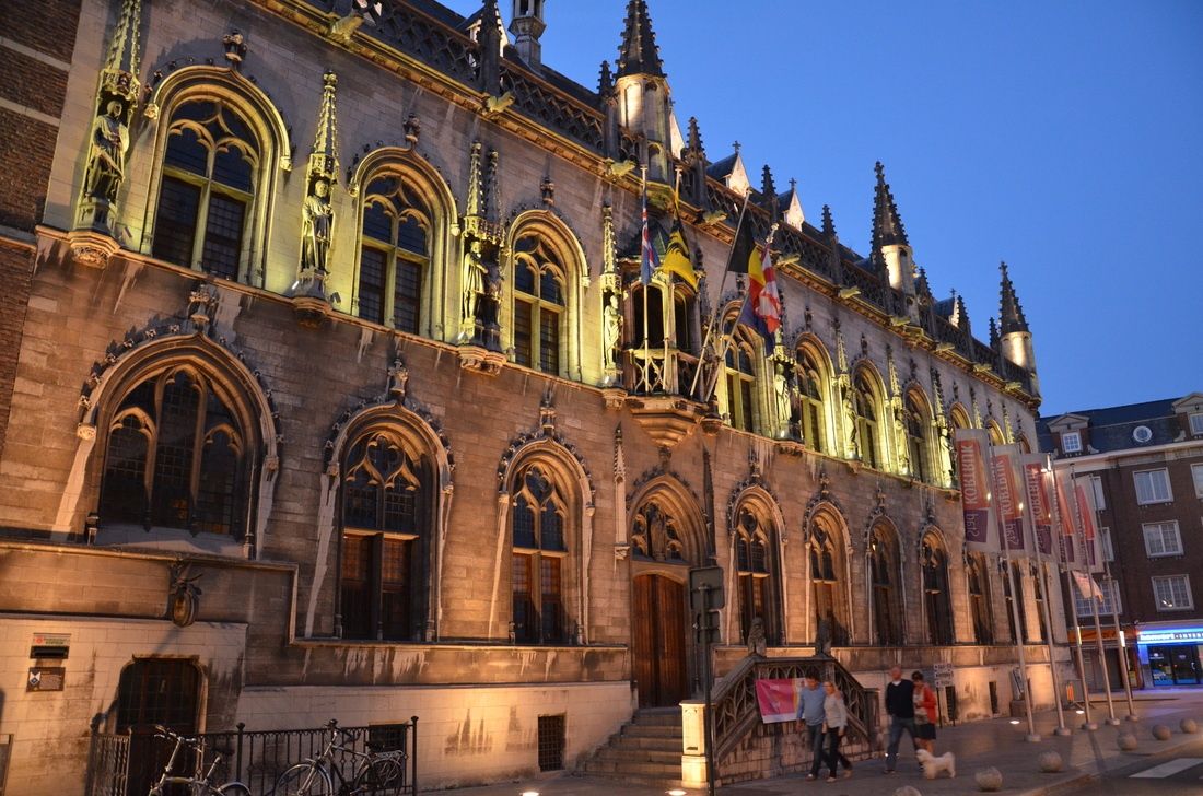
## Description **Courtrai City Hall**, known locally as **Historisch Stadhuis Kortrijk**, is one of the most architecturally layered civic buildings in Belgium. Rather than being the product of a single era, the City Hall is a **composite structure** formed by the gradual integration of several historic buildings, most notably the medieval Cloth Hall and later Renaissance and Baroque additions. This architectural layering makes it a visual record of Kortrijk’s political, economic, and cultural evolution. The origins of the complex date back to the **14th and 15th centuries**, when Kortrijk was a prosperous center of the Flemish cloth trade. The Cloth Hall section symbolized the city’s commercial power and autonomy, while later expansions reflected its growing administrative role. Over time, stylistic elements ranging from Gothic verticality to Renaissance symmetry were added, resulting in a façade that is rich, complex, and deliberately expressive of civic pride. What makes Courtrai City Hall particularly distinctive is its **ornamental façade**, decorated with statues representing Flemish counts and historical figures associated with the region. These sculptures were not merely decorative; they were political statements asserting local identity and authority during periods of regional tension. A lesser-known fact is that several statues visible today are **19th-century restorations**, replacing originals that were damaged or lost during conflicts and urban changes. Another interesting detail is that parts of the interior were adapted multiple times to accommodate shifting administrative needs, meaning some rooms combine medieval proportions with later decorative finishes. Beyond its architectural value, the City Hall has remained a **living institution**. Unlike many historic civic buildings that function solely as museums, it continues to host municipal activities, official ceremonies, and cultural events. This continuity reinforces its role not just as a monument, but as an active participant in the city’s daily life. ## Location **Country:** Belgium **Region:** Flanders **City:** Kortrijk **Province:** West Flanders Courtrai City Hall is located in the historic center of Kortrijk, close to key landmarks such as the main square and medieval streets that define the city’s core. ### How to Get There * **By train:** * Kortrijk Station has direct connections to Brussels, Ghent, and Lille. From the station, the City Hall is a 10–15 minute walk. * **By bus:** * Local bus routes stop near the city center, within walking distance of the building. * **On foot:** * Easily accessible when exploring Kortrijk’s historic center. * **By car:** * Public parking is available nearby, though walking is preferable in the old town. ## Tips * **Check access times:** Interior access may be limited due to official functions or events. * **Look closely at the façade:** The statues and decorative details tell a political and historical story. * **Combine with nearby sites:** Pair your visit with nearby medieval landmarks and museums. * **Visit during daylight:** Natural light highlights the architectural contrasts between different periods. * **Respect civic use:** Some areas may be restricted during working hours. * **Photography policies vary:** Exterior photography is unrestricted; interior rules may apply. ## Conclusion Courtrai City Hall is a powerful expression of civic identity shaped over centuries. Its layered architecture, historical symbolism, and continued administrative role make it a compelling destination for visitors interested in urban history and Flemish heritage. ## FAQ **1. Is Courtrai City Hall a museum?** No, it is an active municipal building, though some areas may be accessible to visitors. **2. How old is the building?** Its oldest parts date back to the late medieval period, with later additions from subsequent centuries. **3. Can visitors enter the City Hall?** Limited interior access is possible, depending on events and official use. **4. How long should a visit take?** Around **20 to 40 minutes** for an exterior and contextual visit; longer if interior access is available. **5. Is it suitable for children?** Yes, particularly for those interested in history and architecture. **6. Is the building accessible?** Accessibility varies due to the historic structure; some areas may have limited access. ## Links * [City of Kortrijk official site](https://www.kortrijk.be)
GemVoyage Team • World
Rome
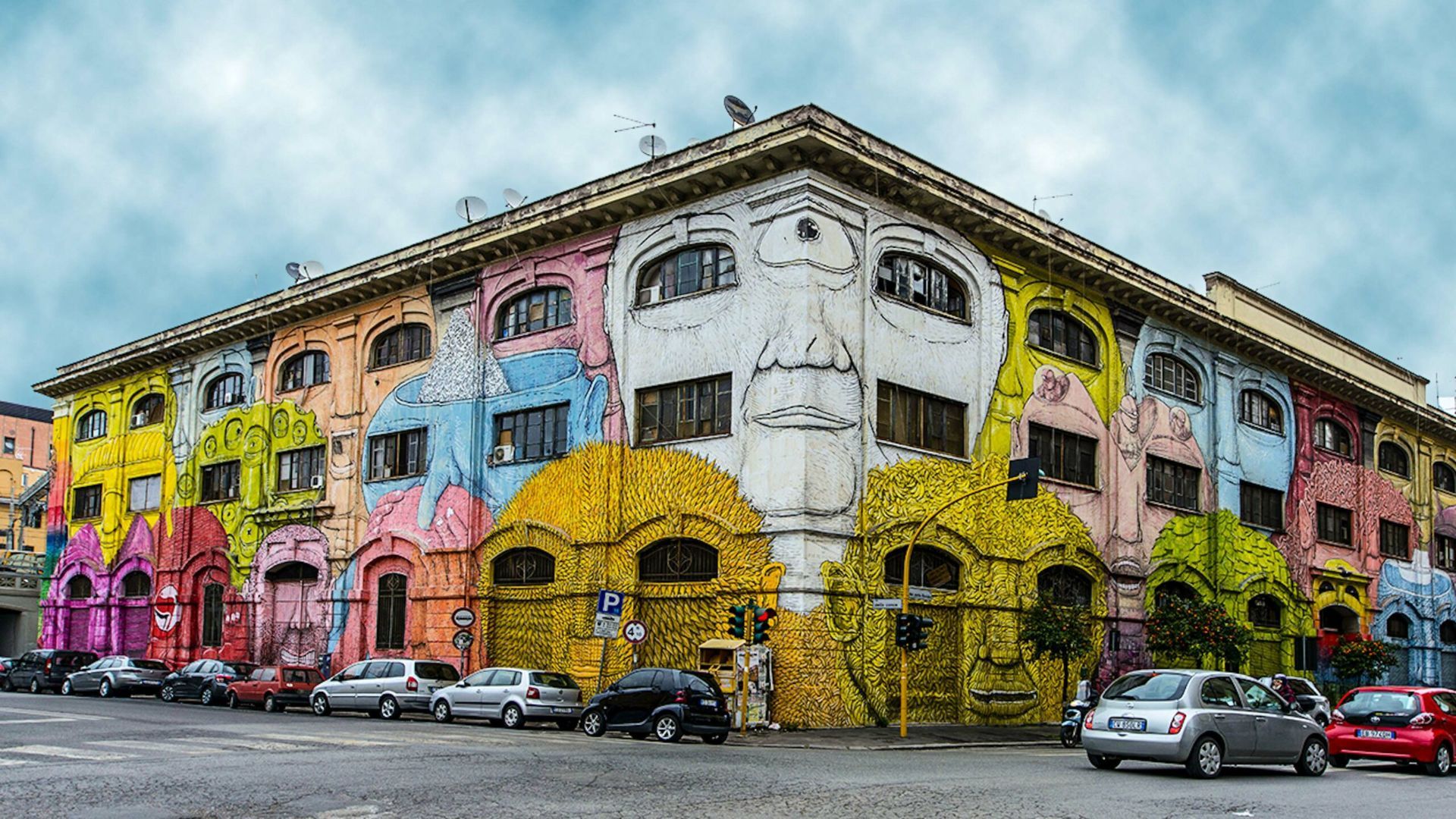
## Description Ostiense in Rome is a neighborhood that quietly combines industrial history, creative reinvention, and a growing street-art scene. Long overlooked in favor of the city’s classical core, Ostiense has become a canvas for large-scale murals, community art projects, and cultural venues that repurpose former warehouses and factories. The area’s atmosphere is energetic and contemporary—the kind of place where gritty, working-class textures meet curated cafes, design-driven restaurants, and cultural centers. One lesser-known detail: many of the murals and public artworks here are the result of organized collaborations between international and Italian artists, local associations, and municipal regeneration programs, meaning the pieces often reflect a distinct local voice rather than random tagging. Ostiense is also notable for nearby cultural institutions such as Centrale Montemartini—an arresting museum that juxtaposes classical sculpture with industrial architecture—as well as evolving food halls and waterfront promenades that add to the neighborhood’s appeal. The daily rhythm here is different from Rome’s historic center: it’s more local, less hurried, and often the setting for pop-up markets, gallery openings, and late-night dining. ## Location Ostiense lies south of Rome’s historic center, adjacent to Stazione Ostiense and the Gasometro area. The neighborhood is easily reachable by metro (Piramide station on Line B), regional trains, and buses, making it convenient for travelers who want to pair a visit with nearby attractions or evening dining options. ## Tips - Walk the streets deliberately and allow time for visual discoveries—large murals and hidden installations are often tucked down industrial lanes. - Consider a guided street-art tour to gain context on the murals, the artists, and the local regeneration efforts that funded them. - Combine visits with cultural stops: Centrale Montemartini, the former Gasometro, and nearby food markets offer a rounded itinerary. - Respect private property and photograph from public sidewalks—some murals occupy private building facades. - Best times: weekday afternoons for quieter explorations, and early evenings for the dining scene; weekends may have markets and events. ## Conclusion Ostiense offers a living gallery of contemporary street art woven into an urban tapestry of industrial heritage and modern cultural life. For travelers who appreciate street art, creative urban renewal, and a less-touristed side of Rome, Ostiense is a rewarding stop that captures both local momentum and adventurous city-making. ## FAQ Q: Are Ostiense’s murals permanent? A: Many are long-term projects, but street art can be transient—check local galleries or tour operators for the most current highlights. Q: Are guided street-art tours available? A: Yes; several local guides and cultural organizations run walking tours that explain the art, artists, and history behind the works. Q: Is Ostiense safe to visit at night? A: Generally yes—areas around the train station and main streets are lively at night, though standard urban caution is advised in quieter lanes. Q: Can I photograph the murals? A: Absolutely; murals in public spaces are typically fine to photograph—avoid obstructing traffic or private entrances while shooting. Q: What else is nearby to pair with an Ostiense visit? A: Centrale Montemartini, food halls, and the riverside promenade are excellent nearby additions. ## Links - [Ostiense](https://www.partir-a-rome.com/quartiers-rome/ostiense-tor-marancia)
GemVoyage Team • World
Prague
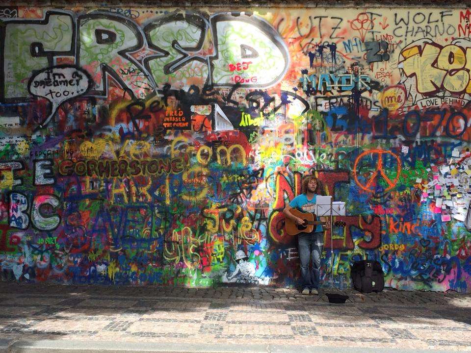
## Description The Lennon Wall in Prague is more than just a colorful stretch of graffiti—it’s a living canvas of freedom, peace, and artistic expression. Located in the historic Malá Strana district, this wall has been a symbol of resistance and hope since the 1980s. After the assassination of John Lennon in 1980, an anonymous artist painted his portrait and lyrics from Beatles songs on the wall. What followed was a spontaneous outpouring of messages, poems, and protest art, especially from Czech youth who saw Lennon as a symbol of Western ideals and freedom during the oppressive communist regime. Over the years, the wall has evolved into a dynamic, ever-changing mural. Layers of paint have buried the original artwork, but the spirit remains. Today, it features vibrant messages of love, peace, and solidarity, often reflecting global movements and local causes. Though the wall is now semi-regulated—with spray painting banned and only designated areas open to public contributions—it continues to attract artists and visitors from around the world. A little-known fact: the wall is owned by the Sovereign Military Order of Malta, whose nearby buildings include a church and embassy. Until 2019, anyone could freely paint on the wall, but due to misuse, it’s now monitored by CCTV and curated by selected artists. ## Location The Lennon Wall is located in **Czechia (Czech Republic)**, in the **Prague Region**, within the city of **Prague**. Specifically, it sits in **Velkopřevorské náměstí (Grand Priory Square)** in the **Malá Strana** neighborhood, just a short walk from the iconic Charles Bridge. ### How to Get There: - **By Foot**: From Charles Bridge, it’s a 5-minute walk through the charming streets of Malá Strana. - **By Tram**: Take tram lines 12, 15, 20, or 22 to Malostranské náměstí, then walk toward the French Embassy. - **By Metro**: The nearest metro station is Malostranská (Line A), followed by a short walk. - **By Bus**: Bus line 194 stops at Malostranské náměstí, close to the wall. Its central location makes it an easy and worthwhile stop on any Prague itinerary. ## Tips for Visitors To make the most of your visit to the Lennon Wall, keep these tips in mind: - **Visit Early or Late**: The wall gets crowded during midday, especially with tour groups. Early morning or evening offers a quieter experience. - **Bring a Marker**: While spray painting is banned, you can still leave a message with a marker in designated areas. - **Respect the Art**: Avoid defacing existing artwork. The wall is a shared space for expression, not vandalism. - **Pair with Nearby Attractions**: Combine your visit with a stroll through Kampa Island or a walk across Charles Bridge. - **Photography**: The wall changes frequently, so it’s a great spot for unique photos. Look for Beatles lyrics or peace symbols hidden among the layers. - **Learn the History**: Guided walking tours often include the Lennon Wall and provide deeper insight into its role during the communist era. ## Conclusion The Lennon Wall in Prague is a vibrant testament to the power of art and free expression. Born from grief and rebellion, it has grown into a global symbol of peace, creativity, and resilience. Whether you're a Beatles fan, a history buff, or simply a curious traveler, the wall offers a colorful and meaningful experience in the heart of Prague. ## FAQ **1. Is there an entrance fee to visit the Lennon Wall?** No, the wall is in a public square and free to visit. **2. Can I paint on the Lennon Wall?** Spray painting is banned, but you can leave messages with markers in designated areas. **3. What is the significance of the Lennon Wall?** It began as a tribute to John Lennon and became a symbol of protest against the communist regime in Czechoslovakia. **4. How often does the wall change?** Constantly. New artwork and messages appear regularly, making each visit unique. **5. Is the wall monitored?** Yes, it’s under CCTV surveillance to prevent vandalism and ensure respectful contributions. **6. What else is nearby?** Charles Bridge, Kampa Island, and the French Embassy are all within walking distance. ## Links - [Lennon Wall – Wikipedia Overview](https://en.wikipedia.org/wiki/Lennon_Wall) - [Prague Tourist Information – Lennon Wall Guide](https://praguetouristinformation.com/en/sightseeing/lesser-town/john-lennon-wall)
GemVoyage Team • World
Tanzania
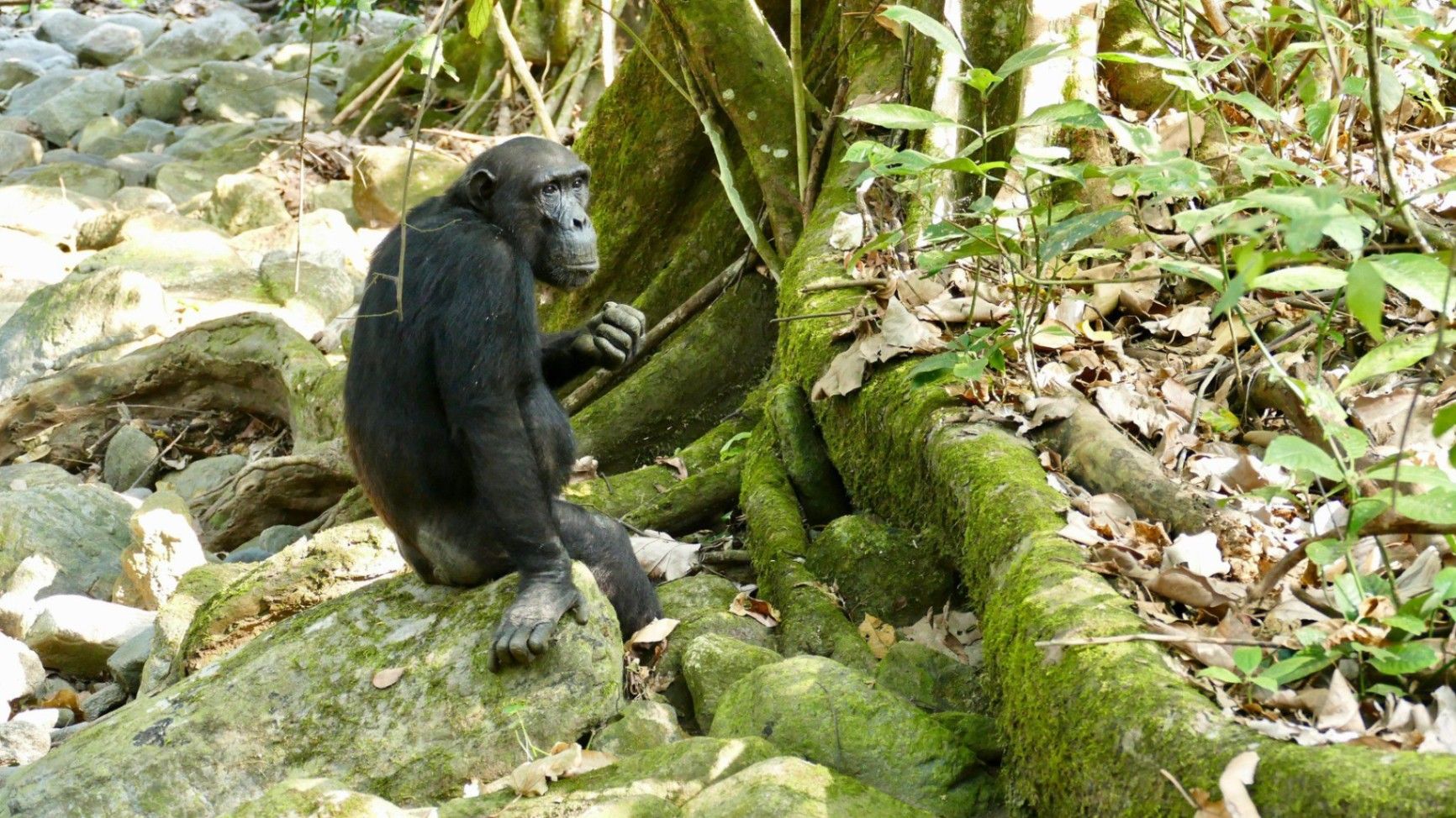
## Description Nestled on the remote eastern shores of **Lake Tanganyika**, the **Mahale Mountains National Park** is one of **Tanzania’s most untouched and magical wilderness areas**. Famous for its **wild chimpanzee population**, pristine forests, and turquoise waters, this park offers an experience unlike any other in Africa — where jungle-clad mountains meet one of the world’s oldest and deepest lakes. Covering over **1,600 square kilometers**, Mahale Mountains National Park lies at the crossroads of **rainforest, savanna, and miombo woodland**, creating a spectacularly diverse ecosystem. Its landscape is dominated by the dramatic **Mahale Mountain Range**, with **Mount Nkungwe** — the highest peak — rising to 2,462 meters above sea level. The park is most renowned for being home to one of the **largest known communities of wild chimpanzees**, with around **800 individuals**. Visitors have the rare opportunity to **trek into the forest** and observe these intelligent primates in their natural habitat — grooming, feeding, and socializing just a few meters away. The **Mimikire community** of chimps has been studied since the 1960s by Japanese researchers, making Mahale a world center for primate research and conservation. Beyond the chimpanzees, Mahale is a haven for **biodiversity**. The park shelters **leopards, bushbucks, red colobus monkeys, blue duikers, warthogs**, and hundreds of **bird species**. The crystal-clear waters of **Lake Tanganyika**, bordering the park to the west, are home to over **250 species of cichlid fish**, many found nowhere else on Earth. One of Mahale’s most fascinating aspects is its isolation — there are **no roads inside the park**. Access is only by **boat or plane**, ensuring that the park remains wild and unspoiled. Visitors walk along forest trails, wade across rivers, and travel by dhow or motorboat, surrounded by breathtaking scenery and deep tranquility. A lesser-known fact is that the area is the **ancestral home of the Tongwe people**, who once lived in the forest and practiced traditional customs linked to nature and the spirits of the mountains. Some cultural heritage still survives, adding a layer of human history to Mahale’s natural beauty. With its mix of adventure, serenity, and ecological wonder, **Mahale Mountains National Park** is a destination for those seeking a **genuine wilderness experience** — where you can track chimpanzees in the morning, swim in the world’s longest freshwater lake in the afternoon, and watch the sun set behind the Congo mountains in the distance. ## Location **Mahale Mountains National Park** is located in **western Tanzania**, along the **eastern shore of Lake Tanganyika**, opposite the **Democratic Republic of the Congo**. **Coordinates:** Approximately 6°S, 30°E To get there: * **By air:** The most convenient way is by **charter flight** from **Arusha, Dar es Salaam, or Kigoma** to the **Mahale airstrip**, followed by a **boat transfer** (typically 1–2 hours) to your lodge or campsite. * **By boat:** From **Kigoma**, you can take a **boat or dhow** along Lake Tanganyika, which takes between **6–10 hours** depending on the vessel. * **By road and boat (adventurous option):** Drive from **Kigoma** to **Kagunga village** (about 3–4 hours), then continue by boat to Mahale. Because of its remoteness, Mahale is best visited as part of a planned safari itinerary with **arranged transport and accommodation** through a tour operator or lodge. ## Tips * **Plan ahead:** Due to its remote location, logistics can be complex — book accommodation and flights well in advance. * **Chimp trekking:** The best time to see chimpanzees is during the **dry season (May to October)** when they stay closer to the lower slopes. * **Fitness required:** Trekking can involve steep and humid trails; wear comfortable shoes, long pants, and bring plenty of water. * **Stay several days:** Allow at least **3–4 nights** to enjoy chimp tracking, lake swimming, and forest hikes. * **Bring lightweight clothing:** The climate is tropical, but evenings near the lake can be cooler. * **Malaria precautions:** Use repellent and consult your doctor before travel — Mahale is a tropical zone. * **No roads, no crowds:** Be prepared for total disconnection — there is limited electricity and no phone signal in most areas. * **Combine with Katavi National Park:** Many travelers pair Mahale with nearby **Katavi**, another remote gem known for its wildlife-filled plains. ## Conclusion The **Mahale Mountains National Park** is one of Africa’s last true wildernesses — a place of **raw beauty and profound peace**. From tracking wild chimpanzees through lush forests to swimming in the crystal-clear waters of Lake Tanganyika, every moment in Mahale feels extraordinary. Its isolation ensures that it remains a haven for both wildlife and travelers seeking solitude. Visiting Mahale is not just a safari — it’s a **journey into the heart of nature**, untouched and unforgettable. ## FAQ **1. What is Mahale Mountains National Park famous for?** It’s best known for its **wild chimpanzees** and stunning **mountain–lake scenery**. **2. How many chimpanzees live in the park?** Around **800 individuals**, including the well-studied **Mimikire community**, habituated to human presence. **3. How do I reach Mahale?** Most visitors arrive by **charter flight** from **Arusha, Dar es Salaam, or Kigoma**, followed by a **boat transfer** to their lodge. **4. When is the best time to visit?** The **dry season (May–October)** is ideal for chimpanzee tracking, while **November–April** brings lush scenery and birdlife. **5. Are there accommodations inside the park?** Yes — there are a few **exclusive lodges and tented camps** along Lake Tanganyika’s shores, such as **Greystoke Mahale** and **Kungwe Beach Lodge**. **6. What other animals can be seen?** Besides chimpanzees, the park is home to **leopards, bushpigs, red colobus monkeys, giant squirrels**, and **hundreds of bird species**. **7. Can visitors swim in Lake Tanganyika?** Yes — it’s safe for swimming and snorkeling near the lodges, with **exceptionally clear freshwater** and tropical fish. ## Links * [Tanzania National Parks Authority – Mahale Mountains](https://storymaps.arcgis.com/stories/4bf12795a5b44f3482b580e692c465a4)
GemVoyage Team • World
Zagreb
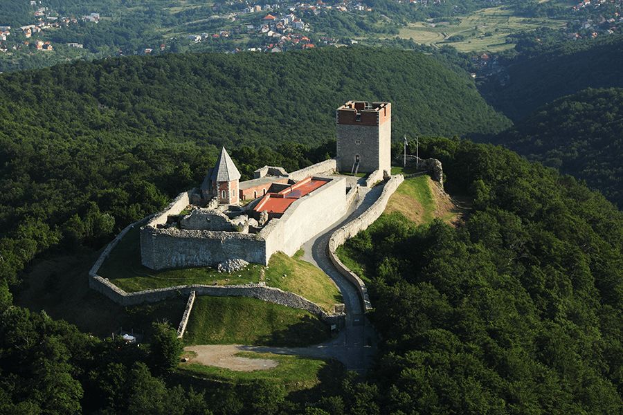
## Description Medvedgrad is a medieval fortress perched high on the southern slopes of Mount Medvednica, overlooking the city of Zagreb. Built in the 13th century following the Mongol invasion of the region, the fortress was designed as a defensive stronghold and later developed into a noble residence. Today, Medvedgrad stands as a powerful symbol of Croatian history, resilience, and national identity, offering visitors both historical insight and sweeping views of the surrounding landscape. What makes Medvedgrad unique is its dramatic setting and layered past. The fortress features preserved walls, towers, courtyards, and chapels that reveal how medieval life and defense were organized. A little-known fact is that Medvedgrad was abandoned relatively early, partly due to repeated earthquakes and difficulties accessing water on the hilltop. Another lesser-known detail is the presence of the “Altar of the Homeland,” a modern memorial within the fortress complex dedicated to Croatian independence, blending medieval heritage with contemporary national symbolism. Walking through Medvedgrad allows visitors to step back in time while also enjoying panoramic views over Zagreb and, on clear days, far beyond. ## Location Medvedgrad is located in **Croatia**, in the **City of Zagreb**, on **Mount Medvednica**, just north of the city center. The fortress sits above the neighborhood of Šestine, surrounded by forested hills and hiking trails. Visitors can reach Medvedgrad by car, taxi, or on foot via marked hiking paths from nearby neighborhoods or Medvednica Nature Park. Driving is the most convenient option, with parking available near the site, followed by a short walk. For those who enjoy outdoor activities, hiking up to Medvedgrad is a popular choice and offers scenic views along the way. ## Tips * Wear comfortable shoes, especially if you plan to hike or explore uneven stone surfaces. * Visit on a clear day to fully enjoy the panoramic views of Zagreb and the surrounding countryside. * Allow time to explore the interior exhibition spaces, which provide historical context. * Bring water and sun protection, particularly during warmer months. * Combine your visit with a walk or picnic in Medvednica Nature Park. * Check opening hours in advance, as they may vary by season. ## Conclusion Medvedgrad is a striking blend of medieval history, natural beauty, and national symbolism. Its hilltop location, well-preserved ruins, and scenic views make it one of Zagreb’s most rewarding attractions for history enthusiasts and nature lovers alike. ## FAQ **When was Medvedgrad built?** The fortress was constructed in the mid-13th century after the Mongol invasion of the region. **How long does a visit take?** Most visitors spend one to two hours exploring the fortress and enjoying the views. **Is Medvedgrad suitable for children?** Yes, though children should be supervised due to uneven terrain and high walls. **Is there an entrance fee?** Yes, a modest entrance fee is usually required to access the site. **Can I hike to Medvedgrad?** Yes, several marked hiking trails lead to the fortress from nearby areas. ## Links * [Medvedgrad Official Information](https://www.medvedgrad.hr) * [Zagreb Tourist Board](https://www.infozagreb.hr/hr)
GemVoyage Team • World

Comments