GemVoyage Team • World
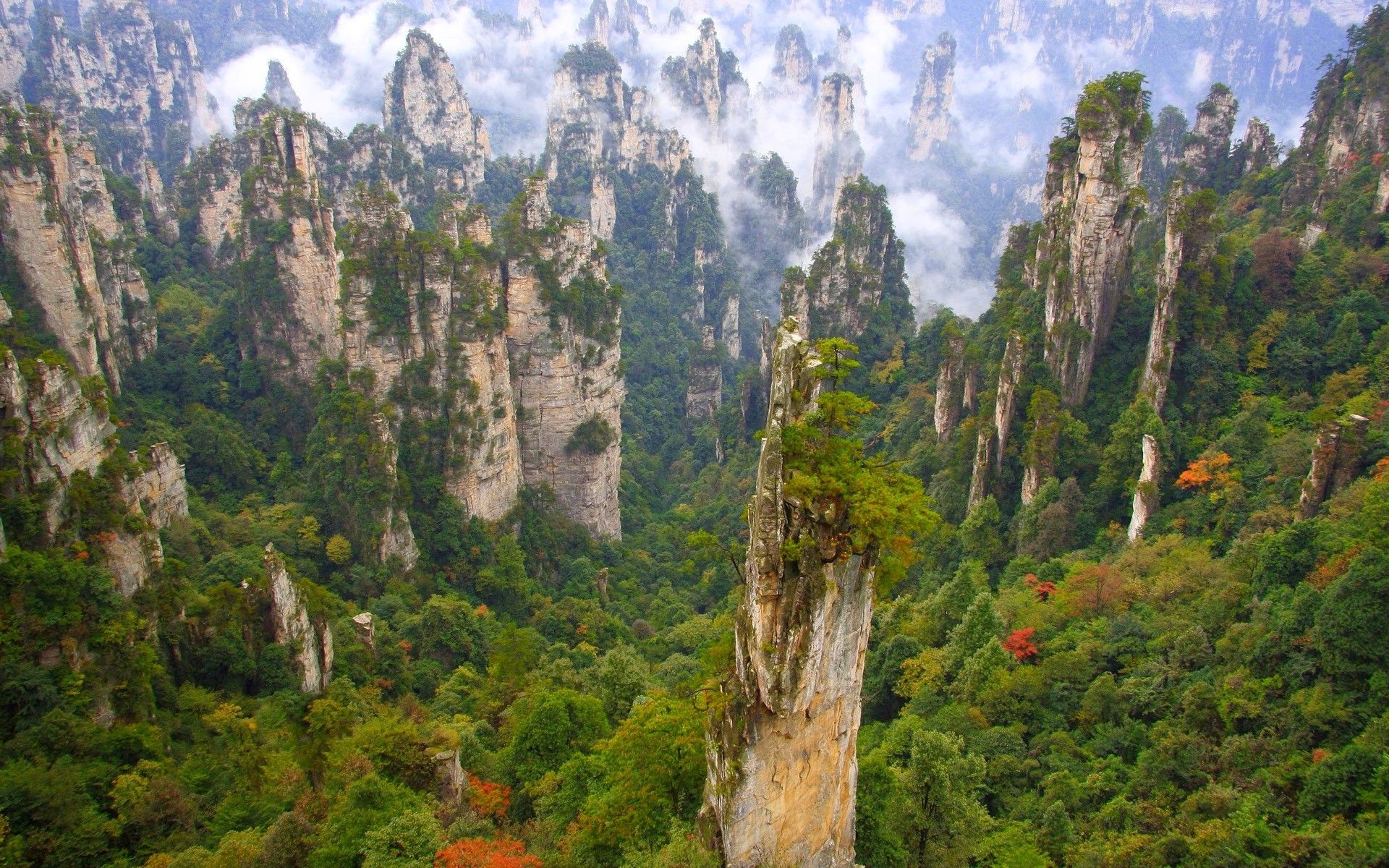
The area’s allure is its scale and verticality: narrow natural bridges, deep ravines, and needle-like pillars draped in evergreen vegetation create a sense of being dwarfed by primeval geometry. A network of footpaths, glass walkways, cable cars and elevators lets visitors move through different elevations to appreciate viewpoints and remote valleys. Wulingyuan comprises several distinct sub-areas including Zhangjiajie National Forest Park, Suoxiyu Nature Reserve, and Tianzi Mountain, each with signature vantage points and trails.
Wulingyuan is an immersive mosaic of vertical landforms and biodiverse temperate forests. The interplay between rock, vegetation and mist creates atmospheric conditions that shift hourly, offering photographers and hikers a constantly changing tableau. The park's infrastructure — from the high skywalks to rock-cut staircases — helps visitors access dramatic overlooks that would otherwise require arduous climbs, but there are still plenty of routes for travelers who prefer quieter, off-the-beaten paths. Birdlife, small mammals and a variety of endemic plants add ecological interest; in certain seasons wildflowers carpet the valley floor while winter brings frosted pinnacles that refract morning light.
Planning matters: popular viewpoints can be crowded during national holidays and summer weekends, and logistics such as cable-car lines and internal shuttle flows are part of the visiting experience. For those seeking solitude, early mornings, shoulder seasons and walking lesser trails can reveal the park's raw character with fewer people. Local towns provide convenient bases with accommodations, and combining a stay in Zhangjiajie with nearby rural villages or other Hunan attractions creates a richer regional itinerary.
Transport within the scenic area often relies on park shuttle buses, cable cars and walking paths. Timetables can vary by season, so allow buffer time in itineraries and consider guided day trips if you prefer efficient routing across multiple highlights. Hotels in Zhangjiajie town range from budget to upscale and can coordinate tickets, transfers and optional guided hikes.
The many faces of Wulingyuan — from misty dawn to sunlit pinnacles and frosted winter ridgelines — make it a destination that rewards repeat visits and patient observation. Thoughtful planning and off-peak travel can turn a crowded attraction into a personal experience of primeval vertical landscapes.
Discover more hidden gems you might love.
Copenhagen
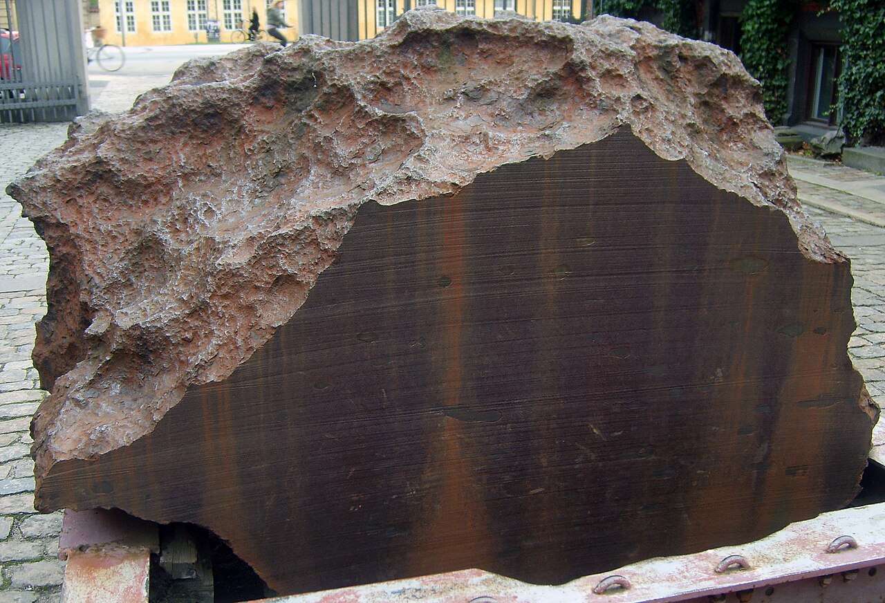
## Description Agpalilik is not your typical museum exhibit—it’s a colossal fragment of an iron meteorite that fell to Earth thousands of years ago and now rests quietly outside the Natural History Museum of Denmark in Copenhagen. Weighing approximately 20 tons, this massive chunk of extraterrestrial metal is part of the Cape York meteorite, one of the largest iron meteorites ever discovered. Its sheer size and origin make it a fascinating and humbling sight for visitors. Discovered in 1963 on the Agpalilik Peninsula in northwestern Greenland by Danish geologist Dr. Vagn Buchwald, the meteorite was later transported to Denmark for study and public display. What makes Agpalilik especially compelling is its connection to the Inuit people, who used fragments of the Cape York meteorite for centuries to craft tools and weapons. The meteorite was a vital resource in a region where metal was otherwise scarce. A little-known fact: Agpalilik is one of several fragments from the Cape York meteorite shower. Others, like the famous “Ahnighito” (weighing 31 tons), are housed in the American Museum of Natural History in New York. Agpalilik’s surface still bears the marks of its long journey through space and its time buried under Greenland’s icy terrain, making it a rare opportunity to see a nearly untouched piece of the cosmos. ## Location Agpalilik is located in **Denmark**, in the **Capital Region**, within the **city of Copenhagen**. It sits just outside the entrance of the Natural History Museum of Denmark, which is part of the University of Copenhagen’s Botanical Garden complex. ### How to Get There - **By Metro**: Take the M1 or M2 line to Nørreport Station. From there, it’s a short walk to the museum. - **By Bus**: Several bus lines, including 5C and 6A, stop near Nørreport Station and the Botanical Garden. - **By Foot or Bike**: If you’re exploring central Copenhagen, the museum is easily accessible on foot or by bicycle. - **By Car**: Parking is limited in the area, so public transport is recommended. Its central location makes it an easy and worthwhile stop during a day of sightseeing in Copenhagen. ## Tips - **Visit During Daylight**: Agpalilik is displayed outdoors, so daylight hours offer the best viewing conditions. - **Pair with a Museum Visit**: Combine your visit with a tour of the Natural History Museum or a walk through the Botanical Garden. - **Touch the Meteorite**: Unlike many museum pieces, Agpalilik is accessible—you can touch a real piece of space rock. - **Read the Plaque**: Don’t miss the informative plaque that explains the meteorite’s origin and significance. - **Bring a Camera**: The meteorite’s texture and scale make for great photos, especially with the museum’s architecture in the background. - **Check for Events**: The museum occasionally hosts astronomy-themed events and lectures that complement a visit to Agpalilik. ## Conclusion Agpalilik is a rare and awe-inspiring encounter with a piece of our solar system’s history. Nestled in the heart of Copenhagen, this massive meteorite fragment offers a tangible connection to space, science, and the cultural heritage of Greenland’s Inuit communities. ## FAQ **1. Is there an entrance fee to see Agpalilik?** No, Agpalilik is displayed outside the museum and can be viewed for free. **2. Can I touch the meteorite?** Yes, visitors are allowed to touch the surface of Agpalilik. **3. What is the best time to visit?** Daytime visits are best, especially in good weather, as the meteorite is outdoors. **4. Is Agpalilik part of a larger exhibit?** While it stands alone outside, it complements the museum’s geological and astronomical exhibits inside. **5. How long should I plan for the visit?** Viewing Agpalilik takes about 15–30 minutes. Combine it with a museum tour for a longer experience. **6. Is it suitable for children?** Yes, children often find the meteorite fascinating, especially when they learn it came from space. ## Links - [Natural History Museum of Denmark – Official Website](https://snm.ku.dk/english/)
GemVoyage Team • World
Copenhagen
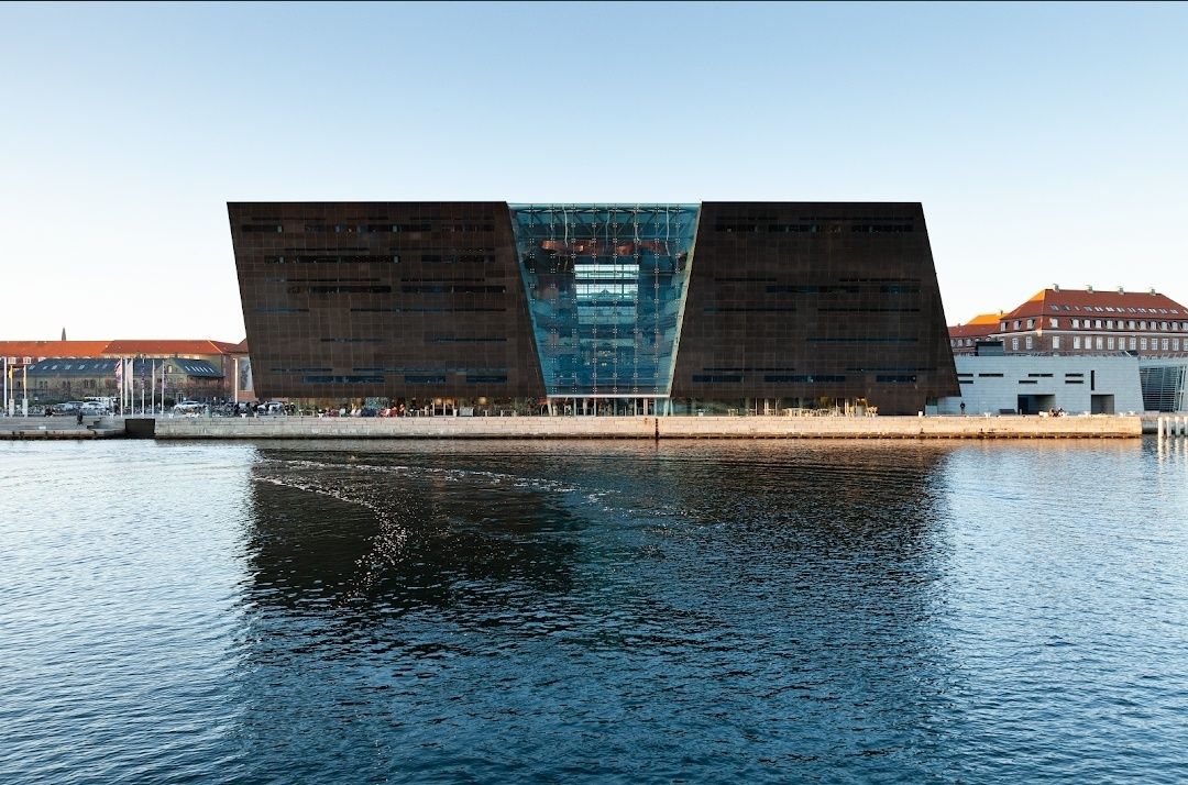
## Description The **Royal Library in Copenhagen**, also known as **Det Kongelige Bibliotek**, is one of Denmark’s most prestigious cultural landmarks and the largest library in the Nordic countries. Founded in 1648 by King Frederik III, the library houses an extraordinary collection of books, manuscripts, maps, photographs, and historical documents that trace the cultural and intellectual evolution of Denmark and beyond. One of the most striking features of the library is the **Black Diamond**, a modern extension completed in 1999. With its sleek black granite façade reflecting the Copenhagen waterfront, the Black Diamond has become an architectural icon blending tradition with modernity. Inside, visitors find an impressive atrium, reading rooms, exhibition halls, and even a concert hall, making it more than just a library—it is a cultural hub. A little-known fact is that the library holds nearly **all works ever printed in Denmark** since the 17th century, thanks to a legal deposit law. Another fascinating detail is its collection of **rare manuscripts**, including original works by Hans Christian Andersen and Søren Kierkegaard. For book lovers, scholars, and travelers with a passion for culture, the Royal Library offers an unparalleled journey through knowledge and history. ## Location The Royal Library is located in **Copenhagen**, the capital of **Denmark**, situated in the **Zealand region**. The library stands prominently along the **Slotsholmen waterfront**, close to many other historic landmarks, including Christiansborg Palace. Getting there is easy. From the **Copenhagen Central Station**, it’s about a 15-minute walk or a short bus ride. Bicycles are also a popular and convenient option, given the city’s bike-friendly infrastructure. For those arriving by metro, the closest stop is **Christianshavn Station**, which is about a 10-minute walk from the library. Visitors can also arrive by boat, as the Black Diamond has its own harbor bus stop. ## Tips Here are some practical tips to make the most of your visit to the Royal Library in Copenhagen: * **Explore both sections** – Don’t miss the contrast between the historic library building and the modern Black Diamond extension. * **Check exhibitions** – The library frequently hosts exhibitions on art, history, and literature, many of which are free to enter. * **Visit the café** – The Black Diamond Café offers stunning views of the waterfront and is a great spot to relax. * **Attend a concert or lecture** – The library’s concert hall hosts performances and talks, adding an extra cultural dimension to your visit. * **Photography** – While photos are allowed in public spaces, avoid photographing in reading rooms to respect the quiet environment. * **Plan for quiet time** – The library is not just a tourist attraction but also a working library, so visitors should maintain a respectful silence in designated areas. ## Conclusion The **Royal Library in Copenhagen** is more than a place to store books—it is a blend of history, culture, and modern design. With its extensive collections, striking architecture, and cultural events, it offers something for scholars, tourists, and casual visitors alike. Whether you’re drawn by the rare manuscripts, the iconic Black Diamond, or the peaceful reading halls, the Royal Library stands as a testament to Denmark’s dedication to knowledge and cultural heritage. ## FAQ **1. What is the Royal Library in Copenhagen famous for?** It is known for being the largest library in the Nordic countries, housing rare manuscripts, and for its modern Black Diamond extension. **2. Can tourists visit the Royal Library?** Yes, the library is open to the public, and visitors can explore exhibitions, the café, and parts of the building, even without a reader’s card. **3. Is there an entry fee?** General entry is free, though some special exhibitions and events may require a ticket. **4. How much time should I spend at the Royal Library?** A typical visit can take 1–2 hours, though book enthusiasts and exhibition visitors may spend longer. **5. What manuscripts are kept in the Royal Library?** The collection includes works by Hans Christian Andersen, Søren Kierkegaard, medieval manuscripts, and countless rare historical documents. **6. When is the best time to visit?** Weekday mornings are ideal for a quieter experience, while afternoons often bring a livelier atmosphere with events and exhibitions. ## Links * [Royal Library Official Website](https://www.kb.dk) * [Visit Copenhagen – Official Tourism Site](https://www.visitcopenhagen.com)
GemVoyage Team • World
Mexico City
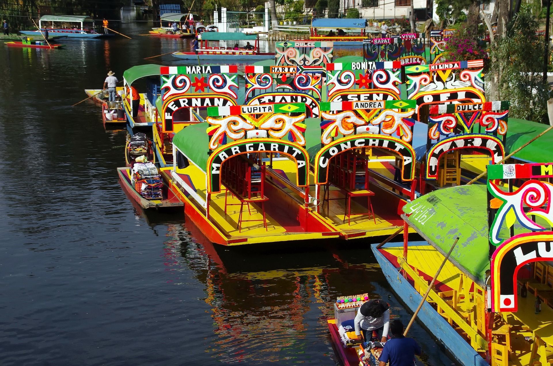
## Description The Xochimilco Canals are one of Mexico City’s most distinctive attractions because they preserve a living relationship between water, agriculture, celebration, and community. Unlike a standard sightseeing canal ride, Xochimilco offers a colorful world of trajineras, music, food, and floating movement through a landscape that reflects centuries of adaptation. It is one of the few places in the capital where visitors can still feel the legacy of the lake system that once defined the Valley of Mexico. What makes Xochimilco so special is that it is both scenic and cultural. A ride along the canals is visually lively, with brightly painted boats, vendors drifting by, musicians performing, and families and friends gathering for celebrations. At the same time, the area connects to the ancient chinampa system, a form of raised agricultural landscaping that has long been admired for its ingenuity. A lesser-known fact is that these canals are among the last surviving remnants of the pre-Hispanic water landscape of the valley. That makes a visit more than entertainment; it is a window into a surviving historical ecosystem. Another little-known detail is that Xochimilco is not just a tourist attraction but also a place with ongoing local life and ecological importance. The canals and surrounding fields continue to matter to residents, farmers, and conservation efforts. That is why the experience can feel so layered. You are not simply on a boat ride. You are moving through a landscape where heritage, tourism, and environmental questions meet. For many travelers, Xochimilco is memorable because of its atmosphere. It can be playful, crowded, musical, and festive, but it can also be surprisingly reflective if you visit at a calmer time. It is one of those places where the experience changes depending on the hour, the weather, and the energy on the water that day. Because of that, it works well for visitors who enjoy local color and are willing to let an outing unfold at a slower, more social pace. ## Location The Xochimilco Canals are in the Xochimilco borough of southern Mexico City, Mexico. The area is well known throughout the capital and can be reached from central Mexico City by public transport, taxi, or rideshare. One of the most common ways to get there is by taking the light rail system toward Xochimilco and then continuing to the canal departure points. Once you arrive, boats depart from designated embarcaderos. If it is your first time, that is the easiest structure to follow because the canals themselves are extensive and the boat-launch area is where the visitor experience starts. Because the area is farther from the center than some other attractions, plan Xochimilco as its own excursion rather than a quick add-on. That gives you enough time to enjoy the canal ride, food, and atmosphere without rushing back and forth across the city. ## Tips Go with a group if possible, because trajineras are more enjoyable when you can share the cost and the atmosphere. Even if you travel solo or as a couple, the social nature of the experience is a big part of the appeal. Bring cash for boat rental, food, drinks, and optional music. It is easier to enjoy the outing if you are prepared for small on-the-spot purchases. Choose the time of day carefully. Earlier visits can feel calmer, while later outings often become livelier and more festive. Pick the mood you want before you go. Respect the local environment and the people who live and work there. Xochimilco is a heritage landscape, not just a party venue, and a more considerate visit tends to be a better one. ## Conclusion Xochimilco Canals are one of Mexico City’s most unforgettable experiences, blending history, ecology, and celebration on the water. They are ideal for travelers who want something colorful, local, and unlike any conventional city attraction. ## FAQ **What are the Xochimilco Canals famous for?** They are famous for trajineras, festive boat rides, and their connection to the ancient chinampa system. **How do I get there?** The most practical options are public transport to Xochimilco followed by a short transfer to the canal departure points. **Is it only for parties?** No. While it can be lively, it is also a heritage site with agricultural and ecological importance. **How long should I plan for a visit?** A few hours is ideal so you can enjoy the boat ride without feeling rushed. **Is it worth visiting if I have limited time in Mexico City?** Yes, especially if you want a memorable local experience that is different from museums and monuments. ## Links - [UNESCO World Heritage information](https://whc.unesco.org/en/list/412/) - [Wikipedia](https://en.wikipedia.org/wiki/Xochimilco)
GemVoyage Team • World
Barcelona
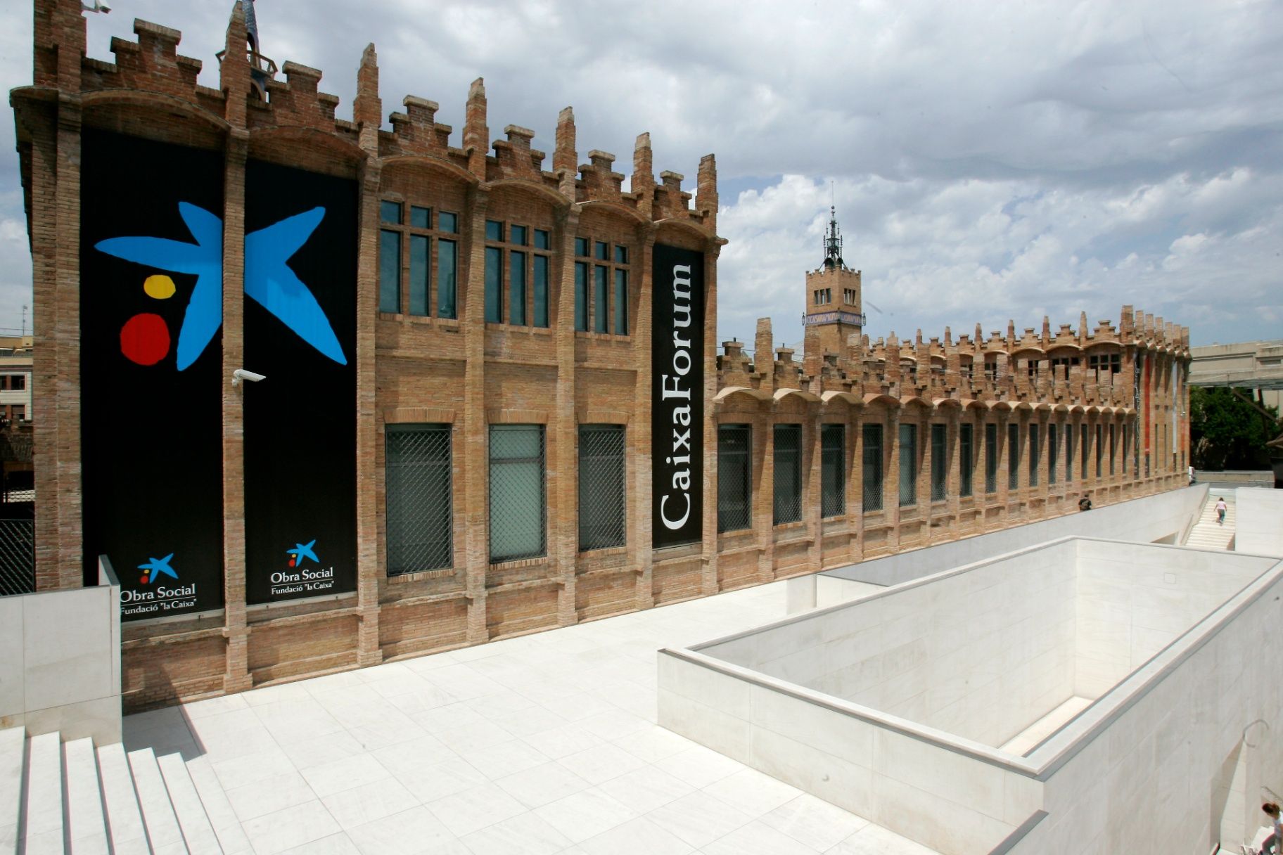
## Description **CaixaForum Barcelona** is one of the city’s most important cultural institutions, combining architecture, contemporary thought, and public education under one roof. It is housed in the former **Casaramona Textile Factory**, an early 20th-century industrial complex designed by the modernist architect Josep Puig i Cadafalch. Rather than demolishing the structure, it was carefully restored and repurposed, turning a once-abandoned factory into a vibrant center for exhibitions, debates, and artistic exploration. What makes CaixaForum Barcelona unique is its **programmatic diversity**. It is not a conventional museum with a permanent collection on display. Instead, it hosts a rotating schedule of high-quality temporary exhibitions covering art, photography, history, science, archaeology, music, and social issues. These exhibitions are often produced in collaboration with major international institutions, giving visitors access to works and ideas that rarely appear elsewhere in the city. Architecturally, the building itself is part of the experience. The red brick façades, sharp geometric volumes, and absence of ornamentation reflect a restrained form of Catalan modernism that contrasts with the more decorative style of Gaudí. A lesser-known fact is that the factory was originally built in 1911 but **never actually operated as an industrial plant**, as production ceased before it could fully open. Another interesting detail is the dramatic entrance plaza, redesigned by Japanese architect Arata Isozaki, which creates a striking dialogue between old and new through stone, steel, and light. Beyond exhibitions, CaixaForum functions as a **cultural forum in the literal sense**. It hosts lectures, film screenings, concerts, workshops, and family-oriented activities, making it appealing to a wide range of audiences. The institution emphasizes accessibility and education, aiming to make complex cultural topics understandable without oversimplifying them. ## Location **Country:** Spain **Region:** Catalonia **City:** Barcelona **District:** Sants-Montjuïc CaixaForum Barcelona is located at the foot of **Montjuïc Hill**, near Plaça d’Espanya, an area known for its concentration of museums, exhibition spaces, and monumental architecture. ### How to Get There * **By metro:** * Lines L1 (Red) or L3 (Green) to **Plaça d’Espanya** station. From there, it is a 5–7 minute walk. * **By bus:** * Several bus lines stop around Plaça d’Espanya and along Avinguda de Francesc Ferrer i Guàrdia. * **On foot:** * Easily reachable from Plaça d’Espanya and the surrounding exhibition grounds. * **By taxi:** * A convenient option if coming from other parts of the city; drop-off points are nearby. ## Tips * **Check the exhibition schedule in advance:** Exhibitions change regularly, and some are time-limited. * **Allow enough time:** One exhibition can easily take 90 minutes if explored thoroughly. * **Visit during weekdays:** Weekends tend to be busier, especially during popular exhibitions. * **Use the audio guides:** They provide context and depth without overwhelming the visitor. * **Combine with Montjuïc sights:** Pair your visit with nearby attractions such as museums or gardens. * **Look for free-entry times:** Certain days or time slots may offer reduced or free admission. ## Conclusion CaixaForum Barcelona is a cultural anchor that successfully bridges Barcelona’s industrial past with its intellectual present. Through its thoughtful exhibitions, adaptive architecture, and commitment to public engagement, it offers a meaningful alternative to traditional museums and rewards visitors seeking substance over spectacle. ## FAQ **1. Is CaixaForum Barcelona a museum?** It functions more as a cultural center with temporary exhibitions rather than a permanent museum collection. **2. How long does a visit usually take?** Most visitors spend between **1.5 and 3 hours**, depending on the exhibitions. **3. Is it suitable for children?** Yes, there are family-friendly exhibitions and interactive educational activities. **4. Are exhibitions available in multiple languages?** Yes, information panels and guides are usually available in Catalan, Spanish, and English. **5. Is the building accessible?** Yes, the center is fully accessible for visitors with reduced mobility. **6. Can you visit just for the architecture?** Yes, the building itself is worth seeing even without attending an exhibition. ## Links * [Official CaixaForum website](https://caixaforum.org/es/home)
GemVoyage Team • World
Lille
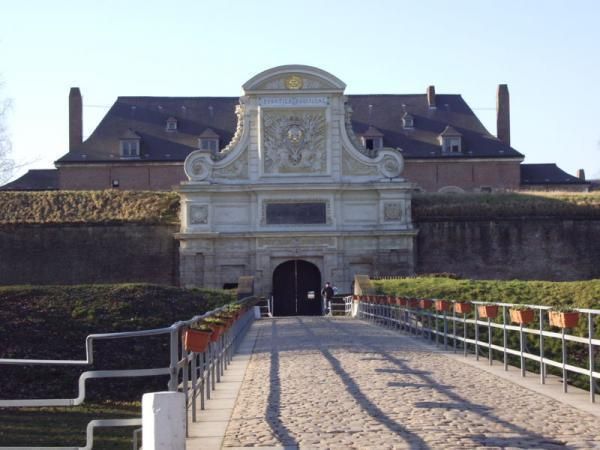
## Description The Citadel of Lille is one of the most impressive military structures in France and a major reason the city is often mentioned in discussions of European fortress design. Built in the 17th century under the direction of Vauban, the citadel is a star-shaped defensive complex that demonstrates both engineering precision and political ambition. It was intended to protect Lille after the city came under French control, and today it stands as a reminder of how military architecture could also shape a city's identity and landscape. What makes the citadel special is that it is not only technically significant but also visually elegant. Its geometric form, wide moats, robust bastions, and open green surroundings make it feel like a fortress designed by someone who understood both defense and urban order. Even if you are not deeply interested in military history, the citadel is compelling because of how it connects architecture, public space, and the natural environment. It is both a monument and a park-like setting, which gives it a very different feeling from densely built old-town landmarks. One little-known fact is that the Citadel of Lille is sometimes referred to as the "queen of citadels" because of its importance in Vauban's defensive system. Another detail many visitors miss is how well the structure fits into the modern city. Although originally conceived for warfare, the citadel now helps define a recreational and cultural zone where walking, cycling, family outings, and visits to nearby attractions all take place. That transformation from military stronghold to civic landmark is part of what makes the site interesting today. The citadel also helps visitors understand Lille's broader history. The city sat near contested borders for centuries, so fortifications were more than symbolic; they were necessary tools of survival and control. Standing at the citadel, you can sense the strategic value of the location and see how a military engineer like Vauban thought about terrain, sightlines, and access. For architecture lovers, history enthusiasts, and casual walkers alike, it is one of Lille's most rewarding destinations. ## Location The Citadel of Lille is in Lille, in the Hauts-de-France region of France, west of the historic center near the Deûle River and surrounding parkland. Its location makes it easy to combine with a broader exploration of Lille's old quarters, especially if you are already spending time around the city center. Unlike a fortress in a remote military zone, this citadel sits comfortably within the urban fabric while still feeling spacious. Getting there is simple by foot, bicycle, or local transport. If you are staying in central Lille, a walk to the citadel is pleasant and reveals how the city's layout changes as you move from dense streets to more open green space. Buses and taxis can also bring you close, but many visitors prefer to use the approach as part of a longer stroll. Because the citadel is surrounded by parks and walking routes, it works especially well as part of a relaxed day outdoors. You can combine it with the nearby zoo, river paths, or other west-side attractions if you want to make the most of the area. ## Tips Allow time for the surroundings as well as the fortress itself. The citadel's setting in parkland is one of its greatest strengths, and the experience improves when you treat it as part of a broader walk rather than a quick photo stop. If you are interested in military history, read a little about Vauban before visiting. His work shaped many French fortifications, and understanding his methods makes the citadel much more meaningful. Visit in good weather if you want to enjoy the outdoor environment fully. The site is enjoyable year-round, but clear conditions make the geometry and scale easier to appreciate. Bring comfortable shoes or use a bicycle if you plan to cover more of the surrounding area. The citadel fits naturally into an active day in Lille and is especially pleasant for travelers who enjoy a mix of history and open-air walking. ## Conclusion The Citadel of Lille is a landmark of French military architecture and a beautiful place to understand the strategic history of the city while enjoying one of its most open and pleasant landscapes. ## FAQ ### Who built the Citadel of Lille? It was designed by Vauban, the famous French military engineer, in the 17th century. ### Why is the citadel important? It is important because it is one of the best examples of Vauban's fortification work and a key part of Lille's historical defense. ### Can you visit the citadel today? Yes. The area is accessible and widely used for walking and recreation, though access may vary in specific sections. ### Is it close to Lille's city center? Yes. It is located west of the center and is easy to reach on foot or by local transport. ## Links - [Lille tourism](https://www.lilletourism.com/) - [Wikipedia article](https://en.wikipedia.org/wiki/Citadel_of_Lille)
GemVoyage Team • World

Myanmar
## Description Bagan is an ancient archaeological zone in central Myanmar where thousands of Buddhist temples, stupas and pagodas dot a broad dry plain along the Irrawaddy River. Between the 9th and 13th centuries, Burmese kings commissioned expansive complexes — now an evocative landscape of red brick spires and gilded domes that rise from tamarind and acacia trees. Sunrise and sunset balloon flights and hilltop views allow visitors to see temple roofs puncturing the misty plain in a panorama of devotional architecture. Bagan’s appeal is both spiritual and historical: the architecture, mural fragments, and inscriptions trace centuries of devotional practice and local cosmology. Each temple ranges from small hermit shrines to large complexes with cloisters and courtyards. Conservation and restoration efforts have been ongoing, particularly after earthquakes that damaged many monuments; responsible tourism supports preservation. Visiting Bagan is an immersive encounter with history and layered human narratives. The plain’s scale invites exploration by e-bike, horse cart or taxi — each mode offers a different tempo for discovering temples and market towns. Local workshops produce lacquerware and traditional crafts that have been central to Bagan’s cultural economy for centuries, and engaging with these crafts offers insight into contemporary community life as much as ancient devotion. Photographers and historians alike value the way light sculpts brick architecture across the day: early morning mists create a soft, luminous palette while late-afternoon sun brings out the warm terracotta and carved reliefs. Responsible visitation is essential. Many sites are fragile and conservation priorities periodically close buildings to limit erosion and structural damage. Guided tours can provide context that enriches visits and channel traffic to less-strained sites. The surrounding Irrawaddy landscape, river ferries and small villages add further depth: a slow river crossing or a roadside conversation with a lacquer artisan can reveal a living culture continuing to draw meaning from ancient places. ## Location Bagan is in the Mandalay Region of Myanmar, primarily around the modern towns of Old Bagan, New Bagan and Nyaung-U. Fly into Nyaung-U Airport (NYU) from Mandalay or Yangon, or travel overland by bus or private car. Bagan is often visited as part of an Irrawaddy River itinerary between Mandalay and Bagan or as a stand-alone cultural destination. Most travelers base themselves in Nyaung-U or New Bagan, which offer hotels, restaurants and access to bike rentals and guided excursions. Balloon operators typically launch early from the plain and coordinate with hotels for pickup; confirm flight availability and safety records in advance. Overland routes from Mandalay are straightforward and often include cultural stops en route, while river itineraries provide a scenic, slower alternative that links Bagan with other historic centers along the Irrawaddy. ## Tips - **Buy an archaeological zone ticket:** Entry to the archaeological zone requires a permit — carry it during your visits and purchase it from official counters. - **Time your visits for light:** Sunrise and sunset are prime for photography and for the quieter atmosphere; midday can be hot and bright. - **Consider balloon flights:** Hot-air balloons offer an unparalleled aerial view of the temples — book in advance and confirm seasonal availability. - **Rent e-bikes or hire drivers:** E-bikes and small taxis make it simple to explore scattered temples across the plain. - **Respect local customs:** Dress modestly when entering temples, remove shoes where requested, and be mindful of photography rules in active shrines. - **Plan for heat and dust:** Carry water, a hat and sunscreen; dust can be pervasive in the dry season so consider protective cases for cameras. - **Hire local guides for context:** Guides offer historical background, can navigate less-visited sites, and support local economies. - **Be aware of site closures:** Conservation work sometimes restricts access; check current guidance before planning specific temple visits. - **Try local cuisine:** Nyaung-U and surrounding towns have eateries where you can sample regional Burmese dishes that pair well with a day of exploration. ## Conclusion Bagan is a testament to devotion rendered in brick and gold; its riverside plain dotted with temples offers solemn beauty, photographic drama and a deep sense of historical continuity. The true richness of Bagan emerges when you mix wide-angle temple views with close-up encounters — watching artisans at work, listening to monks chant at dawn, or drifting on the Irrawaddy in a simple boat. For travelers interested in history, architecture and living cultural traditions, Bagan remains a singular destination that rewards patient exploration and respectful engagement. ## FAQ - **Q: Can you climb the temples?** - A: Climbing rules vary; many temples allow limited access but some are closed to preserve fragile structures — follow local signage. - **Q: Is ballooning available year-round?** - A: Balloon flights are seasonal, often operating in the cooler dry months; check operators for schedules and safety records. - **Q: How many days to explore Bagan?** - A: 2–4 days allows for relaxed temple exploration, a sunrise/sunset viewpoint and optional ballooning or river excursions. - **Q: Is it safe to ride e-bikes around the temples?** - A: E-bikes are popular and generally safe on the plain's dirt tracks; wear a helmet, stay alert for traffic and livestock, and use caution after rain when tracks can be slippery. - **Q: What is the best time of year to visit?** - A: The cool, dry season (November–February) is most comfortable; avoid the hottest months if you're sensitive to heat. - **Q: Are there restrictions on photography inside temples?** - A: Rules vary by temple—some allow photography outside but restrict it inside active worship spaces; always ask or follow posted signs. - **Q: Where can I buy authentic lacquerware?** - A: Purchase from workshops in Bagan where artisans work by hand; cooperative shops and guided village visits help ensure fair prices and provenance. ## Links - [Bagan — Wikipedia](https://en.wikipedia.org/wiki/Bagan)
GemVoyage Team • World

Comments