GemVoyage Team • World
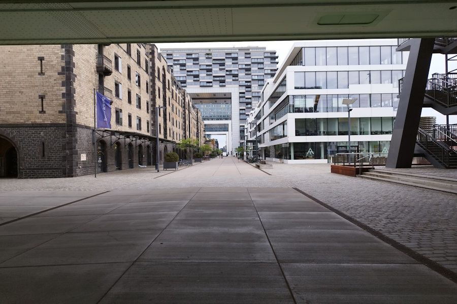
What makes Rheinauhafen particularly interesting is its balance of design ambition and pragmatic public access. The promenades invite walking and cycling; riverside cafés and small parks encourage lingering; and the architecture rewards both appreciation and photography. The transformation of the former harbor area into a mixed-use neighborhood has become one of Cologne's most visible examples of urban regeneration, and the district sits comfortably alongside the city's historic core.
Because Rheinauhafen is adjacent to major city sights, it functions well as an extension of a cultural itinerary—grab coffee or lunch here after a museum visit, or plan an evening walk to see the waterfront at sunset.
Discover more hidden gems you might love.
Malmö
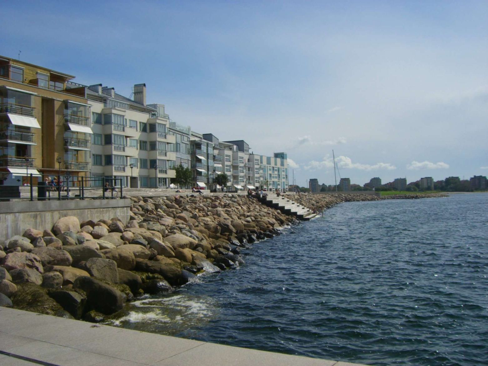
## Description Malmö’s promenades—particularly the waterfront walks in areas like **Sundspromenaden** in **Västra Hamnen**—represent a perfect mix of urban design, nature, sea, and Scandinavian minimalist style. These promenades are places to stroll, cycle, relax by the water, take in views across to Denmark, swim, or simply enjoy public space thoughtfully crafted for citizen leisure. What makes them special is how they combine modern architecture, revitalised waterfront land, and ecological awareness. Västra Hamnen itself is a former industrial/harbour area that has been transformed into a sustainable residential and recreational district. The promenade features wooden jetties, platforms for swimming, promenading paths, seating, small cultural touches, and design elements that allow people to use the space in multiple ways—sunbathing, exercising, enjoying views. ([visitsweden.fr][1]) A lesser-known fact: some portions of the promenades have public bathing decks with ladders into the sea, though the water can be quite deep. Also, lighting design (for example, in other Malmö waterfront developments) is intentionally done so that the ambiance at dusk feels safe, warm, and comfortable—even when colder. ([selux.com][2]) ## Location These promenades are located in **Malmö**, a city in **Skåne County** in southern **Sweden**, lying on the coast of the Öresund strait opposite Denmark. Västra Hamnen is the “Western Harbour” district, by the coast. The sundspromenaden waterfront walk is in/near Västra Hamnen. Other promenades like Ribersborg beach promenade are also in the broader coastal edges of Malmö. ([Travelwider][3]) To get there: if you arrive in Malmö by train (e.g. Malmö Central), you can walk, take local buses or tram to Västra Hamnen. Biking is also very good as Malmö is bike-friendly. From Copenhagen, there are trains across the Öresund Bridge; once in Malmö you use local transport or walk depending on which part of the promenade you aim for. ([Erasmusu][4]) ## Tips * **Time your visit for golden hours**: sunrise or sunset bring beautiful light over the water, especially looking toward Öresund and the Öresund Bridge. ([Wanderlog][5]) * **Bring swim gear**: In summer, many promenades have decks, ladders, or stepping points into the sea. If the weather is warm enough, swimming is possible. ([komoot][6]) * **Dress in layers**: The sea breeze can make things cooler, even in summer evenings. For morning walks or late afternoons it might be windy. * **Biking or walking**: Use the paths designed for pedestrians and cyclists. Some stretches are flat and very pleasant. A bike is a great way to cover longer stretches of promenade. * **Check local weather**: Rain or wind can make parts less pleasant; also, sea conditions vary. Be cautious if swimming. * **Explore by sections**: The waterfront promenade isn’t one single piece—various districts (Ribersborg, Västra Hamnen, etc.) offer different vibes (beach-style, urban, architecturally modern). Choose based on what you want: swimming, views, architecture, relaxation. ## Conclusion Malmö’s promenades are a standout example of how a coastal city can turn its sea edges into spaces that are both beautiful and functional. Whether for locals or visitors, they offer calm, recreation, waterfront views, and a chance to experience Malmö’s blend of urban renewal, sustainability, and Scandinavian waterfront charm. A walk here is more than just moving from A to B—it’s an experience of light, water, architecture, and local life. ## FAQ **1. Are the promenades free to access?** Yes, public promenades are free. There is no entrance fee to walk along Västra Hamnen waterfront or to use public seating areas, jetties, etc. **2. Can you swim there?** Yes—in parts. Some sections have bathing platforms, ladders, and wooden jetties. But water can be deep, and conditions (temperature, currents) vary. It’s good to check locally and stay where it’s safe. ([komoot][6]) **3. What is the best time of year to enjoy the promenade?** Late spring through early autumn (May to September) is best, when weather is warm, days are long, and outdoor amenities are most usable. Summer evenings are particularly lovely. Winters are colder and more challenging for outdoor swimming or lounging. **4. Are the promenades suitable for someone with limited mobility or stroller?** Many paths are flat and well-maintained, so promenading/strollers are possible in many places. However, wooden platforms or jetties might have steps or ladders for water access not suitable for all. It’s best to choose accessible sections near Västra Hamnen or Ribersborg. **5. What else can I see or do near the waterfront promenade?** Plenty: architectural highlights like the Turning Torso, cafés and restaurants in Västra Hamnen, parks, local beaches (Ribersborg), views of the Öresund Bridge, outdoor workouts, bike paths, evening walks. The area combines leisure, modern design, and views. **6. How long should I plan to walk to get a good sense of the place?** If you set aside 1-2 hours, you can enjoy a stretch with views, maybe stop for café or swim. For a full exploration of different sections, 3-4 hours or more allows you to experience the variety between Ribersborg, Västra Hamnen, and other promenades. ## Links * [Visit Sweden – Malmö Outdoor & Nature](https://visitsweden.com) * [Malmö City Official Site](https://malmo.se)
GemVoyage Team • World

Berlin
## Description RAW-Gelände is one of Berlin’s most vivid examples of how the city has repurposed industrial space into a living cultural district. Located in Friedrichshain, the complex is known for its raw, creative atmosphere, street art, nightlife, event spaces, and independent venues. It does not feel polished in the conventional tourist sense, and that is exactly why people seek it out. The attraction is not a single building or museum hall; it is an urban environment shaped by layers of reuse, subculture, and creative experimentation. Historically, the area served railway and industrial functions, and that past still shapes the look and feel of the site. The result is a place of walls, courtyards, metal structures, graffiti, and open space where culture often feels more improvised than formal. One little-known aspect of RAW-Gelände is that it continues to function as a flexible venue ecosystem rather than a fixed monument. That means the experience can change depending on the day of the week, the season, and what events are running at the time. This fluid character is part of its appeal. Visitors often come for different reasons. Some want nightlife and live music, others come for photography, skating, street art, flea-market browsing, or simply to experience a side of Berlin that feels less curated than the central museum districts. The area reflects a very Berlin idea: the city’s strongest attractions are not always polished icons, but places where people still make, modify, and repurpose space in real time. RAW-Gelände captures that spirit extremely well. What makes it particularly interesting for travelers is the contrast between its industrial shell and its social energy. During the day, some sections feel like an open-air cultural playground. At night, certain venues transform the area into a magnet for music and late-night crowds. Because of that, RAW-Gelände is less about a single checklist moment and more about atmosphere. It is the kind of place where the details matter: the walls, the posters, the music drifting from a doorway, and the sense that the district is still being written by the people using it. ## Location RAW-Gelände is in Berlin, Germany, in the Friedrichshain district near the Warschauer Straße area. That puts it in one of the city’s liveliest neighborhoods, with easy access to public transportation, bars, clubs, and other urban attractions. The easiest way to get there is by U-Bahn, S-Bahn, tram, or taxi to the Warschauer Straße area, then continue on foot. Because the site is embedded in a busy neighborhood, walking the final stretch is usually the best way to understand where you are going and to notice the surrounding street life. If you are already exploring East Berlin, RAW-Gelände fits naturally into a larger route that includes the East Side Gallery, riverfront walking paths, and nightlife around Friedrichshain and Kreuzberg. Visitors should remember that the area is not a single enclosed attraction with one gate and one route. It is a district-like complex, so a little flexibility helps. Some parts may be busier or more active than others depending on the time of day. ## Tips Check ahead for events, especially if you want live music, markets, or club nights, because the site’s appeal changes a lot with programming. Wear practical shoes. The ground can be uneven in places, and the atmosphere is more industrial than manicured. That roughness is part of the visual character. If you are sensitive to noise or crowds, visit earlier in the day. If you want the energetic side of the area, go later and be prepared for a more intense urban environment. Take time to look beyond the obvious venues. The graffiti, passageways, posters, and improvised corners are often as interesting as the headline bars or clubs. RAW-Gelände rewards curiosity and is best approached as a walkable culture zone rather than a conventional sightseeing stop. ## Conclusion RAW-Gelände is a distinctly Berlin attraction shaped by industrial history, street culture, and constant reinvention. It is ideal for travelers who want a gritty, creative, and flexible urban experience rather than a traditional monument. ## FAQ **What is RAW-Gelände?** It is a former railway and industrial site in Berlin that now hosts cultural spaces, nightlife, art, and events. **Is it open all day?** Different parts operate on different schedules, so it is best to check individual venues and event listings. **Is it family-friendly?** Some daytime areas can be, but the overall atmosphere varies and may be more suitable for older visitors depending on the time and event. **What is it best for?** Street art, alternative nightlife, urban photography, and experiencing Berlin’s creative edge. **How much time should I plan?** At least one to two hours for a casual visit, more if you are attending an event or planning to eat and explore nearby areas. ## Links - [Official Website](https://raw-gelaende.de/) - [Berlin tourism information](https://www.visitberlin.de/en)
GemVoyage Team • World
Venice
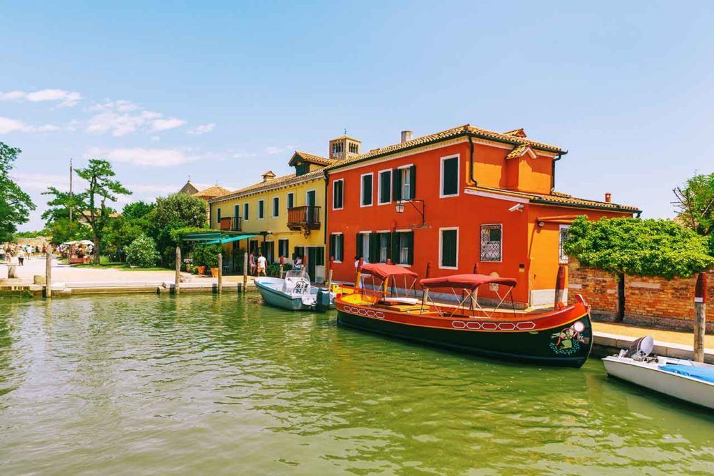
## Description Torcello Island is one of the most atmospheric places in the Venetian lagoon, especially for travelers who want to step away from the busier islands and see a quieter, older side of Venice. The island feels open and restful compared with the crowded center of the city, with broad paths, reeds, water, and a sense of distance that makes the landscape feel almost meditative. Its appeal lies in that stillness. Rather than offering a dense cluster of shops or nightlife, Torcello invites visitors to slow down and imagine what life in the lagoon looked like before Venice became a global symbol of trade and power. One of the most important sights on the island is the Cathedral of Santa Maria Assunta, known for its remarkable early Christian mosaics. Those mosaics are among the most valuable artistic treasures in the lagoon and are a major reason historians and art lovers make the trip. Another detail many visitors find surprising is that Torcello was once far more important than it is today; it played a key role in the region long before many other lagoon settlements rose to prominence. That history gives the island a haunting, almost forgotten beauty. ## Location Torcello is located in the Venetian Lagoon in the Veneto region of northern Italy, north of Venice and near the island of Burano. It is part of the broader Venice area and is reached by public ferry or vaporetto connections that usually involve changing boats from Venice or nearby islands. The journey itself is part of the experience, because the water route helps set the mood before you arrive. Once on the island, the walk from the landing area to the main historic sights is straightforward and pleasant. The best way to get there is by combining the visit with Burano or another nearby lagoon island. That makes the transit feel efficient and gives you a better sense of the lagoon geography. Torcello is not a place you rush through by car or taxi; the slower ferry rhythm is part of its charm. ## Tips - Visit with enough time to appreciate the quiet atmosphere, not just the main cathedral. - Pair Torcello with Burano so your day includes both color and calm. - Bring good walking shoes, since the island is best explored on foot. - If you care about art history, spend time inside the cathedral rather than treating it as a quick photo stop. - Go earlier in the day if you want the most peaceful experience and softer light over the lagoon. - Carry snacks or plan lunch in advance, because dining options are more limited than on larger Venetian islands. ## Conclusion Torcello offers a rare glimpse into the deeper historical memory of Venice. Its open landscapes, quiet paths, and extraordinary mosaics make it an ideal choice for travelers who value atmosphere and heritage over crowds. ## FAQ ### Why is Torcello important? Torcello was one of the earliest populated islands in the lagoon and once held far more influence than it does today. Its significance comes from that early history, the cathedral mosaics, and the way the island preserves a sense of Venice before modern tourism transformed the region. ### How much time do you need on Torcello? Most visitors can see the island in a few hours, especially if they are combining it with Burano. If you want to enjoy the setting, the cathedral, and a relaxed meal, give yourself half a day so you do not feel pressured. ### Is Torcello crowded? It is usually much calmer than central Venice or Burano. That quieter atmosphere is one of the reasons people go there. Crowds can rise during peak tourism periods, but the island generally remains more spacious and reflective than the better-known parts of the lagoon. ### What is the main thing to see on the island? The Cathedral of Santa Maria Assunta is the main highlight for most visitors because of its historic and artistic value. Even so, the real appeal of Torcello is the combination of that monument with the island's open, almost rural-feeling environment. ### Is Torcello worth visiting for a first trip to Venice? Yes, especially if you want more than the classic central Venice experience. It is best for travelers who enjoy history, landscape, and quieter places. If your schedule is very short, you may want to prioritize the core city first, then return for a lagoon excursion. ## Links - [Wikipedia](https://en.wikipedia.org/wiki/Torcello)
GemVoyage Team • World
Lima
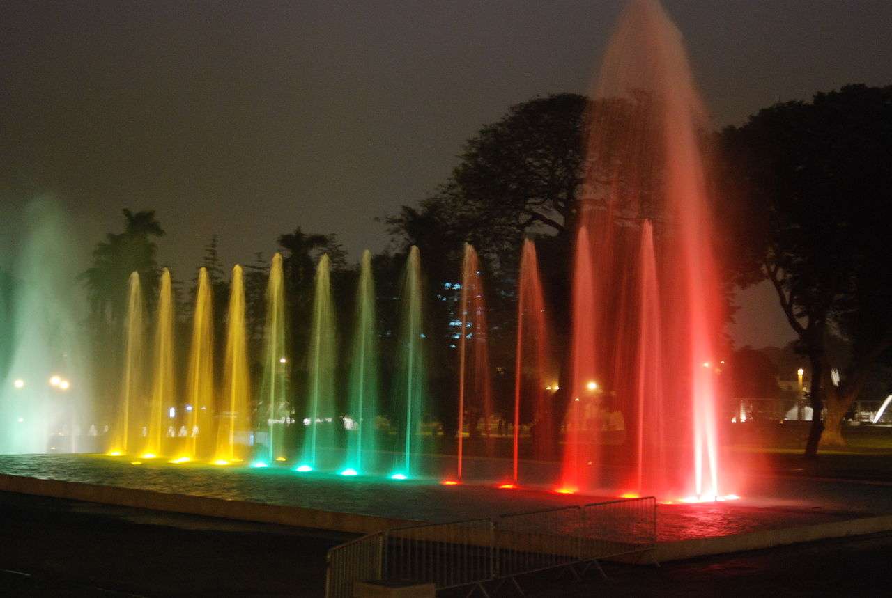
## Description The Magic Water Circuit (Circuito Mágico del Agua) in Lima is a dazzling display of light, music, and water that transforms a traditional city park into a nighttime spectacle. Located in the historic Parque de la Reserva, this attraction features 13 cybernetic fountains that combine cutting-edge technology with artistic choreography. Each fountain is uniquely designed, offering a blend of interactive experiences, visual storytelling, and cultural symbolism. The centerpiece of the park is the Fantasia Fountain, a 130-meter-long installation that hosts nightly multimedia shows. These performances blend water jets, laser lights, and music to create a captivating narrative—often highlighting Peruvian history, landscapes, and folklore. Other notable fountains include the Tunnel of Surprises, a 35-meter-long water tunnel that visitors can walk through, and the Dream Maze, where timing and agility are key to staying dry. A little-known fact: upon its opening in 2007, the Magic Water Circuit was recognized by the Guinness Book of World Records as the largest fountain complex in a public park. Another unique feature is the educational exhibits that occasionally accompany the fountains, such as historical photo displays or water conservation messages, adding depth to the entertainment. ## Location The Magic Water Circuit is located in **Peru**, in the **Lima Region**, within the **city of Lima**. Specifically, it sits in **Parque de la Reserva**, in the downtown district of Cercado de Lima. ### How to Get There - **By Taxi or Ride-Share**: Services like Uber and Cabify are widely available and can drop you off at the main entrance on Jr. Madre de Dios. - **By Public Transport**: The Metropolitano bus system stops nearby at Estación Central. From there, it’s a short walk to the park. - **By Foot**: If you're staying in central Lima, the park is easily accessible on foot from nearby neighborhoods like Jesús María or San Isidro. - **By Car**: Parking is available at the site, with flat rates depending on the lot. Its central location makes it a convenient stop for both tourists and locals exploring Lima’s cultural core. ## Tips - **Visit After Sunset**: The fountain shows begin around 7:15 PM and run multiple times throughout the evening. Arriving after dark ensures you catch the full spectacle. - **Bring a Rain Jacket or Poncho**: Some fountains are interactive, and you may get wet—especially in the maze or tunnel. - **Buy Tickets in Advance**: Entry is affordable (around S/5), but lines can form during weekends and holidays. Booking online or arriving early helps. - **Check for Special Events**: The park occasionally hosts themed shows or cultural exhibitions. Visit the official site for updates. - **Use a Tripod for Photos**: The lighting and water movement make for stunning photography, especially with long exposures. - **Respect the Rules**: Children under 5 enter free with ID, and discounts are available for seniors and people with disabilities. ## Conclusion The Magic Water Circuit in Lima is a vibrant fusion of art, technology, and public space. With its record-breaking fountains, immersive light shows, and family-friendly atmosphere, it offers a memorable evening experience that showcases the creative spirit of Peru’s capital. ## FAQ **1. What are the operating hours of the Magic Water Circuit?** The park is open daily from 3:00 PM to 10:00 PM. Multimedia shows begin at 7:15 PM, 8:15 PM, and 9:10 PM. **2. Is there an entrance fee?** Yes, general admission is S/5. Children under 5 enter free with ID. Discounts are available for seniors and people with disabilities. **3. Is the park suitable for children?** Absolutely. The interactive fountains and colorful displays are especially popular with families. **4. Can I bring food or drinks into the park?** Outside food is discouraged, but there are vendors and kiosks inside offering snacks and refreshments. **5. Are the shows in English or Spanish?** The multimedia shows are primarily visual and musical, with minimal spoken content, making them accessible to all visitors. **6. Is the park wheelchair accessible?** Yes, the park is designed to accommodate visitors with mobility needs, and discounted entry is available with proper ID. ## Links - [Official Magic Water Circuit Website](https://circuitomagicodelagua.pe/)
GemVoyage Team • World
Rome
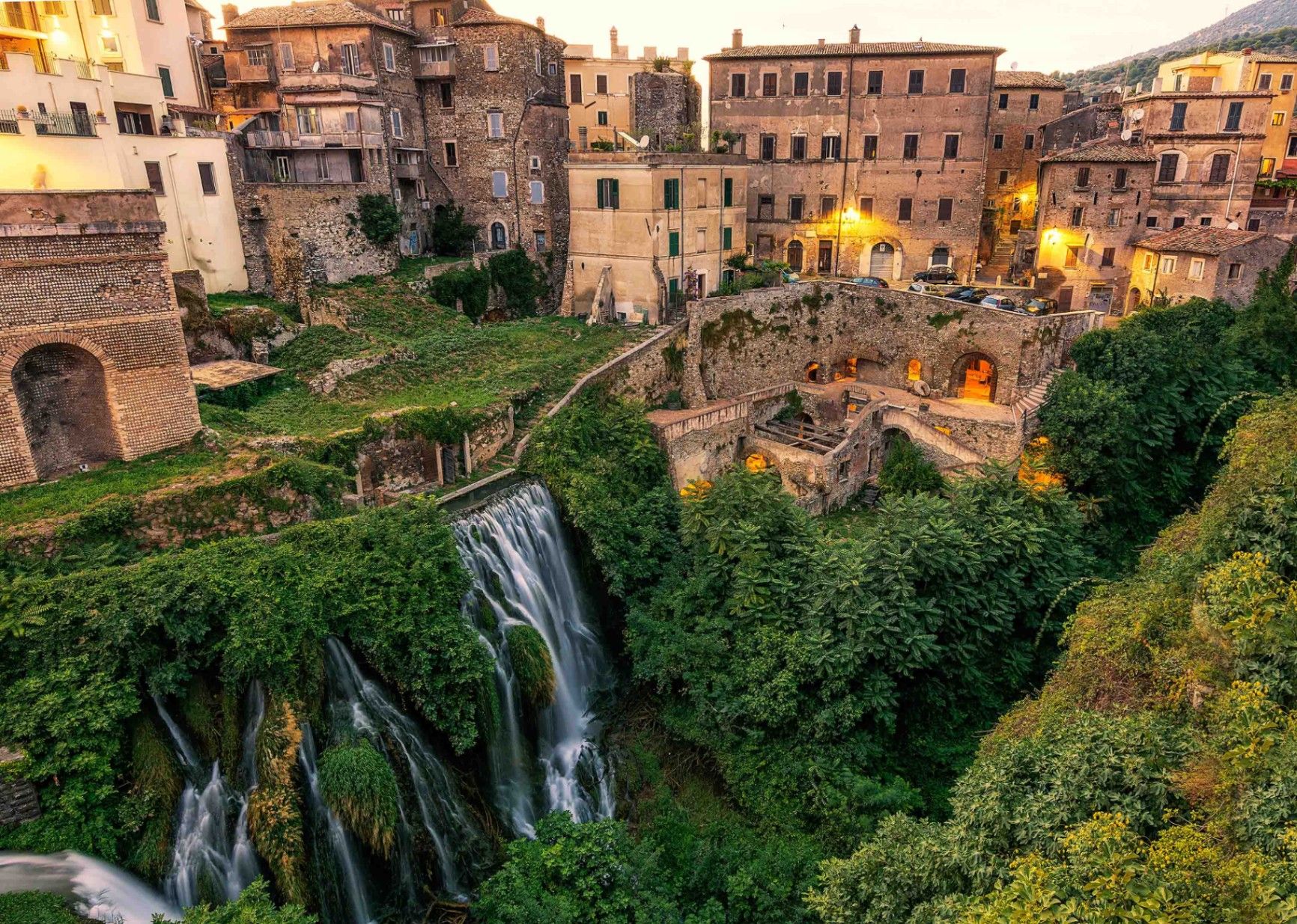
## Description Villa Gregoriana in Tivoli, just outside Rome, is one of Italy’s most captivating landscapes where history, art, and nature blend seamlessly. Unlike the lavish Renaissance villas Tivoli is famous for, such as Villa d’Este or Hadrian’s Villa, Villa Gregoriana is more of a natural park—a romantic landscape garden created in the 19th century. It was commissioned by Pope Gregory XVI in 1835 after a devastating flood of the Aniene River destroyed part of Tivoli. The project diverted the river and transformed the ravine into a park with paths, grottoes, and terraces overlooking dramatic waterfalls. The heart of the villa is the **Great Waterfall (Cascata Grande)**, a spectacular 120-meter drop of the Aniene River that roars through a deep gorge. The park is also dotted with archaeological remains, including Roman temples such as the **Temple of Vesta** and the **Temple of Sibyl**, which crown the cliffs above. Romantic poets and painters of the 19th century, from Goethe to Turner, were inspired by its sublime scenery. A lesser-known fact about Villa Gregoriana is that it fell into neglect for much of the 20th century. It was only restored and reopened to the public in 2005 thanks to the Italian heritage organization **FAI (Fondo Ambiente Italiano)**. Today, it is both a natural reserve and an open-air museum of history, geology, and art. ## Location Villa Gregoriana is located in **Tivoli**, a town in the **Metropolitan City of Rome (RM)**, in the region of **Lazio**, central **Italy**. Tivoli lies about 30 kilometers east of Rome, perched on the slopes of the Tiburtine Hills. To reach Villa Gregoriana, visitors can take a regional train from Rome’s Tiburtina station to Tivoli, which takes around one hour. From Tivoli station, it’s a short walk to the villa’s entrance. Alternatively, buses also run between Rome and Tivoli. If you’re driving, the trip takes about 45 minutes along the A24 motorway. Walking is essential once inside, as the park’s paths wind through steep terrain and natural landscapes. ## Tips * **Wear comfortable shoes:** The park has uneven terrain, stairs, and steep paths. Good walking shoes are essential. * **Allow time:** A full visit can take two to three hours if you want to enjoy both the waterfalls and the archaeological ruins. * **Best seasons to visit:** Spring and autumn offer pleasant weather and lush greenery. In summer, the waterfalls are at their most powerful but the heat can be intense. * **Photography:** Bring a camera—the views of the waterfalls and temples are spectacular from various terraces. * **Check opening hours:** Villa Gregoriana has seasonal hours and may close in winter, so it’s best to check in advance. * **Combine with other villas:** Tivoli is home to Villa d’Este and Hadrian’s Villa, both UNESCO World Heritage Sites, making it an excellent day trip from Rome. ## Conclusion Villa Gregoriana in Tivoli is a place where natural beauty meets history. With its majestic waterfalls, ancient temples, and romantic landscapes, it offers a unique contrast to the opulent villas nearby. Restored after years of neglect, it now stands as one of Italy’s most enchanting sites, ideal for travelers seeking a mix of culture, nature, and tranquility. ## FAQ **1. What is Villa Gregoriana best known for?** It is best known for its dramatic waterfalls, particularly the Great Waterfall, and for its blend of natural landscapes with ancient Roman ruins. **2. How much time do I need to visit?** Plan at least two hours to walk the trails, admire the waterfalls, and explore the archaeological sites. **3. Is Villa Gregoriana family-friendly?** Yes, but keep in mind that the terrain is steep and not suitable for strollers. Children should be supervised on paths near cliffs. **4. Are guided tours available?** Yes, guided tours are offered, and they provide fascinating insights into the park’s history, geology, and architecture. **5. Can I picnic inside the park?** Picnicking is not generally allowed inside the villa, but Tivoli offers many nearby restaurants and cafés for meals. **6. Is Villa Gregoriana accessible by wheelchair?** Due to its rugged terrain and steep paths, the site is not well-suited for wheelchair users or those with limited mobility. ## Links * [FAI – Villa Gregoriana Official Page](https://fondoambiente.it/luoghi/parco-villa-gregoriana)
GemVoyage Team • World
Petén
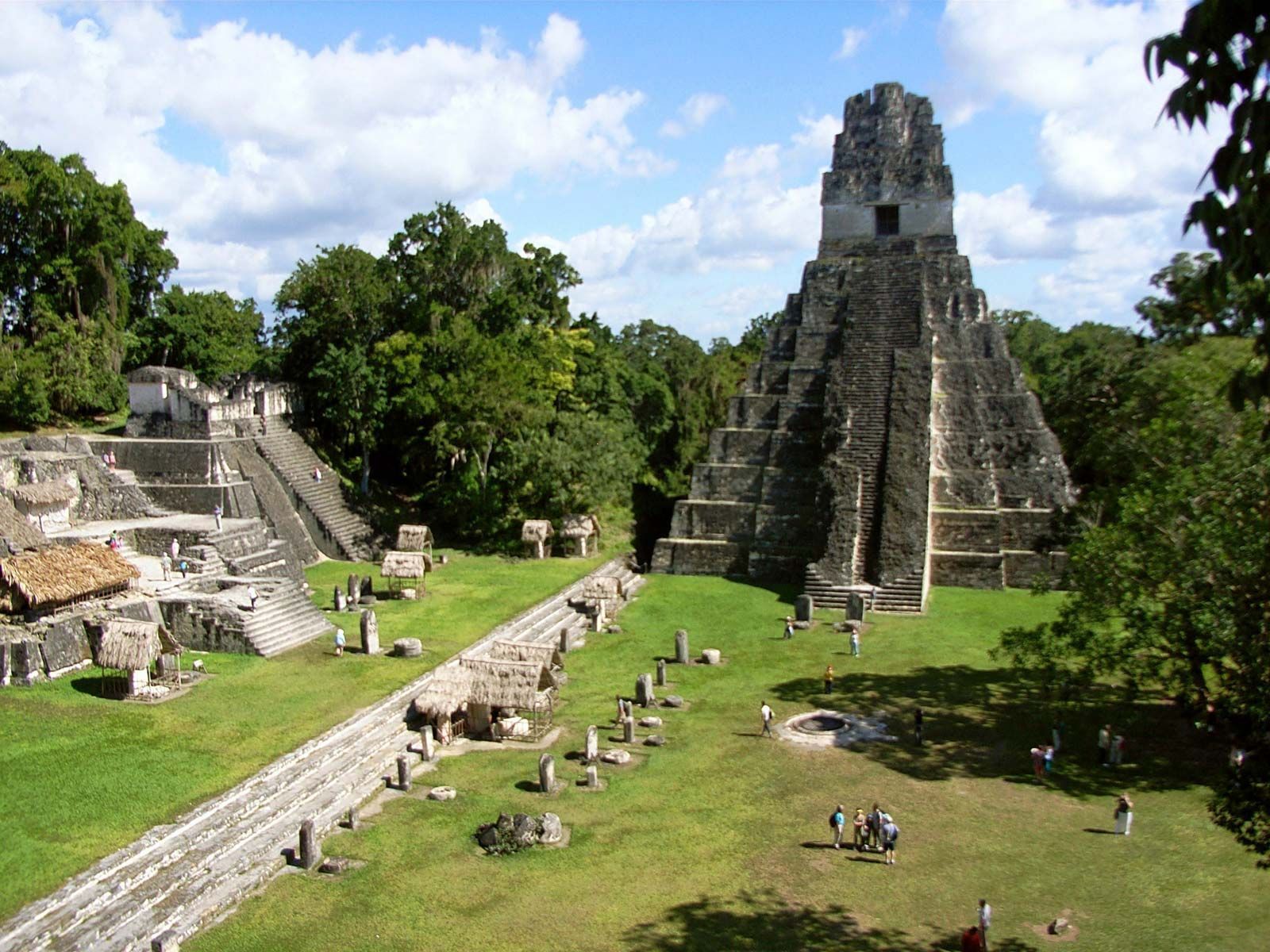
## Description Tikal is one of the most important archaeological sites of the ancient Maya civilization, located within the dense lowland rainforests of Petén, Guatemala. The city’s towering limestone pyramids and plazas emerge above the jungle canopy, offering dramatic skyline views and a palpable sense of antiquity. During its Classic period, Tikal was a major political and ceremonial center; excavated palaces, stelae and ballcourts tell stories of dynasties, calendrical knowledge and cosmology. Visitors to Tikal are rewarded by a blend of monumental architecture and biodiverse rainforest. The temples and palaces rise through the tree canopy, so that from the tops of several structures you can peer over treetops to see other pyramids peeking through the foliage. This interplay between built environment and ecology is central to Tikal’s power: the jungle both conceals and reveals the city, a dramatic reminder of centuries of abandonment and recovery. Tikal’s primary plaza, monumental ballcourts, and the iconic Temple IV and Temple II complexes preserve stelae with carved inscriptions, verifiable sequences of rulers and artistic programs that speak to the city’s political sophistication. Archaeological work also reveals complex water-management features, reservoirs and causeways that allowed the city to sustain a significant population despite a seasonal tropical climate. Walking among Tikal’s temples at sunrise — when the jungle stirs and howler monkeys call — is an evocative way to connect with a complex culture of architecture, ritual and astronomy. Early morning light transforms the stone into warm tones and dramatically silhouettes the temple profiles against the rising sun, making sunrise a photographer’s favorite. Guides can point out hieroglyphic inscriptions, sacred alignments and the role of celestial observation in Maya ritual life. ## Location Tikal National Park is in Guatemala’s northern Petén department. The site is reachable via a short flight to Flores (Mundo Maya International Airport, FLV) or by road from Flores town, which serves as the usual visitor base. Most visitors use Flores as a staging point and arrange shuttle transfers, guided tours, or independent day trips to the park. ## Tips - **Arrive at dawn for temples and wildlife:** Early mornings provide cooler light, bird activity and quieter conditions before larger tour groups arrive. Dawn visits also let you catch the moment when the jungle wakes up. - **Hire a knowledgeable guide:** Licensed local guides provide historical context, translate glyphs and explain how architecture relates to Maya cosmology — essential for getting more from the site. - **Bring insect repellent and sun protection:** The lowland rainforest environment includes biting insects and strong sunlight in exposed plazas. Lightweight long sleeves and repellent are useful. - **Plan logistics from Flores:** Book shuttle transfers or organized tours in advance during high season, and consider staying overnight near the site for sunset or sunrise experiences. - **Support responsible tourism:** Choose certified guides and operators that follow park rules and contribute to local community economies. ## Conclusion Tikal is both a monumental archaeological treasure and a living jungle experience: temples puncturing the canopy, dawn rituals and carved monuments make it an essential site for understanding Maya civilization. For travelers seeking a mix of natural soundscapes, wildlife encounters and a deep cultural history, Tikal offers an immersive and emotionally resonant experience. ## FAQ - **Q: How long should I spend at Tikal?** A: A full day is ideal to cover the main plazas, climb at least one temple for panoramic views, and explore the northern and central complexes. Two days allow for a slower pace, birding and visiting lesser-known complexes. - **Q: Can visitors climb the temples at Tikal?** A: Access to climbable areas varies — some temples allow limited ascent to designated viewpoints while others are closed to protect fragile structures. Follow current park rules and signage. - **Q: What wildlife might I see at Tikal?** A: Expect to see howler monkeys, toucans, parrots, motmots and a range of tropical birds; early morning is best for birdwatching and animal activity. - **Q: Is it safe for solo travelers and families?** A: The site is generally safe during daylight hours. Follow standard travel precautions: use licensed guides, secure belongings, carry water and avoid isolated areas after dark. - **Q: Are there accommodations near the park?**n+ A: Flores and nearby villages offer a range of lodgings from budget hostels to mid-range hotels; staying in Flores provides easy access to flights and transportation. ## Links - [Tikal — Wikipedia](https://en.wikipedia.org/wiki/Tikal)
GemVoyage Team • World

Comments