GemVoyage Team • World
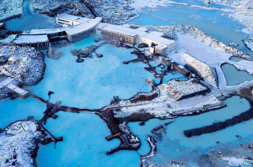
What makes the Blue Lagoon feel special is its blend of high-design hospitality and raw volcanic surroundings: sleek facilities, in-water bars and silica mud treatments meet black lava and open sky. The lagoon is also a refined wellness experience — many visitors combine a soak with spa treatments, saunas and skin clinics that use the lagoon’s mineral-rich waters.
Discover more hidden gems you might love.
Siena
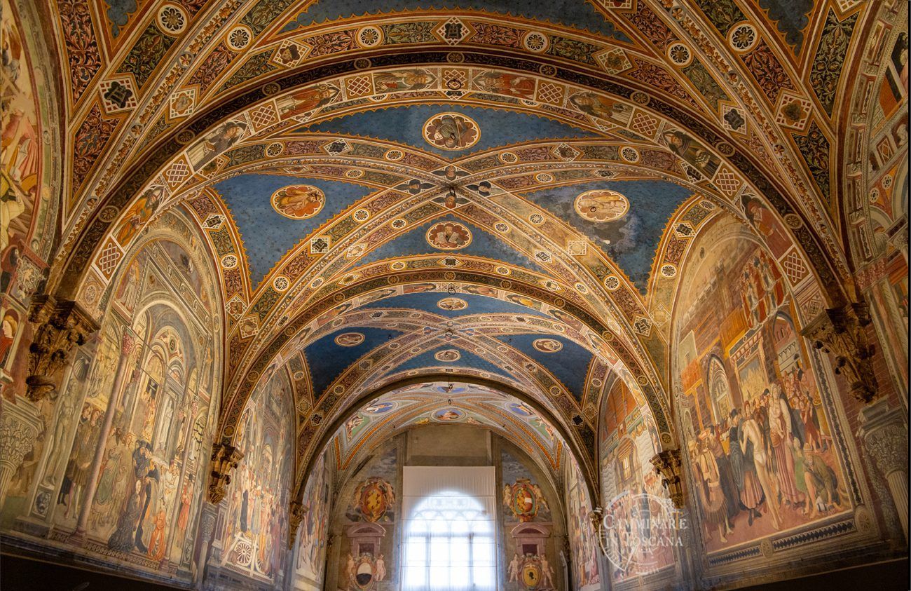
## Description Santa Maria della Scala is one of Siena's most remarkable heritage sites because it combines religious history, civic charity, underground architecture, and museum culture in a single monumental complex. Positioned directly across from Siena Cathedral, it once served as one of Europe's oldest hospitals and later evolved into a major cultural institution. Visiting it today gives travelers a powerful sense of how medieval cities cared for pilgrims, the sick, and vulnerable populations while also expressing civic pride through architecture and art. The complex is striking because it feels like a city within a city. Rooms, corridors, chapels, cloisters, stairways, and subterranean spaces reveal different layers of use over the centuries. You do not just look at one building; you move through an entire institution that grew and adapted over time. Artworks, fresco cycles, archaeological remains, and preserved spaces make the experience intellectually rich and visually engaging. Unlike many museums that isolate objects from their context, Santa Maria della Scala helps you understand how architecture, service, devotion, and public life interacted in medieval Siena. One little-known fact is that pilgrims arriving on the Via Francigena often found shelter here, making the site an important stop on one of Europe's great medieval routes. Another detail many visitors overlook is the sheer scale of the underground spaces, which reflect practical needs for storage, movement, and service as much as ceremonial or artistic ambition. Those lower levels are among the most memorable parts of the visit because they show the functional side of a structure that many people initially expect to be purely decorative or religious. The site is also important because it illustrates Siena's identity as a city that valued public welfare, religious patronage, and artistic expression simultaneously. That combination is part of what makes the complex worth a serious visit. If you want to understand Siena beyond its famous piazza and cathedral, Santa Maria della Scala gives you a fuller picture of the city's medieval social world and its later cultural memory. ## Location Santa Maria della Scala is in Siena, in the Tuscany region of Italy, directly opposite Siena Cathedral near the city's historic center. The location is ideal for sightseeing because it sits within one of Siena's most visited pedestrian areas, making it easy to combine with the Duomo, Piazza del Campo, and nearby museums and churches. Because the city center has limited vehicle access, walking is by far the best way to reach the complex once you are already in Siena. If you are arriving from outside the city, buses and taxis can bring you close to the historic core, but you should expect to continue on foot through narrow streets and sloping lanes. That is part of the Siena experience. The approach to Santa Maria della Scala is rewarding because the surrounding streets reveal the city's medieval layout and its strong relationship between public squares, religious institutions, and commercial life. For most visitors, the best recommendation is to explore the site as part of a broader walking circuit through Siena's center. Allow enough time to move through the exhibit spaces at a relaxed pace rather than trying to fit it into a rushed cathedral-only itinerary. ## Tips Give yourself time. Santa Maria della Scala is not a quick stop, and its value increases when you spend time understanding the different floors, rooms, and thematic displays. If you only skim the site, you miss its most compelling features. Combine your visit with the cathedral area. The relationship between Santa Maria della Scala and Siena Cathedral is one of the most interesting aspects of the site, both visually and historically. Seeing them together helps explain how prestige, religion, and charity coexisted in the city. Pay attention to the underground areas and temporary exhibitions. These spaces often hold some of the most atmospheric material and can be less crowded than the main public rooms. They also show how the institution evolved over centuries instead of freezing it in one period. If you like medieval history, read a little before arriving. The more you know about pilgrimages, hospitals, and civic patronage in Tuscany, the more rewarding the visit becomes. Santa Maria della Scala is rich enough to reward curiosity, and small historical details can transform the experience. ## Conclusion Santa Maria della Scala is one of Siena's most important monuments, offering an unusually complete view of medieval care, devotion, and civic life inside a beautifully layered historic complex. ## FAQ ### What was Santa Maria della Scala used for? It served as a hospital, shelter for pilgrims, charity institution, and later as a cultural and museum complex. ### Why is Santa Maria della Scala important? It is important because it is one of Europe's oldest hospital complexes and because it preserves a rare combination of architecture, art, and social history. ### How much time should I spend there? Most visitors should allow at least one to two hours, and longer if they want to explore the exhibits in depth. ### Is it close to Siena Cathedral? Yes. It is located directly across from the cathedral, making it easy to visit both on the same trip. ## Links - [Official website](https://www.santamariadellascala.com/) - [Wikipedia article](https://en.wikipedia.org/wiki/Santa_Maria_della_Scala)
GemVoyage Team • World
São Paulo
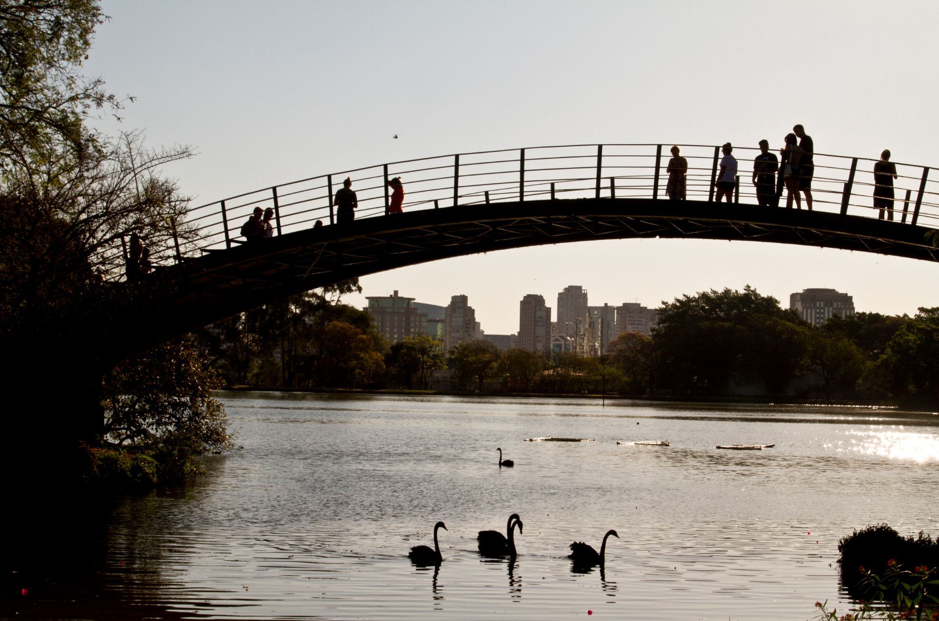
## Description Ibirapuera Park is one of São Paulo’s best-known green spaces, but the real delight for many visitors is not just the major landmarks. It is the quieter corners that reveal why the park matters so much to locals. In a city famous for its intensity, scale, and relentless movement, Ibirapuera provides room to breathe. The park is broad enough to absorb crowds without feeling overwhelming, and its quieter paths, shaded lawns, and tucked-away benches make it easy to find a slower rhythm even on busy days. The park is more than a recreational area. It is a cultural landscape where nature, architecture, exercise, and informal social life come together. You may pass runners, families on blankets, office workers taking breaks, and visitors moving between museums or exhibition spaces. Yet the quieter parts of the park offer a different kind of experience. Instead of chasing the main sights, you can wander into less-trafficked zones, pause under the trees, and notice how the park changes from one pocket of space to another. One little-known fact is that Ibirapuera was designed with major urban ambition in mind, which is why the park feels so integrated with the city rather than separated from it. Another is that the park’s atmosphere can shift dramatically depending on where you stand; some areas feel expansive and ceremonial, while others feel almost hidden and intimate. That contrast is what makes the quieter corners so rewarding. They reveal a softer side of one of Latin America’s great metropolitan parks. For travelers, the appeal lies in balance. You can enjoy famous São Paulo institutions and still have time to sit somewhere calm enough to reflect on the city’s scale. In that sense, Ibirapuera is not only a park but also a reset point. It offers visitors the chance to experience a dense metropolis without being consumed by it. ## Location Ibirapuera Park is located in São Paulo, Brazil, primarily in the southern-central part of the city near neighborhoods such as Vila Mariana and Moema. It is one of the most accessible major parks in São Paulo and sits within reach of both cultural institutions and residential districts, which makes it easy to combine with other city sightseeing. The park is best reached by ride-hailing service, taxi, bus, or a combination of metro and walking depending on where you start. Because the park has multiple entrances and a large footprint, it helps to decide in advance which part you want to visit. If your goal is the quieter side of the park, enter with enough time to wander rather than heading only to one landmark. That way you can move between open lawns, tree-lined paths, and calmer internal areas without feeling rushed. From central São Paulo, travel time varies widely with traffic, so the best strategy is to leave room in your schedule. Mornings and late afternoons are often the most comfortable times to visit because temperatures are milder and the park’s quieter zones feel more spacious. ## Tips - Visit on a weekday if you want the calmest experience. Weekends are lively and fun, but they are also busier. - Bring water, sunscreen, and comfortable shoes. The park is large enough that you will do more walking than expected. - If you want the quietest corners, keep moving away from the most obvious landmarks and main event spaces. - Plan at least part of your visit for sitting and observing instead of only walking. The park’s atmosphere is part of the attraction. - Combine the park with a museum or cultural stop nearby so the day feels balanced between activity and rest. ## Conclusion The quieter corners of Ibirapuera Park show a gentler, more reflective side of São Paulo. It is a place to slow down, recharge, and see how a great city park can feel both grand and personal at the same time. ## FAQ ### Why focus on the quiet corners instead of the park’s main attractions? Because the quieter spaces show a different personality. They are where the park feels restorative, local, and less performative, which can be especially valuable in a city as energetic as São Paulo. ### Is Ibirapuera Park suitable for a short visit? Yes. Even a brief stop can be worthwhile if you know which entrance or area you want to explore. A short visit is enough to enjoy the atmosphere, but longer stays let you appreciate the park’s variety. ### When is the best time to go? Mornings and late afternoons are usually the most pleasant. The light is better, temperatures are easier, and the park’s calmer areas are more enjoyable. ### Can I visit if I am not interested in museums or events? Absolutely. The park works very well as a green urban retreat on its own, especially if you enjoy walking, people-watching, or simply resting in a landscaped setting. ## Links - [Ibirapuera Park official website](https://parqueibirapuera.org/) - [Ibirapuera Park on Wikipedia](https://en.wikipedia.org/wiki/Ibirapuera_Park)
GemVoyage Team • World
Zagreb
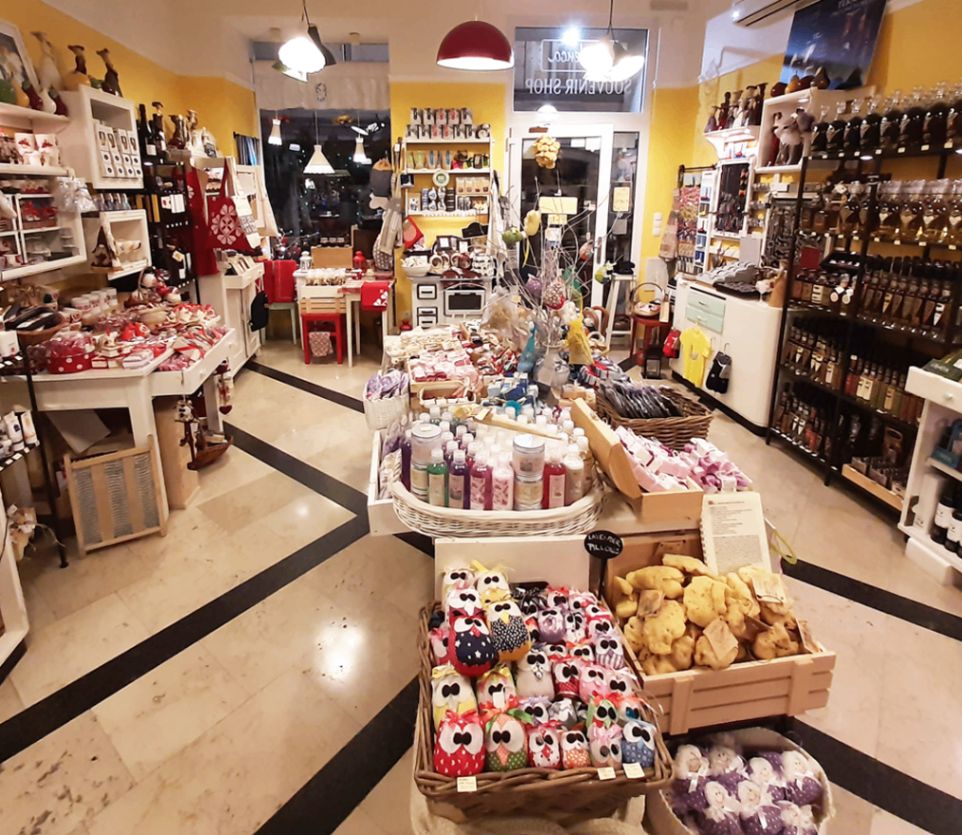
## Description **Kredenca gift shop** in Zagreb is more than just a souvenir store—it’s a showcase of authentic Croatian craftsmanship and flavors. Unlike typical tourist shops filled with mass-produced trinkets, Kredenca offers carefully curated items that represent the country’s rich cultural and culinary heritage. The shop specializes in traditional products like handmade ceramics, natural cosmetics, artisanal chocolates, honey, truffle-infused delicacies, and wines from various Croatian regions. Every item is selected to reflect the uniqueness of Croatia’s traditions and landscapes. One of the little-known facts about Kredenca is that it often collaborates directly with small local producers and family-run farms. This means that by buying something here, visitors are directly supporting Croatian artisans and preserving centuries-old skills. Another charming detail is that the store name “Kredenca” refers to a traditional kitchen cupboard found in Croatian homes, symbolizing a warm, welcoming, and authentic atmosphere. --- ## Location Kredenca is located in **Zagreb**, the capital city of **Croatia**, situated in the **Continental region** of the country. The shop sits right in the heart of the city at **Radićeva Street**, a lively pedestrian zone that connects Ban Jelačić Square with the historic Upper Town. This makes it a convenient stop for anyone exploring Zagreb’s main attractions, such as St. Mark’s Church, Dolac Market, or Tkalčićeva Street. ### How to get there: * If you’re already in the city center, the shop is just a short **walk from Ban Jelačić Square** (about 2–3 minutes). * Travelers arriving by tram can use any line that stops at Ban Jelačić Square and continue on foot. * For those coming from the central train or bus station, it’s a quick tram ride followed by a brief walk. --- ## Tips * **Look beyond souvenirs**: While there are charming trinkets and crafts, the highlight is the **food and drink section**. Many visitors recommend taking home a bottle of Croatian wine, locally made rakija (fruit brandy), or a jar of lavender honey. * **Ask for recommendations**: The staff are known for their friendliness and knowledge—they’ll happily explain the origins of products and suggest the best gifts depending on your budget. * **Taste before you buy**: Some products, especially wines, olive oils, and chocolates, may be available for tasting. Don’t hesitate to ask. * **Visit during weekdays**: The shop can get busy during weekends when tourists flock to the Upper Town. Weekdays usually offer a calmer shopping experience. * **Bring some extra space in your luggage**: Many of the items, like bottles and jars, are best carried in checked baggage if you’re flying home. --- ## Conclusion Kredenca isn’t just a place to pick up a souvenir—it’s a destination that captures the spirit of Croatia in every product it sells. With its mix of artisanal foods, handmade crafts, and unique keepsakes, the shop offers visitors a chance to take home more than just a memory; it’s a way to carry a piece of Croatia’s heritage with you. Whether you’re looking for a thoughtful gift or a treat for yourself, Kredenca is a must-visit while exploring Zagreb. --- ## FAQ **1. What makes Kredenca different from other souvenir shops in Zagreb?** Kredenca focuses on authentic, locally produced items rather than mass-produced souvenirs, giving you a true taste of Croatian culture. **2. Does the shop only sell food and drinks?** No. While food and drinks are highlights, the shop also carries handmade ceramics, natural cosmetics, traditional textiles, and more. **3. Can I sample products before purchasing?** Yes, some items such as wines, olive oils, or chocolates are available for tasting, depending on the day and stock. **4. Is Kredenca located near major attractions?** Yes, it’s right off Ban Jelačić Square, within walking distance of Dolac Market, Tkalčićeva Street, and the Upper Town. **5. Are the products suitable as gifts to bring abroad?** Absolutely—many items are travel-friendly, though it’s best to pack liquids and fragile items in checked luggage if you’re flying. **6. Do they accept credit cards?** Yes, Kredenca accepts major credit cards in addition to cash, making purchases easy for international visitors. --- ## Links * [Official Kredenca Website](https://www.kredenca.com/)
GemVoyage Team • World
Lisbon
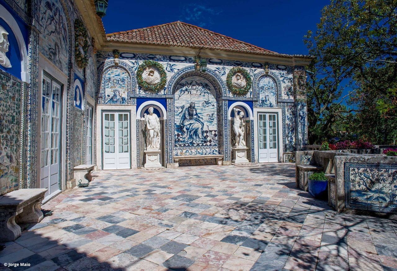
## Description Palácio dos Marqueses de Fronteira is an elegant, family-owned 17th-century estate on the edge of Lisbon that delights visitors with its exceptional azulejo tile panels, intimate museum rooms, and meticulously designed gardens. The palace feels less like a public museum and more like entering a well-preserved private residence that has been lived in and cared for by the same lineage of nobility for centuries. Interiors display an array of period furniture, heirloom portraits, and decorative arts that create a layered sense of domestic aristocratic life. The palace’s defining artistic draw is its azulejo program: large narrative tile panels that record hunting scenes, mythological episodes, allegories, and courtly imagery, executed in the refined blue-and-white and polychrome palettes typical of the 17th and 18th centuries. These tiles cover interior and exterior walls, forming pictorial narratives that reward close looking. Complementing the tiles are frescoes, gilded frames and sculptural elements that reflect Baroque and Rococo tastes adapted to Portuguese sensibilities. The gardens are a major reason to visit. Laid out with geometric hedges, elegant statuary and reflecting pools, they weave Moorish and Renaissance influences into a distinctly Portuguese landscape grammar. Garden rooms framed by clipped yews and boxwood create intimate vistas, while larger terraces open to sweeping views of the surrounding neighborhood. Seasonal plantings and careful maintenance mean the palace is beautiful year-round, although spring and early summer are especially lush. Conservation and stewardship at the palace are noteworthy: the family’s ongoing custodianship has supported careful tile restoration projects and the preservation of original material culture. Many of the conservation interventions have been carried out by local artisans using traditional techniques, preserving not just objects but craft knowledge. Photographic and accessibility note: photographers should plan for a mix of wide-angle shots of garden terraces and close-ups of tile details; early morning light reduces harsh shadows on glazed surfaces. Visitors requiring mobility assistance should contact palace staff ahead of time to arrange the smoothest route through garden paths and to confirm which rooms are accessible. ## Location The palace is located in the Benfica neighborhood of Lisbon, a short drive northwest of central districts like Rossio and Baixa. From the historic center, it typically takes 15–25 minutes by car depending on traffic. Public transit options involve buses and sometimes a combination of tram and bus; travelers should allow extra time for connections and walking to the palace grounds. Getting there: taxis and rideshares are convenient and typically the fastest way for visitors without a car. If using public transport, check current bus routes and schedules and allow for a short walk from the nearest stop to the palace entrance. ## Tips - Book tickets in advance when possible; guided tours are often limited and sell out during peak season. - Wear comfortable shoes: garden paths include gravel and uneven surfaces. - Respect interior rules: certain rooms may be closed or restricted for conservation reasons; photography inside may be limited. - Bring a camera and consider different lenses: a wide-angle captures garden vistas while a close lens helps study tile details. - Time your visit: visit in the morning light for softer photographs and more tranquil garden conditions. - Combine visits: pair the palace with nearby cultural sites such as the National Coach Museum or a walk in Monsanto Forest Park for a varied day. ## Conclusion Palácio dos Marqueses de Fronteira is a quietly grand escape from Lisbon’s busiest tourist routes. It rewards the patient visitor — those who enjoy architectural decoration, tile art and carefully tended gardens — with an intimate glimpse of aristocratic Portuguese life. The palace’s careful preservation and the family’s ongoing care make it a dignified and deeply rewarding stop on a cultural itinerary. ## FAQ Q: Are guided tours available? A: Yes. Guided tours are offered and provide detailed historical context about the palace, its tiles and the family’s history. Check the palace’s official website or local tourism resources for times and booking procedures. Q: Is the palace wheelchair accessible? A: Accessibility is limited in some historic rooms and garden areas due to steps and uneven terrain. Contact the palace in advance to discuss specific access requirements and to learn which sections are accessible. Q: Can I photograph inside the palace and gardens? A: Photography is usually permitted in the gardens; some interior rooms may restrict photography to protect delicate materials. Always follow posted signs and staff instructions. Q: How long should I allow for a visit? A: Plan for 1–2 hours to see the main rooms and stroll the gardens at a relaxed pace. If you are a tile or garden enthusiast, you may wish to allow more time. Q: Are there any special events or seasonal highlights? A: The palace occasionally hosts concerts, temporary exhibitions, or guided thematic tours. Spring and early summer offer peak garden blooms and are popular times to visit. ## Links - [Wikipedia: Palácio dos Marqueses de Fronteira](https://en.wikipedia.org/wiki/Palace_of_the_Marquises_of_Fronteira)
GemVoyage Team • World
Laos
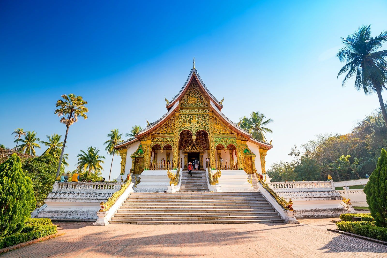
## Description Luang Prabang, nestled where the Mekong and Nam Khan rivers meet, is a compact and remarkably well-preserved city in northern Laos. Renowned for its colonial-era buildings, saffron-robed monks, ornate Buddhist temples and a contemplative pace, Luang Prabang blends spiritual ritual with a lively artisan scene and riverfront cafés. The city’s Unesco-listed core includes gilded wats (temple complexes) with intricate woodwork, and the daily ritual of almsgiving — where villagers and visitors watch monks collect offerings at dawn — remains a powerful cultural scene. Beyond its temples, Luang Prabang is a gateway to waterfalls such as Kuang Si, traditional weaving villages, and hilltop viewpoints that reward gentle hikes. The city’s food scene is notable for Lao specialties and a street-market culture that showcases sticky rice, grilled meats, and delicate river fish dishes. Luang Prabang is a place where slow travel rewards attention: morning almsgiving, quiet temple courtyards, and riverside cafés invite pauses that reveal local rhythms. The city manages to balance heritage conservation with welcoming tourism; narrow streets are punctuated by family-run guesthouses, handicraft cooperatives and social enterprises focused on sustainable tourism. Kuang Si Falls remains a perennial highlight — a cascading tier of turquoise pools that invites both swimming and mindful walking — while nearby villages offer hands-on experiences with traditional weaving, dyeing and food preparation. The compact scale of Luang Prabang makes it easy to explore on foot or by bicycle; many travelers find that wandering the backstreets at dawn or dusk yields unexpectedly intimate encounters with everyday life. Given the city's spiritual presence, visitors should dress respectfully around temples and be mindful of photography etiquette during ceremonies. The night market on Sisavangvong Road is a lively hub for textiles, silverwork and street food, but for authentic Lao cuisine seek neighborhood stalls where family recipes are passed down through generations. Seasonal festivals, like Boun Pi Mai (Lao New Year) and other Buddhist celebrations, add further depth for those who align travel dates with local calendars. ## Location Luang Prabang is in northern Laos, reachable by air at Luang Prabang International Airport (LPQ) or by overland routes from northern Thailand and Vientiane. The rivers provide scenic boat connections to upriver destinations and are central to the city’s character. Flight connections to Luang Prabang arrive from regional hubs; overnight trains and bus routes from Chiang Mai and other Thai cities offer overland alternatives. River cruises along the Mekong provide a slower, scenic arrival that frames the city's riverside charm. Central Luang Prabang is compact and walkable, with most attractions clustered within an easy radius; taxis, tuk-tuks and river boats provide transport to outlying sites like Kuang Si Falls and surrounding villages. ## Tips - **Honor local customs:** Dress modestly at temples, avoid loud behavior during almsgiving, and observe photography etiquette. - **Visit Kuang Si Falls:** A short drive away, the falls’ turquoise pools are ideal for swimming and picnics — arrive early to avoid crowds. - **Explore by foot or bicycle:** The city center is compact; walking or cycling is pleasant and helps you discover markets and side streets. - **Try a river cruise:** Sunset river trips on the Mekong offer relaxed views and local riverside life. - **Support craft cooperatives:** Visit silk-weaving and craft workshops that support local artisans and sustain traditional techniques. - **Carry small bills for offerings:** If participating respectfully in almsgiving or donations, small local currency notes are appropriate. - **Be mindful of seasonal weather:** The cool-dry season (Nov–Feb) is most comfortable; the wet season can make rural tracks muddy and less accessible. - **Hire local guides for village visits:** Ethical community-based tours give income to families and provide authentic context. - **Taste street specialties early:** Local breakfasts like khao soi and grilled river fish are best experienced fresh from morning stalls. ## Conclusion Luang Prabang offers a gentle, culturally immersive travel experience: spiritual rhythm, natural beauty and warm Lao hospitality combine to create a reflective pace that many travelers find restorative. Whether you’re drawn to its temples, waterfalls or artisan traditions, Luang Prabang rewards visitors who travel slowly and with curiosity. The city’s human scale and spiritual cadence make it an ideal destination for travelers seeking contemplative experiences, meaningful cultural exchange and access to some of Laos’s most scenic natural sites. ## FAQ - **Q: Is Luang Prabang safe for solo travelers?** - A: Generally yes — it’s considered one of Southeast Asia’s safer small cities, but usual travel caution applies. - **Q: When is the best time to visit?** - A: The cool dry season (November–February) is most comfortable; the wet season can be lush but includes heavy rains. - **Q: Are there international flights?** - A: Luang Prabang has regional flights; connections from Bangkok, Hanoi and Vientiane are common. - **Q: How many days are ideal for a first visit?** - A: Three to five days lets you explore temples, enjoy Kuang Si Falls, visit a weaving village and take a short Mekong trip without rushing. - **Q: What should I wear for temple visits?** - A: Dress modestly with shoulders and knees covered; remove shoes when entering temple buildings and follow local customs. - **Q: Can I use ATMs and credit cards?** - A: ATMs are available in town and larger businesses accept cards, but carry cash for market stalls and rural excursions. - **Q: Are there ethical ways to visit villages?** - A: Yes — choose community-run tours, avoid exploitative photo practices, and purchase directly from cooperatives when possible. ## Links - [Luang Prabang — Wikipedia](https://en.wikipedia.org/wiki/Luang_Phrabang)
GemVoyage Team • World
Amazonas
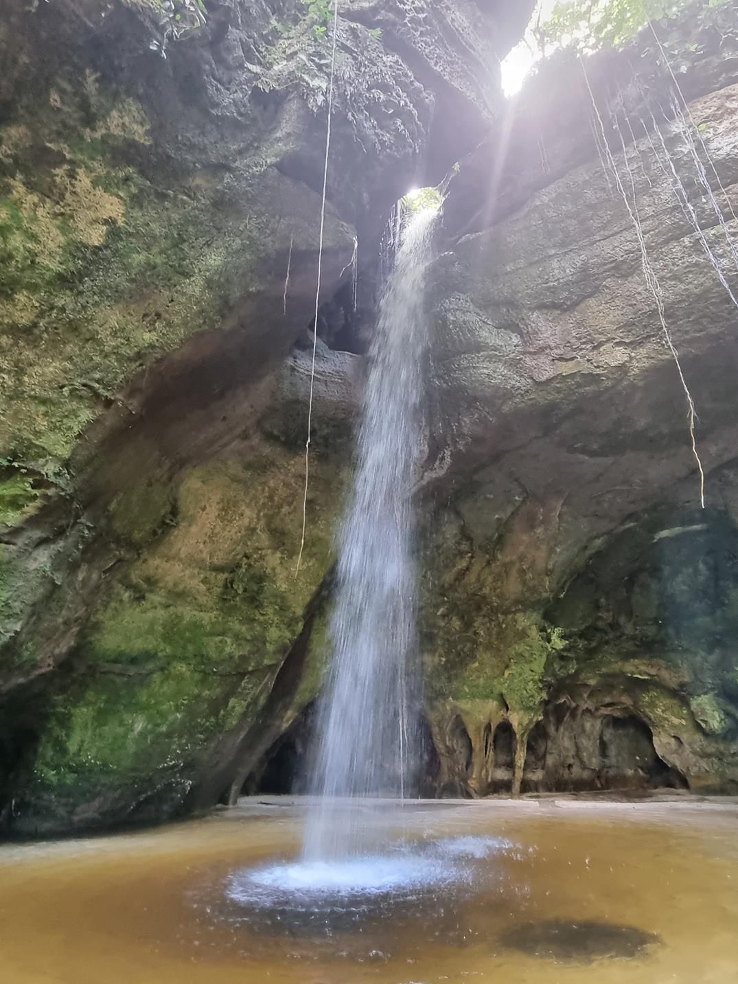
## Description Deep within the lush rainforest of the Amazon lies a pair of natural wonders: **Caverna do Maroaga (Maroaga Cave)** and **Caverna da Judeia (Judeia Cave)**. These caves are part of the Presidente Figueiredo municipality in northern Brazil, often nicknamed the “Land of Waterfalls and Caves” due to its unique geology and landscapes. The **Maroaga Cave** is famous for its dramatic sandstone formations and a stream that flows directly from within, creating a mystical atmosphere as the water emerges from the cave’s dark interior. Sunlight filtering through the forest canopy reflects on the water, giving the cave a magical glow. Its name comes from a local indigenous chief, Maroaga, who is said to have used the cave as a hideout, adding a layer of legend to its natural beauty. The nearby **Judeia Cave** is equally captivating. It features a more intimate setting, with a waterfall cascading over its entrance and forming a natural curtain of water. Walking behind the waterfall offers visitors a unique and refreshing perspective, with the sound of rushing water echoing throughout the cave. A little-known fact is that both caves are part of the same ecological reserve, which shelters a vast variety of flora and fauna. Biologists have recorded rare species of bats and amphibians in these caves, making them not only scenic wonders but also important ecological habitats. ## Location Caverna do Maroaga and Caverna da Judeia are located in **Presidente Figueiredo**, a municipality in the state of **Amazonas**, in northern **Brazil**. The region lies about 107 kilometers north of **Manaus**, the capital of Amazonas, along the BR-174 highway. The most common way to reach the caves is by car or organized tour from Manaus. The drive takes about two hours and passes through dense rainforest landscapes. Once at the entrance to the reserve, guided hikes of varying lengths lead to the caves. The trails are not particularly difficult, but they can be muddy and slippery, especially during the rainy season. For international visitors, the easiest route is to fly into Manaus and then book a day trip or multi-day tour that includes the caves as part of a broader itinerary of waterfalls and natural attractions. ## Tips * **Wear proper footwear:** Hiking boots or sturdy shoes are recommended, as the trails can be wet and uneven. * **Hire a guide:** Local guides not only ensure safety but also provide insights into the caves’ legends, geology, and biodiversity. * **Bring swimwear and a towel:** The waterfalls and streams around the caves are perfect for cooling off after a hike. * **Pack insect repellent:** The Amazon rainforest is home to mosquitoes and other insects, especially near water sources. * **Visit during the dry season:** From June to November, the trails are easier to access, although the rainy season offers stronger waterfalls and a wilder atmosphere. * **Respect the environment:** Avoid leaving litter, and do not disturb the caves’ wildlife, particularly bats and amphibians. ## Conclusion Caverna do Maroaga and Caverna da Judeia showcase the wild beauty and hidden wonders of Brazil’s Amazon rainforest. With their waterfalls, sandstone formations, and legendary history, they are must-visit sites for eco-tourists and adventurers seeking an authentic experience in the heart of nature. Together, they represent not just geological marvels but also living ecosystems that deserve protection and respect. ## FAQ **1. Do I need a guide to visit the caves?** Yes, local guides are highly recommended for safety, navigation, and to ensure the preservation of the natural environment. **2. Can I swim near the caves?** Yes, swimming is allowed in the pools and streams near the caves, but always follow local safety advice. **3. How difficult are the hikes to the caves?** The hikes are moderate in difficulty, with some slippery and uneven sections. Good footwear is essential. **4. Are the caves accessible year-round?** Yes, but the experience differs by season. The rainy season (December–May) offers stronger waterfalls, while the dry season (June–November) makes trails easier to navigate. **5. What wildlife might I see?** Bats, amphibians, tropical birds, and a wide variety of insects inhabit the area. Lucky visitors may even spot monkeys in the surrounding forest. **6. How long should I plan for a visit?** Most tours include both caves in a half-day excursion, though spending a full day allows more time to explore nearby waterfalls and trails. ## Links * [Amazons Wiki](https://en.wikipedia.org/wiki/Amazonas_(Brazilian_state))
GemVoyage Team • World

Comments