GemVoyage Team • World
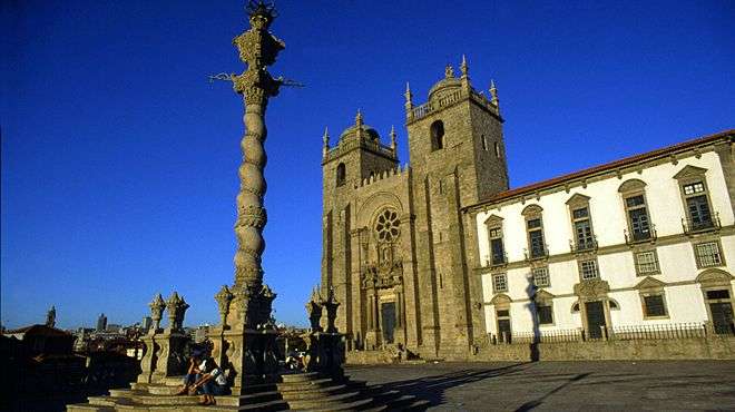
Porto Cathedral, known locally as Sé do Porto, is one of the most iconic and historically significant landmarks in northern Portugal. Perched atop a hill in the heart of Porto’s old town, the cathedral dominates the city skyline with its fortress-like façade and commanding views over the Douro River. Construction began in the early 12th century, making it one of the oldest monuments in Porto and a cornerstone of the city’s religious and architectural heritage.
The cathedral is a fascinating blend of Romanesque, Gothic, and Baroque styles, reflecting centuries of architectural evolution. Its original Romanesque structure is still visible in the heavy granite walls and narrow nave, while later Gothic additions include the elegant cloister and the funerary chapel of João Gordo, a Knight Hospitaller. In the 18th century, Italian architect Nicolau Nasoni added Baroque flourishes, including a grand loggia and ornate altarpieces.
A little-known fact: Porto Cathedral was the site of the royal wedding between King John I of Portugal and Philippa of Lancaster in 1387, a union that sealed the Anglo-Portuguese Alliance—one of the oldest diplomatic alliances in the world. Another hidden gem is the Camino de Santiago pilgrim’s credential office, tucked discreetly beside the cathedral, where modern-day pilgrims begin their journey to Santiago de Compostela.
Porto Cathedral is located in Portugal, within the Norte Region, in the city of Porto. It sits in the Sé neighborhood, one of the oldest quarters of the city, surrounded by winding cobbled streets and historic buildings.
Its elevated position makes it a perfect starting point for exploring Porto’s historic center.
To make the most of your visit to Porto Cathedral, keep these tips in mind:
Porto Cathedral is a majestic fusion of history, architecture, and spirituality. With its commanding presence, rich artistic details, and deep cultural significance, it offers visitors a profound glimpse into the soul of Porto. Whether you're a history buff, architecture lover, or spiritual seeker, the Sé do Porto is a must-see.
1. What are the opening hours of Porto Cathedral?
Typically, the cathedral is open from 9:00 AM to 6:30 PM. Hours may vary on holidays and Sundays.
2. Is there an entrance fee?
Entry to the main cathedral is free. A small fee may apply to access the cloister and museum.
3. Can I take photos inside the cathedral?
Yes, photography is allowed, but flash should be avoided, especially during services.
4. Is Porto Cathedral accessible for people with mobility issues?
The main entrance is accessible, but some areas like the cloister and terrace may have limited access due to stairs.
5. How long should I plan for the visit?
A typical visit lasts 45 minutes to an hour, longer if you explore the cloister and museum.
6. Is there a dress code?
Modest attire is recommended, especially if attending a religious service.
Discover more hidden gems you might love.
Lisbon
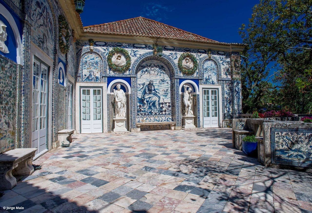
## Description Palácio dos Marqueses de Fronteira is an elegant, family-owned 17th-century estate on the edge of Lisbon that delights visitors with its exceptional azulejo tile panels, intimate museum rooms, and meticulously designed gardens. The palace feels less like a public museum and more like entering a well-preserved private residence that has been lived in and cared for by the same lineage of nobility for centuries. Interiors display an array of period furniture, heirloom portraits, and decorative arts that create a layered sense of domestic aristocratic life. The palace’s defining artistic draw is its azulejo program: large narrative tile panels that record hunting scenes, mythological episodes, allegories, and courtly imagery, executed in the refined blue-and-white and polychrome palettes typical of the 17th and 18th centuries. These tiles cover interior and exterior walls, forming pictorial narratives that reward close looking. Complementing the tiles are frescoes, gilded frames and sculptural elements that reflect Baroque and Rococo tastes adapted to Portuguese sensibilities. The gardens are a major reason to visit. Laid out with geometric hedges, elegant statuary and reflecting pools, they weave Moorish and Renaissance influences into a distinctly Portuguese landscape grammar. Garden rooms framed by clipped yews and boxwood create intimate vistas, while larger terraces open to sweeping views of the surrounding neighborhood. Seasonal plantings and careful maintenance mean the palace is beautiful year-round, although spring and early summer are especially lush. Conservation and stewardship at the palace are noteworthy: the family’s ongoing custodianship has supported careful tile restoration projects and the preservation of original material culture. Many of the conservation interventions have been carried out by local artisans using traditional techniques, preserving not just objects but craft knowledge. Photographic and accessibility note: photographers should plan for a mix of wide-angle shots of garden terraces and close-ups of tile details; early morning light reduces harsh shadows on glazed surfaces. Visitors requiring mobility assistance should contact palace staff ahead of time to arrange the smoothest route through garden paths and to confirm which rooms are accessible. ## Location The palace is located in the Benfica neighborhood of Lisbon, a short drive northwest of central districts like Rossio and Baixa. From the historic center, it typically takes 15–25 minutes by car depending on traffic. Public transit options involve buses and sometimes a combination of tram and bus; travelers should allow extra time for connections and walking to the palace grounds. Getting there: taxis and rideshares are convenient and typically the fastest way for visitors without a car. If using public transport, check current bus routes and schedules and allow for a short walk from the nearest stop to the palace entrance. ## Tips - Book tickets in advance when possible; guided tours are often limited and sell out during peak season. - Wear comfortable shoes: garden paths include gravel and uneven surfaces. - Respect interior rules: certain rooms may be closed or restricted for conservation reasons; photography inside may be limited. - Bring a camera and consider different lenses: a wide-angle captures garden vistas while a close lens helps study tile details. - Time your visit: visit in the morning light for softer photographs and more tranquil garden conditions. - Combine visits: pair the palace with nearby cultural sites such as the National Coach Museum or a walk in Monsanto Forest Park for a varied day. ## Conclusion Palácio dos Marqueses de Fronteira is a quietly grand escape from Lisbon’s busiest tourist routes. It rewards the patient visitor — those who enjoy architectural decoration, tile art and carefully tended gardens — with an intimate glimpse of aristocratic Portuguese life. The palace’s careful preservation and the family’s ongoing care make it a dignified and deeply rewarding stop on a cultural itinerary. ## FAQ Q: Are guided tours available? A: Yes. Guided tours are offered and provide detailed historical context about the palace, its tiles and the family’s history. Check the palace’s official website or local tourism resources for times and booking procedures. Q: Is the palace wheelchair accessible? A: Accessibility is limited in some historic rooms and garden areas due to steps and uneven terrain. Contact the palace in advance to discuss specific access requirements and to learn which sections are accessible. Q: Can I photograph inside the palace and gardens? A: Photography is usually permitted in the gardens; some interior rooms may restrict photography to protect delicate materials. Always follow posted signs and staff instructions. Q: How long should I allow for a visit? A: Plan for 1–2 hours to see the main rooms and stroll the gardens at a relaxed pace. If you are a tile or garden enthusiast, you may wish to allow more time. Q: Are there any special events or seasonal highlights? A: The palace occasionally hosts concerts, temporary exhibitions, or guided thematic tours. Spring and early summer offer peak garden blooms and are popular times to visit. ## Links - [Wikipedia: Palácio dos Marqueses de Fronteira](https://en.wikipedia.org/wiki/Palace_of_the_Marquises_of_Fronteira)
GemVoyage Team • World
Tokyo
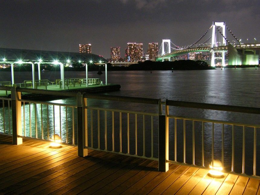
## Description Odaiba Seaside Park is one of Tokyo’s most enjoyable waterfront attractions because it offers a rare combination of open sky, coastal views, and easygoing public space in a city usually defined by density. The park is set on Tokyo Bay, and that location shapes everything about the experience. Instead of narrow streets, you get broad horizons. Instead of constant urban pressure, you get a slower rhythm, with people walking, sitting, cycling, or simply watching the water and the skyline. What makes the park appealing is the sense of contrast. Tokyo is famous for its intensity, but Odaiba gives you a place where the city meets the sea in a more relaxed way. You can see modern structures, bridges, and across-the-water views that feel both futuristic and calm. That blend is especially strong at sunset, when the light across the bay changes the atmosphere dramatically. Visitors often come for photographs, but they stay because the park is genuinely pleasant to spend time in. One little-known fact is that Odaiba itself was originally connected to ambitious land-reclamation and harbor development ideas, so the area reflects a distinctly modern Tokyo story rather than an ancient one. Another is that the park offers a valuable break in a city itinerary because it lets you slow down without feeling disconnected from the urban landscape. The water, beach-like edges, and sightlines make it feel open, but it still belongs fully to Tokyo. The park also works well as part of a larger Odaiba visit. It pairs naturally with shopping, entertainment, and other bay-area attractions, but it does not require you to spend money to enjoy it. That makes it especially useful for travelers who want a scenic stop that is easy to fit into a flexible day. If your idea of Tokyo includes both high energy and moments of calm, Odaiba Seaside Park delivers one of the cleanest transitions between the two. ## Location Odaiba Seaside Park is in Odaiba, Tokyo, Japan, on the waterfront facing Tokyo Bay. The area is well connected to the rest of the city and is one of the most recognizable modern districts in Tokyo’s bay zone. The easiest way to get there is by public transport, including the Yurikamome line or other transit options that serve the Odaiba area. Once you arrive, the park is straightforward to reach on foot. Because the district is designed for visitors and leisure, navigating it is generally simpler than navigating the city’s older, denser neighborhoods. If you are planning a full day, combine the park with nearby attractions or a walk through the broader Odaiba area. That gives you a better sense of why the district has become one of Tokyo’s most photogenic waterfront destinations. ## Tips Go near sunset if possible. The water, skyline, and bridges are especially attractive in the late afternoon and evening light. Bring a light jacket if you are visiting near the water, since the breeze can be stronger than in inland parts of the city. If you like photography, take your time moving around the shoreline. Different angles give you very different views of the city and bay. Use the park as a slower reset during a busier Tokyo itinerary. It is ideal after a day of dense urban exploration. Because Odaiba is so closely tied to modern Tokyo, the park can also feel cinematic in a way that many urban attractions do not. Bridges, towers, water, and open sky create a broad scene that changes with the light. That makes it especially good for visitors who like to photograph cityscapes or simply stand still and take in a less compressed part of Tokyo. The sense of openness is the whole point, and it is one of the reasons the park remains memorable after a busy day elsewhere in the city. It is also useful as a reminder that Tokyo is not only a city of movement but also of carefully designed public space. Odaiba Seaside Park gives you room to breathe without leaving the urban experience behind, and that balance is part of what makes it valuable. If you have already spent time in the tighter streets of central Tokyo, the park offers a visual and psychological reset that can make the rest of your itinerary feel more manageable. ## Conclusion Odaiba Seaside Park offers a refreshing waterfront perspective on Tokyo, combining open space, bay views, and modern city scenery. It is a strong choice for travelers who want a calmer but still distinctly urban experience. ## FAQ **Is Odaiba Seaside Park worth visiting?** Yes, especially if you want open views and a break from Tokyo’s denser districts. **What is the best time to go?** Late afternoon and sunset are especially attractive. **How do I get there?** Public transport to Odaiba is the easiest and most convenient option. **Is it good for families?** Yes. It is a relaxed public space that works well for all kinds of visitors. **Can I combine it with other Odaiba attractions?** Absolutely. It fits naturally into a broader waterfront itinerary. ## Links - [Tokyo Parks guide](https://www.tptc.co.jp/parks/odaiba)
GemVoyage Team • World
Siena
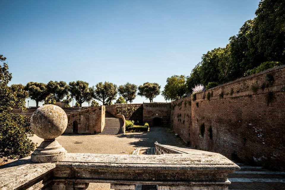
## Description Fortezza Medicea is one of Siena's most imposing landmarks because it represents a different historical layer from the city's medieval churches and squares. Built after Siena's defeat by Florence, the fortress reflects Medici power and the political reshaping of the region during the Renaissance. Unlike a decorative palace or a purely ceremonial monument, it was designed for strategic control and military presence. Today, however, it functions as a public space where history, viewpoints, and local life meet in a surprisingly relaxed way. The fortress is memorable because of its scale and shape. Its bastioned walls form a strong geometric presence above the city, and the elevated position gives visitors sweeping views over Siena and the surrounding Tuscan landscape. That combination of fortification and panorama makes it especially rewarding for travelers who appreciate places where architecture tells a political story. The walls are not just old stone; they are evidence of conquest, rule, and the reshaping of urban space. One little-known fact is that the fortress became less about defense over time and more about civic and cultural use, showing how military architecture can be repurposed for public life. Another detail many visitors miss is how the fortress helps explain the relationship between Siena and Florence. It is not just a monument standing above the city but a reminder of an era when regional power was expressed through earthworks, bastions, and visible control of the landscape. Visitors often appreciate the fortress for its calm atmosphere. While the city center of Siena can be bustling with tourists, the Fortezza Medicea feels more open and spacious. It is a good place to pause, look out across rooftops and hills, and understand how Siena sits within the broader Tuscan setting. If you are interested in military history, urban viewpoints, or Renaissance politics, the fortress is one of the city's most significant stops. ## Location Fortezza Medicea is in Siena, in Tuscany, Italy, just north of the historic center and within walking distance of major city attractions. Because it sits on elevated ground near the old core, it is easy to include in a walking tour of Siena, though the approach may involve some uphill sections depending on your starting point. If you are coming from Piazza del Campo or the cathedral area, the walk to the fortress is straightforward and can be done on foot. Buses and taxis can take you close as well, but walking is usually the best option because it lets you experience the transition from Siena's dense medieval streets to the more open fortified landscape. The most practical recommendation is to visit it while exploring Siena on foot, especially if you want to combine the fortress with other panoramic stops. Because the site is open and spacious, it works well as a late-afternoon or early-evening destination when the light becomes softer. ## Tips Go for the views as much as for the history. The fortress gives some of the best panoramas in Siena, so bring time to linger and not just pass through. If possible, combine the fortress with a walk through the surrounding park-like areas and nearby city streets. That allows you to see how the fortress integrates into Siena's urban edge rather than treating it as a disconnected monument. Read a little about the Medici and the political history of Siena before your visit. Knowing why the fortress was built changes the experience from a simple architectural stop into a clearer story about conquest and control. Visit on a day with good visibility if scenic views matter to you. The fortress is enjoyable in many conditions, but its strongest appeal is the way it frames the city and countryside. ## Conclusion Fortezza Medicea is one of Siena's most powerful historical sites, combining Renaissance military architecture, city views, and a reminder of the region's complex political past. ## FAQ ### Why was Fortezza Medicea built? It was built as a military fortress after Siena came under Medici control, serving as a symbol of political power and strategic dominance. ### Is the fortress open to visitors? Yes, the grounds and surrounding areas are generally accessible, though specific use may vary over time. ### What is the best part of visiting the fortress? The best part is the combination of panoramic views and the chance to understand Siena's political history. ### How long should I spend there? Most visitors spend between 30 minutes and an hour, depending on how much time they want for walking and views. ## Links - [Siena tourism](https://www.visitsiena.it/en/)
GemVoyage Team • World
Taiwan
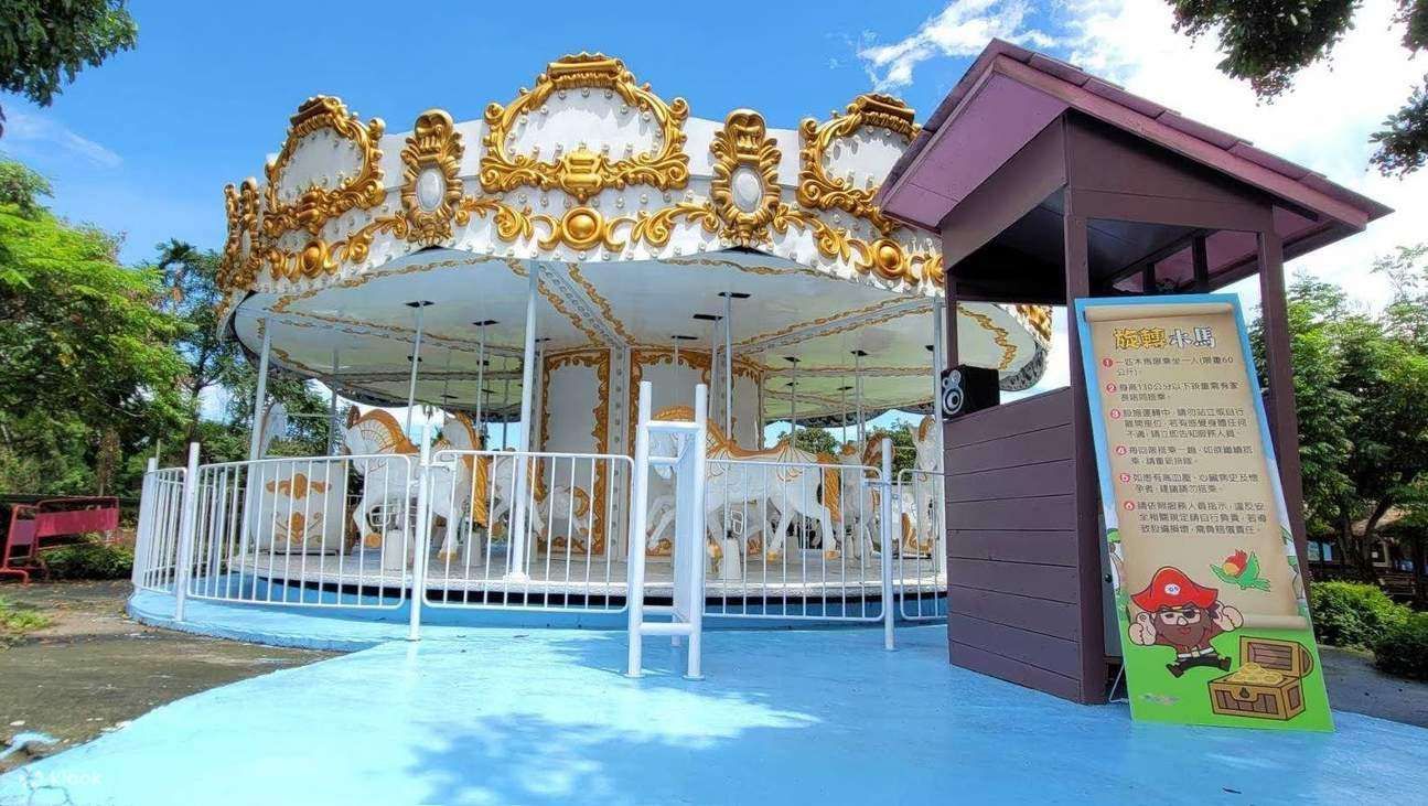
## Description Pirate Village Theme Park is a small but imaginative attraction in Taiwan that brings the spirit of seafaring adventure to life. Designed primarily for families with children, the park is centered around a colorful pirate theme, complete with ship-shaped playgrounds, lookout towers, rope bridges, and interactive installations that encourage exploration and physical activity. Rather than focusing on high-thrill rides, Pirate Village emphasizes creative play, storytelling, and hands-on fun in an open-air setting. What makes Pirate Village Theme Park unique is its community-driven concept. Unlike large commercial theme parks, this attraction was developed as a recreational and cultural space that blends leisure with local identity. Many of the structures are designed to be both playful and educational, helping children develop coordination, imagination, and social skills. A lesser-known fact is that the park often incorporates locally inspired design elements, subtly reflecting Taiwan’s coastal history and maritime culture. Another interesting detail is that Pirate Village regularly hosts small-scale events, such as weekend performances or seasonal activities, which are usually aimed at local families rather than tourists. For travelers looking for a relaxed, off-the-beaten-path experience—especially those traveling with young children—Pirate Village Theme Park offers a pleasant break from Taiwan’s busy city attractions. ## Location Pirate Village Theme Park is located in **Taiwan**, in the **Yunlin County** region, within **Douliu City**. Yunlin County is situated in central-western Taiwan and is known for its slower pace of life compared to major metropolitan areas like Taipei or Kaohsiung. The most convenient way to reach the park is by train to Douliu Station on the Taiwan Railways Administration (TRA) line. From the station, visitors can take a local taxi or bus to reach the park area within a short time. If you are traveling by car, driving is a practical option, as parking is generally easier to find than in larger cities. Visitors coming from other parts of Taiwan may consider combining a visit to Pirate Village with other nearby family attractions or local food stops in Yunlin County. ## Tips * Pirate Village Theme Park is best suited for families with young children, so adults traveling without kids may find the visit relatively short. * Visit during weekdays or early mornings on weekends to avoid local crowds, especially during school holidays. * Bring sun protection such as hats, sunscreen, and water, as much of the park is outdoors. * Wear comfortable shoes, as children are encouraged to climb, run, and explore different play structures. * Check local announcements or social media pages before visiting, as special events or maintenance closures may affect opening times. * Combine your visit with nearby local markets or cafés to make the trip more rewarding. ## Conclusion Pirate Village Theme Park is a charming, low-key attraction that offers imaginative play and family-friendly fun in central Taiwan. While it may not be a large-scale theme park, its creative design, relaxed atmosphere, and local character make it a worthwhile stop for families seeking a simple and enjoyable outing. ## FAQ **Is Pirate Village Theme Park suitable for all ages?** The park is mainly designed for children, especially those in preschool and elementary school age groups. Adults can accompany children but may find limited activities for themselves. **Is there an entrance fee?** In many cases, Pirate Village Theme Park is free or very low-cost, as it functions as a public or community-oriented attraction. Fees, if any, may apply during special events. **How much time should I plan for a visit?** Most visitors spend about one to two hours exploring the park, depending on crowd levels and children’s interest. **Is the park accessible by public transportation?** Yes, it is accessible via train and local buses, though taxis or private cars offer the most convenience. **Are food and drinks available inside the park?** Food options may be limited inside the park itself, so it is a good idea to bring snacks or plan to eat nearby. ## Links * [Yunlin County Government Tourism](https://tour.yunlin.gov.tw/wt-front/Home/Index)
GemVoyage Team • World
Chengdu
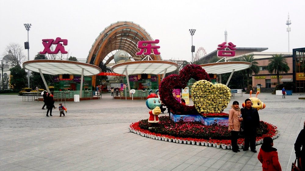
## Description Happy Valley Chengdu, known locally as 成都欢乐谷, is one of the largest and most popular theme parks in western China. Designed to appeal to visitors of all ages, the park combines high-adrenaline rides, family-friendly attractions, live entertainment, and themed zones inspired by global cultures and fantasy worlds. As part of the well-known Happy Valley chain across China, the Chengdu location stands out for its scale, variety, and strong integration of local elements. What makes Happy Valley Chengdu unique is its balance between intense thrill rides and immersive leisure experiences. Roller coasters, giant pendulum rides, and drop towers attract adrenaline seekers, while gentler attractions, parades, and interactive shows cater to families and younger visitors. A little-known fact is that some areas of the park subtly incorporate Sichuan cultural motifs in their design and performances, reflecting the region’s identity beyond the rides themselves. Another lesser-known detail is that Happy Valley Chengdu often hosts large-scale seasonal festivals, such as night-time light events and themed celebrations, which can significantly change the atmosphere of the park depending on when you visit. With its wide range of attractions and polished facilities, Happy Valley Chengdu has become a major entertainment destination not only for tourists but also for residents of Chengdu and neighboring cities. ## Location Happy Valley Chengdu is located in **China**, in **Sichuan Province**, within the city of **Chengdu**. The park sits in the Jinniu District, in the northern part of the city, making it accessible from central Chengdu while still offering a spacious layout. Getting to the park is convenient using public transportation. Visitors can take the Chengdu Metro to **Xipu** or nearby stations depending on current routes, then transfer to a bus or taxi for a short ride to the entrance. Taxis and ride-hailing apps are widely used in Chengdu and provide a straightforward option, especially for families. If traveling by car, the park has designated parking areas, though arriving early is recommended during weekends and holidays. ## Tips * Arrive early in the day to maximize your time and avoid long queues, especially during weekends and public holidays. * Check the park map and show schedules upon arrival to plan your visit efficiently. * Wear comfortable clothing and shoes, as the park is large and involves a lot of walking. * Some of the most popular rides have height or age restrictions, so review requirements in advance if visiting with children. * Visit during weekdays or outside major Chinese holidays for a more relaxed experience. * Stay until evening if possible, as night-time shows and illuminated attractions offer a different atmosphere. ## Conclusion Happy Valley Chengdu is a lively and well-rounded theme park that delivers excitement, entertainment, and memorable experiences for visitors of all ages. Whether you are seeking thrilling rides or relaxed family fun, the park offers a dynamic escape within one of China’s most vibrant cities. ## FAQ **Is Happy Valley Chengdu suitable for young children?** Yes, the park includes many family-friendly rides, play areas, and shows designed specifically for younger visitors. **How long should I plan to spend at Happy Valley Chengdu?** Most visitors spend a full day at the park to experience a wide range of attractions and shows. **Are English signs available in the park?** Some signage includes English, but having a translation app can be helpful for show schedules and ride details. **Is food available inside the park?** Yes, there are numerous food stalls and restaurants offering both Chinese and international options. **When is the best time to visit Happy Valley Chengdu?** Spring and autumn offer the most comfortable weather, while weekdays are best for avoiding crowds. ## Links * [Happy Valley Chengdu Official Website](https://cd.happyvalley.cn/)
GemVoyage Team • World
Alexandria
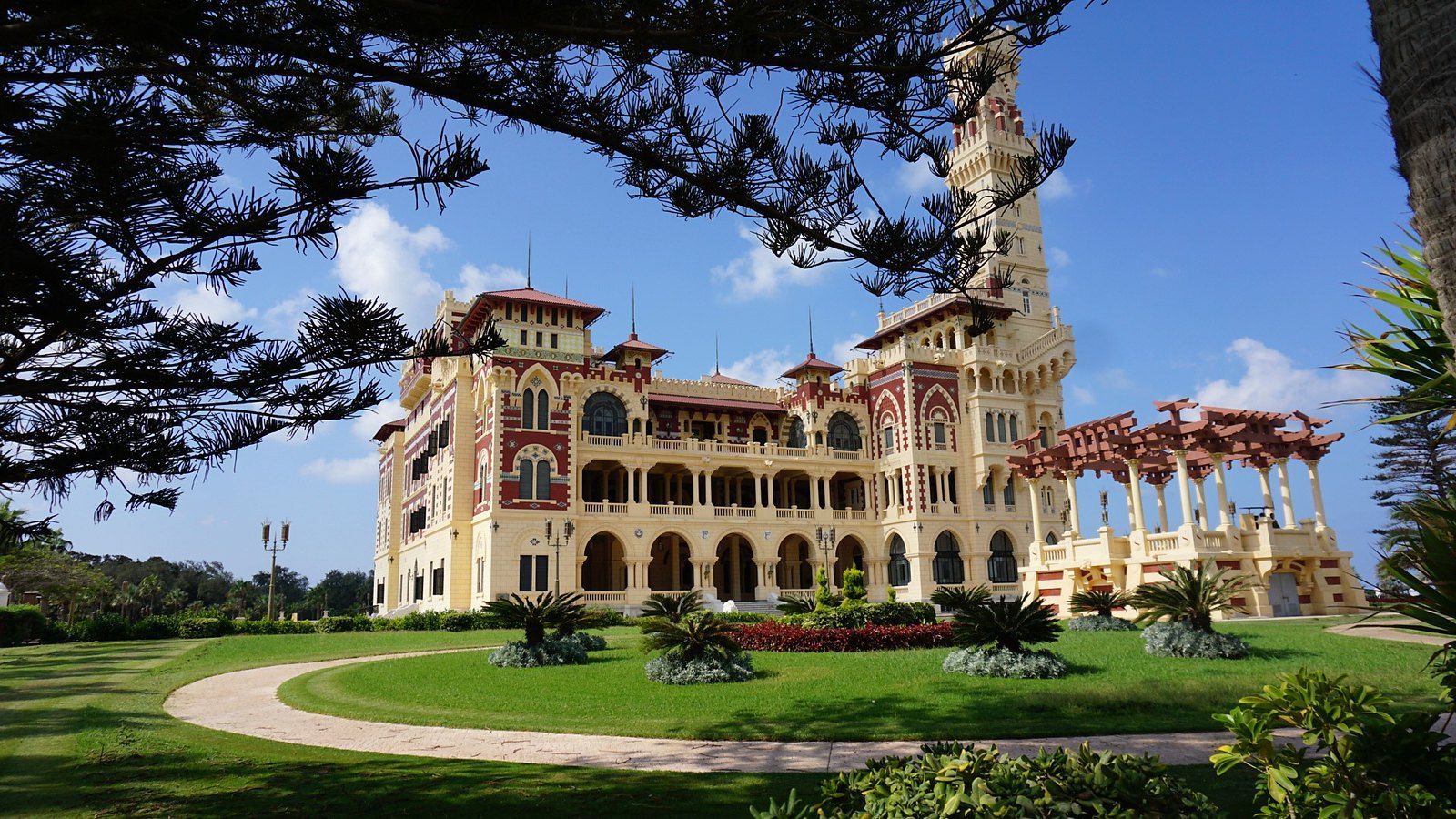
## Description On the eastern edge of Alexandria, where the city dissolves into a long sweep of Mediterranean coastline, lies one of Egypt's most beautiful and historically resonant public spaces. The Montaza Palace Gardens are a vast and carefully maintained park surrounding two royal palaces, stretching along the sea for over 150 acres of palm trees, manicured paths, ornamental fountains, and wild coastal landscape. For Alexandrians, it is a beloved retreat from the heat and noise of the city. For visitors, it is a rare opportunity to walk through a landscape that was once the private domain of Egyptian royalty and to see a side of Alexandria that few tourists ever discover. The garden complex is centered on two palaces: the Salamlek Palace, a small and elegant hunting lodge built in 1892 by Khedive Abbas II for his Austrian mistress, and the Haramlek Palace, a much larger and more elaborate structure built by King Fuad I in the 1930s as a summer residence for the Egyptian royal family. The Haramlek Palace, also sometimes referred to as the Montaza Palace, is the more architecturally dramatic of the two, combining Ottoman and Florentine Renaissance influences in a way that feels simultaneously exotic and strangely European. Its distinctive tower, visible from a considerable distance along the coast, has become one of the iconic images of Alexandria. A lesser-known fact about the Montaza complex is that it was the favored retreat of King Farouk, the last king of Egypt, who spent considerable time here before his abdication and exile following the 1952 revolution. The palace grounds were subsequently nationalized and opened to the public, transforming what had been an entirely private royal estate into one of Alexandria's most treasured public parks. Another interesting detail is that the Salamlek Palace has been converted into a boutique hotel, meaning it is actually possible to stay overnight inside one of the original royal buildings and wake up to views over the Mediterranean. The gardens themselves are beautiful regardless of any historical interest. Paths wind between towering palms and ancient trees, passing small bridges over ornamental streams and opening onto wide lawns that slope down toward the sea. The coastline within the park includes several small beaches and a private harbor. In the late afternoon, the light on the water and across the palace facades is extraordinary. ## Location The Montaza Palace Gardens are located in the Montaza district of Alexandria, Egypt, approximately 12 kilometers east of the city center along the Mediterranean coast. Alexandria is Egypt's second-largest city and sits on the northern coast of the country, about 220 kilometers northwest of Cairo. Getting to the gardens from central Alexandria is straightforward. The most convenient option is by taxi or ride-hailing app, which typically takes 20 to 30 minutes from the city center depending on traffic. Microbuses and public buses also run along the coastal road toward Montaza, though they can be busy and navigation requires some familiarity with local routes. For visitors staying in central Alexandria, a taxi is the recommended option for comfort and simplicity. From Cairo, Alexandria is accessible by train in approximately two hours, with frequent services running throughout the day from Ramses Station. Once in Alexandria, the journey to Montaza continues by taxi from the main train station. ## Tips - **Visit in the late afternoon.** The light over the Mediterranean in the hours before sunset is magical, and the temperature is much more comfortable than in the midday heat, especially in summer. - **Purchase entry to the full park.** There is a small entrance fee to access the main gardens. Certain sections and beach areas may have separate fees. Having Egyptian pounds in small denominations makes entry smoother. - **Explore both palaces.** While the Haramlek Palace is the more visually dramatic, the Salamlek building and its surroundings are worth visiting for the contrast in scale and atmosphere. - **Consider staying at the Salamlek Hotel.** For those seeking a unique accommodation experience, the Salamlek Palace Hotel allows overnight stays in the original royal lodge. It is a remarkable way to experience the atmosphere of the estate. - **Bring water and snacks.** The gardens are large and there are not always food and drink vendors conveniently located throughout the park. Bringing your own supplies ensures you can spend more time exploring comfortably. - **Respect the rules of the park.** As a family-oriented public space with a conservative local clientele, visitors should dress modestly and be mindful of the norms of the space. - **Go on a weekday if possible.** The gardens can be busy on weekends, particularly in summer when Alexandrians escape the heat. Weekday visits tend to be quieter and more relaxed. ## Conclusion The Montaza Palace Gardens represent one of Alexandria's greatest treasures and one of the most underappreciated royal heritage sites in the entire Mediterranean world. The combination of magnificent landscape, royal architecture, a fascinating history rooted in Egypt's final monarchical era, and a setting directly on the Mediterranean coast makes this a destination that rewards visitors generously. Whether you come for the history, the beauty, the sea air, or simply to walk beneath the palms and let the city recede for a few hours, Montaza delivers an experience that is genuinely difficult to find anywhere else in Egypt. ## FAQ **Is there an entrance fee for the Montaza Palace Gardens?** Yes, there is a small entrance fee to access the gardens. The fee is modest and is paid at the main gate. Some areas within the complex, such as certain beaches or the palace viewpoints, may have additional separate fees. It is advisable to bring small denomination Egyptian pound notes. **Can you go inside the Montaza Palace?** The main Haramlek Palace is not generally open for public interior tours, as it is used as a presidential guest residence. The exterior and the surrounding gardens are accessible. The Salamlek Palace functions as a hotel and can be visited or stayed in by hotel guests. **What is the best time of year to visit the Montaza Gardens?** Spring, from March to May, and autumn, from September to November, offer the most comfortable temperatures for exploring the outdoor gardens. Summer is hot but popular with local visitors. Winter tends to be mild but can be rainy. **How long should I spend at the Montaza Gardens?** A visit of two to three hours is typical for a comfortable exploration of the main paths, palace exteriors, and seafront areas. Garden enthusiasts or those who wish to sit and enjoy the atmosphere by the sea may happily spend a full half day. **Is Montaza Palace the same as Montaza Gardens?** The name Montaza refers to the entire complex, which includes the gardens, the coastline, the Haramlek Palace (often called Montaza Palace), and the Salamlek Palace. The gardens and the palaces are part of the same heritage site. **What else is there to see near the Montaza Gardens?** The Montaza district itself has a pleasant coastal road with cafes and seafood restaurants. Further along the coast toward the east is Mamoura Beach, another popular coastal area. Central Alexandria with its many historical sites, including the Citadel of Qaitbay and the Library of Alexandria, is approximately 30 minutes away by taxi. ## Links - [Montaza Palace on Wikipedia](https://en.wikipedia.org/wiki/Montaza_Palace)
GemVoyage Team • World

Comments