GemVoyage Team • World
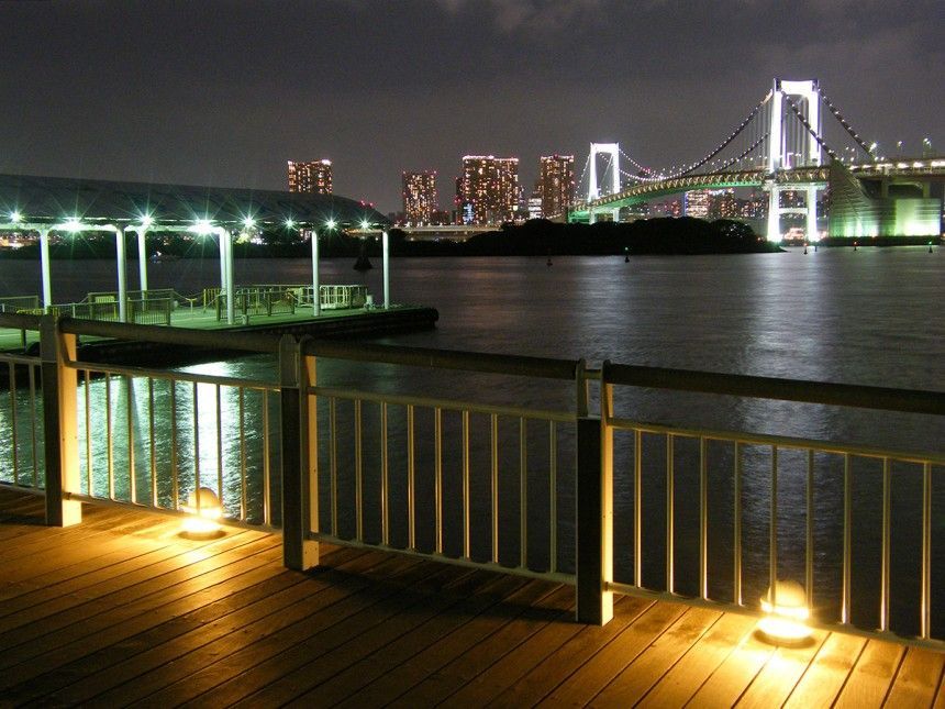
What makes the park appealing is the sense of contrast. Tokyo is famous for its intensity, but Odaiba gives you a place where the city meets the sea in a more relaxed way. You can see modern structures, bridges, and across-the-water views that feel both futuristic and calm. That blend is especially strong at sunset, when the light across the bay changes the atmosphere dramatically. Visitors often come for photographs, but they stay because the park is genuinely pleasant to spend time in.
One little-known fact is that Odaiba itself was originally connected to ambitious land-reclamation and harbor development ideas, so the area reflects a distinctly modern Tokyo story rather than an ancient one. Another is that the park offers a valuable break in a city itinerary because it lets you slow down without feeling disconnected from the urban landscape. The water, beach-like edges, and sightlines make it feel open, but it still belongs fully to Tokyo.
The park also works well as part of a larger Odaiba visit. It pairs naturally with shopping, entertainment, and other bay-area attractions, but it does not require you to spend money to enjoy it. That makes it especially useful for travelers who want a scenic stop that is easy to fit into a flexible day. If your idea of Tokyo includes both high energy and moments of calm, Odaiba Seaside Park delivers one of the cleanest transitions between the two.
The easiest way to get there is by public transport, including the Yurikamome line or other transit options that serve the Odaiba area. Once you arrive, the park is straightforward to reach on foot. Because the district is designed for visitors and leisure, navigating it is generally simpler than navigating the city’s older, denser neighborhoods.
If you are planning a full day, combine the park with nearby attractions or a walk through the broader Odaiba area. That gives you a better sense of why the district has become one of Tokyo’s most photogenic waterfront destinations.
Bring a light jacket if you are visiting near the water, since the breeze can be stronger than in inland parts of the city.
If you like photography, take your time moving around the shoreline. Different angles give you very different views of the city and bay.
Use the park as a slower reset during a busier Tokyo itinerary. It is ideal after a day of dense urban exploration.
Because Odaiba is so closely tied to modern Tokyo, the park can also feel cinematic in a way that many urban attractions do not. Bridges, towers, water, and open sky create a broad scene that changes with the light. That makes it especially good for visitors who like to photograph cityscapes or simply stand still and take in a less compressed part of Tokyo. The sense of openness is the whole point, and it is one of the reasons the park remains memorable after a busy day elsewhere in the city.
It is also useful as a reminder that Tokyo is not only a city of movement but also of carefully designed public space. Odaiba Seaside Park gives you room to breathe without leaving the urban experience behind, and that balance is part of what makes it valuable. If you have already spent time in the tighter streets of central Tokyo, the park offers a visual and psychological reset that can make the rest of your itinerary feel more manageable.
What is the best time to go? Late afternoon and sunset are especially attractive.
How do I get there? Public transport to Odaiba is the easiest and most convenient option.
Is it good for families? Yes. It is a relaxed public space that works well for all kinds of visitors.
Can I combine it with other Odaiba attractions? Absolutely. It fits naturally into a broader waterfront itinerary.
Discover more hidden gems you might love.
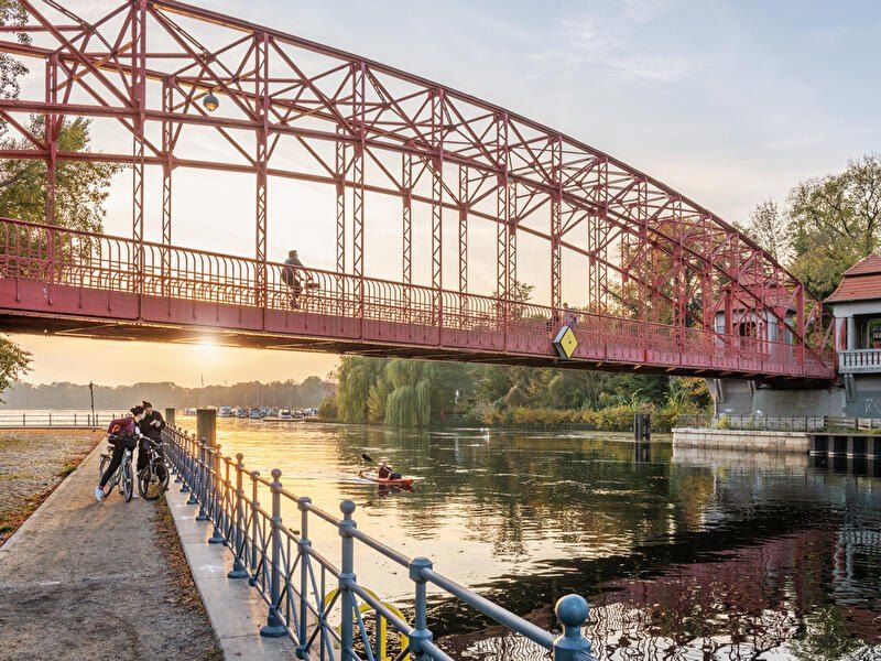
Berlin
## Description **Tegeler See** is one of Berlin’s largest and most beloved lakes, offering a rare combination of **deep forest landscapes, wide open water, historic promenades, and recreational freedom** within a major European capital. Unlike the carefully curated parks of central Berlin, Tegeler See feels **expansive, natural, and quietly powerful**, a place where the city dissolves into wind, water, and tree canopy. The lake stretches across the northern edge of Berlin and forms part of a much larger **interconnected water system** linking rivers, canals, and smaller lakes. Its shoreline alternates between **elegant promenades, dense woodland, sandy bathing areas, hidden coves, and small harbors**, giving every section a distinct character. On one walk you might pass joggers and cyclists near cafés, and moments later find yourself alone on a forested shoreline with only birds and passing sailboats for company. What makes Tegeler See especially unique is its **scale and visual openness**. The lake is wide enough to feel almost coastal in certain sections. Wind patterns shape large ripples across the surface, and on clear days the sky reflects endlessly into the water. Sailboats, paddleboards, kayaks, ferries, and swimmers all share the same space, creating an ever-moving ecological and recreational system. The western and northern edges of the lake are bordered by the **Tegel Forest (Tegeler Forst)**, one of Berlin’s largest continuous woodland zones. This forest contains long hiking paths, wildlife corridors, thick pine stands, and historic hunting routes that once served Prussian royalty. This direct interface between **urban lake and protected forest** is one of Tegeler See’s defining strengths. Few European capitals offer this scale of natural immersion without leaving city limits. From an urban perspective, the lake is closely tied to the borough of **Reinickendorf** and the historic district of **Alt-Tegel**. The Alt-Tegel promenade along the eastern shoreline functions as a social spine, lined with restaurants, ice cream shops, boat docks, beer gardens, and terraces overlooking the water. This area transforms in summer into one of Berlin’s most relaxed outdoor social scenes, blending families, cyclists, couples, and long-term residents. A little-known fact is that Tegeler See was once part of the **Havel River’s natural floodplain system**, and its modern form is the result of long-term hydraulic engineering dating back centuries. Another lesser-known detail is that the famous German poet and philosopher **Gotthold Ephraim Lessing** once lived near the lake, and the nearby Tegel Palace was home to the Humboldt family, including **Alexander von Humboldt**, one of history’s most influential natural scientists. Tegeler See’s emotional identity is shaped by **seasonality**. In spring, the forest releases fresh green layers and migrating birds return. Summer brings swimming, paddleboarding, lakeside dining, and long evening sunsets. Autumn covers the surrounding hills in gold and copper tones. Winter transforms the lake into a minimalist landscape of cold light, mist, and silence, occasionally frozen at the edges. Unlike Berlin’s central landmarks, Tegeler See does not present itself as a destination of spectacle. Its appeal is built on **duration rather than intensity**. People do not come for a single photo; they come to spend hours walking, reading, boating, cycling, swimming, and simply existing beside water and forest. It is one of the few places in Berlin where **time visibly slows down**. In a city often defined by density, history, and cultural pressure, Tegeler See functions as a **pressure valve**. It absorbs excess motion and releases calm. ## Location **Tegeler See** is located in **northwestern Berlin**, primarily within the borough of **Reinickendorf**, near the historic district of **Tegel**. **City:** Berlin **State (Region):** Berlin **Country:** Germany **Primary Area:** Reinickendorf / Alt-Tegel ### How to Get There: * **By S-Bahn:** * Take **S25** to **Tegel Station**, then walk 10 minutes to the lakeside. * **By U-Bahn:** * Take **U6** to **Alt-Tegel**, which places you directly at the main promenade. * **By bus:** Multiple bus routes connect Tegel with central and northern Berlin. * **By bicycle:** A well-developed bike network connects Tegeler See to the city center. * **By car:** Parking is available but is limited on busy summer days. The lake is easily combined with visits to **Alt-Tegel old town, Tegel Forest hiking trails, and the Havel River network**. ## Tips * **Visit on weekdays if you prefer quiet:** Weekends can be very busy in summer. * **Walk both the promenade and the forest side:** Each offers a completely different experience. * **Bring swimwear in summer:** Designated bathing areas are popular and well maintained. * **Sunset is the most atmospheric time:** Especially from western shoreline viewpoints. * **Boat rentals are widely available during the warm season.** * **Dress for wind:** The open water creates noticeable temperature shifts. * **Combine with Alt-Tegel dining:** Lakeside restaurants are a core part of the experience. * **Winter visits are underrated:** The silence and mist create a dramatic, cinematic mood. ## Conclusion **Tegeler See** is Berlin at its most expansive and elemental. It is where the city trades architecture for horizon, traffic for water movement, and density for breathing space. By uniting forest, lake, promenade, and history into one continuous landscape, Tegeler See offers a version of Berlin that is **slower, wider, and deeply restorative**. ## FAQ **1. Is Tegeler See suitable for swimming?** Yes. Several **official bathing areas** operate during the summer season. **2. Can you rent boats on Tegeler See?** Yes. **Paddleboats, kayaks, and small sailboats** are available for rent. **3. Is Tegeler See family-friendly?** Yes. It is widely used by **families, cyclists, walkers, and swimmers**. **4. How long does it take to walk around Tegeler See?** Walking the full perimeter can take **2.5 to 4 hours**, depending on pace and route. **5. Is Tegeler See good in winter?** Yes, especially for **quiet walks, photography, and forest exploration**. **6. Is there wildlife around the lake?** Yes. The area supports **water birds, foxes, deer, and diverse forest species**. ## Links * [Visit Berlin](https://www.visitberlin.de)
GemVoyage Team • World
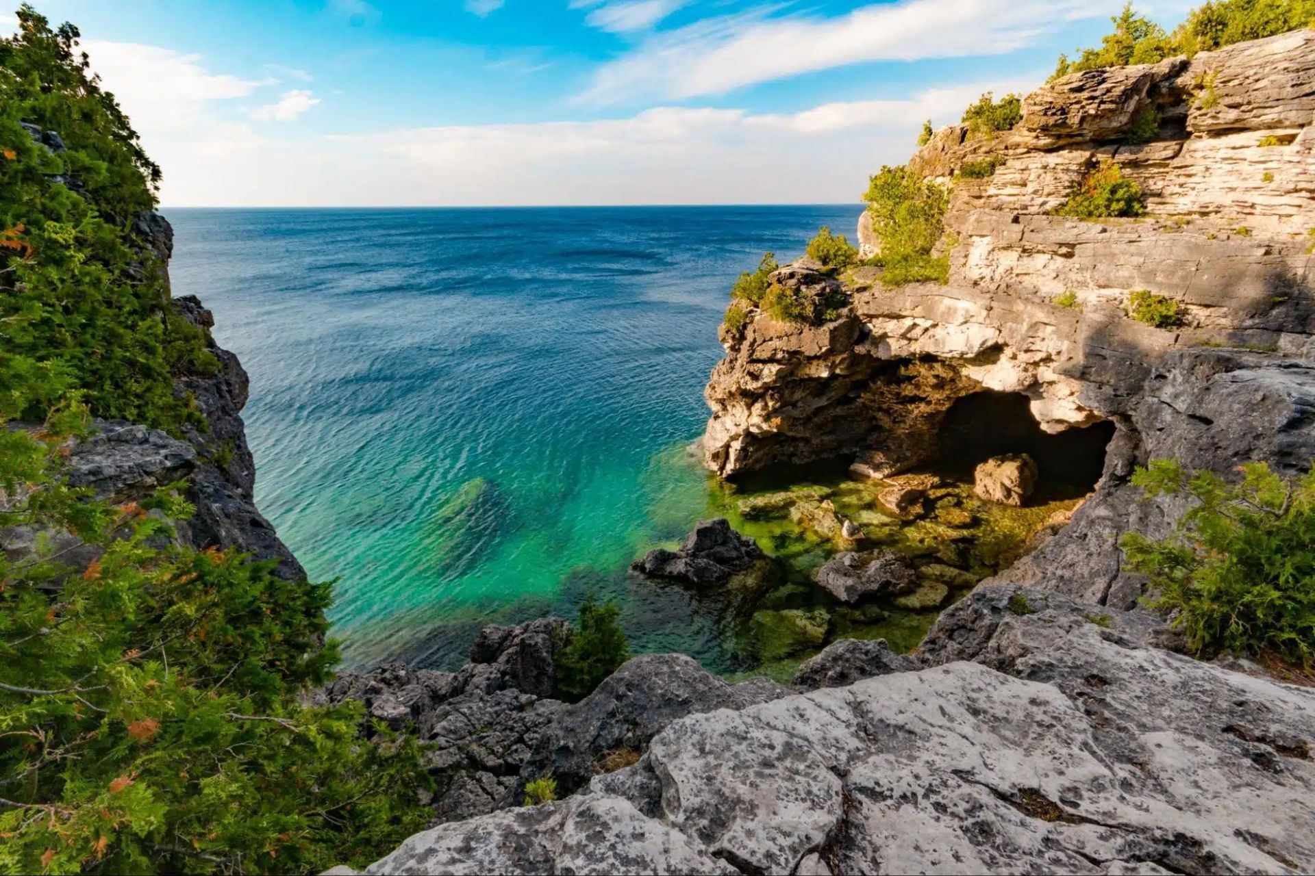
Ontario
## Description The Tobermory Grotto is one of Ontario’s most recognizable natural attractions and a place that has become almost legendary among travelers who love clear water, rocky shoreline, and dramatic coastal scenery. Located along the Bruce Peninsula in Bruce Peninsula National Park, the Grotto is a sea cave and shoreline formation shaped by water and stone over a very long stretch of time. Its appeal is immediate: bright turquoise water, pale limestone cliffs, and a setting that looks more like a distant island destination than a typical inland Canadian getaway. What makes the Grotto so memorable is how strongly it contrasts with expectation. Travelers who arrive expecting a simple viewpoint often discover a landscape that feels startlingly vivid. The water color can seem almost unreal when sunlight is strong, and the surrounding rock formations create a natural frame that feels tailor-made for photography. Beyond the famous cave itself, the broader Bruce Peninsula landscape adds to the experience with forest, shoreline trails, and a sense of remote beauty that is unusually accessible for southern Ontario. One little-known fact is that the Grotto’s appearance changes dramatically with weather and light. On bright days, the water can look intensely blue-green, while overcast conditions make the scene quieter and more subdued. Another detail visitors often discover only when they arrive is that the site’s popularity has changed how it must be visited. Timing, access planning, and park rules matter more than they do at many ordinary day-use destinations. That is not a drawback so much as part of the modern experience of seeing one of Canada’s most celebrated natural spots. The Grotto is also a place that rewards patience. People often talk about it as a photo stop, but the longer you stay in the region, the more complete the experience becomes. The surrounding national park, the shoreline walk, and the broader Tobermory area all help the destination feel like a true outdoor trip rather than a single scenic moment. ## Location The Tobermory Grotto is in Bruce Peninsula National Park near Tobermory, Ontario, on the western side of the Bruce Peninsula along Georgian Bay. Tobermory is a small but well-known community at the northern end of the peninsula, and the Grotto is reached from there by road and park access rather than by urban transit. For most visitors, driving is the standard and most practical way to get there. Because the Grotto is a popular destination with limited access and park management considerations, it is wise to plan ahead rather than assuming you can simply arrive at any time. If you are coming from Toronto, London, or other parts of southern Ontario, the trip is long enough that an overnight stay in the Tobermory area can make the visit far more enjoyable. That also gives you time to explore the park properly instead of rushing in and out around the single most famous viewpoint. ## Tips Book and plan early. This is not the kind of place where improvisation always works best, especially in busy season. Parking, access rules, and timing can shape your experience significantly. If you wait until the last minute, you may find your options limited. Bring sturdy shoes and be prepared for a walk. The Grotto is scenic, but reaching it typically requires more effort than a simple roadside stop. The terrain can be rocky and uneven, so footwear matters. If you plan to swim, remember that natural water is cold even on warm days, and conditions can be less forgiving than they look from a photo. Think beyond the cave itself. The Grotto is the headline, but the whole Bruce Peninsula area is worth time. Nearby trails, shoreline views, and the general Tobermory landscape help transform the trip from a single stop into a richer outing. If possible, stay long enough to enjoy the area during different light conditions. Watch the weather. Clear sky and sunlight can make the water look especially bright, but even cloudy days have their own moody beauty. Safety, however, always matters more than the photo. Check local guidance before entering the water or walking near exposed edges. ## Conclusion The Tobermory Grotto is one of Ontario’s most impressive natural sights, blending dramatic shoreline scenery with the iconic turquoise water of Georgian Bay. It deserves the planning it requires and rewards travelers who make time for the wider peninsula. ## FAQ ### Is the Grotto worth the trip from Toronto? Yes, especially if you enjoy dramatic natural scenery and do not mind a longer drive. Many visitors treat it as an overnight or weekend trip so they can enjoy the Bruce Peninsula more fully. ### Can I swim there? Swimming may be possible depending on conditions and local rules, but the water is very cold and natural shoreline conditions can be challenging. Always check current guidance before entering the water. ### Do I need to visit in summer? Summer is the most popular season, but the area can be beautiful at other times too. The tradeoff is that access, weather, and comfort levels vary by season. ### Is the Grotto suitable for children? It can be, if you are careful and supervise closely. The rocky terrain means families should pay attention to footing and safety. ### How much time should I plan? At minimum, allow enough time for the walk, the viewpoint, and the return. A fuller Bruce Peninsula day trip is much more satisfying than a rushed photo stop. ## Links - [Official website](https://parks.canada.ca/pn-np/on/bruce/activ/experiences/grotto) - [Wikipedia](https://en.wikipedia.org/wiki/Bruce_Peninsula_National_Park)
GemVoyage Team • World
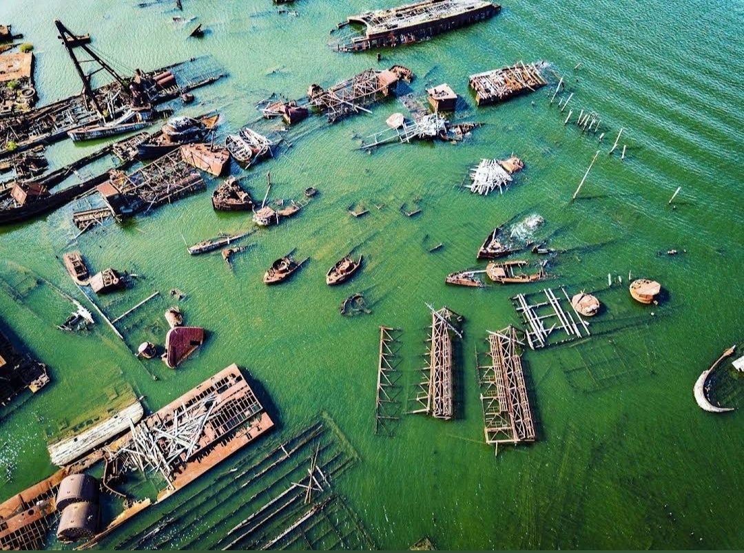
New York
## Description The **Staten Island Boat Graveyard**, officially known as the **Witte Marine Scrap Yard**, is one of New York’s most unusual and fascinating attractions. Nestled along the Arthur Kill waterway, this hidden site is where dozens of decommissioned ships were brought to rest, creating an eerie yet captivating scene. Rusting hulls, half-sunken tugboats, and skeletal remains of vessels stretch across the shoreline, making the boat graveyard a dreamlike place for urban explorers, history buffs, and photographers alike. What makes the site particularly unique is the way nature and industry intertwine. Over decades, the corroding metal has blended with the marshland environment, creating a haunting landscape that feels frozen in time. Unlike a museum display, the graveyard is raw, untouched, and authentic—a piece of living maritime history slowly dissolving into the tide. **Little-known facts**: * The site was founded in the 1930s by John J. Witte, who originally intended it as a marine salvage yard rather than a tourist attraction. Today, it is still an active scrapyard, though parts of it have become a de facto maritime graveyard. * The boat graveyard is sometimes called the “**Tugboat Graveyard**” because many of the vessels abandoned here were tugboats that once served New York Harbor. --- ## Location The Staten Island Boat Graveyard is located in **Staten Island, New York City**, within the state of **New York**, USA. It sits along the Arthur Kill waterway near the neighborhood of Rossville, on the western shore of Staten Island. ### How to get there: * **By car**: The easiest way is to drive, as the site is relatively remote. Visitors can park nearby on Arthur Kill Road and walk toward the shoreline. * **By public transit**: It’s possible, though less convenient, to take an MTA bus (such as the S74 or S78) from the Staten Island Ferry terminal and walk the rest of the way. * **Guided tours**: Some local tour operators and photography groups organize visits to the graveyard, which can be a safer and more informative way to experience the site. --- ## Tips * **Wear sturdy shoes**: The area around the graveyard can be muddy, uneven, and slippery, especially after rain. * **Respect private property**: The scrapyard is privately owned, so visitors should avoid trespassing and stick to public access points along the shore. * **Bring a camera**: The rusting vessels, changing tides, and dramatic light make for excellent photography opportunities. * **Visit at low tide**: More ships and details are visible when the tide is out, allowing for better exploration and photos. * **Stay safe**: The boats themselves are unstable and dangerous to climb. Admire them from a distance rather than attempting to board. * **Go in daylight**: The graveyard is isolated and not well lit, so daytime visits are recommended for safety and visibility. --- ## Conclusion The Staten Island Boat Graveyard is a hauntingly beautiful site where history, decay, and nature converge. It’s not a polished tourist attraction, but that’s what makes it so special—its authenticity, its mystery, and its ability to transport visitors into another era of New York’s maritime past. For those who enjoy off-the-beaten-path destinations, this hidden corner of Staten Island offers a rare and unforgettable experience. --- ## FAQ **1. What is the Staten Island Boat Graveyard?** It’s a marine scrapyard where decommissioned vessels, especially tugboats, have been abandoned over decades along the Arthur Kill waterway. **2. Can I visit the graveyard legally?** Yes, but since it is on private property, visitors should only view it from public access points along the shoreline and avoid trespassing into the scrapyard itself. **3. Is the site safe to explore?** The surrounding area is generally safe, but climbing onto the ships is dangerous and not recommended due to rust, sharp edges, and unstable structures. **4. When is the best time to visit?** Low tide during daylight hours is ideal, as more ships are visible and lighting conditions are better for photography. **5. Do I need special equipment to visit?** No, just wear comfortable shoes and bring a camera. Binoculars can also enhance the experience if you want a closer look at distant vessels. **6. Is it worth visiting for non-photographers?** Absolutely. Even without a camera, the graveyard offers a unique and atmospheric glimpse into New York’s maritime history.
GemVoyage Team • World
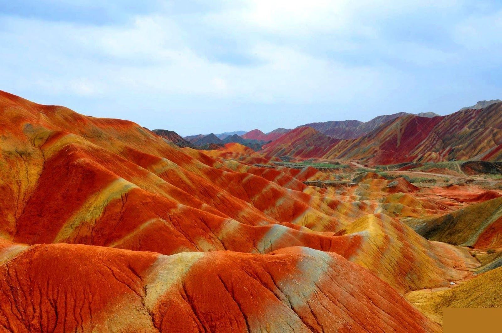
Gansu
## Description The Zhangye Danxia landform in Gansu province is a riot of color spread across layered sandstone ridges and steep cliffs, creating landscapes that look as if someone painted the earth with broad strokes of red, orange, yellow and green. The chromatic bands are the product of red sandstone and mineral deposits laid down over 24 million years and later uplifted and carved by wind and water. Viewed from purpose-built overlooks and winding boardwalks, the patterns create optical illusions of waves and folds that shift with the sun’s angle. The site is remarkable both for its vivid palette and for the scale of the striations: what from a distance seems like painted canvas resolves into a labyrinth of ridges, gullies and panoramic terraces. A lesser-known detail: the colors vary seasonally and with weather conditions; after rain, the hues often deepen, offering particularly saturated photographic opportunities. Beyond the immediate visual drama, Zhangye Danxia offers a lesson in geologic time and human-scale interpretation of landscape. The park's boardwalks and viewing platforms were designed to give visitors a range of compositions at different elevations, while interpretive signs explain the processes of sedimentation, uplift and erosion that produced the striking bands. Photographers and landscape enthusiasts often plan their visits around atmospheric conditions: low-angle light during golden hours casts ridges into sharp relief, while overcast or misty days can soften colors and emphasize shapes. The park's scale means that a single viewpoint never fully captures the variety present across the terrain — taking time to traverse multiple platforms yields a richer sense of the formations. Local infrastructure has expanded to accommodate steady tourism, but many visitors still find quiet corners along lesser-known paths. For those willing to explore beyond the main viewing decks, short hikes and rural lanes reveal unexpected perspectives of the painted cliffs and provide a quieter atmosphere for contemplative study. The town of Zhangye offers practical amenities including hotels, train connections and guided-tour services; most visitors access the geopark via a short drive from the city. When combined with nearby attractions in Gansu province — historic Silk Road sites, oasis towns and desert landscapes — Zhangye Danxia becomes a vivid and contrasting chapter in any northwest China itinerary. ## Location The Zhangye Danxia Geopark lies in Zhangye city, Gansu province, northwestern China. It’s accessible by road from Zhangye city center, which in turn connects by train or air to larger Chinese hubs such as Lanzhou and Xi’an. The park’s viewing platforms are designed for staged sightseeing, enabling visitors to experience different panoramas without extensive trekking. Timetables for trains and regional buses vary seasonally; many travelers arrive by high-speed or conventional rail to Zhangye and then take local shuttle services or taxis to the geopark entrance. The park's layout is linear, with a series of parking lots and platforms that correspond to different photographic viewpoints — plan logistics to avoid backtracking during peak hours. Accommodation in Zhangye ranges from economical guesthouses to mid-range hotels that can arrange guided excursions and private transport. ## Tips - **Visit at golden hour:** Sunrise or sunset gives the painted ridges warmer tones and dramatic shadows. - **Use multiple viewpoints:** Walk the main boardwalk and visit several overlooks to appreciate how the formations change with perspective. - **Protect from dust and sun:** The region is arid; bring sun protection and a dust cover for camera gear. - **Consider guided photo tours:** Local guides can take you to lesser-known vantage points for unique compositions. - **Time your transport:** Parking and shuttle flows can be busy; arrive early to avoid crowds at the main platforms. - **Dress for desert conditions:** Layered clothing, sturdy shoes and water are essential; evenings can cool significantly. - **Respect park rules:** Stay on boardwalks to protect fragile soils and prevent erosion; drones are often restricted. - **Bring varied lenses:** A wide-angle to capture panoramic ridgelines and a moderate telephoto to isolate patterns will be useful. ## Conclusion Zhangye Danxia offers one of the planet’s most vivid examples of sedimentary color and erosion, a landscape that rewards patient observation and thoughtful composition. Visiting Zhangye Danxia is as much an exercise in perception as it is in travel logistics — the colors and forms change with light, season and vantage point, and the most memorable experiences come when you slow down and let the terrain reveal its subtleties. For photographers, geologists and curious travelers, the geopark is a compelling and photogenic stop that pairs well with broader exploration of Gansu’s cultural and natural history. ## FAQ - **Q: Is the park walkable?** - A: Yes — well-maintained boardwalks and viewing platforms offer accessible scenic routes. - **Q: Can I drive between viewpoints?** - A: Internal park transport and short walks connect main viewpoints; check park maps for distances. - **Q: When is the best season for color saturation?** - A: Late spring through early autumn generally provides strong color contrast, but early morning light and post-rain conditions often produce the most saturated hues. - **Q: Are drones allowed for aerial photography?** - A: Drone policies vary and are often restricted near protected viewpoints — always check park regulations and obtain permits if required. - **Q: How much time should I allocate?** - A: A full half-day can cover the primary platforms; photographers might want a full day to cycle through light conditions and multiple viewpoints. - **Q: What other nearby sites pair well with Zhangye Danxia?** - A: Historic Silk Road towns, the Mati Temple Grottoes and desert landscapes around Zhangye make for complementary cultural and geological explorations. ## Links - [Zhangye Danxia — Wikipedia](https://en.wikipedia.org/wiki/Zhangye_National_Geopark)
GemVoyage Team • World

Montpllier
## Description Comedy Square, or **Place de la Comédie**, is the vibrant heart of Montpellier and one of the most iconic squares in southern France. Known locally as *“l’Oeuf”* (The Egg) because of its oval shape, this lively square is a gathering spot for both locals and tourists. It is surrounded by stunning 19th-century Haussmann-style buildings, bustling cafés, and the impressive **Opéra Comédie**, which dominates one side of the square with its grand façade. What makes Comedy Square unique is its **constant energy**—from street performers and musicians to open-air terraces where people enjoy Mediterranean sunshine. It’s not only a cultural hub but also a place to start exploring Montpellier’s historic center. A little-known fact is that the square has been at the core of Montpellier’s social life since the **18th century**, making it one of the oldest urban meeting points in the city. Another interesting detail is the presence of the **Three Graces Fountain**, a beautiful marble sculpture from 1790 that has become a beloved symbol of Montpellier. ## Location Comedy Square is located in **Montpellier, France**, in the **Occitanie region** of southern France. It lies right in the city center, connecting the historic old town with the more modern districts. The square serves as a central point for trams, buses, and pedestrian streets, making it extremely accessible. ### Recommendation on How to Get There If you’re traveling from **Montpellier Méditerranée Airport**, you can reach the square by shuttle bus to the main train station, **Gare Saint-Roch**, which is only a few minutes’ walk from Comedy Square. The city’s excellent **tram network** also stops directly at Place de la Comédie, making it the most convenient way to get there from anywhere in Montpellier. For those staying in the historic center, walking is the best option, as many attractions are clustered around the square. ## Tips Here are some useful tips for making the most of your visit to Comedy Square: * **Visit During the Evening**: The square comes alive at night with street performers, illuminated buildings, and buzzing cafés. * **Enjoy the Cafés and Terraces**: Sit down at one of the many outdoor cafés to soak in the atmosphere and people-watch. * **Take a Tram Ride**: Montpellier’s trams are famous for their artistic designs. Boarding one from the square gives you a unique perspective of the city. * **Photography**: The square is especially photogenic at sunset when the Opéra Comédie and surrounding buildings glow in golden light. * **Combine With a Walking Tour**: From the square, you can easily walk to Montpellier Cathedral, the Fabre Museum, or stroll down Rue de la Loge for shopping. * **Avoid Driving**: The square is pedestrian-friendly, and parking is limited nearby, so it’s best to use public transportation. ## Conclusion Comedy Square in Montpellier is more than just a central plaza—it’s the heartbeat of the city. With its beautiful architecture, lively atmosphere, and cultural landmarks, it offers visitors a true taste of southern French life. Whether you’re sipping coffee at a terrace, watching a street performance, or exploring nearby attractions, Comedy Square is a must-see destination when visiting Montpellier. ## FAQ **1. What is Comedy Square famous for?** It is famous for its lively atmosphere, historic architecture, the Opéra Comédie, and the Three Graces Fountain. **2. Is Comedy Square pedestrian-friendly?** Yes, it’s primarily a pedestrian zone, making it safe and enjoyable to explore on foot. **3. Are there restaurants and cafés in the square?** Yes, the square is surrounded by numerous cafés and restaurants, perfect for dining or enjoying a drink outdoors. **4. How do I get to Comedy Square from the train station?** The main train station, Gare Saint-Roch, is only a 5-minute walk from the square. **5. Is it worth visiting at night?** Absolutely. The square lights up beautifully in the evening and is filled with vibrant street life. **6. Can I take public transport to Comedy Square?** Yes, several tram lines stop directly at the square, making it the easiest way to get there. ## Links * [Official Montpellier Tourism Office](https://www.montpellier-france.com/)
GemVoyage Team • World
Seoul
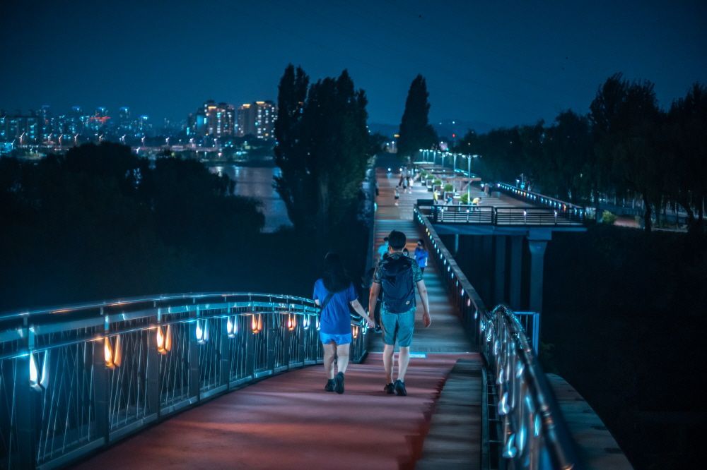
## Description Seonyudo Park is a standout example of urban ecological design: a former water treatment plant reborn as a thoughtfully landscaped public park on an island in the Han River. The designers preserved key elements of the plant—filter basins, machinery platforms, and concrete shells—and repurposed them as botanical displays, reflective ponds and educational spaces. The result is a layered experience where industrial memory and living ecology intersect: walking routes weave through restored filtration beds, shaded groves, themed gardens and interpretive exhibits that explain water purification and habitat restoration. Visitors appreciate Seonyudo for its inviting balance of engineered structure and natural regeneration. The greenhouse and wetland areas host seasonal plantings and migratory birds, while the decks and viewpoints offer long riverside panoramas that are particularly striking at sunset. Beyond the visual appeal, the park operates as a civic classroom: plaques and small exhibits outline the former plant operations and current sustainability initiatives, helping visitors of all ages understand ecological cycles and urban water systems. Seonyudo’s design also makes it a pleasant social space: picnic spots, quiet courtyards and accessible pathways encourage lingering, and occasional cultural events—workshops, guided ecological walks and small performances—lend the park a local community feel. For urban planners, photographers and families alike, Seonyudo Park is a model of how industrial remnants can be transformed into resilient public amenities. ## Location Seonyudo Park sits on Seonyudo Island in the Han River within Mapo-gu, central Seoul. The island is easy to reach by the pedestrian footbridge connecting to the northern riverbank near Dangsan, and public transit options include Seonyudo Station (Line 9) and nearby bus stops. Cyclists frequently access the island via the riverside cycling paths that thread along the Han. Because Seonyudo is integrated into the riverfront network, you can combine a visit with a longer riverside ride or walk that links to adjacent parks and cultural districts. The park’s central location makes it an accessible stop during a day exploring Mapo and the west bank of the Han. ## Tips - Go in late afternoon or early evening for the best light and cooler temperatures, especially in summer. - Rent or bring a bicycle to follow the riverside paths; Seonyudo is well connected to Seoul’s cycling routes. - Take the short interpretive walk through the former filter beds to learn about the site’s history and water treatment processes—signage and occasional guided tours add context. - Pack a picnic or a light snack; while there are small kiosks at times, facilities are limited compared with larger parks. - Watch for seasonal plantings and bird migrations—spring and autumn are especially rewarding for flora and fauna observation. ## Conclusion Seonyudo Park exemplifies how thoughtful design can convert industrial infrastructure into productive green space. It rewards visitors who are curious about urban sustainability, landscape architecture and the layered histories of cities. Whether you are a photographer seeking unique compositions of water and concrete, a family looking for a quiet riverside escape, or a planner studying adaptive reuse, Seonyudo offers a memorable, instructive and restful visit. ## FAQ Q: Is there an entrance fee? A: No. Seonyudo Park is a public park and free to enter, though some seasonal programs or guided workshops may have small fees. Q: Are dogs allowed in the park? A: Dogs are generally allowed but must be kept on a leash and under control; check posted rules for specific zone restrictions. Q: Are there restroom facilities and drinking water? A: Public restrooms and water fountains are available near principal access points, but facilities can be limited—carry water for long summer visits. Q: Can I cycle across the park? A: Cycling routes approach and circle the island; on-site cycling may be restricted in certain pedestrian or ecological zones—dismount where indicated. Q: Is there parking nearby? A: Limited parking is available along nearby roads, but public transit and cycling routes are the preferred ways to reach the island. ## Links - [Seonyudo Park (Wikipedia)](https://en.wikipedia.org/wiki/Seonyudo_Park)
GemVoyage Team • World

Comments