GemVoyage Team • World
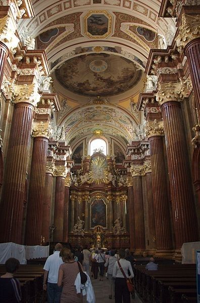
Fara Church, officially known as The Parish Church of St. Stanislaus (Fara Church), is one of the most magnificent Baroque buildings in Poland and a must-visit attraction in Poznań. Built in the 17th century by Jesuits, it has become a symbol of Poznań’s religious and architectural heritage. With its richly decorated interior, fresco-covered ceilings, and breathtaking altars, it is often considered one of the most beautiful Baroque churches in Europe.
What makes the Fara Church unique is not only its grandeur but also the acoustics that make it a popular venue for organ concerts. The church houses an impressive pipe organ with over 2,000 pipes, and visitors are often treated to free concerts showcasing the instrument’s power and elegance.
A little-known fact about the church is that beneath it lies a series of underground chambers and crypts, some of which are occasionally open to the public during guided tours. Another interesting detail is the presence of trompe-l’œil painting techniques inside, which create optical illusions, making the decorations appear three-dimensional and more elaborate than they actually are.
Fara Church is located in Poznań, Poland, in the Greater Poland region. It stands in the Old Town district, just a short walk from the famous Old Market Square (Stary Rynek). The church’s location in the historic heart of the city makes it easy to combine a visit with other nearby attractions such as the Town Hall and the Royal Castle.
From Poznań Główny railway station, you can take a tram to Wrocławska or Marcinkowskiego stops, and from there, it’s only a few minutes’ walk to the church. For those already in the city center, Fara Church is easily accessible on foot. If you’re arriving by car, it’s recommended to park in one of the nearby parking facilities since the Old Town area has limited vehicle access.
To make your visit to Fara Church in Poznań truly memorable, here are some practical tips:
Fara Church in Poznań is a masterpiece of Baroque architecture and a cultural highlight of the city. With its ornate interior, fascinating history, and world-class acoustics, it offers a unique experience for visitors interested in history, art, or music. A trip to Poznań wouldn’t be complete without stepping inside this architectural gem.
1. What is the full name of Fara Church?
Its official name is the Parish Church of St. Stanislaus (Fara Church).
2. Is there an entrance fee to visit the church?
No, entry is free, though donations are welcome. Special guided tours or concerts may have a small fee.
3. Can tourists attend religious services?
Yes, but visitors are asked to remain respectful and quiet during services.
4. What makes the church special compared to others in Poznań?
Its Baroque design, richly decorated interior, and famous pipe organ make it one of the most outstanding churches in Poland.
5. Is the church accessible for people with disabilities?
The main entrance is accessible, but some underground chambers may not be suitable for those with mobility issues.
6. How long does a visit usually take?
A typical visit lasts 30 minutes to 1 hour, but if you attend a concert or guided tour, you might stay longer.
Discover more hidden gems you might love.
Varėna
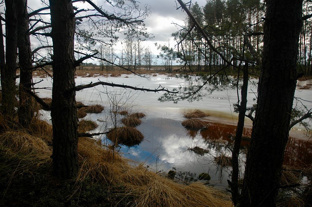
## Description Čepkeliai Raised Bog is among Lithuania’s most important peatland reserves, an expansive raised bog that feels at once remote and intimate. Its surface is a subtle patchwork of sphagnum hummocks, shallow pools, and scattered stunted pines; that patterning creates a fragile, otherworldly landscape that changes color and mood with the light. For naturalists and quiet travelers the bog offers a concentration of specialized habitats where rare mosses, sedges, and lichens flourish alongside insect life and bird species adapted to waterlogged peat. Beyond its visible beauty, Čepkeliai is scientifically invaluable. The peat layers here have accumulated over millennia, trapping pollen, seeds, and macrofossils that give researchers a continuous record of past vegetation and climate. That archive helps reconstruct regional environmental history and informs conservation decisions today. The bog’s intact hydrology—its network of raised surfaces and water-filled hollows—supports unique ecological processes, from specialized plant communities to breeding cycles for rare birds. Although the terrain looks invitingly wild, it’s also extremely fragile. Walking off designated paths can crush sphagnum carpets and disturb microhabitats that take decades to recover. To balance access with protection, visitation in Čepkeliai is carefully managed: boardwalks, observation platforms, and tightly controlled trails concentrate human presence on durable surfaces and minimize harm. This measured approach preserves the bog’s ecological integrity while still allowing people to experience its unusual beauty and quiet drama. For photographers, botanists, and birdwatchers the bog offers intimate encounters with species and textures rarely seen outside specialized reserves. In spring and summer, sunlit pools mirror cloudscapes and dragonflies patrol the grassy margins. Autumn brings a palette of muted reds, golds, and moss greens; winter covers the place in a hush of snow and ice that highlights the bog’s sculptural shapes. Guided walks—often led by local naturalists—are invaluable for understanding the subtle signs of bog life and the reasons for strict protection. ## Location Čepkeliai Bog is located in southern Lithuania, near the town of Varėna in Alytus County, within the larger Dzūkija region. It sits in a sparsely populated, forested landscape that reinforces the sense of remoteness. The reserve forms part of Lithuania’s system of protected areas and is managed to conserve both its natural features and the scientific information contained within its peat layers. How to get there: the most practical route for independent travelers is to drive from Varėna, following local roads into the reserve’s access points. Some conservation organizations and local guides run organized excursions from Varėna and nearby towns; these are often the best option if you don’t have a car. Public transport options are limited and may require additional local transfers and walking; if you rely on buses, plan carefully and allow extra time. In many cases, visiting with an experienced guide not only eases logistics but also improves the interpretive experience—guides can point out rare species and explain the bog’s geological story. ## Tips - Stay on boardwalks, platforms, and marked trails—stepping onto soft peat damages the vegetation and disrupts hydrology. - Wear waterproof, sturdy footwear; some approaches are muddy even in summer, and the boardwalks can be damp. - Bring binoculars and a field guide (plants, birds, insects) to make the most of wildlife spotting opportunities. - Visit in the early morning or late afternoon for the best light and more active bird life; midday can be quieter for wildlife. - Book guided walks where available—local guides provide historical and ecological context and reduce your impact. - Respect seasonal closures and nesting zones; some areas close during bird breeding seasons to protect sensitive species. - Travel light and pack out any litter; even biodegradable waste can alter nutrient cycles in peat ecosystems. ## Conclusion Čepkeliai Raised Bog rewards visitors who slow down and look closely. It is a living archive and sanctuary where the physical landscape—peat layers, patterned pools, and sphagnum carpets—holds stories of centuries of changing vegetation and climate. Visiting responsibly, on boardwalks and under guidance, reveals a quiet world of specialized life and an ecological history that connects modern conservation to deep time. ## FAQ Q: Can I walk freely in the bog? A: No. To protect delicate peat and the species that depend on it, walking is restricted to boardwalks and designated trails. Off-trail access is prohibited in many areas. Q: Are guided tours available? A: Yes. Organized guided nature walks are often offered by conservation groups or local guides; they improve the experience and reduce ecological impact. Q: When is the best time to visit for wildlife viewing? A: Spring and early summer are excellent for bird activity and insect life; early morning and late afternoon offer better sightings and softer light for photography. Q: Is the bog safe for solo visitors? A: The area is generally safe, but the remoteness and fragile terrain mean solo visits are best for experienced, well-prepared hikers; joining a guided walk is recommended for most visitors. Q: Can I take photographs or drones in the reserve? A: Photography from boardwalks and platforms is usually permitted; drones are commonly restricted to prevent disturbance—check reserve rules in advance. Q: Are there facilities nearby? A: Facilities are limited; plan for basic needs (water, layers, footwear) and expect minimal infrastructure near the main access points. ## Links - [Čepkeliai (Wikipedia)](https://en.wikipedia.org/wiki/%C4%8Cepkeliai)
GemVoyage Team • World
Madagascar
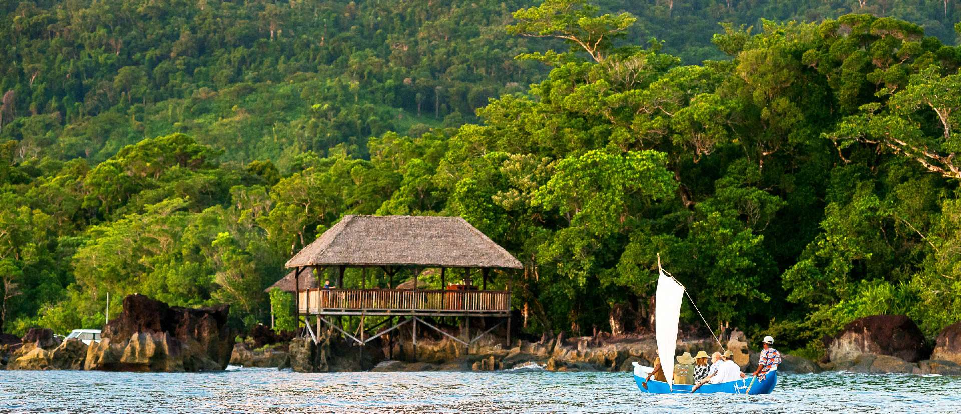
## Description Masoala National Park is Madagascar’s largest and most ecologically diverse protected area, a true Eden for nature lovers and adventurers. Located on the Masoala Peninsula in the northeast of the island, the park spans over 2,300 square kilometers of pristine rainforest and an additional 100 square kilometers of marine reserves. It’s one of the few places on Earth where lush jungle meets coral-rich coastline, creating a rare blend of terrestrial and marine biodiversity. The park is home to an astonishing array of wildlife, much of it endemic to Madagascar. Among its most famous residents is the red-ruffed lemur, found only in this region. Visitors may also encounter the elusive aye-aye, leaf-tailed geckos, tomato frogs, and over 60 species of reptiles. Birdwatchers flock to Masoala to spot rare species like the helmet vanga and the Madagascar red owl. Offshore, the marine parks protect vibrant coral reefs and host humpback whales during their migration from July to September. A little-known fact: the name “Masoala” translates to “eyes of the forest,” a poetic reference to the glowing eyes of the nocturnal aye-aye. Another fascinating detail is that the Madagascar serpent eagle, once thought extinct, was rediscovered in Masoala and now thrives in its dense canopy. ## Location Masoala National Park is located in **Madagascar**, within the **Sava Region**, near the coastal city of **Maroantsetra**. A portion of the park also extends into the **Analanjirofo Region**, making it a vast and varied landscape of rainforest, mangroves, and coral reefs. ### How to Get There: - **By Air**: Fly from Antananarivo to Maroantsetra Airport. Flights are limited, so booking in advance is essential. - **By Boat**: From Maroantsetra, the park is accessible via a 2–3 hour boat ride across Antongil Bay. This scenic journey offers glimpses of dolphins and coastal villages. - **By Tour**: Many eco-tour operators offer guided packages that include transport, accommodation, and park entry. Due to its remote location, Masoala is best visited with the help of local guides or tour companies familiar with the terrain and logistics. ## Tips for Visitors To make the most of your Masoala adventure, keep these tips in mind: - **Visit During Dry Season**: The best time to visit is from June to November. Avoid January to March due to heavy rains and cyclone risk. - **Pack Smart**: Bring waterproof gear, insect repellent, sturdy hiking shoes, and lightweight clothing. The rainforest is humid and unpredictable. - **Hire a Guide**: Local guides enhance the experience with wildlife spotting and cultural insights. Guides are mandatory for most trails. - **Explore Nosy Mangabe**: This nearby island reserve is part of the park and offers excellent chances to see the aye-aye and ancient tombs. - **Respect Wildlife**: Night walks are restricted to protect sensitive species like the aye-aye. Always follow park rules. - **Try Kayaking or Snorkeling**: The marine parks—Tampolo, Ambodilaitry, and Ifaho—are perfect for exploring coral reefs and spotting sea turtles. ## Conclusion Masoala National Park is a sanctuary of biodiversity and natural wonder. With its rare wildlife, untouched rainforest, and vibrant marine life, it offers a truly immersive experience for those seeking Madagascar’s wild heart. ## FAQ **1. What is the entrance fee for Masoala National Park?** The fee is approximately 45,000 Ariary (~16 EUR) for adults and 25,000 Ariary (~6 EUR) for children. **2. How many lemur species are found in Masoala?** The park hosts over 10 species, including the red-ruffed lemur and aye-aye. **3. Can I camp inside the park?** Yes, designated camping areas are available, especially on Nosy Mangabe Island. Guided tours often include camping options. **4. Is Masoala suitable for families?** Yes, but due to its remote location and rugged terrain, it’s best for families with older children who enjoy nature and hiking. **5. Are there accommodations near the park?** Eco-lodges and guesthouses are available in Maroantsetra and near the park’s entrance. Booking ahead is recommended. **6. What marine activities are available?** Snorkeling, kayaking, and whale watching are popular in the park’s marine reserves, especially from July to September. ## Links - [Masoala National Park – Wikipedia Overview](https://en.wikipedia.org/wiki/Masoala_National_Park) - [Masoala National Park – Official GANP Page](https://national-parks.org/madagascar/masoala)
GemVoyage Team • World
Ontario
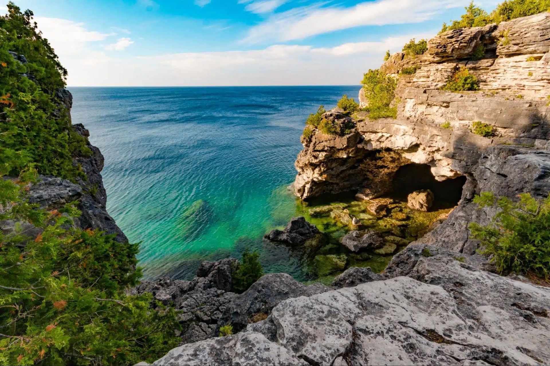
## Description The Tobermory Grotto is one of Ontario’s most recognizable natural attractions and a place that has become almost legendary among travelers who love clear water, rocky shoreline, and dramatic coastal scenery. Located along the Bruce Peninsula in Bruce Peninsula National Park, the Grotto is a sea cave and shoreline formation shaped by water and stone over a very long stretch of time. Its appeal is immediate: bright turquoise water, pale limestone cliffs, and a setting that looks more like a distant island destination than a typical inland Canadian getaway. What makes the Grotto so memorable is how strongly it contrasts with expectation. Travelers who arrive expecting a simple viewpoint often discover a landscape that feels startlingly vivid. The water color can seem almost unreal when sunlight is strong, and the surrounding rock formations create a natural frame that feels tailor-made for photography. Beyond the famous cave itself, the broader Bruce Peninsula landscape adds to the experience with forest, shoreline trails, and a sense of remote beauty that is unusually accessible for southern Ontario. One little-known fact is that the Grotto’s appearance changes dramatically with weather and light. On bright days, the water can look intensely blue-green, while overcast conditions make the scene quieter and more subdued. Another detail visitors often discover only when they arrive is that the site’s popularity has changed how it must be visited. Timing, access planning, and park rules matter more than they do at many ordinary day-use destinations. That is not a drawback so much as part of the modern experience of seeing one of Canada’s most celebrated natural spots. The Grotto is also a place that rewards patience. People often talk about it as a photo stop, but the longer you stay in the region, the more complete the experience becomes. The surrounding national park, the shoreline walk, and the broader Tobermory area all help the destination feel like a true outdoor trip rather than a single scenic moment. ## Location The Tobermory Grotto is in Bruce Peninsula National Park near Tobermory, Ontario, on the western side of the Bruce Peninsula along Georgian Bay. Tobermory is a small but well-known community at the northern end of the peninsula, and the Grotto is reached from there by road and park access rather than by urban transit. For most visitors, driving is the standard and most practical way to get there. Because the Grotto is a popular destination with limited access and park management considerations, it is wise to plan ahead rather than assuming you can simply arrive at any time. If you are coming from Toronto, London, or other parts of southern Ontario, the trip is long enough that an overnight stay in the Tobermory area can make the visit far more enjoyable. That also gives you time to explore the park properly instead of rushing in and out around the single most famous viewpoint. ## Tips Book and plan early. This is not the kind of place where improvisation always works best, especially in busy season. Parking, access rules, and timing can shape your experience significantly. If you wait until the last minute, you may find your options limited. Bring sturdy shoes and be prepared for a walk. The Grotto is scenic, but reaching it typically requires more effort than a simple roadside stop. The terrain can be rocky and uneven, so footwear matters. If you plan to swim, remember that natural water is cold even on warm days, and conditions can be less forgiving than they look from a photo. Think beyond the cave itself. The Grotto is the headline, but the whole Bruce Peninsula area is worth time. Nearby trails, shoreline views, and the general Tobermory landscape help transform the trip from a single stop into a richer outing. If possible, stay long enough to enjoy the area during different light conditions. Watch the weather. Clear sky and sunlight can make the water look especially bright, but even cloudy days have their own moody beauty. Safety, however, always matters more than the photo. Check local guidance before entering the water or walking near exposed edges. ## Conclusion The Tobermory Grotto is one of Ontario’s most impressive natural sights, blending dramatic shoreline scenery with the iconic turquoise water of Georgian Bay. It deserves the planning it requires and rewards travelers who make time for the wider peninsula. ## FAQ ### Is the Grotto worth the trip from Toronto? Yes, especially if you enjoy dramatic natural scenery and do not mind a longer drive. Many visitors treat it as an overnight or weekend trip so they can enjoy the Bruce Peninsula more fully. ### Can I swim there? Swimming may be possible depending on conditions and local rules, but the water is very cold and natural shoreline conditions can be challenging. Always check current guidance before entering the water. ### Do I need to visit in summer? Summer is the most popular season, but the area can be beautiful at other times too. The tradeoff is that access, weather, and comfort levels vary by season. ### Is the Grotto suitable for children? It can be, if you are careful and supervise closely. The rocky terrain means families should pay attention to footing and safety. ### How much time should I plan? At minimum, allow enough time for the walk, the viewpoint, and the return. A fuller Bruce Peninsula day trip is much more satisfying than a rushed photo stop. ## Links - [Official website](https://parks.canada.ca/pn-np/on/bruce/activ/experiences/grotto) - [Wikipedia](https://en.wikipedia.org/wiki/Bruce_Peninsula_National_Park)
GemVoyage Team • World
Bonn
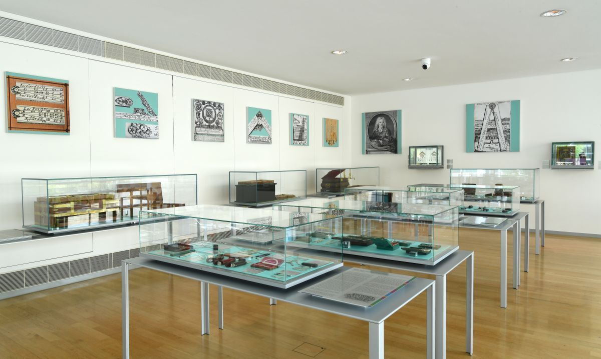
## Description The Arithmeum Museum in Bonn is a highly original museum that turns the history of calculation into a visually engaging and intellectually satisfying visit. Dedicated to the development of arithmetic machines, the museum explores how people have tried to make counting faster, more accurate, and more automated over the centuries. Its collection includes historic calculating devices, elegant mechanical instruments, and exhibits that show how mathematics became part of modern technology. What makes the Arithmeum stand out is that it is both scholarly and accessible. The museum does not expect every visitor to be an expert in mathematics or engineering. Instead, it presents the history of computation through objects, design, and clear narrative structure. That means you can enjoy it whether you are fascinated by mechanical engineering, the history of ideas, or the aesthetic beauty of precision instruments. One lesser-known fact is that the museum is closely associated with academic research on the history of calculation, which gives it an unusually strong intellectual foundation. Another interesting point is that the building’s architecture and presentation style reinforce the idea that mathematics can be elegant as well as practical. The museum is especially rewarding for travelers who like compact museums with a unique theme. It is not overwhelming in scale, but it is memorable because it covers a topic that most people rarely see interpreted so carefully. Visitors often leave with a new appreciation for the long path from abacus and slide rule to digital computation. Even those who do not think of themselves as “math people” usually find something in the collection that captures their attention, whether it is an ornate machine, a clever mechanism, or the logic behind a technological breakthrough. ## Location Arithmeum is located in Bonn, North Rhine-Westphalia, Germany, in the city’s central academic and cultural area. Bonn itself is easy to navigate, and the museum’s position makes it a practical stop during a day of exploring the old federal city. The best way to get there is by local public transport or on foot if you are staying in the center. Bonn’s compact layout makes walking convenient, especially if you are combining the museum with other nearby institutions or university-related sites. If you are arriving from farther away, regional trains and the city’s transit network provide straightforward access to central Bonn. ## Tips Read the display labels carefully, because the story behind each object often matters as much as the object itself. This is a great museum for rainy days or for travelers who want an indoor cultural stop between larger city visits. If you enjoy design, pay attention to the museum’s architecture and how the exhibition spaces guide the flow of the visit. Families with older children and teens may find it especially interesting if they enjoy puzzles, mechanisms, or STEM topics. Pair the visit with other Bonn sights to make the most of your time in the city. ## Conclusion Arithmeum is a thoughtful and elegant museum that turns the history of calculation into a memorable cultural experience in Bonn. ## FAQ ### What is the Arithmeum about? It focuses on the history of arithmetic, calculating machines, and the development of computation. ### Is it only for mathematicians? No. The museum is accessible to general visitors, design lovers, and anyone curious about technology history. ### How long does a visit take? Most visitors spend around one to two hours. ### Is it close to other Bonn attractions? Yes. Its central location makes it easy to combine with other museums and historic sites. ### Why is it considered unique? Because it treats a technical subject with strong visual design and clear storytelling. ## Links - [Official website](https://www.arithmeum.uni-bonn.de/) - [Arithmeum on Wikipedia](https://en.wikipedia.org/wiki/Arithmeum)
GemVoyage Team • World
Siena
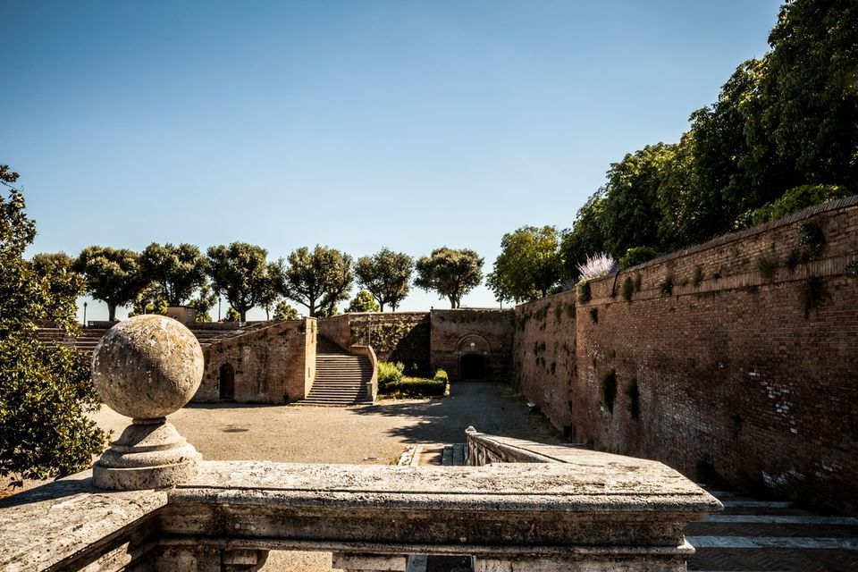
## Description Fortezza Medicea is one of Siena's most imposing landmarks because it represents a different historical layer from the city's medieval churches and squares. Built after Siena's defeat by Florence, the fortress reflects Medici power and the political reshaping of the region during the Renaissance. Unlike a decorative palace or a purely ceremonial monument, it was designed for strategic control and military presence. Today, however, it functions as a public space where history, viewpoints, and local life meet in a surprisingly relaxed way. The fortress is memorable because of its scale and shape. Its bastioned walls form a strong geometric presence above the city, and the elevated position gives visitors sweeping views over Siena and the surrounding Tuscan landscape. That combination of fortification and panorama makes it especially rewarding for travelers who appreciate places where architecture tells a political story. The walls are not just old stone; they are evidence of conquest, rule, and the reshaping of urban space. One little-known fact is that the fortress became less about defense over time and more about civic and cultural use, showing how military architecture can be repurposed for public life. Another detail many visitors miss is how the fortress helps explain the relationship between Siena and Florence. It is not just a monument standing above the city but a reminder of an era when regional power was expressed through earthworks, bastions, and visible control of the landscape. Visitors often appreciate the fortress for its calm atmosphere. While the city center of Siena can be bustling with tourists, the Fortezza Medicea feels more open and spacious. It is a good place to pause, look out across rooftops and hills, and understand how Siena sits within the broader Tuscan setting. If you are interested in military history, urban viewpoints, or Renaissance politics, the fortress is one of the city's most significant stops. ## Location Fortezza Medicea is in Siena, in Tuscany, Italy, just north of the historic center and within walking distance of major city attractions. Because it sits on elevated ground near the old core, it is easy to include in a walking tour of Siena, though the approach may involve some uphill sections depending on your starting point. If you are coming from Piazza del Campo or the cathedral area, the walk to the fortress is straightforward and can be done on foot. Buses and taxis can take you close as well, but walking is usually the best option because it lets you experience the transition from Siena's dense medieval streets to the more open fortified landscape. The most practical recommendation is to visit it while exploring Siena on foot, especially if you want to combine the fortress with other panoramic stops. Because the site is open and spacious, it works well as a late-afternoon or early-evening destination when the light becomes softer. ## Tips Go for the views as much as for the history. The fortress gives some of the best panoramas in Siena, so bring time to linger and not just pass through. If possible, combine the fortress with a walk through the surrounding park-like areas and nearby city streets. That allows you to see how the fortress integrates into Siena's urban edge rather than treating it as a disconnected monument. Read a little about the Medici and the political history of Siena before your visit. Knowing why the fortress was built changes the experience from a simple architectural stop into a clearer story about conquest and control. Visit on a day with good visibility if scenic views matter to you. The fortress is enjoyable in many conditions, but its strongest appeal is the way it frames the city and countryside. ## Conclusion Fortezza Medicea is one of Siena's most powerful historical sites, combining Renaissance military architecture, city views, and a reminder of the region's complex political past. ## FAQ ### Why was Fortezza Medicea built? It was built as a military fortress after Siena came under Medici control, serving as a symbol of political power and strategic dominance. ### Is the fortress open to visitors? Yes, the grounds and surrounding areas are generally accessible, though specific use may vary over time. ### What is the best part of visiting the fortress? The best part is the combination of panoramic views and the chance to understand Siena's political history. ### How long should I spend there? Most visitors spend between 30 minutes and an hour, depending on how much time they want for walking and views. ## Links - [Siena tourism](https://www.visitsiena.it/en/)
GemVoyage Team • World
Lisbon
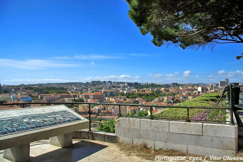
## Description Miradouro da Senhora do Monte is one of Lisbon’s most beloved viewpoints, offering a tranquil perch with unrestricted vistas across the city’s red rooftops, the Tagus River and landmarks like São Jorge Castle and the historic downtown. Tucked in the Graça neighborhood, the miradouro (viewpoint) is less crowded than some of Lisbon’s better-known terraces, making it a favorite among locals seeking a peaceful panorama and photographers hunting for unobstructed compositions. The small chapel of Senhora do Monte adds a devotional nuance to the setting, while benches and shaded nooks invite lingering. The viewpoint’s orientation gives particularly broad views to the east and south of the city, and because it is elevated, light at sunrise and sunset can be spectacular. Little-known facts: Miradouro da Senhora do Monte sits at one of the city’s highest natural points and was historically used to monitor the Tagus approaches; its quieter reputation owes partly to steeper approaches that keep the most casual visitors away. ## Location Miradouro da Senhora do Monte is located in the Graça parish of Lisbon, in the Lisbon District, Portugal. The viewpoint occupies a hilltop position above the Alfama and Graça neighborhoods and is within walking distance of São Vicente hill and several historic lanes. Getting there: The easiest ways are a short uphill walk through Graça from the tram 28 route or a ride to the Largo da Graça and a brief ascent. Tram 28 passes through Alfama and Graça and is a scenic option; buses also serve nearby stops. If using a taxi or rideshare, ask to be dropped at Largo da Senhora do Monte or the small square near the chapel. Wear comfortable shoes for the short climb. ## Tips - Timing: Sunrise and sunset are prime times for soft, warm light; sunrise is quieter and ideal for photographers. Weekday mornings are the least busy. - Safety & comfort: The area is generally safe and frequented by locals; standard precautions suffice. Bring water in warmer months and a light jacket in evenings. - Accessibility: The viewpoint involves steep streets and steps; it’s less accessible for visitors with limited mobility. - Neighborhood exploration: Combine the visit with a walk through Graça and Alfama’s lanes, sample local cafés and pastelarias nearby. - Respectful behavior: The chapel is a place of worship; observe quiet respect if services occur. ## Conclusion Miradouro da Senhora do Monte is an essential Lisbon experience for those seeking scenic calm and panoramic perspectives without the crowds of more famous terraces. Its high vantage point, local atmosphere and exceptional light conditions make it ideal for reflective moments, photography, and absorbing Lisbon’s layered skyline. ## FAQ Q: Is the miradouro crowded? A: It’s quieter than many Lisbon viewpoints but can be busy at sunset on weekends. Q: Are there cafés nearby? A: Yes, Graça and Alfama have several small cafés and bakeries within a short walk. Q: Does public transport reach it? A: Yes — Tram 28 and several buses serve the Graça area; from stops expect a short uphill walk. Q: Is there a fee to visit? A: No. The viewpoint and surrounding terraces are free and open to the public. ## Links [Detailed Guide](https://lisbonlisboaportugal.com/Alfama-Lisbon/miradouro-da-senhora-do-monte-lisbon.html)
GemVoyage Team • World

Comments