GemVoyage Team • World
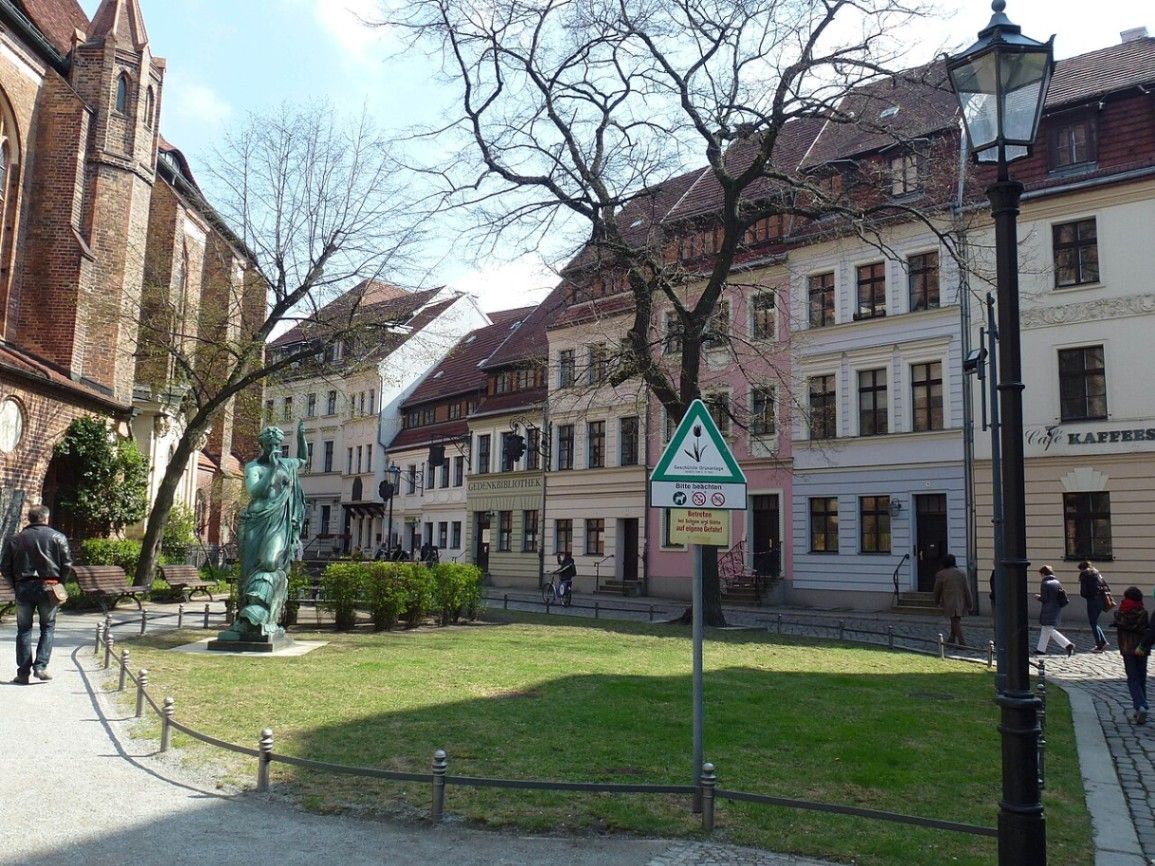
Nikolaiviertel is one of Berlin’s most atmospheric neighborhoods and holds a special place in the city’s history. Often referred to as the birthplace of Berlin, this compact quarter feels worlds away from the modern capital filled with glass towers and busy avenues. Cobblestone streets, narrow alleyways, and colorful facades create an almost storybook setting that invites visitors to slow down and explore at a relaxed pace.
What makes Nikolaiviertel unique is the way it blends reconstruction with genuine historical remnants. Much of the area was rebuilt in the 1980s by East Germany to celebrate Berlin’s 750th anniversary, carefully recreating the medieval street layout and architectural style. However, it is not merely a replica. Several buildings are authentically old, including the famous Nikolaikirche (St. Nicholas’ Church), Berlin’s oldest church, whose foundations date back to the 13th century.
A little-known fact is that some of the buildings in Nikolaiviertel were reconstructed using original architectural fragments salvaged from destroyed historic houses across Berlin. Another interesting detail is that the neighborhood was once home to notable figures such as philosopher Georg Wilhelm Friedrich Hegel, whose former residence can still be seen today. Together, these elements give Nikolaiviertel a sense of authenticity that goes beyond its relatively recent reconstruction.
Today, the quarter is known for its small museums, traditional restaurants, cozy cafés, and artisan shops. It is an excellent place to experience a quieter, more intimate side of Berlin while learning about the city’s medieval origins.
Nikolaiviertel is located in Germany, in the federal state and city of Berlin. More precisely, it lies in the central borough of Mitte, close to the eastern bank of the River Spree. The neighborhood sits between Alexanderplatz and the Berlin Cathedral, making it easy to combine with other major attractions in the historic center.
Getting to Nikolaiviertel is simple and convenient. The easiest way is by public transport. Visitors can take the U-Bahn (underground) to Klosterstraße (U2 line), which is just a short walk away. Alternatively, Alexanderplatz, one of Berlin’s main transport hubs, is about a 10-minute walk from the quarter. From there, multiple S-Bahn, U-Bahn, tram, and bus lines are available. Walking is also highly recommended if you are already exploring central Berlin, as the surrounding area is pedestrian-friendly and rich in sights.
To make the most out of a visit to Nikolaiviertel, it is best to arrive early in the day or later in the afternoon. Midday can become crowded, especially during the summer tourist season. Early mornings offer a quieter atmosphere and better opportunities for photography.
Comfortable walking shoes are essential, as the cobblestone streets can be uneven. Take your time wandering through the small side streets rather than sticking only to the main paths. This is where you will find hidden courtyards, lesser-known shops, and quieter corners.
Consider visiting one of the local museums, such as the Museum Knoblauchhaus, which offers insight into bourgeois life in 18th- and 19th-century Berlin. For food, traditional German restaurants in the area serve classic dishes, but prices can be slightly higher due to the central location. Checking menus beforehand can help avoid surprises.
Lastly, Nikolaiviertel is especially charming in the evening when the lights come on and the area feels more intimate. It is a great place for a relaxed dinner after a day of sightseeing.
Nikolaiviertel offers a rare glimpse into Berlin’s medieval past while remaining accessible and welcoming to modern visitors. With its historic atmosphere, central location, and cultural significance, it is a rewarding stop for anyone looking to experience a more traditional and intimate side of the German capital.
Is Nikolaiviertel an original medieval neighborhood?
Nikolaiviertel is a mix of original historic buildings and carefully reconstructed ones. While much of it was rebuilt in the 1980s, several key structures, including Nikolaikirche, are genuinely old.
How much time should I plan for visiting Nikolaiviertel?
Most visitors spend between one and two hours exploring the area. This allows enough time for a leisurely walk, a museum visit, and a meal or coffee break.
Is Nikolaiviertel suitable for families with children?
Yes, the area is family-friendly. Its compact size, pedestrian streets, and small museums make it easy to explore with children.
Do I need to pay an entrance fee to visit Nikolaiviertel?
No, the neighborhood itself is free to explore. However, some museums and attractions within the area may charge an admission fee.
What is the best season to visit Nikolaiviertel?
Spring and early autumn are ideal, offering mild weather and fewer crowds. Summer is also popular but can be busier.
Discover more hidden gems you might love.
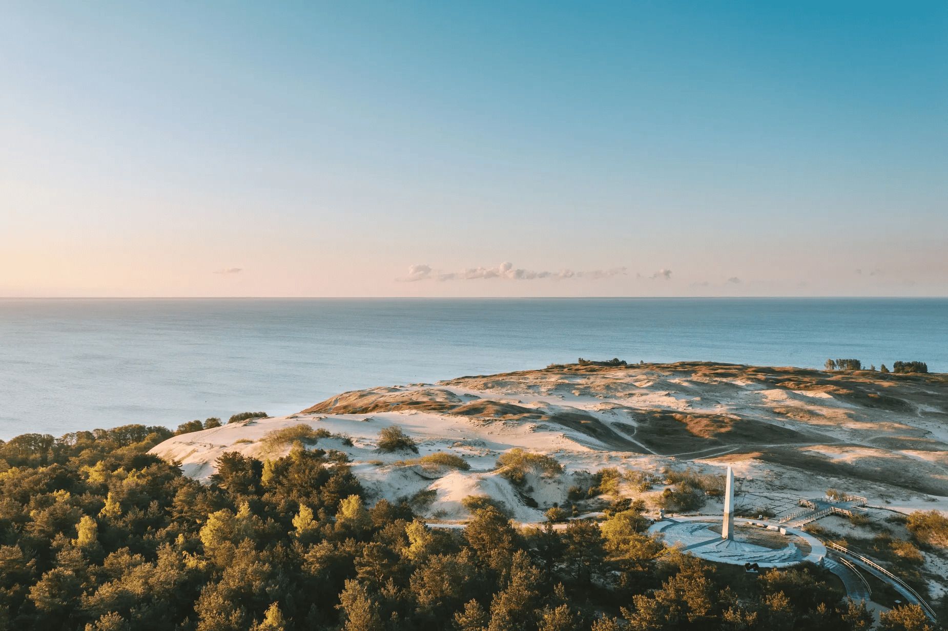
Nida
## Description The Parnidis Dune sundial on the Curonian Spit is an elegant meeting point of coastal geology and human curiosity. Carved into a prominent dune ridge near Nida, the sundial uses a simple stone gnomon and stone markers to register the sun’s arc across the sky, while the dune itself provides sweeping views over the Curonian Lagoon and the Baltic Sea. The combination of sculpted sand, long sightlines, and the shifting play of light makes the site both visually stirring and quietly contemplative. Visitors encounter an open landscape shaped by wind and water: dunes that migrate slowly with prevailing winds, vegetation adapted to sandy, saline conditions, and an expansive horizon where sky and water blend. The sundial is part functional instrument, part landscape sculpture: its hour lines and markers are calibrated to local solar time and offer an accessible way to experience astronomical motion at ground level. Restoration and maintenance are ongoing challenges because the dune is dynamic—sand moves, vegetation changes, and repairs must respect both the scientific accuracy of the instrument and the dune’s natural processes. Local authorities and conservation groups work to stabilize key paths and protect fragile slopes so that people can enjoy the views without accelerating erosion. Cultural events and astronomy programs often use the site as a natural amphitheater, further connecting visitors with the seasonal rhythms of sky and sea. ## Location Parnidis Dune is located in Nida on the Curonian Spit, within Neringa municipality in Klaipėda County on Lithuania’s western coast. The dune crowns a ridge that overlooks the Curonian Lagoon on one side and the Baltic Sea on the other, giving it dramatic vantage points in both directions. How to get there: Nida is accessible by car along the Curonian Spit road from Klaipėda; if approaching from mainland Lithuania, a ferry crossing into the spit may be necessary depending on route. Regular buses also run from Klaipėda to Nida during the tourist season. Once in Nida, the Parnidis Dune is a short, well-signed walk from the town center; follow the marked paths to the main observation points and sundial. ## Tips - Visit at sunrise or sunset for the most dramatic light and to see the sundial’s shadows lengthen. - Stay on marked trails and access ramps—dune vegetation is fragile and paths help prevent runaway erosion. - Bring windproof layers and sun protection; the exposed ridge can be quite breezy even on mild days. - Use binoculars or a telephoto lens to scan the lagoon for birds, fishing boats, and shifting sandbars. - Combine a dune visit with a walk through Nida’s quaint center and nearby cultural sites, such as the Thomas Mann museum. - Check local signage for any temporary closures or restoration work; some sections may be rerouted to protect the landscape. ## Conclusion Parnidis Dune’s sundial offers more than a neat photo opportunity: it is an invitation to feel how landscape, time, and human craft can intersect. The ridge’s panoramic views, paired with the simple mechanics of the sundial, make the place an evocative stop for anyone exploring the Curonian Spit. ## FAQ Q: Is there an admission fee to access the dune? A: There is typically no admission fee to reach Parnidis Dune itself; however, parking or guided services may charge fees. Seasonal event programming may require tickets. Q: When is the best time to photograph the sundial and landscape? A: Sunrise and sunset provide warm, low-angle light that accentuates dune textures and long shadows; golden hour is ideal for landscape photography. Q: Can I climb anywhere on the dune? A: No. To protect dune vegetation and prevent erosion, visitors should use the marked trails and observation points only; climbing fragile slopes is discouraged or prohibited. Q: Are there guided tours or astronomy events at the site? A: Yes. Local guides and cultural groups sometimes offer tours that explain the sundial’s construction and the dune’s ecology; astronomy and cultural events are occasionally scheduled—check Nida’s visitor information. Q: Is the area accessible for visitors with limited mobility? A: Some paths and viewpoints may have improved access, but the dune’s terrain is inherently uneven. Check local visitor resources for the latest information on accessible routes. ## Links - [Parnidis Dune (Wikipedia)](https://en.wikipedia.org/wiki/Parnidis_Dune)
GemVoyage Team • World
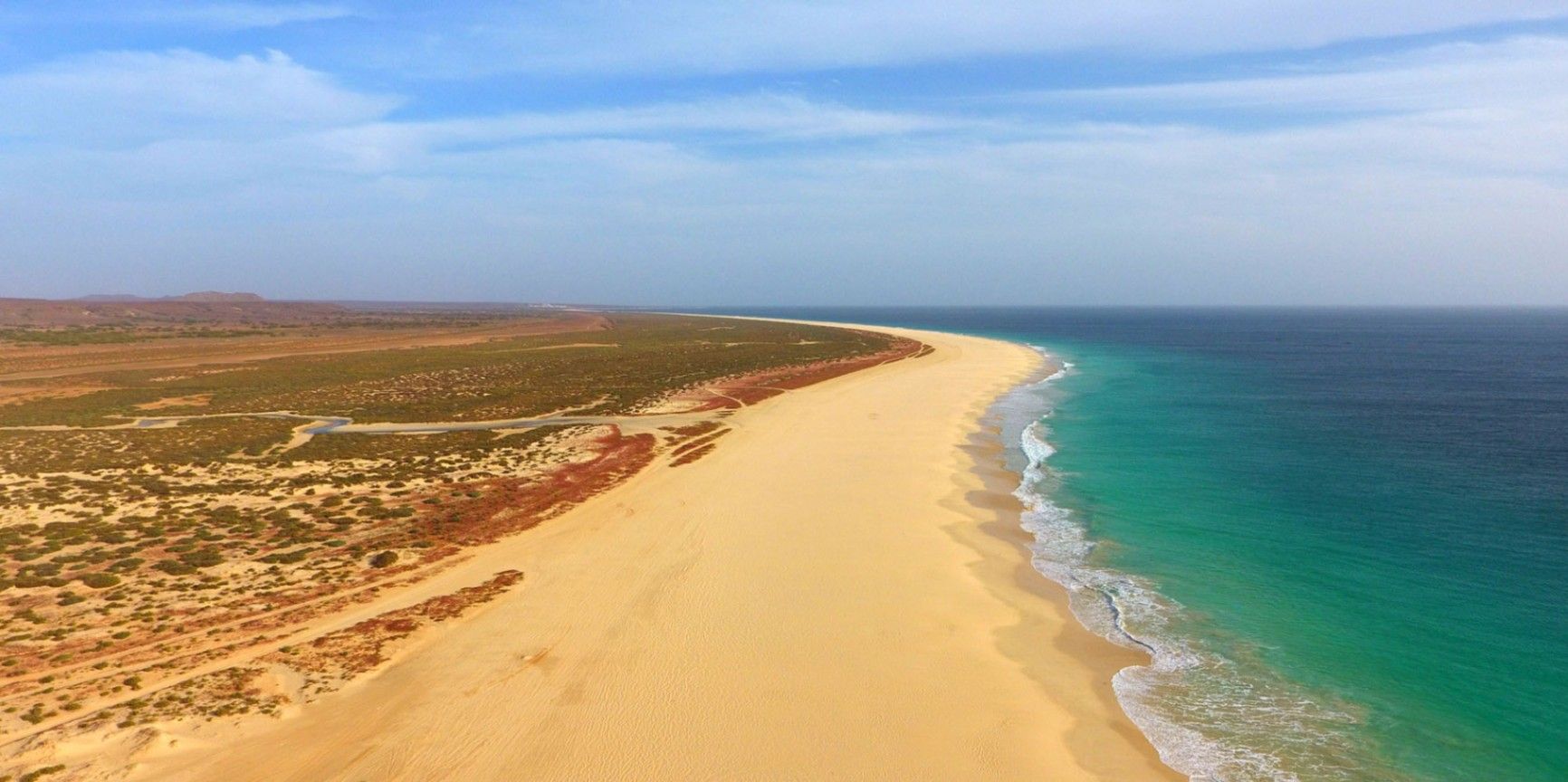
Boa Vista
## Description Praia de Santa Mónica is often described as one of the most beautiful beaches in the world—and with good reason. Stretching over 18 kilometers along the southern coast of Boa Vista, Cape Verde, this vast expanse of golden sand and turquoise water remains almost untouched by development. Its name, “Santa Mónica,” was inspired by California’s famous beach, yet its charm lies in its wild and pristine character. The beach is unique because of its sheer size and tranquility. Unlike other popular destinations, Praia de Santa Mónica rarely feels crowded, even during peak travel seasons. Visitors are treated to panoramic views of rolling dunes, crystal-clear waves, and endless horizons. The beach is also known for being a nesting site for sea turtles, particularly the endangered Caretta caretta (loggerhead turtle). During nesting season, guided tours allow travelers to observe these creatures responsibly, making for a truly unforgettable experience. A little-known fact is that the beach is part of the Morro de Areia Nature Reserve, a protected area aimed at conserving both marine and terrestrial biodiversity. This adds an extra layer of significance for those seeking eco-friendly and sustainable travel experiences. ## Location Praia de Santa Mónica is located on the island of **Boa Vista**, one of the ten main islands of **Cape Verde**, an archipelago off the west coast of **Africa** in the Atlantic Ocean. The beach lies on the southwestern coast of Boa Vista, approximately 20 kilometers from the island’s capital, Sal Rei. To reach Praia de Santa Mónica, most visitors first arrive at Aristides Pereira International Airport (BVC) in Boa Vista. From there, taxis or guided tours can take you to the beach in around 40 minutes. Since public transport is limited on the island, arranging private transfers or joining an organized excursion is recommended. Off-road vehicles are often used, as some roads to the beach remain unpaved, adding a sense of adventure to the journey. ## Tips * **Bring essentials:** There are few facilities on-site, so pack water, snacks, sunscreen, and shade if you plan to spend several hours there. * **Swimming caution:** While the water looks inviting, currents can sometimes be strong. Check local conditions before swimming and stick to calmer areas. * **Best time to visit:** Early morning or late afternoon provide not only cooler temperatures but also the most stunning light for photography. * **Turtle watching:** If visiting between June and October, book a guided turtle-watching excursion to witness the nesting or hatching process. These tours are regulated to ensure the animals are not disturbed. * **Respect the environment:** Stay on marked paths to protect dunes and wildlife, and avoid leaving litter behind. * **Combine with a tour:** Many excursions include stops at Santa Mónica along with other highlights of Boa Vista, such as the Viana Desert or the shipwreck of Cabo Santa Maria. ## Conclusion Praia de Santa Mónica in Cape Verde is a destination for those seeking unspoiled beauty, peace, and a connection with nature. With its endless sandy shores, rich biodiversity, and breathtaking views, it offers a paradise-like escape far removed from crowded tourist resorts. For travelers looking to experience Cape Verde at its most authentic, this beach is an absolute must. ## FAQ **1. Is Praia de Santa Mónica suitable for families?** Yes, families can enjoy the wide sandy beach, but parents should monitor children closely when swimming due to occasional strong currents. **2. Are there restaurants or shops nearby?** No, the beach is largely undeveloped. It’s best to bring supplies from Sal Rei or your hotel before heading there. **3. How long should I plan to spend at the beach?** Many visitors spend a half-day to enjoy the scenery and relax, but nature lovers and photographers often stay longer. **4. Is it possible to surf or kiteboard at Santa Mónica?** The beach can offer good waves, but it’s less developed for water sports than other parts of Boa Vista. Consult local guides if you’re looking for surfing or kitesurfing opportunities. **5. Can I see turtles on my own?** For conservation reasons, turtle watching should only be done with licensed guides. This ensures the safety of both the turtles and visitors. **6. What’s the best way to get there?** The easiest way is by booking a taxi or an organized 4x4 tour from Sal Rei or your resort. Public transport does not reach the area. ## Links * [Cape Verde Tourism Official Site](https://www.visit-caboverde.com) * [Boa Vista Tourism Guide](https://www.boavistaofficial.com)
GemVoyage Team • World
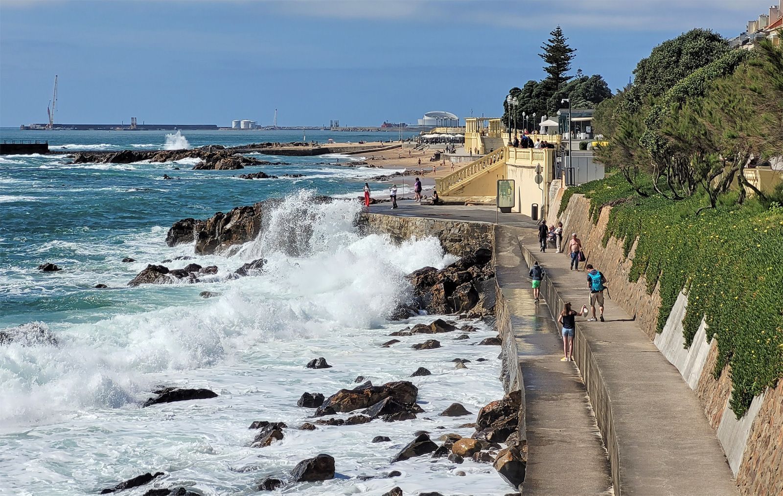
Porto
## Description Foz do Douro Promenade is one of the most enjoyable walks in Porto because it captures the city at its most open, breezy, and scenic. Located where the Douro River approaches the Atlantic Ocean, Foz do Douro is known for its waterfront paths, beaches, cafés, parks, and dramatic light. It gives visitors a different side of Porto from the historic center: less compact, more coastal, and shaped by wind, water, and long views rather than narrow medieval streets. The promenade is special because it lets you experience the transition from river to sea in a very direct way. The Douro's strong identity as a working river, a wine route, and an urban boundary becomes visible here, where the city meets larger natural forces. Walking the promenade, you can watch waves strike the seawall, see locals out for exercise or family time, and move between beaches, lighthouses, and garden spaces. It is one of those urban landscapes that works equally well for slow contemplation and active strolling. One little-known fact is that Foz has long been associated with leisure and summer life among Porto residents, especially as the city expanded and more people began seeking breezy coastal escapes close to home. Another detail many visitors miss is the extent to which the area changes mood with the weather. On a clear day, Foz feels luminous and expansive; on a windy day, it becomes dramatic and powerful. The promenade is therefore not just a route but an experience shaped by the Atlantic itself. The area also reveals a lot about Porto's identity. The city is often celebrated for its historic center and wine cellars, but Foz shows a different and equally important side: a living, modern waterfront where people come to walk, cycle, talk, and watch the sea. If you want a place in Porto that combines fresh air, urban life, and landscape, this is one of the best choices. ## Location Foz do Douro is a district in Porto, in the Norte region of Portugal, located at the mouth of the Douro River where it opens toward the Atlantic Ocean. The promenade runs along the waterfront in the western part of the city, making it farther from the old center than Ribeira but still easy to reach by public transport, taxi, or a scenic walk if you have time. One of the easiest ways to get there is by bus or tram, especially if you want to enjoy the trip without worrying about parking. Walking from the riverfront is possible and rewarding if you have a full day, but most visitors will prefer a shorter transfer followed by a long, leisurely walk along the coast. The route can be combined with stops at beaches, gardens, and small cafés along the way. For orientation, think of the promenade as a westward extension of Porto's river story. It is a place to end the day, not just begin it, because sunset and late afternoon light are especially beautiful here. ## Tips Choose a clear or mildly windy day if you want the best experience. The promenade is pleasant in many conditions, but it is most memorable when the sky and sea are visible in full color. Bring a light jacket even in warm weather. The Atlantic can cool the air quickly, especially near evening, and visitors often underestimate how different the climate feels compared with Porto's inland streets. If you enjoy a slower pace, start near the river mouth and walk toward the beaches and garden areas. That direction helps you experience the transition from urban river edge to open sea more naturally. Use the promenade as a break from sightseeing density. Porto's historic center can feel packed with monuments and steep lanes, while Foz offers breathing room and a chance to enjoy the city in a more relaxed frame. ## Conclusion Foz do Douro Promenade is one of Porto's best places for a scenic walk, combining sea air, river views, and a calm waterfront atmosphere that contrasts beautifully with the city's historic core. ## FAQ ### Why do people visit Foz do Douro? People visit for the seaside atmosphere, promenade walks, beaches, cafés, and the chance to see where the Douro River meets the Atlantic. ### Is Foz do Douro good for sunsets? Yes. The area is one of the best places in Porto for evening light and coastal views. ### Can I walk or cycle there? Yes. The waterfront is ideal for walking and cycling, and both locals and visitors use it for exercise and leisure. ### How far is it from downtown Porto? It is farther than the central historic districts, but still easy to reach by public transport or taxi. ## Links - [Porto tourism](https://visitporto.travel/) - [Wikipedia article](https://en.wikipedia.org/wiki/Foz_do_Douro)
GemVoyage Team • World
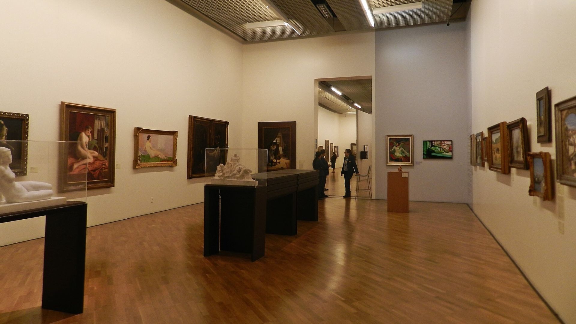
São Paulo
## Description Pinacoteca de São Paulo is one of Brazil’s most important art museums, and it has the kind of presence that makes a visit feel meaningful even before you step inside. Set in a historic building near Luz, the museum combines architecture, collection depth, and curatorial seriousness in a way that appeals to both first-time visitors and dedicated art travelers. It is not simply a place to tick off a museum list. It is one of the essential cultural experiences in São Paulo. The museum’s strength lies in how it balances scale and intimacy. You can encounter major works from Brazilian art history, yet the overall visit still feels navigable and human-sized. The building itself also contributes to the experience, with restored spaces that create a strong sense of continuity between old and new São Paulo. One little-known fact is that the museum occupies one of the city’s most recognizable historic structures, which gives the collection a powerful architectural frame. Another is that the museum’s location near Luz places it in a district shaped by rail history, urban transformation, and cultural reinvention. For travelers, the Pinacoteca is especially rewarding because it helps decode São Paulo’s broader cultural identity. The city is often described through business, scale, and speed, but the museum reveals another side: artistic ambition, historical memory, and deep engagement with Brazilian visual culture. You can spend time with painting, sculpture, and installation works, then step back into the urban landscape with a much richer understanding of the city. The museum is also a good choice for visitors who like structure. Unlike some larger institutions that can feel overwhelming, the Pinacoteca encourages a thoughtful pace. You can move through the galleries at a measured speed, pause where something catches your eye, and still feel that you have had a full and substantial experience. For many people, it becomes one of the most memorable stops in São Paulo because it offers clarity, beauty, and context in equal measure. ## Location Pinacoteca de São Paulo is located in the Luz area of central São Paulo, Brazil, near the city’s historic train and transit hub. The museum sits within easy reach of other central attractions, making it practical to combine with a wider cultural day in downtown São Paulo. The easiest way to get there is by metro or taxi/rideshare. Luz station is the most convenient reference point, and arriving by public transport helps avoid some of the congestion and parking complexity of central São Paulo. Because the area has a busy urban character, it is wise to plan your route in advance and keep your visit focused on museum hours and nearby movement. If possible, avoid arriving in a rush. The museum deserves an unhurried approach, and the surrounding district is best experienced with enough time to orient yourself before entering. ## Tips - Buy or reserve tickets ahead of time when possible, especially on weekends or during special exhibitions. - Give yourself time for both the collection and the building. The architecture is part of the experience. - Visit earlier in the day if you want a quieter atmosphere in the galleries. - Combine the Pinacoteca with other downtown cultural stops so your trip feels efficient and rewarding. - Wear comfortable shoes. Even a museum visit here often becomes part of a broader walking itinerary. ## Conclusion Pinacoteca de São Paulo is a cornerstone of the city’s cultural life and one of the best places to understand Brazilian art in an elegant historic setting. It offers a visit that is both intellectually satisfying and visually rich. ## FAQ ### How much time should I spend at the Pinacoteca? Most visitors benefit from at least two hours, and more if they enjoy reading labels or visiting special exhibitions. It is easy to spend longer if the collection draws you in. ### Is the museum good for first-time visitors to São Paulo? Yes. It is one of the best places to start if you want a strong cultural anchor in the city and an introduction to Brazilian art. ### Do I need to be an art expert to enjoy it? No. The museum is accessible for general visitors while still offering depth for people with more art background. ### Can I visit it with other downtown attractions? Absolutely. Its central location makes it a natural part of a full day in the Luz and downtown area. ## Links - [Pinacoteca de São Paulo official website](https://pinacoteca.org.br/) - [Pinacoteca de São Paulo on Wikipedia](https://en.wikipedia.org/wiki/Pinacoteca_do_Estado_de_S%C3%A3o_Paulo)
GemVoyage Team • World

Shirahama
## Description Adventure World in Japan is a one-of-a-kind destination that seamlessly blends the excitement of an amusement park with the wonder of a zoo and the serenity of an aquarium. Located in the coastal town of Shirahama, Wakayama Prefecture, this sprawling complex offers a full day—or more—of entertainment for families, animal lovers, and thrill-seekers alike. What makes Adventure World truly unique is its immersive approach to connecting humans, animals, and nature, all under the motto of “Smile for Everyone.” The park is especially famous for its giant panda breeding program, which is the most successful outside of mainland China. Adventure World has bred more pandas than any other facility in Japan, and visitors can observe these beloved creatures in the “Panda Love” zone, where they roam freely in spacious enclosures. The park is also home to dolphins, sea lions, flamingos, elephants, and even cheetahs, all housed in thoughtfully designed habitats. A little-known fact: Adventure World operates as the Japanese branch of the Chengdu Giant Panda Research Base, and its panda ambassadors have even been appointed as mascots for traffic safety campaigns in Wakayama Prefecture. Another quirky detail—visitors can rent golf carts to explore the Safari World zone, provided they have a valid Japanese or international driver’s license. ## Location Adventure World is located in **Japan**, within the **Kansai Region**, in the town of **Shirahama**, **Wakayama Prefecture**. The park sits near the Pacific coast, offering scenic views and easy access to other local attractions like Shirahama Beach and the Sandanbeki cliffs. ### How to Get There: - **By Train**: Take the JR Limited Express Kuroshio from Shin-Osaka Station to Shirahama Station (approx. 2.5 hours). From there, it’s a 20-minute bus ride to the park. - **By Air**: Fly into Nanki-Shirahama Airport, which is just a 5-minute drive from Adventure World. - **By Car**: From Osaka, it’s about a 2.5-hour drive via the Hanwa Expressway. Parking is available on-site. Its proximity to both the airport and train station makes it a convenient destination for domestic and international travelers. ## Tips for Visitors To make the most of your visit to Adventure World, consider these tips: - **Arrive Early**: The park opens at 10:00 AM, and arriving early helps you beat the crowds and catch the morning animal feedings. - **Buy Tickets Online**: Advance purchase is recommended to avoid long lines and ensure availability, especially during weekends and holidays. - **Don’t Miss the Shows**: The dolphin and sea lion performances are crowd favorites and showcase impressive aquatic acrobatics. - **Use the Safari Kart**: If you have a valid license, rent a golf cart to explore the Safari World zone—it’s fun and saves time. - **Pack Light**: The park is large, so wear comfortable shoes and bring essentials like sunscreen, water, and a camera. - **Explore the Food Options**: From themed cafés to local Wakayama cuisine, there’s a variety of dining choices inside the park. ## Conclusion Adventure World is a vibrant fusion of wildlife, entertainment, and education. With its world-class panda program, thrilling rides, and interactive animal zones, it offers a joyful and enriching experience for visitors of all ages. Whether you're traveling solo or with family, this park is a must-see gem in southern Japan. ## FAQ **1. What are the opening hours of Adventure World?** Typically, the park is open from 10:00 AM to 5:00 PM. Hours may vary seasonally. **2. Is Adventure World suitable for young children?** Yes, the park is family-friendly with attractions and animal zones designed for all age groups. **3. Can I interact with animals at the park?** Yes, there are designated areas where you can feed or observe animals up close, including capybaras, giraffes, and penguins. **4. Are there any multilingual services available?** Basic English signage is available, but guided tours are primarily in Japanese. It’s helpful to download a translation app. **5. Is there a discount for group or family tickets?** Yes, group rates and family packages are available. Check the official website for details. **6. Can I bring my own food into the park?** Outside food is generally not allowed, but there are plenty of dining options inside. ## Links - [Adventure World Official Website](https://www.aws-s.com/en) - [Adventure World – Wikipedia](https://en.wikipedia.org/wiki/Adventure_World_%28Japan%29)
GemVoyage Team • World
Bernese Oberland
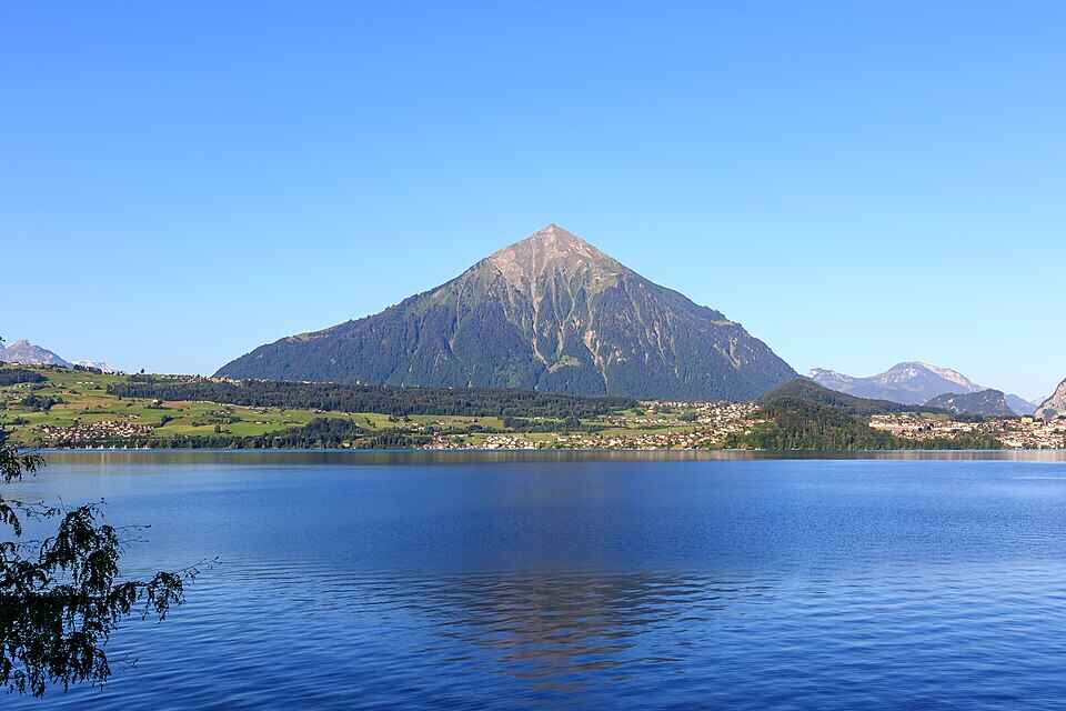
## Description Niesen Mountain, often referred to as the “Swiss Pyramid,” is one of Switzerland’s most visually striking peaks. Its near-perfect triangular shape resembles the iconic Egyptian pyramids, making it a favorite subject for artists like Paul Klee and Ferdinand Hodler. Rising to an elevation of 2,362 meters (7,749 feet), Niesen offers panoramic views over Lake Thun, the Bernese Alps, and the Simmen and Kander valleys. What makes Niesen truly unique isn’t just its shape—it’s the experience of getting to the summit. Visitors can ascend via the **Niesenbahn**, a historic funicular railway that’s been operating since 1910. The ride itself is a scenic journey, taking just 30 minutes to reach the top. But here’s a little-known fact: running alongside the funicular is the **world’s longest stairway**, with a staggering 11,674 steps. While it’s not open to the public for regular use, it hosts an annual stair run event that draws athletes from around the globe. Another charming detail? The mountain’s original name was “Yesen,” derived from the yellow gentian flower, which still blooms on its slopes today. ## Location Niesen is located in **Switzerland**, within the **Canton of Bern**, specifically in the **Bernese Oberland** region. The mountain overlooks **Lake Thun** and lies between the municipalities of **Wimmis** and **Reichenbach im Kandertal**. ### How to Get There: - **By Train**: Take a train to **Mülenen**, a small village that serves as the base station for the Niesenbahn funicular. - **By Car**: Mülenen is accessible via the A6 motorway. Parking is available near the funicular station. - **By Public Transport**: Swiss Travel Pass holders enjoy discounted fares on the funicular, making it an ideal choice for tourists. Once in Mülenen, hop on the funicular for a scenic ride to the summit. ## Tips for Visitors To make the most of your visit to Niesen, consider the following tips: - **Time Your Visit**: The mountain is open from mid-April to mid-November. For the most breathtaking views, aim for a sunrise or sunset trip—overnight stays at the Berghaus Niesen Kulm offer this magical experience. - **Book Ahead**: The funicular and restaurant can get busy during peak season. Booking tickets and meals in advance is highly recommended. - **Dress Appropriately**: Weather can change quickly at high altitudes. Bring layers, even in summer. - **Photography**: Don’t forget your camera—the glass pavilion at the summit offers unobstructed views perfect for landscape shots. - **Dining**: Try the full-moon dinner or breakfast buffet at the summit restaurant for a truly memorable culinary experience. - **Family Friendly**: Story rides and cultural events make Niesen a great destination for kids too. ## Conclusion Niesen Mountain is more than just a scenic peak—it’s a blend of natural beauty, historical charm, and cultural significance. Whether you're drawn by its pyramid shape, the thrill of the funicular ride, or the serenity of alpine views, Niesen offers an unforgettable Swiss experience. ## FAQ **1. What is the elevation of Niesen Mountain?** Niesen stands at 2,362 meters (7,749 feet) above sea level. **2. How do I reach the summit?** You can take the Niesenbahn funicular from Mülenen, which takes about 30 minutes to reach the top. **3. Is the stairway open to the public?** No, the 11,674-step stairway is only accessible during the annual Niesen stair run event. **4. When is the best time to visit Niesen?** Between mid-April and mid-November. Sunrise and sunset visits are especially stunning. **5. Are there accommodations at the summit?** Yes, the Berghaus Niesen Kulm offers cozy rooms and dining options with spectacular views. **6. Is Niesen suitable for children?** Absolutely. There are story rides and cultural activities designed for families. ## Links - [Official Niesen Website](https://www.niesen.ch/en/) - [Switzerland Tourism – Niesen](https://www.myswitzerland.com/en-us/destinations/niesen/)
GemVoyage Team • World

Comments