GemVoyage Team • World
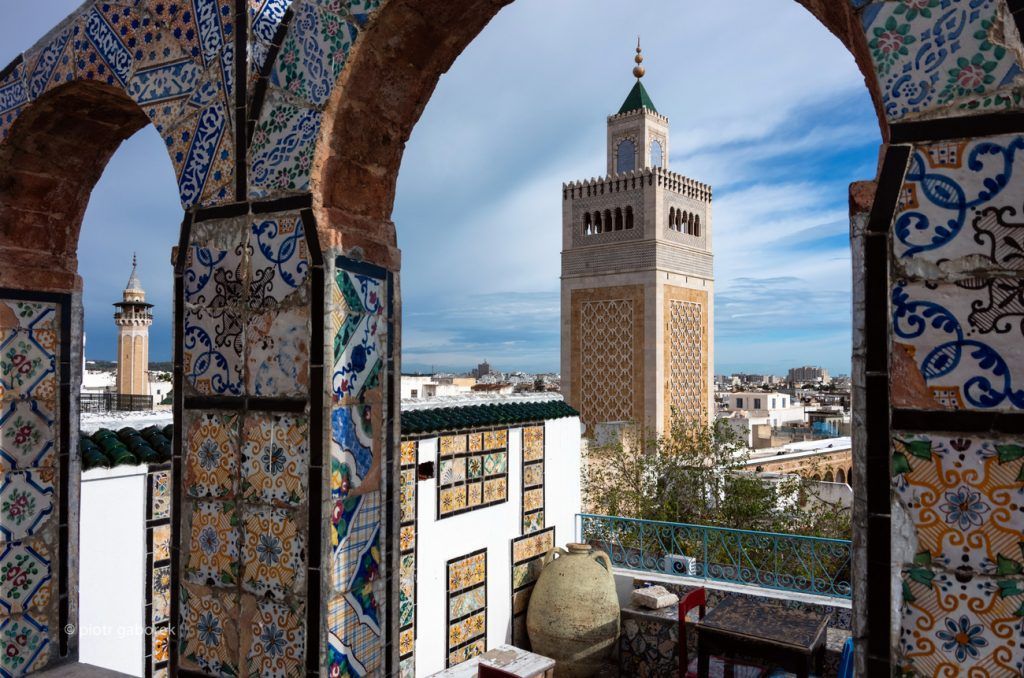
What makes the medina memorable is the density of experience. You can walk from a bustling souk to a quiet courtyard, from a textile shop to a mosque exterior, from a spice stall to a passage that suddenly narrows and feels much older than the streets around it. The medina rewards patience. It is not about racing from one famous stop to the next. It is about absorbing the patterns of city life that have persisted across different eras of Tunisian history.
One lesser-known fact is that the Medina of Tunis is recognized for its remarkable urban heritage and has long been one of the best-preserved historic centers in the Arab world. Another is that its value comes not just from architecture, but from how the district still functions as a living place of commerce and social exchange. The medina is not preserved by being frozen. It stays alive because people keep using it.
For travelers, the medina is especially rewarding if you enjoy walking and observing. It can feel both lively and intimate, with frequent shifts in sound, color, and pace. There is also a strong sense of continuity here: traditional crafts, local commerce, historic religious landmarks, and everyday errands all happen in the same urban landscape. That gives the experience depth. You are not only seeing old streets; you are moving through a system that still shapes modern Tunis.
The best way to explore it is on foot. Depending on where you are staying, you can reach it by taxi, local transport, or a short walk from central areas. Once inside, walking is the only practical way to experience the medina properly, because the network of streets is part of the attraction. If you are using a guide or map, it can help at the start, but some of the best moments come from simply following the flow of streets and letting the district unfold.
The medina is also a good anchor point for a broader Tunis day. You can pair it with a museum visit, a café stop, or another historic site and still keep the whole itinerary manageable.
Respect local customs, especially around religious buildings and private areas. The medina is a living district, not only a tourist zone.
Leave room in your schedule for spontaneous stops. The best discoveries often come from unexpectedly turning into a market lane or noticing a craft workshop.
If you want a calmer experience, go earlier in the day. Later hours can be busier and more intense, which can be rewarding too but less relaxed.
Is it safe and easy to visit? Yes, though like any busy historic district, it is best explored with normal city awareness and respect.
How long should I plan for a visit? At least two to three hours if you want to explore it properly.
Is it a good place to shop? Yes. It is known for local commerce, crafts, and market activity.
Should I hire a guide? Not strictly necessary, but a guide can help if you want deeper historical context.
Discover more hidden gems you might love.
Copenhagen
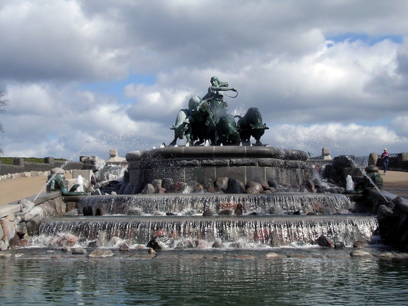
## Description The **Gefion Fountain (Gefionspringvandet)** is one of **Copenhagen’s most iconic landmarks**, combining stunning sculpture, mythological symbolism, and the serene beauty of its waterfront setting. Unveiled in **1908**, the fountain depicts the **Norse goddess Gefion**, a figure from ancient Scandinavian mythology, driving a group of **powerful oxen** as they pull the land that became the island of **Zealand (Sjælland)** — where Copenhagen stands today — from the depths of the sea. Designed by **Danish sculptor Anders Bundgaard**, the fountain is both a **monumental work of art** and a **celebration of Danish legend and identity**. The dynamic bronze figures, set atop a granite basin, capture the dramatic moment of transformation: Gefion’s oxen straining against their harnesses, water surging around them, and the goddess commanding them with divine strength. The story behind the sculpture comes from **Norse mythology**, where Gefion tricks the Swedish king **Gylfi** into granting her as much land as she can plow in one night. Transforming her four sons into oxen, she plows through the earth and casts the land into the sea — forming the island of Zealand. The resulting lake in Sweden, **Lake Vänern**, is said to match Zealand’s shape. What makes the Gefion Fountain unique is not only its **artistic detail and mythological depth** but also its **location** — it sits between **Kastellet Fortress** and **Langelinie Promenade**, surrounded by lush greenery and views of the **harbor** and **The Little Mermaid statue** nearby. The fountain is especially magical when illuminated at night, with the flowing water and shimmering bronze giving it an ethereal glow. A lesser-known fact is that the fountain was originally commissioned by the **Carlsberg Foundation** to celebrate the brewery’s 50th anniversary and was gifted to the city of Copenhagen. Another interesting detail: the granite blocks forming the base came from **Sweden**, a subtle nod to the myth that connects the two lands. ## Location The **Gefion Fountain** is located in **Churchillparken (Churchill Park)** near **Langelinie**, in the **central harbor area of Copenhagen**, **Denmark**. It sits just east of **Amalienborg Palace** and north of the **Kastellet (The Citadel)** fortress. To get there: * **By metro:** Take the **M3 (City Circle Line)** to **Marmorkirken Station**, then walk about **10 minutes** northeast toward the harbor. * **By bus:** Several local buses, including routes **26** and **27**, stop nearby at **Esplanaden**. * **By foot or bike:** The fountain is part of a popular **walking and cycling route** that connects **Amalienborg**, **The Little Mermaid**, and **Kastellet**. * **By car:** Limited parking is available nearby, though walking or cycling is more convenient in this area. ## Tips * **Visit in the morning or late evening:** The light at sunrise and sunset enhances the sculpture’s bronze tones and reflections. * **Combine with nearby landmarks:** The **Little Mermaid**, **Kastellet Fortress**, and **Amalienborg Palace** are all within walking distance. * **Evening illumination:** Visit after dark to see the fountain beautifully lit — a favorite spot for photographers. * **Learn the mythology:** Understanding the legend of Gefion adds depth to your visit; many plaques around the site explain the story. * **Bring a camera:** The fountain’s movement, water effects, and sculptural detail make it a fantastic subject for photos. * **Relax nearby:** The surrounding park offers benches and green spaces perfect for a quiet break during a city walk. * **Visit year-round:** While the fountain operates mainly in warmer months, the sculptures remain accessible and impressive throughout the year. ## Conclusion The **Gefion Fountain** is much more than a beautiful monument — it’s a vivid connection between Denmark’s ancient mythology and its modern identity. With its stunning artistry, powerful symbolism, and scenic harbor location, it perfectly embodies Copenhagen’s blend of **history, legend, and elegance**. Whether you’re tracing the city’s cultural landmarks, enjoying a peaceful stroll through Churchill Park, or exploring Norse mythology, the Gefion Fountain offers a moment of reflection and wonder that captures the timeless spirit of Denmark. ## FAQ **1. What does the Gefion Fountain represent?** It depicts the Norse goddess **Gefion** plowing the land that became the island of **Zealand (Sjælland)**, symbolizing the creation of Denmark’s largest island. **2. Who designed the fountain?** The fountain was created by **Anders Bundgaard**, one of Denmark’s most celebrated sculptors, and unveiled in **1908**. **3. Where is the Gefion Fountain located?** In **Churchillparken**, near **Langelinie Promenade** and **Kastellet Fortress**, in central **Copenhagen**, Denmark. **4. Is it near other attractions?** Yes — it’s just a short walk from **The Little Mermaid**, **Amalienborg Palace**, and the **harborfront**. **5. When does the fountain operate?** The fountain usually runs from **April to October**, depending on weather conditions. The sculptures can be viewed year-round. **6. Is there an entrance fee?** No — visiting the Gefion Fountain is **free of charge**. **7. Can I visit at night?** Yes, and it’s highly recommended. The **evening lighting** creates a beautiful, almost mythical atmosphere. ## Links * [Official Visit Copenhagen – Gefion Fountain](https://www.visitcopenhagen.com/)
GemVoyage Team • World
Griva
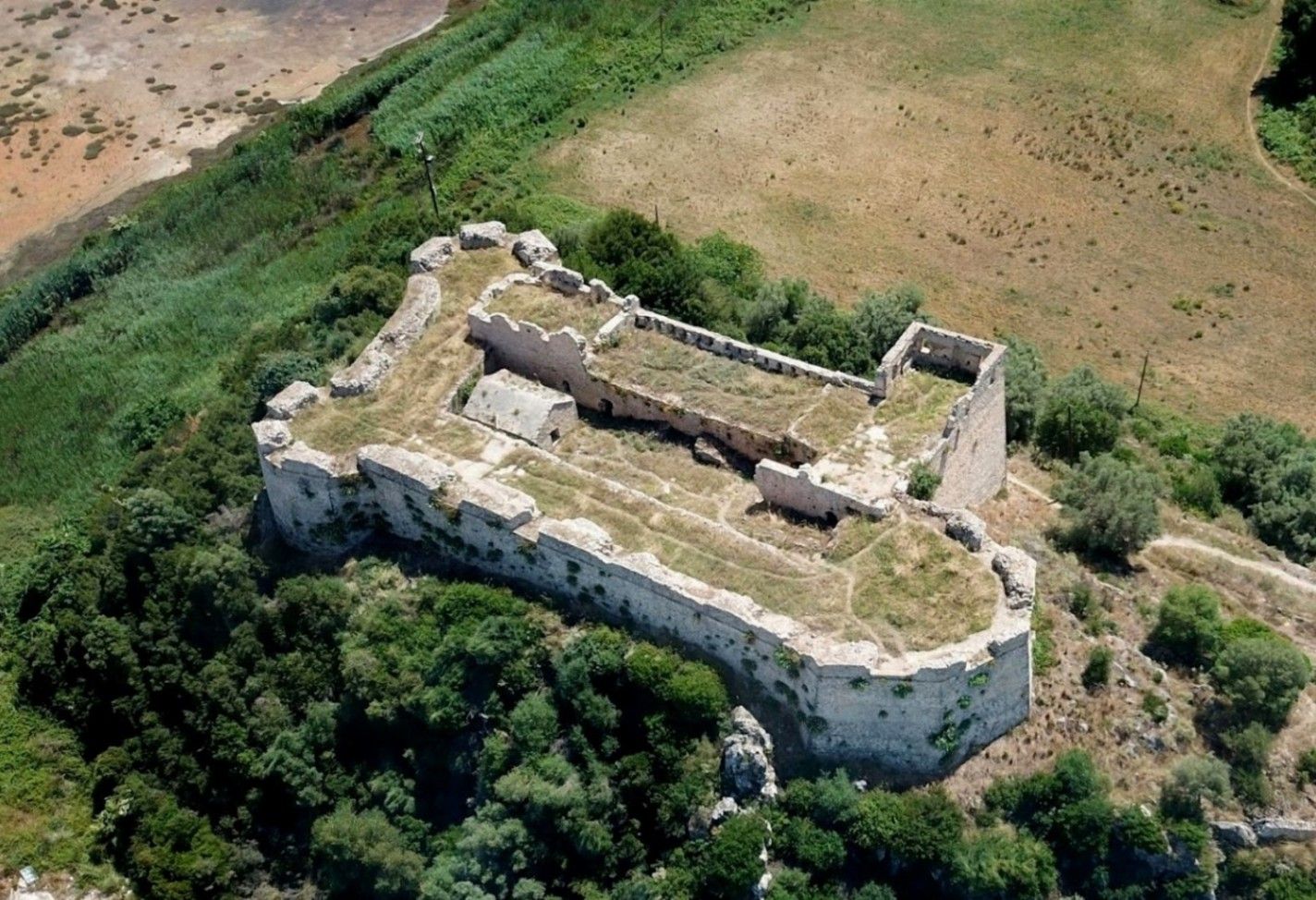
## Description **Griva Castle** (Κάστρο Γρίβα) is a lesser-known but historically significant fortress perched on a ridge in the region of Central Greece. Unlike Greece’s major medieval castles that attract heavy tourism, Griva Castle stands out for its **raw ruins, unfiltered atmosphere, and panoramic vantage point** over the surrounding mountains and valleys. The site is largely untouched by large-scale restoration efforts, which preserves an authenticity that appeals to explorers, hikers, and history enthusiasts seeking off-the-beaten-path destinations. The castle’s origins date back to the **Ottoman period**, when the structure served as a fortified outpost controlling local routes and offering surveillance over the strategic landscape. Its position was not chosen for grandeur but for **tactical visibility**; from the top of the hill, occupants could observe movements across the region long before they reached nearby settlements. Today, visitors can still walk along the remnants of its stone walls, towers, and defensive perimeters, all while imagining the military operations that once shaped the area. A little-known fact is that the castle area was later used during the **Greek War of Independence**, serving as a refuge and observation point for local fighters resisting Ottoman rule. Another interesting detail is that small-scale excavations have revealed architectural traces suggesting earlier defensive uses, which may predate the Ottoman era. What sets Griva Castle apart is the **simplicity of the experience**. There are no curated exhibitions, no ticket booths, and no commercial vendors. Instead, you step into a quiet, windswept landscape that has retained its historic atmosphere. The lack of crowds makes it ideal for slow-paced exploration, photography, and reflection. With clear weather, the views are expansive, capturing rural settlements, forested hillsides, and rolling terrain that highlight the natural beauty of central Greece. ## Location **Country:** Greece **Region:** Central Greece (Sterea Ellada) **Nearest Town:** Griva or surrounding villages depending on the specific approach The castle sits atop a hill overlooking the local countryside, accessible through rural roads and small village paths. ### How to Get There * **By car:** * The most practical option. Rural roads lead to the village area, from which a short uphill walk brings you to the castle ruins. A standard vehicle is usually sufficient, but some paths may be uneven. * **By bus:** * Limited. Regional buses connect nearby towns, but reaching the castle itself generally requires private transport. * **On foot:** * Hiking paths from the village allow visitors to reach the castle in about 15–25 minutes depending on the route chosen. * **By guided tour:** * Occasional historical or hiking groups include the site, but these are not frequent. ## Tips * **Wear proper footwear:** The terrain is rocky, uneven, and sometimes slippery after rain. * **Visit during daylight:** The area has no lighting, and navigating the ruins after sunset is unsafe. * **Bring water and snacks:** There are no facilities near the castle. * **Check the weather:** Clear skies enhance the views significantly and make the hike easier. * **Combine the visit with nearby villages:** Traditional tavernas in surrounding settlements are ideal for a post-hike meal. * **Photography enthusiasts should visit during golden hour:** The light over the surrounding hills is excellent. ## Conclusion Griva Castle is a quiet, rugged, and historically rich destination that rewards visitors willing to venture beyond mainstream tourist circuits. Its ruins, elevated position, and connection to regional history make it a compelling stop for those seeking authentic Greek landscapes and immersive outdoor exploration. ## FAQ **1. Is there an entrance fee?** No. The site is freely accessible to visitors. **2. Are the ruins safe to explore?** Generally yes, but caution is essential due to uneven paths and the absence of barriers. **3. How long does the visit take?** Most visitors spend **45 minutes to 1.5 hours** depending on hiking time and interest. **4. Is it suitable for children?** Only with supervision. Some sections have steep drops and loose stones. **5. Are guided tours available?** Occasionally, especially by local history or hiking groups, but not regularly. **6. What is the best time of year to visit?** Spring and early autumn offer comfortable temperatures and clear views. ## Links * [Greek tourism information](https://visitgreece.gr)
GemVoyage Team • World
Aswan
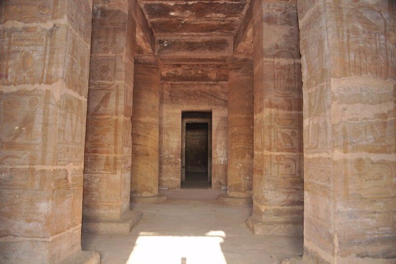
## Description **The Temple of Amada** is one of the oldest surviving stone temples in Nubia and a remarkable example of **New Kingdom Egyptian architecture** outside the Nile Valley’s main centers. Built during the reigns of **Thutmose III** and **Amenhotep II** in the 18th Dynasty (15th century BCE), the temple was dedicated to the gods **Amun-Re** and **Re-Horakhty**. While modest in size compared to the great temples of Luxor, Amada’s historical and artistic value is exceptionally high. What makes the Temple of Amada unique is its **well-preserved interior inscriptions**. The walls are covered with detailed reliefs and hieroglyphic texts that document military campaigns in Nubia and the Near East. One inscription records a victory so overwhelming that it claims the stench of defeated enemies filled the land—an unusually vivid and rare narrative detail in Egyptian temple texts. A lesser-known but crucial fact is that the temple originally stood several kilometers south of its current location. During the 1960s, it was **relocated intact** as part of UNESCO’s Nubian Monuments rescue campaign, launched to save ancient sites threatened by flooding from the construction of the Aswan High Dam. Unlike Abu Simbel, which was cut into blocks, the Temple of Amada was moved as a **single structure**, an extraordinary engineering achievement that preserved its fragile wall paintings. The temple’s proportions are elegant and restrained, with a small pylon, open courtyard, hypostyle hall, and sanctuary. Its compact scale allows visitors to closely study reliefs and inscriptions without the overwhelming crowds found at larger sites, making it especially rewarding for those interested in Egyptian history and epigraphy. ## Location **Country:** Egypt **Region:** Upper Egypt / Nubia **Nearest City:** Aswan The Temple of Amada is located approximately **20 kilometers south of Aswan**, near Lake Nasser, close to the modern village of New Amada. ### How to Get There * **By guided tour:** * Most visitors reach Amada as part of a **Lake Nasser archaeological tour**, either by road or boat. * **By car:** * Accessible via the Aswan–Abu Simbel road, though permits may be required for independent travel. * **By cruise boat:** * Some Lake Nasser cruises include Amada as a scheduled stop. ## Tips * **Visit with a guide:** The inscriptions are historically rich but easy to miss without explanation. * **Allow time inside:** The temple’s value lies primarily in its interior reliefs, not its exterior. * **Bring sun protection:** The site is exposed, and shade is limited. * **Photography is allowed:** Flash should be avoided to protect the wall paintings. * **Combine with nearby sites:** The temples of Derr and the Tomb of Pennut are often visited together. * **Best visited in winter:** Cooler temperatures make exploration far more comfortable. ## Conclusion The Temple of Amada is a quiet but powerful witness to Egypt’s imperial presence in Nubia. Its vivid inscriptions, elegant design, and dramatic modern relocation make it one of the most historically important yet underrated ancient temples in southern Egypt. ## FAQ **1. When was the Temple of Amada built?** It dates to the 18th Dynasty, primarily during the reigns of Thutmose III and Amenhotep II. **2. Why was the temple moved?** It was relocated to prevent flooding caused by the creation of Lake Nasser after the Aswan High Dam. **3. Is the temple original or reconstructed?** It is original; the entire structure was moved intact rather than rebuilt from blocks. **4. How long does a visit take?** Approximately **30–60 minutes**, depending on interest in inscriptions. **5. Is it crowded?** No. It is much quieter than major temples along the Nile. **6. Is the site suitable for casual visitors?** Yes, though history enthusiasts will appreciate it the most. ## Links * [Egypt tourism portal](https://www.experienceegypt.eg/en)
GemVoyage Team • World
Cairo
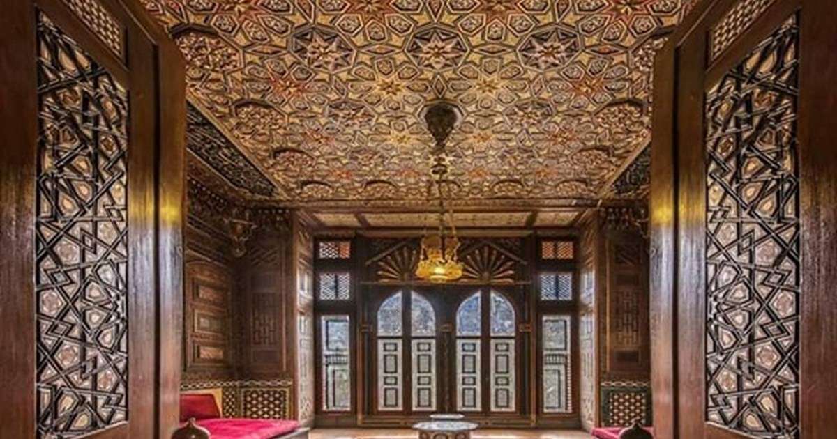
## Description Manial Palace is one of Cairo’s most enchanting and architecturally eclectic landmarks, offering a rare glimpse into Egypt’s royal past through the eyes of Prince Mohamed Ali Tewfik. Built between 1900 and 1929, the palace is a testament to the prince’s passion for Islamic art, history, and design. It blends a variety of architectural styles—including Ottoman, Moorish, Persian, Andalusian, and Mamluk—into a harmonious and visually stunning complex that feels both regal and deeply personal. The palace compound consists of several distinct buildings: the Residence Palace, the Reception Palace, the Throne Hall, a mosque, a hunting museum, and a private museum. Each structure is adorned with intricate woodwork, stained glass, and decorative tiles that reflect the prince’s artistic sensibilities. The interiors are filled with rare antiques, textiles, and artworks collected from across the Islamic world. One of the most captivating rooms is the Shell Salon, decorated with thousands of seashells arranged in elaborate patterns. Surrounding the palace is a lush garden inspired by Persian and English landscaping traditions. It features exotic plants, rare trees, and winding paths that create a tranquil escape from the city’s bustle. A little-known fact: Prince Mohamed Ali personally oversaw the design and decoration of the palace and left instructions for it to be converted into a museum after his death—a wish that was honored, preserving his legacy for future generations. ## Location Manial Palace is located in **Egypt**, in the **Cairo Governorate**, within the **city of Cairo**. It sits on **Rhoda Island**, along the Nile River, in the El-Manial district. ### How to Get There - **By Metro**: Take Line 1 to El-Malek El-Saleh Station. From there, it’s a short taxi ride or a 15-minute walk to the palace. - **By Taxi or Ride-Share**: Services like Uber and local taxis can take you directly to the entrance on Sharia Al-Saray. - **By Car**: Parking is available nearby, though traffic in central Cairo can be heavy. - **By Tour**: Many cultural and historical tours of Cairo include Manial Palace as a stop, often paired with visits to the Egyptian Museum or Coptic Cairo. Its central location makes it easily accessible from most parts of the city. ## Tips - **Visit Early**: Arriving in the morning helps you avoid crowds and enjoy the gardens in cooler temperatures. - **Photography**: While photography is allowed in most areas, flash is prohibited. Bring a camera with good low-light capability to capture the ornate interiors. - **Dress Modestly**: As with many historical and religious sites in Egypt, modest attire is appreciated. - **Take Your Time**: The palace is rich in detail. Allocate at least 2–3 hours to explore the buildings and gardens thoroughly. - **Check for Events**: Occasionally, the palace hosts cultural exhibitions or art events. Check local listings or the museum’s website for updates. - **Avoid Large Bags**: Bags larger than 40x40 cm are not permitted inside and must be stored in the cloakroom. ## Conclusion Manial Palace is a hidden gem in Cairo that offers a unique blend of history, art, and architecture. With its richly decorated interiors, serene gardens, and fascinating royal legacy, it provides an immersive experience into Egypt’s early 20th-century aristocratic life. ## FAQ **1. What are the opening hours of Manial Palace?** The museum is open daily from 9:00 AM to 5:00 PM. **2. What is the entrance fee?** Foreign adults: EGP 220; foreign students: EGP 110. Egyptian adults: EGP 20; Egyptian students: EGP 5. **3. Is the palace suitable for children?** Yes, but children must be accompanied by an adult at all times. **4. Can I sketch or take notes inside the museum?** Yes, but only pencils are allowed. Sketchbooks must not exceed 18 x 24 inches. **5. Are guided tours available?** Yes, guided tours can be arranged on-site or through local tour operators. **6. Is the palace wheelchair accessible?** Accessibility is limited due to the historic nature of the building. Contact the museum in advance for specific accommodations. ## Links - [Manial Palace and Museum – Wikipedia Overview](https://en.wikipedia.org/wiki/Manial_Palace_and_Museum) - [Manial Palace Museum – Ministry of Tourism and Antiquities](https://egymonuments.gov.eg/museums/manial-palace-museum/)
GemVoyage Team • World
Berlin
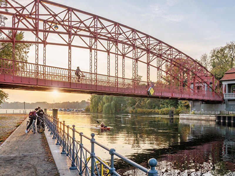
## Description **Tegeler See** is one of Berlin’s largest and most beloved lakes, offering a rare combination of **deep forest landscapes, wide open water, historic promenades, and recreational freedom** within a major European capital. Unlike the carefully curated parks of central Berlin, Tegeler See feels **expansive, natural, and quietly powerful**, a place where the city dissolves into wind, water, and tree canopy. The lake stretches across the northern edge of Berlin and forms part of a much larger **interconnected water system** linking rivers, canals, and smaller lakes. Its shoreline alternates between **elegant promenades, dense woodland, sandy bathing areas, hidden coves, and small harbors**, giving every section a distinct character. On one walk you might pass joggers and cyclists near cafés, and moments later find yourself alone on a forested shoreline with only birds and passing sailboats for company. What makes Tegeler See especially unique is its **scale and visual openness**. The lake is wide enough to feel almost coastal in certain sections. Wind patterns shape large ripples across the surface, and on clear days the sky reflects endlessly into the water. Sailboats, paddleboards, kayaks, ferries, and swimmers all share the same space, creating an ever-moving ecological and recreational system. The western and northern edges of the lake are bordered by the **Tegel Forest (Tegeler Forst)**, one of Berlin’s largest continuous woodland zones. This forest contains long hiking paths, wildlife corridors, thick pine stands, and historic hunting routes that once served Prussian royalty. This direct interface between **urban lake and protected forest** is one of Tegeler See’s defining strengths. Few European capitals offer this scale of natural immersion without leaving city limits. From an urban perspective, the lake is closely tied to the borough of **Reinickendorf** and the historic district of **Alt-Tegel**. The Alt-Tegel promenade along the eastern shoreline functions as a social spine, lined with restaurants, ice cream shops, boat docks, beer gardens, and terraces overlooking the water. This area transforms in summer into one of Berlin’s most relaxed outdoor social scenes, blending families, cyclists, couples, and long-term residents. A little-known fact is that Tegeler See was once part of the **Havel River’s natural floodplain system**, and its modern form is the result of long-term hydraulic engineering dating back centuries. Another lesser-known detail is that the famous German poet and philosopher **Gotthold Ephraim Lessing** once lived near the lake, and the nearby Tegel Palace was home to the Humboldt family, including **Alexander von Humboldt**, one of history’s most influential natural scientists. Tegeler See’s emotional identity is shaped by **seasonality**. In spring, the forest releases fresh green layers and migrating birds return. Summer brings swimming, paddleboarding, lakeside dining, and long evening sunsets. Autumn covers the surrounding hills in gold and copper tones. Winter transforms the lake into a minimalist landscape of cold light, mist, and silence, occasionally frozen at the edges. Unlike Berlin’s central landmarks, Tegeler See does not present itself as a destination of spectacle. Its appeal is built on **duration rather than intensity**. People do not come for a single photo; they come to spend hours walking, reading, boating, cycling, swimming, and simply existing beside water and forest. It is one of the few places in Berlin where **time visibly slows down**. In a city often defined by density, history, and cultural pressure, Tegeler See functions as a **pressure valve**. It absorbs excess motion and releases calm. ## Location **Tegeler See** is located in **northwestern Berlin**, primarily within the borough of **Reinickendorf**, near the historic district of **Tegel**. **City:** Berlin **State (Region):** Berlin **Country:** Germany **Primary Area:** Reinickendorf / Alt-Tegel ### How to Get There: * **By S-Bahn:** * Take **S25** to **Tegel Station**, then walk 10 minutes to the lakeside. * **By U-Bahn:** * Take **U6** to **Alt-Tegel**, which places you directly at the main promenade. * **By bus:** Multiple bus routes connect Tegel with central and northern Berlin. * **By bicycle:** A well-developed bike network connects Tegeler See to the city center. * **By car:** Parking is available but is limited on busy summer days. The lake is easily combined with visits to **Alt-Tegel old town, Tegel Forest hiking trails, and the Havel River network**. ## Tips * **Visit on weekdays if you prefer quiet:** Weekends can be very busy in summer. * **Walk both the promenade and the forest side:** Each offers a completely different experience. * **Bring swimwear in summer:** Designated bathing areas are popular and well maintained. * **Sunset is the most atmospheric time:** Especially from western shoreline viewpoints. * **Boat rentals are widely available during the warm season.** * **Dress for wind:** The open water creates noticeable temperature shifts. * **Combine with Alt-Tegel dining:** Lakeside restaurants are a core part of the experience. * **Winter visits are underrated:** The silence and mist create a dramatic, cinematic mood. ## Conclusion **Tegeler See** is Berlin at its most expansive and elemental. It is where the city trades architecture for horizon, traffic for water movement, and density for breathing space. By uniting forest, lake, promenade, and history into one continuous landscape, Tegeler See offers a version of Berlin that is **slower, wider, and deeply restorative**. ## FAQ **1. Is Tegeler See suitable for swimming?** Yes. Several **official bathing areas** operate during the summer season. **2. Can you rent boats on Tegeler See?** Yes. **Paddleboats, kayaks, and small sailboats** are available for rent. **3. Is Tegeler See family-friendly?** Yes. It is widely used by **families, cyclists, walkers, and swimmers**. **4. How long does it take to walk around Tegeler See?** Walking the full perimeter can take **2.5 to 4 hours**, depending on pace and route. **5. Is Tegeler See good in winter?** Yes, especially for **quiet walks, photography, and forest exploration**. **6. Is there wildlife around the lake?** Yes. The area supports **water birds, foxes, deer, and diverse forest species**. ## Links * [Visit Berlin](https://www.visitberlin.de)
GemVoyage Team • World
Stuttgart
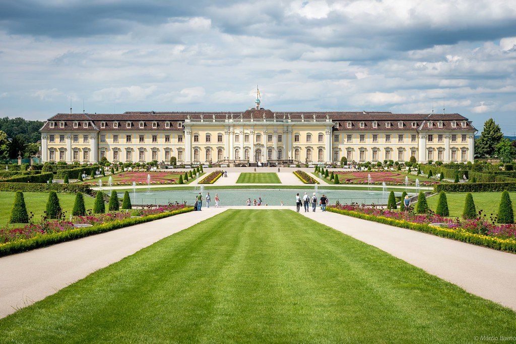
## Description The **Ludwigsburg Residential Palace (Residenzschloss Ludwigsburg)** is one of Europe’s most magnificent Baroque palaces and a true masterpiece of royal architecture and design. Often referred to as the **“Swabian Versailles,”** it is the **largest preserved Baroque palace in Germany**, blending **Baroque, Rococo, and Neoclassical** styles across its sprawling complex. Construction began in **1704** under **Duke Eberhard Ludwig of Württemberg**, who envisioned a grand residence to reflect his power and sophistication. Over the next decades, the palace grew into a breathtaking ensemble of **18 buildings**, **452 rooms**, and vast gardens that stretch across **32 hectares**. Each wing and hall tells a different story of Württemberg’s history, art, and royal life. Inside, visitors can explore elaborately decorated **ballrooms, royal apartments, chapels, and galleries**, many of which remain in their original condition. Highlights include the **Marble Hall**, adorned with gilded stucco and crystal chandeliers; the **Baroque Gallery**, featuring masterpieces by European painters; and the **Ancient Theatre**, one of the oldest preserved court theaters in Europe still in operation. The palace is also home to **three museums**: the **Baroque Gallery (Barockgalerie)**, the **Fashion Museum (Modemuseum)** — showcasing 18th- to 20th-century European fashion — and the **Ceramics Museum**, which displays exquisite porcelain collections. A lesser-known fact is that during the **Napoleonic Wars**, the palace served as a temporary refuge for royalty and diplomats. Another interesting detail: the building narrowly escaped destruction during World War II, making it one of the few German palaces to survive fully intact. Today, it offers visitors a glimpse into over **300 years of royal life and European artistry**. The surrounding **Blooming Baroque Gardens (Blühendes Barock)** are a spectacle in their own right — a vibrant re-creation of Baroque landscaping, filled with fountains, sculptures, and floral displays that change seasonally. The gardens also include the **Fairy-Tale Garden (Märchengarten)**, a delightful attraction for children and families, where classic fairy tales come to life. ## Location The **Ludwigsburg Residential Palace** is located in the **city of Ludwigsburg**, about **15 kilometers (9 miles)** north of **Stuttgart**, in the **Baden-Württemberg** region of **southern Germany**. To get there: * **By train:** From **Stuttgart Hauptbahnhof (main station)**, take the **S4 or S5 S-Bahn** to **Ludwigsburg Station** (about 15–20 minutes). From there, it’s a **15-minute walk** or a short bus ride to the palace. * **By car:** Take the **A81 motorway** (exit Ludwigsburg-Süd or Ludwigsburg-Nord). Parking is available near the palace grounds. * **By guided tour:** Many Stuttgart-based tour operators offer day trips that include transportation, entry tickets, and guided tours of the palace and gardens. ## Tips * **Take a guided tour:** The palace is huge, and guided tours (available in English and German) provide deep insights into its history and hidden details. * **Explore the museums:** Don’t miss the **Fashion Museum** and **Baroque Gallery** — they’re both fascinating and included in the entry ticket. * **Visit the gardens:** The **Blühendes Barock** gardens are stunning in spring and summer, especially during the **pumpkin festival (Kürbisausstellung)** held from late August to early November. * **Plan for at least half a day:** The site is extensive — allow time to stroll through the interiors, gardens, and museums. * **Family-friendly attractions:** The **Fairy-Tale Garden** is a great spot for kids and adds a magical touch to the visit. * **Photography:** Indoor photography may require permission, but outdoor photography in the gardens is encouraged. * **Combine with nearby attractions:** Ludwigsburg’s charming old town and market square are within walking distance, and **Stuttgart** is easily reachable by train. ## Conclusion The **Ludwigsburg Residential Palace** stands as a living monument to the grandeur of Baroque Europe and the cultural legacy of Württemberg’s rulers. With its stunning architecture, ornate interiors, and beautifully preserved gardens, it offers visitors a rare chance to step into the royal world of the 18th century. Whether you come for its art, history, or seasonal festivals, Ludwigsburg is a destination that effortlessly combines **majestic beauty with historical authenticity**, making it one of Germany’s most rewarding cultural experiences. ## FAQ **1. When was the Ludwigsburg Palace built?** Construction began in **1704** under **Duke Eberhard Ludwig** and continued for several decades, evolving through different architectural styles. **2. How large is the palace?** The complex features **18 buildings and over 450 rooms**, making it the **largest Baroque palace in Germany**. **3. Can I visit the gardens separately?** Yes, the **Blühendes Barock gardens** can be visited separately and often host seasonal events, including flower shows and the famous **pumpkin festival**. **4. Are guided tours available in English?** Yes, English-language tours are offered regularly; check the official schedule in advance. **5. How long should I plan to spend there?** Most visitors spend **half a day to a full day** exploring the palace, gardens, and museums. **6. Is it suitable for children?** Absolutely — the **Fairy-Tale Garden** and open grounds make it enjoyable for families. **7. Is the palace open year-round?** Yes, though some outdoor events and gardens are seasonal. Indoor exhibitions are open year-round. ## Links * [Official Ludwigsburg Palace Website (Residenzschloss Ludwigsburg)](https://www.schloss-ludwigsburg.de/en)
GemVoyage Team • World

Comments