GemVoyage Team • World
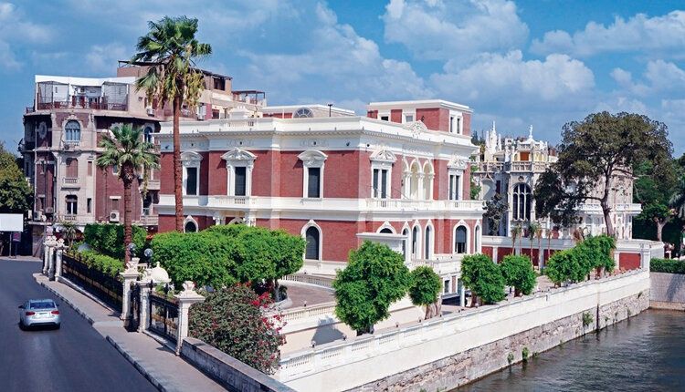
Aisha Fahmy Palace is one of Cairo’s most elegant examples of early 20th-century aristocratic architecture and a rare survivor of the city’s Belle Époque period. Built in 1907, the palace reflects a time when Cairo’s elite embraced European artistic influences while maintaining a distinct Egyptian identity. Today, it stands not as a frozen relic, but as a carefully restored cultural venue that bridges past luxury with contemporary artistic expression.
The palace was commissioned by Ali Fahmy Pasha and later inherited by his daughter, Aisha Fahmy, whose name it still carries. Designed by Italian architect Antonio Lasciac, the building combines Italian Renaissance influences with Art Nouveau and neoclassical details. Marble staircases, ornate ironwork, stained glass windows, and elaborately decorated ceilings reveal the level of craftsmanship invested in elite residential architecture at the time.
What makes Aisha Fahmy Palace particularly compelling is its interior artistry. The walls and ceilings feature painted panels inspired by classical European mythology, floral motifs, and allegorical scenes, many of which were executed by European artists working in Cairo. A lesser-known fact is that the palace once hosted private salons and cultural gatherings attended by prominent figures from Egypt’s political and artistic circles. Another overlooked detail is that, despite periods of neglect during the late 20th century, much of the original decorative work survived and was meticulously restored rather than replaced.
Today, the palace functions as a temporary exhibition space under the Egyptian Ministry of Culture. Contemporary art exhibitions are staged within the historic rooms, creating a deliberate contrast between modern creative expression and early 1900s aristocratic interiors. This dialogue between eras is central to the palace’s renewed relevance.
Country: Egypt
Governorate: Cairo
District: Zamalek
Aisha Fahmy Palace is located in Zamalek, one of Cairo’s most refined and leafy neighborhoods, situated on Gezira Island in the Nile.
* The most practical option, especially from central Cairo or downtown.
* Take Line 2 to Opera Station, then walk or take a short taxi ride.
* Easily reachable when exploring Zamalek’s cultural venues and riverfront.
* Limited street parking is available in the surrounding area.
Aisha Fahmy Palace is a refined cultural landmark that captures a sophisticated chapter of Cairo’s modern history. Its restored interiors, aristocratic architecture, and evolving role as an art space make it a rewarding destination for visitors seeking depth, elegance, and context beyond the city’s ancient monuments.
1. Is Aisha Fahmy Palace a museum?
It functions primarily as a temporary exhibition venue rather than a traditional museum.
2. How old is the palace?
It was completed in 1907.
3. How long should I plan for a visit?
Approximately 45 minutes to 1.5 hours, depending on exhibitions.
4. Is there an entrance fee?
Yes, a modest fee is usually charged and may vary by exhibition.
5. Is the palace suitable for children?
Yes, particularly for older children interested in art or architecture.
6. Is the palace accessible?
Accessibility is limited in some areas due to the historic structure.
Discover more hidden gems you might love.
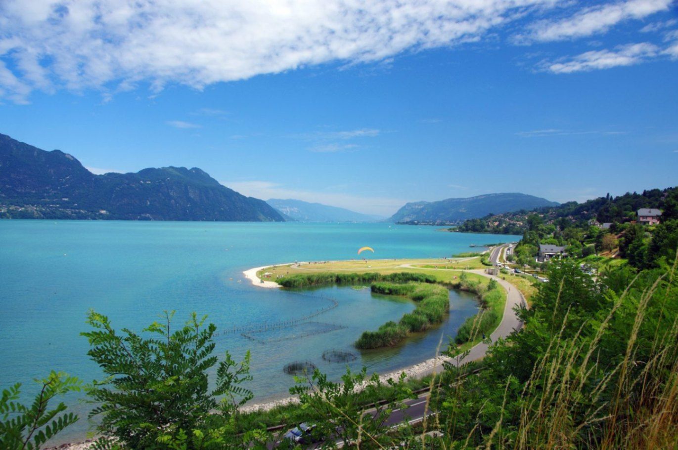
Auvergne-Rhône-Alpes
## Description Lac du Bourget is the largest natural lake entirely within France and one of the most scenic bodies of water in the country. Surrounded by mountains, historic towns, and thermal spa resorts, the lake offers a perfect blend of natural beauty, outdoor activities, and cultural heritage. Its calm blue waters and dramatic alpine backdrop have inspired writers, poets, and travelers for centuries, making it a destination that appeals to nature lovers and culture seekers alike. What makes Lac du Bourget truly unique is its diversity. Visitors can enjoy swimming, sailing, paddleboarding, and cycling along the shoreline, while also exploring charming lakeside towns such as Aix-les-Bains and Le Bourget-du-Lac. A little-known fact is that the lake reaches depths of over 140 meters, making it not only the largest but also one of the deepest lakes in France. Another lesser-known detail is its strong literary connection: the famous French poet Alphonse de Lamartine immortalized the lake in his poem *Le Lac*, turning it into a symbol of romantic longing in French literature. Despite its popularity, Lac du Bourget retains a peaceful atmosphere, especially outside peak summer months, making it ideal for travelers seeking both relaxation and discovery. ## Location Lac du Bourget is located in **France**, in the **Auvergne-Rhône-Alpes** region, within the **Savoie** department. The lake lies between the cities of Aix-les-Bains and Chambéry, at the western edge of the Alps. Reaching Lac du Bourget is easy. The closest major town, Aix-les-Bains, has a well-connected train station with direct services from cities such as Lyon, Geneva, and Paris. From the station, local buses, taxis, or walking paths lead directly to the lakeshore. Travelers arriving by car can access the area via the A41 motorway, which connects Chambéry to Geneva. Cycling paths also run along parts of the lake, offering a scenic and eco-friendly way to explore the surroundings. ## Tips * Visit between late spring and early autumn for the best weather and full access to water activities. * Early mornings and weekdays are ideal for enjoying the lake in a quieter, more peaceful setting. * Bring swimwear and a towel, as many public beaches offer free or low-cost access. * Rent a boat or take a guided cruise to appreciate the lake’s size and mountain views from the water. * Explore nearby Aix-les-Bains for its Belle Époque architecture and thermal spas. * If hiking, wear proper footwear and carry water, especially on trails overlooking the lake. ## Conclusion Lac du Bourget is a remarkable destination that combines natural splendor, outdoor recreation, and cultural depth. Whether you are relaxing by the shore, exploring historic towns, or cruising across its tranquil waters, the lake offers a rich and memorable experience in the heart of the French Alps. ## FAQ **Is Lac du Bourget suitable for swimming?** Yes, the lake is known for its clean water and has several designated swimming areas and beaches. **What is the best town to stay near Lac du Bourget?** Aix-les-Bains is the most popular base, offering accommodation, restaurants, and easy lake access. **Are boat tours available on the lake?** Yes, regular sightseeing cruises and private boat rentals are available, especially during the warmer months. **Is Lac du Bourget family-friendly?** Absolutely. Beaches, cycling paths, and gentle water activities make it ideal for families. **Can I visit Lac du Bourget in winter?** Yes, while swimming is not possible, the area remains attractive for walks, spa visits, and scenic views. ## Links * [Lac du Bourget Tourism Official Website](https://www.lac-du-bourget.com)
GemVoyage Team • World
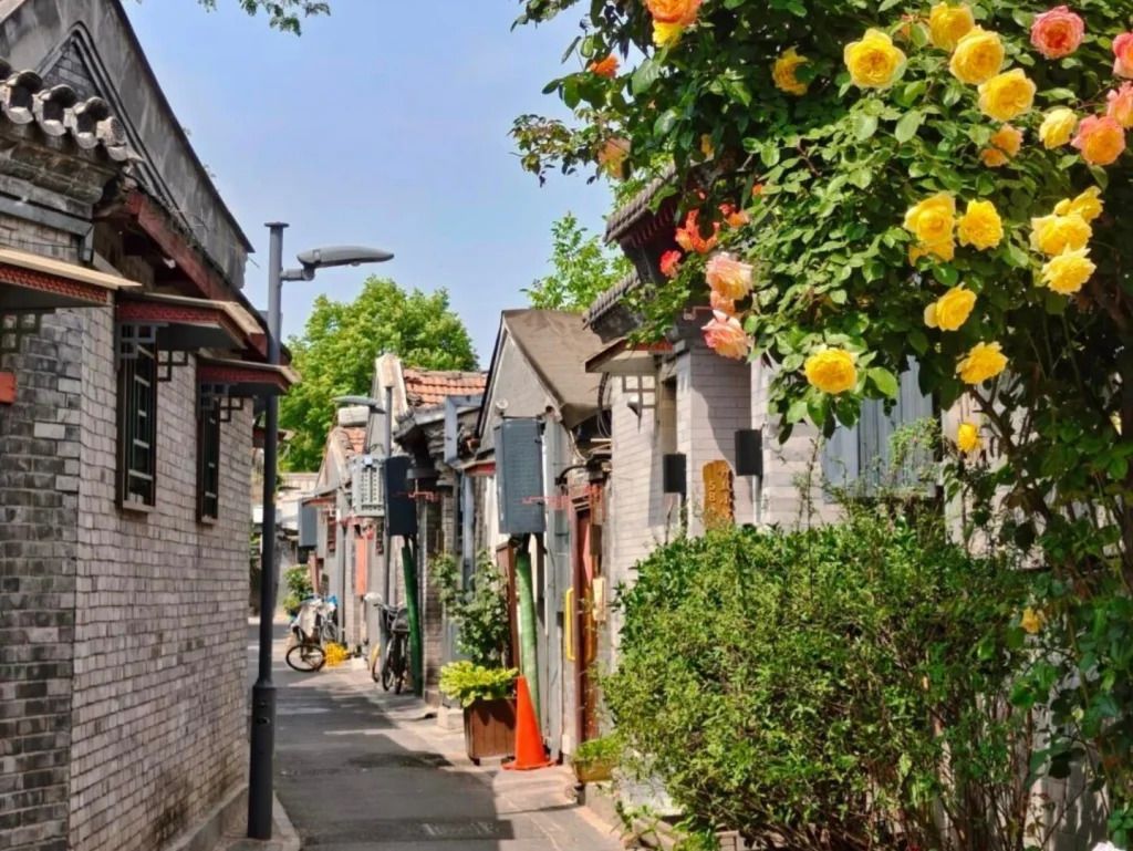
Beijing
## Description Qinhuangdao Alley Hutongs, as a travel idea, points to one of Beijing’s most rewarding urban experiences: moving through the city’s traditional hutong lanes and seeing how historic residential fabric still shapes everyday life. Hutongs are not grand monuments in the usual sense. They are narrow lanes, courtyard-house networks, and neighborhood corridors that preserve a more intimate view of Beijing than the city’s large avenues and famous landmarks. That is exactly why they remain so compelling. They let visitors step into the scale of older Beijing, where community, domestic life, and street activity sit in close proximity. The appeal of the hutong experience lies in its texture. Instead of one single iconic object, you get layered details: gray brick walls, courtyard entrances, hand-painted signs, hidden cafés, neighborhood shops, bicycles, small temples, and the daily rhythm of residents going about ordinary routines. A lesser-known fact is that hutongs are not just tourist curiosities; they are living urban forms that have survived because they still support local life, even as some areas have changed dramatically. Another overlooked detail is that many of the most interesting hutong walks reveal small architectural differences from lane to lane, including gate styles, courtyard layouts, and adaptations made over time to fit modern use. If you are traveling in Beijing for the first time, hutongs can be one of the most useful experiences you choose because they explain the city in a human-scale way. They show how neighborhoods are organized, how people move, and how history remains present without always announcing itself loudly. Unlike large museums, the hutong district does not ask you to stand still. It invites you to wander, notice, and compare. That makes it especially rewarding for slow travelers, photographers, architecture lovers, and anyone who prefers atmosphere over checklist sightseeing. The name “Qinhuangdao Alley Hutongs” may be used locally or descriptively, but the broader experience belongs firmly to Beijing’s historic center. Rather than approaching it as a single fenced attraction, think of it as a neighborhood exploration. That mindset will help you appreciate it much more fully. ## Location The hutong experience is centered in Beijing Municipality, China, especially in the older districts of Dongcheng and Xicheng where historic lanes remain most visible. Depending on the exact lane or alley you plan to visit, you may be close to landmarks such as Shichahai, Nanluoguxiang, the Bell and Drum Towers, or other traditional neighborhoods. Because hutongs are embedded in the city’s fabric, their location is best understood as a district-level experience rather than a single destination pin. Getting there is usually easiest by subway, followed by a short walk. Beijing’s public transit network is efficient for reaching the historic core, and once you exit the station, the pleasure comes from entering the smaller lanes on foot. Taxis and rideshares are also practical, but traffic can make them slower than the metro during busy hours. If you prefer a more immersive approach, combine subway access with a walking route that allows for detours into side streets. Because the exact lanes can be harder to define than a single monument, it helps to visit with an open itinerary. Choose a starting point in a known hutong district and then let the side alleys guide your exploration. That approach usually produces the most interesting results. ## Tips Walk slowly. Hutongs reward attention to detail, and many of their best moments are found between the obvious sights. Respect private space. These are living neighborhoods, not theme park sets, so it is important to be considerate when taking photos or peering into courtyards. Visit at a comfortable time of day. Morning and late afternoon often feel more pleasant for walking, with softer light and a calmer pace. Combine the walk with food. Small noodle shops, tea spots, and casual eateries can turn a simple stroll into a much richer cultural experience. Do not try to “finish” the hutongs. The value is in wandering a manageable section well, not in covering everything. ## Conclusion The hutongs of Beijing offer one of the most atmospheric ways to understand the city. They are historic, living, and quietly beautiful, with enough variation to reward curiosity at every turn. For travelers who want Beijing beyond its headline monuments, this is an essential experience. ## FAQ ### What is a hutong? A hutong is a traditional Beijing alley or lane, usually linked to courtyard-house neighborhoods. The form reflects older patterns of urban life and remains an important part of the city’s identity. ### Are hutongs still inhabited? Yes. Many hutong areas are still lived in, even though some have been renovated, adapted, or repurposed for commerce and tourism. ### Is this more of a walking experience than a fixed attraction? Exactly. Hutongs are best understood as a walkable neighborhood environment rather than a single enclosed site. ### How long should I spend there? A focused walk might take 1 to 2 hours, but a more rewarding visit can easily stretch longer if you stop for food, tea, or photography. ## Links - [Hutong on Wikipedia](https://en.wikipedia.org/wiki/Hutong) - [Beijing official tourism](https://english.beijing.gov.cn/)
GemVoyage Team • World
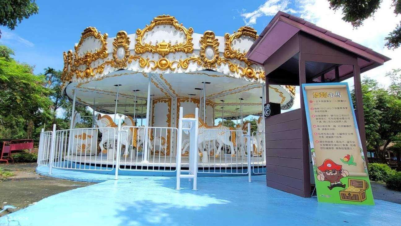
Taiwan
## Description Pirate Village Theme Park is a small but imaginative attraction in Taiwan that brings the spirit of seafaring adventure to life. Designed primarily for families with children, the park is centered around a colorful pirate theme, complete with ship-shaped playgrounds, lookout towers, rope bridges, and interactive installations that encourage exploration and physical activity. Rather than focusing on high-thrill rides, Pirate Village emphasizes creative play, storytelling, and hands-on fun in an open-air setting. What makes Pirate Village Theme Park unique is its community-driven concept. Unlike large commercial theme parks, this attraction was developed as a recreational and cultural space that blends leisure with local identity. Many of the structures are designed to be both playful and educational, helping children develop coordination, imagination, and social skills. A lesser-known fact is that the park often incorporates locally inspired design elements, subtly reflecting Taiwan’s coastal history and maritime culture. Another interesting detail is that Pirate Village regularly hosts small-scale events, such as weekend performances or seasonal activities, which are usually aimed at local families rather than tourists. For travelers looking for a relaxed, off-the-beaten-path experience—especially those traveling with young children—Pirate Village Theme Park offers a pleasant break from Taiwan’s busy city attractions. ## Location Pirate Village Theme Park is located in **Taiwan**, in the **Yunlin County** region, within **Douliu City**. Yunlin County is situated in central-western Taiwan and is known for its slower pace of life compared to major metropolitan areas like Taipei or Kaohsiung. The most convenient way to reach the park is by train to Douliu Station on the Taiwan Railways Administration (TRA) line. From the station, visitors can take a local taxi or bus to reach the park area within a short time. If you are traveling by car, driving is a practical option, as parking is generally easier to find than in larger cities. Visitors coming from other parts of Taiwan may consider combining a visit to Pirate Village with other nearby family attractions or local food stops in Yunlin County. ## Tips * Pirate Village Theme Park is best suited for families with young children, so adults traveling without kids may find the visit relatively short. * Visit during weekdays or early mornings on weekends to avoid local crowds, especially during school holidays. * Bring sun protection such as hats, sunscreen, and water, as much of the park is outdoors. * Wear comfortable shoes, as children are encouraged to climb, run, and explore different play structures. * Check local announcements or social media pages before visiting, as special events or maintenance closures may affect opening times. * Combine your visit with nearby local markets or cafés to make the trip more rewarding. ## Conclusion Pirate Village Theme Park is a charming, low-key attraction that offers imaginative play and family-friendly fun in central Taiwan. While it may not be a large-scale theme park, its creative design, relaxed atmosphere, and local character make it a worthwhile stop for families seeking a simple and enjoyable outing. ## FAQ **Is Pirate Village Theme Park suitable for all ages?** The park is mainly designed for children, especially those in preschool and elementary school age groups. Adults can accompany children but may find limited activities for themselves. **Is there an entrance fee?** In many cases, Pirate Village Theme Park is free or very low-cost, as it functions as a public or community-oriented attraction. Fees, if any, may apply during special events. **How much time should I plan for a visit?** Most visitors spend about one to two hours exploring the park, depending on crowd levels and children’s interest. **Is the park accessible by public transportation?** Yes, it is accessible via train and local buses, though taxis or private cars offer the most convenience. **Are food and drinks available inside the park?** Food options may be limited inside the park itself, so it is a good idea to bring snacks or plan to eat nearby. ## Links * [Yunlin County Government Tourism](https://tour.yunlin.gov.tw/wt-front/Home/Index)
GemVoyage Team • World
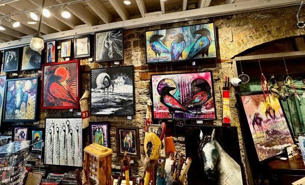
Minneapolis
## Description Northland Visions is a well-known Native American shop in Minneapolis that celebrates Indigenous art, culture, and craftsmanship from across North America. More than just a retail space, the shop functions as a cultural bridge, offering visitors a meaningful opportunity to engage with Native traditions through authentic, ethically sourced items. The store features a wide range of products, including traditional and contemporary jewelry, beadwork, carvings, pottery, clothing, books, and ceremonial objects. What makes Northland Visions unique is its strong commitment to authenticity and Native representation. The shop works directly with Native American artists and communities, ensuring that the items sold are genuine and that artists are fairly compensated. A lesser-known fact is that Northland Visions has long been connected to the local Native community in Minnesota, particularly the Dakota and Ojibwe nations, making it an important cultural space as well as a business. Another interesting detail is that the shop often carries items connected to seasonal ceremonies and powwow culture, reflecting living traditions rather than static displays. For visitors interested in Indigenous culture, Northland Visions offers an experience rooted in respect, education, and cultural continuity. ## Location Northland Visions is located in the **United States**, in the state of **Minnesota**, within the city of **Minneapolis**. The shop is situated in the Powderhorn area of South Minneapolis, a neighborhood known for its strong community identity and cultural diversity. Visitors can reach the shop by car, public bus, or bicycle. Several Metro Transit bus routes serve the surrounding area, making it accessible from downtown Minneapolis and other neighborhoods. For those driving, street parking is generally available nearby. Using a navigation app is recommended for first-time visitors, as the shop is located in a primarily residential and commercial mixed-use area. ## Tips * Take time to ask staff about the origins and meanings of the items, as they are often happy to share cultural context. * If you are purchasing jewelry or artwork, inquire about the artist to better understand the piece’s background. * Be respectful when viewing or asking about ceremonial items, as some objects may have cultural restrictions. * Bring cash or a card, as most major payment methods are accepted. * Combine your visit with nearby local cafés or parks to explore more of South Minneapolis. * Check opening hours in advance, as they may vary seasonally or during cultural events. ## Conclusion Northland Visions offers a thoughtful and authentic introduction to Native American art and culture in Minneapolis. Through its carefully curated selection and strong community ties, the shop provides visitors with both meaningful purchases and a deeper cultural understanding. ## FAQ **Are the items at Northland Visions authentic?** Yes, the shop emphasizes genuine, Native-made products and works directly with Indigenous artists and communities. **Can I learn about the cultural significance of the items?** Yes, staff members are knowledgeable and often share information about the history and meaning behind many products. **Is Northland Visions suitable for tourists?** Absolutely. Visitors are welcome and often find the shop educational as well as culturally enriching. **Does the shop sell gifts and souvenirs?** Yes, it offers a wide range of items suitable for meaningful gifts, from small crafts to fine art pieces. **Is the shop accessible by public transportation?** Yes, multiple bus routes serve the area, making it accessible without a car. ## Links * [Northland Visions Official Website](https://www.northlandvisions.com) * [Explore Minneapolis](https://www.minneapolis.org)
GemVoyage Team • World
Gansu
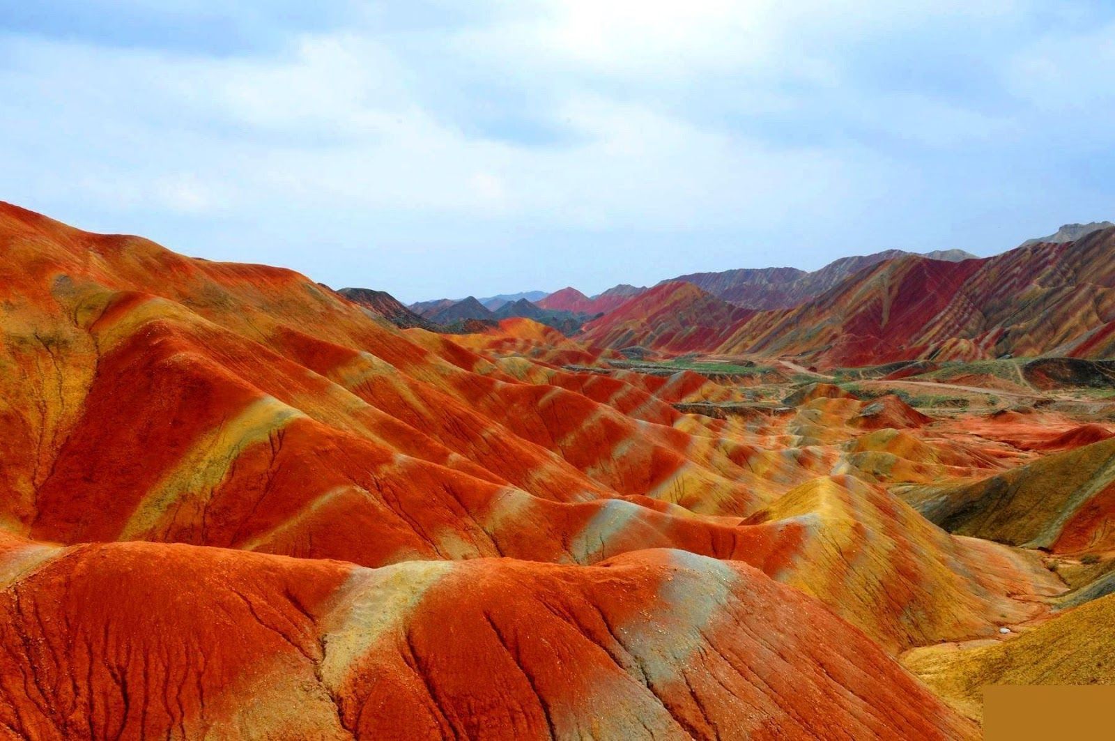
## Description The Zhangye Danxia landform in Gansu province is a riot of color spread across layered sandstone ridges and steep cliffs, creating landscapes that look as if someone painted the earth with broad strokes of red, orange, yellow and green. The chromatic bands are the product of red sandstone and mineral deposits laid down over 24 million years and later uplifted and carved by wind and water. Viewed from purpose-built overlooks and winding boardwalks, the patterns create optical illusions of waves and folds that shift with the sun’s angle. The site is remarkable both for its vivid palette and for the scale of the striations: what from a distance seems like painted canvas resolves into a labyrinth of ridges, gullies and panoramic terraces. A lesser-known detail: the colors vary seasonally and with weather conditions; after rain, the hues often deepen, offering particularly saturated photographic opportunities. Beyond the immediate visual drama, Zhangye Danxia offers a lesson in geologic time and human-scale interpretation of landscape. The park's boardwalks and viewing platforms were designed to give visitors a range of compositions at different elevations, while interpretive signs explain the processes of sedimentation, uplift and erosion that produced the striking bands. Photographers and landscape enthusiasts often plan their visits around atmospheric conditions: low-angle light during golden hours casts ridges into sharp relief, while overcast or misty days can soften colors and emphasize shapes. The park's scale means that a single viewpoint never fully captures the variety present across the terrain — taking time to traverse multiple platforms yields a richer sense of the formations. Local infrastructure has expanded to accommodate steady tourism, but many visitors still find quiet corners along lesser-known paths. For those willing to explore beyond the main viewing decks, short hikes and rural lanes reveal unexpected perspectives of the painted cliffs and provide a quieter atmosphere for contemplative study. The town of Zhangye offers practical amenities including hotels, train connections and guided-tour services; most visitors access the geopark via a short drive from the city. When combined with nearby attractions in Gansu province — historic Silk Road sites, oasis towns and desert landscapes — Zhangye Danxia becomes a vivid and contrasting chapter in any northwest China itinerary. ## Location The Zhangye Danxia Geopark lies in Zhangye city, Gansu province, northwestern China. It’s accessible by road from Zhangye city center, which in turn connects by train or air to larger Chinese hubs such as Lanzhou and Xi’an. The park’s viewing platforms are designed for staged sightseeing, enabling visitors to experience different panoramas without extensive trekking. Timetables for trains and regional buses vary seasonally; many travelers arrive by high-speed or conventional rail to Zhangye and then take local shuttle services or taxis to the geopark entrance. The park's layout is linear, with a series of parking lots and platforms that correspond to different photographic viewpoints — plan logistics to avoid backtracking during peak hours. Accommodation in Zhangye ranges from economical guesthouses to mid-range hotels that can arrange guided excursions and private transport. ## Tips - **Visit at golden hour:** Sunrise or sunset gives the painted ridges warmer tones and dramatic shadows. - **Use multiple viewpoints:** Walk the main boardwalk and visit several overlooks to appreciate how the formations change with perspective. - **Protect from dust and sun:** The region is arid; bring sun protection and a dust cover for camera gear. - **Consider guided photo tours:** Local guides can take you to lesser-known vantage points for unique compositions. - **Time your transport:** Parking and shuttle flows can be busy; arrive early to avoid crowds at the main platforms. - **Dress for desert conditions:** Layered clothing, sturdy shoes and water are essential; evenings can cool significantly. - **Respect park rules:** Stay on boardwalks to protect fragile soils and prevent erosion; drones are often restricted. - **Bring varied lenses:** A wide-angle to capture panoramic ridgelines and a moderate telephoto to isolate patterns will be useful. ## Conclusion Zhangye Danxia offers one of the planet’s most vivid examples of sedimentary color and erosion, a landscape that rewards patient observation and thoughtful composition. Visiting Zhangye Danxia is as much an exercise in perception as it is in travel logistics — the colors and forms change with light, season and vantage point, and the most memorable experiences come when you slow down and let the terrain reveal its subtleties. For photographers, geologists and curious travelers, the geopark is a compelling and photogenic stop that pairs well with broader exploration of Gansu’s cultural and natural history. ## FAQ - **Q: Is the park walkable?** - A: Yes — well-maintained boardwalks and viewing platforms offer accessible scenic routes. - **Q: Can I drive between viewpoints?** - A: Internal park transport and short walks connect main viewpoints; check park maps for distances. - **Q: When is the best season for color saturation?** - A: Late spring through early autumn generally provides strong color contrast, but early morning light and post-rain conditions often produce the most saturated hues. - **Q: Are drones allowed for aerial photography?** - A: Drone policies vary and are often restricted near protected viewpoints — always check park regulations and obtain permits if required. - **Q: How much time should I allocate?** - A: A full half-day can cover the primary platforms; photographers might want a full day to cycle through light conditions and multiple viewpoints. - **Q: What other nearby sites pair well with Zhangye Danxia?** - A: Historic Silk Road towns, the Mati Temple Grottoes and desert landscapes around Zhangye make for complementary cultural and geological explorations. ## Links - [Zhangye Danxia — Wikipedia](https://en.wikipedia.org/wiki/Zhangye_National_Geopark)
GemVoyage Team • World
Paris
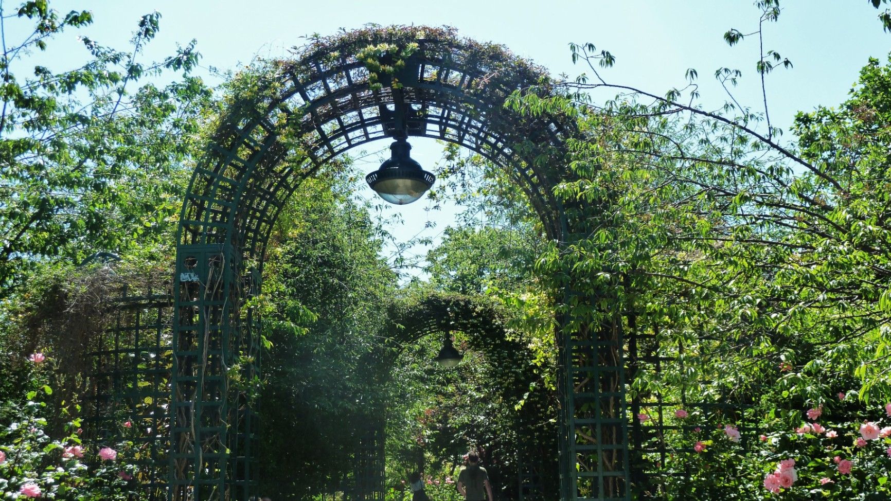
## Description The **Coulée Verte René-Dumont** is one of Paris’s most quietly transformative urban landscapes: a **4.7-kilometer elevated green corridor** built on a former 19th-century railway viaduct. Long before New York’s High Line became famous, Paris had already pioneered the idea of reclaiming industrial infrastructure and turning it into a **linear park suspended above city streets**. Opened in **1993**, the Coulée Verte stretches across eastern Paris, offering a continuous ribbon of trees, gardens, pergolas, tunnels, and walkways that float above neighborhoods, rooftops, and traffic. Rather than being a monumental tourist attraction, its strength lies in its **subtle intimacy**. The path winds between apartment balconies, over narrow streets, through shaded cuttings, and across stone viaducts, allowing visitors to experience Paris from an **unexpected vertical perspective**. The design philosophy of the park is deeply rooted in **soft landscaping rather than formal symmetry**. Instead of wide lawns or dramatic vistas, the Coulée Verte contains **layered vegetation, winding paths, seasonal flowers, bamboo groves, climbing roses, and shaded benches**. This makes it feel more like a secret garden than a grand urban park. One of the most remarkable architectural features of the route is the **Viaduc des Arts**, where the park runs along a series of brick arches originally built for railway use. Beneath these arches now sit artisan workshops, design studios, galleries, instrument makers, and boutique craftspeople. This dual-level experience—**green tranquility above and creative commerce below**—is one of the Coulée Verte’s defining identities. Unlike Paris’s grand axial parks such as the Tuileries or Luxembourg Gardens, the Coulée Verte offers a **continuously shifting urban narrative**. At one point, you are enclosed in forest-like silence; minutes later, you emerge into balcony-lined streets where residents drink coffee just meters away from your path. This creates an emotional tension between **privacy and exposure**, urban density and botanical escape. A little-known fact is that the park is named after **René Dumont**, a pioneering French agronomist and environmentalist who was also **France’s first Green Party presidential candidate**. The naming itself reinforces the park’s identity not just as a recreational space, but as a **symbol of ecological urban thinking**. Another little-known detail is that parts of the route pass directly behind residential buildings at eye level, leading to long-standing unspoken etiquette between walkers and residents regarding privacy. Today, the Coulée Verte is used daily by **joggers, dog walkers, commuters, couples, photographers, and elderly residents**, each group engaging with the space differently depending on time of day. Mornings are quiet and rhythmical. Afternoons bring families and visitors. Evenings soften into slow movement, conversation, and golden-hour light filtering through leaves onto brick and stone. The Coulée Verte does not dominate Paris visually or symbolically. Instead, it **slips through the city like a green seam**, quietly stitching nature into urban density. ## Location The **Coulée Verte René-Dumont** runs through the **12th arrondissement of Paris**, beginning near **Opéra Bastille** and extending eastward toward the **Périphérique (city ring road)**. **City:** Paris **Region:** Île-de-France **Country:** France **Primary Arrondissement:** 12th **Main Entrance Area:** Near Bastille and Avenue Daumesnil ### How to Get There: * **By metro:** * **Line 1, 5, or 8** to **Bastille Station** * **Line 6 or 8** to **Daumesnil Station** * **By RER:** **RER A** to **Nation Station**, then walk. * **By bus:** Multiple lines serve Avenue Daumesnil and the surrounding streets. * **By bicycle:** Easy access from eastern Paris cycle lanes. * **On foot:** Ideal as part of a walking route between Bastille, Bercy, and Nation. Multiple staircases and ramps provide access at different points along the route. ## Tips * **Walk the full length if possible:** The character of the park changes dramatically from west to east. * **Visit in spring or early autumn:** Vegetation is at its best and temperatures are comfortable. * **Early mornings are best for solitude:** Especially on weekdays. * **Evenings are best for atmosphere:** Soft lighting and slower rhythms dominate. * **Respect residential privacy:** Some sections run directly past apartment windows. * **Combine with Viaduc des Arts shopping:** The artisan shops beneath the arches are worth exploring. * **Bring water:** There are few vendors directly on the elevated path. * **Not ideal for fast cycling:** The path is narrow and shared heavily with pedestrians. ## Conclusion The **Coulée Verte René-Dumont** is not loud, monumental, or iconic in the traditional Parisian sense. Its power lies in **subversion and continuity**—a quiet green artery that transforms obsolete railway infrastructure into a flowing garden above the city. It offers a Paris of **movement, transition, and subtle beauty**, experienced not through grand monuments, but through shifting light, layered leaves, and elevated urban silence. ## FAQ **1. What is the Coulée Verte René-Dumont?** It is an **elevated linear park** built on an abandoned railway line in eastern Paris. **2. Is the Coulée Verte free to access?** Yes. It is **completely free and open to the public**. **3. How long does it take to walk the full route?** A full walk typically takes **1 to 1.5 hours** at a relaxed pace. **4. Is it similar to the High Line in New York?** Yes in concept, but the Coulée Verte is **older, greener, and more intimate** in character. **5. Is the park suitable for children?** Yes. It is widely used by families, though supervision is required in elevated or narrow sections. **6. Are there cafés or shops along the route?** Not directly on the path, but many cafés and bakeries are located at street level nearby. ## Links * [Paris City Guide](https://parisjetaime.com/eng/)
GemVoyage Team • World

Comments