GemVoyage Team • World
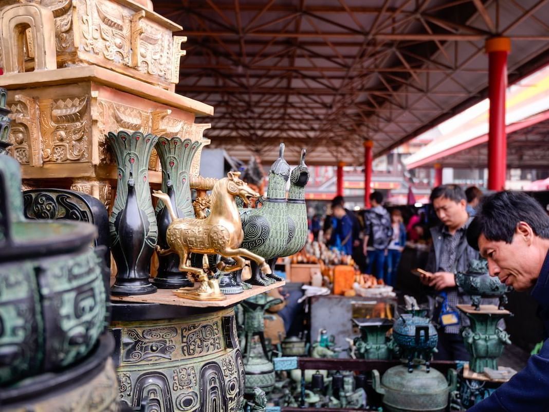
The market is compelling because it contains many different worlds at once. You may find traditional crafts, replica objects, old decorative pieces, calligraphy supplies, beads, paintings, jewelry, souvenirs, and a range of goods that reflect both local taste and the expectations of visitors. A lesser-known fact is that Panjiayuan has long been associated with weekend browsing culture and has become a major destination for both serious collectors and casual shoppers. Another interesting detail is that the market’s atmosphere often changes depending on the time and day of visit, with early morning tending to be the best period for finding variety and doing serious browsing before the crowds become dense.
For travelers, the real appeal is less about guaranteed rare finds and more about the experience of looking. Panjiayuan rewards patience, curiosity, and negotiation. It is the type of place where you can spend hours without realizing how much time has passed because every row offers something different. Even if you are not an antique buyer, the market is still fascinating as a cultural snapshot of Beijing’s consumer life and souvenir economy.
It is also an excellent place for people who enjoy photography and people-watching, though you should be considerate and ask before taking close photos of vendors or merchandise. The market’s scale and texture make it one of the most memorable commercial spaces in the city.
The easiest way to reach the market is by subway followed by a short walk. Beijing’s metro is usually the most efficient transport method, especially if you want to avoid traffic. Taxis and rideshares also work well if you are carrying purchases or traveling with a group. Once you arrive, the market is straightforward to explore on foot, and the surrounding streets make it easy to orient yourself.
If you are serious about browsing, mornings and weekends are often the most rewarding. If you prefer a quieter visit, go earlier in the day or plan around less busy times when possible.
Check items carefully before buying. Quality and authenticity vary, especially with antiques and collectible-style merchandise.
Arrive early if you want the widest selection. Serious buyers often do better before the market becomes crowded.
Do not expect every item to be a true antique. The market includes a wide range of goods, from genuine older objects to decorative reproductions.
Leave enough time to wander without a fixed list. The market rewards discovery more than efficiency.
Discover more hidden gems you might love.
Brussels
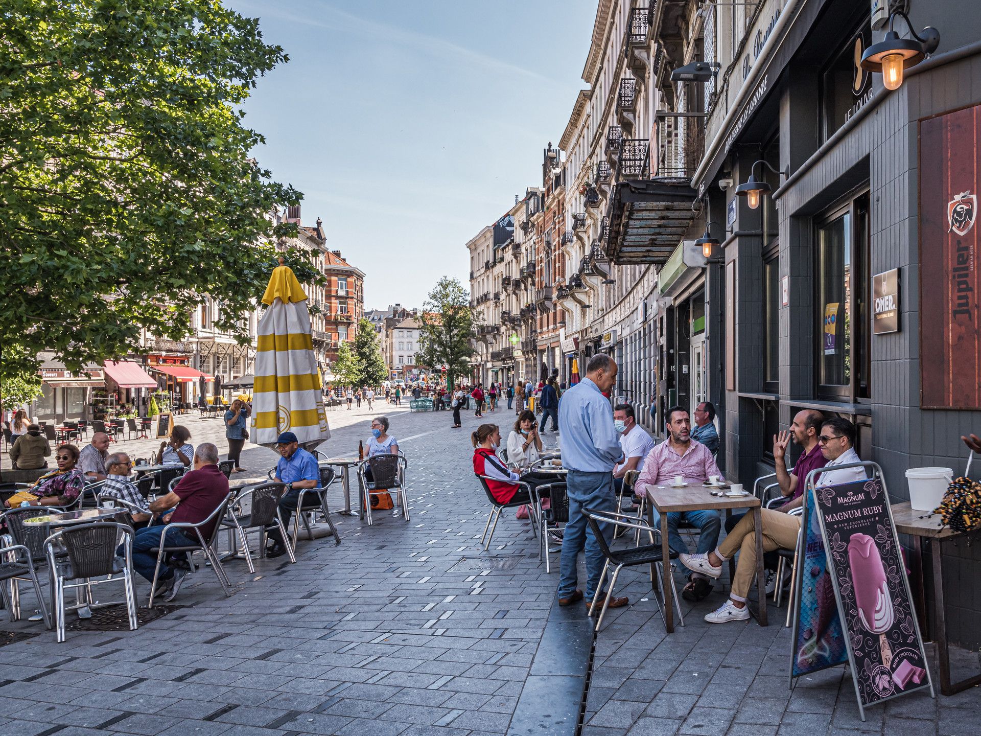
## Description Saint-Gilles is one of Brussels’ most interesting neighborhoods because it feels lived-in, creative, and slightly unruly in ways that make urban travel more rewarding. It is not a single attraction in the conventional sense. Instead, it is a district where architecture, cafés, local life, art spaces, and residential streets come together to form a strong neighborhood identity. For travelers who prefer walking through cities rather than just checking off monuments, Saint-Gilles offers exactly the kind of layered experience that makes Brussels memorable. The neighborhood stands out because it combines elegance and texture. You will find Art Nouveau and eclectic architecture, busy local streets, small shops, community energy, and a range of everyday scenes that make the area feel authentic rather than curated. A lesser-known fact is that Saint-Gilles has long attracted artists, creatives, and socially diverse residents, which helps explain its visual and cultural variety. Another detail many visitors notice is the way the neighborhood shifts from quiet residential blocks to more animated streets with cafés, bakeries, and independent businesses, creating a sequence of moods within a relatively compact area. For visitors, the appeal is that Saint-Gilles rewards wandering. You can walk without a strict plan and still encounter buildings worth noticing, neighborhood squares, and cafés that reflect local rhythm rather than generic tourism. The district also works well if you enjoy comparing Brussels neighborhoods, because it feels distinct from the more polished central commercial zones and from the quieter residential areas elsewhere in the city. Saint-Gilles is especially good for travelers who want a more grounded version of Brussels. It gives you a sense of people living, working, and socializing in ways that feel immediate and real. That quality is often more memorable than a single headline monument. ## Location Saint-Gilles is a municipality and neighborhood area in Brussels-Capital Region, Belgium, located just south of the city center. Its location makes it easy to reach from central Brussels while still feeling like a district with its own identity. Because it is connected to major transport corridors and adjacent neighborhoods, it works well as part of a broader walking itinerary. The easiest way to get there is by tram, metro, or on foot from central Brussels depending on your starting point. Many visitors find that a walk into Saint-Gilles helps the neighborhood reveal itself gradually. Once there, the streets are best explored slowly, with a mix of aimless wandering and a few concrete stops such as cafés, architectural highlights, or local squares. If you are planning a Brussels visit that includes multiple neighborhoods, Saint-Gilles fits well alongside Ixelles, the city center, or other south-side districts. ## Tips Walk without rushing. The neighborhood’s character comes from details in the street life and architecture. Look up at the façades. Saint-Gilles is one of the better Brussels districts for architectural variety. Stop at a local café or bakery. The neighborhood is best experienced through everyday routines as much as sightseeing. Be open to small discoveries. A side street or square may end up being more interesting than a famous landmark. Use it as a neighborhood day rather than a single-photo stop. The area rewards longer, slower exploration. ## Conclusion Saint-Gilles is one of Brussels’ most rewarding neighborhoods for travelers who like authentic city life, architecture, and walkable streets. It offers a strong sense of place that comes from everyday urban texture rather than one big attraction. ## FAQ ### Is Saint-Gilles worth visiting for tourists? Yes, especially if you enjoy neighborhoods with character, architecture, and a local feel rather than purely tourist-oriented sights. ### How long should I spend there? At least a couple of hours if you want to walk, stop for coffee, and notice the neighborhood properly. ### Is it easy to combine with other Brussels areas? Yes. It works well with the city center, Ixelles, and other nearby districts. ### What is the main reason to go? To experience a creative, lived-in part of Brussels that feels distinct from the more polished tourist core. ## Links - [Saint-Gilles on Wikipedia](https://en.wikipedia.org/wiki/Saint-Gilles,_Belgium)
GemVoyage Team • World
Seoul
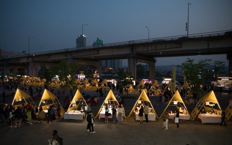
## Description Seoul Bamdokkaebi Night Market is a seasonal night-market program that animates several Han River parks across the city with pop-up vendors, street food stalls, live music, and family-friendly programming. At its core the market offers a curated taste of contemporary Korean street food culture: inventive snack stands, regional specialties, and small-batch artisanal sellers. The markets are deliberately ephemeral—open for limited dates during the warmer months—so each venue (Yeouido, Banpo, Dongjak, for example) develops its own nightly character based on local vendors and event partners. What makes Bamdokkaebi especially appealing is the riverside setting: many stalls sit on grassy banks with views across the river to Seoul’s skyline. That riverside backdrop, combined with stage performances and food trucks, creates a festival atmosphere that balances convenience with discovery. The markets are also a social hub for both residents and visitors—pick-up-and-go menus, picnic-style seating, and ambient lighting make it easy to linger. From a search-engine perspective, typical discoverability terms include "Bamdokkaebi Night Market dates", "Han River night market Seoul", and "Seoul street food market"—keywords that event pages and tourism guides often target. ## Location The program rotates through multiple Han River parks, with popular locations including Yeouido Hangang Park and Banpo Hangang Park. Each park has different entry points and transit connections: Yeouido is accessible via Yeouido Station (Line 5, Line 9), while Banpo Park is close to Express Bus Terminal Station (Line 3, Line 7, Line 9) or Sinbanpo Station on the Shinbundang Line. Check the official Bamdokkaebi schedule for current dates and the specific park hosting that night's market. Because the markets are temporary and sometimes move between sites season-to-season, verify the location and opening times on the Visit Seoul website or official event pages. Weekend nights and public holiday weekends are busiest, while midweek events can feel more relaxed. ## Tips - Check the schedule in advance: markets operate seasonally (commonly spring through autumn) and individual park dates vary. - Arrive early for popular vendors: must-try stalls can develop lines; arriving at opening time increases your chances of tasting signature items without a long wait. - Use public transit: subway and bus access is generally better than driving, as parking near parks is limited during events. - Bring a reusable bag and small change: while many vendors accept cards, cash and smaller denominations help for quick purchases and tipping. - Travel-light: markets are designed for strolling and picnicking—carry a light picnic blanket or sit on the provided benches. - Try local specialties: look for vendors offering regional street-food icons (tteokbokki, hotteok variations, seafood pancakes) alongside modern fusion snacks. - Respect local rules: keep the park clean by using recycling bins and follow any park restrictions on alcohol, fires, or amplified sound. ## Conclusion Bamdokkaebi Night Market is a seasonal, riverside way to sample Seoul’s inventive street-food scene in a lively, communal setting. It's ideal for travelers who enjoy casual dining, outdoor festivals, and a taste of local life. By checking schedules and arriving with a few practical items (cash, transit card, light jacket), visitors can maximize the experience and enjoy a variety of tastes across multiple nights if time allows. ## FAQ Q: When does Bamdokkaebi Night Market usually run? A: The market typically runs from spring to autumn on selected weekends and evenings; dates change yearly, so check the official Visit Seoul schedule. Q: Are pets allowed at the market? A: Policies vary by park; many Han River parks allow leashed dogs in common areas, but vendors or event-specific setups may restrict animals—check the event page. Q: Are there vegetarian or halal options? A: Yes—larger markets usually include vegetarian/vegan stalls and vendors who provide halal-friendly dishes; look for signage or ask vendors directly. Q: Is entry free? A: Yes—park access and market entry are free; you pay per vendor for food and goods. Q: What payment methods are accepted? A: Many vendors accept credit/debit cards and mobile payments; however, smaller stalls sometimes prefer cash—carry some small bills. ## Links - [Bamdokkaebi Night Market](https://www.visitseoul.net)
GemVoyage Team • World
Petén
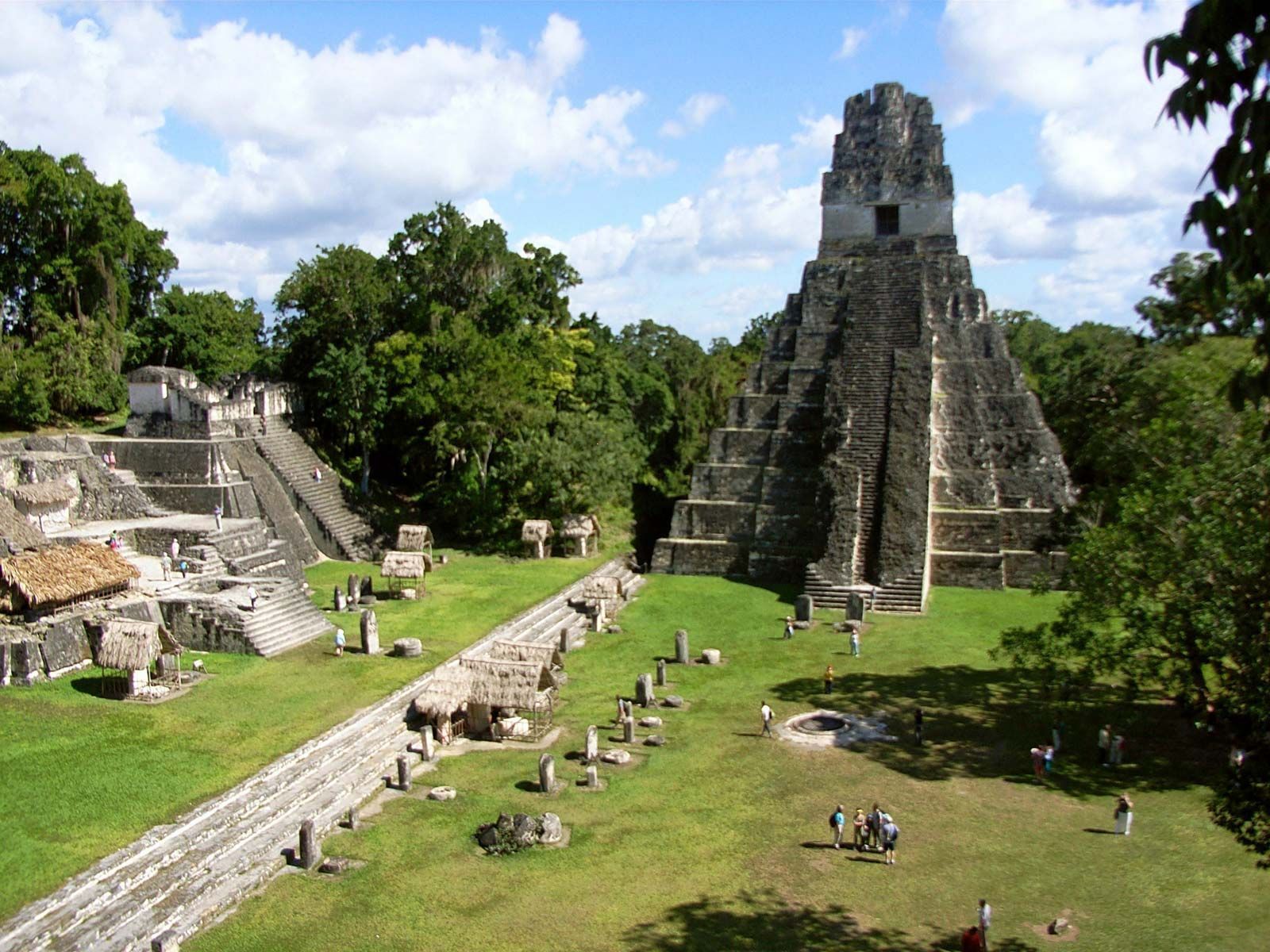
## Description Tikal is one of the most important archaeological sites of the ancient Maya civilization, located within the dense lowland rainforests of Petén, Guatemala. The city’s towering limestone pyramids and plazas emerge above the jungle canopy, offering dramatic skyline views and a palpable sense of antiquity. During its Classic period, Tikal was a major political and ceremonial center; excavated palaces, stelae and ballcourts tell stories of dynasties, calendrical knowledge and cosmology. Visitors to Tikal are rewarded by a blend of monumental architecture and biodiverse rainforest. The temples and palaces rise through the tree canopy, so that from the tops of several structures you can peer over treetops to see other pyramids peeking through the foliage. This interplay between built environment and ecology is central to Tikal’s power: the jungle both conceals and reveals the city, a dramatic reminder of centuries of abandonment and recovery. Tikal’s primary plaza, monumental ballcourts, and the iconic Temple IV and Temple II complexes preserve stelae with carved inscriptions, verifiable sequences of rulers and artistic programs that speak to the city’s political sophistication. Archaeological work also reveals complex water-management features, reservoirs and causeways that allowed the city to sustain a significant population despite a seasonal tropical climate. Walking among Tikal’s temples at sunrise — when the jungle stirs and howler monkeys call — is an evocative way to connect with a complex culture of architecture, ritual and astronomy. Early morning light transforms the stone into warm tones and dramatically silhouettes the temple profiles against the rising sun, making sunrise a photographer’s favorite. Guides can point out hieroglyphic inscriptions, sacred alignments and the role of celestial observation in Maya ritual life. ## Location Tikal National Park is in Guatemala’s northern Petén department. The site is reachable via a short flight to Flores (Mundo Maya International Airport, FLV) or by road from Flores town, which serves as the usual visitor base. Most visitors use Flores as a staging point and arrange shuttle transfers, guided tours, or independent day trips to the park. ## Tips - **Arrive at dawn for temples and wildlife:** Early mornings provide cooler light, bird activity and quieter conditions before larger tour groups arrive. Dawn visits also let you catch the moment when the jungle wakes up. - **Hire a knowledgeable guide:** Licensed local guides provide historical context, translate glyphs and explain how architecture relates to Maya cosmology — essential for getting more from the site. - **Bring insect repellent and sun protection:** The lowland rainforest environment includes biting insects and strong sunlight in exposed plazas. Lightweight long sleeves and repellent are useful. - **Plan logistics from Flores:** Book shuttle transfers or organized tours in advance during high season, and consider staying overnight near the site for sunset or sunrise experiences. - **Support responsible tourism:** Choose certified guides and operators that follow park rules and contribute to local community economies. ## Conclusion Tikal is both a monumental archaeological treasure and a living jungle experience: temples puncturing the canopy, dawn rituals and carved monuments make it an essential site for understanding Maya civilization. For travelers seeking a mix of natural soundscapes, wildlife encounters and a deep cultural history, Tikal offers an immersive and emotionally resonant experience. ## FAQ - **Q: How long should I spend at Tikal?** A: A full day is ideal to cover the main plazas, climb at least one temple for panoramic views, and explore the northern and central complexes. Two days allow for a slower pace, birding and visiting lesser-known complexes. - **Q: Can visitors climb the temples at Tikal?** A: Access to climbable areas varies — some temples allow limited ascent to designated viewpoints while others are closed to protect fragile structures. Follow current park rules and signage. - **Q: What wildlife might I see at Tikal?** A: Expect to see howler monkeys, toucans, parrots, motmots and a range of tropical birds; early morning is best for birdwatching and animal activity. - **Q: Is it safe for solo travelers and families?** A: The site is generally safe during daylight hours. Follow standard travel precautions: use licensed guides, secure belongings, carry water and avoid isolated areas after dark. - **Q: Are there accommodations near the park?**n+ A: Flores and nearby villages offer a range of lodgings from budget hostels to mid-range hotels; staying in Flores provides easy access to flights and transportation. ## Links - [Tikal — Wikipedia](https://en.wikipedia.org/wiki/Tikal)
GemVoyage Team • World
Lisbon
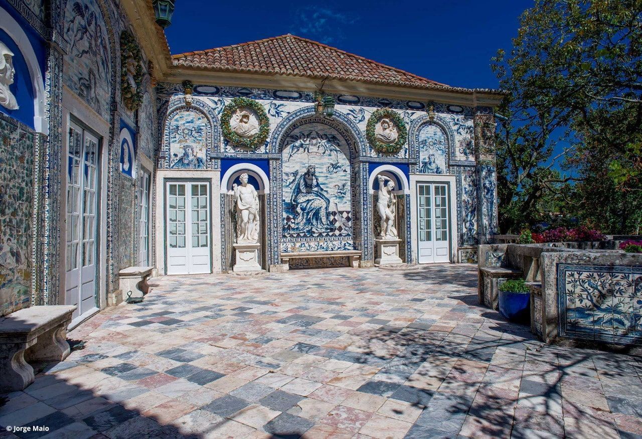
## Description Palácio dos Marqueses de Fronteira is an elegant, family-owned 17th-century estate on the edge of Lisbon that delights visitors with its exceptional azulejo tile panels, intimate museum rooms, and meticulously designed gardens. The palace feels less like a public museum and more like entering a well-preserved private residence that has been lived in and cared for by the same lineage of nobility for centuries. Interiors display an array of period furniture, heirloom portraits, and decorative arts that create a layered sense of domestic aristocratic life. The palace’s defining artistic draw is its azulejo program: large narrative tile panels that record hunting scenes, mythological episodes, allegories, and courtly imagery, executed in the refined blue-and-white and polychrome palettes typical of the 17th and 18th centuries. These tiles cover interior and exterior walls, forming pictorial narratives that reward close looking. Complementing the tiles are frescoes, gilded frames and sculptural elements that reflect Baroque and Rococo tastes adapted to Portuguese sensibilities. The gardens are a major reason to visit. Laid out with geometric hedges, elegant statuary and reflecting pools, they weave Moorish and Renaissance influences into a distinctly Portuguese landscape grammar. Garden rooms framed by clipped yews and boxwood create intimate vistas, while larger terraces open to sweeping views of the surrounding neighborhood. Seasonal plantings and careful maintenance mean the palace is beautiful year-round, although spring and early summer are especially lush. Conservation and stewardship at the palace are noteworthy: the family’s ongoing custodianship has supported careful tile restoration projects and the preservation of original material culture. Many of the conservation interventions have been carried out by local artisans using traditional techniques, preserving not just objects but craft knowledge. Photographic and accessibility note: photographers should plan for a mix of wide-angle shots of garden terraces and close-ups of tile details; early morning light reduces harsh shadows on glazed surfaces. Visitors requiring mobility assistance should contact palace staff ahead of time to arrange the smoothest route through garden paths and to confirm which rooms are accessible. ## Location The palace is located in the Benfica neighborhood of Lisbon, a short drive northwest of central districts like Rossio and Baixa. From the historic center, it typically takes 15–25 minutes by car depending on traffic. Public transit options involve buses and sometimes a combination of tram and bus; travelers should allow extra time for connections and walking to the palace grounds. Getting there: taxis and rideshares are convenient and typically the fastest way for visitors without a car. If using public transport, check current bus routes and schedules and allow for a short walk from the nearest stop to the palace entrance. ## Tips - Book tickets in advance when possible; guided tours are often limited and sell out during peak season. - Wear comfortable shoes: garden paths include gravel and uneven surfaces. - Respect interior rules: certain rooms may be closed or restricted for conservation reasons; photography inside may be limited. - Bring a camera and consider different lenses: a wide-angle captures garden vistas while a close lens helps study tile details. - Time your visit: visit in the morning light for softer photographs and more tranquil garden conditions. - Combine visits: pair the palace with nearby cultural sites such as the National Coach Museum or a walk in Monsanto Forest Park for a varied day. ## Conclusion Palácio dos Marqueses de Fronteira is a quietly grand escape from Lisbon’s busiest tourist routes. It rewards the patient visitor — those who enjoy architectural decoration, tile art and carefully tended gardens — with an intimate glimpse of aristocratic Portuguese life. The palace’s careful preservation and the family’s ongoing care make it a dignified and deeply rewarding stop on a cultural itinerary. ## FAQ Q: Are guided tours available? A: Yes. Guided tours are offered and provide detailed historical context about the palace, its tiles and the family’s history. Check the palace’s official website or local tourism resources for times and booking procedures. Q: Is the palace wheelchair accessible? A: Accessibility is limited in some historic rooms and garden areas due to steps and uneven terrain. Contact the palace in advance to discuss specific access requirements and to learn which sections are accessible. Q: Can I photograph inside the palace and gardens? A: Photography is usually permitted in the gardens; some interior rooms may restrict photography to protect delicate materials. Always follow posted signs and staff instructions. Q: How long should I allow for a visit? A: Plan for 1–2 hours to see the main rooms and stroll the gardens at a relaxed pace. If you are a tile or garden enthusiast, you may wish to allow more time. Q: Are there any special events or seasonal highlights? A: The palace occasionally hosts concerts, temporary exhibitions, or guided thematic tours. Spring and early summer offer peak garden blooms and are popular times to visit. ## Links - [Wikipedia: Palácio dos Marqueses de Fronteira](https://en.wikipedia.org/wiki/Palace_of_the_Marquises_of_Fronteira)
GemVoyage Team • World
Cologne
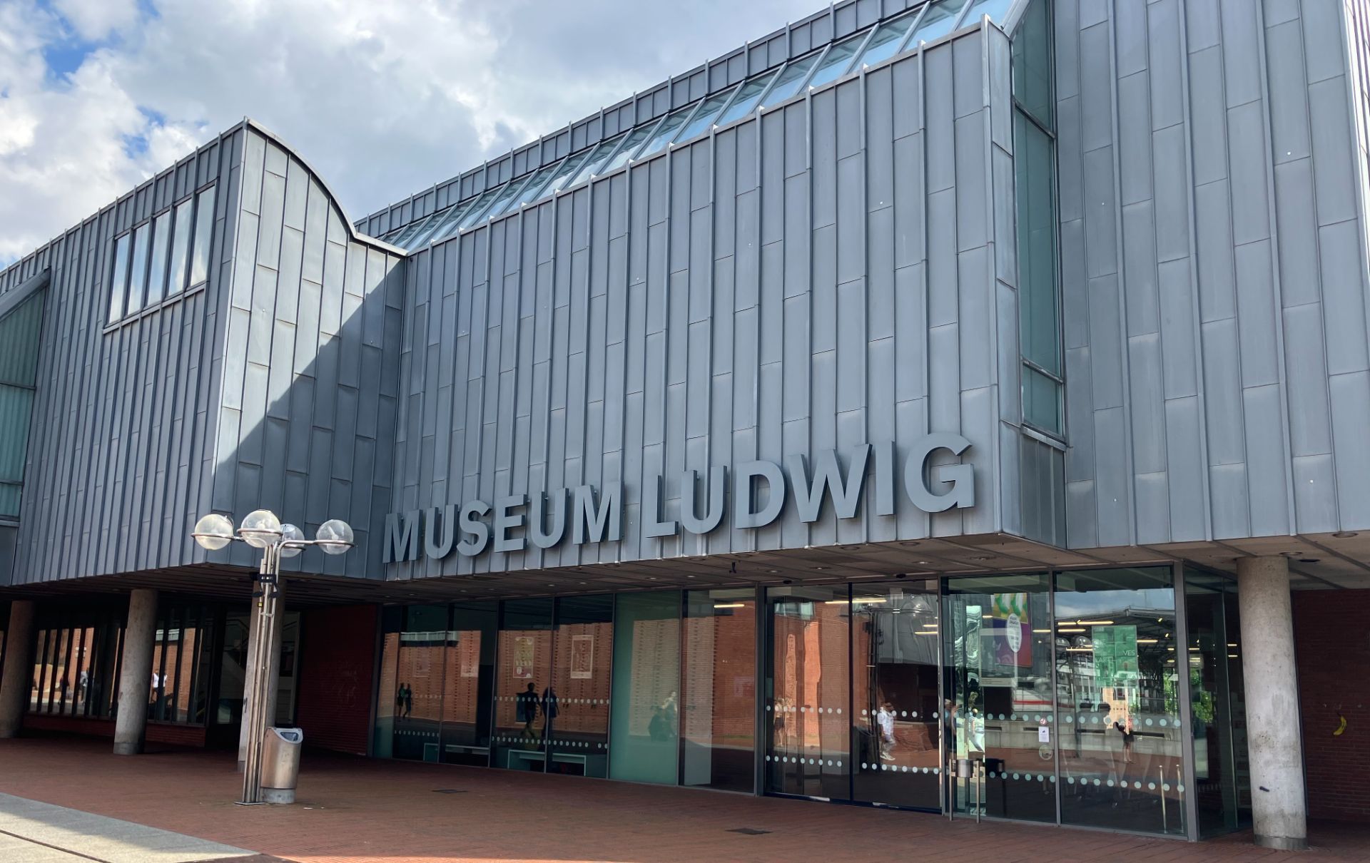
## Description Museum Ludwig is a major international hub for modern and contemporary art located in the heart of Cologne. Its reputation rests on a deep and thoughtfully curated collection that spans late nineteenth-century modernism to major postwar movements, with particular strengths in Pop Art, Russian avant-garde, abstract expressionism, and photography. For travelers interested in understanding how German cultural life intersects with global art histories, a visit to Museum Ludwig offers a compact but powerful overview: important canonical works sit alongside provocative contemporary installations, and rotating special exhibitions keep the program fresh and timely. The museum’s collection was built through a mix of visionary private donations and institutional acquisitions, which is one reason its holdings read both as scholarly and as a public cultural resource. One of the museum’s unique qualities is how it situates modern art within the city’s broader historical landscape—Museum Ludwig stands almost adjacent to Cologne Cathedral, creating an immediate visual and thematic conversation between medieval architectural splendor and modern artistic experimentation. That proximity invites visitors to compare and contrast different ways societies express identity and value across time. Visitors will find several natural entry points depending on interest: photography lovers can focus on the museum’s extensive photographic holdings and rotating photo exhibitions; those drawn to painting and sculpture can follow galleries dedicated to postwar movements and European modernism; and architecture or design enthusiasts will appreciate the building’s circulation and how exhibitions are installed to dialogue with the museum’s volumes. The museum also programs talks, guided tours, and educational events that make it accessible for first-time visitors and rewarding for repeat visitors seeking deeper context. ## Location Museum Ludwig sits beside the Cathedral Square (Domplatz) and is a short walk from Köln Hauptbahnhof (Cologne Central Station), making it extremely convenient for travelers arriving by train. The museum’s riverside location near the Rhine also encourages combining a museum visit with a stroll along the riverbank, lunch in the old town, or a visit to nearby galleries and cultural sites. Because of the central setting, it’s easy to incorporate Museum Ludwig into a single-day cultural loop: cathedral visit, museum, riverside walk, and Old Town meal all within comfortable walking distance. The centralized placement also means it’s simple to check real-time transit options and add the museum to broader city itineraries. ## Tips - Confirm opening hours and ticketing details on the museum’s website before you go—special exhibitions may have separate entry rules. - Allocate at least two hours for a relaxed visit; three hours gives more breathing room for reading labels and enjoying temporary shows. - Consider a guided tour or audio guide for richer context around key works and movements. - Combine the visit with Cologne Cathedral and a riverside walk to balance indoor culture with fresh air and local cafés. - Check photography rules in each gallery—some exhibitions prohibit flash or tripods. - If you’re short on time, target one gallery (photography, Pop Art, or postwar European painting) and read up on the highlights before arrival. ## Conclusion Museum Ludwig is more than a stop on a cultural tour; it’s a place where major threads of twentieth- and twenty-first-century art come together in a compact, approachable way. Whether you’re an art specialist or a curious traveler, the museum rewards careful looking and thoughtful pacing. ## FAQ ### What is Museum Ludwig known for? Highlights include a significant Pop Art collection, strong photography holdings, and substantial works representing major postwar movements. It’s a reference point for modern art in Germany and beyond. ### How long should I plan for a visit? Plan at least two hours for a focused visit; three hours is better if you want to see temporary exhibitions too. ### Are guided tours available? Yes. The museum offers guided tours and educational programs—check the website for schedules and language options. ### Is the museum accessible? Museum Ludwig provides accessibility services including step-free access and elevators; check specific facility notes for assistance options. ### Can I photograph works inside? Photography rules vary by exhibition—many permanent collections allow non-flash photography, but temporary shows sometimes restrict images. ## Links - [Official website](https://www.museum-ludwig.de/) - [Wikipedia](https://en.wikipedia.org/wiki/Museum_Ludwig)
GemVoyage Team • World
Madagascar
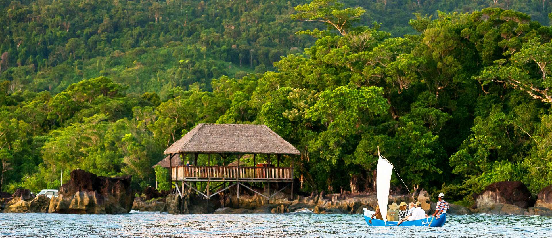
## Description Masoala National Park is Madagascar’s largest and most ecologically diverse protected area, a true Eden for nature lovers and adventurers. Located on the Masoala Peninsula in the northeast of the island, the park spans over 2,300 square kilometers of pristine rainforest and an additional 100 square kilometers of marine reserves. It’s one of the few places on Earth where lush jungle meets coral-rich coastline, creating a rare blend of terrestrial and marine biodiversity. The park is home to an astonishing array of wildlife, much of it endemic to Madagascar. Among its most famous residents is the red-ruffed lemur, found only in this region. Visitors may also encounter the elusive aye-aye, leaf-tailed geckos, tomato frogs, and over 60 species of reptiles. Birdwatchers flock to Masoala to spot rare species like the helmet vanga and the Madagascar red owl. Offshore, the marine parks protect vibrant coral reefs and host humpback whales during their migration from July to September. A little-known fact: the name “Masoala” translates to “eyes of the forest,” a poetic reference to the glowing eyes of the nocturnal aye-aye. Another fascinating detail is that the Madagascar serpent eagle, once thought extinct, was rediscovered in Masoala and now thrives in its dense canopy. ## Location Masoala National Park is located in **Madagascar**, within the **Sava Region**, near the coastal city of **Maroantsetra**. A portion of the park also extends into the **Analanjirofo Region**, making it a vast and varied landscape of rainforest, mangroves, and coral reefs. ### How to Get There: - **By Air**: Fly from Antananarivo to Maroantsetra Airport. Flights are limited, so booking in advance is essential. - **By Boat**: From Maroantsetra, the park is accessible via a 2–3 hour boat ride across Antongil Bay. This scenic journey offers glimpses of dolphins and coastal villages. - **By Tour**: Many eco-tour operators offer guided packages that include transport, accommodation, and park entry. Due to its remote location, Masoala is best visited with the help of local guides or tour companies familiar with the terrain and logistics. ## Tips for Visitors To make the most of your Masoala adventure, keep these tips in mind: - **Visit During Dry Season**: The best time to visit is from June to November. Avoid January to March due to heavy rains and cyclone risk. - **Pack Smart**: Bring waterproof gear, insect repellent, sturdy hiking shoes, and lightweight clothing. The rainforest is humid and unpredictable. - **Hire a Guide**: Local guides enhance the experience with wildlife spotting and cultural insights. Guides are mandatory for most trails. - **Explore Nosy Mangabe**: This nearby island reserve is part of the park and offers excellent chances to see the aye-aye and ancient tombs. - **Respect Wildlife**: Night walks are restricted to protect sensitive species like the aye-aye. Always follow park rules. - **Try Kayaking or Snorkeling**: The marine parks—Tampolo, Ambodilaitry, and Ifaho—are perfect for exploring coral reefs and spotting sea turtles. ## Conclusion Masoala National Park is a sanctuary of biodiversity and natural wonder. With its rare wildlife, untouched rainforest, and vibrant marine life, it offers a truly immersive experience for those seeking Madagascar’s wild heart. ## FAQ **1. What is the entrance fee for Masoala National Park?** The fee is approximately 45,000 Ariary (~16 EUR) for adults and 25,000 Ariary (~6 EUR) for children. **2. How many lemur species are found in Masoala?** The park hosts over 10 species, including the red-ruffed lemur and aye-aye. **3. Can I camp inside the park?** Yes, designated camping areas are available, especially on Nosy Mangabe Island. Guided tours often include camping options. **4. Is Masoala suitable for families?** Yes, but due to its remote location and rugged terrain, it’s best for families with older children who enjoy nature and hiking. **5. Are there accommodations near the park?** Eco-lodges and guesthouses are available in Maroantsetra and near the park’s entrance. Booking ahead is recommended. **6. What marine activities are available?** Snorkeling, kayaking, and whale watching are popular in the park’s marine reserves, especially from July to September. ## Links - [Masoala National Park – Wikipedia Overview](https://en.wikipedia.org/wiki/Masoala_National_Park) - [Masoala National Park – Official GANP Page](https://national-parks.org/madagascar/masoala)
GemVoyage Team • World

Comments