GemVoyage Team • World
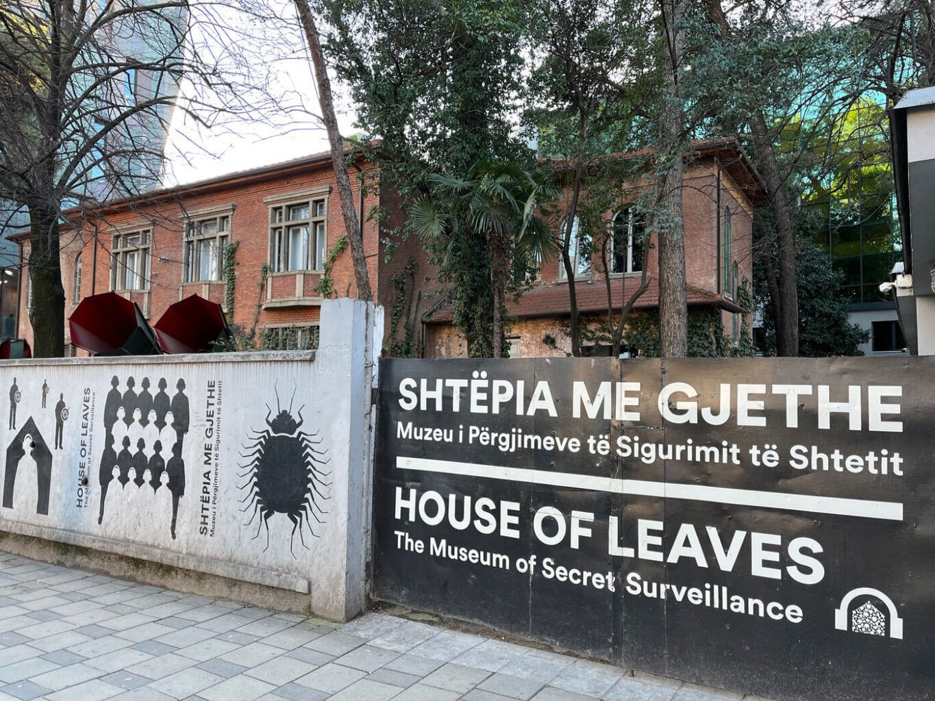
What makes the House of Leaves unique is the way it uses space. Rather than only displaying information on panels, the museum lets visitors move through rooms that once served a hidden institutional purpose. That physical dimension makes the subject matter feel immediate. You are not just reading about surveillance; you are walking through the kind of environment where surveillance was organized. One lesser-known detail is that the building’s original role was concealed in plain sight for years, which is part of what gives the museum its name and atmosphere. Another important fact is that the museum’s significance reaches beyond Albania, because it speaks to a broader twentieth-century European history of state secrecy and political control.
The museum is especially valuable for travelers who want more than a surface-level city visit. Tirana has a lively modern personality, but places like this help explain why the city’s present-day openness and creativity matter so much. The contrast between the museum’s restrained, serious tone and the bustling streets outside is one of the reasons it stays with visitors long after they leave.
The easiest way to get there is on foot if you are already in central Tirana, or by taxi and local transport if you are staying farther out. Since the museum is part of a walkable area, combining it with nearby historical and administrative sites makes the most sense. If you are planning a broader day in the capital, pair it with Skanderbeg Square and other central attractions for a fuller picture of the city.
Visit with a calm pace rather than rushing through, because the experience depends on reflection.
If you are unfamiliar with Albania’s recent history, a short background read beforehand can make the museum much more meaningful.
Photography policies can vary, so check current rules before taking pictures inside.
This is a strong choice for travelers who prefer historically significant sites over purely visual attractions.
Discover more hidden gems you might love.
Umbria
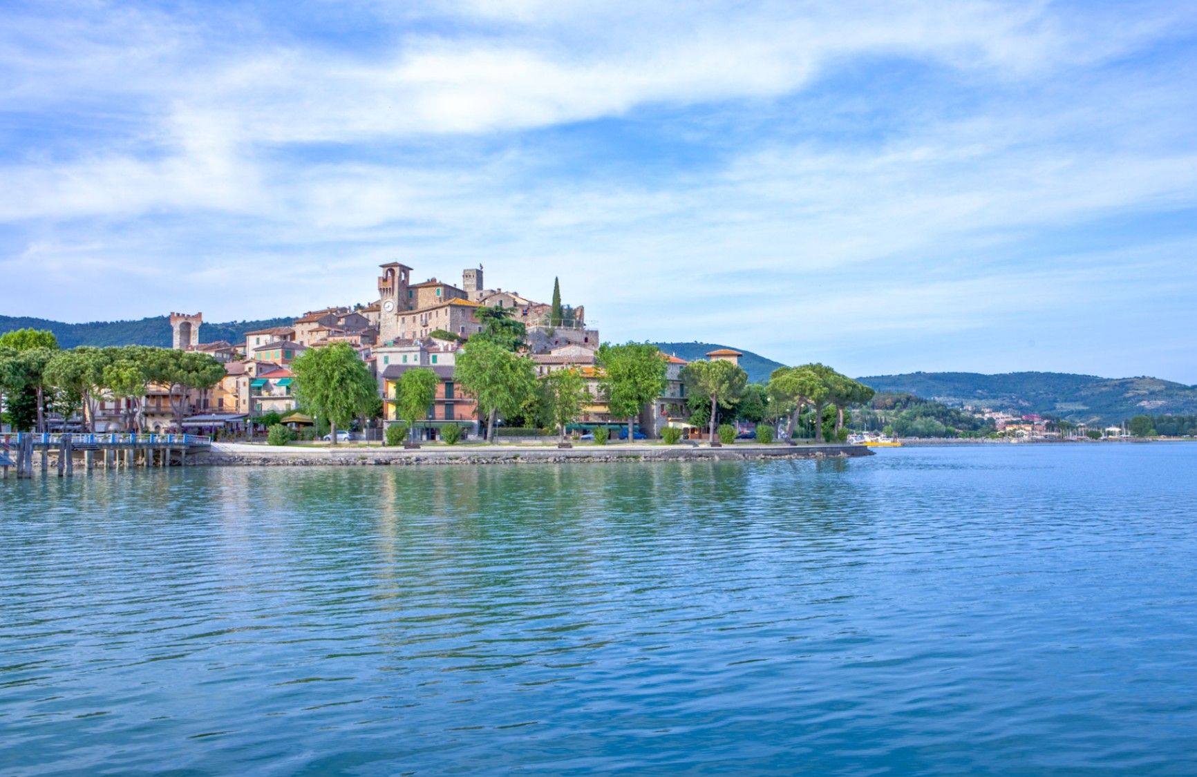
## Description **Lago Trasimeno** is one of Italy’s largest lakes and among its most understated. Unlike the dramatic alpine lakes of the north, Lago Trasimeno is defined by **breadth rather than depth**, calm waters, and a landscape shaped by agriculture, small towns, and slow rhythms. It is a place where nature, history, and everyday Umbrian life coexist without spectacle. The lake is shallow—its average depth is only a few meters—which gives it a distinctive character. Water levels fluctuate noticeably with the seasons, creating wetlands that attract migratory birds and sustain a delicate ecosystem. This makes Lago Trasimeno an important **natural reserve**, particularly for birdwatchers and ecologists. The surrounding reeds, olive groves, and rolling hills contribute to a serene atmosphere that feels far removed from mass tourism. Historically, the lake is best known as the site of the **Battle of Lake Trasimene (217 BCE)**, one of Hannibal’s greatest victories against the Roman Republic during the Second Punic War. Roman legions were ambushed along the lakeshore, making the area one of the most strategically significant ancient battlefields in Italy. A lesser-known fact is that remnants of Roman roads and settlements still lie scattered around the basin, largely unmarked and integrated into the modern landscape. Another overlooked detail is that the lake supports **three inhabited islands**, each with a distinct identity, rather than serving purely as a scenic backdrop. Today, Lago Trasimeno remains deliberately low-key. Fishing villages, medieval towns, cycling paths, and ferry crossings define the experience. It is a destination that rewards patience and curiosity rather than tight itineraries. ## Location **Country:** Italy **Region:** Umbria **Province:** Province of Perugia **Nearby City:** Perugia Lago Trasimeno lies west of Perugia, close to the border with Tuscany, making it a natural crossroads between central Italy’s cultural regions. ### How to Get There * **By train:** * Regional trains run along the northern shore of the lake, stopping at towns such as Passignano sul Trasimeno and Castiglione del Lago. * **By car:** * Easily accessible via regional roads from Perugia, Cortona, or Arezzo. A car is the most flexible option for exploring the lakeside. * **By bus:** * Local buses connect Perugia to towns around the lake, though schedules are limited. * **By bicycle:** * Popular with cyclists, with relatively flat routes and scenic views. ## Tips * **Explore multiple towns:** Each lakeside town has a different character; do not limit yourself to one stop. * **Take a ferry:** Boat trips to the islands offer a different perspective of the lake. * **Visit in spring or early autumn:** Mild weather and fewer crowds enhance the experience. * **Rent a bike:** The flat terrain makes cycling particularly enjoyable. * **Manage expectations:** This is not a swimming-focused lake; its appeal lies elsewhere. * **Stay overnight:** Sunset and early morning reveal the lake at its most atmospheric. ## Conclusion Lago Trasimeno is a place of quiet depth rather than visual drama. Rooted in ancient history and shaped by nature and rural life, it offers an authentic Umbrian experience for visitors who value calm landscapes, local culture, and unhurried exploration. ## FAQ **1. Is Lago Trasimeno good for swimming?** Swimming is possible in designated areas, but the lake is better suited to boating and relaxation. **2. How many islands are on the lake?** There are three inhabited islands: Isola Maggiore, Isola Minore, and Isola Polvese. **3. How much time should I plan for a visit?** At least **one full day**, more if exploring towns or cycling. **4. Is the lake suitable for families?** Yes, especially for gentle outdoor activities and relaxed travel. **5. Can you visit without a car?** Yes, but a car provides greater flexibility. **6. Is Lago Trasimeno crowded?** Compared to other Italian lakes, it remains relatively uncrowded year-round. ## Links * [Umbria official tourism site](https://www.umbriatourism.it)
GemVoyage Team • World
Lisbon
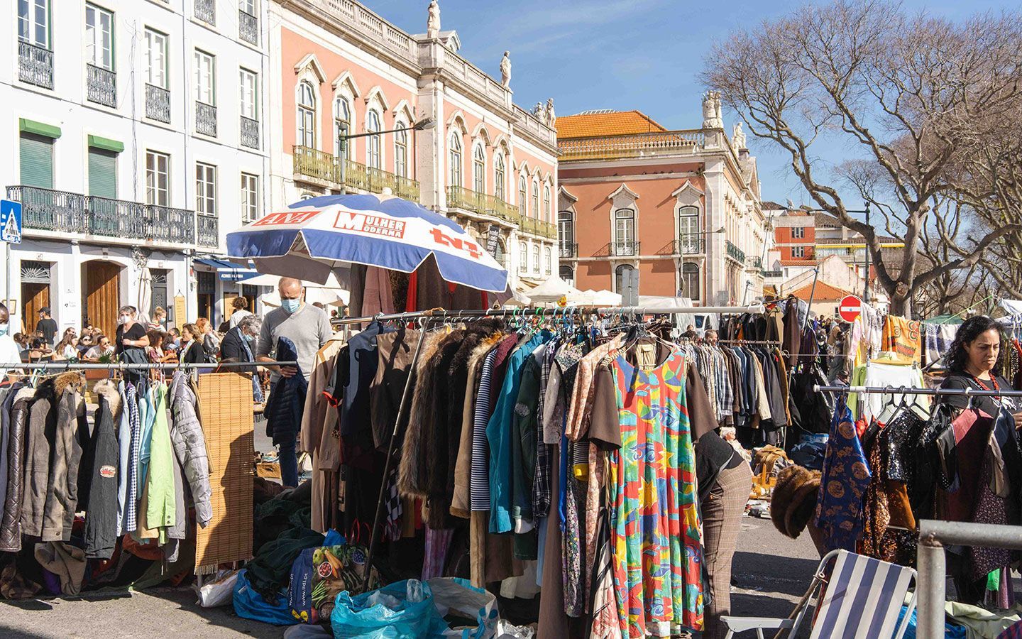
## Description Feira da Ladra is Lisbon’s most atmospheric flea market, a living patchwork of Portuguese life, history and commerce. More than a simple collection of stalls, it functions as a social square where generations of Lisboetas and visitors mingle among secondhand fabrics, antique furniture, faded postcards and artisan curios. The market’s energy is tactile and sensory: the smell of roasted chestnuts on a cool morning, the clack of wooden crates being stacked, and the low negotiation voices that form an audible backdrop to careful inspection of objects that often carry long personal histories. The market’s layout is informal and sprawling across Campo de Santa Clara and adjacent streets, which gives Feira da Ladra a serendipitous quality. Shoppers come for the big-ticket antiques as often as for tiny discoveries — old postcards that reveal vanished streets, or a single ceramic shard that hints at an earlier factory’s palette. Stallholders tend to be people who work in niches: collectors who’ve spent years sourcing porcelain and glass, families passing down boxes of personal effects, or young makers showcasing vintage-inspired handicrafts. That variety is exactly what makes the market valuable for cultural and material history research as well as for treasure hunting. Historically, the name "Feira da Ladra" — literally "thief’s fair" — is layered in nuance rather than literal accusation. Its origin reflects an age when informal markets, barter and secondhand trade were common ways to redistribute goods brought by sailors, seasonal workers and small-time traders. Over centuries, the market evolved from ad-hoc trading to an organized, municipally permitted event; yet it has preserved that improvisational spirit. Locals often stroll the market not just to shop but to socialize, to enjoy street food and to find oddities that become stories to tell. From a visitor’s perspective, Feira da Ladra rewards patience and curiosity. The most memorable finds are rarely the first item seen; rather, they emerge from methodical, slow browsing and conversations with vendors. For photographers and writers, the market provides rich visual and narrative material: candid portraits, evocative still lifes and oral histories that surface in impromptu discussions. For collectors, the market can be a source of rare pieces — old military medals, ill-fitted mirrors with gilded frames, and long-forgotten vinyl records — provided you take the time to look beyond the more tourist-oriented stands. To add practical depth: prices at Feira da Ladra vary widely, from a few euros for secondhand books to hundreds or thousands for verified antiques. If you are buying a significant artifact, ask for provenance information and vendor contact details; many dealers will provide a short history or provenance note for higher-value items. If you're an academic or conservator, the market can be a useful place to connect with sources, restorers and individuals who work in regional crafts. Conversations at stalls often yield unexpected context — the name of a maker, the story of how an item arrived in Portugal, or a tip about a specialist restorer in nearby neighborhoods. For visitors who want a focused approach, consider creating a short checklist: categories of interest (textiles, ceramics, books), approximate size limits for what you can carry, and a preliminary budget. This lets you sift quickly while staying alert for serendipity. Photographers may want to prioritize early hours when stalls are being set up; the quality of light in the plaza and narrow alleys often enhances texture and color in ways that late-day crowds do not. ## Location Feira da Ladra is anchored in Campo de Santa Clara, a broad plaza in Lisbon’s Alfama quarter, a neighborhood known for winding alleys, Fado houses and terraced viewpoints. The market commonly takes place on Tuesdays and Saturdays, though schedules can vary for holidays and municipal regulations — always verify current opening days before traveling. Getting there: the iconic Tram 28 winds through Alfama and stops within reasonable walking distance of Campo de Santa Clara, offering a scenic approach that doubles as a short city tour. For those who prefer other transit, buses and the nearby Santa Apolónia train station provide alternatives. Driving is possible but parking in central Lisbon is limited; rideshares and taxis are convenient options. Because the market sprawls across cobbled streets, wear sturdy shoes and be prepared for narrow passages. Insider transit tip: if you’re trying to avoid the busiest hours on Saturdays, arrive just after opening or target a Tuesday visit. Weekdays mean fewer tourists and better chances to speak with long-term stallholders. Also note that in summer months local festivals and holiday schedules can push setup times earlier or later. ## Tips - Visit early: stalls are fresher and the best items are still available in the morning. - Bring small bills and coins: many vendors prefer cash and it speeds up negotiations. - Learn a few Portuguese phrases for polite bargaining; a warm greeting goes far. - Inspect goods carefully — antiques and vintage items can have hidden damage. - Pack a reusable bag and a small tape measure; some items will need measurements. - Leave time to explore Alfama after the market: viewpoints, narrow streets, and authentic eateries nearby make for a full day. - Respect vendors: ask before photographing and approach trades with courtesy. - If planning larger purchases, discuss delivery options in advance; some vendors have recommended couriers and can help with packing. - Consider bringing a handheld UV light if you’re assessing paper items and stamps — it helps detect repairs and alterations (use respectfully and sparingly). ## Conclusion Feira da Ladra is more than a market: it’s a cultural habit of Lisbon, where history, economy, and daily life intersect. The market rewards visitors who slow down, ask questions and let discoveries find them. Whether you’re a focused collector, a photographer seeking texture and color, or a traveler searching for a distinctive souvenir, Feira da Ladra offers an authentic experience rooted in local rhythms and old-world charm. Suggested half-day itinerary: arrive at opening, walk the perimeter for an overview, focus on two or three categories of interest, take a mid-morning coffee at a nearby cafe, and return for a second pass before noon to finalize purchases. This rhythm helps you avoid decision fatigue and increases the chance of discovering a meaningful item. ## FAQ Q: When is Feira da Ladra open? A: The market normally runs on Tuesdays and Saturdays, with the largest crowds on Saturday mornings. Special municipal events, public holidays, or seasonal adjustments may change the schedule — check local listings or municipal websites for the latest calendar. Q: Is haggling acceptable and common? A: Yes. Polite bargaining is part of the experience, especially for antiques and larger items. Start with a respectful offer and keep interactions friendly; vendors are more likely to lower prices for warm, patient customers. Q: What should I bring to shop at Feira da Ladra? A: Bring cash (small denominations), a sturdy bag for purchases, comfortable shoes, and a phone or notebook to capture vendor details if you’re researching a find. If you plan to purchase large items, have transportation arranged in advance. Q: Are there authentic antiques or mostly tourist souvenirs? A: You’ll find a mix. Some stalls explicitly cater to tourists with souvenirs, but many dealers and long-term stallholders sell genuinely antique or collectible items. Careful browsing and asking informed questions helps locate authentic pieces. Q: Is the market family-friendly and safe? A: Generally yes — it’s a lively neighborhood market with families, collectors, and tourists. Standard urban precautions apply: watch your belongings, be mindful in crowded aisles, and avoid displaying large sums of cash. ## Links - [Wikipedia: Feira da Ladra](https://en.wikipedia.org/wiki/Feira_da_Ladra) - [Lisbon tourism info (markets)](https://www.visitlisboa.com)
GemVoyage Team • World
Tokyo
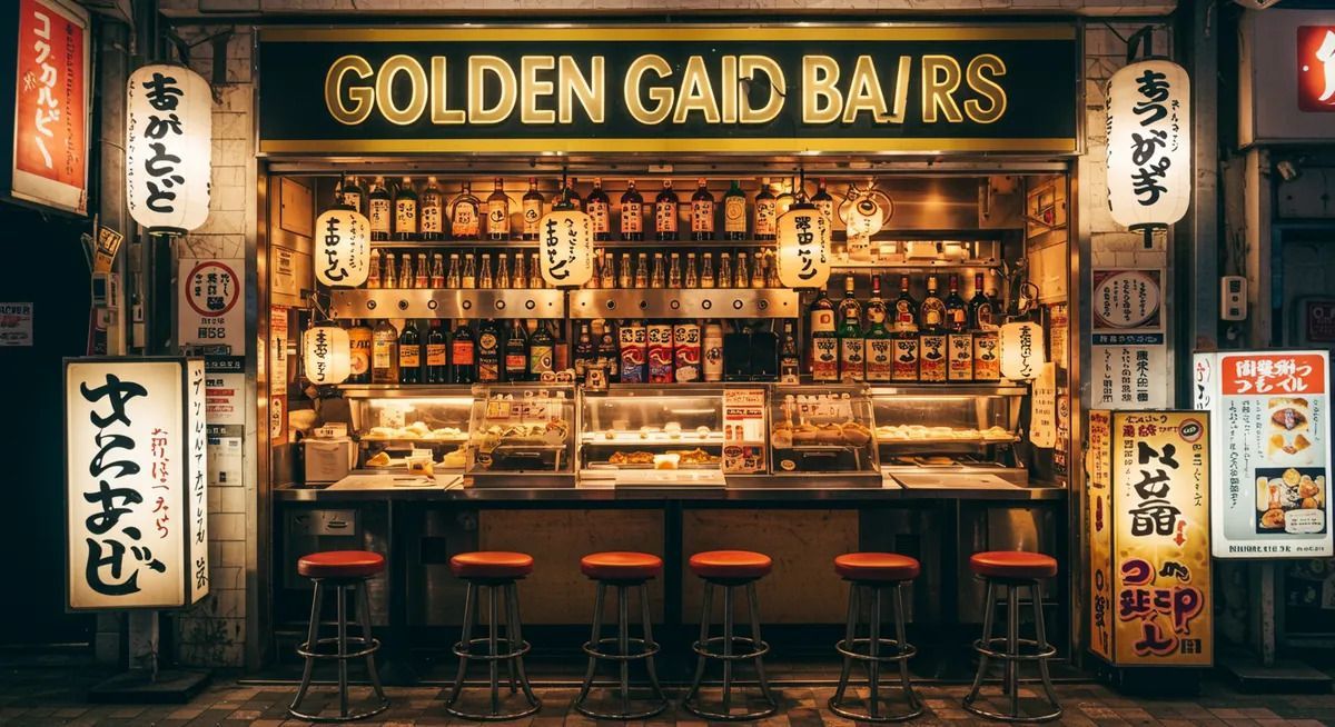
## Description Golden Gai is one of Tokyo's most distinctive nightlife districts, known for its narrow lanes, compact buildings, and dozens of tiny bars packed into a remarkably small area. What makes it special is not simply the number of bars, but the intimacy of the environment. Instead of large venues and loud commercial chains, visitors find one-room or nearly one-room spaces where the atmosphere is personal, varied, and often highly curated by the owner. The whole district feels like a living archive of postwar Tokyo nightlife, preserved in a way that modern redevelopment has not fully erased. Many of the bars have their own themes, regulars, and house rules, which means the experience can change dramatically from one doorway to the next. That unpredictability is part of the appeal. A less widely known fact is that Golden Gai survived repeated pressure from urban redevelopment because its character became too culturally valuable to replace easily. Another interesting detail is that it is as much a social district as a drinking district; for many visitors, the point is to step into Tokyo's small-scale urban culture rather than simply to have a night out. ## Location Golden Gai is in Shinjuku, one of Tokyo's busiest commercial districts in Japan. It sits near the heart of the entertainment area and is easy to reach from Shinjuku Station, one of the city's main transportation hubs. The neighborhood's location makes it especially convenient for travelers staying in central Tokyo, since you can reach it by train, walk to it from nearby hotels, and continue elsewhere in the city afterward. Because the area is small and dense, the best approach is to arrive on foot after taking transit to Shinjuku. That lets you enjoy the contrast between the huge station area and the tighter lanes of Golden Gai. Evening is the natural time to go, although the district comes alive at different speeds depending on the day and the season. ## Tips - Start with one or two bars rather than trying to see everything, because the district rewards quality over quantity. - Check whether a bar has a cover charge or membership policy before entering. - Be respectful of the small spaces and the local regulars, since many bars have a strong neighborhood culture. - Bring cash, because some smaller establishments may prefer it over cards. - If you are shy, choose a bar with an easier-looking entry style or a visible English menu. - Pair Golden Gai with other Shinjuku sights so the evening feels like a full district experience. ## Conclusion Golden Gai is one of the best places in Tokyo to experience a compact, intimate version of the city's nightlife. Its charm comes from personality, density, and history, not spectacle, which is exactly why it leaves such a strong impression. ## FAQ ### Is Golden Gai only for drinking? Mostly, yes, but the experience is broader than drinking alone. Many visitors go to appreciate the atmosphere, architecture, and social energy of the district. Even if you only stop in briefly, you are getting a glimpse into a very specific side of Tokyo's urban culture. ### Is Golden Gai expensive? It can be, especially compared with everyday bars elsewhere in Tokyo. Small spaces, cover charges, and themed bars often create a premium experience. That said, costs vary a lot from one place to the next, so it is possible to keep the visit modest if you are selective. ### Do I need to speak Japanese? Not necessarily. Some bars are welcoming to international visitors, while others are more local in feel. Basic courtesy goes a long way, and a little patience helps. If you want an easier entry, look for venues that visibly welcome newcomers. ### What is the best time to go? Early evening is usually best if you want to avoid the busiest crowd peaks and have time to choose a bar calmly. Later at night can be lively, but the narrow lanes may feel crowded. Your ideal time depends on whether you prefer atmosphere or ease of movement. ### Can I visit Golden Gai without staying long? Yes, and that is common. Some people drop in for a single drink, a brief look around, or a photo walk. Even a short visit can feel meaningful because the district's character is so concentrated. You do not need a long itinerary to appreciate it. ## Links - [Wikipedia](https://en.wikipedia.org/wiki/Golden_Gai)
GemVoyage Team • World
Montpllier
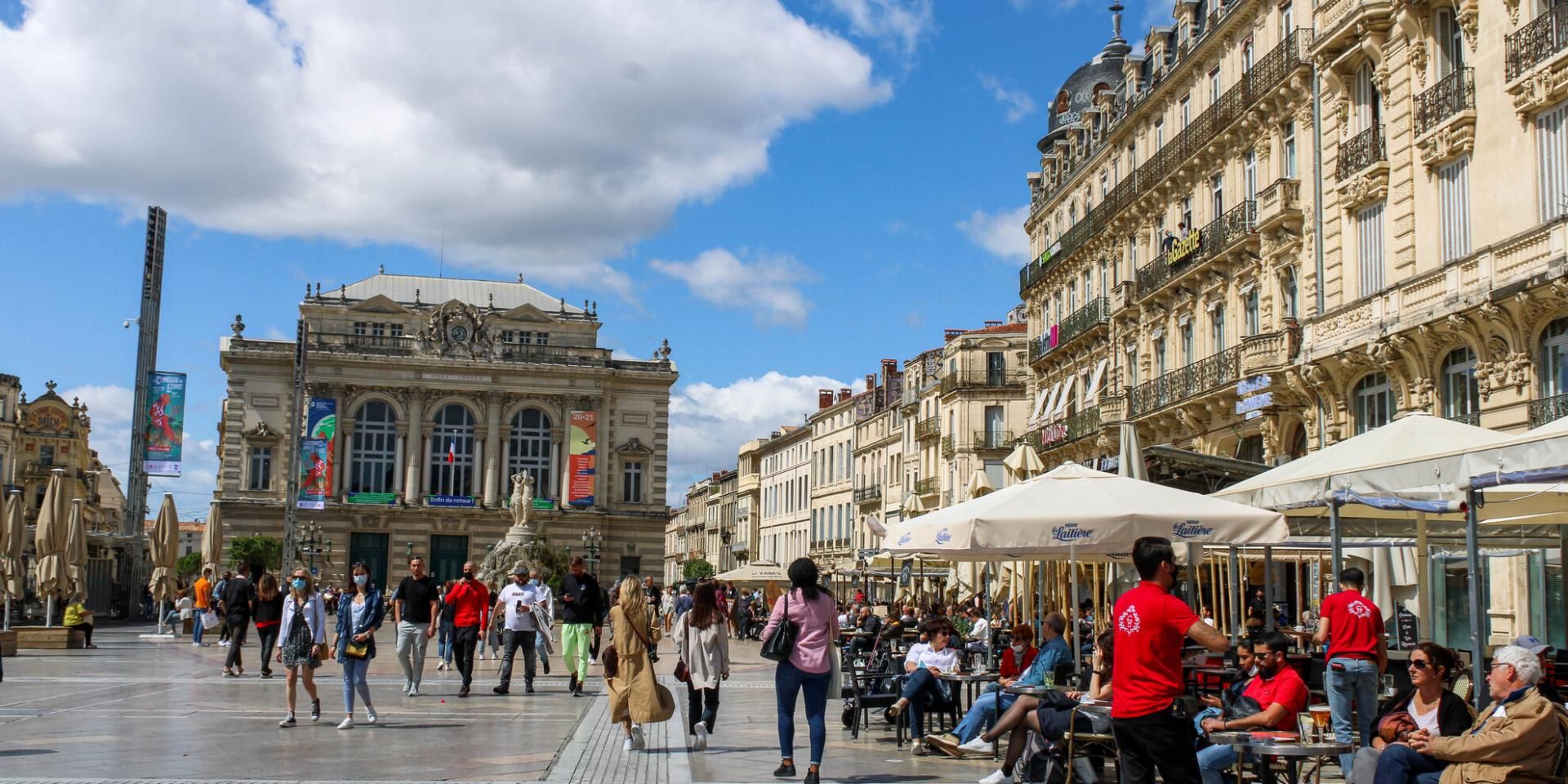
## Description Comedy Square, or **Place de la Comédie**, is the vibrant heart of Montpellier and one of the most iconic squares in southern France. Known locally as *“l’Oeuf”* (The Egg) because of its oval shape, this lively square is a gathering spot for both locals and tourists. It is surrounded by stunning 19th-century Haussmann-style buildings, bustling cafés, and the impressive **Opéra Comédie**, which dominates one side of the square with its grand façade. What makes Comedy Square unique is its **constant energy**—from street performers and musicians to open-air terraces where people enjoy Mediterranean sunshine. It’s not only a cultural hub but also a place to start exploring Montpellier’s historic center. A little-known fact is that the square has been at the core of Montpellier’s social life since the **18th century**, making it one of the oldest urban meeting points in the city. Another interesting detail is the presence of the **Three Graces Fountain**, a beautiful marble sculpture from 1790 that has become a beloved symbol of Montpellier. ## Location Comedy Square is located in **Montpellier, France**, in the **Occitanie region** of southern France. It lies right in the city center, connecting the historic old town with the more modern districts. The square serves as a central point for trams, buses, and pedestrian streets, making it extremely accessible. ### Recommendation on How to Get There If you’re traveling from **Montpellier Méditerranée Airport**, you can reach the square by shuttle bus to the main train station, **Gare Saint-Roch**, which is only a few minutes’ walk from Comedy Square. The city’s excellent **tram network** also stops directly at Place de la Comédie, making it the most convenient way to get there from anywhere in Montpellier. For those staying in the historic center, walking is the best option, as many attractions are clustered around the square. ## Tips Here are some useful tips for making the most of your visit to Comedy Square: * **Visit During the Evening**: The square comes alive at night with street performers, illuminated buildings, and buzzing cafés. * **Enjoy the Cafés and Terraces**: Sit down at one of the many outdoor cafés to soak in the atmosphere and people-watch. * **Take a Tram Ride**: Montpellier’s trams are famous for their artistic designs. Boarding one from the square gives you a unique perspective of the city. * **Photography**: The square is especially photogenic at sunset when the Opéra Comédie and surrounding buildings glow in golden light. * **Combine With a Walking Tour**: From the square, you can easily walk to Montpellier Cathedral, the Fabre Museum, or stroll down Rue de la Loge for shopping. * **Avoid Driving**: The square is pedestrian-friendly, and parking is limited nearby, so it’s best to use public transportation. ## Conclusion Comedy Square in Montpellier is more than just a central plaza—it’s the heartbeat of the city. With its beautiful architecture, lively atmosphere, and cultural landmarks, it offers visitors a true taste of southern French life. Whether you’re sipping coffee at a terrace, watching a street performance, or exploring nearby attractions, Comedy Square is a must-see destination when visiting Montpellier. ## FAQ **1. What is Comedy Square famous for?** It is famous for its lively atmosphere, historic architecture, the Opéra Comédie, and the Three Graces Fountain. **2. Is Comedy Square pedestrian-friendly?** Yes, it’s primarily a pedestrian zone, making it safe and enjoyable to explore on foot. **3. Are there restaurants and cafés in the square?** Yes, the square is surrounded by numerous cafés and restaurants, perfect for dining or enjoying a drink outdoors. **4. How do I get to Comedy Square from the train station?** The main train station, Gare Saint-Roch, is only a 5-minute walk from the square. **5. Is it worth visiting at night?** Absolutely. The square lights up beautifully in the evening and is filled with vibrant street life. **6. Can I take public transport to Comedy Square?** Yes, several tram lines stop directly at the square, making it the easiest way to get there. ## Links * [Official Montpellier Tourism Office](https://www.montpellier-france.com/)
GemVoyage Team • World
Reykjavik
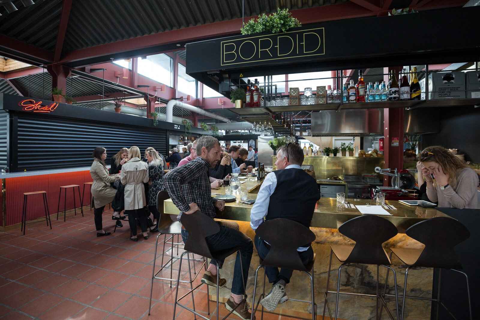
## Description Hlemmur Mathöll is one of **Reykjavík’s most vibrant food halls**, offering locals and tourists alike a chance to taste the very best of Icelandic and international cuisine under one roof. Once a busy central bus terminal, Hlemmur has been transformed into a lively dining destination where visitors can explore a wide range of flavors—from traditional Icelandic dishes to Asian street food, fresh baked goods, and craft coffee. What makes Hlemmur Mathöll truly unique is its **blend of tradition and modern innovation**. Some of the city’s top chefs and food entrepreneurs have opened stalls here, making it a great spot to sample fine dining in a casual setting. Visitors can enjoy Icelandic delicacies such as **lamb, fresh fish, and artisanal skyr**, alongside global options like tacos, Vietnamese pho, and Italian pizza. A little-known fact is that Hlemmur Mathöll was **Iceland’s very first food hall**, opening in 2017, and it has since inspired a wave of similar concepts around the country. Another interesting detail is that while the building was once associated with transit and bustling crowds, today it has become a symbol of how Reykjavík embraces creativity and cultural renewal. ## Location Hlemmur Mathöll is located in the **capital city of Reykjavík**, in the **Capital Region of Iceland**. It sits at the eastern end of Laugavegur, Reykjavík’s main shopping street, making it both central and easy to find. ### Recommendation on How to Get There If you’re staying in downtown Reykjavík, Hlemmur Mathöll is within **walking distance**—about 10–15 minutes from the city center. For those staying farther away, Reykjavík’s bus system makes it simple to reach the food hall, as many routes stop directly at Hlemmur. Taxis and rental scooters are also available, but walking remains the most convenient and enjoyable way to get there, especially since you can explore nearby shops and cafés along the way. ## Tips To make the most of your visit to Hlemmur Mathöll, keep these tips in mind: * **Go Hungry**: With so many food stalls to choose from, it’s best to arrive ready to sample multiple dishes. * **Try the Icelandic Specialties**: Don’t miss out on stalls offering local lamb, Arctic char, or skyr-based desserts. * **Pair with Drinks**: Some stalls serve Icelandic craft beers, cocktails, and excellent coffee that pair perfectly with the meals. * **Visit at Different Times**: The atmosphere changes throughout the day—lunchtime is bustling with workers, while evenings bring a more relaxed dining experience. * **Bring Friends**: Food halls are best enjoyed with company, as you can share and taste more dishes. * **Check Opening Hours**: While the hall is usually open from morning until late evening, individual vendors may have different schedules. ## Conclusion Hlemmur Mathöll is more than just a food hall—it’s a cultural landmark that captures the spirit of modern Reykjavík. With its unique mix of Icelandic and international flavors, its history as a former bus terminal, and its welcoming atmosphere, it’s the perfect spot for food lovers to experience the evolving culinary scene of Iceland. Whether you’re stopping for a quick bite or spending a leisurely evening with friends, Hlemmur Mathöll is a must-visit in the Icelandic capital. ## FAQ **1. What kind of food can I find at Hlemmur Mathöll?** You’ll find a wide variety, including Icelandic dishes, Asian street food, Italian pizzas, tacos, and artisanal desserts. **2. Is it expensive to eat at Hlemmur Mathöll?** Prices vary by stall, but it offers a range of affordable street food options alongside slightly more upscale dishes. **3. When is the best time to visit?** Evenings are particularly lively, but if you want to avoid crowds, lunchtime on weekdays is a good option. **4. Can I bring kids to Hlemmur Mathöll?** Yes, the hall is family-friendly, with casual seating and plenty of food choices for all ages. **5. Do vendors accept credit cards?** Yes, nearly all stalls accept credit and debit cards, which are the most common form of payment in Iceland. **6. Is it easy to get there without a car?** Absolutely—Hlemmur Mathöll is centrally located and easily accessible by foot or public transportation. ## Links * [Visit Reykjavík Official Website](https://visitreykjavik.is/)
GemVoyage Team • World
Siena
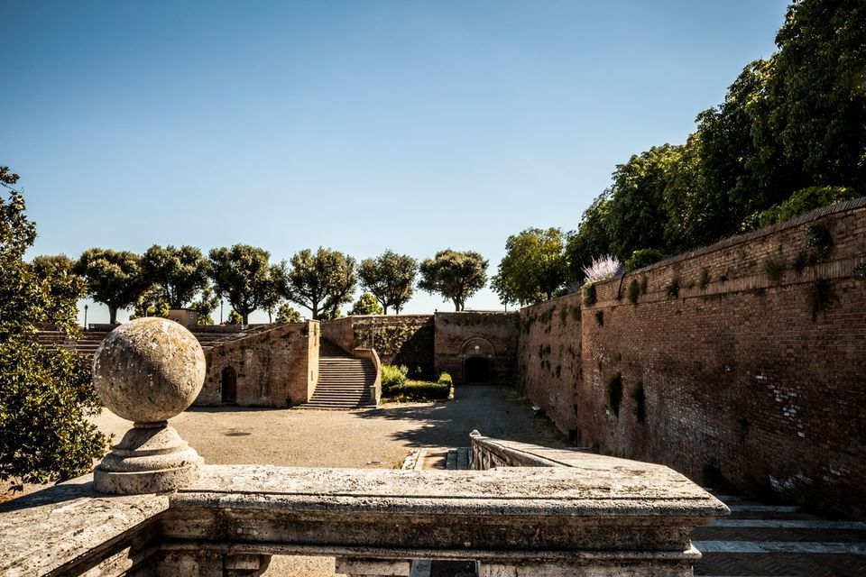
## Description Fortezza Medicea is one of Siena's most imposing landmarks because it represents a different historical layer from the city's medieval churches and squares. Built after Siena's defeat by Florence, the fortress reflects Medici power and the political reshaping of the region during the Renaissance. Unlike a decorative palace or a purely ceremonial monument, it was designed for strategic control and military presence. Today, however, it functions as a public space where history, viewpoints, and local life meet in a surprisingly relaxed way. The fortress is memorable because of its scale and shape. Its bastioned walls form a strong geometric presence above the city, and the elevated position gives visitors sweeping views over Siena and the surrounding Tuscan landscape. That combination of fortification and panorama makes it especially rewarding for travelers who appreciate places where architecture tells a political story. The walls are not just old stone; they are evidence of conquest, rule, and the reshaping of urban space. One little-known fact is that the fortress became less about defense over time and more about civic and cultural use, showing how military architecture can be repurposed for public life. Another detail many visitors miss is how the fortress helps explain the relationship between Siena and Florence. It is not just a monument standing above the city but a reminder of an era when regional power was expressed through earthworks, bastions, and visible control of the landscape. Visitors often appreciate the fortress for its calm atmosphere. While the city center of Siena can be bustling with tourists, the Fortezza Medicea feels more open and spacious. It is a good place to pause, look out across rooftops and hills, and understand how Siena sits within the broader Tuscan setting. If you are interested in military history, urban viewpoints, or Renaissance politics, the fortress is one of the city's most significant stops. ## Location Fortezza Medicea is in Siena, in Tuscany, Italy, just north of the historic center and within walking distance of major city attractions. Because it sits on elevated ground near the old core, it is easy to include in a walking tour of Siena, though the approach may involve some uphill sections depending on your starting point. If you are coming from Piazza del Campo or the cathedral area, the walk to the fortress is straightforward and can be done on foot. Buses and taxis can take you close as well, but walking is usually the best option because it lets you experience the transition from Siena's dense medieval streets to the more open fortified landscape. The most practical recommendation is to visit it while exploring Siena on foot, especially if you want to combine the fortress with other panoramic stops. Because the site is open and spacious, it works well as a late-afternoon or early-evening destination when the light becomes softer. ## Tips Go for the views as much as for the history. The fortress gives some of the best panoramas in Siena, so bring time to linger and not just pass through. If possible, combine the fortress with a walk through the surrounding park-like areas and nearby city streets. That allows you to see how the fortress integrates into Siena's urban edge rather than treating it as a disconnected monument. Read a little about the Medici and the political history of Siena before your visit. Knowing why the fortress was built changes the experience from a simple architectural stop into a clearer story about conquest and control. Visit on a day with good visibility if scenic views matter to you. The fortress is enjoyable in many conditions, but its strongest appeal is the way it frames the city and countryside. ## Conclusion Fortezza Medicea is one of Siena's most powerful historical sites, combining Renaissance military architecture, city views, and a reminder of the region's complex political past. ## FAQ ### Why was Fortezza Medicea built? It was built as a military fortress after Siena came under Medici control, serving as a symbol of political power and strategic dominance. ### Is the fortress open to visitors? Yes, the grounds and surrounding areas are generally accessible, though specific use may vary over time. ### What is the best part of visiting the fortress? The best part is the combination of panoramic views and the chance to understand Siena's political history. ### How long should I spend there? Most visitors spend between 30 minutes and an hour, depending on how much time they want for walking and views. ## Links - [Siena tourism](https://www.visitsiena.it/en/)
GemVoyage Team • World

Comments