GemVoyage Team • World
El Korba Square, located in the historic district of Heliopolis (Masr El Gedida), is one of Cairo’s most architecturally distinctive and socially vibrant urban spaces. Unlike the medieval fabric of Islamic Cairo or the colonial density of Downtown, El Korba represents a unique fusion of European town planning, Moorish revival architecture, and early 20th-century cosmopolitan lifestyle. It is widely regarded as the ceremonial heart of Heliopolis, a neighborhood originally designed as a modern garden city on the northeastern edge of Cairo.
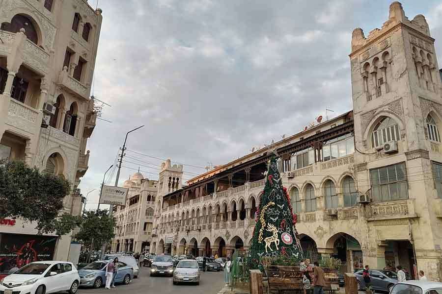
The square is surrounded by a remarkable collection of arcaded buildings, balconies, domed corner towers, and cream-colored façades that form one of the largest continuous ensembles of Heliopolis-style architecture in Egypt. This architectural style blends Islamic motifs, Andalusian arches, Art Deco symmetry, and European urban planning principles. The result is an environment that feels at once North African, Mediterranean, and unmistakably Cairene.
El Korba’s importance is not purely visual. It functions as a social engine. Cafés, pastry shops, restaurants, cinemas, and boutiques line the arcades, creating a space that is active from morning until late at night. Families stroll in the evening, students meet for coffee, office workers pass through during the day, and wedding photographers stage shoots beneath the arches. The square is not a preserved museum zone. It is a living city room, constantly shifting in rhythm and purpose throughout the day.
Historically, Heliopolis was founded in 1905 by Belgian industrialist Baron Édouard Empain, who envisioned a modern city in the desert connected to Cairo by electric tram. El Korba became the symbolic downtown of this new settlement. Its arcades were designed to provide shade, promote walkability, and unify commercial activity within a visually coherent framework. This concept was decades ahead of its time in Egypt and remains one of the district’s most successful urban legacies.
A little-known fact is that several of El Korba’s buildings were originally constructed with private rooftop gardens and internal ventilation corridors, engineered to cool interiors naturally before widespread air conditioning. Another lesser-known detail is that the square once hosted open-air orchestras and formal social promenades in the early 20th century, modeled after European city squares.
Atmospherically, El Korba carries a powerful sense of nostalgia mixed with everyday vitality. It is one of the few places in Cairo where early modern urban planning still shapes daily behavior: people walk, sit, linger, watch, and return repeatedly. The square holds emotional weight for generations of residents who associate it with first dates, family outings, late-night conversations, and childhood memories.
Unlike Cairo’s grand monuments, El Korba’s beauty lies in repetition and continuity rather than singular spectacle. Its arches frame everyday life. Its balconies observe the street silently. Its cafés serve as informal civic institutions. Together, they create one of the rare public environments in Egypt where architecture, commerce, and community remain structurally aligned.
El Korba Square is located in the heart of Heliopolis, in northeastern Cairo.
City: Cairo
District: Heliopolis (Masr El Gedida)
Governorate: Cairo Governorate
Country: Egypt
The square sits near the intersection of Baghdad Street, Al-Ahram Street, Ibrahim Al-Laqani Street, and El Merghany Street.
* Take Line 3 toward Adly Mansour and exit at Heliopolis Square Station or nearby stations, then walk or take a short taxi ride.
El Korba is easily combined with visits to Baron Empain Palace, El Merghany Street, and Heliopolis Sporting Club.
El Korba Square is the emotional and architectural center of Heliopolis, a space where early modern urban vision still shapes daily life in contemporary Cairo. With its graceful arcades, steady pedestrian rhythm, and deep social memory, El Korba offers something rare in Egypt’s megacity environment: a walkable, human-scaled public square that works both historically and socially.
1. What is El Korba Square known for?
It is known for its Heliopolis-style architecture, arcaded buildings, cafés, and vibrant social life.
2. When was El Korba developed?
It was developed in the early 20th century, shortly after the founding of Heliopolis in 1905.
3. Is El Korba tourist-friendly?
Yes, though it remains primarily a local social hub rather than a mass tourism site.
4. Is there an entrance fee?
No. It is a public square open at all times.
5. Is El Korba suitable for families?
Yes. It is especially popular for evening family walks and casual dining.
6. Can El Korba be visited with Baron Palace on the same trip?
Yes. They are located within short walking or driving distance of each other.
Discover more hidden gems you might love.
Dublin
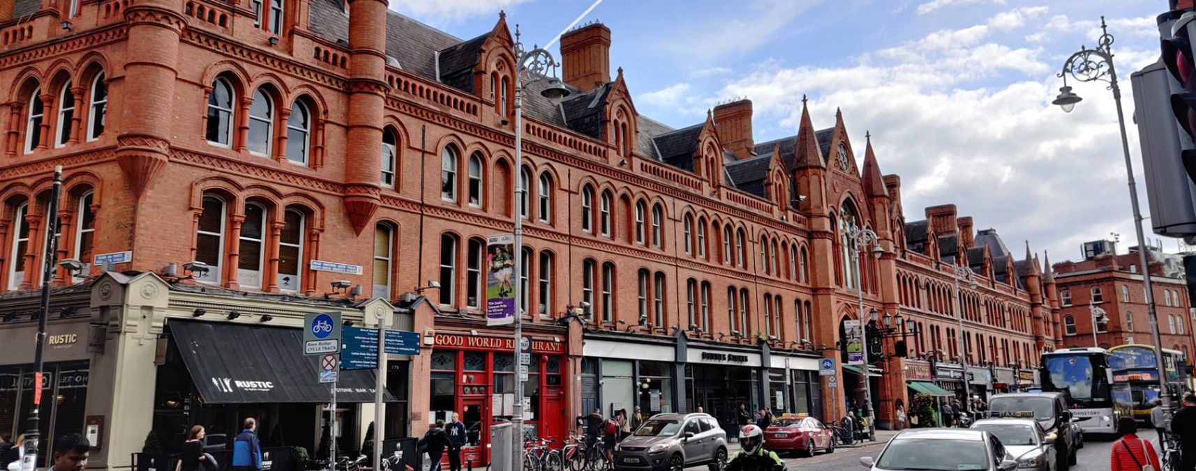
## Description **George’s Street Arcade (Stiúrtha Shráid Sheoirse)** is one of **Dublin’s oldest and most beloved shopping destinations**, offering a delightful blend of history, culture, and creativity. Opened in **1881**, it is one of the earliest purpose-built shopping arcades in Europe and remains a vibrant hub for both locals and visitors. Housed within a beautifully restored **Victorian red-brick structure**, the arcade features high wrought-iron arches, decorative glass roofing, and an atmosphere that blends the old with the contemporary. Inside, the narrow aisles are lined with an eclectic mix of independent stalls and boutique shops selling everything from vintage clothing and handmade jewelry to records, art, books, and collectibles. Street food vendors and cafés add delicious aromas to the air, making the experience as sensory as it is cultural. What makes George’s Street Arcade unique is its **authentic local character**—unlike chain-filled shopping centers, this market has remained fiercely independent for more than a century. It survived a major fire in 1892 and was rebuilt within two years, preserving its original charm. Another lesser-known fact is that the arcade was designed by English architects Lockwood & Mawson, the same team behind the iconic City Hall in Bradford, England. ## Location George’s Street Arcade is located in the heart of **Dublin City Centre**, **Ireland**, on **South Great George’s Street**, between Dame Street and Drury Street. Its central position places it just a few minutes’ walk from popular landmarks such as **Grafton Street**, **Trinity College**, and **Temple Bar**. To get there: * **On foot:** If you’re already exploring the city center, the arcade is within easy walking distance of most attractions. * **By public transport:** Take the **Luas Green Line** to the St. Stephen’s Green stop, or use Dublin Bus routes that pass through Dame Street or Aungier Street. * **By car:** Parking is available at nearby car parks such as Drury Street Car Park, though walking or public transport is recommended due to limited city parking. ## Tips * **Visit in the morning or early afternoon:** Crowds are smaller, and shop owners often have time to chat and share stories about their wares. * **Bring cash:** While many stalls accept cards, some smaller traders prefer cash for quick transactions. * **Try local snacks:** Sample treats from the market cafés — popular picks include crepes, pastries, or locally roasted coffee. * **Look for vintage and handmade goods:** The arcade is known for its one-of-a-kind finds, especially clothing, vinyl, and jewelry. * **Photography tip:** The interior’s glass roof and iron arches make for stunning photos, especially when sunlight filters through the skylights. * **Explore nearby:** After your visit, stroll along South William Street or George’s Street for more indie boutiques, pubs, and street art. ## Conclusion **George’s Street Arcade** is a living piece of Dublin’s history — a place where Victorian architecture meets contemporary creativity. Whether you’re shopping for a unique souvenir, enjoying local food, or simply soaking in the lively ambiance, this market captures the essence of Dublin’s independent spirit. It’s not just a shopping destination; it’s an experience that connects the city’s past with its ever-evolving present. ## FAQ **1. When was George’s Street Arcade built?** It was originally opened in 1881 and rebuilt in 1894 after a devastating fire. **2. What can I buy there?** The arcade offers handmade crafts, vintage fashion, jewelry, books, vinyl records, art, souvenirs, and local food. **3. Is there an entrance fee?** No, entry to the arcade is free for all visitors. **4. What are the opening hours?** Typically open **Monday to Saturday from 9:30 a.m. to 6:00 p.m.** and **Sunday from 12:00 p.m. to 6:00 p.m.**, though hours can vary slightly by shop. **5. Can I find local Irish products?** Yes — many vendors sell handcrafted Irish goods, from Celtic jewelry and wool accessories to local artwork and artisan foods. **6. Is it wheelchair accessible?** Yes, the main entrances and interior walkways are accessible, though some smaller stalls may have tight spaces. ## Links * [Official George’s Street Arcade Website](https://www.georgesstreetarcade.ie) * [Visit Dublin – George’s Street Arcade](https://www.visitdublin.com)
GemVoyage Team • World
Vienna
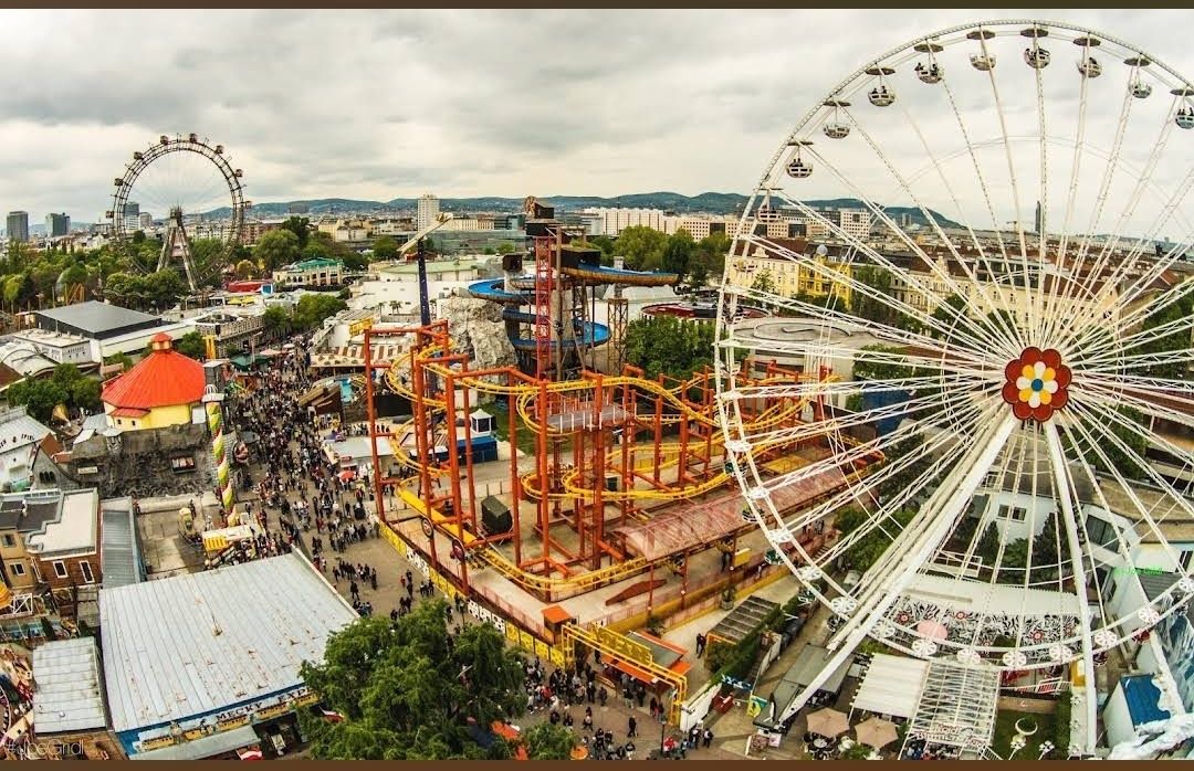
## Description **Prater Funpark** in Vienna, commonly referred to as the **Wurstelprater**, is one of Europe’s most iconic amusement parks and a beloved attraction for both locals and tourists. Nestled within the vast Prater public park, this funfair has been entertaining visitors for over 250 years. It’s a place where history, nostalgia, and modern thrills come together, offering everything from traditional carousels and bumper cars to cutting-edge roller coasters and high-adrenaline rides. What makes the Prater unique is its blend of old-world charm and contemporary entertainment. The park’s symbol, the **Wiener Riesenrad** (Giant Ferris Wheel), dates back to 1897 and is one of Vienna’s most recognized landmarks. Riding the Ferris wheel provides not only fun but also breathtaking panoramic views of the city. At the same time, newer attractions like turbo coasters and virtual reality experiences ensure that thrill-seekers are never bored. **Little-known facts**: * The Prater was originally an imperial hunting ground before being opened to the public in 1766. The amusement park grew organically from stalls, performers, and small rides. * Unlike most theme parks, **entry to the Prater Funpark is free**. Visitors pay only for the rides and attractions they choose, making it a flexible experience for all budgets. --- ## Location Prater Funpark is located in **Vienna**, the capital of **Austria**, within the **Leopoldstadt district**. It sits inside the larger **Prater public park**, a green oasis that stretches over six square kilometers and also includes walking paths, meadows, and sports facilities. ### How to get there: * **By metro**: The fastest way is to take the U1 or U2 subway lines to the station **Praterstern**, which is just a short walk from the park. * **By tram**: Trams 0 and 5 also stop near Prater. * **By foot or bike**: Visitors staying in central Vienna can enjoy a scenic walk or bike ride to the park, as it’s close to the city center. --- ## Tips * **Visit in the evening**: The Prater comes alive after sunset when the rides light up, creating a magical carnival atmosphere. * **Don’t miss the Giant Ferris Wheel**: It’s the park’s most famous attraction and a must for first-time visitors. * **Plan your budget**: Since entry is free but rides are paid individually, decide beforehand how many attractions you’d like to try. Ride prices vary, so bringing cash can be useful. * **Try the local food stalls**: Beyond rides, the park is known for its traditional Austrian snacks like bratwurst, pretzels, and candied nuts. * **Combine with a stroll in the Prater park**: After the excitement of the rides, the surrounding green spaces offer a relaxing contrast. * **Check seasonal events**: The park hosts festivals, concerts, and themed events throughout the year, especially during summer and around Christmas. --- ## Conclusion Prater Funpark in Vienna is more than just an amusement park—it’s a cultural institution that blends history, fun, and nostalgia. With its mix of historic attractions like the Wiener Riesenrad and thrilling modern rides, it offers something for everyone, from families to adrenaline junkies. Whether you go for the rides, the food, or the atmosphere, the Prater promises an unforgettable Viennese experience. --- ## FAQ **1. Is there an entrance fee for Prater Funpark?** No, entrance is free. Visitors only pay for the rides and attractions they choose. **2. What is the most famous ride at Prater?** The **Wiener Riesenrad (Giant Ferris Wheel)** is the park’s most iconic attraction and a symbol of Vienna. **3. When is the best time to visit?** Evenings are particularly magical with illuminated rides, but daytime visits are better for families with young children. **4. How long should I plan to spend at Prater?** Most visitors spend 2–4 hours, though you could easily spend a whole day enjoying the rides and the larger Prater park. **5. Is Prater open year-round?** The park is open all year, but many rides operate seasonally, typically from March to October. The Giant Ferris Wheel and some attractions remain open in winter. **6. Can I find food and drinks inside the park?** Yes, the park is filled with restaurants, snack stalls, and beer gardens serving Austrian and international food. --- ## Links * [Prater Wien – Official Website](https://www.praterwien.com/) * [Wiener Riesenrad – Official Website](https://www.wienerriesenrad.com/)
GemVoyage Team • World
Tirana
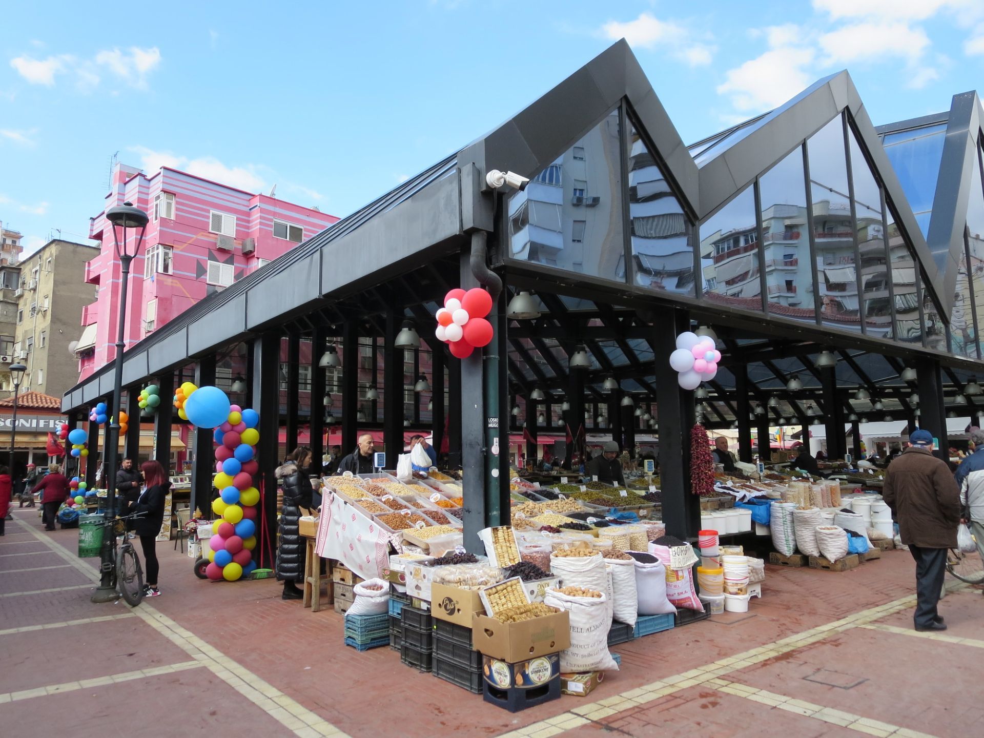
## Description Pazari i Ri, or the New Bazaar, is one of the most engaging places to experience Tirana in everyday motion. It is a market, but also much more than that. The area combines food, neighborhood life, casual shopping, and urban social energy in a way that makes it feel central to how the city now presents itself. Visitors often come expecting a simple market stop and end up spending much longer because the atmosphere is so easy to enjoy. The market’s strength is its blend of old and new. Traditional produce stalls and food sellers sit alongside cafés, contemporary public space, and a district that has been reimagined for modern city life without losing its local feel. One little-known fact is that Pazari i Ri has become a symbol of Tirana’s broader urban renewal, showing how the city can update itself while keeping a neighborhood scale. Another is that it is one of the easiest places to observe how locals shop, eat, and meet during the day, making it valuable for travelers who want more than landmark sightseeing. Food is a major reason to go. Fresh fruit, vegetables, herbs, cheeses, spices, and prepared dishes all contribute to a lively market atmosphere. The surrounding area also makes it simple to sit down for coffee or a meal after browsing. That flexibility is important because it allows the market to work as both a practical stop and a relaxed social outing. You do not have to buy anything to enjoy the visit. Watching the movement, hearing the conversations, and taking in the color and rhythm of the place is enough. For visitors, Pazari i Ri offers a nice balance between structure and spontaneity. You can go there with a shopping list if you want, but you can also simply wander and let the market lead you. Because it sits within central Tirana, it is one of the easiest places to combine with sightseeing, making it a very efficient and satisfying addition to a city day. ## Location Pazari i Ri is located in central Tirana, Albania, a short distance from the city’s main center and many of its major pedestrian and civic areas. It is easy to fit into a day that also includes Skanderbeg Square, nearby museums, or central cafés. The market is very accessible on foot from the core city center, which makes it especially convenient for visitors staying in central Tirana. Taxis and ride-hailing services are also simple options, but walking is often the most pleasant way to arrive because it lets you approach the area gradually and notice the changing urban texture around it. Since the market is central, it works well at almost any time of day, though morning and lunchtime visits tend to feel most active. If your schedule is open, try to arrive when people are shopping for daily supplies, because that is when the market feels most local and animated. ## Tips - Go hungry. The area around the market is one of the easiest places in Tirana to combine browsing with a meal or snack. - Visit in the morning if you want the freshest produce and the most active local rhythm. - Take time to look beyond the main stalls. The surrounding streets and cafés are part of the experience. - Use the market as a people-watching stop as well as a shopping stop. It is a good place to observe daily life. - Bring small notes or a card, but be flexible. Different vendors may prefer different payment methods. ## Conclusion Pazari i Ri is one of Tirana’s best examples of a market that feels both practical and social. It gives travelers an easy way to see the city’s everyday life while enjoying food, color, and a lively central setting. ## FAQ ### Is Pazari i Ri mostly for tourists? No. It is used by locals as well, especially for shopping and daily routines, which gives it a more authentic atmosphere. ### What should I buy there? Fresh produce, local foods, small snacks, and market-style goods are the most natural purchases, though the experience is just as enjoyable if you only browse. ### Is it a good place for lunch? Yes. The surrounding area has enough food and café options that it works very well as a lunch stop. ### How long should I stay? You can see the essentials in under an hour, but a slower visit with coffee or a meal often makes the experience much better. ## Links - [Tirana official tourism information](https://visit-tirana.com/) - [Tirana on Wikipedia](https://en.wikipedia.org/wiki/Tirana)
GemVoyage Team • World

Uyuni
## Description The Salar de Uyuni in Bolivia is the world’s largest salt flat — an immense expanse of white crust stretching to the horizon. In the dry season it becomes a seemingly endless plain of hexagonal salt polygons; during the wet season, thin water turns the surface into a giant mirror that reflects sky and clouds in breathtaking panoramas. The flats’ surreal scale creates optical illusions that photographers exploit for creative forced-perspective shots and astronomical impressions. Uyuni’s uniqueness stems from its scale and seasonal transformation: an austere white desert that alternates between reflective glass and textured salt crust. Beneath the crust lie rich lithium brines that have become geopolitically important, and the region supports unique high-altitude wildlife including flamingos in nearby lagoons and vicuñas on the surrounding altiplano. A lesser-known feature is the train cemetery near Uyuni town, whose rusting locomotives echo the area’s industrial past against the vast natural backdrop. Visitors experience two very different seasons: the wet months (roughly December–April) turn the flats into a seamless mirror where the horizon disappears, producing surreal photographic opportunities; the dry months (May–November) reveal the networked hexagonal salt polygons and easier vehicle travel across firmer crust. Both seasons offer remarkable visual experiences, but logistics and vehicle access differ significantly. ## Location Salar de Uyuni is in southwest Bolivia near the town of Uyuni in Potosí Department. Most visitors begin in Uyuni and travel by 4x4 tours that range from day-trips to multi-day circuits visiting colored lagoons, hot springs, high-altitude deserts and remote salt hotels. ## Tips - **Choose season based on photographic goals:** Wet season for mirror reflections and dynamic sky photography; dry season for crisp salt polygons and easier driving conditions. - **Acclimatize and dress for altitude:** Uyuni sits over 3,600 m above sea level—allow time to adjust, stay hydrated and use sun protection. Nights are cold; warm layers are essential. - **Book reputable 4x4 operators and confirm vehicle safety:** Select experienced guides who understand remote driving, fuel logistics and high-altitude first aid. - **Plan for basic accommodations on multi-day tours:** Many overnight stops are simple lodges or salt hotels; bring essentials and respect eco-guidelines. - **Protect camera gear from salt and dust:** Use protective coverings, and clean equipment carefully after excursions to avoid salt corrosion. ## Conclusion Salar de Uyuni is an elemental landscape that redefines scale and reflection: a place where sky, salt and solitude combine to produce unforgettable visual experiences. Whether you chase inverted skies in the wet season or striding across crystalline salt in the dry months, Uyuni offers some of the planet’s most surreal and photogenic landscapes. ## FAQ - **Q: Can visitors drive across the Salar de Uyuni themselves?** A: Self-driving is possible but not recommended for first-time visitors—conditions vary, and poorly marked hazards or seasonal flooding can be dangerous. Use experienced local operators who know safe routes. - **Q: When is the best time for mirror reflections?** A: The wet season (roughly December–April) after rains produces the mirror effect; brighter skies and calm days improve reflections. - **Q: Will I experience altitude sickness at Uyuni?** A: Many travelers experience mild altitude effects; acclimatize in Uyuni or nearby towns, avoid heavy exertion on the first day and consider consulting a doctor if you have pre-existing health concerns. - **Q: Are there eco or cultural concerns to be aware of?** A: Respect fragile ecosystems and local communities; use operators who practice sustainable tourism and avoid leaving waste on the salt crust. - **Q: How many days do I need to appreciate the area?** A: Day trips are possible, but 3–4 day circuits are recommended to reach colored lagoons, hot springs and the Eduardo Avaroa reserve, giving a fuller, less rushed experience. ## Links - [Salar de Uyuni — Wikipedia](https://en.wikipedia.org/wiki/Salar_de_Uyuni)
GemVoyage Team • World
Toronto
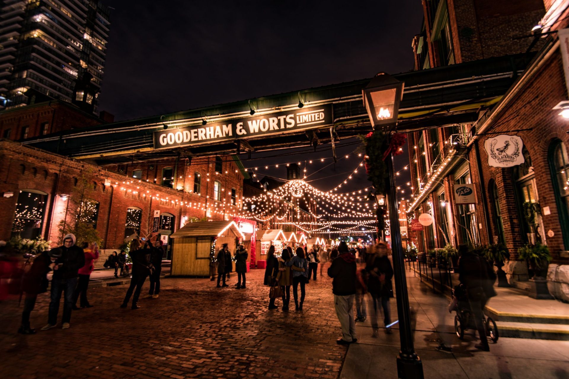
## Description The Distillery District is one of Toronto’s most distinctive neighborhoods, and it feels almost purpose-built for travelers who enjoy atmosphere. Set within a preserved historic industrial complex, the district combines red brick architecture, pedestrian streets, galleries, restaurants, shops, event spaces, and public art into a compact destination that is easy to explore and hard to forget. It is stylish without feeling anonymous, and historic without feeling static. That combination makes it one of the city’s strongest examples of adaptive reuse done well. The district’s appeal begins with the architecture. The old industrial buildings create a strong visual identity, and the pedestrian-only layout encourages visitors to slow down and notice details. You do not just move through the Distillery District; you linger in it. The cobbled or brick-lined atmosphere, the converted warehouses, and the layered signage all contribute to the sense that this is a place where Toronto’s past has been carefully repurposed for modern use. At the same time, the neighborhood is lively rather than museum-like. Food, shopping, exhibitions, and events keep it active year-round. One little-known fact is that the district’s visual character has made it a popular location for film, photography, and seasonal events, especially when the area is decorated or adapted for festivals. Another detail visitors sometimes miss is that the district works best as an experience rather than a checklist. It is tempting to arrive, take a few photos, and leave, but the better approach is to let yourself sit down for a meal, look into side courtyards, and notice how the district changes with time of day and season. For travelers who enjoy cities with strong identities, the Distillery District is especially satisfying because it offers more than a single attraction. It is a district you can inhabit for a few hours. You can browse, eat, photograph, rest, and then continue on to other downtown areas. That versatility is a big part of why it remains one of Toronto’s most reliable visitor destinations. ## Location The Distillery District is in downtown Toronto, Ontario, just east of the central core. Its location makes it accessible from many parts of the city by streetcar, bus, rideshare, bicycle, or on foot if you are already nearby. Because it is pedestrian-friendly, the visit starts to feel distinct as soon as you enter the district, and that separateness is part of the appeal. If you are planning a wider downtown itinerary, the district fits well with waterfront walks, downtown shopping, and other central attractions. It is also easy to combine with holiday events or seasonal markets when those are taking place. For many visitors, the most practical option is to use public transit or walk from nearby neighborhoods so that parking does not become a distraction from the experience. ## Tips Allow enough time to enjoy the district properly. The Distillery District is at its best when you slow down, sit for a coffee or meal, and wander without rushing. If you only pass through in ten minutes, you will miss much of what makes it special. Go if you like photography, but also go if you like dining. The area’s visual appeal is obvious, yet its food and drink scene are equally central to the experience. A good meal or café stop can anchor the visit and make the historic setting feel more vivid. Check whether there are special events happening. Seasonal markets, art installations, performances, and holiday programming can transform the district significantly. That can be a major advantage if you like lively environments, though it also means the area may be busier than usual. Visit on a weekday if you want a quieter experience. Weekends and event periods can be excellent for energy and atmosphere, but they also bring crowds. There is no wrong choice, only different moods depending on what you want from the visit. ## Conclusion The Distillery District is one of Toronto’s best examples of historic urban space reimagined for modern life. It combines architecture, food, culture, and walkability in a way that feels polished but still characterful. ## FAQ ### Why is it called the Distillery District? The name comes from its industrial origins and the historic distilling complex that once occupied the site. That heritage is still visible in the architecture and layout. ### Is it worth visiting if I only have one afternoon in Toronto? Yes. It is one of the city’s most efficient and visually rewarding districts for a short visit. ### Is the area family-friendly? Yes, especially for daytime visits. The pedestrian layout and public spaces make it easy to navigate with children. ### What is the best time to go? It depends on your goals. Quiet weekday visits suit slow exploration, while evenings and event periods suit people who want more energy and activity. ### Can I just walk around without spending much money? Absolutely. You can enjoy the architecture, art, and atmosphere without committing to shopping or dining, although many visitors choose to stay for a meal. ## Links - [Official website](https://www.thedistillerydistrict.com/) - [Wikipedia](https://en.wikipedia.org/wiki/Distillery_District)
GemVoyage Team • World
Tirana
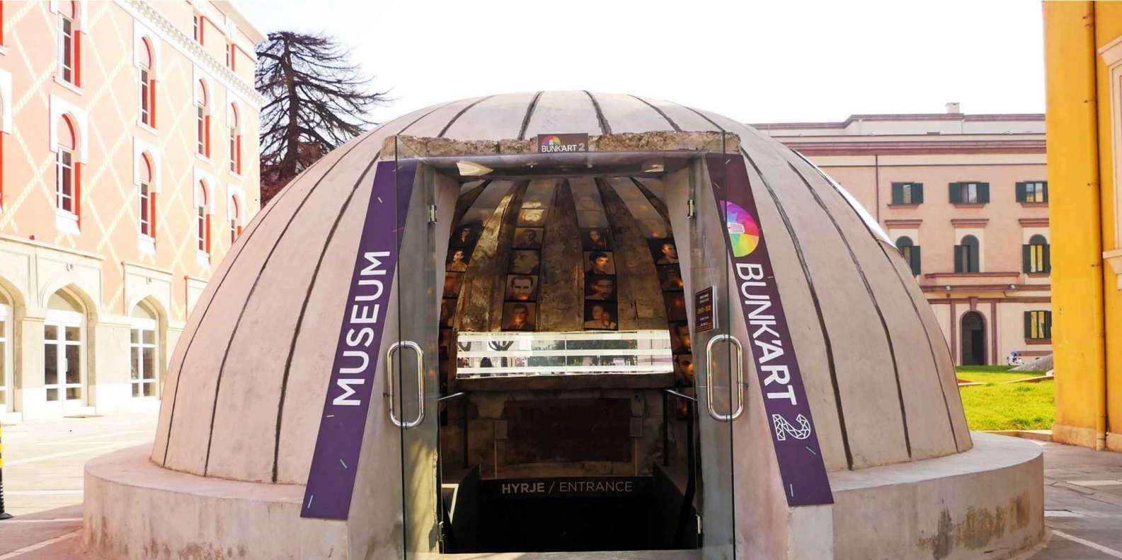
## Description Bunk’Art 2 is one of Tirana’s most powerful and memorable attractions, offering visitors a chance to experience Albanian history in a setting that is both physically and emotionally striking. Set in a former underground bunker, the museum focuses on the country’s recent past, particularly the structures of surveillance, fear, and political control that shaped daily life under the communist regime. It is not a light or decorative museum; it is immersive, sometimes stark, and designed to make the historical material feel immediate. What makes Bunk’Art 2 so compelling is the way the space itself becomes part of the exhibition. The underground architecture creates an atmosphere of confinement and tension, which helps visitors understand the historical context on a sensory level rather than only through text and artifacts. The combination of displays, corridors, and bunker-like rooms turns the visit into a journey through memory and state power. This is one of the reasons the museum has become such a significant stop for travelers who want to understand Albania beyond surface impressions. One little-known fact is that the bunker setting gives the museum a narrative force that would be much harder to achieve in a standard gallery. The physical descent into the space reflects the emotional descent into a difficult chapter of history. Another detail many visitors appreciate is that Bunk’Art 2 complements a wider understanding of Tirana’s transformation. The city today is colorful, active, and outward-looking, which makes the bunker museum even more striking because it reminds visitors of how recent and profound that transformation has been. For travelers interested in history, political systems, memory studies, or Cold War-era narratives, Bunk’Art 2 is particularly valuable. But even general travelers often find it unforgettable because it offers a very direct encounter with the past. It is the kind of museum that stays with you after you leave, not because it is overwhelming in scale, but because it is so effective at combining space and story. ## Location Bunk’Art 2 is in central Tirana, Albania, making it one of the more accessible major historical attractions in the city. Its central location means visitors can reach it easily on foot or by taxi depending on where they are staying. Because it is located in the capital’s core, it is also simple to combine with other downtown sights, cafés, and public spaces. If you are already exploring Tirana’s center, adding Bunk’Art 2 is usually straightforward. It works well as part of a day that includes walking the city, visiting civic areas, and comparing older and newer faces of the capital. The museum’s central placement is especially useful for travelers who want to avoid complicated transport just to visit a major historical site. ## Tips Give yourself enough time to absorb the exhibits. The museum is more meaningful when you slow down and read the displays rather than rushing through the bunker corridors. The space is atmospheric, but the interpretation is what turns that atmosphere into understanding. Prepare for a serious visit. This is not a playful museum, and the tone can be somber. If you are sensitive to themes of surveillance, repression, or political hardship, be ready for that emotional weight. The reward is a deeper understanding of Albania’s modern history. Visit earlier in the day if possible. That can help you avoid crowds and give you more room to move through the underground spaces at your own pace. If you like photography, be aware that lighting conditions can be dim and challenging. Combine it with an above-ground walk. The contrast between the museum’s underground history and Tirana’s modern, energetic streets is part of what makes the visit so meaningful. Spending time outdoors before or after can help you reflect on what you have seen. ## Conclusion Bunk’Art 2 is one of Tirana’s most important museums, turning an underground bunker into a powerful historical experience. It is ideal for travelers who want a serious, immersive, and memorable introduction to Albania’s recent past. ## FAQ ### Is Bunk’Art 2 suitable for all visitors? It is suitable for most adults and older children who can engage with serious historical material. Because of its subject matter, it may be intense for some visitors. ### How long should I plan for the visit? Many visitors spend one to two hours, depending on how deeply they read the exhibits and move through the space. ### Is it different from Bunk’Art 1? Yes. The two museums are related but distinct experiences, with different locations and emphases. ### Do I need to know Albanian history beforehand? No, but a little context helps. The museum is designed to be informative for visitors who are learning about the topic for the first time. ### Is photography allowed? Policies can change, so it is best to check current rules on site. Even when photos are allowed, the museum’s atmosphere is often better appreciated with focused attention rather than constant shooting. ## Links - [Official website](https://www.bunkart.al/)
GemVoyage Team • World

Comments