GemVoyage Team • World
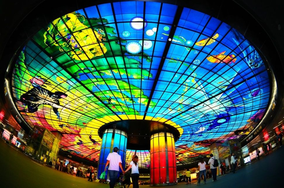
The Dome of Light (光之穹頂) is one of the most breathtaking examples of public art in the world, transforming an ordinary metro station into a dazzling celebration of color, light, and human creativity. Located inside the Formosa Boulevard Station in Kaohsiung, Taiwan’s second-largest city, the Dome of Light is the largest glass artwork in the world, covering over 660 square meters and made up of 4,500 individual glass panels.
Created by Italian artist Narcissus Quagliata, the dome was completed in 2008 as part of Kaohsiung’s Mass Rapid Transit (MRT) system. The artwork tells a powerful story of human life and cosmic unity, divided into four sections that symbolize the cycle of existence — Water (birth), Earth (growth), Light (creativity), and Fire (destruction and rebirth). The vibrant interplay of colors and light gives visitors the feeling of standing inside a living, glowing painting.
What makes the Dome of Light truly special is its emotional resonance. Beyond its visual impact, the dome serves as a symbol of peace and hope, inspired by Taiwan’s journey toward democracy. The artist worked closely with Taiwanese glass artisans to ensure every piece reflected the spirit of the island — a lesser-known fact that adds to the dome’s cultural depth. Another interesting detail is that the glass was handcrafted and colored in Germany, then carefully assembled in Kaohsiung, taking nearly four years to complete.
When the dome is illuminated at night or during special light shows, it becomes an immersive experience that draws both locals and international visitors. Whether you’re a commuter or a traveler, standing beneath this glowing ceiling feels like entering a world suspended between art and the cosmos.
The Dome of Light is located in Formosa Boulevard Station (美麗島站), the interchange between the Red and Orange lines of the Kaohsiung MRT system, in Kaohsiung City, southern Taiwan.
To get there:
The site is indoors and accessible year-round, making it a convenient stop for travelers exploring the city.
The Dome of Light is more than a stunning piece of art — it’s a symbol of creativity, peace, and transformation that perfectly reflects Taiwan’s modern cultural spirit. Blending Italian artistry with Taiwanese craftsmanship, it turns an urban metro station into a place of wonder and contemplation. Whether you’re passing through Formosa Boulevard or making a special trip, standing beneath its radiant glass ceiling is an experience that will stay with you long after you’ve left Kaohsiung.
1. Who designed the Dome of Light?
It was designed by Narcissus Quagliata, an Italian artist known for his innovative work in glass and light.
2. When was it completed?
The Dome of Light was finished in 2008 as part of Kaohsiung’s MRT construction project.
3. How big is it?
It covers 660 square meters (7,100 square feet) and consists of over 4,500 glass panels, making it the largest glass dome in the world.
4. Where is it located?
Inside Formosa Boulevard Station in Kaohsiung City, Taiwan, at the intersection of the Red and Orange MRT lines.
5. Is there an entrance fee?
No, access to the Dome of Light is free of charge, even if you are not riding the metro.
6. Are there light shows?
Yes, light and music shows are held several times daily, especially in the evenings. Check the schedule at the station for show times.
Discover more hidden gems you might love.
.jpg)
Scotland
## Description The Fairy Pools on the Isle of Skye in Scotland are a series of crystal-clear, aqua-blue pools and cascading waterfalls that tumble down from the foothills of the Black Cuillin mountains. These natural pools, fed by the Allt Coire a’ Mhadaidh stream, are renowned for their ethereal beauty and have become one of Skye’s most iconic and photographed attractions. Whether you're a hiker, wild swimmer, or simply a lover of dramatic landscapes, the Fairy Pools offer a magical experience that feels straight out of folklore. The walk to the pools is relatively short—about 2.4 kilometers round trip—and follows a well-maintained gravel path that winds through heather-covered moorland. Along the way, visitors encounter a series of waterfalls and pools, each more striking than the last. The water is so clear that you can see the rocky bottoms and reflections of the surrounding hills, making it a favorite spot for photographers and nature enthusiasts. A little-known fact: the area around the Fairy Pools was the site of the last and bloodiest clan battle in Scottish history—the Battle of Coire na Creiche in 1601 between the MacLeods of Dunvegan and the MacDonalds of Sleat. Legend has it that the stream ran red with blood, a stark contrast to its current tranquil appearance. Another quirky detail is that despite their name, there’s no historical association with fairies—the name “Fairy Pools” only began appearing in guidebooks in the 20th century. ## Location The Fairy Pools are located in **Scotland**, on the **Isle of Skye**, near the village of **Carbost** in the **Highland region**. They sit at the base of the Black Cuillin mountains in **Glen Brittle**, on the western side of the island. ### How to Get There - **By Car**: From Portree, the island’s main town, it’s about a 30-minute drive (20.5 miles) via the B8009 and Glenbrittle road. The route includes single-track roads with passing places. - **By Bus**: Public transport is limited. Buses run to Carbost, but you’ll need to arrange a taxi or walk from there. - **By Tour**: Several guided tours from Portree or Inverness include the Fairy Pools as part of a day trip. - **By Foot**: The walk to the pools begins at the Fairy Pools car park, located near Glenbrittle. From the car park, it’s a 20-minute walk to the first waterfall. ## Tips - **Visit Early or Late**: The site gets crowded during peak hours, especially in summer. Early morning or late afternoon offers better light and fewer visitors. - **Wear Waterproof Footwear**: The path can be muddy and uneven, especially after rain. - **Bring Layers**: Weather on Skye is unpredictable. Pack a waterproof jacket and warm clothing. - **Wild Swimming**: Brave souls can swim in the pools, but the water is icy year-round. A wetsuit is recommended. - **Respect Nature**: Follow the Scottish Outdoor Access Code—take your litter with you and stick to marked paths. - **Parking**: There is a charge for parking at the Fairy Pools car park, which helps maintain the site. ## Conclusion The Fairy Pools on the Isle of Skye are a breathtaking blend of natural beauty and Highland mystique. With their vivid waters, dramatic mountain backdrop, and rich history, they offer a memorable experience for anyone exploring Scotland’s rugged landscapes. ## FAQ **1. Is there an entrance fee to visit the Fairy Pools?** No, the pools are free to visit, but there is a charge for parking. **2. How long is the walk to the Fairy Pools?** The round-trip walk is approximately 2.4 kilometers and takes 40 minutes to 1.5 hours depending on pace and stops. **3. Can I swim in the Fairy Pools?** Yes, wild swimming is allowed, but the water is extremely cold. A wetsuit is recommended. **4. Are the Fairy Pools suitable for children?** Yes, but children should be supervised due to uneven terrain and cold water. **5. Is the site wheelchair accessible?** No, the terrain is rugged and includes steep inclines, making it unsuitable for wheelchairs. **6. What is the best time of year to visit?** Spring and autumn offer mild weather and fewer crowds. Summer is busiest, while winter can be icy and less accessible. ## Links - [Fairy Pools Walk – Isle of Skye Guide](https://www.isleofskye.com/skye-guide/top-ten-skye-walks/fairy-pools) - [Fairy Pools – VisitScotland Overview](https://www.visitscotland.com/info/see-do/fairy-pools-p1770011) - [Fairy Pools – Wikipedia Entry](https://en.wikipedia.org/wiki/Fairy_Pools) Description The Fairy Pools on the Isle of Skye in Scotland are a series of crystal-clear, aqua-blue pools and cascading waterfalls that tumble down from the foothills of the Black Cuillin mountains. These natural pools, fed by the Allt Coire a’ Mhadaidh stream, are renowned for their ethereal beauty and have become one of Skye’s most iconic and photographed attractions. Whether you're a hiker, wild swimmer, or simply a lover of dramatic landscapes, the Fairy Pools offer a magical experience that feels straight out of folklore. The walk to the pools is relatively short—about 2.4 kilometers round trip—and follows a well-maintained gravel path that winds through heather-covered moorland. Along the way, visitors encounter a series of waterfalls and pools, each more striking than the last. The water is so clear that you can see the rocky bottoms and reflections of the surrounding hills, making it a favorite spot for photographers and nature enthusiasts. A little-known fact: the area around the Fairy Pools was the site of the last and bloodiest clan battle in Scottish history—the Battle of Coire na Creiche in 1601 between the MacLeods of Dunvegan and the MacDonalds of Sleat. Legend has it that the stream ran red with blood, a stark contrast to its current tranquil appearance. Another quirky detail is that despite their name, there’s no historical association with fairies—the name “Fairy Pools” only began appearing in guidebooks in the 20th century. Location The Fairy Pools are located in Scotland, on the Isle of Skye, near the village of Carbost in the Highland region. They sit at the base of the Black Cuillin mountains in Glen Brittle, on the western side of the island. How to Get There By Car: From Portree, the island’s main town, it’s about a 30-minute drive (20.5 miles) via the B8009 and Glenbrittle road. The route includes single-track roads with passing places. By Bus: Public transport is limited. Buses run to Carbost, but you’ll need to arrange a taxi or walk from there. By Tour: Several guided tours from Portree or Inverness include the Fairy Pools as part of a day trip. By Foot: The walk to the pools begins at the Fairy Pools car park, located near Glenbrittle. From the car park, it’s a 20-minute walk to the first waterfall. Tips Visit Early or Late: The site gets crowded during peak hours, especially in summer. Early morning or late afternoon offers better light and fewer visitors. Wear Waterproof Footwear: The path can be muddy and uneven, especially after rain. Bring Layers: Weather on Skye is unpredictable. Pack a waterproof jacket and warm clothing. Wild Swimming: Brave souls can swim in the pools, but the water is icy year-round. A wetsuit is recommended. Respect Nature: Follow the Scottish Outdoor Access Code—take your litter with you and stick to marked paths. Parking: There is a charge for parking at the Fairy Pools car park, which helps maintain the site. Conclusion The Fairy Pools on the Isle of Skye are a breathtaking blend of natural beauty and Highland mystique. With their vivid waters, dramatic mountain backdrop, and rich history, they offer a memorable experience for anyone exploring Scotland’s rugged landscapes. FAQ 1. Is there an entrance fee to visit the Fairy Pools? No, the pools are free to visit, but there is a charge for parking. 2. How long is the walk to the Fairy Pools? The round-trip walk is approximately 2.4 kilometers and takes 40 minutes to 1.5 hours depending on pace and stops. 3. Can I swim in the Fairy Pools? Yes, wild swimming is allowed, but the water is extremely cold. A wetsuit is recommended. 4. Are the Fairy Pools suitable for children? Yes, but children should be supervised due to uneven terrain and cold water. 5. Is the site wheelchair accessible? No, the terrain is rugged and includes steep inclines, making it unsuitable for wheelchairs. 6. What is the best time of year to visit? Spring and autumn offer mild weather and fewer crowds. Summer is busiest, while winter can be icy and less accessible. Links Fairy Pools Walk – Isle of Skye Guide Fairy Pools – VisitScotland Overview Fairy Pools – Wikipedia Entry 715 words37 lines4484 characters4520 bytes
GemVoyage Team • World
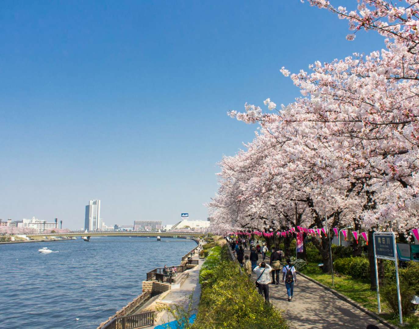
Tokyo
## Description Sumida Park is a serene riverside oasis in the heart of Tokyo, offering a refreshing contrast to the city’s fast-paced urban energy. Stretching along both banks of the Sumida River, the park is located between the Azumabashi and Sakurabashi bridges and provides stunning views of the Tokyo Skytree rising above the skyline. It’s a favorite spot for locals and tourists alike, especially during spring when the park transforms into one of Tokyo’s most celebrated cherry blossom viewing locations. The park’s history dates back to the Edo period, when the riverbanks were popular gathering spots for hanami (cherry blossom viewing), festivals, and leisurely strolls. Today, Sumida Park continues that tradition with over 600 cherry trees lining the paths, creating a tunnel of blossoms that draws thousands of visitors each year. In summer, the park becomes a prime viewing location for the Sumida River Fireworks Festival, one of Japan’s oldest and most spectacular pyrotechnic displays. A little-known fact: the cherry trees in Sumida Park were planted under the orders of shogun Tokugawa Yoshimune in the 18th century, making the park not only a natural retreat but also a living piece of Tokyo’s cultural heritage. Another quirky detail is the nearby Asahi Beer Tower, visible from the park, which was designed to resemble a frothy mug of beer—a playful architectural nod to the area’s modern flair. ## Location Sumida Park is located in **Japan**, in the **Kanto region**, within the **city of Tokyo**. It spans the **Taito and Sumida wards**, with entrances near the historic Asakusa district and the Sumida River waterfront. ### How to Get There - **By Train**: The park is a five-minute walk from Asakusa Station, served by the Ginza Line, Asakusa Line, Tobu Isesaki Line, and Tsukuba Express. - **By Bus**: Several local buses stop near Asakusa and Sumida Park. - **By Water Bus**: The Tokyo Water Bus docks near the park and offers scenic rides to destinations like Odaiba and Hamarikyu Gardens. - **By Foot or Bike**: The park is easily accessible from nearby neighborhoods and is ideal for walking or cycling along the river. Its central location makes it a convenient stop during a day of sightseeing in eastern Tokyo. ## Tips - **Visit During Cherry Blossom Season**: Late March to early April is peak bloom time. Arrive early to avoid crowds and secure a good picnic spot. - **Stay for the Fireworks**: If visiting in late July, plan to attend the Sumida River Fireworks Festival. Arrive hours in advance for a good viewing location. - **Bring a Camera**: The park offers excellent photo opportunities, especially with Tokyo Skytree in the background. - **Explore Both Sides of the River**: Cross the Sakurabashi pedestrian bridge to enjoy views from both banks. - **Pack a Picnic**: There are no large restaurants inside the park, but nearby Asakusa has plenty of takeout options. - **Check for Events**: Seasonal festivals and cultural performances are often held in the park—check local listings for details. ## Conclusion Sumida Park is a tranquil yet culturally rich destination in Tokyo, offering scenic river views, seasonal beauty, and a deep connection to the city’s history. Whether you're admiring cherry blossoms, watching fireworks, or simply enjoying a quiet walk, the park provides a memorable escape in the heart of the metropolis. ## FAQ **1. Is there an entrance fee to Sumida Park?** No, the park is free and open to the public year-round. **2. When is the best time to visit Sumida Park?** Spring (late March to early April) for cherry blossoms and summer (late July) for the fireworks festival. **3. Are there restrooms and facilities in the park?** Yes, there are public restrooms and seating areas throughout the park. **4. Can I bring pets to Sumida Park?** Yes, pets are allowed but should be kept on a leash and cleaned up after. **5. Is the park wheelchair accessible?** Most paths are flat and accessible, though some areas may have uneven terrain. **6. Are there guided tours available?** While not specific to the park, many Asakusa walking tours include Sumida Park as part of their itinerary. ## Links - [Sumida Park – Japan National Tourism Organization](https://www.japan.travel/en/spot/2114/)
GemVoyage Team • World
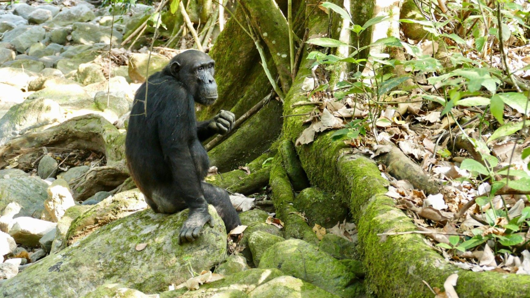
Tanzania
## Description Nestled on the remote eastern shores of **Lake Tanganyika**, the **Mahale Mountains National Park** is one of **Tanzania’s most untouched and magical wilderness areas**. Famous for its **wild chimpanzee population**, pristine forests, and turquoise waters, this park offers an experience unlike any other in Africa — where jungle-clad mountains meet one of the world’s oldest and deepest lakes. Covering over **1,600 square kilometers**, Mahale Mountains National Park lies at the crossroads of **rainforest, savanna, and miombo woodland**, creating a spectacularly diverse ecosystem. Its landscape is dominated by the dramatic **Mahale Mountain Range**, with **Mount Nkungwe** — the highest peak — rising to 2,462 meters above sea level. The park is most renowned for being home to one of the **largest known communities of wild chimpanzees**, with around **800 individuals**. Visitors have the rare opportunity to **trek into the forest** and observe these intelligent primates in their natural habitat — grooming, feeding, and socializing just a few meters away. The **Mimikire community** of chimps has been studied since the 1960s by Japanese researchers, making Mahale a world center for primate research and conservation. Beyond the chimpanzees, Mahale is a haven for **biodiversity**. The park shelters **leopards, bushbucks, red colobus monkeys, blue duikers, warthogs**, and hundreds of **bird species**. The crystal-clear waters of **Lake Tanganyika**, bordering the park to the west, are home to over **250 species of cichlid fish**, many found nowhere else on Earth. One of Mahale’s most fascinating aspects is its isolation — there are **no roads inside the park**. Access is only by **boat or plane**, ensuring that the park remains wild and unspoiled. Visitors walk along forest trails, wade across rivers, and travel by dhow or motorboat, surrounded by breathtaking scenery and deep tranquility. A lesser-known fact is that the area is the **ancestral home of the Tongwe people**, who once lived in the forest and practiced traditional customs linked to nature and the spirits of the mountains. Some cultural heritage still survives, adding a layer of human history to Mahale’s natural beauty. With its mix of adventure, serenity, and ecological wonder, **Mahale Mountains National Park** is a destination for those seeking a **genuine wilderness experience** — where you can track chimpanzees in the morning, swim in the world’s longest freshwater lake in the afternoon, and watch the sun set behind the Congo mountains in the distance. ## Location **Mahale Mountains National Park** is located in **western Tanzania**, along the **eastern shore of Lake Tanganyika**, opposite the **Democratic Republic of the Congo**. **Coordinates:** Approximately 6°S, 30°E To get there: * **By air:** The most convenient way is by **charter flight** from **Arusha, Dar es Salaam, or Kigoma** to the **Mahale airstrip**, followed by a **boat transfer** (typically 1–2 hours) to your lodge or campsite. * **By boat:** From **Kigoma**, you can take a **boat or dhow** along Lake Tanganyika, which takes between **6–10 hours** depending on the vessel. * **By road and boat (adventurous option):** Drive from **Kigoma** to **Kagunga village** (about 3–4 hours), then continue by boat to Mahale. Because of its remoteness, Mahale is best visited as part of a planned safari itinerary with **arranged transport and accommodation** through a tour operator or lodge. ## Tips * **Plan ahead:** Due to its remote location, logistics can be complex — book accommodation and flights well in advance. * **Chimp trekking:** The best time to see chimpanzees is during the **dry season (May to October)** when they stay closer to the lower slopes. * **Fitness required:** Trekking can involve steep and humid trails; wear comfortable shoes, long pants, and bring plenty of water. * **Stay several days:** Allow at least **3–4 nights** to enjoy chimp tracking, lake swimming, and forest hikes. * **Bring lightweight clothing:** The climate is tropical, but evenings near the lake can be cooler. * **Malaria precautions:** Use repellent and consult your doctor before travel — Mahale is a tropical zone. * **No roads, no crowds:** Be prepared for total disconnection — there is limited electricity and no phone signal in most areas. * **Combine with Katavi National Park:** Many travelers pair Mahale with nearby **Katavi**, another remote gem known for its wildlife-filled plains. ## Conclusion The **Mahale Mountains National Park** is one of Africa’s last true wildernesses — a place of **raw beauty and profound peace**. From tracking wild chimpanzees through lush forests to swimming in the crystal-clear waters of Lake Tanganyika, every moment in Mahale feels extraordinary. Its isolation ensures that it remains a haven for both wildlife and travelers seeking solitude. Visiting Mahale is not just a safari — it’s a **journey into the heart of nature**, untouched and unforgettable. ## FAQ **1. What is Mahale Mountains National Park famous for?** It’s best known for its **wild chimpanzees** and stunning **mountain–lake scenery**. **2. How many chimpanzees live in the park?** Around **800 individuals**, including the well-studied **Mimikire community**, habituated to human presence. **3. How do I reach Mahale?** Most visitors arrive by **charter flight** from **Arusha, Dar es Salaam, or Kigoma**, followed by a **boat transfer** to their lodge. **4. When is the best time to visit?** The **dry season (May–October)** is ideal for chimpanzee tracking, while **November–April** brings lush scenery and birdlife. **5. Are there accommodations inside the park?** Yes — there are a few **exclusive lodges and tented camps** along Lake Tanganyika’s shores, such as **Greystoke Mahale** and **Kungwe Beach Lodge**. **6. What other animals can be seen?** Besides chimpanzees, the park is home to **leopards, bushpigs, red colobus monkeys, giant squirrels**, and **hundreds of bird species**. **7. Can visitors swim in Lake Tanganyika?** Yes — it’s safe for swimming and snorkeling near the lodges, with **exceptionally clear freshwater** and tropical fish. ## Links * [Tanzania National Parks Authority – Mahale Mountains](https://storymaps.arcgis.com/stories/4bf12795a5b44f3482b580e692c465a4)
GemVoyage Team • World
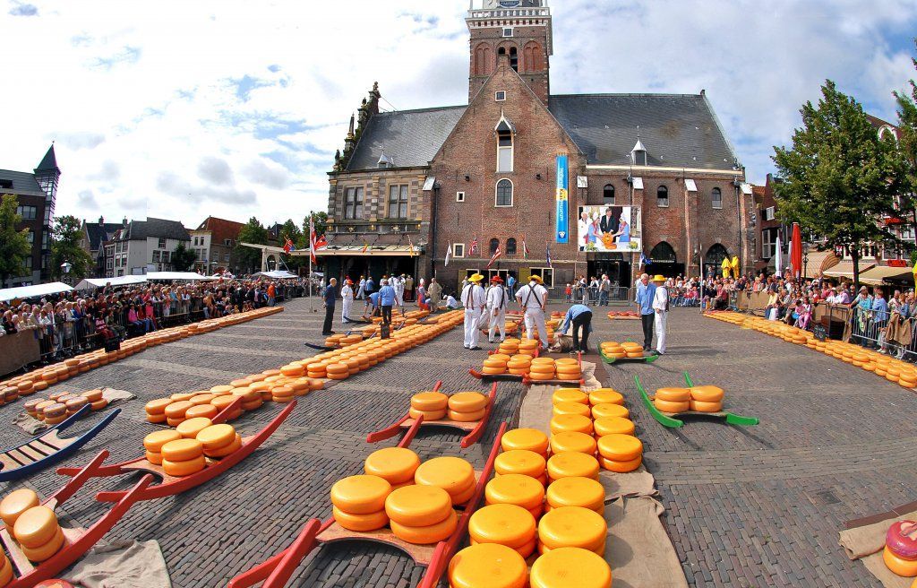
Alkmaar
## Description The Alkmaar Cheese Museum is one of the best places to understand why cheese is such an important part of Dutch identity and regional heritage. Located in the historic Waag building, the museum explores the history, production, trade, and cultural significance of cheese in the Netherlands, with special attention to Alkmaar’s long association with the cheese market tradition. It is a compact but engaging museum that helps visitors see cheese not just as food, but as part of a larger economic and social story. One of the museum’s strengths is its accessibility. It presents information in a way that is easy to follow for casual visitors while still giving enough depth to satisfy people interested in local history. The setting matters too: being in a historic weighing house adds a strong sense of place. One lesser-known fact is that Alkmaar’s cheese heritage is linked not only to local farming but also to the broader trading systems that shaped Dutch cities for centuries. Another interesting detail is that the museum helps explain the rituals and practical logistics behind cheese commerce, including how products were measured, moved, and valued in a market town. The museum is also a good reminder that cultural attractions do not have to be large to be effective. Its size makes it easy to fit into a walking day in Alkmaar, and it works especially well when combined with the city’s old streets, canals, and other historic sites. For many visitors, the appeal is partly culinary and partly atmospheric: you learn about cheese, but you also absorb the character of a Dutch market city that built part of its identity around this trade. That makes the museum feel both educational and local. ## Location The Alkmaar Cheese Museum is in the center of Alkmaar, North Holland, the Netherlands, inside the historic Waag building near the city’s old market area. Because it is centrally located, it is easy to reach on foot from most of Alkmaar’s historic core. If you are coming by train, Alkmaar’s station connects well to the city center, and the walk to the museum is straightforward. Visitors arriving from Amsterdam or other nearby cities usually find the trip simple by rail, making it a practical day trip destination. Once in town, the compact center is best explored on foot. ## Tips Combine the museum with a visit to Alkmaar’s historic center for the full experience. If you are interested in the traditional cheese market, check the schedule before your trip so you can align your visit. The museum is a good rainy-day option because it is compact and easy to visit without much planning. Leave room in your itinerary for tasting local cheese or exploring nearby shops. ## Conclusion The Alkmaar Cheese Museum is a small but worthwhile stop that turns the city’s cheese heritage into a clear and enjoyable cultural visit. ## FAQ ### What does the Alkmaar Cheese Museum focus on? It explains the history, trade, and cultural importance of cheese in Alkmaar and the Netherlands. ### Is the museum connected to the cheese market? Yes, it is closely tied to Alkmaar’s famous cheese-trading tradition. ### How much time do I need? A visit usually takes around one hour, depending on how much you read. ### Is it suitable for children? Yes, especially for families that want a short, easy museum visit with a clear theme. ### Can I visit it together with the cheese market? Yes, and that is one of the best ways to experience Alkmaar’s cheese culture. ## Links - [Official website](https://www.kaasmuseum.nl/en/)
GemVoyage Team • World
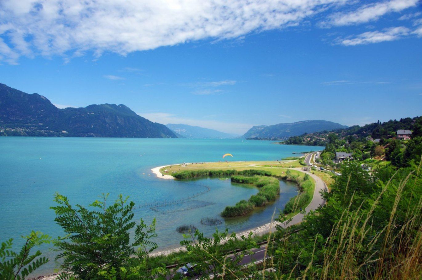
Auvergne-Rhône-Alpes
## Description Lac du Bourget is the largest natural lake entirely within France and one of the most scenic bodies of water in the country. Surrounded by mountains, historic towns, and thermal spa resorts, the lake offers a perfect blend of natural beauty, outdoor activities, and cultural heritage. Its calm blue waters and dramatic alpine backdrop have inspired writers, poets, and travelers for centuries, making it a destination that appeals to nature lovers and culture seekers alike. What makes Lac du Bourget truly unique is its diversity. Visitors can enjoy swimming, sailing, paddleboarding, and cycling along the shoreline, while also exploring charming lakeside towns such as Aix-les-Bains and Le Bourget-du-Lac. A little-known fact is that the lake reaches depths of over 140 meters, making it not only the largest but also one of the deepest lakes in France. Another lesser-known detail is its strong literary connection: the famous French poet Alphonse de Lamartine immortalized the lake in his poem *Le Lac*, turning it into a symbol of romantic longing in French literature. Despite its popularity, Lac du Bourget retains a peaceful atmosphere, especially outside peak summer months, making it ideal for travelers seeking both relaxation and discovery. ## Location Lac du Bourget is located in **France**, in the **Auvergne-Rhône-Alpes** region, within the **Savoie** department. The lake lies between the cities of Aix-les-Bains and Chambéry, at the western edge of the Alps. Reaching Lac du Bourget is easy. The closest major town, Aix-les-Bains, has a well-connected train station with direct services from cities such as Lyon, Geneva, and Paris. From the station, local buses, taxis, or walking paths lead directly to the lakeshore. Travelers arriving by car can access the area via the A41 motorway, which connects Chambéry to Geneva. Cycling paths also run along parts of the lake, offering a scenic and eco-friendly way to explore the surroundings. ## Tips * Visit between late spring and early autumn for the best weather and full access to water activities. * Early mornings and weekdays are ideal for enjoying the lake in a quieter, more peaceful setting. * Bring swimwear and a towel, as many public beaches offer free or low-cost access. * Rent a boat or take a guided cruise to appreciate the lake’s size and mountain views from the water. * Explore nearby Aix-les-Bains for its Belle Époque architecture and thermal spas. * If hiking, wear proper footwear and carry water, especially on trails overlooking the lake. ## Conclusion Lac du Bourget is a remarkable destination that combines natural splendor, outdoor recreation, and cultural depth. Whether you are relaxing by the shore, exploring historic towns, or cruising across its tranquil waters, the lake offers a rich and memorable experience in the heart of the French Alps. ## FAQ **Is Lac du Bourget suitable for swimming?** Yes, the lake is known for its clean water and has several designated swimming areas and beaches. **What is the best town to stay near Lac du Bourget?** Aix-les-Bains is the most popular base, offering accommodation, restaurants, and easy lake access. **Are boat tours available on the lake?** Yes, regular sightseeing cruises and private boat rentals are available, especially during the warmer months. **Is Lac du Bourget family-friendly?** Absolutely. Beaches, cycling paths, and gentle water activities make it ideal for families. **Can I visit Lac du Bourget in winter?** Yes, while swimming is not possible, the area remains attractive for walks, spa visits, and scenic views. ## Links * [Lac du Bourget Tourism Official Website](https://www.lac-du-bourget.com)
GemVoyage Team • World

Los Angeles
## Description Two Bit Circus is a modern micro-amusement concept that blends hands-on nostalgia with cutting-edge interactive entertainment. Designed as a social hub rather than a sprawling theme park, it curates short, intense experiences—virtual reality arenas, escape rooms, skill-based arcades, and immersive storytelling booths—so groups can mix and match activities in a single visit. The emphasis is on collaboration, shared laughter, and creative tech-driven play that appeals to friends, families, and corporate groups seeking memorable experiences. What sets Two Bit Circus apart is the careful balance between retro charm and contemporary technology. Classic arcade cabinets and carnival aesthetics sit alongside augmented reality installations and multiplayer VR experiences, creating a playful design language often described by the founders as “steampunk meets Silicon Valley.” The venue also acts as an incubator for event concepts and experiential design, with many of its ideas adopted by other entertainment venues worldwide. Beyond public attractions, Two Bit Circus often hosts private events, corporate team-building sessions, and evening social gatherings. Food, drink, and curated programming extend the experience beyond ride-based entertainment—expect pop-up events, themed nights, and collaborative challenges that keep the programming fresh. For visitors who enjoy both nostalgia and novelty, the venue’s layered experiences deliver short bursts of excitement and opportunities for friendly competition. ## Location Two Bit Circus operates within Los Angeles, California, though the venue and address have evolved over time as the concept expanded. Always check the official website or event listings for the most current location and hours. Getting there: Driving or rideshare is typically the most convenient option, and many locations provide nearby parking. Depending on the venue, public transit may be possible—plan connections ahead of time. If you’re attending a popular event, allow extra time for arrival and parking. ## Tips - Book tickets or reserve experiences ahead of time, especially on weekends and during special events when capacities fill quickly. - Combine complementary experiences (for example, a VR arena session plus an escape room) to get the most value and variety from a single visit. - Review any age, height, or health restrictions before booking; some VR or motion-based experiences may not be suitable for all guests. - Carry a charged phone for leaderboards, event check-in, and sharing moments, but follow venue rules about device use in certain experiences. - Consider group or corporate packages if you’re organizing a team-building event—these can include private space, catered food, and tailored programming. - Check the schedule for themed nights, pop-ups, or special tournaments to time your visit with unique programming. ## Conclusion Two Bit Circus offers a lively, flexible entertainment model that rewards curiosity and social play. Whether you’re seeking a date night, family outing, or corporate event, its mixture of nostalgia, technology, and quick, memorable experiences makes it a versatile option in a city known for big attractions. ## FAQ Q: Is Two Bit Circus suitable for families? A: Yes. Many attractions are family-friendly, though some experiences are geared toward older teens and adults. Always check specific activity age guidelines. Q: Are walk-ins allowed or should I book in advance? A: Some experiences accept limited walk-ins, but booking in advance is strongly recommended to secure time slots and avoid long waits. Q: Does Two Bit Circus offer food and drink? A: Many locations and event configurations include bars, cafes, or pop-up food options—check the venue’s amenities before you go. Q: Can I host a private event or corporate team-building session? A: Yes. The venue is frequently used for private hire and corporate events; packages typically include curated experiences, catering options, and dedicated staff. Q: Are there accessibility accommodations? A: Accessibility varies by location and experience; contact the venue ahead of booking to discuss needs and confirm accommodations. Q: What should I wear or bring? A: Wear comfortable clothing and shoes suitable for movement; bring any required IDs for entry and a charged phone for check-ins and digital tickets. ## Links - [Two Bit Circus (official)](https://twobitcircus.com) - [Wikipedia: Two Bit Circus](https://en.wikipedia.org/wiki/Two_Bit_Circus)
GemVoyage Team • World

Comments